Items Similar to 1912 "Panoramic View of New York City and Vicinity" by Jacob Ruppert

Want more images or videos?
Request additional images or videos from the seller
1 of 12
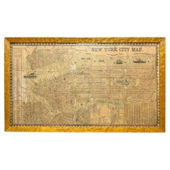
1912 "Panoramic View of New York City and Vicinity" by Jacob Ruppert
$8,500
£6,353.97
€7,329.44
CA$11,900.01
A$12,574.33
CHF 6,762.54
MX$150,538.08
NOK 84,726.71
SEK 77,597.37
DKK 54,742.38
About the Item
This is an attractive and very scarce map of New York, published by the Yorkville brewer Jacob Ruppert in 1912. The map shows an expansive view of the region reaching from Sandy Hook in the south and Yonkers to the north, to Hicksville in the east and past Newark to the west. This beautifully colored birds eye view shows waterways with all shipping traffic, boroughs, and clearly labeled railroad routes. It is presented on period dowels and backed on its original linen.
Jacob Ruppert was born in New York City in 1842 to Bavarian immigrants. His father owned a brewery in Manhattan where young Jacob learned the business of brewing. In 1862, Jacob established the Jacob Ruppert Brewery and in the first year of production he sold over 5,000 barrels of beer. Jacob Ruppert's son, Jake, emerged as general manager of the company in 1890. By that time, the Jacob Ruppert Brewery was producing over a half a million barrels a year. The location of the brewery is noted on the map with a black star. The year after this map's publishing, the brewery expanded with a bigger and better plant that grew to an eventual 2 million barrel capacity.
Beyond his beer empire, Ruppert is an important figure in New York sports. He and a partner bought the struggling New York Yankees franchise in 1915, brought Babe Ruth from Boston in 1919, and in 1923 opened Yankee Stadium in the Bronx. The beer was highly featured at the team's baseball stadium.
Condition:
Chromolithograph. Map is attached to period dowels and backed on original linen. Paper has several small losses, cracks, and light to moderate toning. The upper margin of the map has been previously trimmed, excising the "Jacob Ruppert's Knickerbocker Beer" advertisement banner seen on some other existing copies.
Archivally framed. Map is mounted hanging in front of acid-free linen matting in a custom black and brushed gold wooden frame.
- Dimensions:Height: 30 in (76.2 cm)Width: 38.5 in (97.79 cm)Depth: 3.5 in (8.89 cm)
- Materials and Techniques:
- Place of Origin:
- Period:1910-1919
- Date of Manufacture:1912
- Condition:Additions or alterations made to the original: Archivally framed. Map is mounted hanging in front of acid-free linen matting in a custom black and brushed gold wooden frame. Wear consistent with age and use. Chromolithograph. Map is attached to period dowels and backed on original linen. Paper has several small losses, cracks, and light to moderate toning. The upper margin of the map has been previously trimmed.
- Seller Location:Colorado Springs, CO
- Reference Number:Seller: M2871stDibs: LU909729127352
About the Seller
4.9
Platinum Seller
Premium sellers with a 4.7+ rating and 24-hour response times
Established in 2010
1stDibs seller since 2011
474 sales on 1stDibs
Typical response time: 2 hours
- ShippingRetrieving quote...Shipping from: Colorado Springs, CO
- Return Policy
More From This Seller
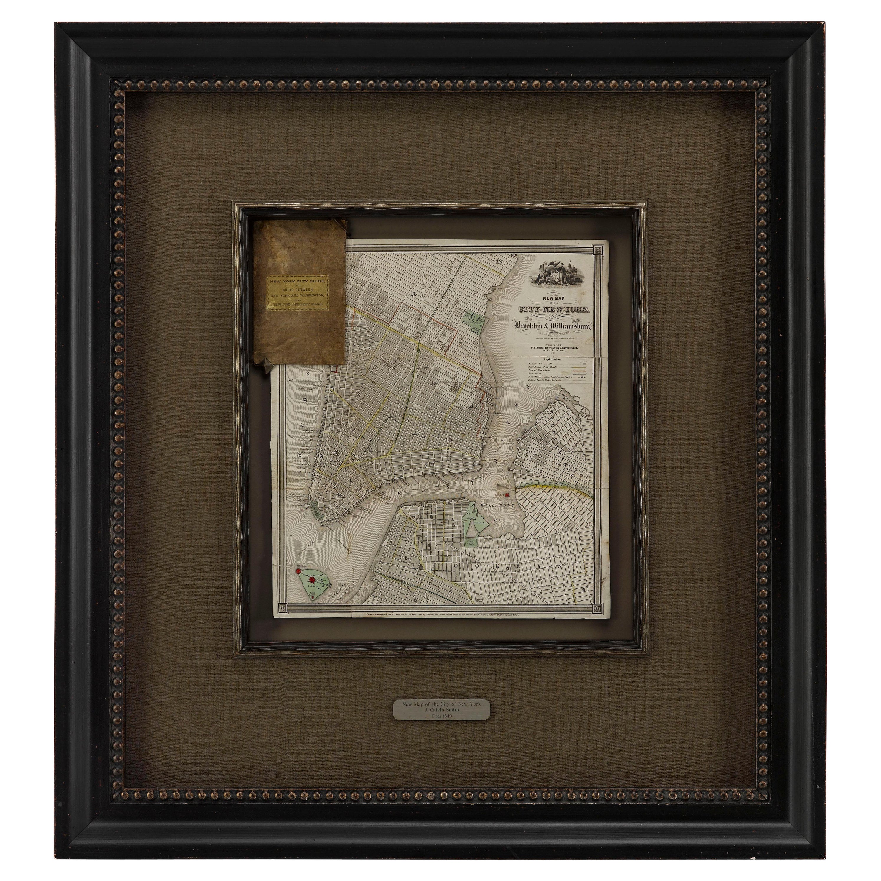
View All1840 "New Map of the City of New York With Part of Brooklyn
Williamsburg"
Located in Colorado Springs, CO
Presented is a hand-colored, engraved folding map titled "New Map of the City of New York With Part of Brooklyn & Williamsburg" by J. Calvin Smith. The map was issued bound in the bo...
Category
Antique 1840s American Maps
Materials
Paper

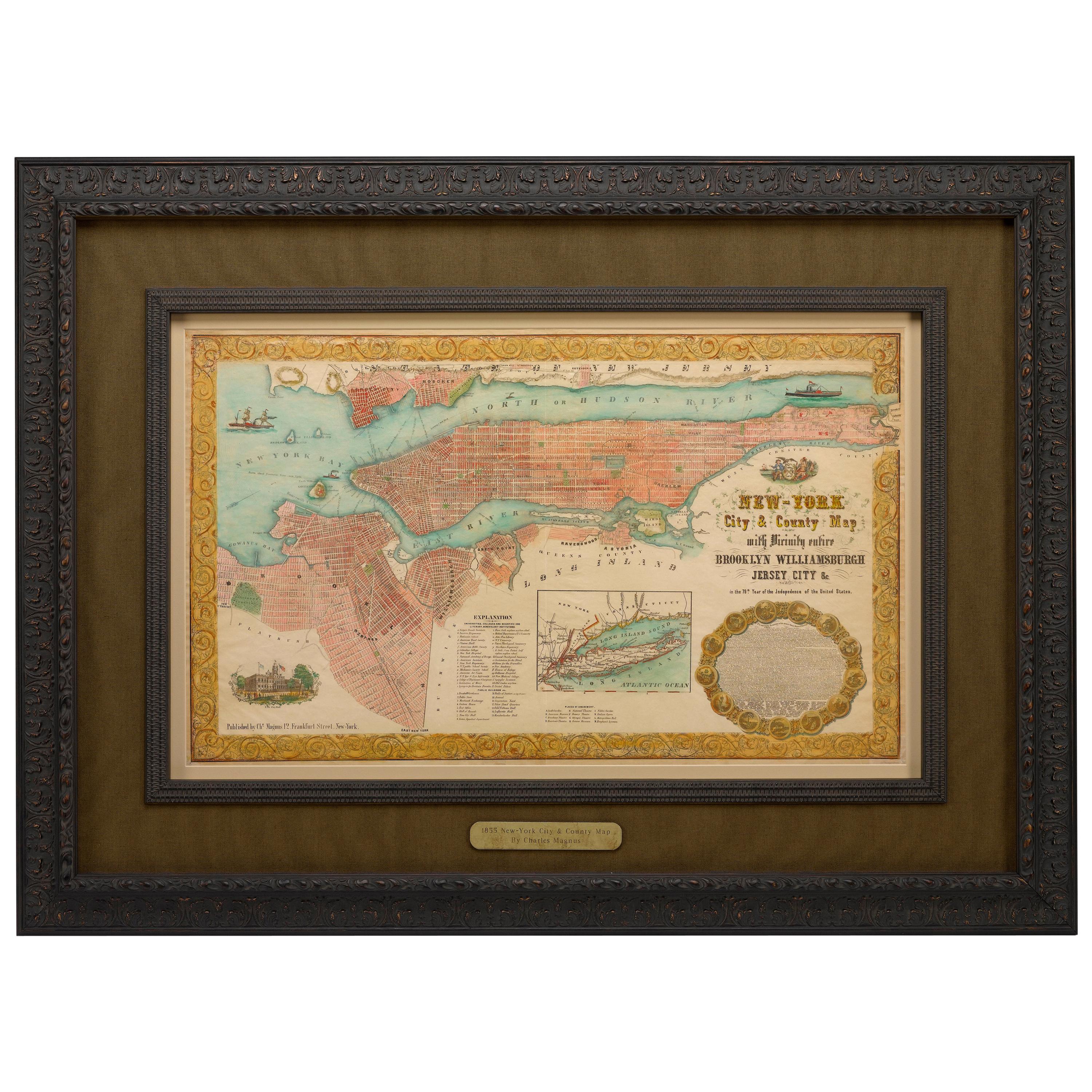
1855 "New-York City
County Map" by Charles Magnus
By Charles Magnus
Located in Colorado Springs, CO
This is a beautiful hand-colored map titled “New York City & County Map with Vicinity entire Brooklyn, Williamsburgh, Jersey City &c.” The work was published in 1855 by Charles Magnu...
Category
Antique 1850s American Maps
Materials
Paper

1915 "San Francisco City and County" Hanging Map by W. Bashford Smith
Located in Colorado Springs, CO
Presented is a rare wall map of San Francisco by W. Bashford Smith. Published in San Francisco in 1915, this map indicates streets and city districts, and, most notably, shows the si...
Category
Vintage 1910s American Art Deco Maps
Materials
Wood, Paper

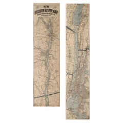
1917 "New Hudson River Map" by Wallace Bruce, Later Edition, Folding Map
Located in Colorado Springs, CO
Presented is a 1917 printing of “New Hudson Map” by Wallace Bruce. The map was published by Bryant Union Publishing Co., in New York City. The map is a later edition, issued in a distinct strip-chart format that is over 100 inches long. The map includes amazing detail, compiled mostly from U.S. Coast Survey data. It is drawn on a scale of 1.5 miles per inch, allowing ample space for it to show historical landmarks, landings, islands, list prominent residents, and more. The verso is filled with related text and illustrations about the Hudson River valley. The map folds into cream paper wrappers, titled "Hudson River Map...
Category
Vintage 1910s American Beaux Arts Maps
Materials
Paper
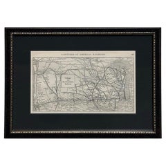
1919 "Chicago and Northwestern Railway" Map by P. F. Collier
Son
Located in Colorado Springs, CO
Presented is an antique Chicago and Northwestern Railway map from 1919. This small map is from The Gazetteer of American Railroads section of Collier’s New World Atlas and Gazetteer....
Category
Vintage 1910s American Art Deco Maps
Materials
Paper
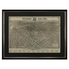
1923 "Washington, The Beautiful Capital of the Nation" Baltimore and Ohio RR Map
Located in Colorado Springs, CO
This is a fabulous 1923 bird's eye map of Washington, DC that shows the city in amazing detail. Every building is individually drawn and all major roads in the city are shown. The vi...
Category
Vintage 1920s American Art Deco Maps
Materials
Paper
You May Also Like
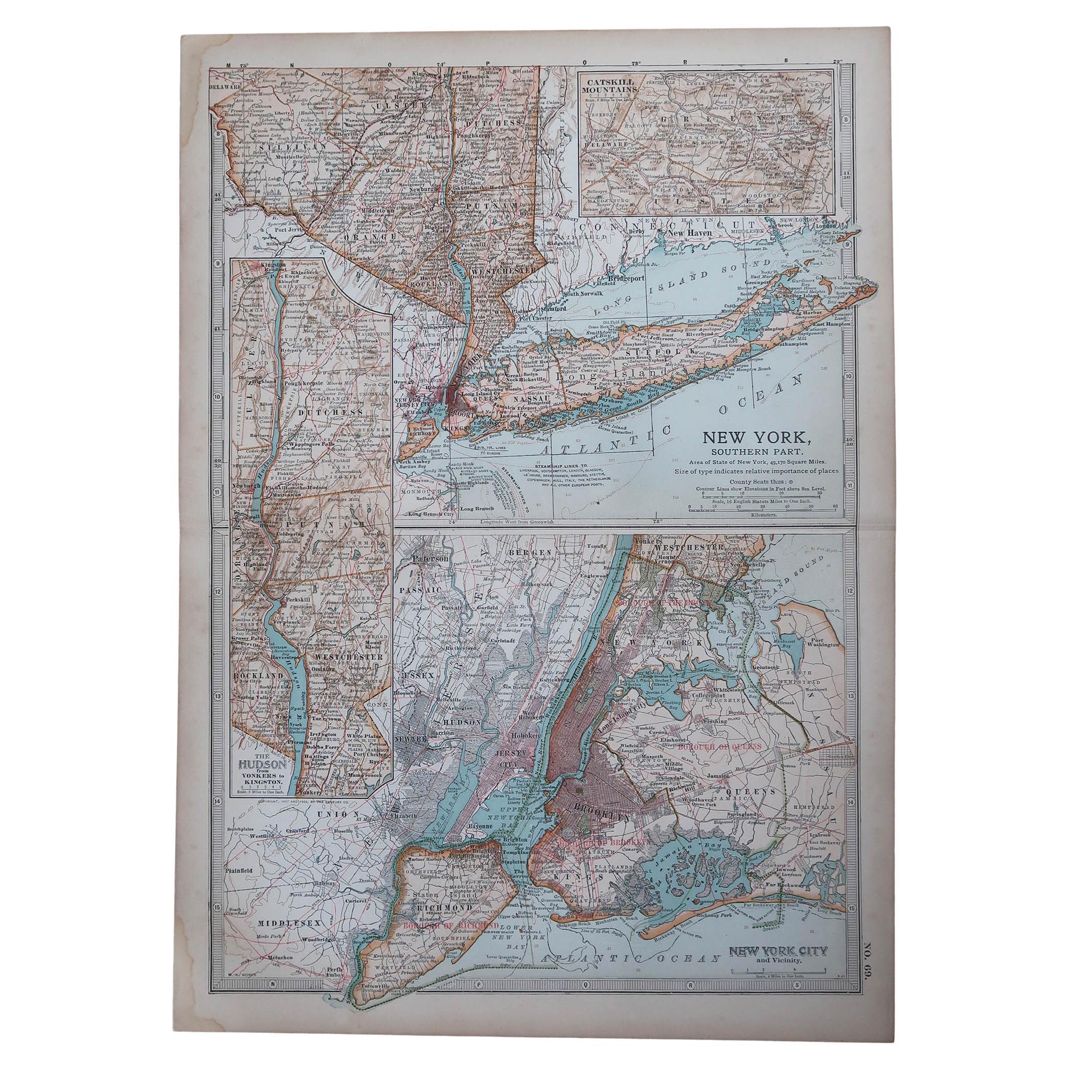
Original Antique Map of the American State of New York ( Southern Part ) 1903
Located in St Annes, Lancashire
Antique map of New York ( Southern Part )
Published By A & C Black. 1903
Original colour
Good condition
Unframed.
Free shipping
Category
Antique Early 1900s English Maps
Materials
Paper

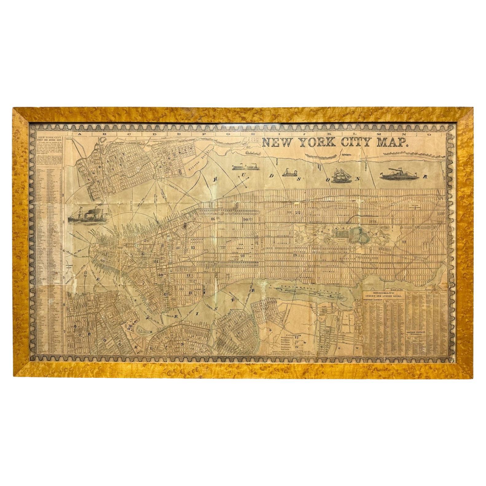
Antique 1857 New York City Map by Humphrey Phelps, Framed in Burlwood
Located in Black Rock, CT
A unique 1857 New York City map published by Humphrey Phelps, showing Manhattan, Brooklyn, Jersey City and Hoboken. Engraved in exquisite detail with a full street index, ward bounda...
Category
Antique 1850s American American Classical Decorative Art
Materials
Burl, Paper
Vintage Oversized New York City Lower Manhattan 1840s Map Print
Located in Dayton, OH
Vintage late 20th century reproduction print of New York City featuring lower Manhattan in 1840.
Category
Late 20th Century Victorian Maps
Materials
Paper

$700 Sale Price
30% Off
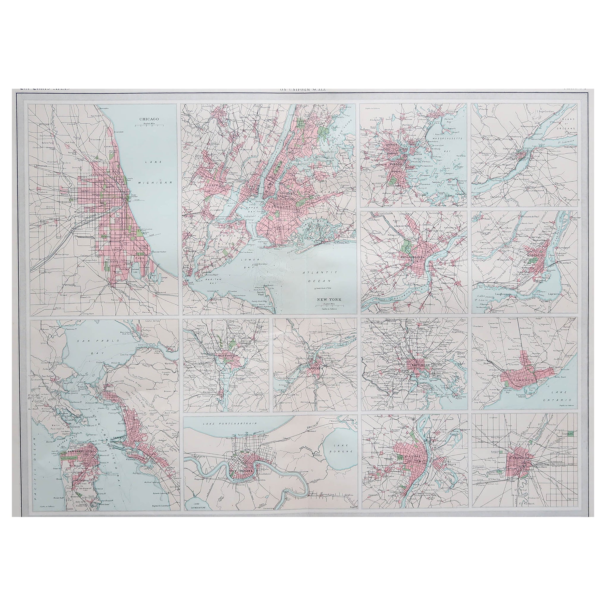
Antique Map of American Cities, Vignette of New York City, circa 1920
Located in St Annes, Lancashire
Great maps of American Cities
Unframed
Original color
By John Bartholomew and Co. Edinburgh Geographical Institute
Published, circa 1920
Category
Vintage 1920s British Maps
Materials
Paper

Original Antique Map of the American State of New York ( Western Part ) 1903
Located in St Annes, Lancashire
Antique map of New York ( Western Part )
Published By A & C Black. 1903
Original colour
Good condition
Unframed.
Free shipping
Category
Antique Early 1900s English Maps
Materials
Paper

1868 Map of the Upper Part of the Island of Manhattan Above 86th Street
By Wm. Rogers Mfg. Co.
Located in San Francisco, CA
This wonderful piece of New York City history is over 150 years old. It depicts 86th street and above. It was lithographed by WC Rogers and company. It was made to show what was the Battle of Harlem during the Revolutionary war...
Category
Antique 1860s American American Colonial Maps
Materials
Paper
More Ways To Browse
Antique Baseball
Dowel Back
Babe Ruth
Yankee Stadium
Beer Barrel
Antique Maps Of Long Island
Calcutta Map
Gibraltar Antique Map
Guyana Antique Map
Maps Of New Mexico
Saudi Arabia Map
16th Century Scotland
Antique Leather Map
Antique Map Of Argentina
Antique Map Of Colombia
Cornwall Map
Early Texas Furniture
Iraq Map