Items Similar to 1915 "San Francisco City and County" Hanging Map by W. Bashford Smith
Want more images or videos?
Request additional images or videos from the seller
1 of 11
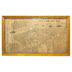
1915 "San Francisco City and County" Hanging Map by W. Bashford Smith
$5,950
£4,509.41
€5,171.92
CA$8,313.28
A$9,069.34
CHF 4,810.19
MX$109,265.07
NOK 61,050.68
SEK 55,893.55
DKK 38,626.48
About the Item
Presented is a rare wall map of San Francisco by W. Bashford Smith. Published in San Francisco in 1915, this map indicates streets and city districts, and, most notably, shows the site of the Panama-Pacific International Exposition, with a smaller guide to "Exhibit Palaces." The map is printed in black and white and is surrounded by a large index of city street names. Based on OCLC records, this map was issued in at least two sizes: a smaller sheet map and a larger wall map on rollers, as seen here.
In 1915, San Francisco hosted the world's fair called the Panama-Pacific International Exposition. The expansive fair stretched along two and a half miles of waterfront property. The fair celebrated a great American achievement– the triumphant completion of the Panama Canal. It also highlighted San Francisco’s grandeur and successful rebuild after the terrible earthquake of 1906. Nine years earlier, San Francisco experienced one of the worst national disasters to date– a 7.9 magnitude earthquake and resulting fires that destroyed over 80% of the city. The city overcame great challenges to rebuild and welcome the world by the time the Exposition opened in 1915.
Between February and December 1915, over 18 million people visited the fair. Fairgoers attended scientific and educational presentations, explored international pavilions, and enjoyed displays of advancements in science, art, racing, and technology. The Panama-Pacific International Exposition was the first world’s fair to demonstrate a transcontinental telephone call, to promote wireless telegraphy, and to endorse the use of the automobile.
CONDITION:
Very good condition. Wall map, printed in black and white, on wooden rollers. Paper is healthy. Light toning. Creasing to margins, from past use and storage as a rolled map. Scattered tiny black spots, contained mostly to the index and outer margins.
Map has been artfully mounted, hanging, inside a custom wooden frame, with linen mats, and UV Plexiglas. Framed Dimensions: 39 1/2" H x 45 1/2" W x 3 1/4" D.
- Dimensions:Height: 39.5 in (100.33 cm)Width: 45.5 in (115.57 cm)Depth: 3.5 in (8.89 cm)
- Style:Art Deco (Of the Period)
- Materials and Techniques:
- Place of Origin:
- Period:1910-1919
- Date of Manufacture:1915
- Condition:Additions or alterations made to the original: Framed by Art Source International Framing in Boulder, Colorado in March of 2024. Wear consistent with age and use.
- Seller Location:Colorado Springs, CO
- Reference Number:Seller: M3621stDibs: LU909739017172
About the Seller
4.9
Gold Seller
Premium sellers maintaining a 4.3+ rating and 24-hour response times
Established in 2010
1stDibs seller since 2011
473 sales on 1stDibs
Typical response time: 4 hours
- ShippingRetrieving quote...Shipping from: Colorado Springs, CO
- Return Policy
More From This Seller
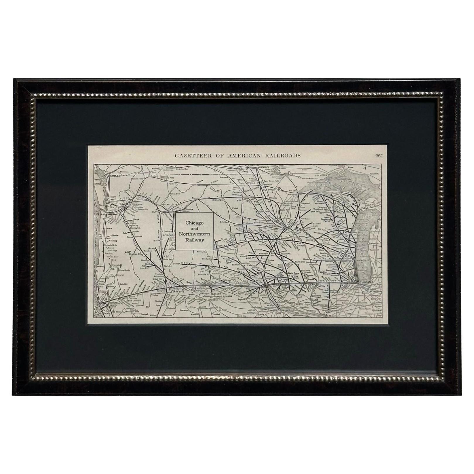
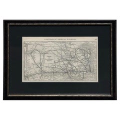
View All1919 "Chicago and Northwestern Railway" Map by P. F. Collier
Son
Located in Colorado Springs, CO
Presented is an antique Chicago and Northwestern Railway map from 1919. This small map is from The Gazetteer of American Railroads section of Collier’s New World Atlas and Gazetteer....
Category
Vintage 1910s American Art Deco Maps
Materials
Paper
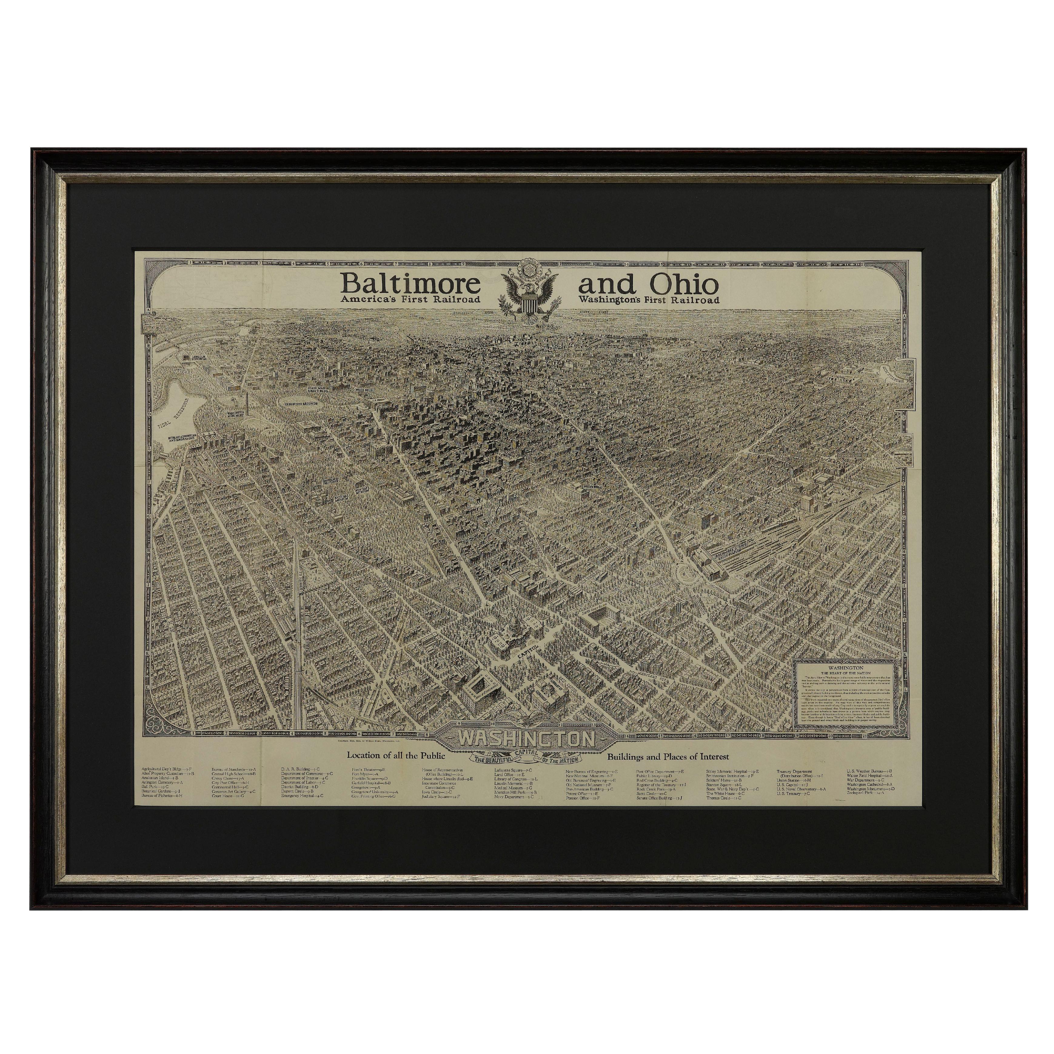
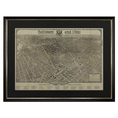
1923 "Washington, The Beautiful Capital of the Nation" Baltimore and Ohio RR Map
Located in Colorado Springs, CO
This is a fabulous 1923 bird's eye map of Washington, DC that shows the city in amazing detail. Every building is individually drawn and all major roads in the city are shown. The vi...
Category
Vintage 1920s American Art Deco Maps
Materials
Paper
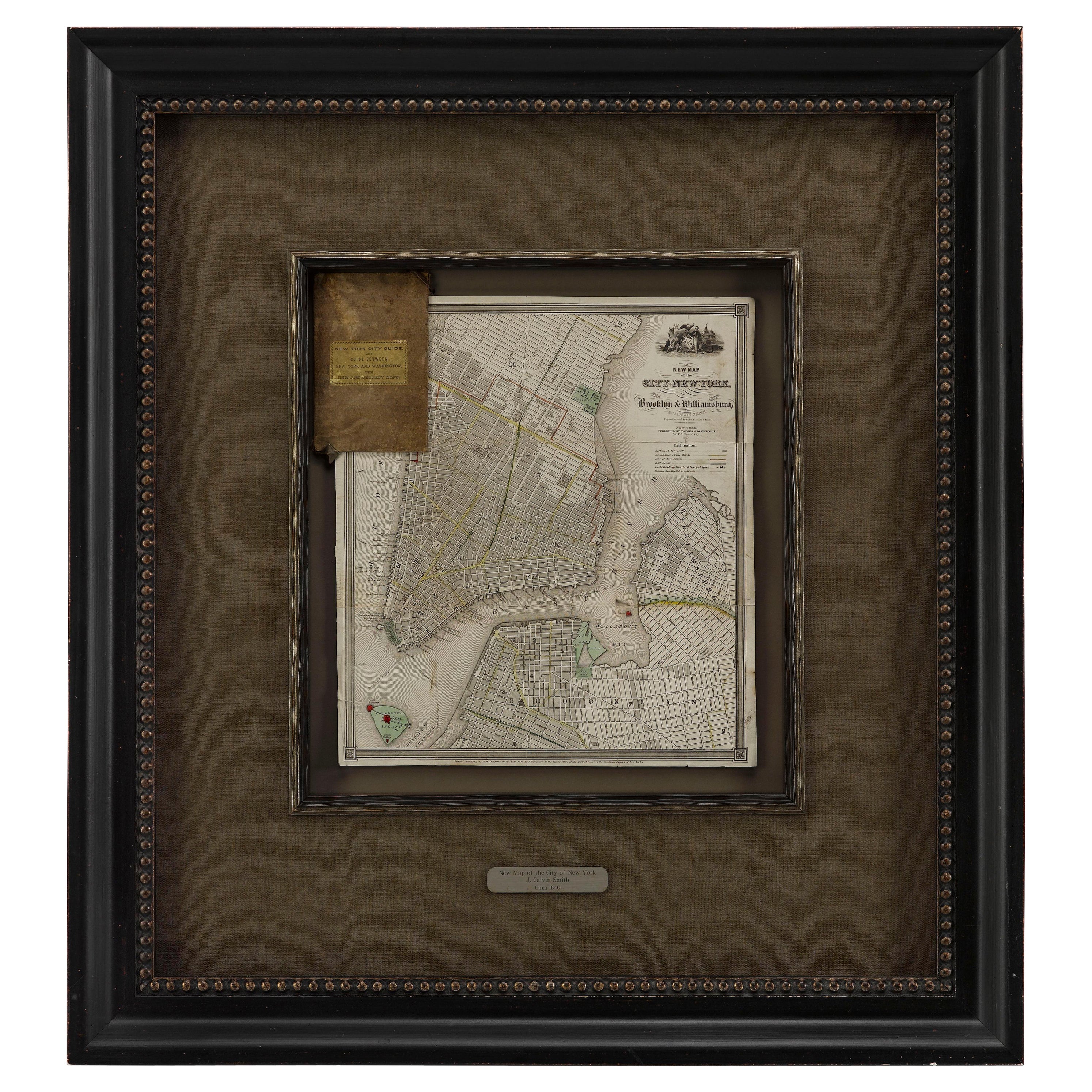
1840 "New Map of the City of New York With Part of Brooklyn
Williamsburg"
Located in Colorado Springs, CO
Presented is a hand-colored, engraved folding map titled "New Map of the City of New York With Part of Brooklyn & Williamsburg" by J. Calvin Smith. The map was issued bound in the bo...
Category
Antique 1840s American Maps
Materials
Paper

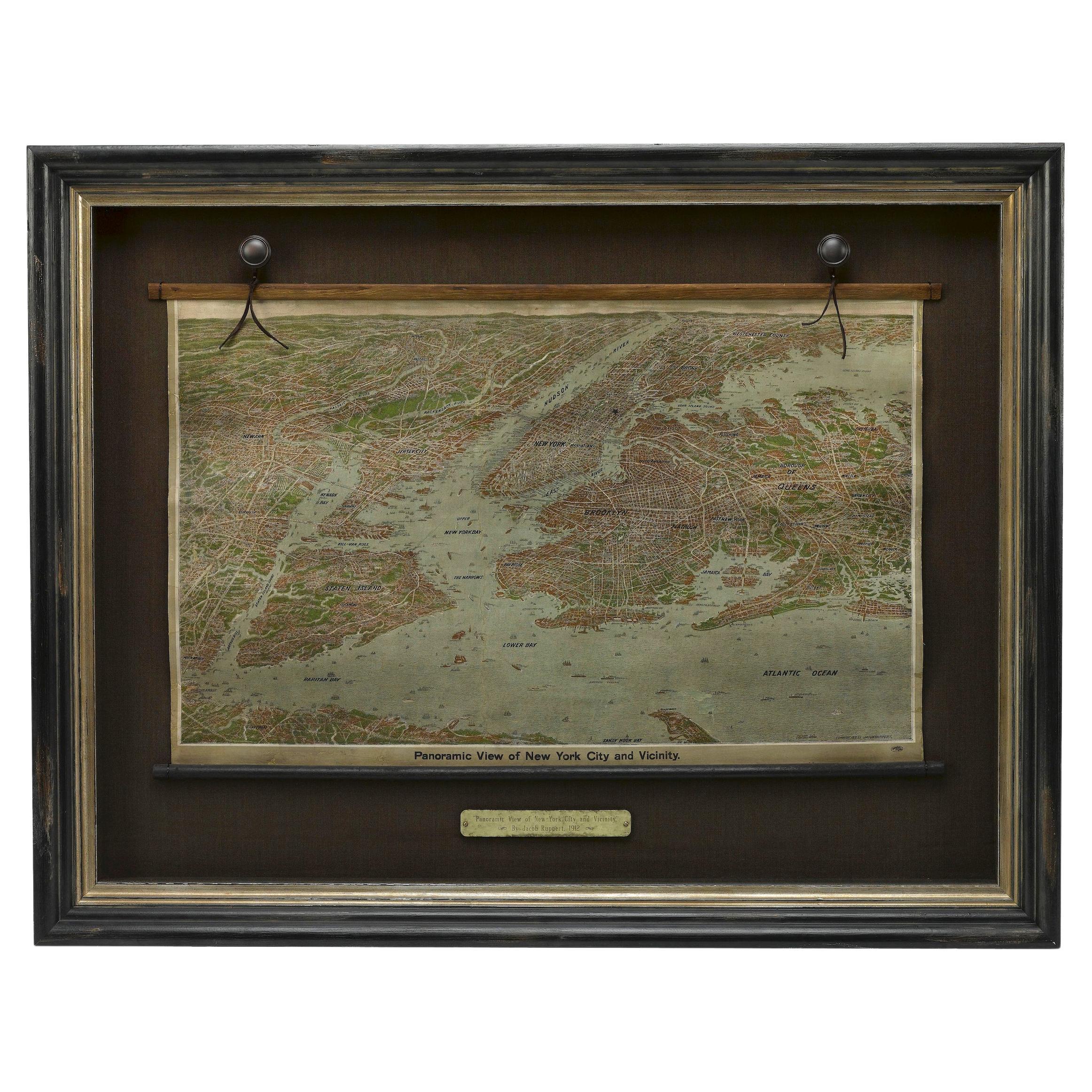
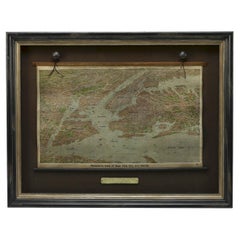
1912 "Panoramic View of New York City and Vicinity" by Jacob Ruppert
Located in Colorado Springs, CO
This is an attractive and very scarce map of New York, published by the Yorkville brewer Jacob Ruppert in 1912. The map shows an expansive view of the region reaching from Sandy Hook in the south and Yonkers to the north, to Hicksville in the east and past Newark to the west. This beautifully colored birds eye view shows waterways with all shipping traffic, boroughs, and clearly labeled railroad routes. It is presented on period dowels and backed on its original linen.
Jacob Ruppert was born in New York City in 1842 to Bavarian immigrants. His father owned a brewery in Manhattan where young Jacob learned the business of brewing. In 1862, Jacob established the Jacob...
Category
Vintage 1910s American Maps
Materials
Paper
Antique Map of Paris, "Carte Routiere des Environs de Paris" 1841
Located in Colorado Springs, CO
This beautiful hand-colored road map of Paris was published in 1841. The map shows Paris and the surrounding area in a folding pocket map. Organized and detailed for travelers, this ...
Category
Antique 1840s French Maps
Materials
Paper

1943 "USO Map Guide to Washington"
Located in Colorado Springs, CO
This is a WWII map of Washington, DC, issued as a guide for service men and women visiting or working in the city during the war. The map was created by Allen F. Free and published a...
Category
Vintage 1940s American Mid-Century Modern Maps
Materials
Paper
You May Also Like
Antique Map of American Cities, Vignette of New York City, circa 1920
Located in St Annes, Lancashire
Great maps of American Cities
Unframed
Original color
By John Bartholomew and Co. Edinburgh Geographical Institute
Published, circa 1920
Category
Vintage 1920s British Maps
Materials
Paper

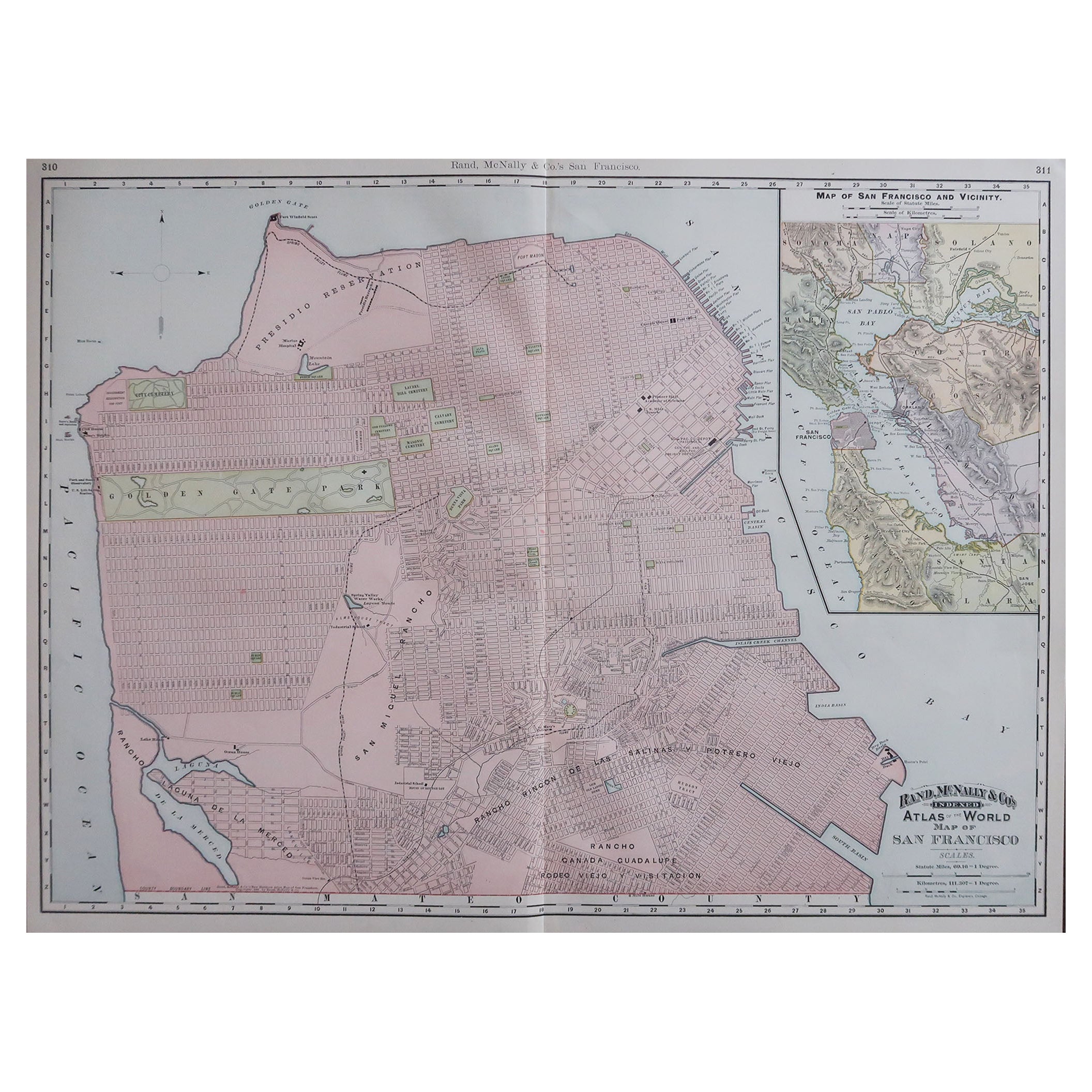
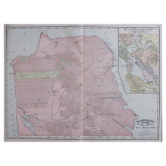
Large Original Antique City Plan of San Francisco, USA, 1894
By Rand McNally
Co.
Located in St Annes, Lancashire
Fabulous colorful map of San Francisco
Original color
By Rand, McNally & Co.
Published, 1894
Unframed
Free shipping.
Category
Antique 1890s American Maps
Materials
Paper
Antique 1857 New York City Map by Humphrey Phelps, Framed in Burlwood
Located in Black Rock, CT
A unique 1857 New York City map published by Humphrey Phelps, showing Manhattan, Brooklyn, Jersey City and Hoboken. Engraved in exquisite detail with a full street index, ward bounda...
Category
Antique 1850s American American Classical Decorative Art
Materials
Burl, Paper
Original Antique Map of the American State of California ( Southern Part ), 1903
Located in St Annes, Lancashire
Antique map of California ( Southern part )
Published By A & C Black. 1903
Original colour
Good condition
Unframed.
Free shipping
Category
Antique Early 1900s English Maps
Materials
Paper

Original Antique Map of the American State of California ( Northern Part ), 1903
Located in St Annes, Lancashire
Antique map of California ( Northern part )
Published By A & C Black. 1903
Original colour
Good condition
Unframed.
Free shipping
Category
Antique Early 1900s English Maps
Materials
Paper

Scarce U.S. Coast Survey Map Depicting Entrance to San Francisco Bay Dated 1856
Located in San Francisco, CA
A fine example of the 1856 U.S. Coast lithographic survey nautical chart of the entrance to San Francisco bay and the city. Published in 1856 by the Office of the Coast Survey the of...
Category
Antique Mid-19th Century American Maps
Materials
Paper

$780 Sale Price
47% Off
More Ways To Browse
San Francisco Used Furniture
Antique Earthquake
Maps Rolled
Large Wall Maps
Mid Century Modern Danish Teak Dining Tables
Long Rug Runners
Pair Arm Chairs
Sterling Silver Dinner Sets
United Chair Company
Italian Beech Chairs
Shirvan Rugs
Spain Marble
Vintage Danish Tables And Chairs
1960s Glass Top Coffee Table
Black Glass Coffee Tables
Burnt Wood
Mid Century Wrought Iron Chairs
Earth Toned Rug