Items Similar to 19th Century Map of Hérault, France – Montpellier, Béziers, Coastal Languedoc


Want more images or videos?
Request additional images or videos from the seller
1 of 10
19th Century Map of Hérault, France – Montpellier, Béziers, Coastal Languedoc
$167.53
£125.13
€140
CA$230.80
A$251.53
CHF 133.20
MX$3,021.20
NOK 1,686.32
SEK 1,550.41
DKK 1,066.56
About the Item
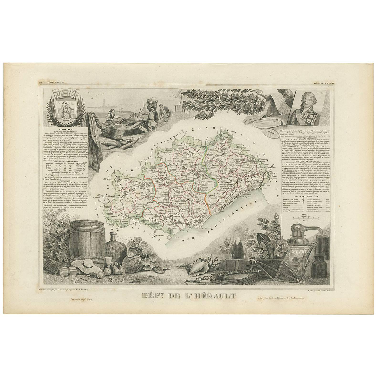
Antique Map of Hérault, France by Vuillemin, 19th Century
This finely detailed antique map depicts the French département of Hérault, part of the Languedoc region in southern France, with the Mediterranean Sea forming its southeastern boundary. Published in the mid-19th century, the map originates from Alexandre Vuillemin’s richly illustrated atlas of the departments of France.
The map shows the département’s towns, villages, rivers, and road networks, with boundaries highlighted in original hand-coloring. To the left, an inset vignette presents a view of *Cette* (modern-day Sète), a bustling Mediterranean port. At the upper right, a portrait of the celebrated French dramatist Molière recalls his ties to the region. The départemental coat of arms appears above the map, adding decorative and heraldic interest.
Hérault is historically known for its viticulture, Mediterranean trade, and cultural heritage. Montpellier, the département’s capital, has long been a center of learning, while the coastal towns like Sète provided vital access to Mediterranean commerce.
Cartographer Alexandre Vuillemin (1812–1880) was a prominent 19th-century French geographer and publisher, celebrated for his clear yet decorative maps that combined geographic precision with artistic embellishments. His atlases of France remain highly regarded among collectors of regional cartography.
Condition report: Very good condition with original outline hand-coloring. Light age toning and faint spotting in the margins, typical of 19th-century paper. Strong impression and clean image.
Framing tips: Best displayed in a classic dark wood or ebonized frame with a cream or ivory mat. A thin colored liner in wine red or muted green would complement the hand-color accents.
Technique: Engraving with original hand color
Maker: Alexandre Vuillemin, France, mid-19th century
- Dimensions:Height: 10.28 in (26.1 cm)Width: 12.8 in (32.5 cm)Depth: 0.01 in (0.2 mm)
- Materials and Techniques:Paper,Engraved
- Place of Origin:
- Period:
- Date of Manufacture:circa 1850
- Condition:Condition report: Very good condition with original outline hand-coloring. Light age toning and faint spotting in the margins, typical of 19th-century paper. Strong impression and clean image.
- Seller Location:Langweer, NL
- Reference Number:Seller: BG-13331-331stDibs: LU3054346796582
About the Seller
5.0
Recognized Seller
These prestigious sellers are industry leaders and represent the highest echelon for item quality and design.
Platinum Seller
Premium sellers with a 4.7+ rating and 24-hour response times
Established in 2009
1stDibs seller since 2017
2,788 sales on 1stDibs
Typical response time: <1 hour
- ShippingRetrieving quote...Shipping from: Langweer, Netherlands
- Return Policy
More From This Seller
View AllAntique Map of Hérault ‘France’ by V. Levasseur, 1854
Located in Langweer, NL
Antique map titled 'Dépt. de l'Hérault'. Map of the French department of Herault, France. This area is home to a wide variety of vineyards and is part of the larger Languedoc wine-gr...
Category
Antique Mid-19th Century Maps
Materials
Paper
Antique Map of France, 1903, with Inset of Paris and Corsica
Located in Langweer, NL
Title: Antique Map of France, 1903, with Inset of Paris and Corsica
Description:
This antique map, titled "France," was engraved and published in 1903 by the renowned W. & A.K. John...
Category
Early 20th Century Maps
Materials
Paper

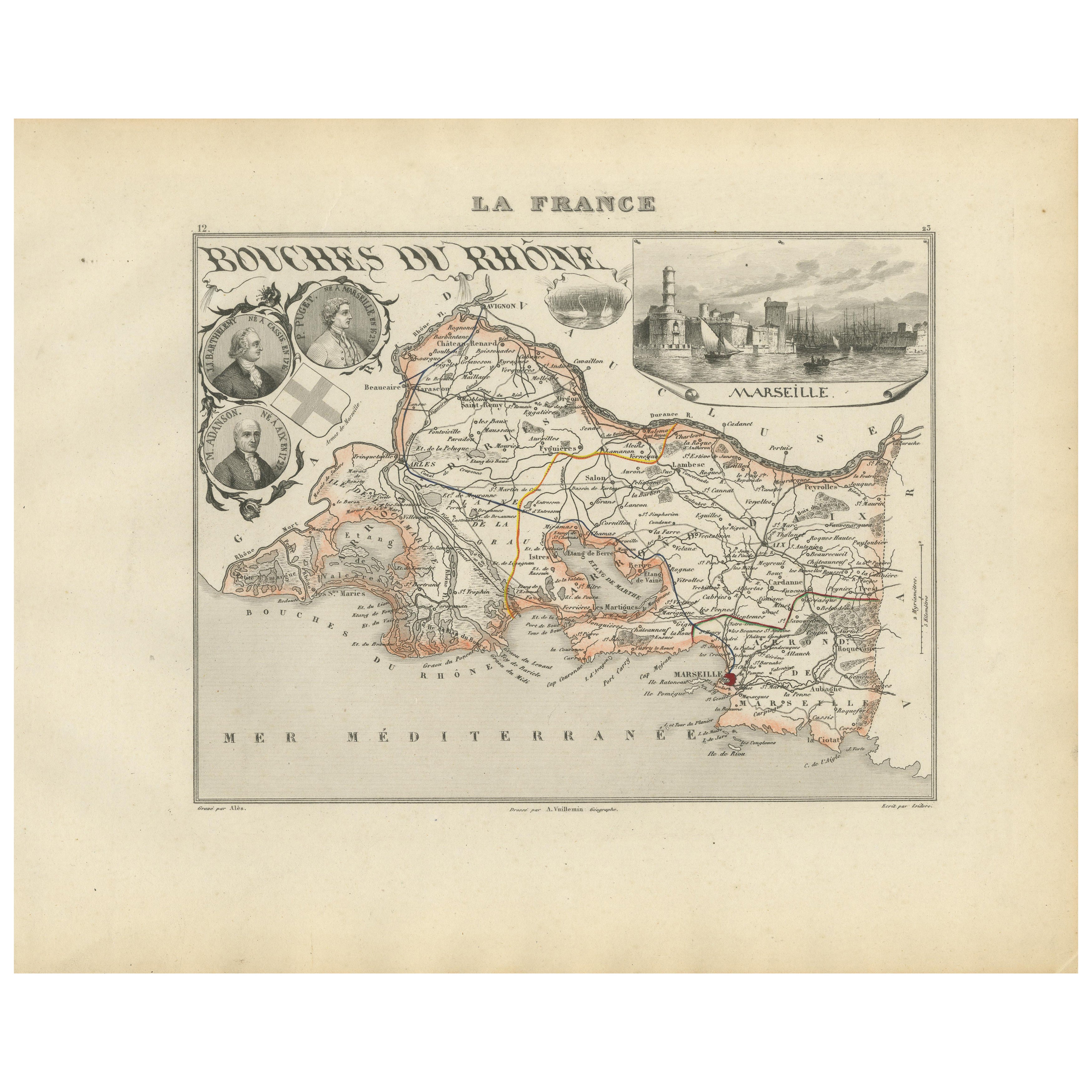
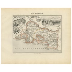
Map of Bouches-du-Rhône France with Marseille and Rhône Delta, 19th Century
Located in Langweer, NL
Map of Bouches-du-Rhône France with Marseille and Rhône Delta, 19th Century
Description:
This finely engraved 19th-century map of the Bouches-du-Rhône department in southeastern Fra...
Category
Antique Mid-19th Century French Maps
Materials
Paper
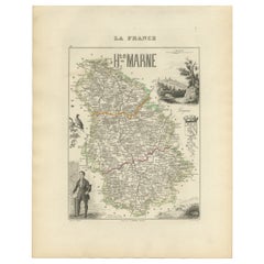
Antique Map of Haute-Marne France by Vuillemin with Decorative Insets, 1850s
Located in Langweer, NL
Antique Map of Haute-Marne France by Vuillemin with Decorative Insets, 1840s
This finely engraved and hand-colored map of Haute-Marne, a historical department in northeastern France...
Category
Antique Mid-19th Century French Maps
Materials
Paper
Map of Allier France with Saint-Pourçain Wine Region by Vuillemin, 19th c
Located in Langweer, NL
Map of Allier France with Saint-Pourçain Wine Region by Vuillemin, 19th c
This decorative 19th-century map of Allier, a central department of France, comes from the celebrated Nouve...
Category
Antique Mid-19th Century French Maps
Materials
Paper

Map of Côtes-du-Nord France with Saint-Brieuc and Brittany Coastline, c.1850
Located in Langweer, NL
Map of Côtes-du-Nord France with Saint-Brieuc and Brittany Coastline, 19th c
Description:
This elegant 19th-century map of Côtes-du-Nord, the historic name for what is now known as ...
Category
Antique Mid-19th Century French Maps
Materials
Paper

You May Also Like
L
Herault, France. Antique map of a French department, 1856
By Victor Levasseur
Located in Melbourne, Victoria
'Dept. de Saone et Loire', steel engraving with original outline hand-colouring., 1856, from Levasseur's Atlas National Illustre.
This area is home to a wide variety of vineyards a...
Category
19th Century Naturalistic Landscape Prints
Materials
Engraving

Large 19th Century Map of France
Located in Pease pottage, West Sussex
Large 19th Century Map of France.
Remarkable condition, with a pleasing age worn patina.
Recently framed.
France Circa 1874.
Category
Antique Late 19th Century French Maps
Materials
Linen, Paper

Var, France. Antique map of a French department, 1856
By Victor Levasseur
Located in Melbourne, Victoria
'Dept. du Var', steel engraving with original outline hand-colouring., 1856, from Levasseur's Atlas National Illustre.
Var covers the heart of the French Riviera or Cote d'Azur., and includes the resort cities of Cannes, Nice and San Tropez...
Category
19th Century Naturalistic Landscape Prints
Materials
Engraving

France, Northern Part. Century Atlas antique map
Located in Melbourne, Victoria
'The Century Atlas. France, Northern Part.'
Original antique map, 1903.
Inset maps of 'France in Provinces' and 'Paris and Vicinity'.
Central fold as issued. Map name and number pr...
Category
Early 20th Century Victorian More Prints
Materials
Lithograph

Map of Vendée - Etching - 19th Century
Located in Roma, IT
Map of Vendée is an etching realized by an anonymous engraver of the 19t century.
Printed in series of "France Pittoresque" at the top center.
The state of preservation of the artw...
Category
19th Century Modern Figurative Prints
Materials
Etching

Map of France - Etching - 1820
Located in Roma, IT
Map of France is an Original Etching realized by an unknown artist of 19th century in 1820.
Very good condition on two sheets of white paper joined at t...
Category
1820s Modern Figurative Prints
Materials
Etching
