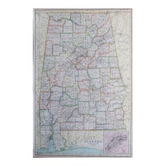
Items Similar to Alabama Antique Map 1888 – The Heart of Dixie, Railroads
Towns
Want more images or videos?
Request additional images or videos from the seller
1 of 10
Alabama Antique Map 1888 – The Heart of Dixie, Railroads
Towns
$551
£412.03
€460
CA$759.15
A$827.96
CHF 438.60
MX$9,926.02
NOK 5,585.76
SEK 5,107.76
DKK 3,505.38
About the Item
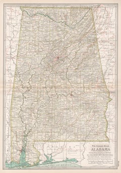
Alabama Map 1888 – Rand McNally Antique Lithograph
This antique 1888 map of Alabama, published by Rand, McNally
Co., provides a highly detailed view of the state during a period of industrial expansion and agricultural reliance. The map shows counties, towns, railroads, and rivers, illustrating Alabama at a time when railroads were reshaping its economy and connecting the state to broader national trade networks.
Counties are neatly engraved with county seats marked, from the fertile Black Belt counties of Dallas, Perry, and Marengo to the northern regions around Madison, Limestone, and Lauderdale. Major cities such as Montgomery, Birmingham, Mobile, and Huntsville are prominently shown, along with countless smaller towns and settlements that had developed along railway lines and rivers.
Railroads, printed in red and blue, dominate the map, highlighting the state’s growing transportation infrastructure. Lines such as the Louisville
Nashville Railroad, the Alabama Great Southern, and the East Tennessee, Virginia
Georgia Railroad are all represented. These connections underscored Birmingham’s rapid rise as an industrial center based on coal, iron, and steel, while Mobile continued to function as a vital Gulf Coast port for cotton and lumber exports.
The state’s natural features are also carefully marked, with rivers including the Alabama, Tombigbee, and Tennessee playing central roles in both transportation and agriculture. The Gulf of Mexico coastline with Mobile Bay is clearly delineated, showing the port city’s crucial place in international trade.
This map is an excellent example of Rand, McNally’s cartographic precision, designed both for practical reference and as a historical record. It illustrates Alabama in the post-Reconstruction era, as it transitioned into a more industrialized economy while still deeply tied to agriculture.
For collectors, genealogists, and historians of the American South, this 1888 Alabama map offers a valuable snapshot of the state’s infrastructure and settlement during an important moment of transformation.
Condition: Very good, with light age toning and mild foxing, mostly in margins. Center fold as issued. Paper strong with plate mark visible; no tears or major damage.
Framing tips: A dark wood or black frame with a cream mat will highlight the density of the railroad network. For added emphasis, a secondary mat in red can draw attention to the railway routes.
Technique: Lithograph with printed detail
Maker: Rand, McNally
Co., Chicago, 1888
Special note: Maps of Southern states like Alabama from the late 19th century are especially appealing to collectors, as they capture both the agricultural Black Belt and the emergence of new industrial centers such as Birmingham. They also highlight the role of railroads in reshaping the post-Reconstruction South.
- Dimensions:Height: 20.67 in (52.5 cm)Width: 14.18 in (36 cm)Depth: 0.01 in (0.2 mm)
- Materials and Techniques:Paper,Engraved
- Place of Origin:
- Period:
- Date of Manufacture:1888
- Condition:Condition: Very good, with light age toning and mild foxing, mostly in margins. Center fold as issued. Paper strong with plate mark visible; no tears or major damage.
- Seller Location:Langweer, NL
- Reference Number:Seller: BG-12794-431stDibs: LU3054346391332
About the Seller
5.0
Recognized Seller
These prestigious sellers are industry leaders and represent the highest echelon for item quality and design.
Platinum Seller
Premium sellers with a 4.7+ rating and 24-hour response times
Established in 2009
1stDibs seller since 2017
2,791 sales on 1stDibs
Typical response time: <1 hour
- ShippingRetrieving quote...Shipping from: Langweer, Netherlands
- Return Policy
More From This Seller
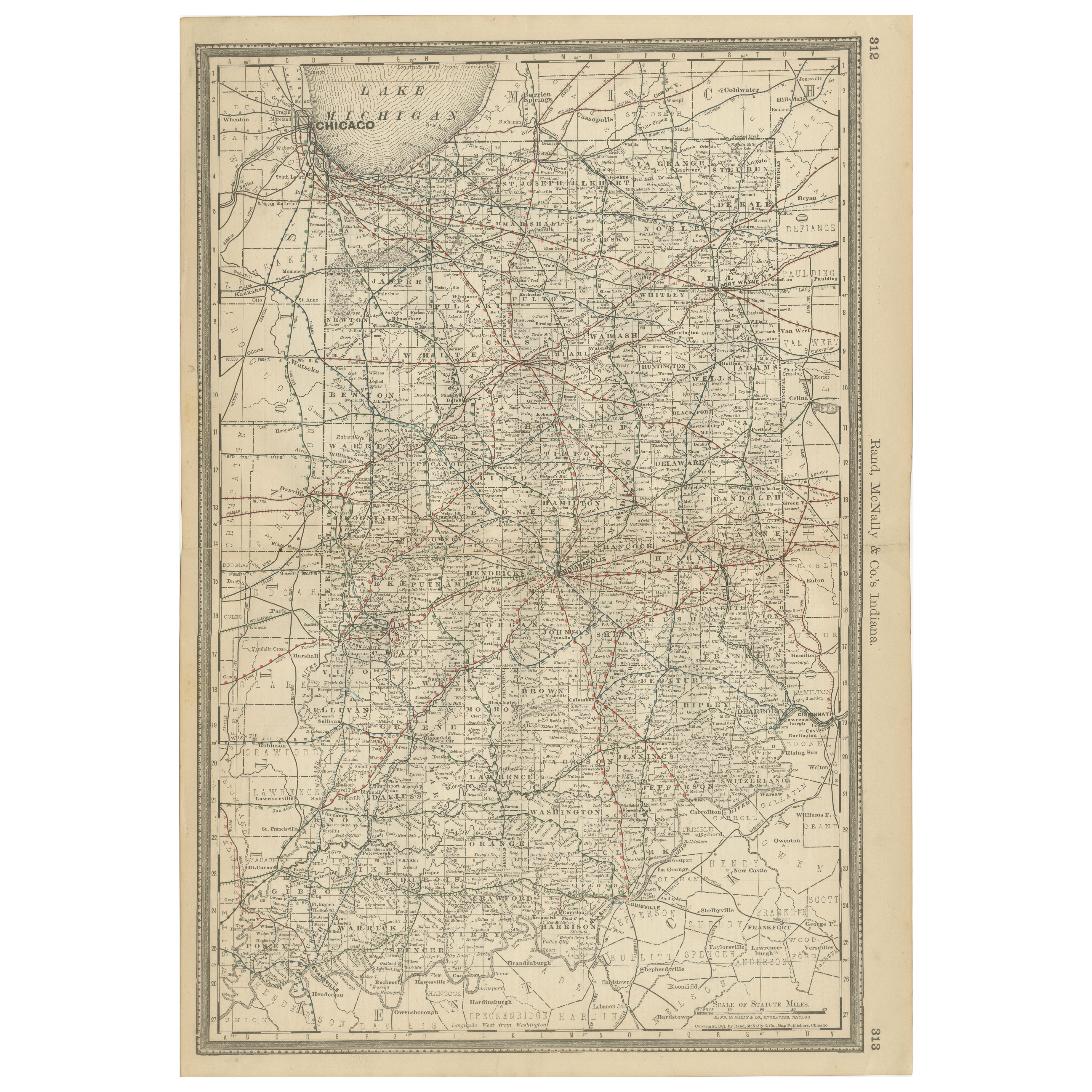
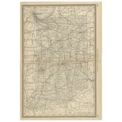
View AllAntique Map of Indiana – The Hoosier State with Railroads
Counties, 1888
Located in Langweer, NL
Antique Map of Indiana – The Hoosier State with Railroads & Counties, 1888
This antique engraved map of Indiana, published in 1888 by Rand, McNally & Co. in Chicago for their *Impro...
Category
Antique Late 19th Century American Maps
Materials
Paper
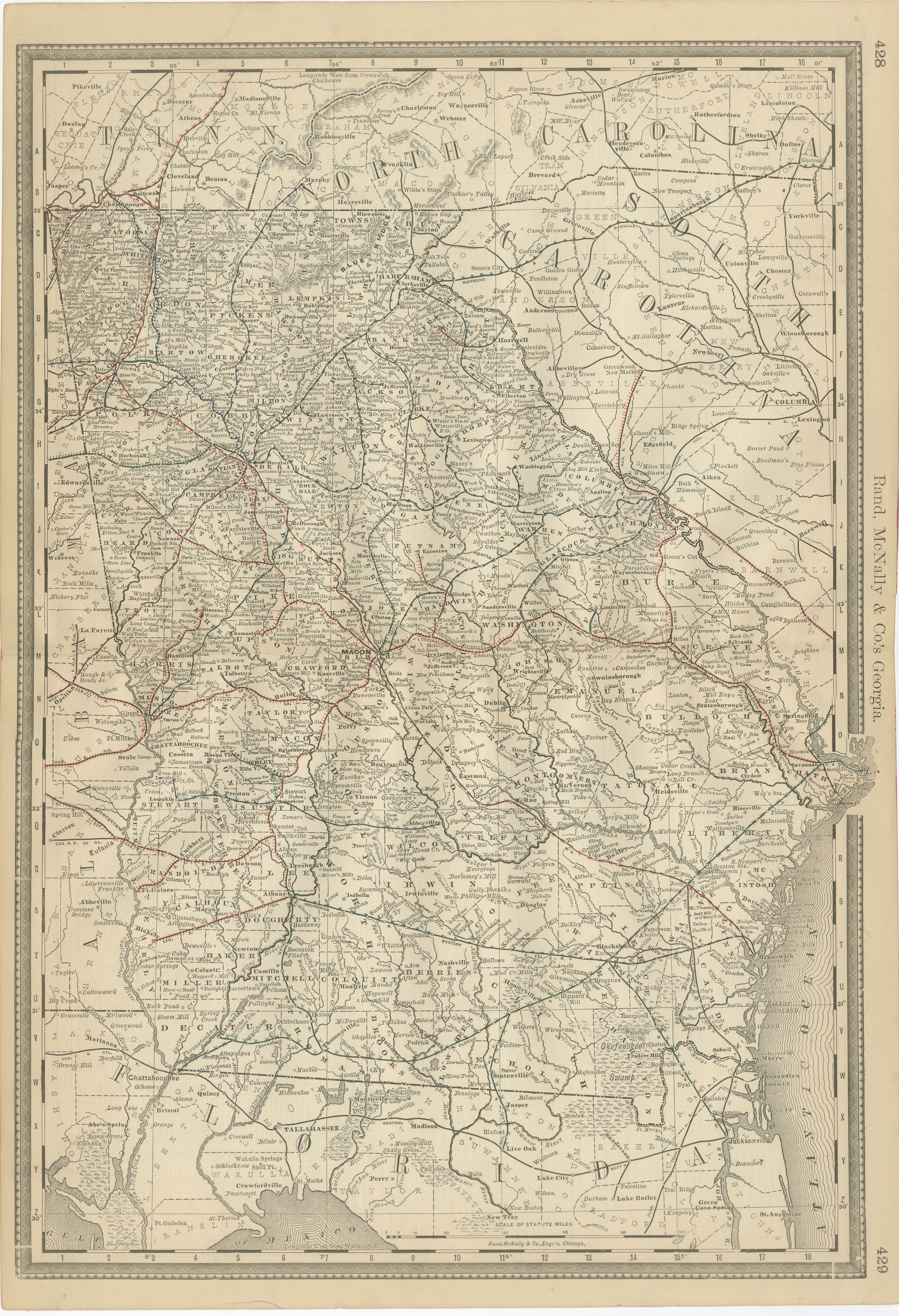
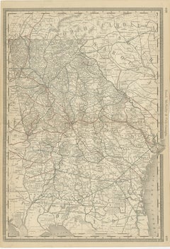
Georgia 1888 Antique Map – Railroads, Settlements
Frontier Counties
Located in Langweer, NL
Georgia Map 1888 – Rand McNally Antique Lithograph
This antique 1888 map of Georgia, published by Rand, McNally & Co., offers a detailed portrayal of the state in the post-Reconstru...
Category
Antique Late 19th Century American Maps
Materials
Paper
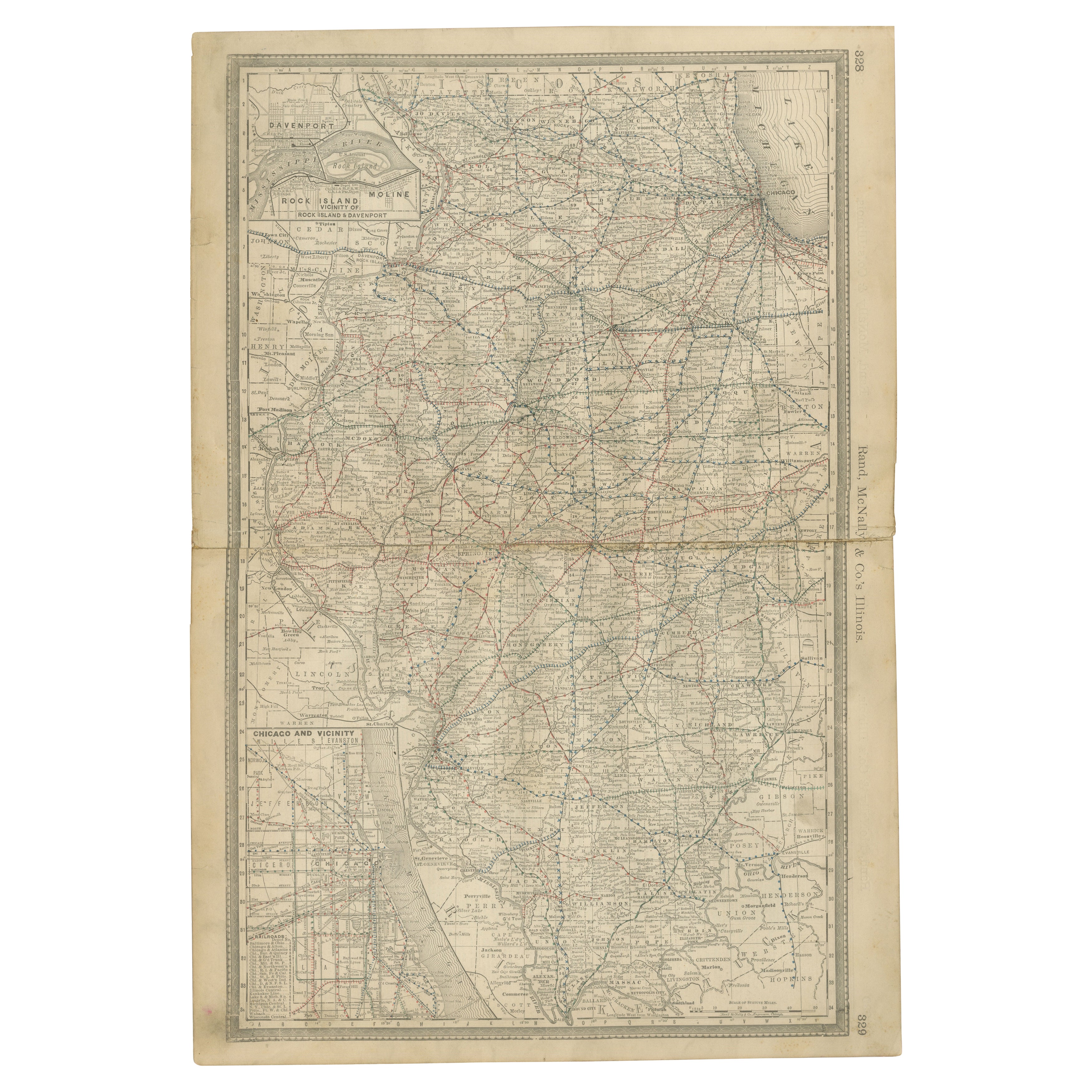
Detailed Antique Map of Illinois – Railroads, Cities
Counties, 1888
Located in Langweer, NL
Antique Map of Illinois – Railroads, Cities & Counties, 1888
This finely detailed antique map shows the state of Illinois in the late 19th century, engraved and published in 1888 by...
Category
Antique Late 19th Century American Maps
Materials
Paper

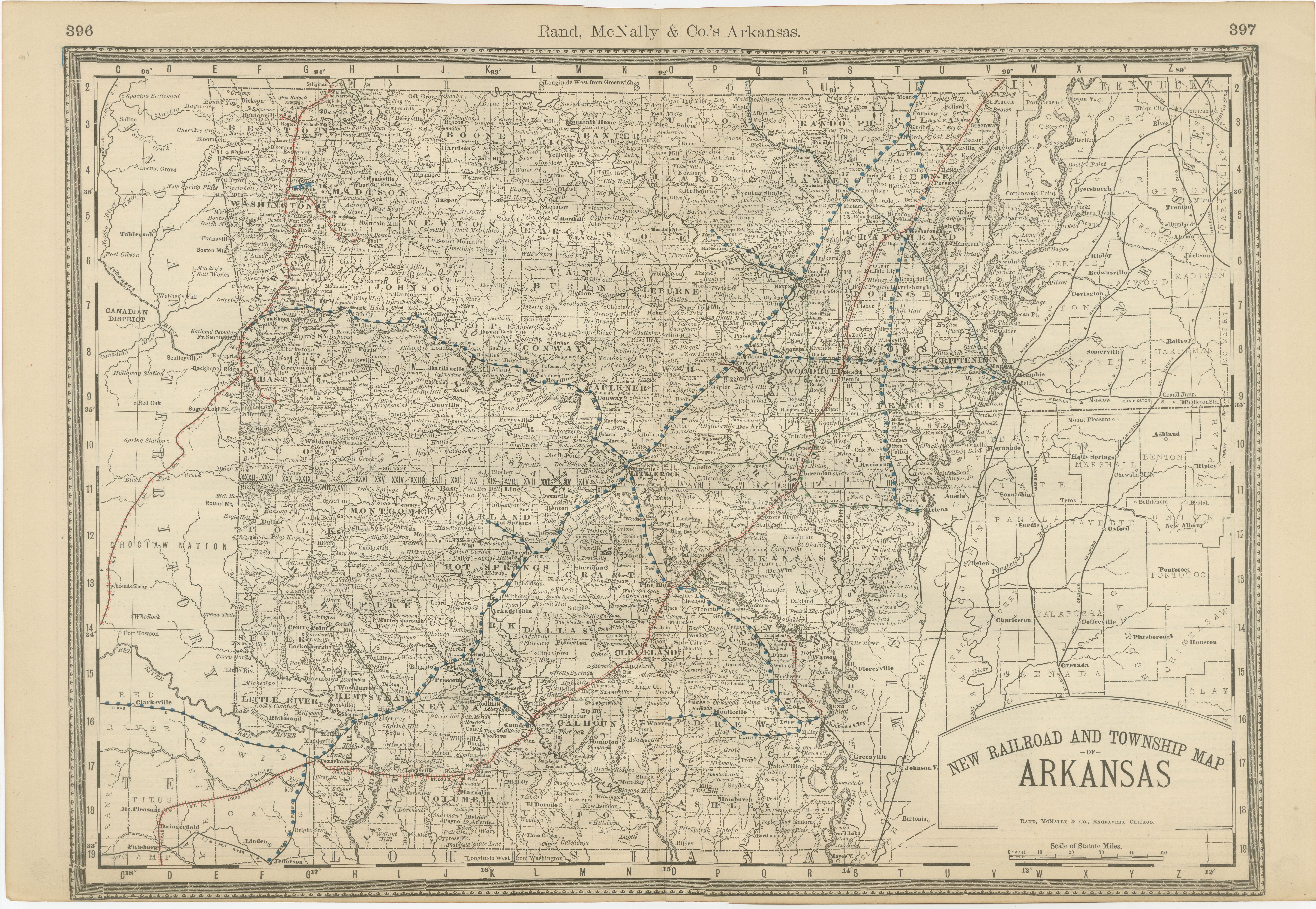
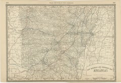
Antique Map of Arkansas 1888 – The Natural State, Railroads
Cities
Located in Langweer, NL
Arkansas Map 1888 – Rand McNally Antique Lithograph
This antique 1888 map of Arkansas, published by Rand, McNally & Co., provides a detailed portrayal of the state during the late 1...
Category
Antique Late 19th Century American Maps
Materials
Paper
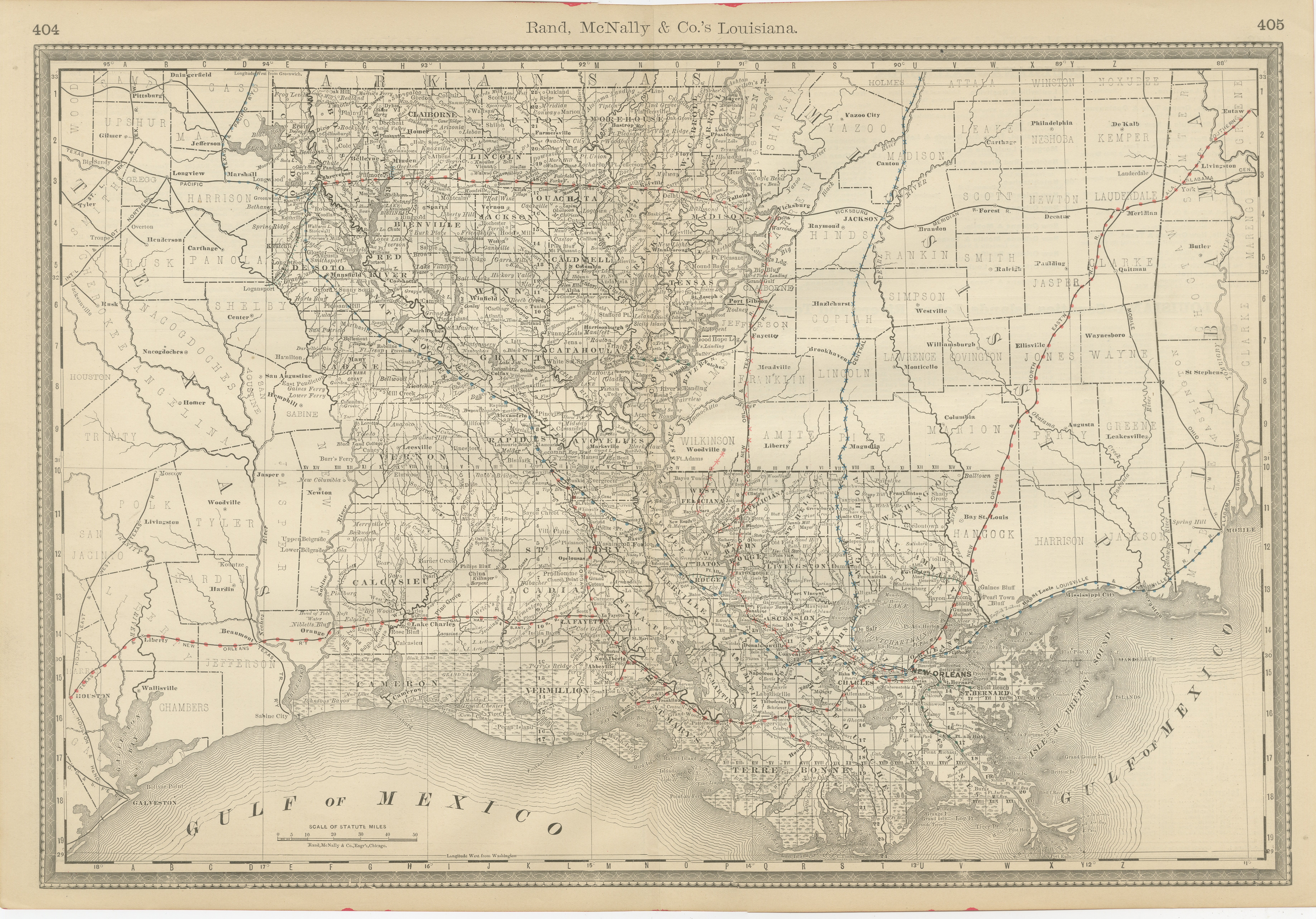
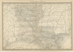
Louisiana Antique Map 1888 – The Pelican State, Railroads
Counties
Located in Langweer, NL
Louisiana Map 1888 – Rand McNally Antique Lithograph
This antique 1888 map of Louisiana, published by Rand, McNally & Co., provides a richly detailed picture of the state in the lat...
Category
Antique Late 19th Century American Maps
Materials
Paper
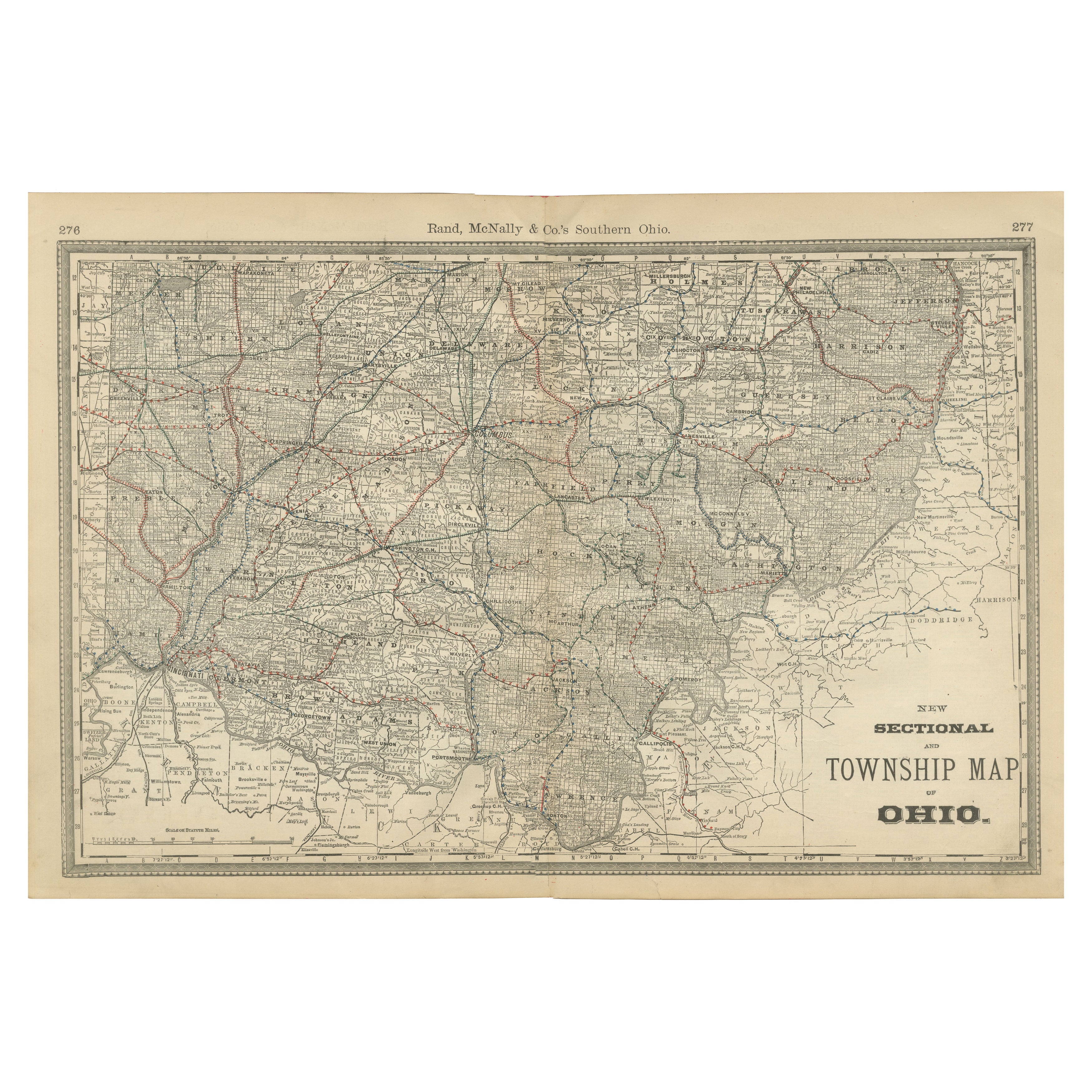
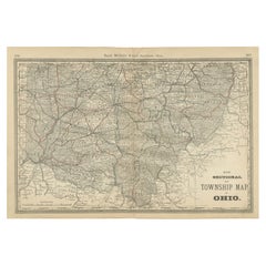
Antique Map of Southern Ohio – The Buckeye State - Railroads
Townships, 1888
Located in Langweer, NL
Antique Map of Southern Ohio – The Buckeye State with Railroads & Townships, 1888
This antique engraved map of Southern Ohio, published in 1888 by Rand, McNally & Co. in Chicago for...
Category
Antique Late 19th Century American Maps
Materials
Paper
You May Also Like
Original Antique Map of the American State of Alabama, 1903
Located in St Annes, Lancashire
Antique map of Alabama
Published By A & C Black. 1903
Original colour
Good condition
Unframed.
Free shipping
Category
Antique Early 1900s English Maps
Materials
Paper

Original Antique Map of the American State of Mississippi, 1903
Located in St Annes, Lancashire
Antique map of Mississippi
Published By A & C Black. 1903
Original colour
Good condition
Unframed.
Free shipping
Category
Antique Early 1900s English Maps
Materials
Paper

Large Original Antique Map of Alabama, USA, C.1900
Located in St Annes, Lancashire
Fabulous map of Alabama
Original color
Engraved and printed by the George F. Cram Company, Indianapolis.
Published, C.1900
Unframed
Repair to a minor edge tear top left corner
...
Category
Antique 1890s American Maps
Materials
Paper
Original Antique Map of The United States of America by Dower, circa 1835
Located in St Annes, Lancashire
Nice map of the USA
Drawn and engraved by J.Dower
Published by Orr & Smith. C.1835
Unframed.
Free shipping
Category
Antique 1830s English Maps
Materials
Paper

Alabama. USA Century Atlas state antique vintage map
Located in Melbourne, Victoria
'The Century Atlas. Alabama'
Original antique map, 1903.
Central fold as issued. Map name and number printed on the reverse corners.
Sheet 40cm by 29.5cm.
Category
Early 20th Century Victorian More Prints
Materials
Lithograph
Original Antique Map of the American State of Tennessee, 1903
Located in St Annes, Lancashire
Antique map of Tennessee
Published By A & C Black. 1903
Original colour
Good condition
Unframed.
Free shipping
Category
Antique Early 1900s English Maps
Materials
Paper
