Items Similar to Ancient Egypt – Nile Valley Map by d’Anville, Classical Antiquity, c.1765


Want more images or videos?
Request additional images or videos from the seller
1 of 9
Ancient Egypt – Nile Valley Map by d’Anville, Classical Antiquity, c.1765
$680.96
£508.92
€570
CA$939.42
A$1,028.96
CHF 541.75
MX$12,280.31
NOK 6,904.09
SEK 6,311.38
DKK 4,344.62
About the Item
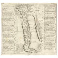
Ancient Egypt – Nile Valley Map by d’Anville, Classical Antiquity, c.1765
This finely engraved map depicts Ancient Egypt as understood through classical sources, extending along the Nile Valley from the Mediterranean Delta southward into Nubia, with adjacent regions of Arabia Petraea and the Red Sea coast. The map is titled “Ægyptus Antiqua” and was compiled by Jean-Baptiste Bourguignon d’Anville, one of the most influential and scholarly cartographers of the 18th century.
D’Anville’s approach marked a decisive shift away from speculative geography. Drawing on ancient Greek and Roman authors such as Herodotus, Strabo, Pliny, and Ptolemy, he sought to reconstruct the geography of antiquity with critical rigor. Cities, nomes, temples, and classical place names are carefully plotted along the Nile, offering a structured and historically grounded vision of Pharaonic Egypt as interpreted through classical antiquity.
The Nile dominates the composition, rendered as the organizing spine of Egyptian civilization. Branches of the Delta, desert regions, and mountain ranges are delicately engraved, while subtle hand color highlights coastlines and regional boundaries without overwhelming the clarity of the map. To the east, the Red Sea and Arabian Peninsula provide geographical context for ancient trade routes and cultural exchange.
Visually, the map balances scholarship and elegance. The restrained engraving style, generous white space, and vertical format give it a calm, architectural presence, making it particularly attractive for interior display. It works equally well as a collector’s piece or as a refined statement map in both classic and contemporary settings.
This map is highly sought after by collectors of Egyptology, classical history, and Enlightenment cartography, and it pairs beautifully with other 18th-century maps of North Africa, the Mediterranean, or the ancient world.
Condition report
Good condition overall. Light age toning. Original outline hand color. Plate mark visible. Margins intact. Right margin tight. Strong paper.
Framing tips
A wide off-white or light sand-colored mat enhances the vertical composition and emphasizes the Nile’s flow through the map. A medium to dark wood frame or softly ebonized frame gives the piece a refined, museum-style appearance, suitable for both residential and hospitality interiors.
Technique: Copper engraving with contemporary outline hand color
Maker: Jean-Baptiste Bourguignon d’Anville, France, c.1765
- Dimensions:Height: 21.93 in (55.7 cm)Width: 14.77 in (37.5 cm)Depth: 0.01 in (0.2 mm)
- Materials and Techniques:Paper,Engraved
- Place of Origin:
- Period:1760-1769
- Date of Manufacture:circa 1765
- Condition:Good condition overall. Light age toning. Original outline hand color. Plate mark visible. Margins intact. Right margin tight. Strong paper.
- Seller Location:Langweer, NL
- Reference Number:Seller: BG-14128-161stDibs: LU3054348017302
About the Seller
5.0
Recognized Seller
These prestigious sellers are industry leaders and represent the highest echelon for item quality and design.
Platinum Seller
Premium sellers with a 4.7+ rating and 24-hour response times
Established in 2009
1stDibs seller since 2017
2,806 sales on 1stDibs
Typical response time: 1 hour
- ShippingRetrieving quote...Shipping from: Langweer, Netherlands
- Return Policy
More From This Seller
View AllEgypt
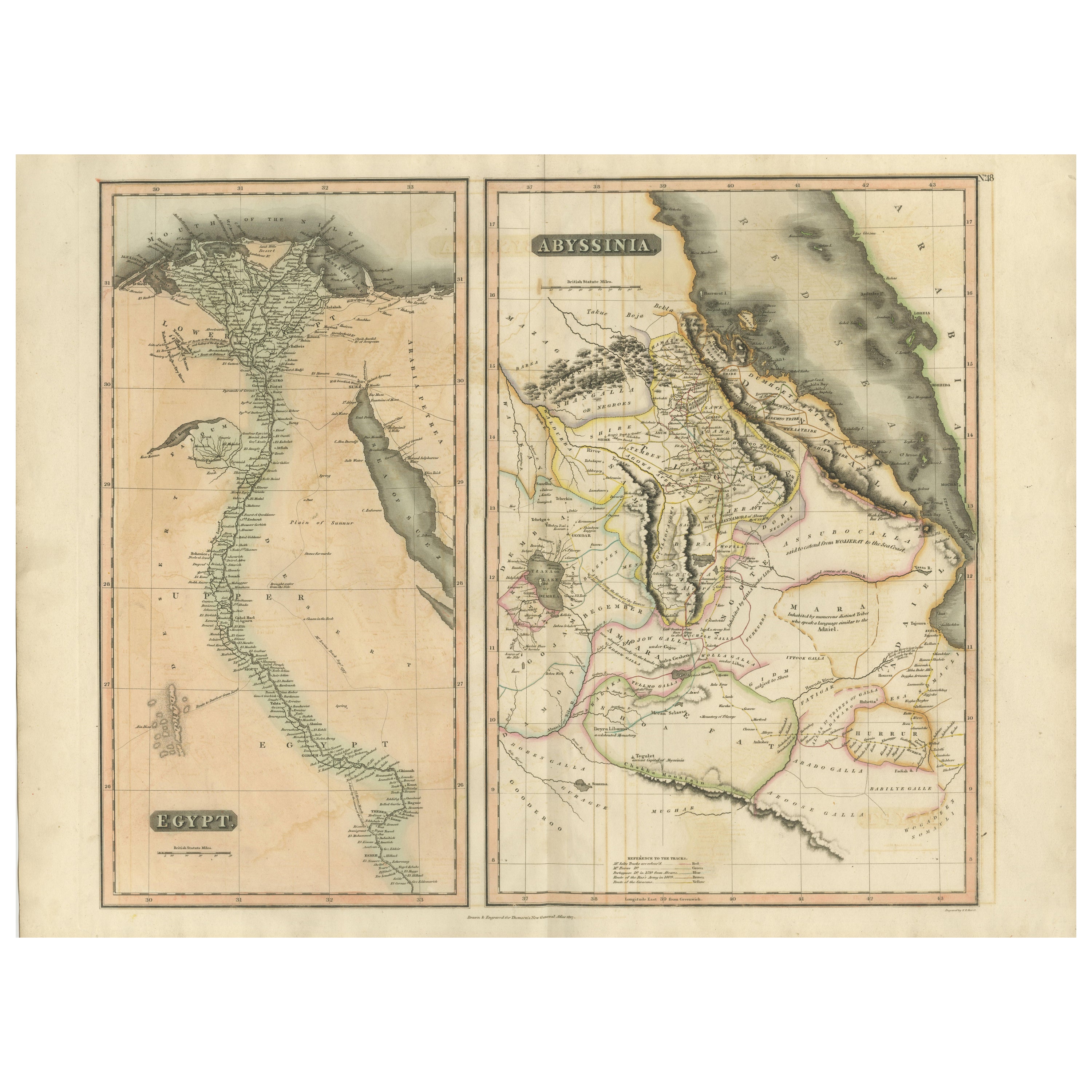
Abyssinia – Original Nile Valley and Horn of Africa Maps, c.1817
Located in Langweer, NL
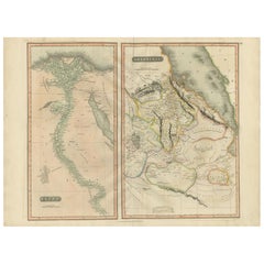
Egypt & Abyssinia – Nile Valley and Horn of Africa Maps, c.1817–1820
This refined early 19th-century map composition presents two related geographic views of Northeast Africa: Egypt...
Category
Antique 1810s British Maps
Materials
Paper
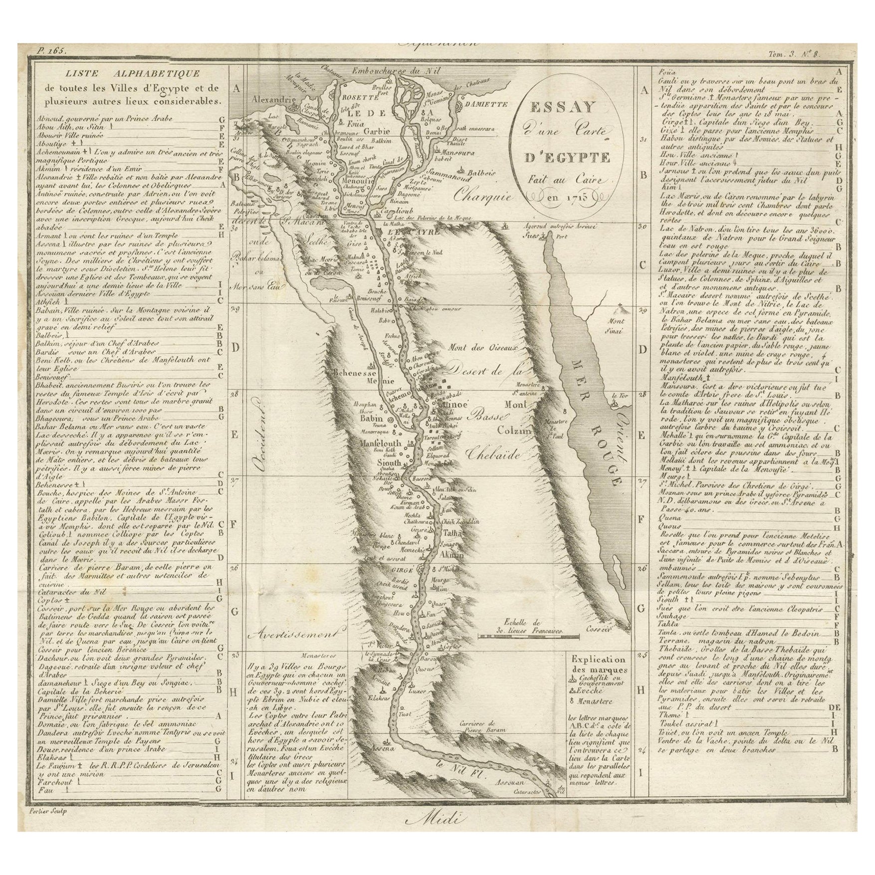
Antique Map of Egypt and the Nile Valley with City Index, 1715
Located in Langweer, NL
Antique map of Egypt, titled "Essay d'une Carte d'Égypte Fait au Caire en 1715".
This finely engraved map presents a detailed depiction of Egypt along the Nile River from the Medit...
Category
Antique Early 18th Century French Maps
Materials
Paper
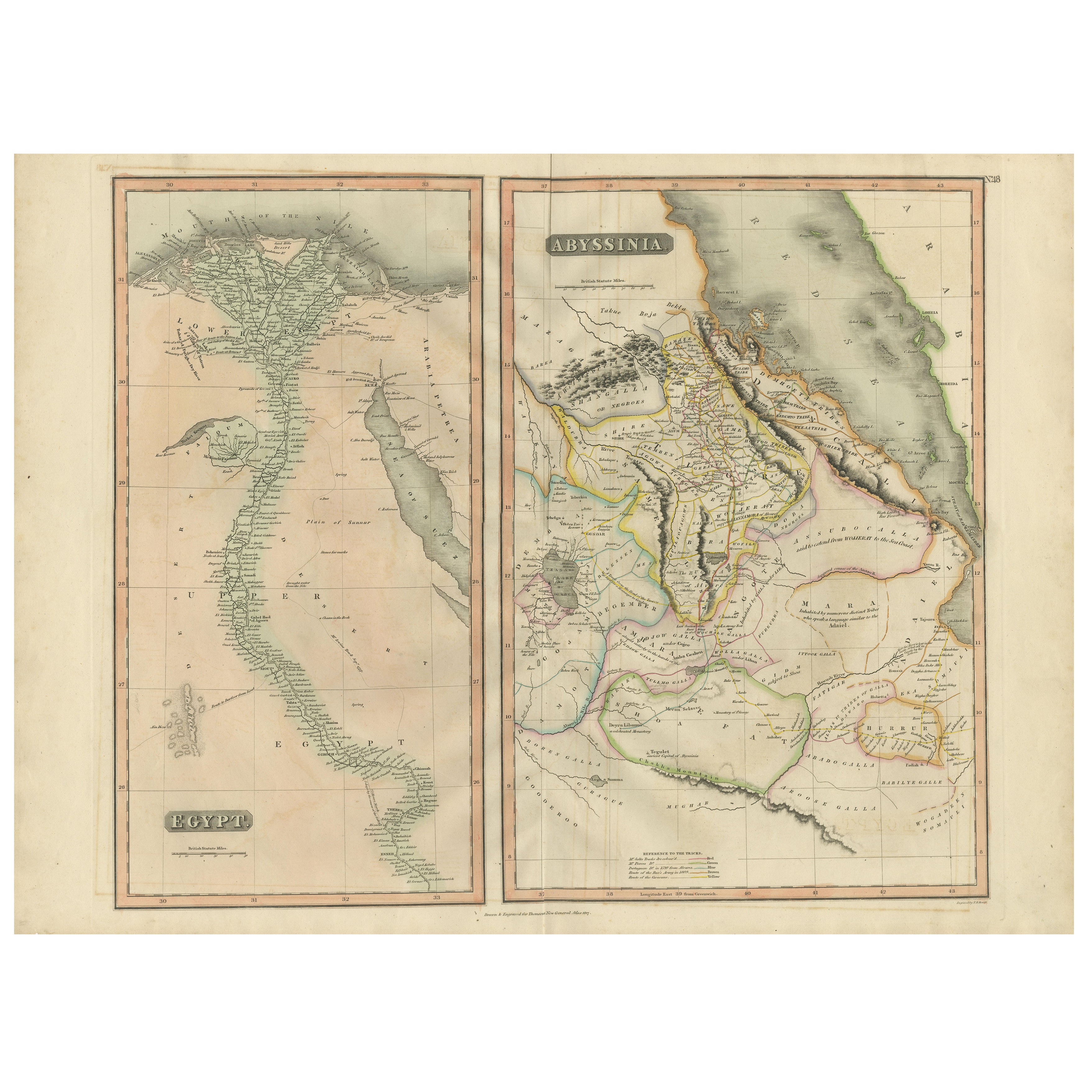
Egypt and Abyssinia – Nile Valley
Horn of Africa Maps, c.1817–1820
Located in Langweer, NL
Egypt and Abyssinia – Nile Valley & Horn of Africa Maps, c.1817–1820
This refined early 19th-century paired map presents Egypt and Abyssinia (Ethiopia) as two complementary geograph...
Category
Antique 1810s British Maps
Materials
Paper
Antique Map of Egypt with Detailed Inset of the Nile Delta, ca. 1799
Located in Langweer, NL
Antique Map of Egypt with Detailed Inset of the Nile Delta, ca. 1799
This finely engraved antique map titled Carte Physique et Politique de l’Égypte presents a detailed and scientif...
Category
Antique Early 1800s French Maps
Materials
Paper

Antique Map of The Nile, Egypt and the Red Sea by Bachiene, 1765
Located in Langweer, NL
Antique map titled 'De XIde Landkaart verbeeldende Egypte en de Woestyne der Schelf-Zee (..).' Map of Biblical Egypt and the Red Sea. With title cartouche, compass rose and scale. Th...
Category
Antique 18th Century Maps
Materials
Paper

Antique Map of Ancient Egypt Also Depicting the Nile River and Red Sea, 1845
Located in Langweer, NL
Antique map Egypt titled 'General Karte von Alt Aegypten von A.H. Brué'. Large map of Egypt also depicting the Nile river and Red Sea. Source unknown...
Category
Antique 19th Century Maps
Materials
Paper

You May Also Like
Map of Nubia and Abissinia - Original Etching by Antonio Zatta - 1784
Located in Roma, IT
This Map of Nubia and Abissinia is an etching realized by Antonio Zatta in Venice in 1784.
The state of preservation of the artwork is good expect for the worn paper with some littl...
Category
1770s Landscape Prints
Materials
Etching

Original Antique Map of Ancient Greece- Boeotia, Thebes, 1787
Located in St Annes, Lancashire
Great map of Ancient Greece. Showing the region of Boeotia, including Thebes
Drawn by J.D. Barbie Du Bocage
Copper plate engraving by P.F T...
Category
Antique 1780s French Other Maps
Materials
Paper

Original Antique Map of Ancient Greece, Achaia, Corinth, 1786
Located in St Annes, Lancashire
Great map of Ancient Greece. Showing the region of Thessaly, including Mount Olympus
Drawn by J.D. Barbie Du Bocage
Copper plate engraving by P.F Tardieu
Original hand color...
Category
Antique 1780s French Other Maps
Materials
Paper

Africa. North-East Part. Century Atlas antique vintage map
Located in Melbourne, Victoria
'The Century Atlas. Africa. North-East Part'
Original antique map, 1903.
Inset map of 'Nile Delta and Suez Canal'.
Central fold as issued. Map name and nu...
Category
Early 20th Century Victorian More Prints
Materials
Lithograph

Map of the Holy Land "Carte de la Syrie et de l
Egypte" by Pierre Lapie
By Pierre M. Lapie
Located in Alamo, CA
This is an early 19th century map of ancient Syria and Egypt entitled "Carte de la Syrie et de l'Egypte anciennes/dressée par M. Lapie, Colonel d'Etat M...
Category
1830s Landscape Prints
Materials
Engraving

Original Antique Map of Africa by Dower, circa 1835
Located in St Annes, Lancashire
Nice map of Africa
Drawn and engraved by J.Dower
Published by Orr & Smith. C.1835
Unframed.
Free shipping
Category
Antique 1830s English Maps
Materials
Paper
