Items Similar to Ancient Europe Map 1652, Europa Antiqua – Nicolas Blancardus, Roman World

Want more images or videos?
Request additional images or videos from the seller
1 of 9
Ancient Europe Map 1652, Europa Antiqua – Nicolas Blancardus, Roman World
$830.59
£620.08
€700
CA$1,153.94
A$1,241.23
CHF 663.35
MX$14,630.54
NOK 8,363.27
SEK 7,645.61
DKK 5,334.79
About the Item
Ancient Europe Map 1652, Europa Antiqua – Nicolas Blancardus, Roman World
Description:
This uncommon mid-17th-century map of ancient Europe presents the classical world as understood during the height of the Roman Empire. Titled Europa Antiqua cum finitimis Africae
utriusque Asiae regionibus, it was drawn by Nicolaus Blancardus and published in Amsterdam by Joannes Janssonius around 1652. The map extends well beyond Europe proper to include North Africa, the eastern Mediterranean, and parts of the Near East, reflecting the geographic scope of Roman influence and classical historiography.
The map is offered unframed, enabling custom framing to personal or interior preferences.
The entire sheet is densely filled with ancient place names, tribal territories, and regional designations drawn from Greek and Roman sources. Modern country names are absent; instead, the map uses classical nomenclature for provinces, cities, and peoples, making it a visual companion to the study of antiquity. Rivers, mountain ranges, and coastlines are rendered with fine pictorial engraving, while subtle relief and stylized forests enhance the topographical character.
Britannia, Gallia, Hispania, Italia, Germania, and Graecia are shown alongside Asia Minor, the Levant, and northern Africa, with the Mediterranean occupying a central role as the Mare Mediterraneum. Decorative elements include an elaborate cartouche in the lower left bearing the title and Blancardus’s name, as well as an armorial dedication panel in the upper left, typical of Janssonius’s scholarly atlas production.
Blancardus, a professor at Leiden University, designed this map specifically as an educational tool for students of ancient history and classical geography. Rather than serving navigational purposes, it functioned as a didactic reference, aligning geography with historical texts by authors such as Ptolemy, Strabo, and Pliny. As such, it occupies an important place within the tradition of “antique” or historical maps that flourished in the 17th century.
Today, this map is prized by collectors of classical antiquity, early historical cartography, and scholars interested in how the early modern period visualized the ancient world. Its restrained engraving, academic intent, and broad geographic scope make it equally suitable for a study, library, or refined interior setting.
Condition report:
Original 17th-century engraving. Even age toning throughout, with light spotting and handling marks consistent with age. A vertical centerfold as issued. Margins ample; no losses. Overall a well-preserved, honest example.
Framing tips:
This map benefits from a dark walnut or ebonized frame paired with a wide ivory or warm grey mat to emphasize the fine engraving. Museum glass is recommended. A classic library or study setting suits this scholarly map particularly well. The map is offered unframed, enabling custom framing to personal or interior preferences.
Technique: Engraving
Maker: Nicolaus Blancardus, Leiden / Amsterdam, circa 1652
- Dimensions:Height: 20.79 in (52.8 cm)Width: 25.04 in (63.6 cm)Depth: 0.02 in (0.5 mm)
- Materials and Techniques:Paper,Engraved
- Place of Origin:
- Period:Mid-17th Century
- Date of Manufacture:circa 1652
- Condition:Original 17th-century engraving. Even age toning throughout, with light spotting and handling marks consistent with age. A vertical centerfold as issued. Margins ample; no losses. Overall a well-preserved, honest example. Sold unframed.
- Seller Location:Langweer, NL
- Reference Number:Seller: BG-091811stDibs: LU3054348269102
About the Seller
5.0
Recognized Seller
These prestigious sellers are industry leaders and represent the highest echelon for item quality and design.
Platinum Seller
Premium sellers with a 4.7+ rating and 24-hour response times
Established in 2009
1stDibs seller since 2017
2,836 sales on 1stDibs
Typical response time: 1 hour
- ShippingRetrieving quote...Shipping from: Langweer, Netherlands
- Return Policy
More From This Seller
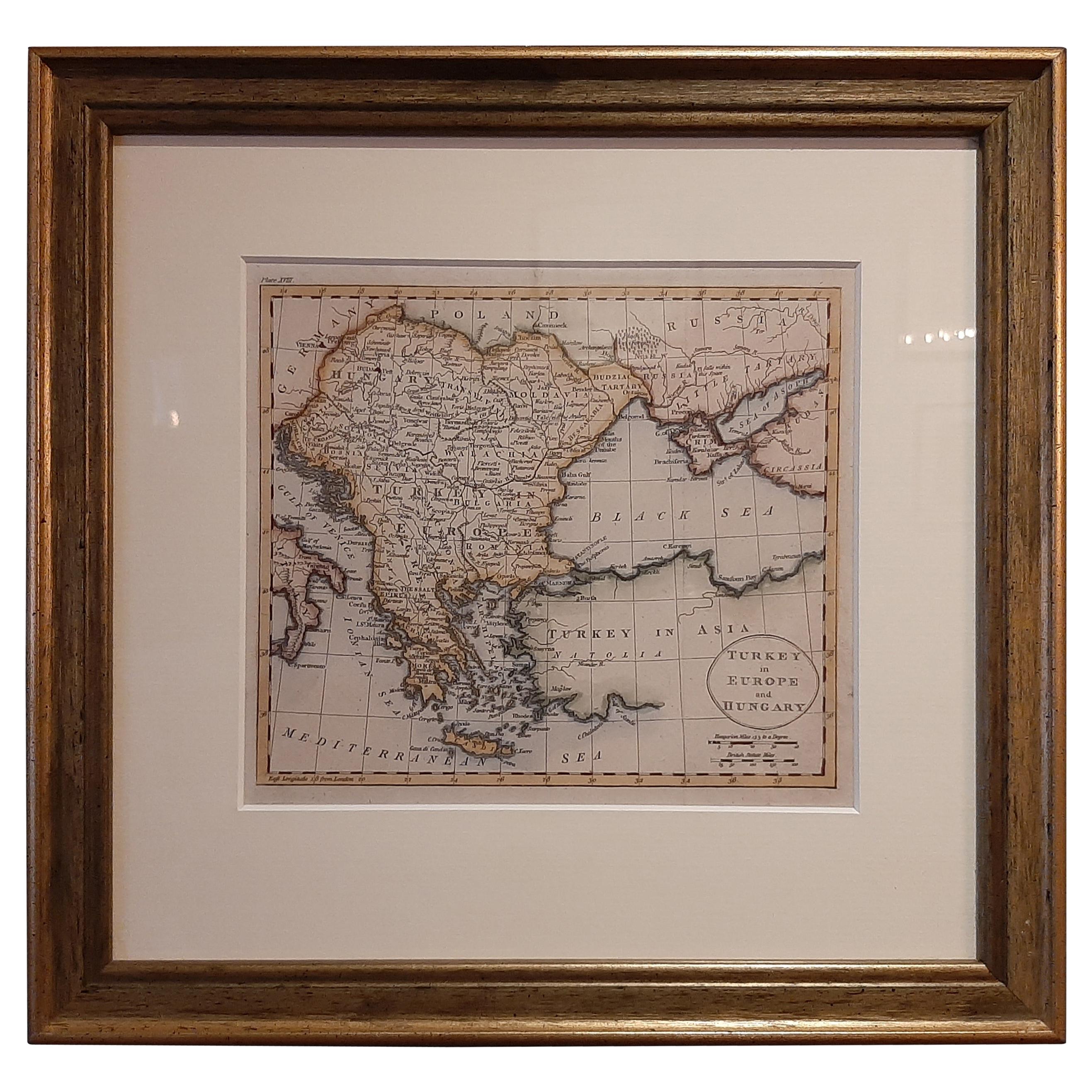
View AllAntique Map of Turkey in Europe by Russell, circa 1795
Located in Langweer, NL
Antique map titled 'Turkey in Europe and Hungary'. Original map of Turkey in Europe. Covers present day Northern Turkey, Greece, Albania, Romania, Hungary, Croatia, Bosnia Herzogovin...
Category
Antique Late 18th Century Maps
Materials
Paper
$332 Sale Price
20% Off
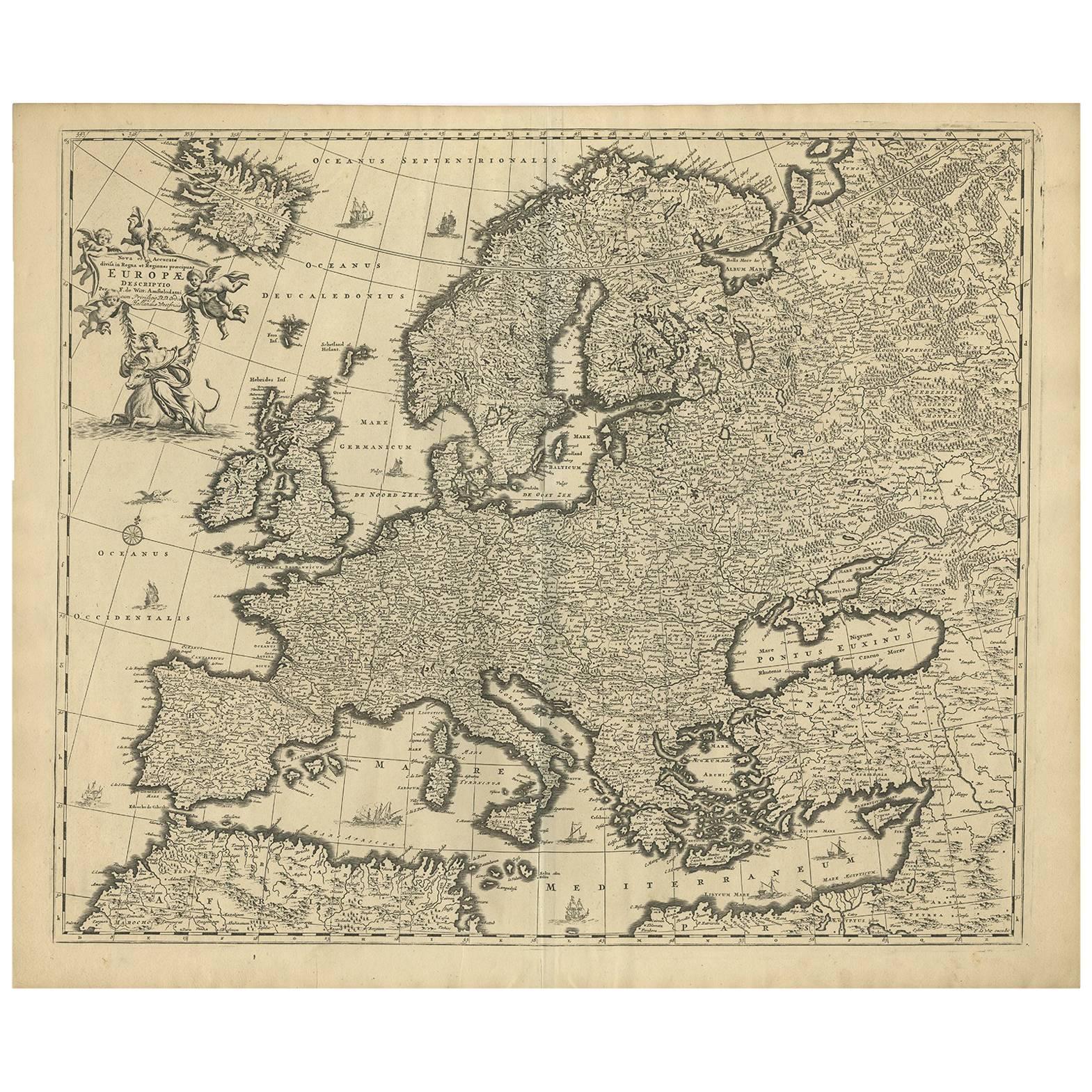
Grand Map of Europe by Frederick de Wit, Circa 1690: A Baroque Era Masterpiece.
Located in Langweer, NL
This is an attractive historical map of Europe created by Frederick de Wit, published around 1690. Here's a detailed description of the map and additional context about its creation:...
Category
Antique Late 17th Century Dutch Maps
Materials
Paper
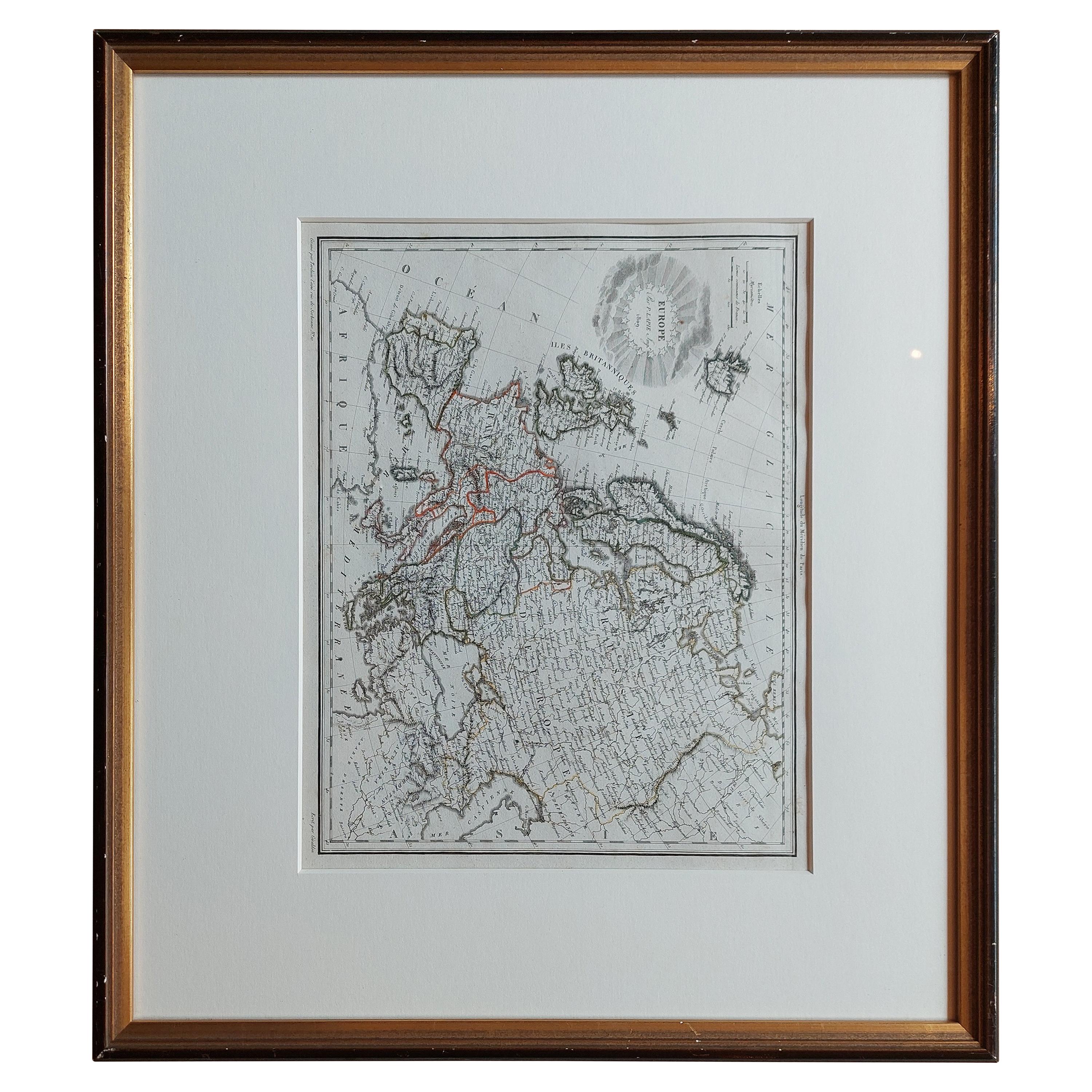
Antique Map of Europe by Lapie,
1809
Located in Langweer, NL
Antique map titled 'Europe'. Original antique map of Europe by P. Lapie, published 1809. Frame included.
Category
Antique Early 19th Century Maps
Materials
Paper
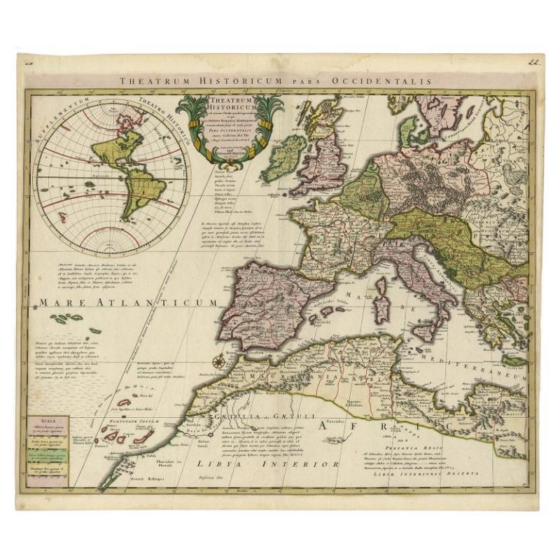
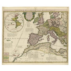
Finely Engraved Antique Map of Europe with inset of America, c.1745
By Guillaume De L
Isle
Located in Langweer, NL
Antique map titled 'Theatrum Historicum pars Occidentalis.' Finely engraved historical map with a profusion of details. It shows western Europe and the northern Mediterranean basin a...
Category
Antique 18th Century Maps
Materials
Paper
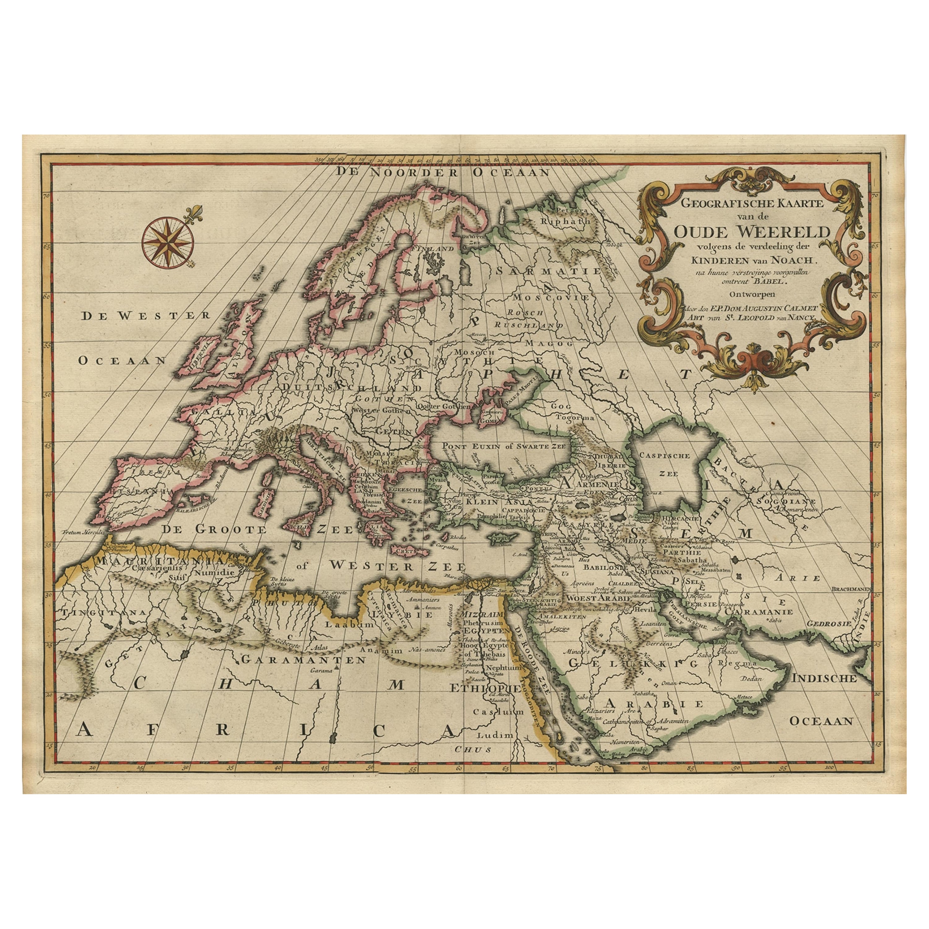
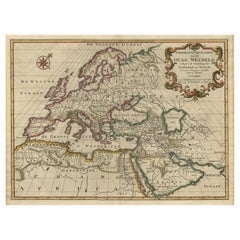
Ancient World Map of Europe, Asia
Northern Africa with Ancient Names, 1725
Located in Langweer, NL
Antique map titled 'Geografische Kaarte van de Oude Weereld (..).'
Original antique map of the ancient world depicting Europe, Asia, and northern Africa with ancient place names....
Category
Antique 1720s French Maps
Materials
Paper
Rare Antique Bible Map of Southern Europe by A. Schut, 1743
Located in Langweer, NL
Antique map of the Mediterranean and a large part of Europe, illustrating the voyage of St. Paul to Rome. This map originates from ‘Biblia Sacra, dat is, de H. Schriftuer van het Oud...
Category
Antique Mid-18th Century Maps
Materials
Paper
$519 Sale Price
32% Off
You May Also Like
Vintage Reproduction 17th Century Map of Europe, American, Cartography, Blaeuw
Located in Hele, Devon, GB
This is a vintage reproduction map of Europe. An American, paper stock cartography print in frame after the work by Blaeuw, dating to the late 20t...
Category
Late 20th Century Central American Mid-Century Modern Maps
Materials
Glass, Wood, Paper

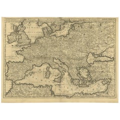
17th Century Nicolas Visscher Map of Southeastern Europe
Located in Hamilton, Ontario
A beautiful, highly detailed map of southeastern Europe by Nicolas Visscher. Includes regions of Northern Italy (showing the cities Bologna, Padua, and Venice), Bohemia, Austria (sho...
Category
Antique 17th Century Dutch Maps
Materials
Paper

$1,350 Sale Price
38% Off
Large Original Antique Map of Europe by Sidney Hall, 1847
Located in St Annes, Lancashire
Great map of Europe
Drawn and engraved by Sidney Hall
Steel engraving
Original colour outline
Published by A & C Black. 1847
Unframed
Free shipping.
Category
Antique 1840s Scottish Maps
Materials
Paper

Southern
Eastern Europe: A Large 17th C. Hand-colored Map by Sanson
Jaillot
By Nicolas Sanson
Located in Alamo, CA
This large hand-colored map entitled "Estats de L'Empire des Turqs en Europe, ou sont les Beglerbeglicz our Gouvernements" was originally created by Nicholas Sanson d'Abbeville and t...
Category
Antique 1690s French Maps
Materials
Paper

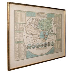
Antique Plan de l
Historie Universelle World Map, Framed Cartography, Circa 1730
Located in Hele, Devon, GB
This is an antique Plan de l'Historie Universelle World Map. A Dutch, framed atlas engraving by Henri Abraham Chatelain, dating to the 18th century and later, circa 1730.
Published...
Category
Antique 1730s Dutch George II Maps
Materials
Glass, Paper
Italy, Sicily, Sardinia, Corsica and Dalmatian Coast: A 17th Century Dutch Map
By Theodorus Danckerts
Located in Alamo, CA
This hand colored 17th century Dutch map entitled "Novissima et Accuratissima totius Italiae Corsicae et Sardiniae Descriptio" by Theodore Danckerts depicts the Italian Peninsula in ...
Category
Antique Late 17th Century Dutch Maps
Materials
Paper
