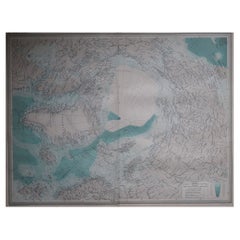
Items Similar to Antarctic Exploration Map by Noothoven van Goor with Early Discoveries, c.1876

Want more images or videos?
Request additional images or videos from the seller
1 of 9
Antarctic Exploration Map by Noothoven van Goor with Early Discoveries, c.1876
$498.36
£371.65
€420
CA$693.69
A$744.48
CHF 399.07
MX$8,959.53
NOK 5,031.72
SEK 4,588.23
DKK 3,200.15
About the Item
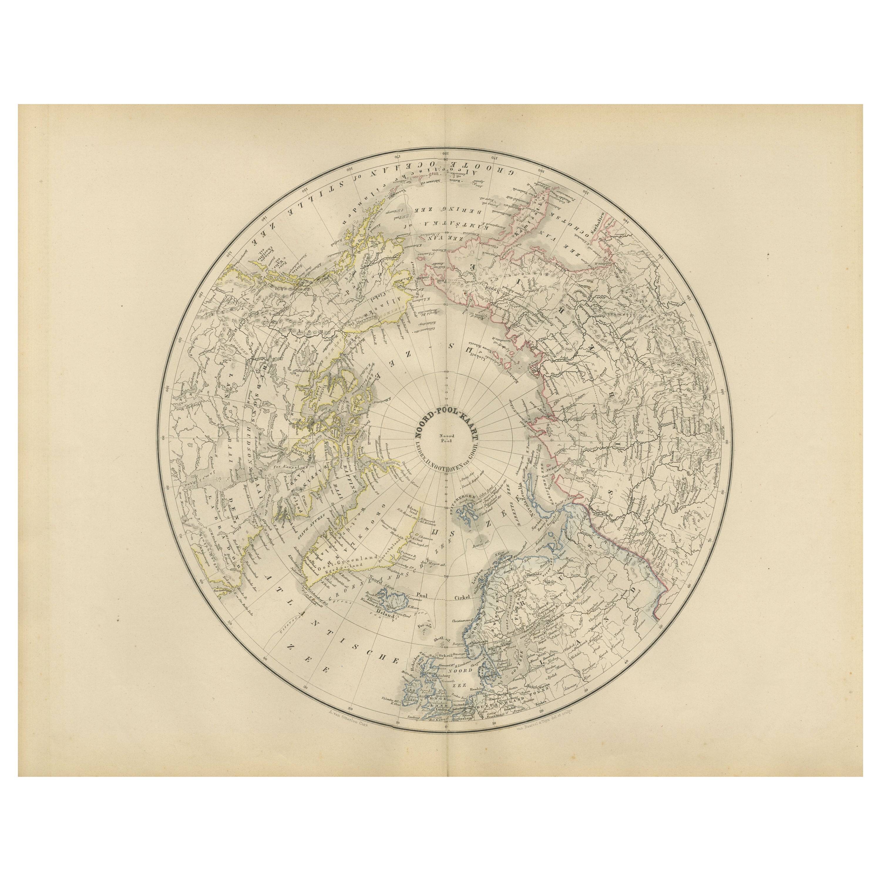
Antarctic Exploration Map by Noothoven van Goor with Early Discoveries, c.1876
This impressive 19th-century circular map of the Antarctic region was published in Leiden by D. Noothoven van Goor for the *Nieuwe Hand-Atlas der Aarde* around 1876. It presents one of the era’s most engaging visual summaries of polar exploration, created at a time when Antarctica was still largely speculative, its coastline incomplete, and its continental form uncertain. The map is centred on the South Pole and radiates outward, showing the southern extremities of South America, Africa, Australia, and New Zealand, along with the fragmented and often conjectural outlines of the Antarctic continent as known during the mid-1800s.
The engraving reflects the accumulated knowledge from expeditions led by major explorers of the period. Among these are the voyages of James Cook, whose circumnavigation of the Southern Ocean is marked with clarity; the discoveries of Bellingshausen and Lazarev; and the early 19th-century British, French, and American expeditions led by Ross, Dumont d’Urville, and Wilkes. These routes and discovery points are carefully marked in fine linework, illustrating the uncertain and competitive nature of Antarctic exploration. Coastlines are often labelled with the names of the explorers who first recorded them, such as Victoria Land, Adelie Land, Enderby Land, and Graham Land, demonstrating the cartographer’s reliance on fragmented expedition reports rather than definitive surveys.
The delicate hand-colouring outlines the known and presumed portions of the Antarctic coast, differentiating speculative ice shelves from confirmed land masses. The map also depicts early oceanographic features, including major currents and sea routes across the Southern Ocean, linking the Cape of Good Hope, Tasmania, New Zealand, and Cape Horn. As a scientific document, it encapsulates the period just before the Heroic Age of Antarctic Exploration, making it a historically significant piece for collectors of polar history, cartography, and exploration narratives.
Large and visually striking, the circular projection gives the map a decorative appeal beyond its scientific value. It serves as both a study of geographic uncertainty and a reminder of the challenges faced by early polar expeditions attempting to chart one of the world’s most inhospitable regions.
Condition report:
Good condition for age. Light toning throughout. Scattered foxing in margins. Original centre fold as issued. No tears or repairs observed. Image area clean with only minor age spots.
Framing tips:
A wide off-white or ivory mat enhances the circular projection. Black or dark walnut frames give a classic, museum-style presentation. Floating the map in a shadow-box frame also works well due to the strong geometric form.
Keyword block:
Antarctica, South Pole, polar exploration, Southern Ocean, James Cook, Ross expedition, Wilkes expedition, Dumont d’Urville, Bellingshausen, Victorian cartography, 19th-century map, Dutch atlas, Noothoven van Goor, circular map, exploration routes, early Antarctic discoveries, southern hemisphere map, antique engraving.
- Dimensions:Height: 17.33 in (44 cm)Width: 21.66 in (55 cm)Depth: 0.01 in (0.2 mm)
- Materials and Techniques:
- Place of Origin:
- Period:
- Date of Manufacture:1876
- Condition:Good condition for age. Light toning throughout. Scattered foxing in margins. Original centre fold as issued. No tears or repairs observed. Image area clean with only minor age spots.
- Seller Location:Langweer, NL
- Reference Number:Seller: BG-12788-321stDibs: LU3054347571322
About the Seller
5.0
Recognized Seller
These prestigious sellers are industry leaders and represent the highest echelon for item quality and design.
Platinum Seller
Premium sellers with a 4.7+ rating and 24-hour response times
Established in 2009
1stDibs seller since 2017
2,830 sales on 1stDibs
Typical response time: 1 hour
- ShippingRetrieving quote...Shipping from: Langweer, Netherlands
- Return Policy
More From This Seller
View AllNorthern Hemisphere Map Centered on the North Pole, Leiden 1876
Located in Langweer, NL
Title: Northern Hemisphere Map Centered on the North Pole, Leiden 1876
Description:
This 19th-century Dutch map titled “Noordpoolkaart” (Map of the North Pole) was published in 1876...
Category
Antique 1870s Dutch Maps
Materials
Paper
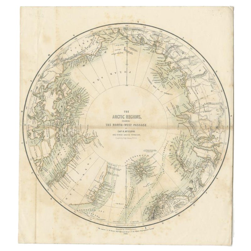
Antique Map of the North Pole by Fullarton, 1856
Located in Langweer, NL
Antique map titled 'The Arctic Regions showing the North-West Passage of Captain R. McClure'. Old map of the North Pole, displaying the Northwest Passage di...
Category
Antique 19th Century Maps
Materials
Paper
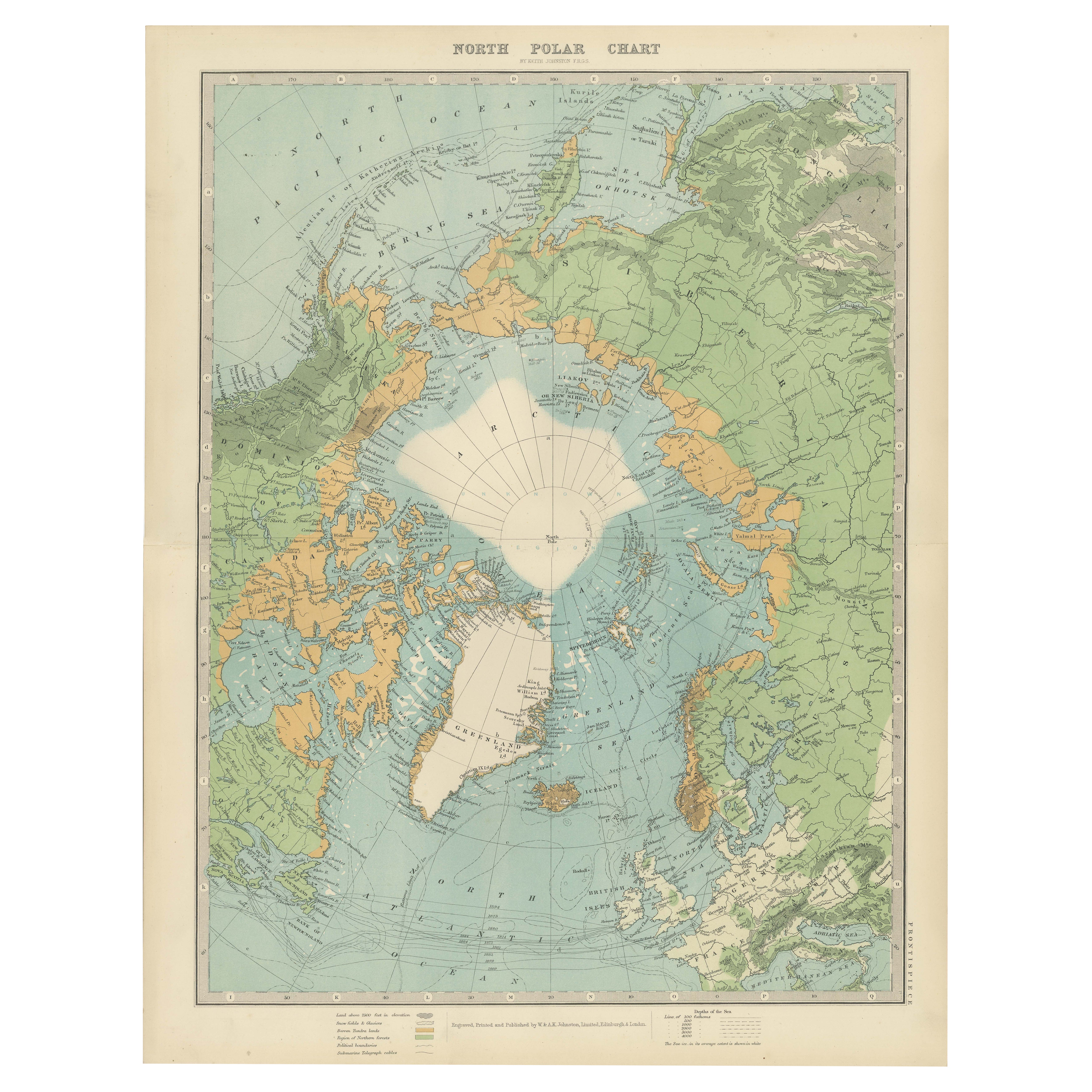
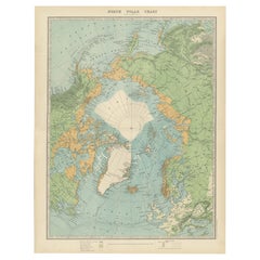
Vintage North Polar Chart Featuring Arctic Exploration Routes, 1903
Located in Langweer, NL
Title: Vintage North Polar Chart Featuring Arctic Exploration Routes, 1903
This vintage map titled "North Polar Chart" offers a fascinating glimpse into early 20th-century Arctic ex...
Category
Early 20th Century Scottish Maps
Materials
Paper
$341 Sale Price
20% Off
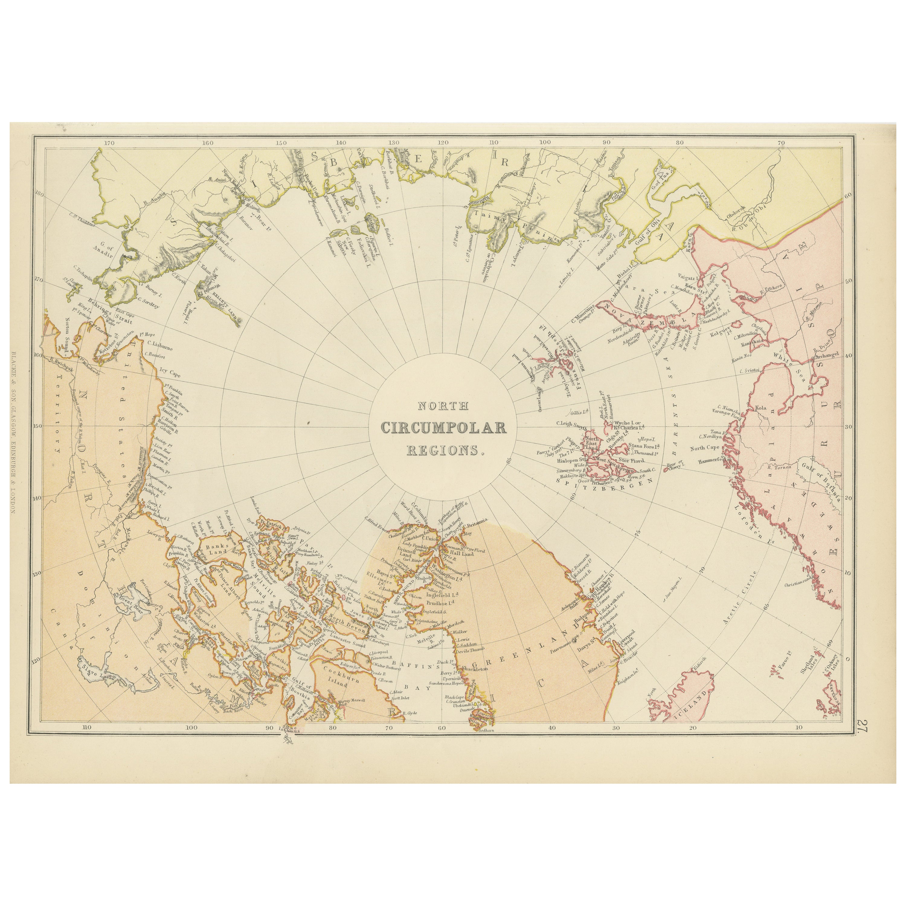
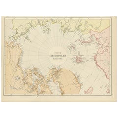
Arctic Exploration: An Original Map of the North Circumpolar Regions, 1882
Located in Langweer, NL
This map, extracted from the 1882 atlas by Blackie & Son, presents the North Circumpolar Regions in a projection centered on the North Pole, offering a unique view of the Arctic territories. The map's radial lines emanate from the pole, focusing on the northernmost parts of continents and the intricate archipelagos that are scattered across the Arctic Ocean.
The territories of Canada, Greenland, Northern Europe, Russia, and the northern extremities of Asia are portrayed with careful detail, highlighting the geography known to Victorian explorers. Notably, the map's color palette is subdued, with the cold regions depicted in pale hues, while coastlines and political boundaries are traced in warmer tones, providing a stark contrast that emphasizes the frigid environment.
The map likely served purposes both educational and navigational, capturing the extent of polar exploration at the time. Names of seas, straits, and islands honor explorers and patrons of the age of Arctic exploration, and the map also hints at the incomplete knowledge of the era, with some areas less detailed than others, reflecting the limits of exploration and cartographic knowledge of the Arctic region at that time.
Moreover, the map includes longitudinal and latitudinal markers, which would have been crucial for navigation and expedition planning. The inclusion of such detail illustrates the growing interest in polar exploration during the late 19th century...
Category
Antique 1880s Maps
Materials
Paper
$265 Sale Price
20% Off
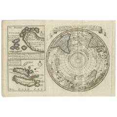
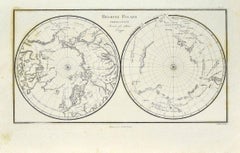
Antique Map of the South Pole by Keizer
de Lat, 1788
Located in Langweer, NL
Antique map titled 'De Zuid Pool, waar in aangetoont werd alle de Nieuwe Landen (..)'. Original antique map of the South Pole including two small inset maps...
Category
Antique Late 18th Century Maps
Materials
Paper
$474 Sale Price
20% Off
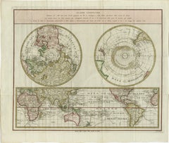
Old World Map Featuring Captain Cook
s Exploration Routes and Polar Views, 1787
Located in Langweer, NL
1786 World Map with Polar Projections - "Globo Terrestre" by Giovanni Maria Cassini
This 1786 map titled "Globo Terrestre" by Giovanni Maria Cassini offers a fascinating and detai...
Category
Antique 1860s Maps
Materials
Paper
$1,803 Sale Price
20% Off
You May Also Like
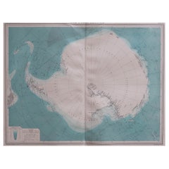
Large Original Vintage Map of the South Pole, circa 1920
Located in St Annes, Lancashire
Great map of the South pole.
Unframed.
Original color.
By John Bartholomew and Co. Edinburgh Geographical Institute.
Published, circa 1920.
Category
Vintage 1920s British Maps
Materials
Paper
Map of Polar Regions - Original Etching - Late 19th Century
Located in Roma, IT
This Map of Polar regions is an etching realized by an anonymous artist.
The state of preservation of the artwork is good with some small diffused stains.
Sheet dimension: 28.5 x 4...
Category
Late 19th Century Modern Figurative Prints
Materials
Etching
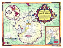
Original Byrd Map of Antartic Expedition 1934 vintage poster map
Located in Spokane, WA
Original Authorized Map of the Second BYRD Antarctic Expedition vintage poster map. Printed in 1934 by G.F. Corp. Artist: George Annand. Authentic 1934 Print: This is the genuin...
Category
1930s American Realist Landscape Prints
Materials
Offset
Ancient Map-Poli Arctici (Map of the Poles)-Etching by Johannes Janssonius-1650s
By Johannes Janssonius
Located in Roma, IT
Poli Arctici is an ancient map realized in 1650 by Johannes Janssonius (1588-1664).
The Map is a Hand-colored etching, with coeval watercoloring.
Good conditions with slight foxing...
Category
1650s Modern Figurative Prints
Materials
Etching

Original Antique Map of The Eastern Hemisphere by Dower, circa 1835
Located in St Annes, Lancashire
Nice map of the Eastern Hemisphere
Drawn and engraved by J.Dower
Published by Orr & Smith. C.1835
Unframed.
Free shipping
Category
Antique 1830s English Maps
Materials
Paper

Large Original Vintage Map of The North Pole, circa 1920
Located in St Annes, Lancashire
Great maps of The North Pole.
Unframed.
Original color.
By John Bartholomew and Co. Edinburgh Geographical Institute.
Published, circa 1920.
Free shipp...
Category
Vintage 1920s British Maps
Materials
Paper