Items Similar to Antique Astronomical Chart of the Solar System and Seasons – Black’s Atlas, 1884
Video Loading
Want more images or videos?
Request additional images or videos from the seller
1 of 11
Antique Astronomical Chart of the Solar System and Seasons – Black’s Atlas, 1884
$380.40
£283.13
€320
CA$527.57
A$567.98
CHF 304.16
MX$6,843.96
NOK 3,837.71
SEK 3,512.12
DKK 2,438.99
About the Item
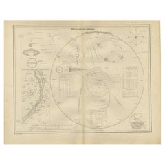
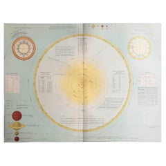
Antique Astronomical Chart of the Solar System and Seasons – Black’s Atlas, 1884
This striking scientific chart comes from the New and Revised Edition of Black’s General Atlas of the World, published in Edinburgh in 1884. It combines detailed astronomical diagrams with explanations of planetary motion, eclipses, tides, and seasonal cycles, reflecting the Victorian era’s commitment to both education and visual clarity.
The left-hand side features a large diagram of the Solar System, showing the orbits of the planets, Halley’s Comet, and other celestial paths. Comparative scales highlight the immense distances of the planets from the sun, while diagrams also illustrate the relative sizes of planets compared to the sun. The engraver has captured not only astronomical accuracy but also the sense of wonder with which 19th-century science approached the heavens.
On the right-hand side, a series of smaller explanatory charts delve into the Theory of the Seasons, the Phases of the Moon, Eclipses (both solar and lunar), and the Theory of the Tides, with distinctions between spring and neap tides. A diagram of the Mariner’s Compass is also included, underscoring the practical applications of celestial knowledge for navigation.
These combined diagrams formed an invaluable teaching aid in the 19th century, providing atlas readers with both a terrestrial and celestial education. They represent the marriage of geography, astronomy, and navigation at a time when global exploration and scientific discovery were tightly linked.
Condition report:
Good condition. Clean impression with original hand-applied tints still fresh. Light toning to margins with a faint patina of age. One tear almost touching the image in the left border, otherwise fine.
Framing tips:
This chart is especially well suited for display in a study, library, or educational space. A pale cream or light blue archival mat complements the delicate coloring. A black, silver, or dark wood frame emphasizes the scientific precision of the engraving, while a gilt frame lends it a decorative Victorian touch.
Technique: Engraving with original hand coloring
Maker: Black’s General Atlas, Edinburgh, 1884
- Dimensions:Height: 12.37 in (31.4 cm)Width: 17.84 in (45.3 cm)Depth: 0.01 in (0.2 mm)
- Materials and Techniques:
- Place of Origin:
- Period:
- Date of Manufacture:1884
- Condition:Good condition. Clean impression with original hand-applied tints still fresh. Light toning to margins with a faint patina of age. One tear almost touching the image in the left border, otherwise fine.
- Seller Location:Langweer, NL
- Reference Number:Seller: BG-13601-3-51stDibs: LU3054346514492
About the Seller
5.0
Recognized Seller
These prestigious sellers are industry leaders and represent the highest echelon for item quality and design.
Platinum Seller
Premium sellers with a 4.7+ rating and 24-hour response times
Established in 2009
1stDibs seller since 2017
2,828 sales on 1stDibs
Typical response time: 1 hour
- ShippingRetrieving quote...Shipping from: Langweer, Netherlands
- Return Policy
More From This Seller
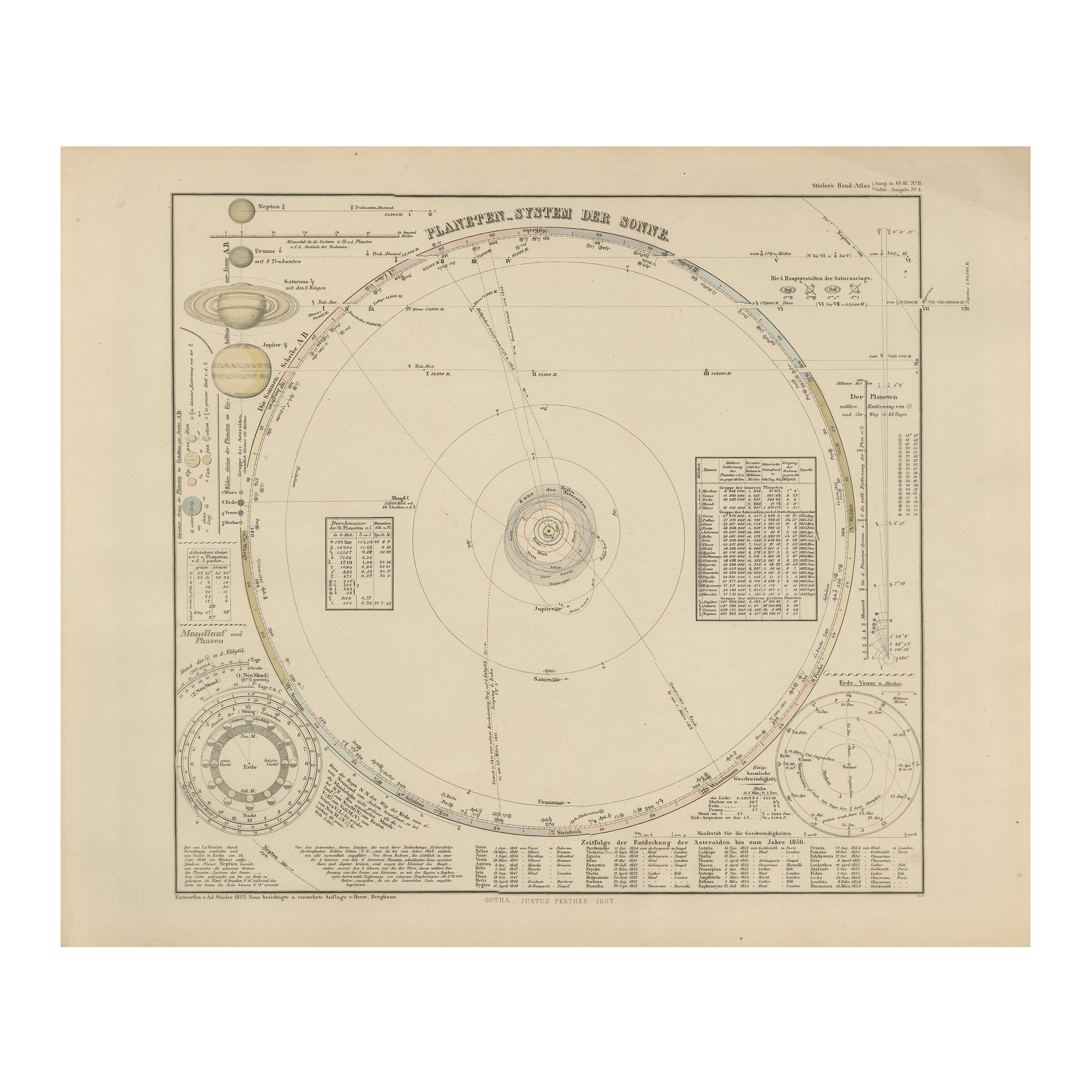
View AllSolar System Map – Planetary Orbits and Data Chart, Published in 1857
Located in Langweer, NL
Solar System Map – Planetary Orbits and Data Chart 1857
This antique print shows a detailed diagram of the solar system titled “Planeten-System der Sonne” meaning “Planetary System ...
Category
Antique Mid-19th Century German Maps
Materials
Paper
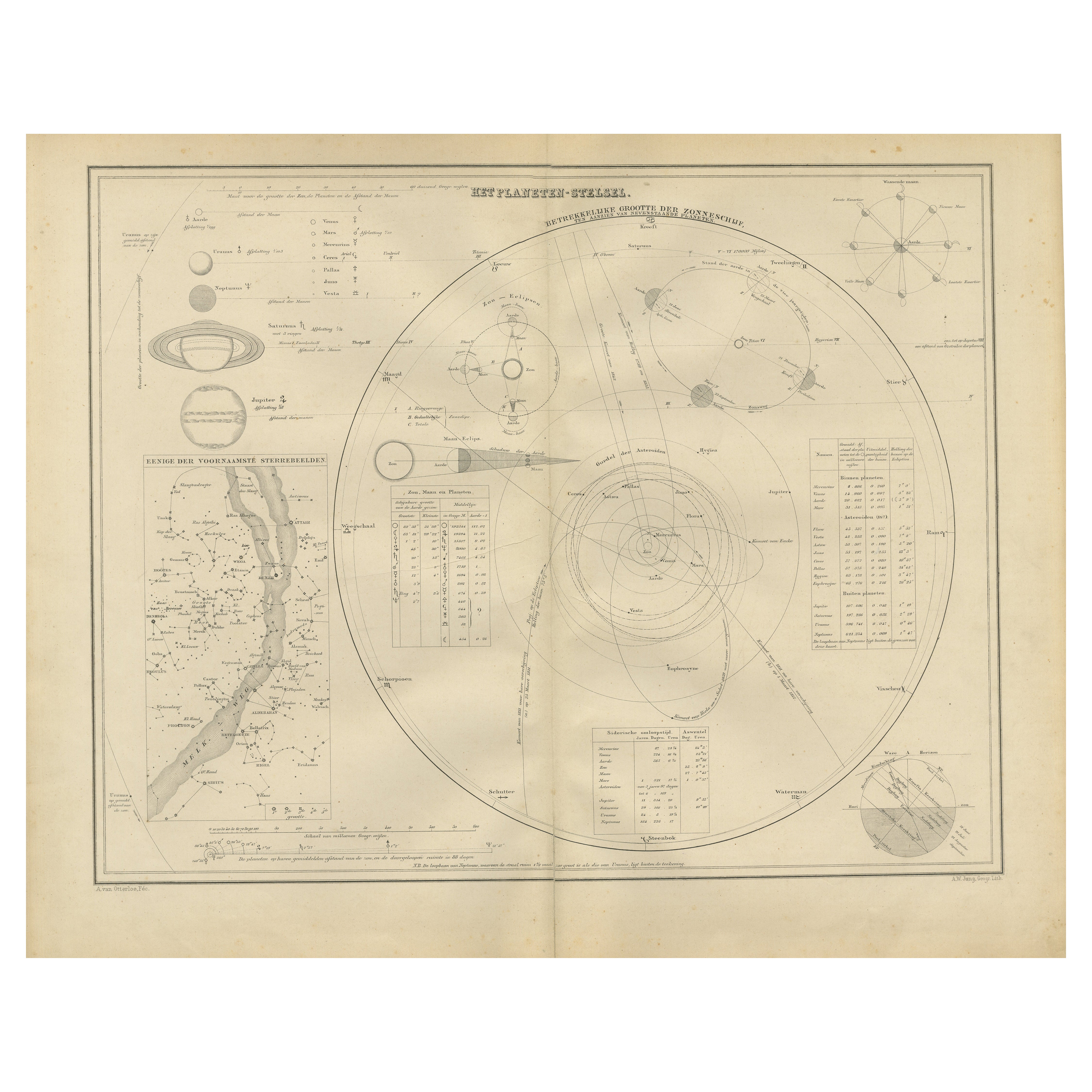
The Solar System – Astronomical Lithograph - The Nieuwe Hand-Atlas, Leiden 1876
Located in Langweer, NL
The Solar System – Astronomical Lithograph from the Nieuwe Hand-Atlas, Leiden 1876
This detailed 19th-century Dutch astronomical lithograph, titled “Het Planeten-Stelsel” (The Plane...
Category
Antique 1870s Dutch Maps
Materials
Paper
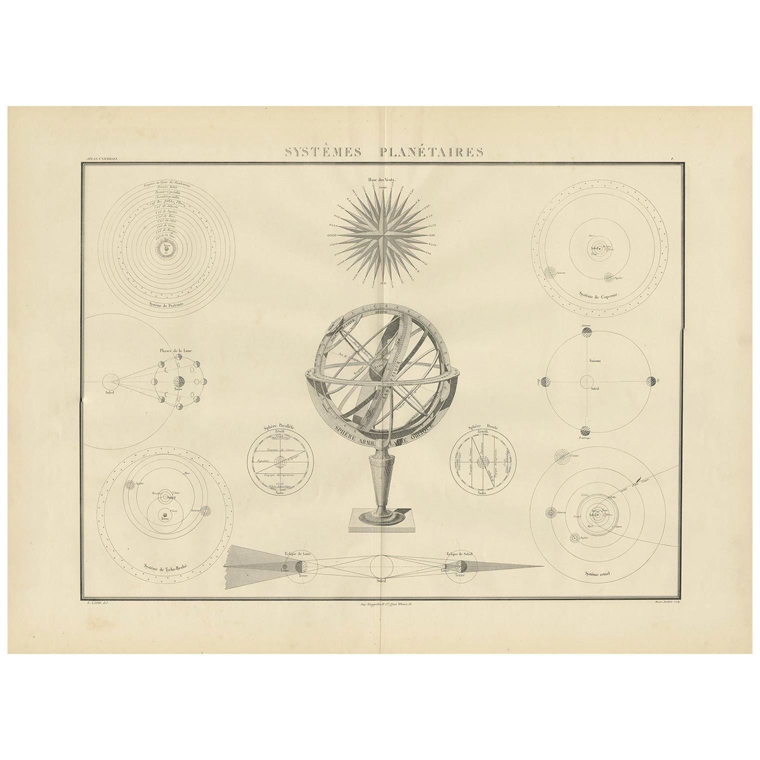
Systèmes Planétaires Antique Print, Celestial Models Chart, 1842
Located in Langweer, NL
Antique print titled 'Systèmes Planétaires'. Chart of various celestial and scientific models. Includes an armillary sphere and various models of the universe, the season, eclipses, a Copernican, Tycho...
Category
Antique Mid-19th Century French Prints
Materials
Paper
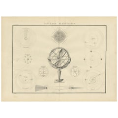
$665 Sale Price
30% Off
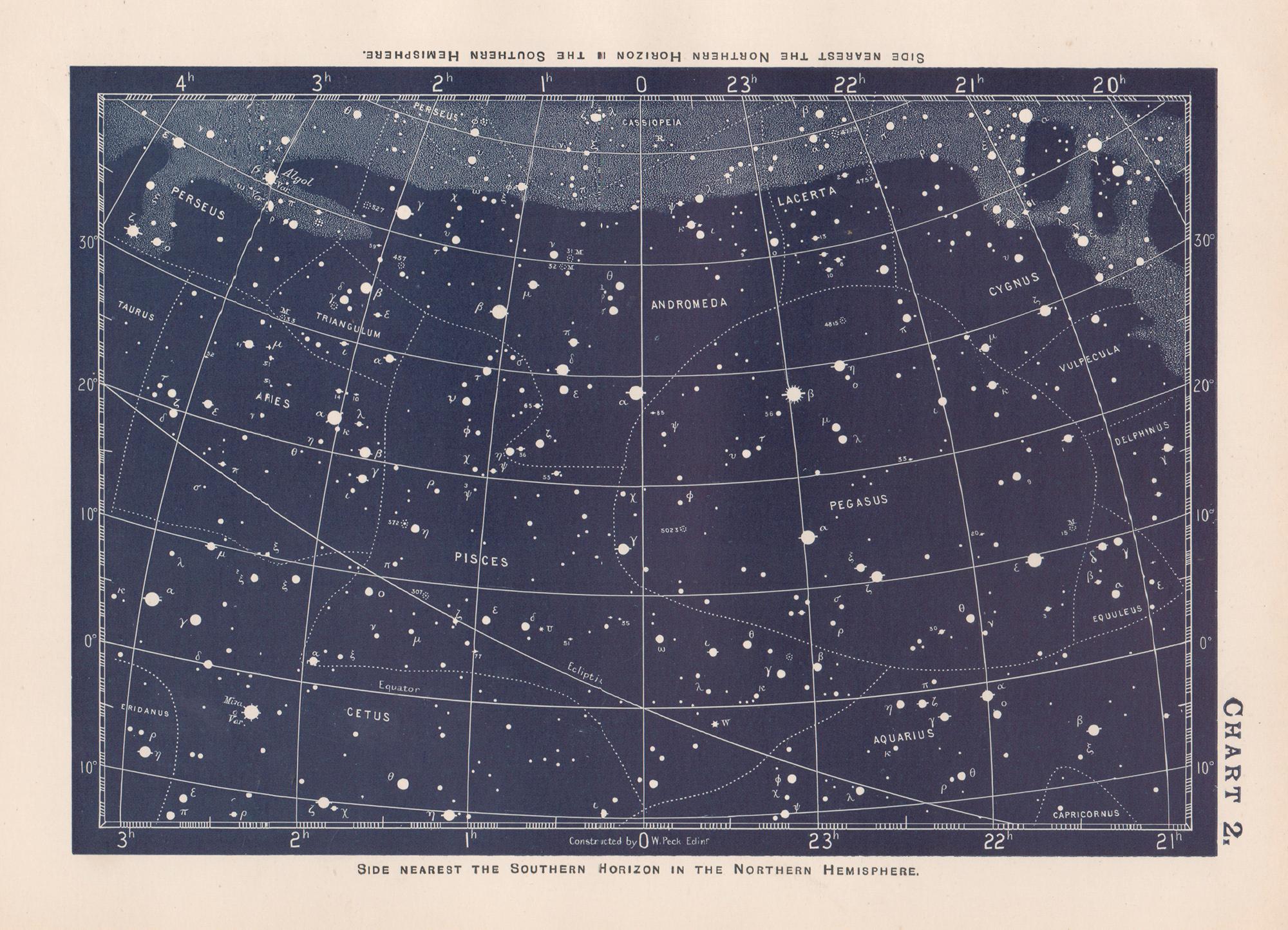
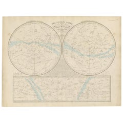
Antique Celestial Star Map – Northern
Southern Hemispheres, 1860
Located in Langweer, NL
Antique Celestial Star Map – Northern & Southern Hemispheres, Andriveau-Goujon 1860
This elegant antique celestial chart, published in Paris in 1860 by the noted French cartographer...
Category
Antique Mid-19th Century French Maps
Materials
Paper
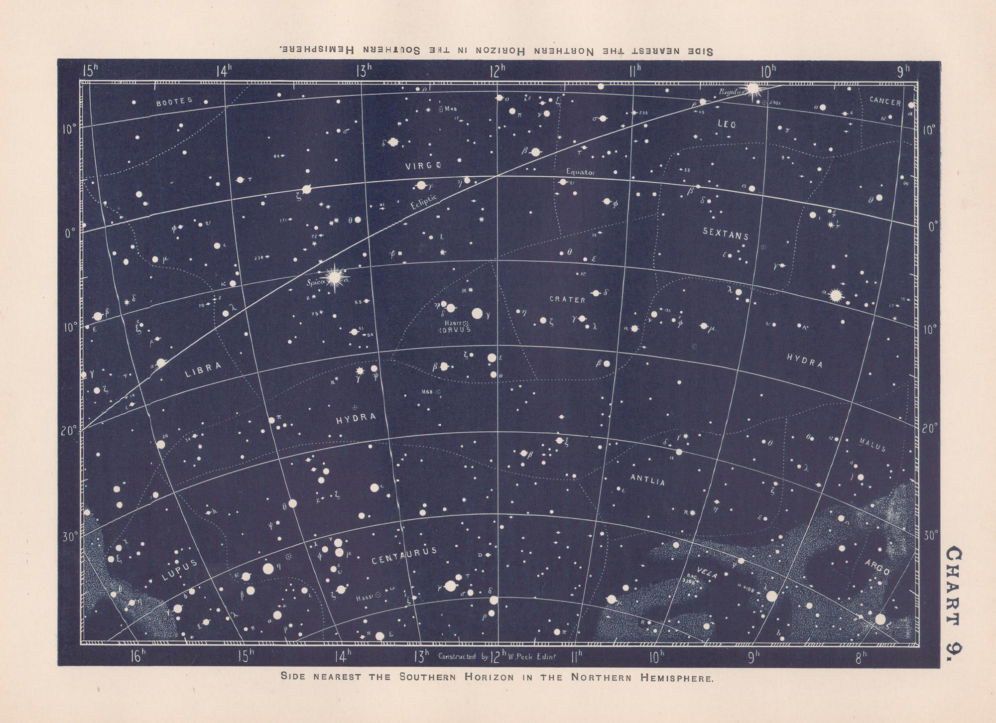
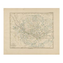
Northern Hemisphere Star Map – Constellations
Astronomical Chart, c.1858
Located in Langweer, NL
Northern Hemisphere Star Map – Constellations & Astronomical Chart c.1858
This attractive antique print shows the northern starry sky titled “Der nördliche gestirnte Himmel”, meanin...
Category
Antique Mid-19th Century German Maps
Materials
Paper
Antique Chart of the Passage of Comets in the Southern Sky, circa 1740
Located in Langweer, NL
Antique map titled 'Motus Comtarum in Hemispaerio Australi (..)'. This uncommon chart depicts the passage of comets in the southern sky between the years 1530-1704. Centered on the ecliptic poles and shows the constellation figures based on classical mythology, without showing the stars. The paths of dozens of comets are illustrated, eincluding those sighted by Tycho Brahe...
Category
Antique Mid-18th Century German Maps
Materials
Paper
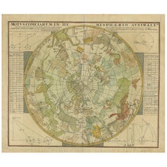
$2,228 Sale Price
25% Off
You May Also Like
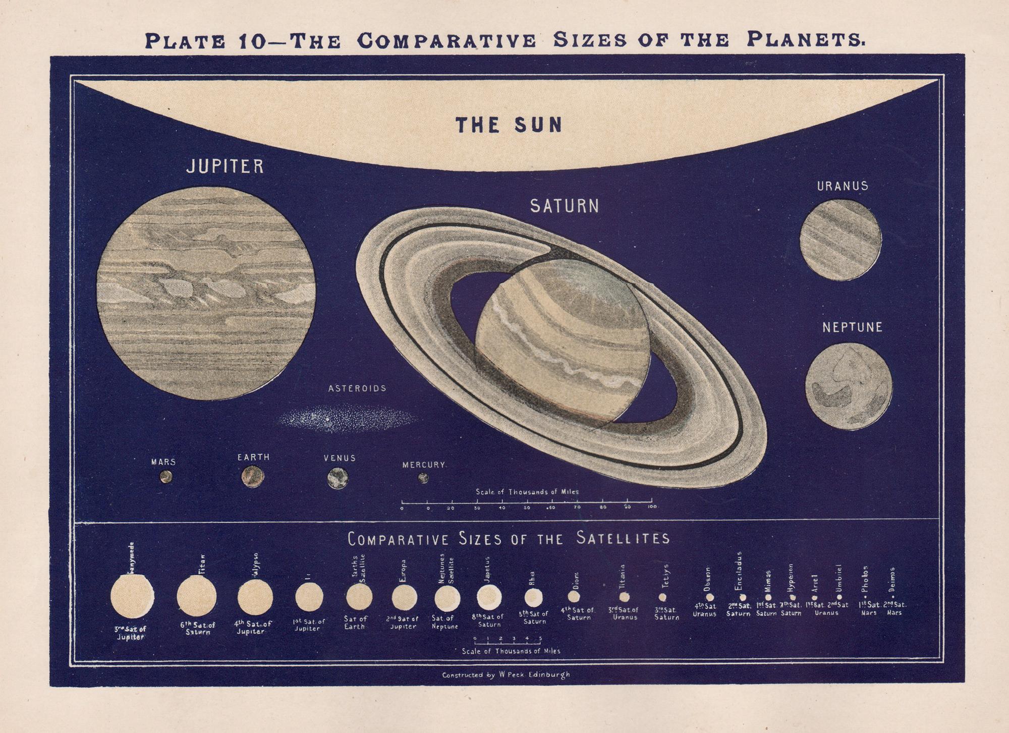
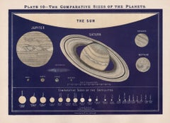
The Comparative Sizes of the Planets. Antique Astronomy diagram
Located in Melbourne, Victoria
Colour lithograph, 1890. 210mm by 285mm (sheet). From W Peck's 'A Handbook and Atlas of Astronomy', 1890. Sir William Peck FRSE FRAS (1862 – 1925) was a Scottish astronomer and scien...
Category
Late 19th Century Victorian More Prints
Materials
Lithograph
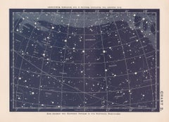
Star Chart. Antique Astronomy celestial print
Located in Melbourne, Victoria
Colour lithograph, 1890. 210mm by 285mm (sheet). From W Peck's 'A Handbook and Atlas of Astronomy', 1890. Sir William Peck FRSE FRAS (1862 – 1925) was a Scottish astronomer and scien...
Category
Late 19th Century Victorian More Prints
Materials
Lithograph
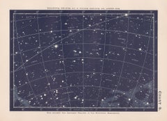
Star Chart. Antique Astronomy celestial print
Located in Melbourne, Victoria
Colour lithograph, 1890. 210mm by 285mm (sheet). From W Peck's 'A Handbook and Atlas of Astronomy', 1890. Sir William Peck FRSE FRAS (1862 – 1925) was a Scottish astronomer and scien...
Category
Late 19th Century Victorian More Prints
Materials
Lithograph
Original Antique Astronomy Print. C.1900
Located in St Annes, Lancashire
Great image of the solar system
Unframed.
Chromo-lithograph
Published, C.1900
The measurement is the paper size of the print
Free shipping.
Category
Antique Early 1900s English Folk Art Prints
Materials
Paper
Eclipses. Antique Astronomy science print
Located in Melbourne, Victoria
Colour lithograph, 1890. 285mm by 210mm (sheet). From W Peck's 'A Handbook and Atlas of Astronomy', 1890. Sir William Peck FRSE FRAS (1862 – 1925) was a Scottish astronomer and scien...
Category
Late 19th Century Victorian More Prints
Materials
Lithograph
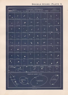
Double Stars. Antique Astronomy science print
Located in Melbourne, Victoria
Colour lithograph, 1890. 285mm by 210mm (sheet). From W Peck's 'A Handbook and Atlas of Astronomy', 1890. Sir William Peck FRSE FRAS (1862 – 1925) was a Scottish astronomer and scien...
Category
Late 19th Century Victorian More Prints
Materials
Lithograph