Items Similar to Antique Australia
New Zealand Map Wall Art – Rand McNally Atlas, c.1888
Want more images or videos?
Request additional images or videos from the seller
1 of 10
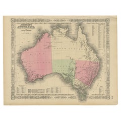
Antique Australia
New Zealand Map Wall Art – Rand McNally Atlas, c.1888
$700.07
£522.63
€590
CA$972.61
A$1,046.18
CHF 559.11
MX$12,331.45
NOK 7,049.04
SEK 6,444.16
DKK 4,496.46
About the Item
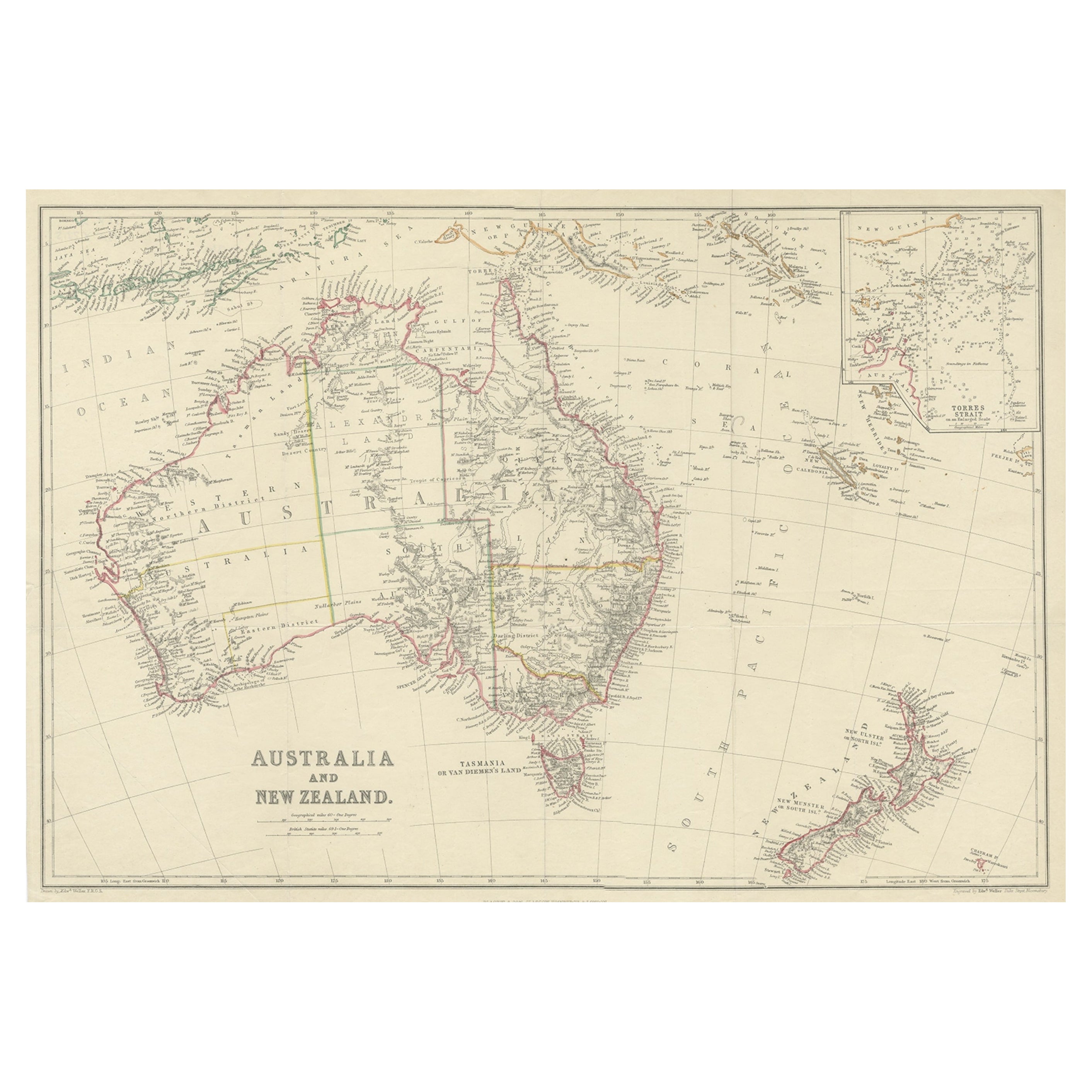
Title: Antique Australia
New Zealand Map Wall Art – Rand McNally Atlas, c.1888
Description:
This finely colored antique atlas map presents Australia in full, accompanied by inset maps of New Zealand, Tasmania, and Sydney Harbour. The composition is both informative and highly decorative, balancing dense geographic detail with a calm, harmonious color palette that reads beautifully on the wall. On the reverse a map of Upper Nubia and Habesh or Abyssinia.
Published by Rand, McNally
Co. in the late 19th to early 20th century, the map reflects the height of classical atlas cartography. Soft pastel color washes distinguish colonial boundaries and regions, while finely engraved coastlines, rivers, and place names add texture and depth. The surrounding seas are animated with delicate bathymetric lines, giving the map a sense of movement and scale.
Australia dominates the sheet with a strong, centered presence, while the carefully placed insets provide visual rhythm and additional points of interest. The overall effect is elegant rather than technical, making this an excellent choice for interior decoration as well as for collectors of historical maps.
Printed on original period atlas paper, the sheet retains the authentic surface and tone expected of a genuine antique map. Once framed, it becomes a striking focal point for a study, library, office, or travel-inspired interior.
Condition report: Light age toning consistent with age. Minor edge wear and small handling marks from original atlas binding. Overall clean and well preserved.
Framing tips: Particularly effective in a walnut, light oak, or black frame with an ivory or soft sand-colored mat. Museum glass recommended.
Technique: Color lithograph
Maker: Rand, McNally
Co., United States, late 19th–early 20th century
Keywords:
antique australia map, australia wall art, new zealand antique map, rand mcnally map, antique atlas map, vintage australia print, colonial australia map, travel wall art, world map decor, historical geography print
- Dimensions:Height: 14.18 in (36 cm)Width: 20.99 in (53.3 cm)Depth: 0.01 in (0.2 mm)
- Materials and Techniques:Paper,Engraved
- Place of Origin:
- Period:
- Date of Manufacture:1888
- Condition:Light age toning consistent with age. Minor edge wear and small handling marks from original atlas binding. Overall clean and well preserved.
- Seller Location:Langweer, NL
- Reference Number:Seller: BG-12794-731stDibs: LU3054348221642
About the Seller
5.0
Recognized Seller
These prestigious sellers are industry leaders and represent the highest echelon for item quality and design.
Platinum Seller
Premium sellers with a 4.7+ rating and 24-hour response times
Established in 2009
1stDibs seller since 2017
2,838 sales on 1stDibs
Typical response time: 1 hour
- ShippingRetrieving quote...Shipping from: Langweer, Netherlands
- Return Policy
More From This Seller
View AllAntique Map of Australia, 1903, with Colonial Divisions and Detailed Topography
Located in Langweer, NL
Title: Antique Map of Australia, 1903, with Colonial Divisions and Detailed Topography
Description: This antique map, titled "Australia," was engraved and published in 1903 by W. & ...
Category
Early 20th Century Maps
Materials
Paper

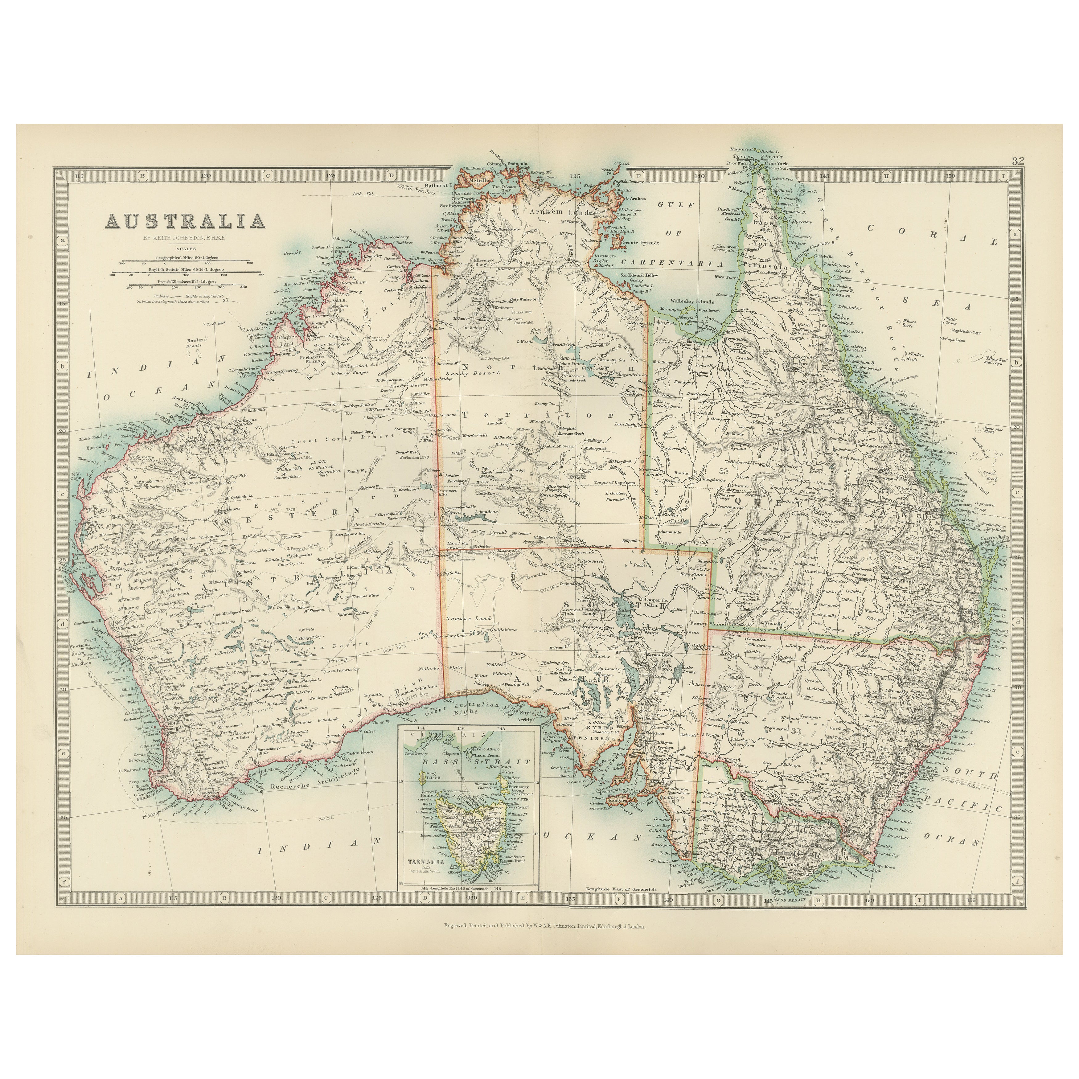
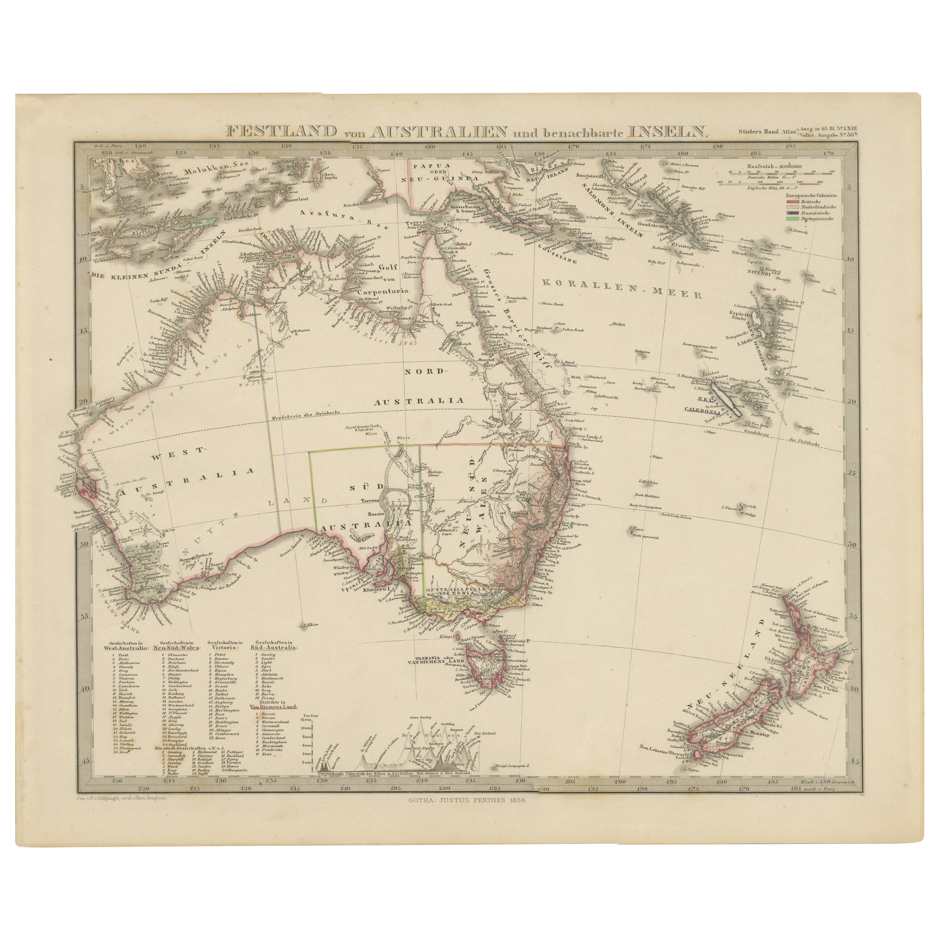
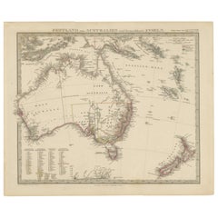
Australia, New Zealand, and Neighbouring Islands Map 1858
Located in Langweer, NL
Australia and Neighbouring Islands Map 1858
This attractive antique print shows “Festland von Australien und benachbarte Inseln” meaning “Mainland Australia and neighbouring islands...
Category
Antique Mid-19th Century German Maps
Materials
Paper
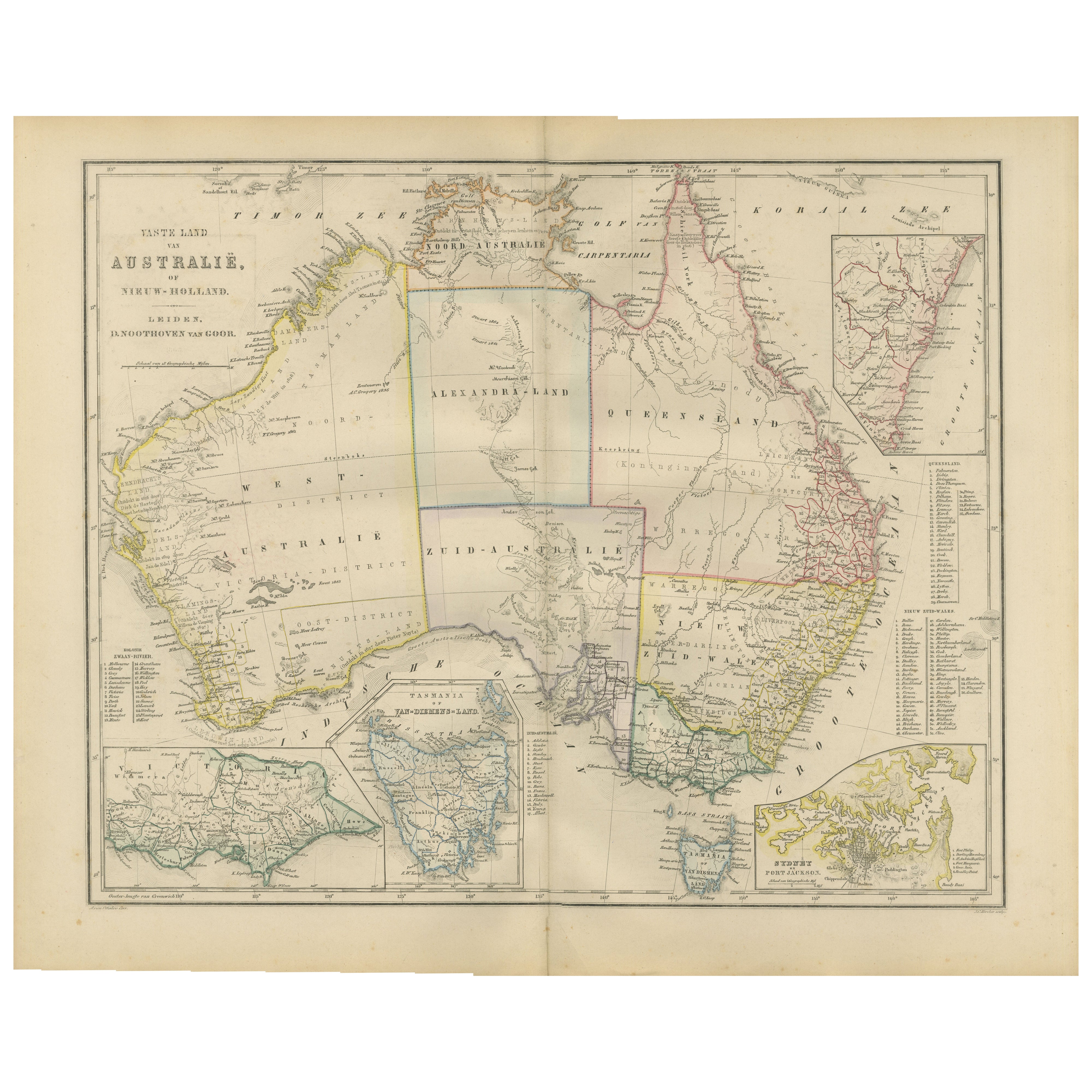
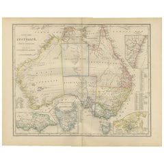
Australia or New Holland Map with Inset Regions by Noothoven van Goor, 1876
Located in Langweer, NL
Australia or New Holland Map with Inset Regions by Noothoven van Goor, 1876
This detailed 19th-century map, titled “Vaste Land van Australië, of Nieuw-Holland,” was published in Lei...
Category
Antique 1870s Dutch Maps
Materials
Paper
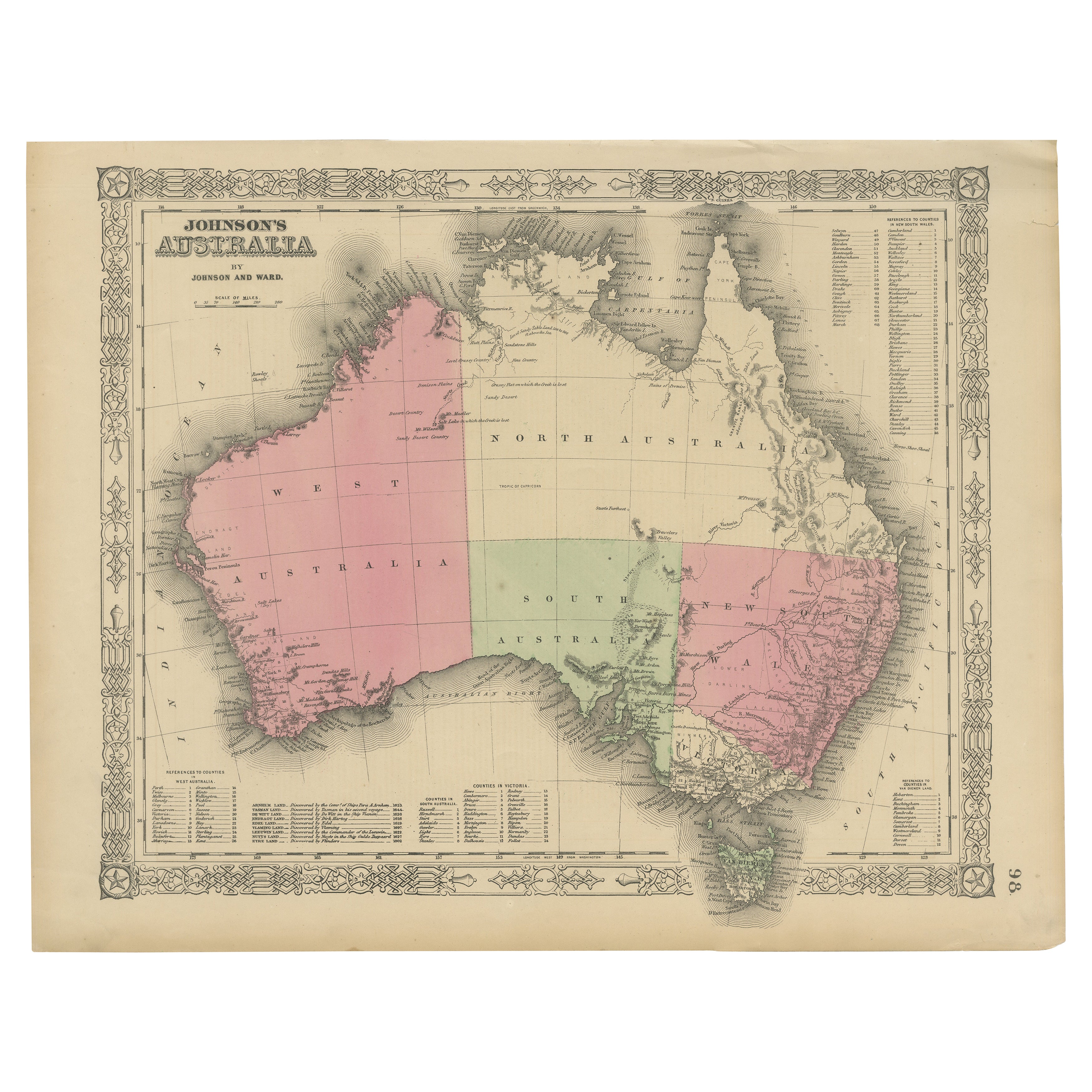
Johnson’s Australia Map, USA Published c.1864 – Decorative Hand-Colored Map
Located in Langweer, NL
Johnson’s Australia Map, USA Published c.1864 – Decorative Hand-Colored Map
This is a finely engraved and hand-colored map titled Johnson’s Australia published by Johnson and Ward i...
Category
Antique Mid-19th Century American Maps
Materials
Paper
Antique Map of Australia and New Zealand, c.1860
Located in Langweer, NL
Antique map titled 'Australia and New Zealand'. Unusual edition of this map of Australia and New Zealand, on very thin paper and multiple folding lines. Source unknown, to be determi...
Category
Antique 19th Century Maps
Materials
Paper

$132 Sale Price
20% Off
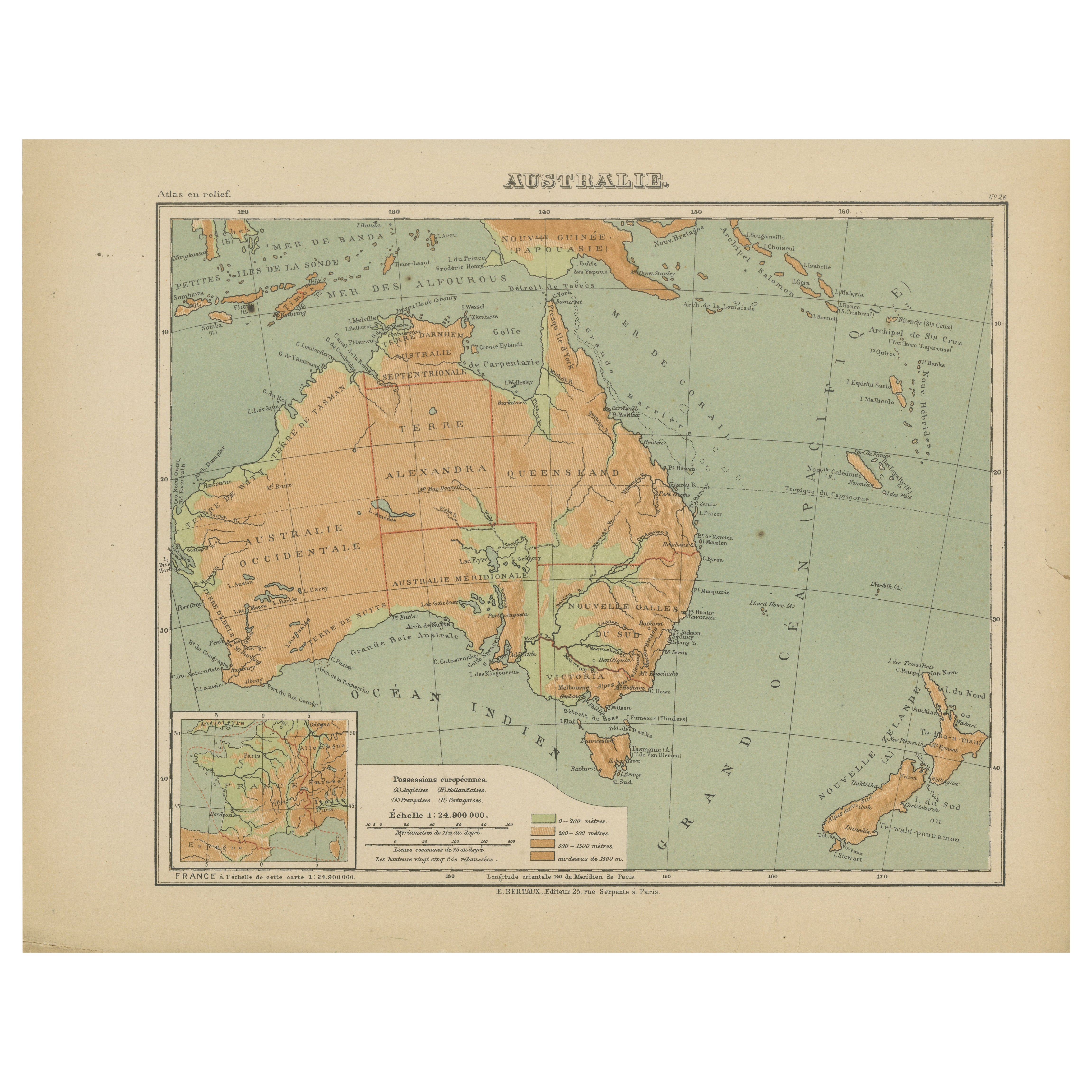
Antique Map of Australia and Oceania – Physical Relief Map by Hachette, c.1883
Located in Langweer, NL
Antique Map of Australia and Oceania – Physical Relief Map by Hachette, c.1883
Description:
This antique map titled “Australie” was published circa 1883 by Hachette in Paris as part...
Category
Antique Late 19th Century French Maps
Materials
Paper
You May Also Like
Original Antique Map of Australia by Dower, circa 1835
Located in St Annes, Lancashire
Nice map of Australia
Drawn and engraved by J.Dower
Published by Orr & Smith. C.1835
Unframed.
Free shipping
Category
Antique 1830s English Maps
Materials
Paper

Large Original Antique Map of Australia by Sidney Hall, 1847
Located in St Annes, Lancashire
Great map of Australia
Drawn and engraved by Sidney Hall
Steel engraving
Original colour outline
Published by A & C Black. 1847
Unframed
Free shipping.
Category
Antique 1840s Scottish Maps
Materials
Paper

Australia, Tallis antique map, 1851
Located in Melbourne, Victoria
'Australia'
With decorative border surrounds and vignettes including a view of Sydney, Kangaroos, Natives of Australia Felix, Australian Parrots and Cockatoos and Natives of the Tri...
Category
19th Century Naturalistic Landscape Prints
Materials
Engraving

Vintage Australia Map, Framed, Historic 19th Century Cartography Interest, 1988
Located in Hele, Devon, GB
This is a vintage Australia map. A late 20th century reproduction of John Tallis’ original 1850 steel engraving, produced to mark the 1988 Australian Bicentennial.
Fascinating repro...
Category
1990s Australian Victorian Maps
Materials
Glass, Paper

Antique Vintage Australia Wall Map By W
A K Johnston
By W.
A.K. Johnston
Located in Stockbridge, GB
Vintage Australia Wall Map By W & A K Johnston
A vintage school pull down wall map of Australia. The map has a wooden hanging pole at the top...
Category
Mid-20th Century British Schoolhouse Posters
Materials
Canvas, Wood
Large Original Vintage Map of New Zealand, North Island, circa 1920
Located in St Annes, Lancashire
Great map of North Island, New Zealand
Original color.
Good condition / minor foxing to right edge
Published by Alexander Gross
Unframed.
Category
Vintage 1920s English Edwardian Maps
Materials
Paper
