Items Similar to Antique Caernarvon Map, Framed Cartography, Welsh County, John Speed, Circa 1610


Want more images or videos?
Request additional images or videos from the seller
1 of 13
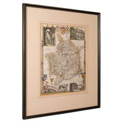
Antique Caernarvon Map, Framed Cartography, Welsh County, John Speed, Circa 1610
$1,170.50
£856
€1,006.01
CA$1,629.17
A$1,747.80
CHF 937.49
MX$21,043.32
NOK 11,818.11
SEK 10,776.48
DKK 7,516.25
About the Item
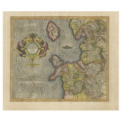
This is an antique Caernarvon map. An English, framed engraving of the historic Welsh county, dating to the 17th century and later, circa 1610.
Superb cartography reproduction of Caernarvon town and shire - perfect for display
Displays a desirable aged patina and in good original order
Fascinating cartography, framed in the mid-20th century with period Boots label
Originally compiled by John Speed (1552 - 1629) in the early 17th century
Hand coloured palette accentuates the map with crests, historic ships and borders
Engraved here for sale John Sudbury and George Humble on Pope's Head Lane, London
A hub for print houses, the location was referenced by Samuel Pepys, and was the site of Lloyd's Coffee House
Town plans for Caernarvon and Bangor provide great period detail
Dressed to the rear with hanging wire for ease of mounting
This is a quality antique Caernarvon county map, with fine cartographic interest and a fine example of Speed’s work. Delivered ready to display.
Dimensions:
Max Width: 56cm (22'')
Max Depth: 2.5cm (1'')
Max Height: 43cm (17'')
Map Width: 51cm (20'')
Map Height: 38cm (15'')
- Dimensions:Height: 16.93 in (43 cm)Width: 22.05 in (56 cm)Depth: 0.99 in (2.5 cm)
- Style:Jacobean (Of the Period)
- Materials and Techniques:
- Place of Origin:
- Period:
- Date of Manufacture:Circa 1610
- Condition:Wear consistent with age and use. Presented in good, original antique condition.
- Seller Location:Hele, Devon, GB
- Reference Number:Seller: 256861stDibs: LU2645348232672
About the Seller
5.0
Platinum Seller
Premium sellers with a 4.7+ rating and 24-hour response times
Established in 2005
1stDibs seller since 2017
1,090 sales on 1stDibs
Typical response time: <1 hour
- ShippingRetrieving quote...Shipping from: Hele, Devon, United Kingdom
- Return Policy
More From This Seller
View AllAntique County Map of Cheshire, Dutch, Framed, Cartography, Janssonius, C.1660
Located in Hele, Devon, GB
This is an antique county map of Cheshire. A Dutch, framed atlas engraving by Johannes Janssonius, dating to the 17th century and later.
A treat for the collector or county native,...
Category
Antique Mid-17th Century Dutch Charles II Maps
Materials
Glass, Wood, Paper

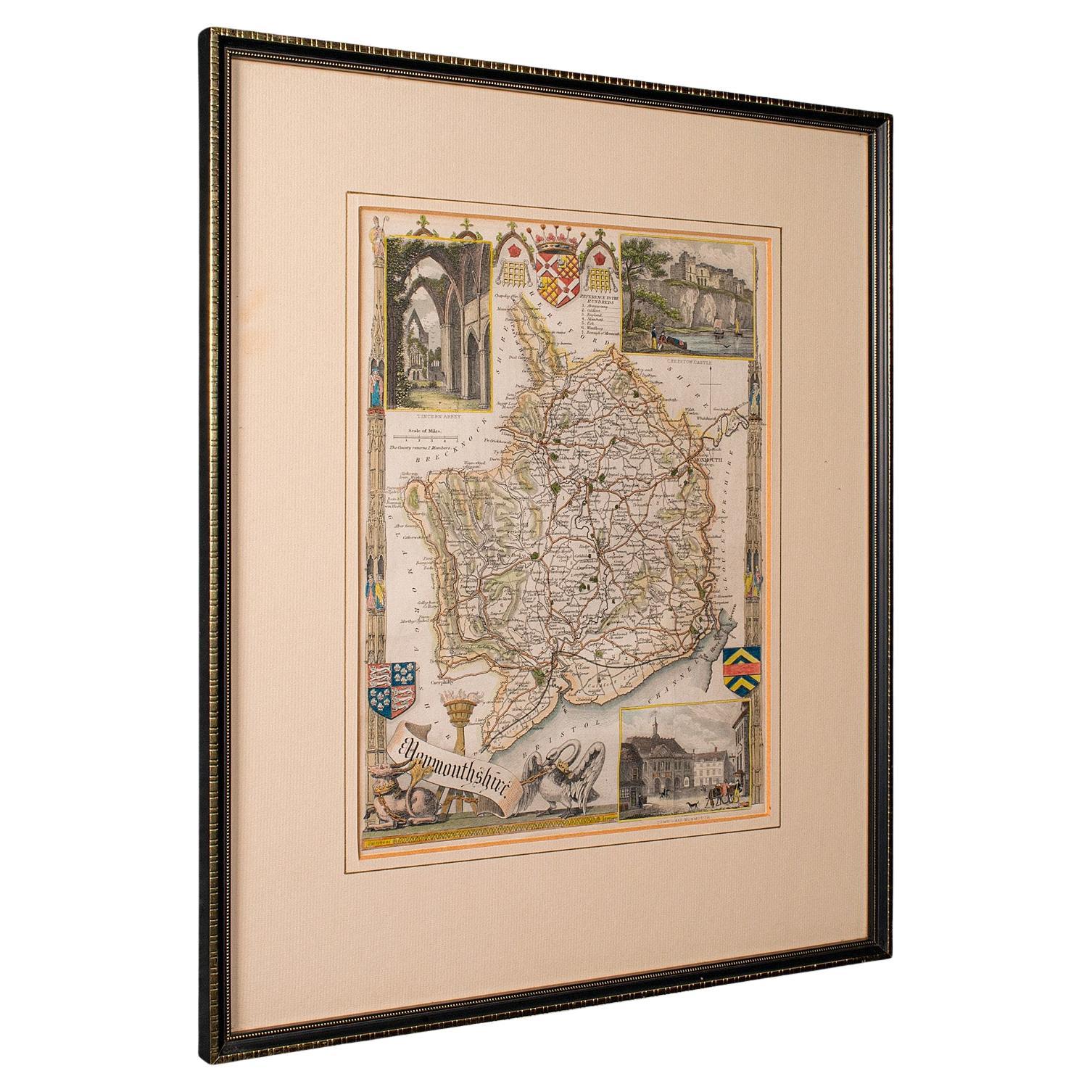
Antique Lithography Map, Monmouthshire, Framed, Welsh Cartography, Victorian
Located in Hele, Devon, GB
This is an antique lithography map of Monmouthshire. An English, framed atlas engraving of cartographic interest, dating to the mid 19th century and later.
Superb lithography of Mo...
Category
Antique Mid-19th Century British Victorian Maps
Materials
Glass, Wood, Paper
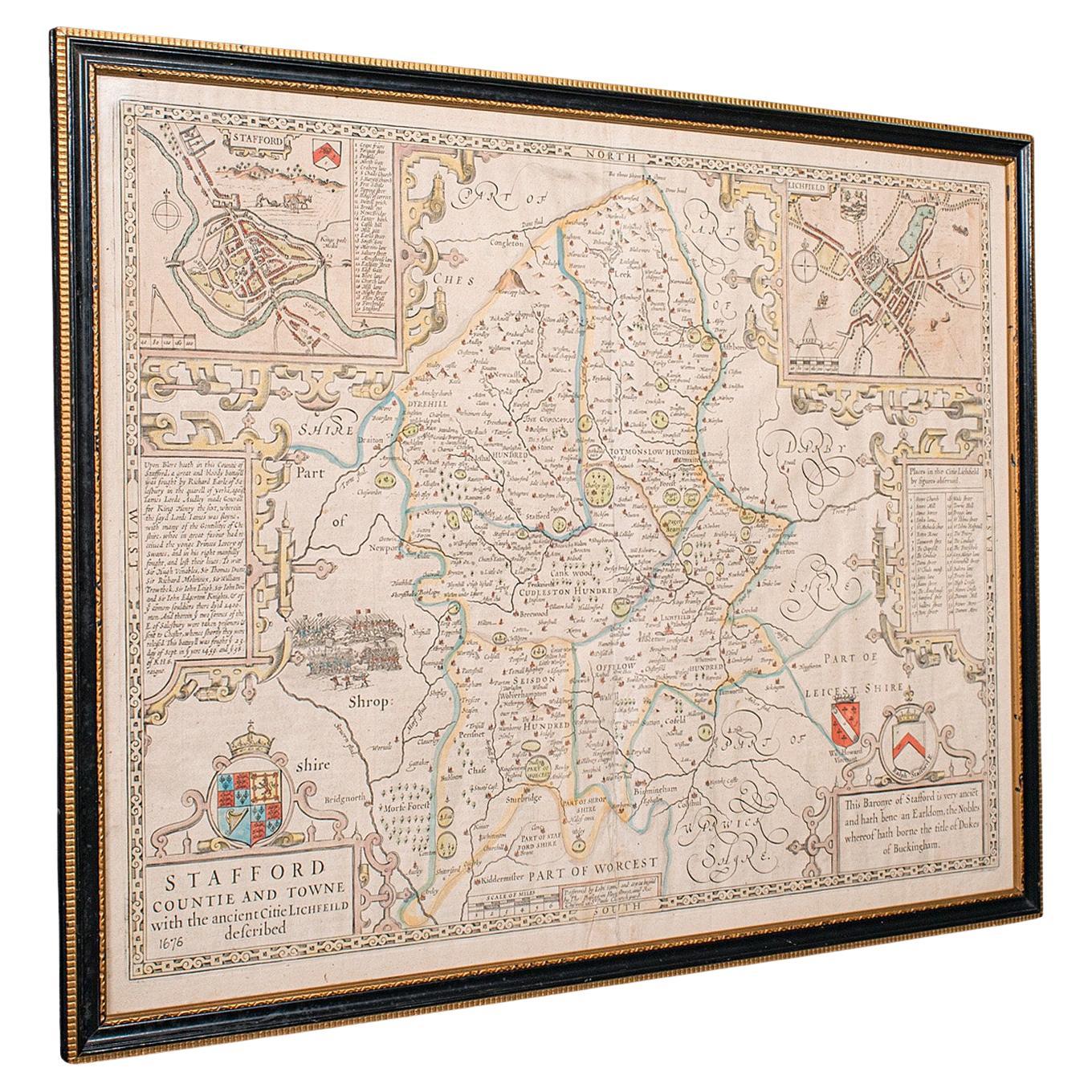
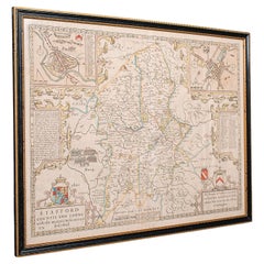
Antique Stafford County Map, English, Atlas Engraving, 17th Century, Cartography
Located in Hele, Devon, GB
This is an antique Stafford County Map. An English, framed atlas engraving of Staffordshire, dating to the 17th century and later, circa 1676.
Superb cartography reproduction of St...
Category
Antique Late 17th Century British Charles II Maps
Materials
Glass, Paper
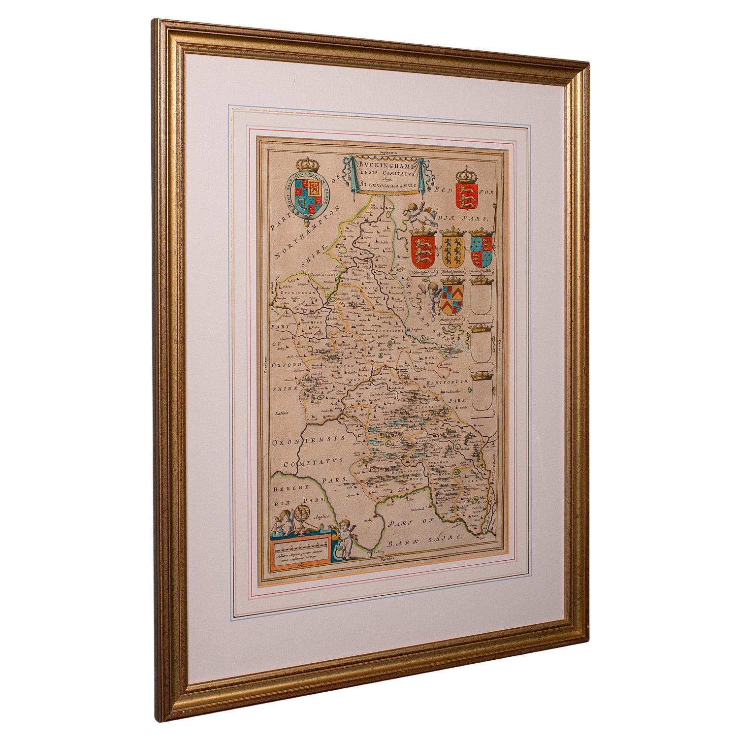
Antique Buckinghamshire Map, English, Framed 17th Century County Cartography
Located in Hele, Devon, GB
This is an antique county map of Buckinghamshire. An English, framed atlas engraving reproduction by Dutchman Joan Blaeu, dating to the 17th century and later.
A treat for the colle...
Category
Early 20th Century British Victorian Maps
Materials
Glass, Paper
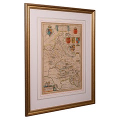
Antique County Map, Buckinghamshire, Bedfordshire, Dutch, Framed, Janssonius
Located in Hele, Devon, GB
This is an antique county map of Buckinghamshire and Bedfordshire. A Dutch, framed atlas engraving by Johannes Janssonius, dating to the 17th century and later.
A treat for the col...
Category
Antique Mid-17th Century Dutch Maps
Materials
Paper

Antique County Map, Cheshire, English, Framed Cartography, Robert Morden, 18th.C
Located in Hele, Devon, GB
This is an antique county map of Cheshire, an English framed cartographic engraving by Robert Morden, dating to the early Georgian period, circa 1720. A charming and historically ric...
Category
Early 20th Century British Georgian Maps
Materials
Glass, Paper
You May Also Like
Framed 17th Century Map of Cumberland, England by John Speed, 1610
By John Speed
Located in Middleburg, VA
A fascinating and richly detailed antique map of Cumberland County in northwest England, drawn and published by the celebrated English cartographer John Spe...
Category
Antique Early 17th Century English British Colonial Maps
Materials
Copper, Gold Leaf

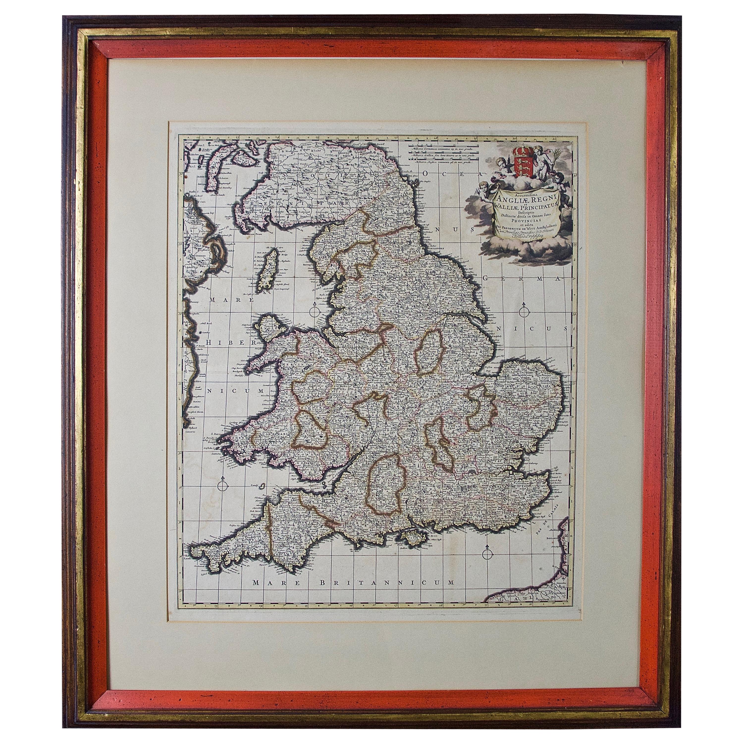
Large 17th Century Hand Colored Map of England and the British Isles by de Wit
By Frederick de Wit
Located in Alamo, CA
A large hand colored 17th century map of England and the British Isles by Frederick de Wit entitled "Accuratissima Angliæ Regni et Walliæ Principatus", published in Amsterdam in 1680. It is a highly detailed map of England, Scotland, the Scottish Isles...
Category
Antique Late 17th Century Dutch Maps
Materials
Paper

Antique Map of England by Mercator/Hondius, circa 1600
Located in Langweer, NL
Antique map titled 'Westmorlandia, Lancastria, Caernvan, Denbigh, Flint, Merionidh, Dalopia cum issulis Mania et Anglesey'. Original antique map of England...
Category
Antique 16th Century Maps
Materials
Paper
17th Century John Speed Map of Denbighshire, c.1610
By John Speed
Located in Royal Tunbridge Wells, Kent
Antique early 17th century British very rare and original John Speed, hand coloured map of Denbighshire, dated 1610, by John Sunbury and George Humble. John...
Category
Antique 17th Century British Maps
Materials
Wood, Paper

Northern Scotland: A 16th Century Hand-colored Map by Mercator
By Gerard Mercator
Located in Alamo, CA
A framed hand-colored 16th century map of Northern Scotland by Gerard Mercator entitled "Scotiae pars Septentrionalis", published in Amsterdam in 1636. It is a highly detailed map of the northern part of Scotland, with the northwest Highlands and the cities Inverness and Aberdeen, as well as the Orkney Islands and the Hebrides. There is a decorative title cartouche in the upper left corner.
The map is presented in an antiqued brown wood...
Category
Antique 16th Century Dutch Maps
Materials
Paper
Northern Scotland: A 17th Century Hand-colored Map by Mercator
By Gerard Mercator
Located in Alamo, CA
This is a framed hand-colored 17th century map of Northern Scotland by Gerard Mercator entitled "Scotiae pars Septentrionalis", published in Amsterdam in 1636. It is a highly detailed map of the northern part of Scotland, with the northwest Highlands and the cities Inverness and Aberdeen, as well as the Orkney Islands and the Hebrides. There is a decorative title cartouche in the upper left corner.
The map is presented in an antiqued brown wood...
Category
Antique 1630s Dutch Maps
Materials
Paper
