Items Similar to Antique Chart of the US Malarial Deaths,
1874

Want more images or videos?
Request additional images or videos from the seller
1 of 5
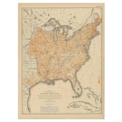
Antique Chart of the US Malarial Deaths,
1874
$597.11
£446.17
€500
CA$823.62
A$902.25
CHF 474.91
MX$10,768.60
NOK 6,053.90
SEK 5,534.18
DKK 3,809.61
About the Item
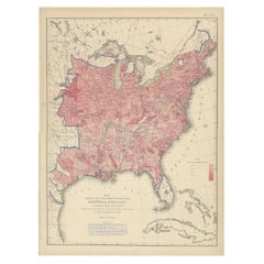
Antique chart titled 'Map showing the proportion of deaths from malarial diseases to deaths from all causes. Compiled from the returns of mortality at the ninth census of the United States, 1870'. Chart of the US malarial deaths. Originates from 'Statistical Atlas of the United States based on the results of the ninth census 1870 (..)' by Francis A. Walker.
- Dimensions:Height: 21.66 in (55 cm)Width: 16.15 in (41 cm)Depth: 0.02 in (0.5 mm)
- Materials and Techniques:
- Period:
- Date of Manufacture:1874
- Condition:General age-related toning, minor wear. Blank verso, please study image carefully.
- Seller Location:Langweer, NL
- Reference Number:Seller: BG-11875-341stDibs: LU3054319792242
About the Seller
5.0
Recognized Seller
These prestigious sellers are industry leaders and represent the highest echelon for item quality and design.
Platinum Seller
Premium sellers with a 4.7+ rating and 24-hour response times
Established in 2009
1stDibs seller since 2017
2,809 sales on 1stDibs
Typical response time: 1 hour
- ShippingRetrieving quote...Shipping from: Langweer, Netherlands
- Return Policy
More From This Seller
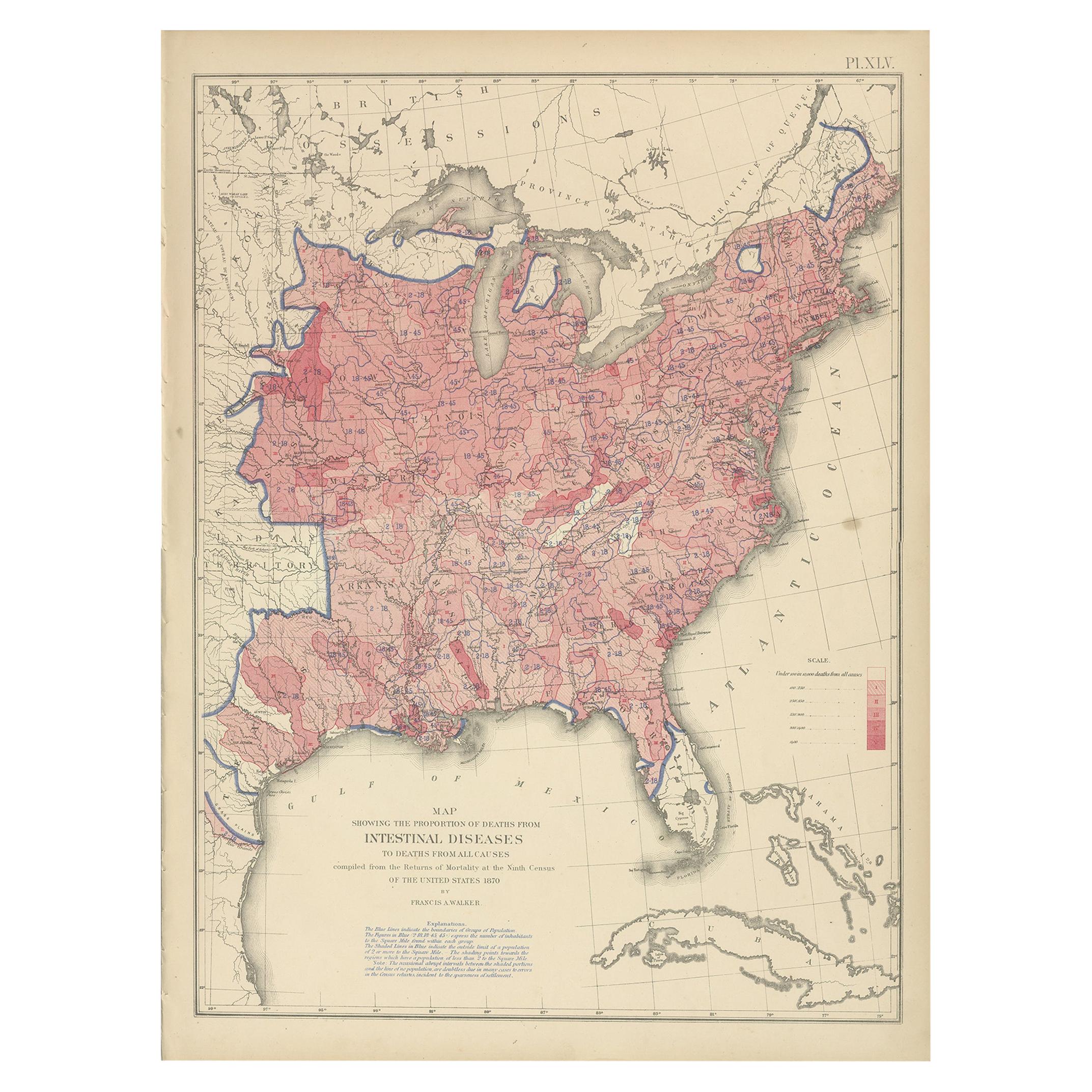
View AllPl. 45 Antique Chart of the US Inestinal Diseases Deaths, 1874
Located in Langweer, NL
Antique chart titled 'Map showing the proportion of deaths from intestinal diseases to deaths from all causes. Compiled from the returns of mortality at the ninth census of the Unite...
Category
Antique Late 19th Century Maps
Materials
Paper
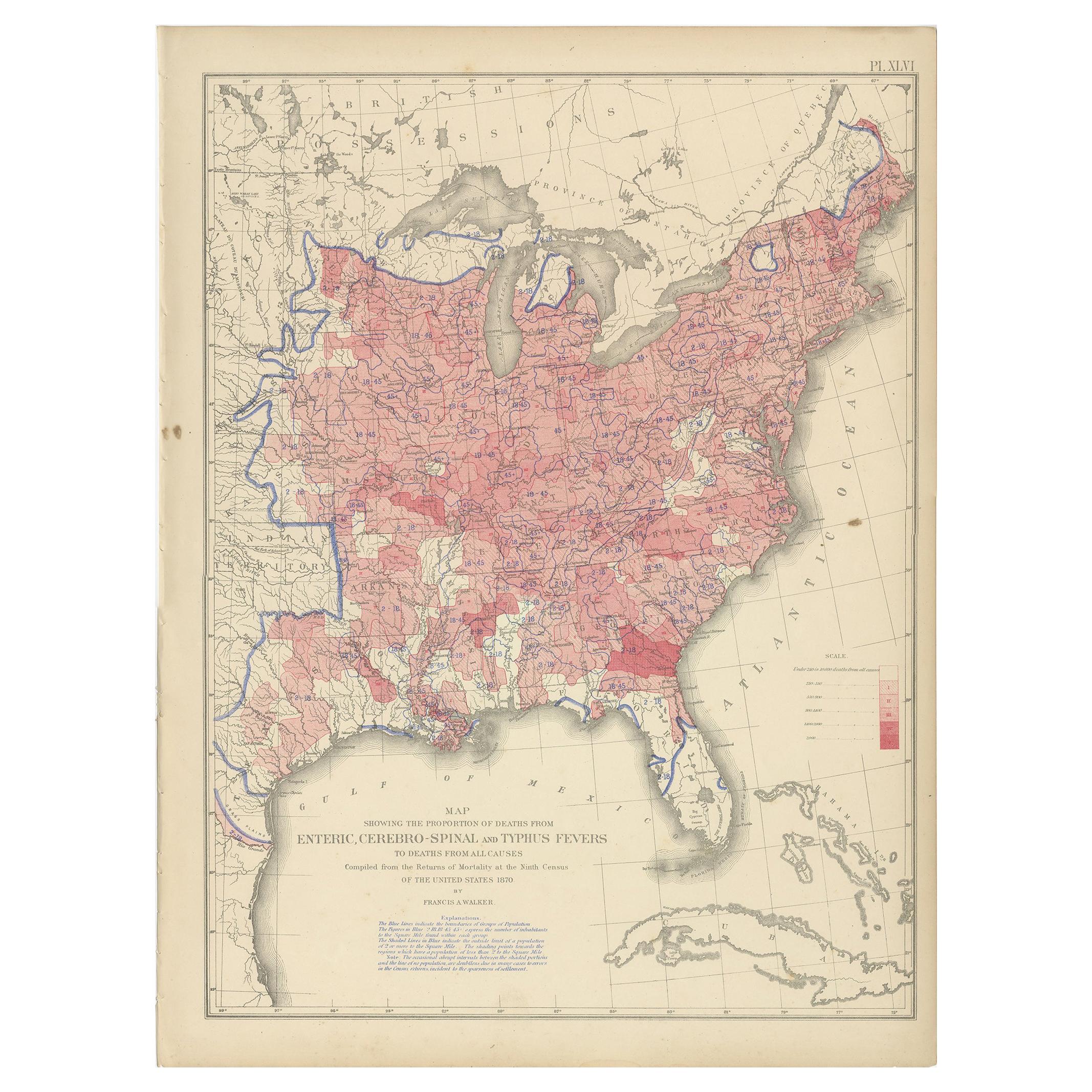
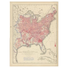
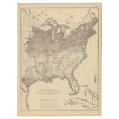
Antique Chart of the US Enteric, Cerebro-Spinal, Typhus Deaths,
1874
Located in Langweer, NL
Antique chart titled 'Map showing the proportion of deaths from enteric, cerebro-spinal and typhus fevers to deaths from all causes. Compiled from the returns of mortality at the nin...
Category
Antique Late 19th Century Maps
Materials
Paper
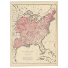
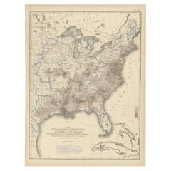
Antique Chart of the US Consumption Deaths,
1874
Located in Langweer, NL
Antique chart titled 'Map showing the proportion of deaths from consumption to deaths from all causes. Compiled from the returns of mortality at the nint...
Category
Antique Late 19th Century American Maps
Materials
Paper
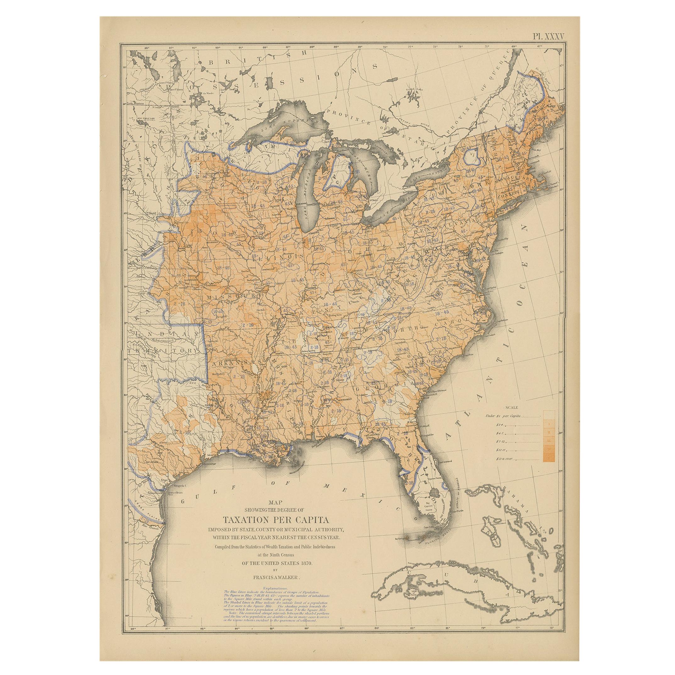
Pl. 35 Antique Chart of the US Taxation, 1874
Located in Langweer, NL
Antique chart titled 'Map showing the degree of taxation per capita imposed by state, county or municipal authority, within the fiscal year nearest the c...
Category
Antique Late 19th Century Maps
Materials
Paper
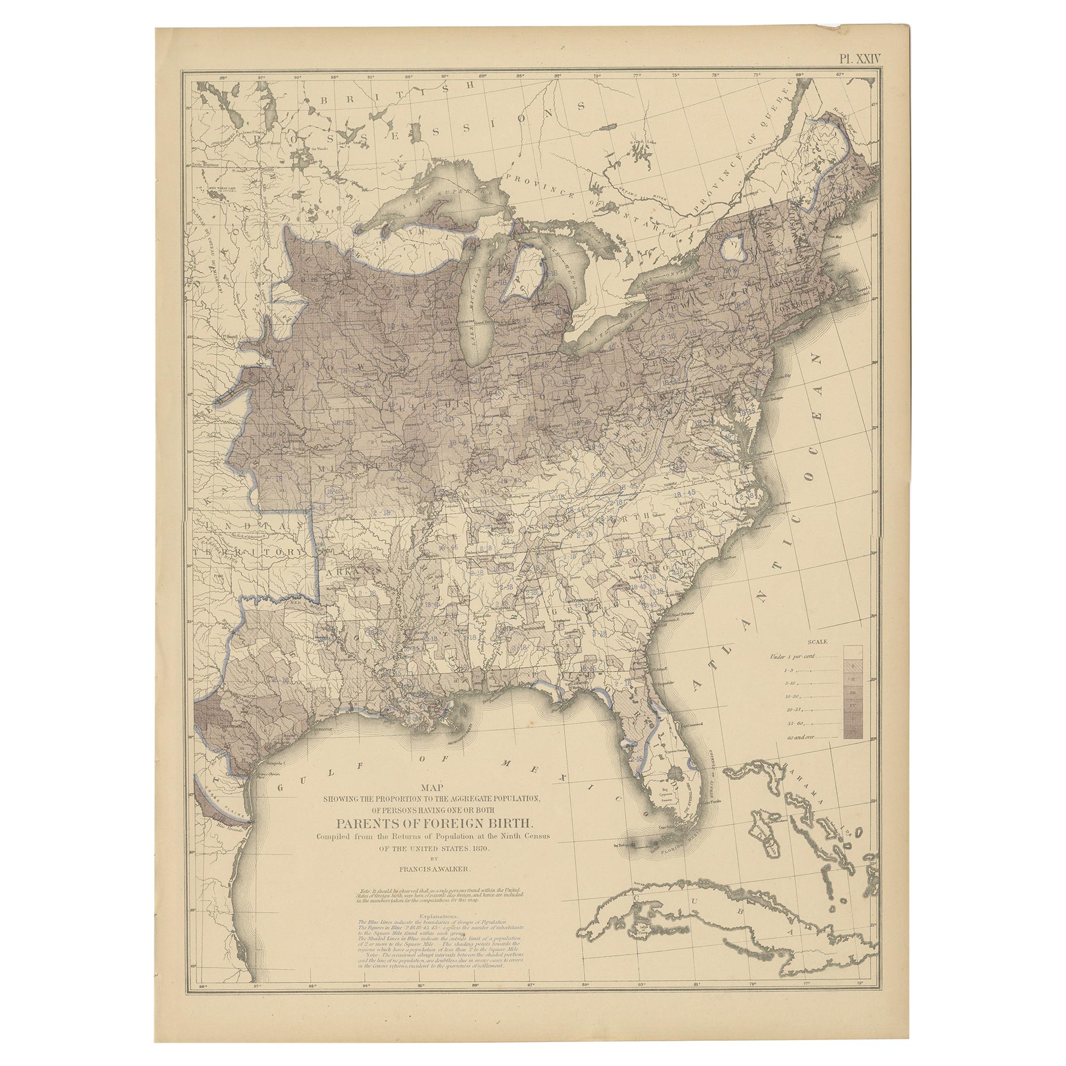
Antique Chart of the US Foreign Parentage Proportion in 1870,
1874
Located in Langweer, NL
Antique chart titled 'Map showing the proportion to the aggregate population, of persons having one or both parents of foreign birth. Compiled from the returns of population at the n...
Category
Antique Late 19th Century Maps
Materials
Paper
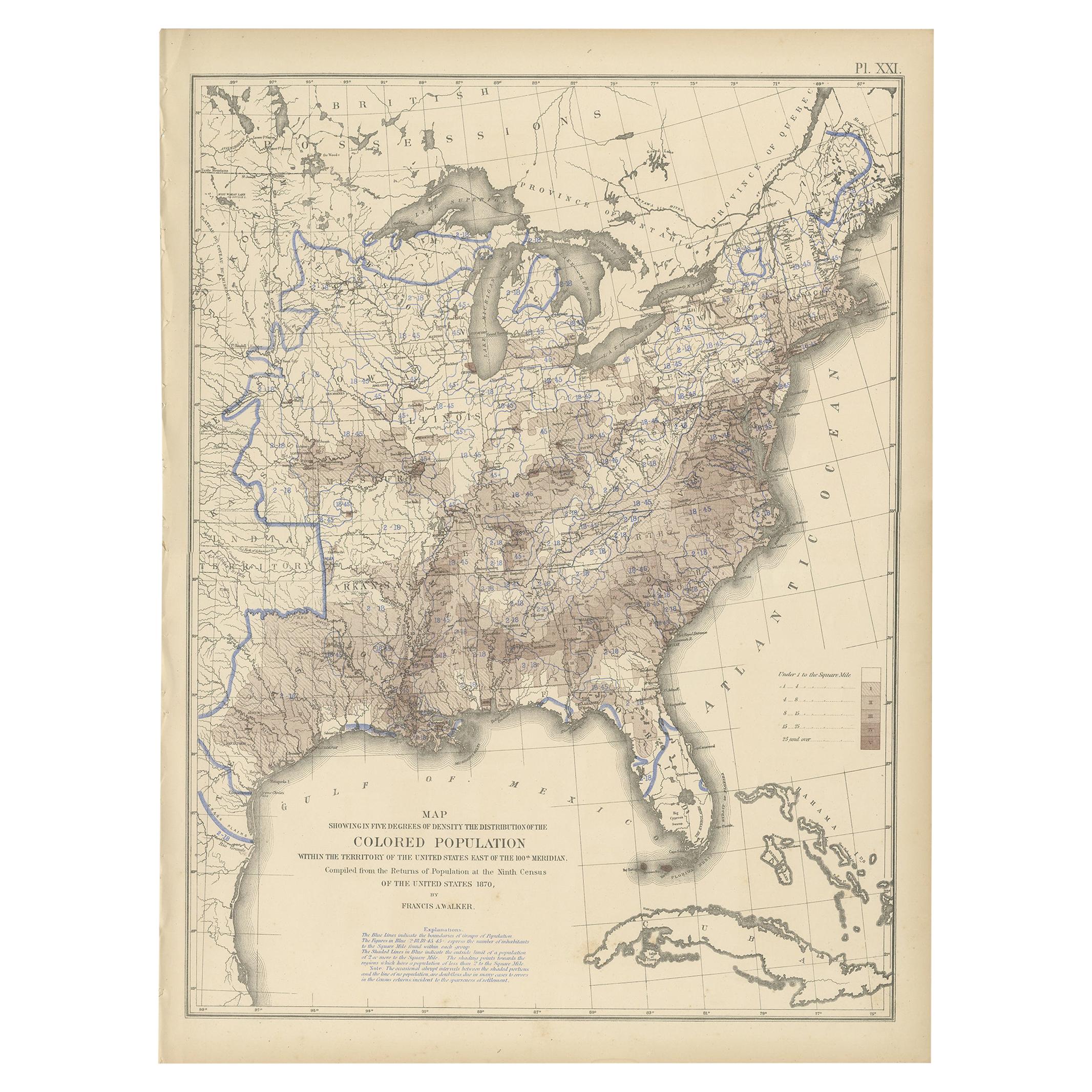
Pl. 21 Antique Chart of the US Colored Population Density in 1870,
1874
Located in Langweer, NL
Antique chart titled 'Map showing in five degrees of density the distribution of the colored population within the territory of the United States east of the 100th Meridian. Compiled...
Category
Antique Late 19th Century Maps
Materials
Paper
You May Also Like
Original Antique Map of United States, Grattan and Gilbert, 1843
Located in St Annes, Lancashire
Great map of United States
Drawn and engraved by Archer
Published by Grattan and Gilbert. 1843
Original colour
Unframed.
Category
Antique 1840s English Maps
Materials
Paper

Original Antique Map of The United States of America by Dower, circa 1835
Located in St Annes, Lancashire
Nice map of the USA
Drawn and engraved by J.Dower
Published by Orr & Smith. C.1835
Unframed.
Free shipping
Category
Antique 1830s English Maps
Materials
Paper

1864 Map of North America, Antique Hand-Colored Map, by Adolphe Hippolyte Dufour
Located in Colorado Springs, CO
Offered is a map of North America entitled Amerique du Nord from 1864. This rare, separately published wall map was produced by Adolphe Hippolyte Dufour. This map includes vibrant an...
Category
Antique 1860s French Maps
Materials
Paper

1842 Wall Map of the United States by J. H. Young, Published by S. A. Mitchell
Located in Colorado Springs, CO
Presented is an 1842 hanging “Map of the United States,” engraved by J. H. Young and published by Samuel Augustus Mitchell, Philadelphia. This is a beautiful example of the rare 1842...
Category
Antique 1840s American Maps
Materials
Paper

Large Original Vintage Map of North America, circa 1920
Located in St Annes, Lancashire
Great map of North America
Original color. Good condition
Published by Alexander Gross
Unframed.
Category
Vintage 1920s English Edwardian Maps
Materials
Paper

1866 "Johnson
s United States" Map, Published by Johnson and Ward
Located in Colorado Springs, CO
Presented is a detailed map of the United States by A. J. Johnson. Spanning the whole of the continental United States, as well as adjacent parts of Canada and Mexico, the map reflec...
Category
Antique 1860s American Victorian Maps
Materials
Paper

More Ways To Browse
Antique Maps Scotland
Furniture Russian 18th Century
Antique Map Of Middle East
London Antique Maps
Map Colorful
Maps Of Australia
Antique Railroad Furniture
Map Of London
Antique Galleon
Antique Maps Australia
Used Nautical Charts
Antique Collectables Australia
Joan Blaeu
Map Greece
Antique Maps Of New York City
Map Railroad
Antique Railroad Maps
Pirate Antique