Items Similar to Antique Chester County Map, English, Cheshire, Framed Cartography, Georgian

Want more images or videos?
Request additional images or videos from the seller
1 of 13
Antique Chester County Map, English, Cheshire, Framed Cartography, Georgian
$1,405.91
£1,029
€1,208.56
CA$1,953.23
A$2,100.98
CHF 1,122.83
MX$24,764.61
NOK 14,156.21
SEK 12,941.47
DKK 9,030.01
About the Item
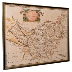
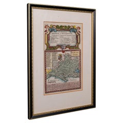
This is an antique Palantine of Chester county map. An English, framed atlas engraving of Cheshire by Emanuel Bowen, dating to the 18th century and later, circa 1770.
Superb cartography reproduction of Cheshire - perfect for display
Displaying a desirable aged patina and in good original order
Fascinating period map, appealingly set within a later glazed frame
Compiled by Emanuel Bowen (1694 - 1767) in the mid-18th century
Fine legibility in the monochromatic presentation
Fully annotated with historic and commercial detail relating to the county
Illustrated title panel shows two mill workers carrying sacks of corn
Architectural interest with a fine engraving of Chester's cathedral
Dressed to the rear with hanging braid for ease of mounting
This is a quality antique Palantine of Chester county map, with fine cartographic and historic interest. A visually pleasing example, delivered ready to display.
Dimensions:
Max Width: 58cm (22.75'')
Max Depth: 2.5cm (1'')
Max Height: 47.5cm (18.75'')
Map Width: 49.5cm (19.5'')
Map Height: 40.5cm (16'')
- Dimensions:Height: 0.99 in (2.5 cm)Width: 22.84 in (58 cm)Depth: 18.71 in (47.5 cm)
- Style:Georgian (Of the Period)
- Materials and Techniques:
- Place of Origin:
- Period:1770-1779
- Date of Manufacture:Circa 1770
- Condition:Wear consistent with age and use. Presented in good, original antique condition.
- Seller Location:Hele, Devon, GB
- Reference Number:Seller: 256891stDibs: LU2645348233182
About the Seller
5.0
Platinum Seller
Premium sellers with a 4.7+ rating and 24-hour response times
Established in 2005
1stDibs seller since 2017
1,091 sales on 1stDibs
Typical response time: <1 hour
- ShippingRetrieving quote...Shipping from: Hele, Devon, United Kingdom
- Return Policy
More From This Seller
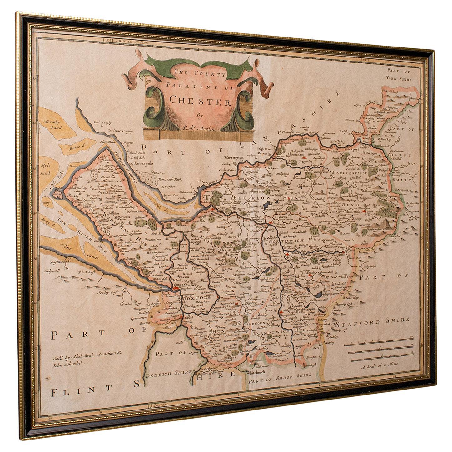
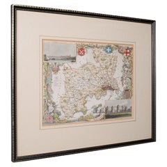
View AllAntique County Map, Cheshire, English, Framed Cartography, Robert Morden, 18th.C
Located in Hele, Devon, GB
This is an antique county map of Cheshire, an English framed cartographic engraving by Robert Morden, dating to the early Georgian period, circa 1720. A charming and historically ric...
Category
Early 20th Century British Georgian Maps
Materials
Glass, Paper
Vintage County Map of Cheshire, English, After John Cary, Cartography Interest
Located in Hele, Devon, GB
This is a vintage Cheshire map, a fine reproduction of John Cary’s late 18th century cartography, and presented within a smart glazed frame.
Superb county map of Cheshire, offering ...
Category
Vintage 1980s British Georgian Maps
Materials
Glass, Paper
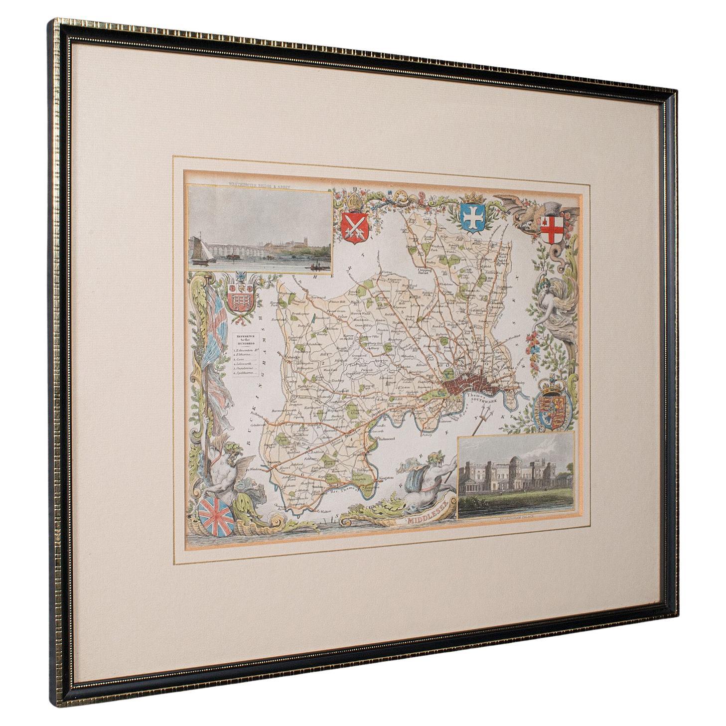
Antique County Map, Middlesex, English, Framed, Litho, Cartography, Victorian
Located in Hele, Devon, GB
This is an antique lithography map of Middlesex. An English, framed atlas engraving of cartographic interest, dating to the mid 19th century and later.
Superb lithography of Middle...
Category
Antique Mid-19th Century British Victorian Maps
Materials
Paper
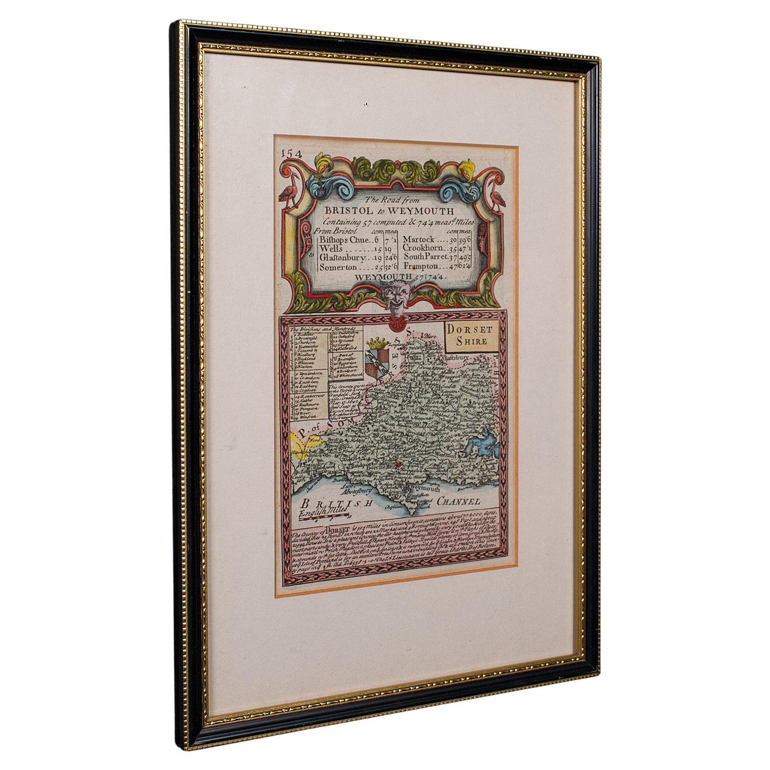
Antique Road Map, Bristol to Weymouth, English, Framed Cartography, Georgian
Located in Hele, Devon, GB
This is an antique coaching road map of Bristol to Weymouth. An English, framed lithograph engraving of regional interest with second map to reverse, dating to the mid 18th century ...
Category
Antique Mid-18th Century British George II Maps
Materials
Glass, Wood, Paper
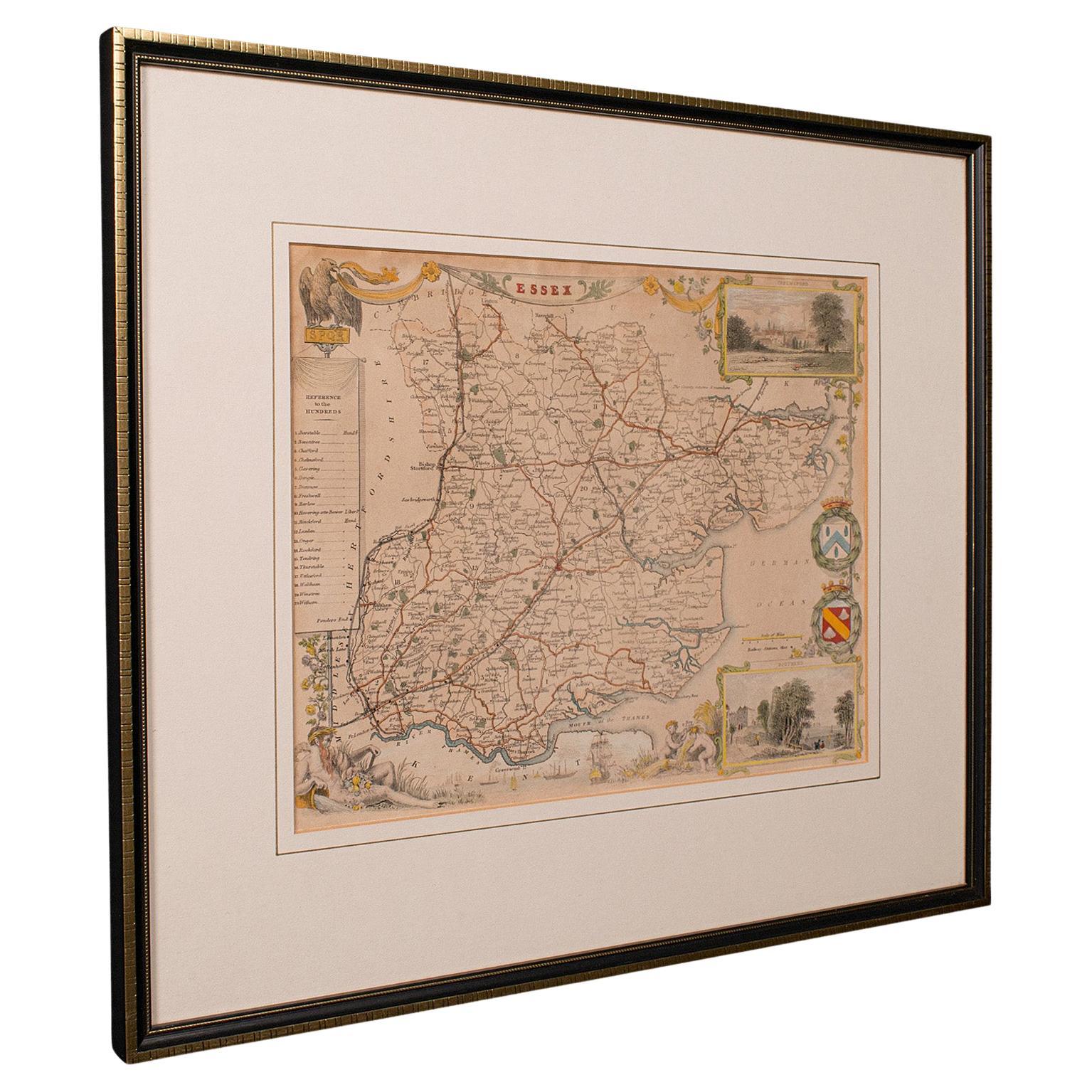
Antique County Map, Essex, English, Framed, Cartographic Interest, Victorian
Located in Hele, Devon, GB
This is an antique lithography map of Essex. An English, framed atlas engraving of cartographic interest, dating to the mid 19th century and later.
Superb lithography of Essex and ...
Category
Antique Mid-19th Century British Victorian Maps
Materials
Wood

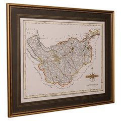
Antique Lithography Map, Cumbria, English, Framed Cartography Interest, Georgian
Located in Hele, Devon, GB
This is an antique lithography map of Cumbria. An English, framed engraving of cartographic interest, dating to the early 18th century and later.
...
Category
Antique Early 18th Century British Georgian Maps
Materials
Wood

You May Also Like
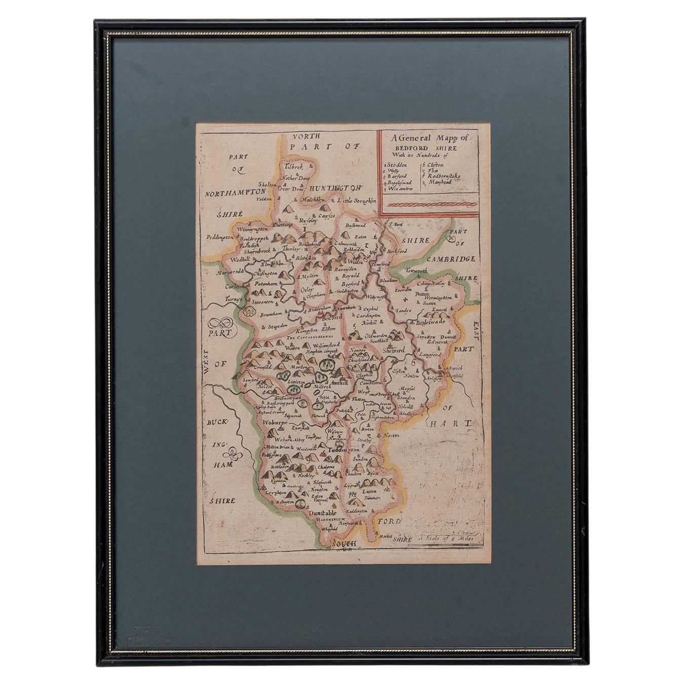
Map Bedfordshire General Framed
Located in BUNGAY, SUFFOLK
A general map of Bedfordshire with its hundreds
A scale of 5 miles
in the original green mount and traditional black and gold frame. Measures: 36cm 14" high.
Category
Antique 18th Century English Georgian Maps
Materials
Paper

Map Bedfordshire No 3 General Framed
Located in BUNGAY, SUFFOLK
A general map of Bedfordshire with its hundreds. Measure: 37cm 14 1/2" high
A scale of 5 miles.
in the original green mount and traditional black and gold frame.
charming map with...
Category
Antique 18th Century English Georgian Maps
Materials
Paper

Map Shropshire Joseph Ellis Robert Sayer Carington Bowles Framed
Located in BUNGAY, SUFFOLK
A modern map of Shropshire Drawn from the latest surveys corrected and improved by the best authorities.
Artist Joseph Ellis sculptor.
Joseph Ellis was an engraver and publisher from Clerkenwell in London and was apprenticed to Richard William Seale in 1749. He is best know to county map collectors for The New English Atlas published in 1765 which was later reissued as Ellis's English Atlas in 1766, 1768 1777, 1786, 1790 and 1796.
Maker carington bowles 1724 - 1793.
Carington Bowles worked in London as a publisher in partnership with his father John Bowles from about 1752 until 1763. Carington Bowles worked as a publisher in partnership with his father John Bowles from about 1752 until 1763 before taking over his uncle's business. His address was 69 St. Pauls Church Yard, London. He worked with a number of well known cartographers of the day including Emanuel Bowen, Thomas Kitchin, Robert Sayer...
Category
Antique 18th Century English Georgian Maps
Materials
Paper

Antique Map of Leicester and Rutland by Tinney
Sayer,
circa 1756
Located in Langweer, NL
Antique map titled 'An Accurate Map of the Counties of Leicester and Rutland (..)'. Large map of Leicester and Rutland with dedications to the Most Noble John Duke of Rutland, and to...
Category
Antique Mid-18th Century Maps
Materials
Paper

$759 Sale Price
20% Off
Framed 17th Century Map of Cumberland, England by John Speed, 1610
By John Speed
Located in Middleburg, VA
A fascinating and richly detailed antique map of Cumberland County in northwest England, drawn and published by the celebrated English cartographer John Spe...
Category
Antique Early 17th Century English British Colonial Maps
Materials
Copper, Gold Leaf

Antique Map of Essex by Overton, circa 1710
Located in Langweer, NL
Antique map titled 'Essex, devided into Hundreds, with the most antient and fayre Towne Colchester (..)'. Map of Essex, England. Includes an inset town pl...
Category
Antique Early 18th Century Maps
Materials
Paper

$901 Sale Price
20% Off