Items Similar to Antique Chicago Map Wall Art – Railroads, Lake Michigan
City Grid, ca.1888
Want more images or videos?
Request additional images or videos from the seller
1 of 9
Antique Chicago Map Wall Art – Railroads, Lake Michigan
City Grid, ca.1888
$308.50
£230.31
€260
CA$428.61
A$461.03
CHF 246.39
MX$5,434.20
NOK 3,106.36
SEK 2,839.80
DKK 1,981.49
About the Item
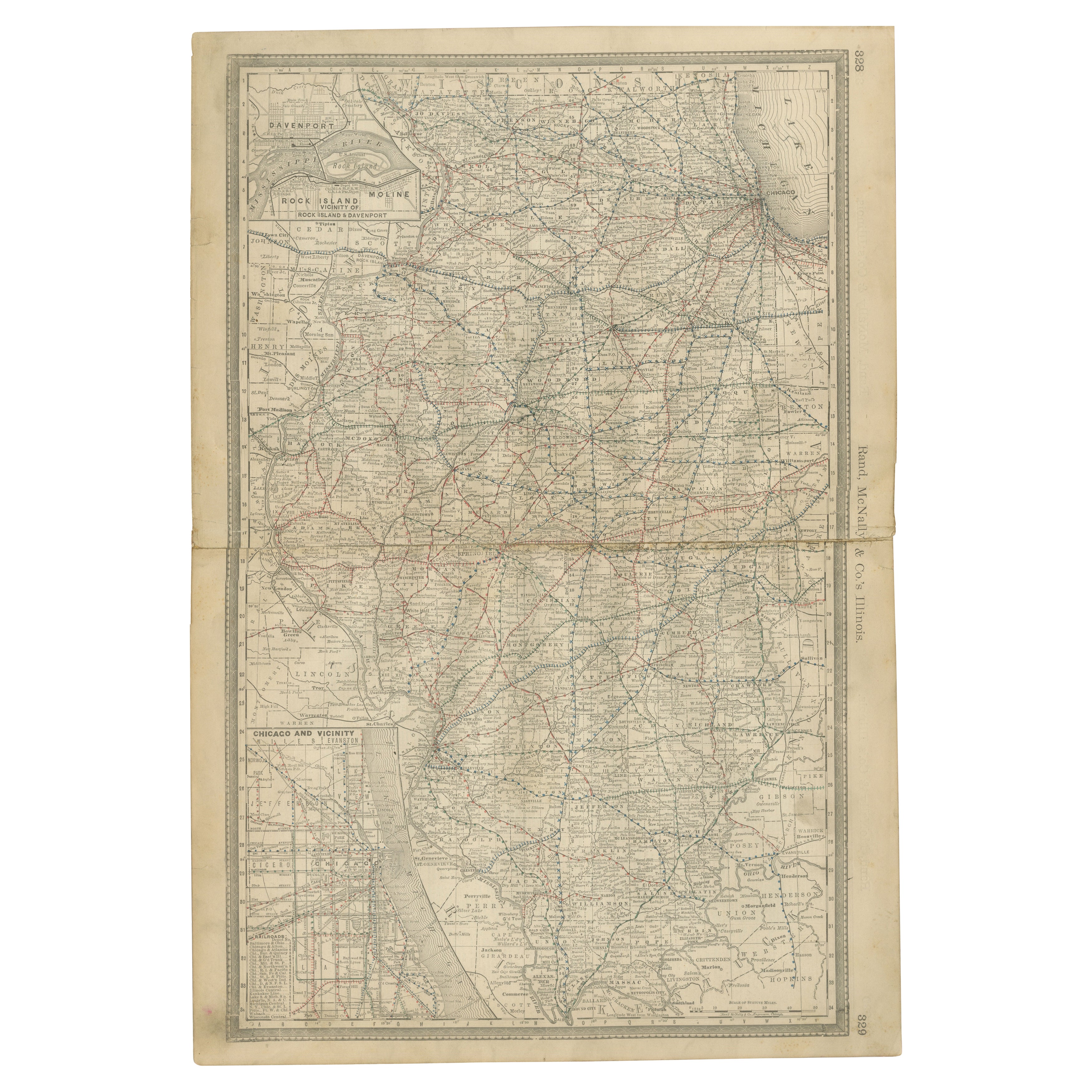
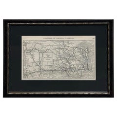
Antique Chicago Map Wall Art – Railroads, Lake Michigan
City Grid, Rand McNally
This original antique atlas map presents Chicago in remarkable urban detail, showing the city’s street grid, railroads, industrial zones, and waterfront along Lake Michigan. The dense network of rail lines, depots, and freight yards reveals Chicago at a moment of extraordinary growth, when it functioned as the central transportation hub of the American Midwest.
Published by Rand, McNally
Co. in the late 19th century, the map captures the city’s rapid expansion south and west, with neighborhoods such as Lake View, Lincoln Park, Hyde Park, Englewood, Cicero, and Lake Calumet clearly delineated. An inset map highlights the central portion of Chicago in even finer detail, emphasizing passenger and freight depots and reinforcing the city’s importance as a rail and commercial center.
The restrained monochrome palette and precise line work give the map a strong graphic presence that translates exceptionally well as wall art. Despite the density of information, the composition remains balanced and architectural, making it appealing not only to historians and collectors but also to interior designers and urban art enthusiasts.
Printed on original period atlas paper, the sheet retains the authentic surface texture and light patina characteristic of genuine 19th-century maps. Its tall vertical format makes it particularly effective for offices, studies, libraries, or city-themed interiors.
Condition report: Light age toning consistent with age. Minor edge wear and small handling marks from original atlas binding. Overall clean and well preserved.
Framing tips: Works especially well in black, dark walnut, or natural oak frames with an ivory or warm off-white mat. Museum glass recommended.
Technique: Lithograph
Maker: Rand, McNally
Co., United States, late 19th century
Keywords:
antique chicago map, chicago wall art, rand mcnally map, lake michigan map, historic chicago, railroad map chicago, antique city plan, lincoln park chicago map, hyde park chicago, englewood chicago, midwest urban map, architectural wall decor
- Dimensions:Height: 14.18 in (36 cm)Width: 10.63 in (27 cm)Depth: 0.01 in (0.2 mm)
- Materials and Techniques:
- Place of Origin:
- Period:
- Date of Manufacture:circa 1888
- Condition:Light age toning consistent with age. Minor edge wear and small handling marks from original atlas binding. Overall clean and well preserved.
- Seller Location:Langweer, NL
- Reference Number:Seller: BG-12794-791stDibs: LU3054348231372
About the Seller
5.0
Recognized Seller
These prestigious sellers are industry leaders and represent the highest echelon for item quality and design.
Platinum Seller
Premium sellers with a 4.7+ rating and 24-hour response times
Established in 2009
1stDibs seller since 2017
2,836 sales on 1stDibs
Typical response time: 1 hour
- ShippingRetrieving quote...Shipping from: Langweer, Netherlands
- Return Policy
More From This Seller
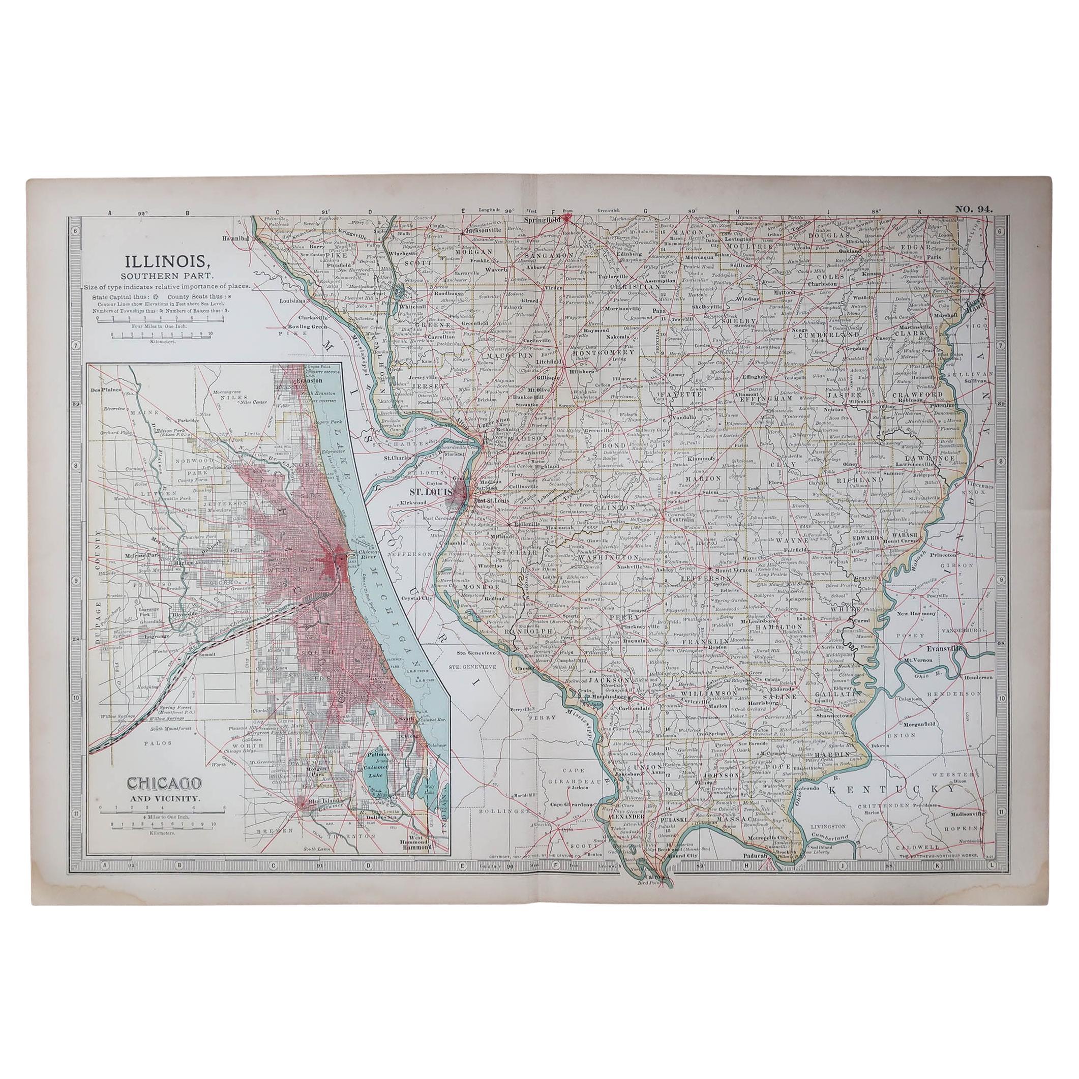
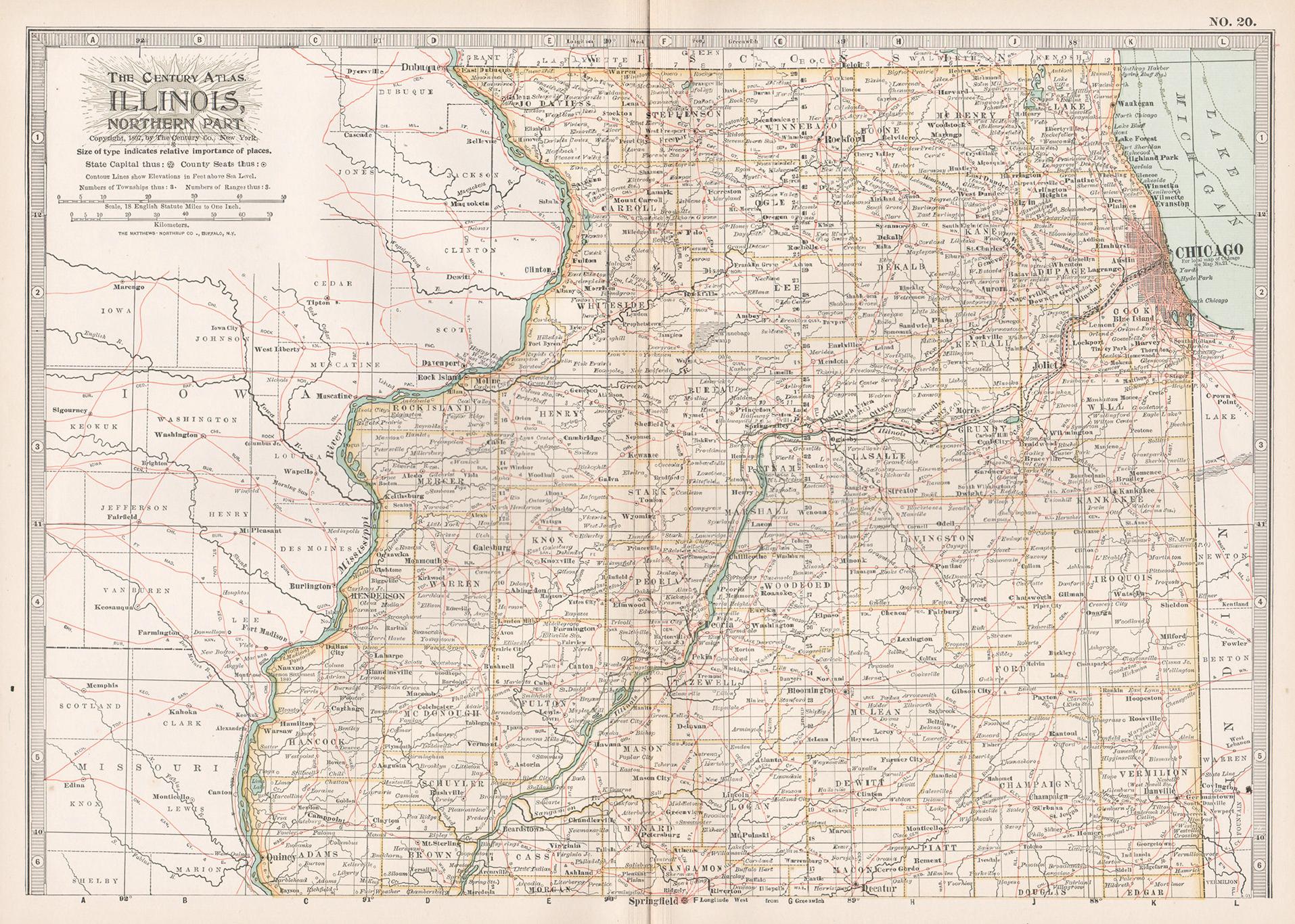
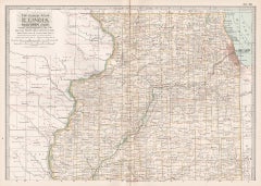
View AllDetailed Antique Map of Illinois – Railroads, Cities
Counties, 1888
Located in Langweer, NL
Antique Map of Illinois – Railroads, Cities & Counties, 1888
This finely detailed antique map shows the state of Illinois in the late 19th century, engraved and published in 1888 by...
Category
Antique Late 19th Century American Maps
Materials
Paper

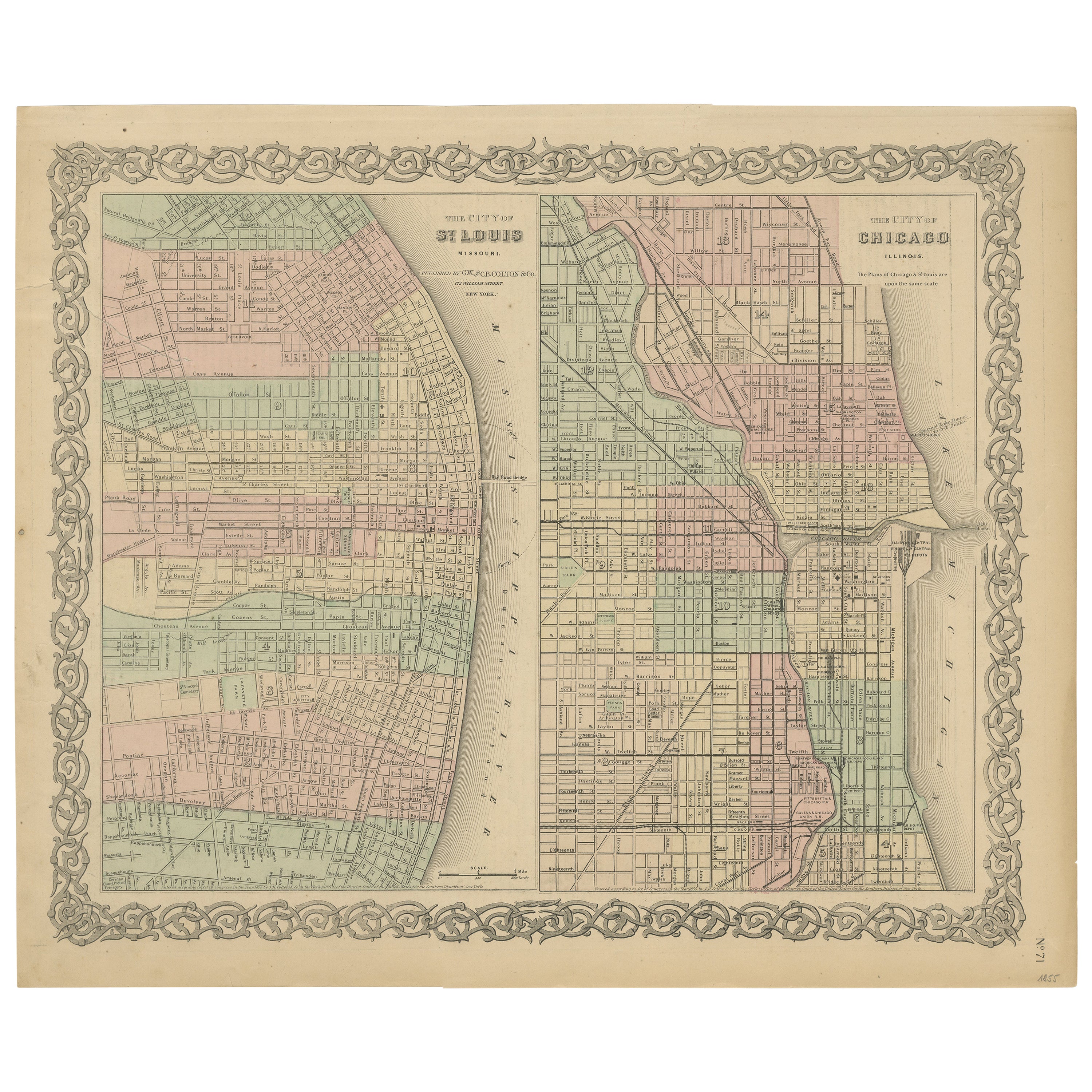
Antique Map of St. Louis and Chicago
Located in Langweer, NL
Antique map titled 'The City of St. Louis Missouri - The City of Chicago Illinois'. Dual map on single page showing St. Louis and Chicago. Finely produ...
Category
Antique Mid-19th Century Maps
Materials
Paper

$142 Sale Price
20% Off
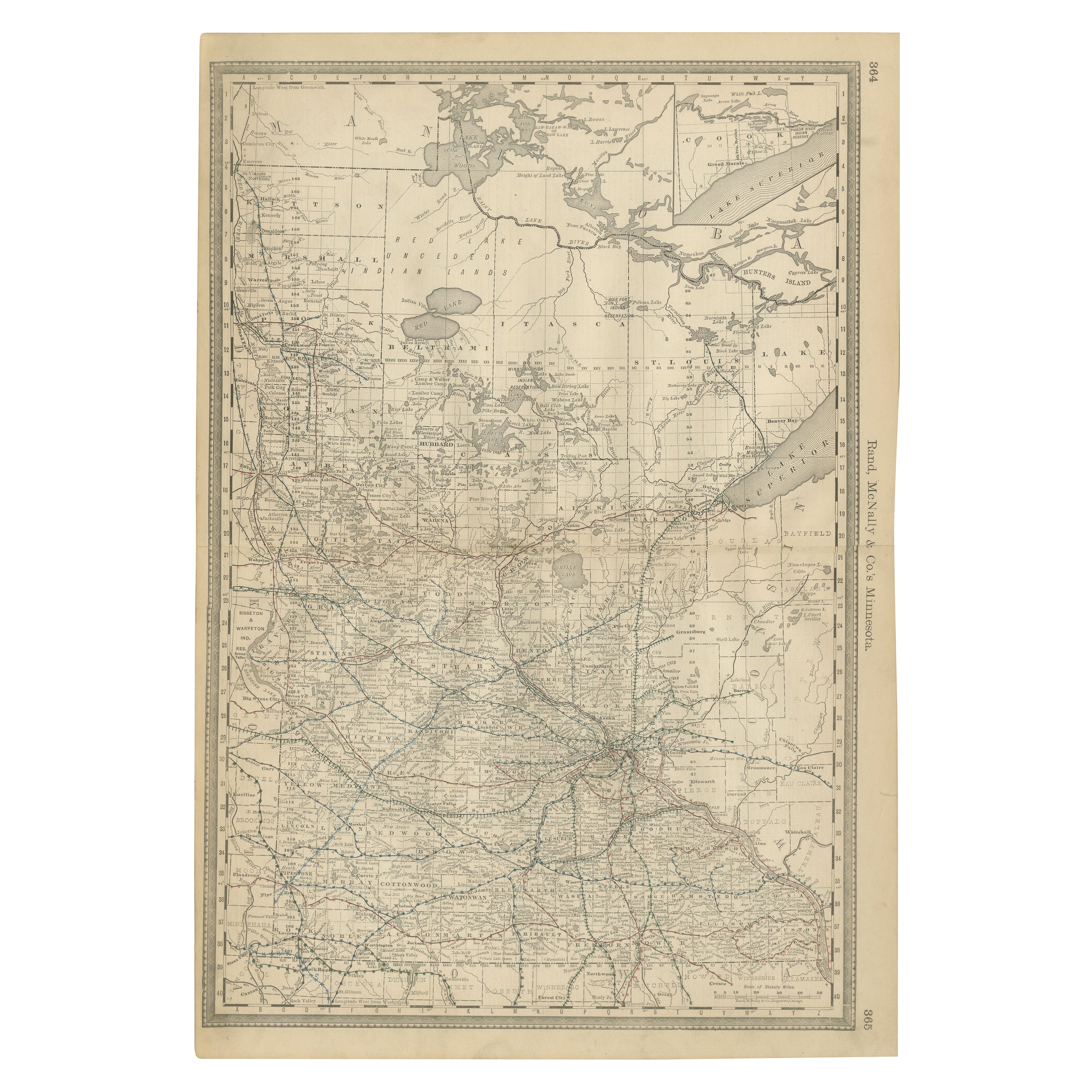
Antique Minnesota Map Wall Art by Rand McNally, Color Lithograph, 1888
Located in Langweer, NL
Title: Antique Minnesota Map Wall Art – Railroads, Lakes
Cities, Rand McNally
Description:
This original antique atlas map depicts the state of Minnesota in rich geographic de...
Category
Antique Late 19th Century American Maps
Materials
Paper
Antique Kansas City Map Wall Art – Missouri–Kansas Border, Rand McNally, ca.1888
Located in Langweer, NL
Title: Antique Kansas City Map Wall Art – Missouri–Kansas Border, Rand McNally
Description:
This original antique atlas map shows Kansas City in fine urban detail, depicting the str...
Category
Antique Late 19th Century American Maps
Materials
Paper
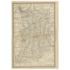
Antique Map of Indiana – The Hoosier State with Railroads
Counties, 1888
Located in Langweer, NL
Antique Map of Indiana – The Hoosier State with Railroads & Counties, 1888
This antique engraved map of Indiana, published in 1888 by Rand, McNally & Co. in Chicago for their *Impro...
Category
Antique Late 19th Century American Maps
Materials
Paper
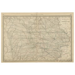
Antique Map of Iowa – The Hawkeye State with Railroads
Townships, 1888
Located in Langweer, NL
Antique Map of Iowa – Railroads, Counties & Townships, 1888
This antique engraved map of Iowa, published in 1888 by Rand, McNally & Co. in Chicago for their Improved Indexed Busines...
Category
Antique Late 19th Century American Maps
Materials
Paper
You May Also Like
Original Antique Map of the American State of Illinois ( Southern Part ), 1903
Located in St Annes, Lancashire
Antique map of Illinois ( Southern part )
Published By A & C Black. 1903
Original colour
Good condition
Unframed.
Free shipping
Category
Antique Early 1900s English Maps
Materials
Paper

Original Antique Map of the American State of Illinois ( Northern Part ), 1903
Located in St Annes, Lancashire
Antique map of Illinois ( Northern part )
Published By A & C Black. 1903
Original colour
Good condition
Unframed.
Free shipping
Category
Antique Early 1900s English Maps
Materials
Paper

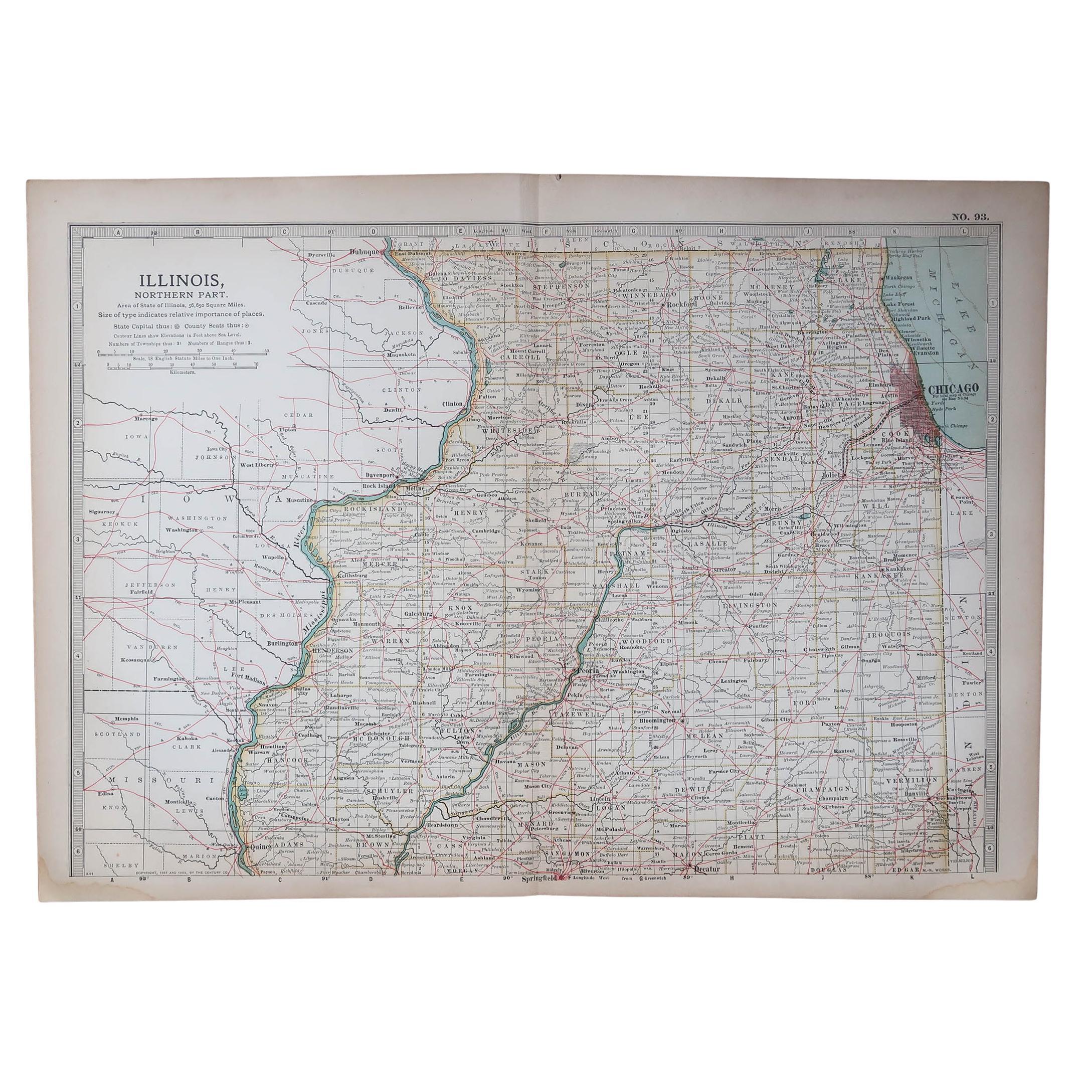
Illinois, Northern Part. USA. Century Atlas state antique vintage map
Located in Melbourne, Victoria
'The Century Atlas. Illinois, Northern Part'
Original antique map, 1903.
Central fold as issued. Map name and number printed on the reverse corners.
Sheet 29.5cm by 40cm.
Category
Early 20th Century Victorian More Prints
Materials
Lithograph
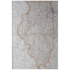
Large Original Antique Map of Illinois, USA, 1894
By Rand McNally
Co.
Located in St Annes, Lancashire
Fabulous map of Illinois
Original color
By Rand, McNally & Co.
Published, 1894
Unframed
Free shipping.
Category
Antique 1890s American Maps
Materials
Paper
1919 "Chicago and Northwestern Railway" Map by P. F. Collier
Son
Located in Colorado Springs, CO
Presented is an antique Chicago and Northwestern Railway map from 1919. This small map is from The Gazetteer of American Railroads section of Collier’s New World Atlas and Gazetteer....
Category
Vintage 1910s American Art Deco Maps
Materials
Paper
1899 Poole Brothers Antique Railroad Map of the Illinois Central Railroad
Located in Colorado Springs, CO
This is an 1899 railroad map of the Illinois Central and Yazoo and Mississippi Valley Railroads, published by the Poole Brothers. The map focuses on the continuous United States from the Atlantic to the Pacific Oceans, the Gulf of Mexico, and the Antilles. Remarkably detailed, the rail routes of the Illinois Central RR are marked in red, which each stop labeled. Major stops are overprinted in red, bold letters, with the short rail distances to New York listed above the stop and short rail distances to New Orleans listed below the name.
In addition to the Illinois Central network, numerous different rail lines are illustrated and the company running that line is noted along with many stops along each route. Sea routes from New Orleans to locations in Central America, the Caribbean, and Europe are marked and labeled with destination and distance, along with routes originating from Havana. Inset at bottom left is a map of Cuba; an inset map of Puerto Rico...
Category
Antique 1890s American Maps
Materials
Paper
