Items Similar to Antique Colourful and Decorative County Map of Bedfordshire, England, 1804

Want more images or videos?
Request additional images or videos from the seller
1 of 6
Antique Colourful and Decorative County Map of Bedfordshire, England, 1804
$312.23
$390.2920% Off
£231.26
£289.0720% Off
€260
€32520% Off
CA$427.12
CA$533.9020% Off
A$464.84
A$581.0520% Off
CHF 246.41
CHF 308.0120% Off
MX$5,592.35
MX$6,990.4320% Off
NOK 3,125.27
NOK 3,906.5820% Off
SEK 2,859.40
SEK 3,574.2520% Off
DKK 1,981.24
DKK 2,476.5620% Off
About the Item
Antique county map of Bedfordshire first published c.1800. Villages, towns, and cities illustrated include Bedford, Todington, and Potton.
Charles Smith was a cartographer working in London from circa 1800. His maps were finely engraved on copper and featured beautiful hand colouring. The county maps were initially issued as single sheets for travelers from 1800. In 1804 they were published as an atlas, Smith's New English Atlas.
- Dimensions:Height: 25.2 in (64 cm)Width: 21.26 in (54 cm)Depth: 0 in (0.02 mm)
- Materials and Techniques:Paper,Engraved
- Period:
- Date of Manufacture:1804
- Condition:Wear consistent with age and use. General age-related toning with a few light brown spots. Folding line as issued. Tears on the edges of the paper, but not into the image and only once touching the plate mark. Original Colors. Please study image carefully.
- Seller Location:Langweer, NL
- Reference Number:Seller: BG-12924-71stDibs: LU3054326992582
About the Seller
5.0
Recognized Seller
These prestigious sellers are industry leaders and represent the highest echelon for item quality and design.
Platinum Seller
Premium sellers with a 4.7+ rating and 24-hour response times
Established in 2009
1stDibs seller since 2017
2,816 sales on 1stDibs
Typical response time: 1 hour
- ShippingRetrieving quote...Shipping from: Langweer, Netherlands
- Return Policy
More From This Seller
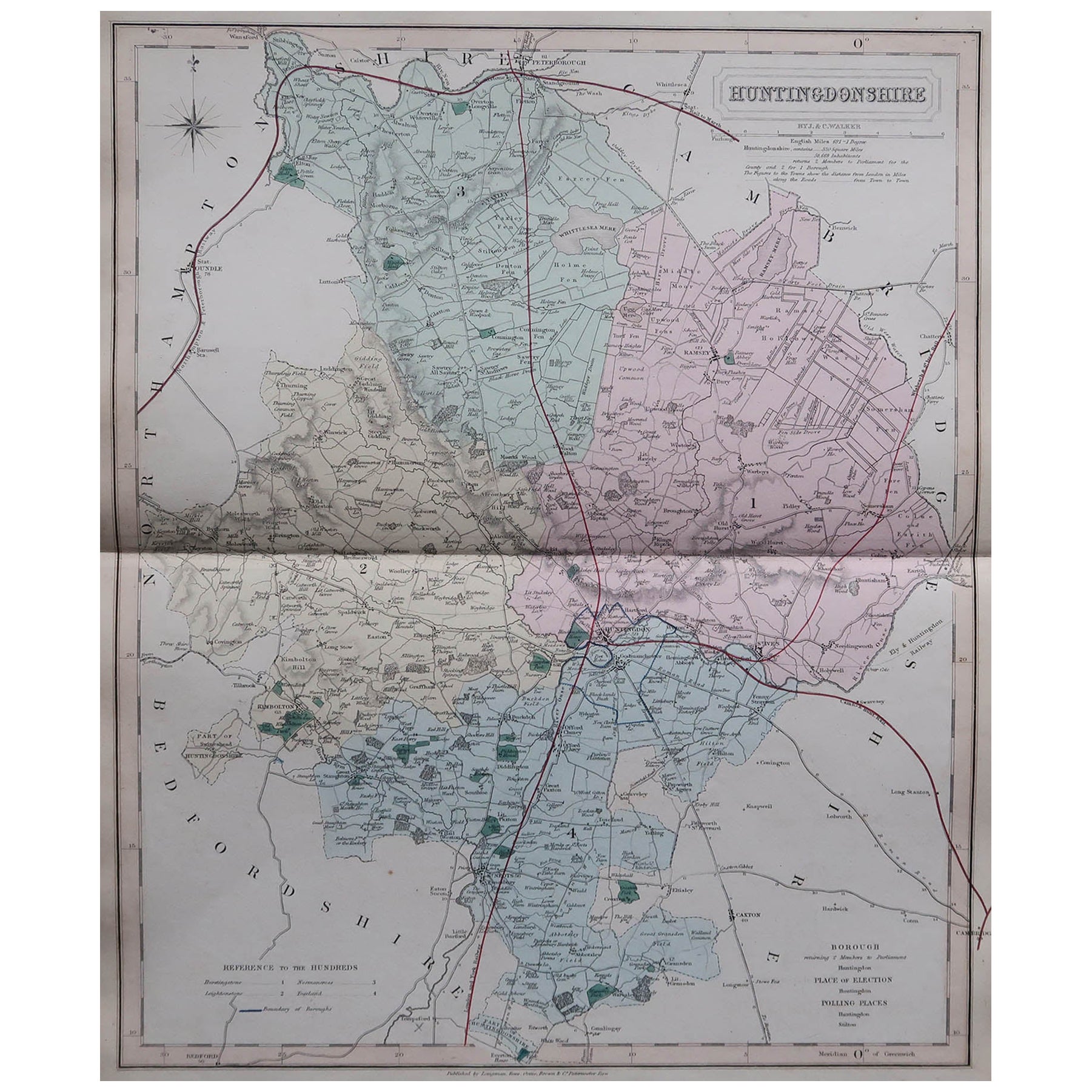
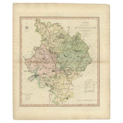
View AllAntique Decorative County Map of Huntingdonshire, England, 1804
Located in Langweer, NL
Antique county map of Huntingdonshire first published c.1800. Cities illustrated include Kimbolton, Chesterton, Folkesworth, and Great Stewkeley.
Charles Smith was a cartographer ...
Category
Antique Early 1800s Maps
Materials
Paper
$312 Sale Price
20% Off
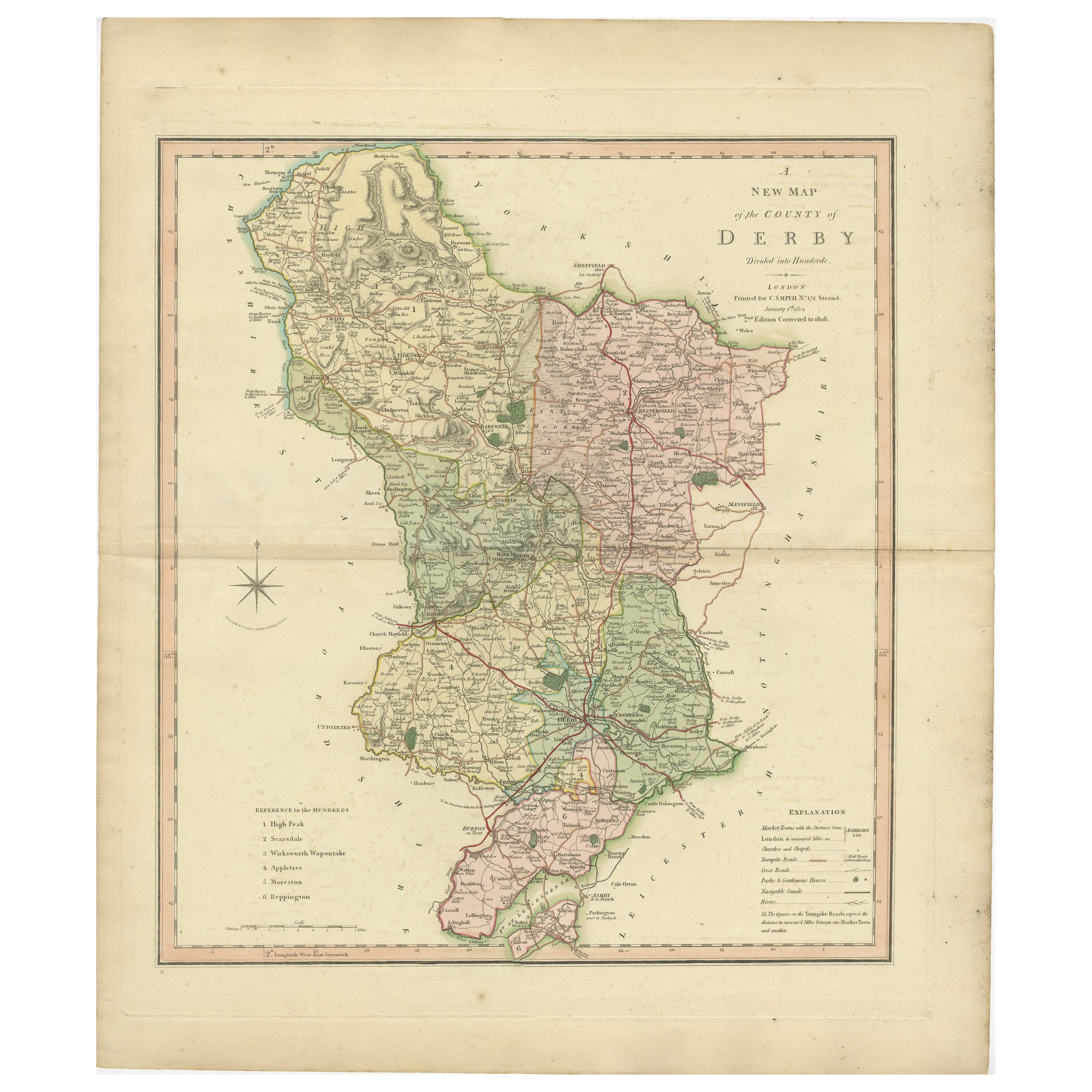
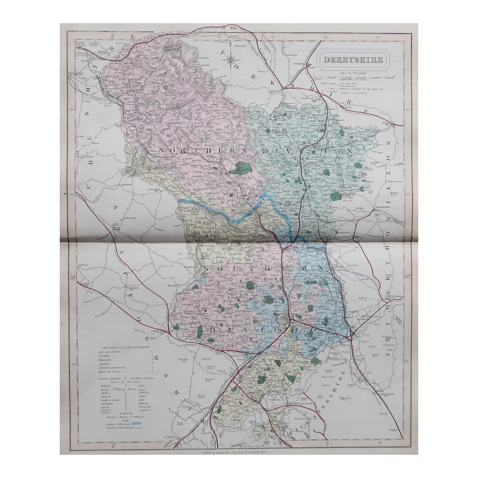
Antique County Map of Derbyshire, England, 1804
Located in Langweer, NL
Antique county map of Derbyshire first published, circa 1800. Villages, towns, and cities illustrated include Chesterfield, Wirksworth, Derby, and ...
Category
Antique Early 1800s Maps
Materials
Paper

$312 Sale Price
20% Off
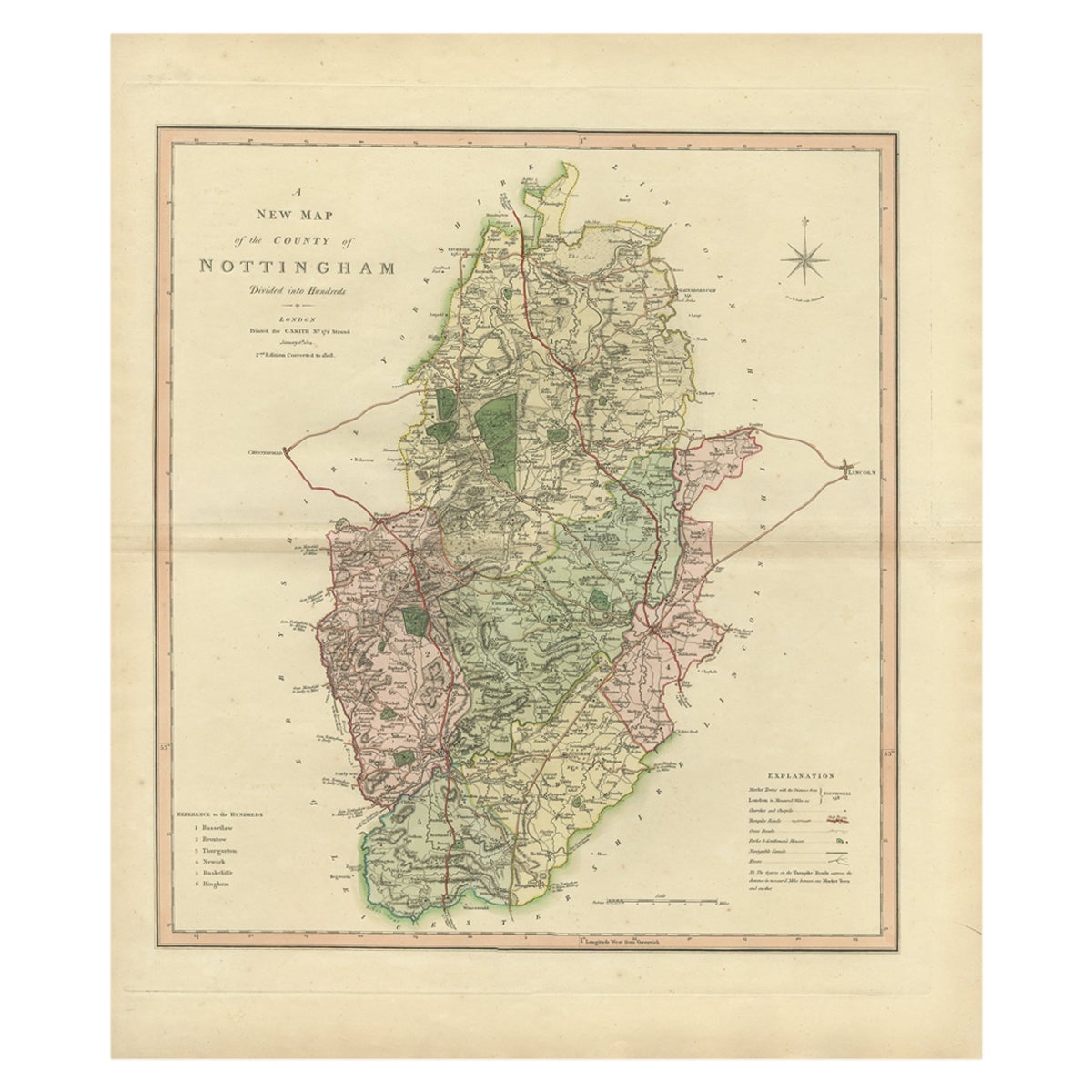
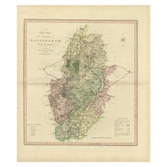
Antique Decorative Map of The County of Nottinghamshire, England, 1804
Located in Langweer, NL
Antique county map of Nottinghamshire first published c.1800. Villages, towns, and cities illustrated include Worksop, Neware, Tuxford, and Maplebe...
Category
Antique Early 1800s Maps
Materials
Paper
$312 Sale Price
20% Off
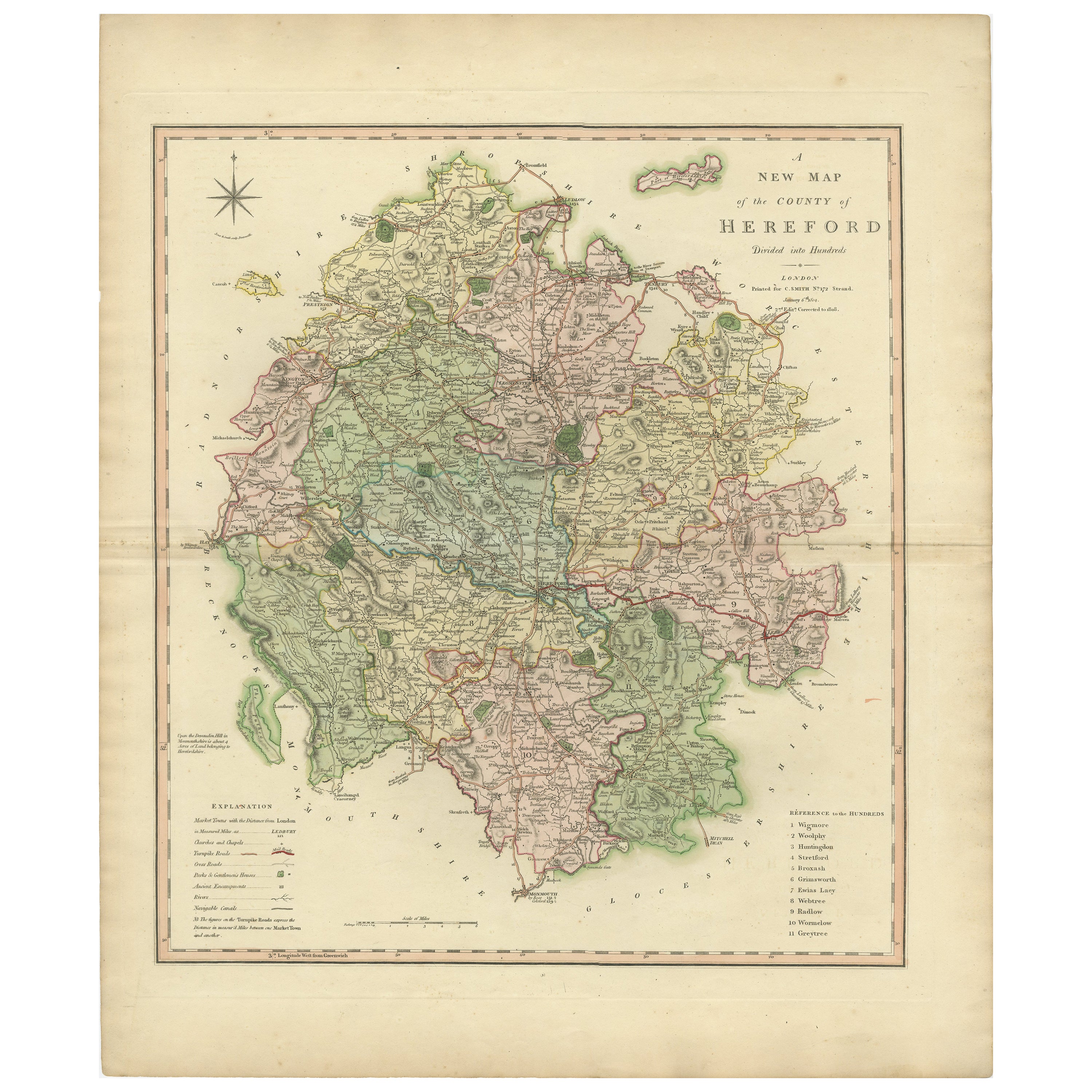
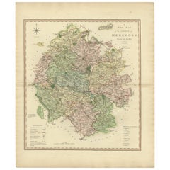
Original Hand-Colored Antique Map of the County of Hereford in England, 1804
Located in Langweer, NL
Antique county map of Herefordshire first published c.1800. Villages, towns, and cities illustrated Avenbury, Ashpurton, Kineton, and Bromyard.
...
Category
Antique Early 19th Century Maps
Materials
Paper
$312 Sale Price
20% Off
Antique Decorative County Map of Lincolnshire, England, 1804
Located in Langweer, NL
Antique county map of Lincolnshire first published circa 1800 Cities illustrated include Grantham, Spalding, Boston, and Market Raisin.
Charles Smith was a cartographer working in...
Category
Antique Early 1800s Maps
Materials
Paper

$312 Sale Price
20% Off
Antique County Map of Leicestershire, England, 1804
Located in Langweer, NL
Antique county map of Leicestershire first published c.1800. Villages, towns, and cities illustrated include Lutterworth, Ashby, Hinkley, and Marke...
Category
Antique Early 1800s Maps
Materials
Paper
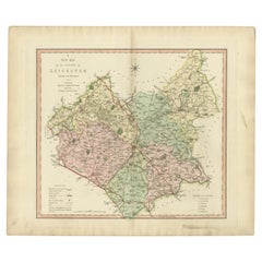
$312 Sale Price
20% Off
You May Also Like
Original Antique English County Map, Huntingdonshire, J
C Walker, 1851
Located in St Annes, Lancashire
Great map of Huntingdonshire
Original colour
By J & C Walker
Published by Longman, Rees, Orme, Brown & Co. 1851
Unframed.
Category
Antique 1850s English Other Maps
Materials
Paper

Original Antique English County Map, Derbyshire, J
C Walker, 1851
Located in St Annes, Lancashire
Great map of Derbyshire
Original colour
By J & C Walker
Published by Longman, Rees, Orme, Brown & Co. 1851
Unframed.
Category
Antique 1850s English Other Maps
Materials
Paper

Original Antique English County Map, Buckinghamshire, J
C Walker, 1851
Located in St Annes, Lancashire
Great map of Buckinghamshire
Original colour
By J & C Walker
Published by Longman, Rees, Orme, Brown & Co. 1851
Unframed.
Category
Antique 1850s English Other Maps
Materials
Paper

Original Antique English County Map, Leicestershire, J
C Walker, 1851
Located in St Annes, Lancashire
Great map of Leicestershire
Original colour
By J & C Walker
Published by Longman, Rees, Orme, Brown & Co. 1851
Unframed.
Category
Antique 1850s English Other Maps
Materials
Paper

Original Antique English County Map, Cambridgeshire, J
C Walker, 1851
Located in St Annes, Lancashire
Great map of Cambridgeshire
Original colour
By J & C Walker
Published by Longman, Rees, Orme, Brown & Co. 1851
Unframed.
Category
Antique 1850s English Other Maps
Materials
Paper

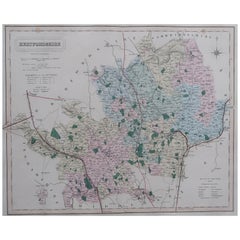
Original Antique English County Map, Hertfordshire. J
C Walker, 1851
Located in St Annes, Lancashire
Great map of Hertfordshire
Original colour
By J & C Walker
Published by Longman, Rees, Orme, Brown & Co. 1851
Unframed.
Category
Antique 1850s English Other Maps
Materials
Paper
More Ways To Browse
Antique Florida Map
Antique Map Chile
Antique Map Of Georgia
Antique Mississippi Furniture
Burgundy Map
John Speed Antique Maps
Malabar Map
Malaysia Map
Map Of Syria
Taiwan Map
Antique Chicago Maps
Dutch Bible
New Jersey 19th Century
Thailand Map
Antique Coal Mining
Antique Dutch Bible
Antique Louisiana Map
Antique Maps Of Sicily