Items Similar to Antique County Map of Cheshire, Dutch, Framed, Cartography, Janssonius, C.1660

Want more images or videos?
Request additional images or videos from the seller
1 of 13
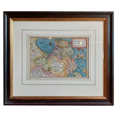
Antique County Map of Cheshire, Dutch, Framed, Cartography, Janssonius, C.1660
$2,274.56
£1,661
€1,947.01
CA$3,132.25
A$3,409.38
CHF 1,806.51
MX$41,002.95
NOK 22,969.29
SEK 21,048.81
DKK 14,544.08
About the Item
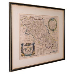
This is an antique county map of Cheshire. A Dutch, framed atlas engraving by Johannes Janssonius, dating to the 17th century and later.
A treat for the collector or county native, with this charming Cheshire map
Displays a desirable aged patina within a later, quality frame
Skilfully charted by the Dutch cartographer Johannes Janssonius (1558 - 1664)
Rear features the accompanying county entry from the Novus Atlus, Amsterdam
Annotated with fascinating heraldic detail for prominent families
Cherub figures accentuate the scale, shown in 'Milliaria Anglica' and 'Milliaria Germanica'
Hand coloured finish adds an appealing decorative appearance
Dressed to the rear with mounting wire for ease of hanging
This is a fascinating antique county map of Cheshire, with superb detail and 17th century cartographic interest. Delivered ready to display.
Dimensions:
Max Width: 66cm (26'')
Max Depth: 2.5cm (1'')
Max Height: 56cm (22'')
Map Width: 49.5cm (19.5'')
Map Height: 38cm (15'')
- Dimensions:Height: 22.05 in (56 cm)Width: 25.99 in (66 cm)Depth: 0.99 in (2.5 cm)
- Style:Charles II (Of the Period)
- Materials and Techniques:
- Place of Origin:
- Period:Mid-17th Century
- Date of Manufacture:circa 1660
- Condition:Wear consistent with age and use. Presented in very good antique condition.
- Seller Location:Hele, Devon, GB
- Reference Number:Seller: 245621stDibs: LU2645340746562
About the Seller
5.0
Platinum Seller
Premium sellers with a 4.7+ rating and 24-hour response times
Established in 2005
1stDibs seller since 2017
1,089 sales on 1stDibs
Typical response time: <1 hour
- ShippingRetrieving quote...Shipping from: Hele, Devon, United Kingdom
- Return Policy
More From This Seller
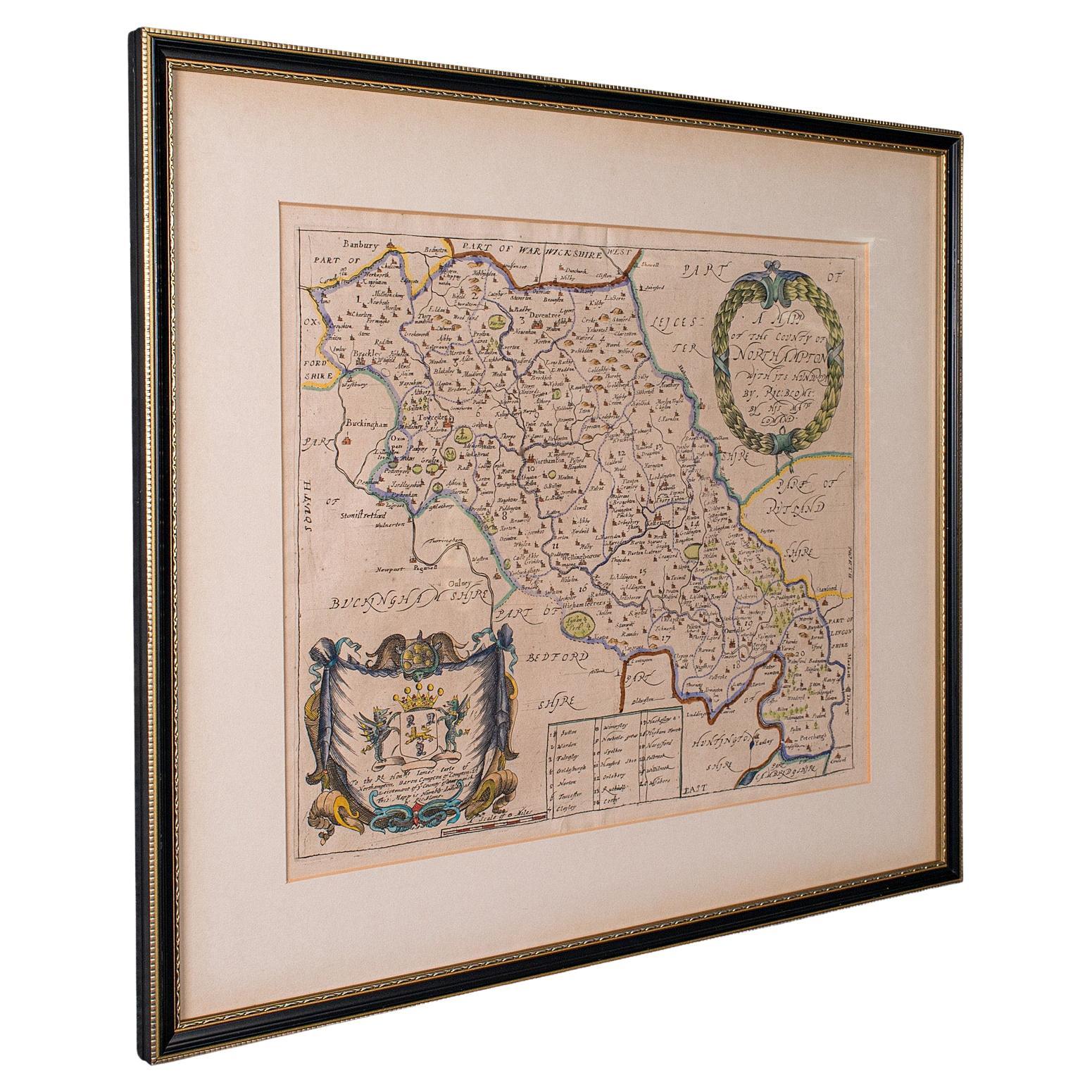
View AllAntique County Map, Northamptonshire, English, Framed Cartography, Richard Blome
Located in Hele, Devon, GB
This is an antique county map of Northamptonshire. An English, framed atlas engraving by Richard Blome, dating to the 17th century and later.
Fascinating cartography, oriented 90 d...
Category
Antique Late 17th Century British Charles II Maps
Materials
Glass, Wood, Paper
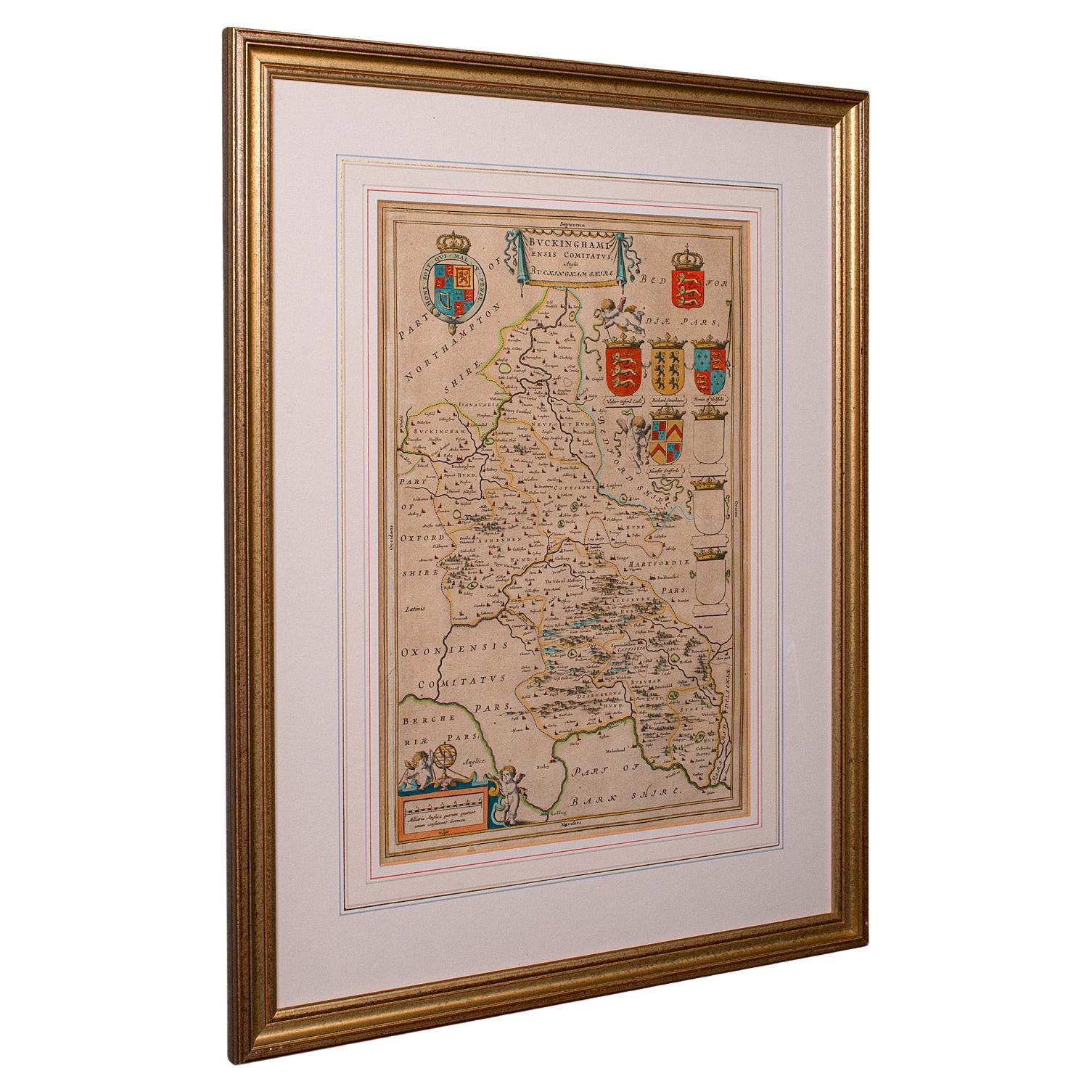
Antique Buckinghamshire Map, English, Framed 17th Century County Cartography
Located in Hele, Devon, GB
This is an antique county map of Buckinghamshire. An English, framed atlas engraving reproduction by Dutchman Joan Blaeu, dating to the 17th century and later.
A treat for the colle...
Category
Early 20th Century British Victorian Maps
Materials
Glass, Paper
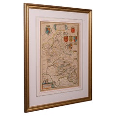
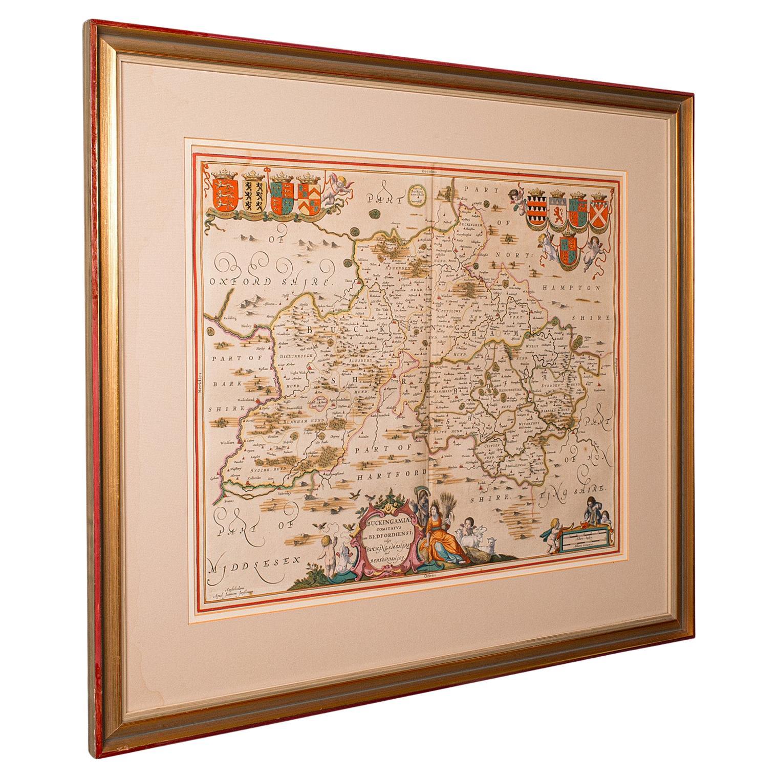
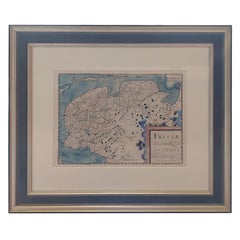
Antique County Map, Buckinghamshire, Bedfordshire, Dutch, Framed, Janssonius
Located in Hele, Devon, GB
This is an antique county map of Buckinghamshire and Bedfordshire. A Dutch, framed atlas engraving by Johannes Janssonius, dating to the 17th century and later.
A treat for the col...
Category
Antique Mid-17th Century Dutch Maps
Materials
Paper

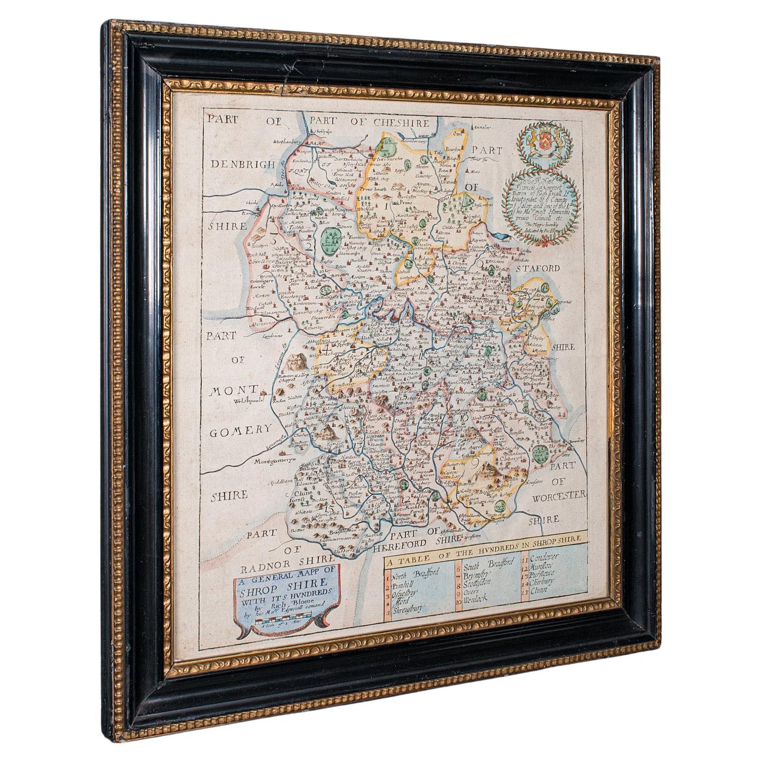
Antique County Map, Shropshire, English, Atlas Engraving, Richard Blome, C.1673
Located in Hele, Devon, GB
This is an antique county map of Shropshire. An English, framed atlas engraving by Richard Blome, dating to the 17th century and later.
A treat for the collector or county native, ...
Category
Antique 17th Century British Restauration Maps
Materials
Glass, Wood, Paper

Antique County Map, Cheshire, English, Framed Cartography, Robert Morden, 18th.C
Located in Hele, Devon, GB
This is an antique county map of Cheshire, an English framed cartographic engraving by Robert Morden, dating to the early Georgian period, circa 1720. A charming and historically ric...
Category
Early 20th Century British Georgian Maps
Materials
Glass, Paper
Antique County Map, Hampshire, English, Framed Cartography, Robert Morden, 1700
Located in Hele, Devon, GB
This is an antique county map of Hampshire. An English, framed atlas engraving of cartographic interest By Robert Morden, dating to the late 17th century and later.
Superb lithogra...
Category
Antique Late 17th Century British Other Maps
Materials
Glass, Wood, Paper

You May Also Like
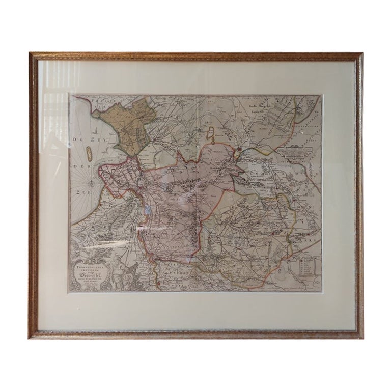
Antique Map of Overijssel by Visscher, c.1660
Located in Langweer, NL
Antique map titled 'Transisalania provincia vulgo Over-yssel'. Original antique map of the province of Overijssel, the Netherlands. Published by N. Visscher after N. ten Have, circa ...
Category
Antique 17th Century Maps
Materials
Paper

$703 Sale Price
20% Off
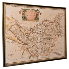
Framed 17th Century Map of Cumberland, England by John Speed, 1610
By John Speed
Located in Middleburg, VA
A fascinating and richly detailed antique map of Cumberland County in northwest England, drawn and published by the celebrated English cartographer John Spe...
Category
Antique Early 17th Century English British Colonial Maps
Materials
Copper, Gold Leaf

Antique Map of Friesland by Bussemacher in Frame, c.1592
Located in Langweer, NL
Original antique map titled 'Frisiae Antiquissimae (..)'. Original antique map of Friesland. Published by J. Bussemacher, circa 1592. Artists and Engravers: Bussemacher was active as...
Category
Antique 18th Century Maps
Materials
Paper
Antique Map of Essex by Overton, circa 1710
Located in Langweer, NL
Antique map titled 'Essex, devided into Hundreds, with the most antient and fayre Towne Colchester (..)'. Map of Essex, England. Includes an inset town pl...
Category
Antique Early 18th Century Maps
Materials
Paper

$905 Sale Price
20% Off
Original Antique Map of Friesland in Frame, The Netherlands, 1612
Located in Langweer, NL
Antique map titled 'Frisiae Occidentalis Typus'. Original antique map of the province of Friesland, the Netherlands. Second state, published 1612. Artists and Engravers: Published by...
Category
Antique 17th Century Maps
Materials
Paper
Antique Map of Leicester and Rutland by Tinney
Sayer,
circa 1756
Located in Langweer, NL
Antique map titled 'An Accurate Map of the Counties of Leicester and Rutland (..)'. Large map of Leicester and Rutland with dedications to the Most Noble John Duke of Rutland, and to...
Category
Antique Mid-18th Century Maps
Materials
Paper

$762 Sale Price
20% Off
More Ways To Browse
Dutch Engravings
17th Century Dutch Wood Frames
1960s Glass Top Coffee Table
Black Glass Coffee Tables
Mid Century Wrought Iron Chairs
Earth Toned Rug
Black Marble Table Vintage
Goblets
Mid Century Modern Yellow Chair
Paulin Pierre
Used Pianos Pianos
18th Century Engravings
Antique Carved Wood Chair
Black Scandinavian Modern Dining Chairs
Dutch Mid Century Modern Table
Gold Modern Coffee Table
Iconic Modern Furniture
Japanese Metal