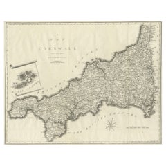
Items Similar to Antique County Map, Cornwall, Kernow, English, Framed, Robert Morden, Georgian

Want more images or videos?
Request additional images or videos from the seller
1 of 13
Antique County Map, Cornwall, Kernow, English, Framed, Robert Morden, Georgian
$1,178.71
£856
€1,001.07
CA$1,612.77
A$1,754.82
CHF 929.15
MX$21,111.67
NOK 11,798.20
SEK 10,794.52
DKK 7,479.40
About the Item
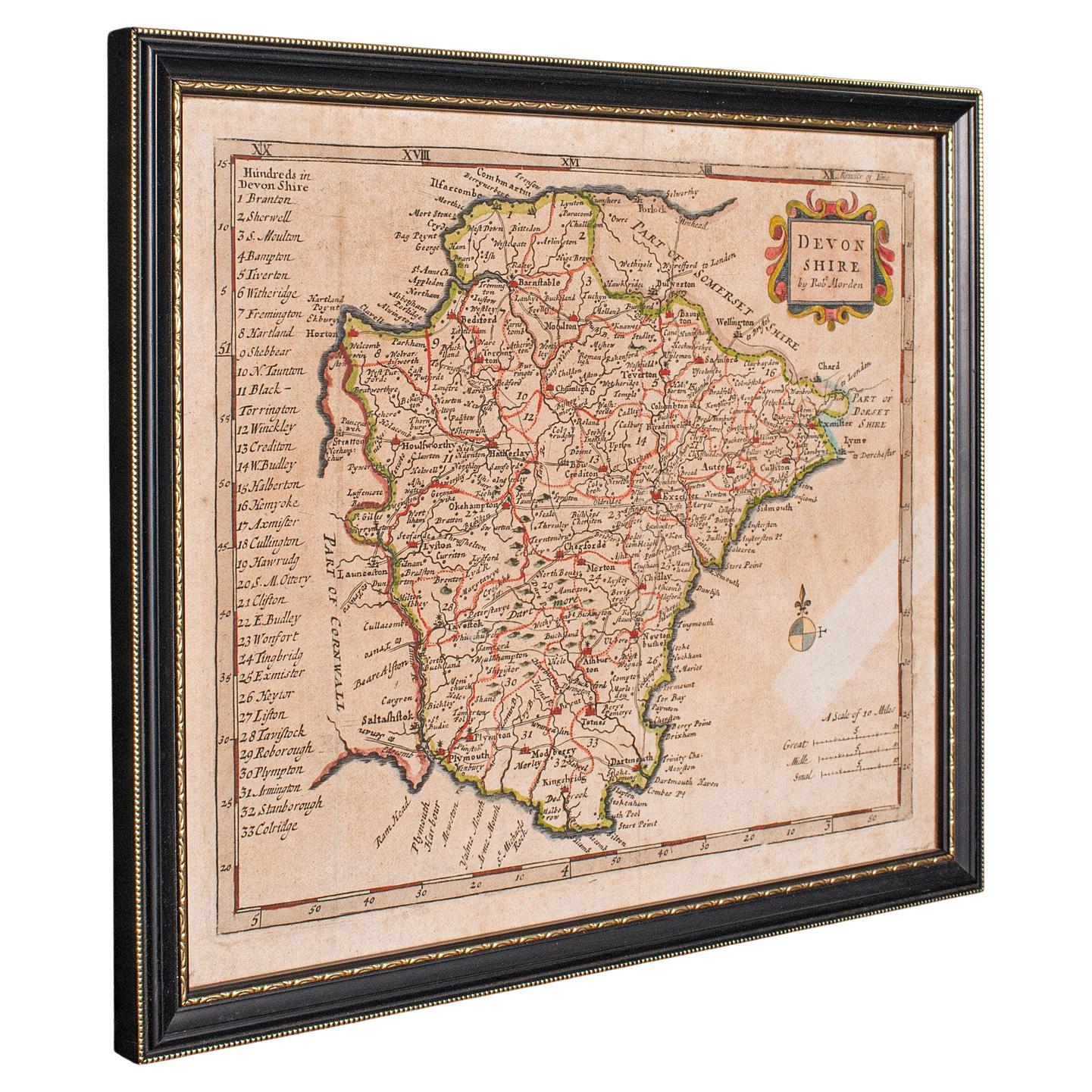
This is an antique county map of Cornwall. An English, framed atlas engraving of cartographic interest By Robert Morden, dating to the late 17th century and later.
Superb lithography of Cornwall and its county detail, perfect for display
Displaying a desirable aged patina and in good order throughout
Fascinating cartography, appealingly set within a quality, later frame
Table of Explanation and key notes add further interesting detail
Fine historical appeal, with place names written in their 17th century form
County represented by The Hundreds, the administrative divisions within counties until the mid 19th century
Mapped by Robert Morden (1650 - 1703) in high detail and hand coloured for visual appeal
Dressed to the rear with hanging cord for ease of mounting
This is a quality antique county map of Cornwall, with fine cartographic interest. Delivered ready to display.
Dimensions:
Max Width: 49.5cm (19.5'')
Max Depth: 3cm (1.25'')
Max Height: 44cm (17.25'')
Map Width: 42.5cm (16.75'')
Map Height: 37cm (14.5'')
- Dimensions:Height: 17.33 in (44 cm)Width: 19.49 in (49.5 cm)Depth: 1.19 in (3 cm)
- Style:Georgian (Of the Period)
- Materials and Techniques:
- Place of Origin:
- Period:
- Date of Manufacture:Circa 1700
- Condition:Wear consistent with age and use. Presented in good antique condition.
- Seller Location:Hele, Devon, GB
- Reference Number:Seller: 254851stDibs: LU2645347289492
About the Seller
5.0
Platinum Seller
Premium sellers with a 4.7+ rating and 24-hour response times
Established in 2005
1stDibs seller since 2017
1,088 sales on 1stDibs
Typical response time: <1 hour
- ShippingRetrieving quote...Shipping from: Hele, Devon, United Kingdom
- Return Policy
More From This Seller
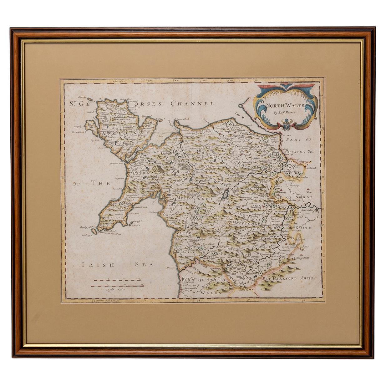
View AllAntique Devonshire Map, English Framed Robert Morden Devon Cartography, Georgian
Located in Hele, Devon, GB
This is a small antique map of Devonshire, an English framed cartographic engraving by Robert Morden, dating to the early Georgian period, circa 1720. A charming and historically ric...
Category
Antique 1720s British Georgian Maps
Materials
Glass, Paper

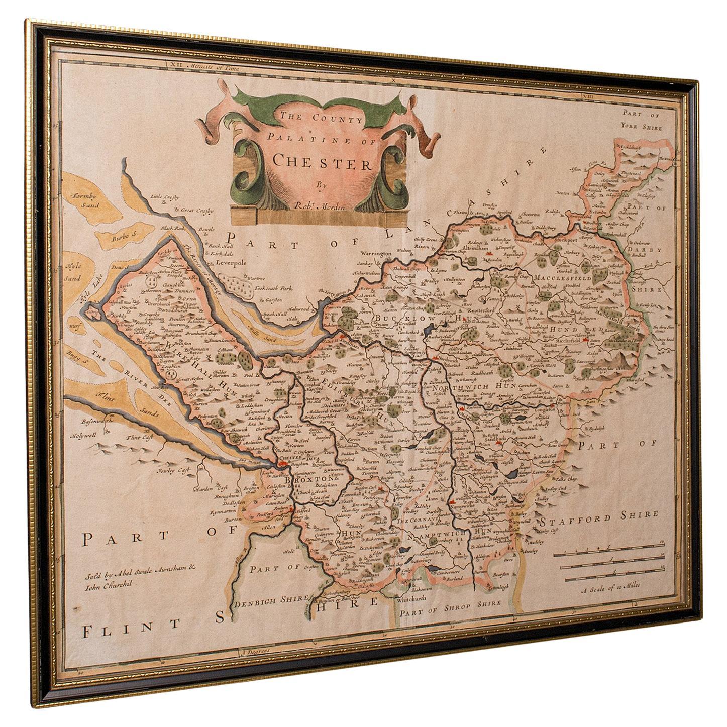
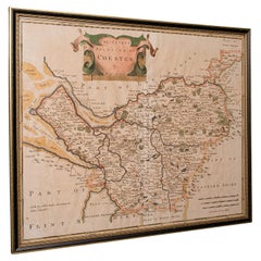
Antique County Map, Cheshire, English, Framed Cartography, Robert Morden, 18th.C
Located in Hele, Devon, GB
This is an antique county map of Cheshire, an English framed cartographic engraving by Robert Morden, dating to the early Georgian period, circa 1720. A charming and historically ric...
Category
Early 20th Century British Georgian Maps
Materials
Glass, Paper
Vintage County Map of Cheshire, English, After John Cary, Cartography Interest
Located in Hele, Devon, GB
This is a vintage Cheshire map, a fine reproduction of John Cary’s late 18th century cartography, and presented within a smart glazed frame.
Superb county map of Cheshire, offering ...
Category
Vintage 1980s British Georgian Maps
Materials
Glass, Paper
Antique Lithography Map, Cumbria, English, Framed Cartography Interest, Georgian
Located in Hele, Devon, GB
This is an antique lithography map of Cumbria. An English, framed engraving of cartographic interest, dating to the early 18th century and later.
...
Category
Antique Early 18th Century British Georgian Maps
Materials
Wood

Antique Somerset Map, Thomas Kitchin, English, Cartographic Reference, Georgian
Located in Hele, Devon, GB
This is a fine antique Somerset map. An 18th century English cartographic county reference engraving by Thomas Kitchin (1718–1784), dating to the Georgian period, circa 1780. A beaut...
Category
Antique 1780s British Georgian Maps
Materials
Glass, Paper

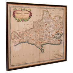
Large Antique 17th Century Dorset Map, Framed Cartography, Atlas, Robert Morden
Located in Hele, Devon, GB
This is an antique county map of Dorset. An English, framed atlas engraving of cartographic interest By Robert Morden, dating to the late 17th century and later.
Superb lithography ...
Category
Antique 1690s British William and Mary Decorative Art
Materials
Glass, Paper
You May Also Like
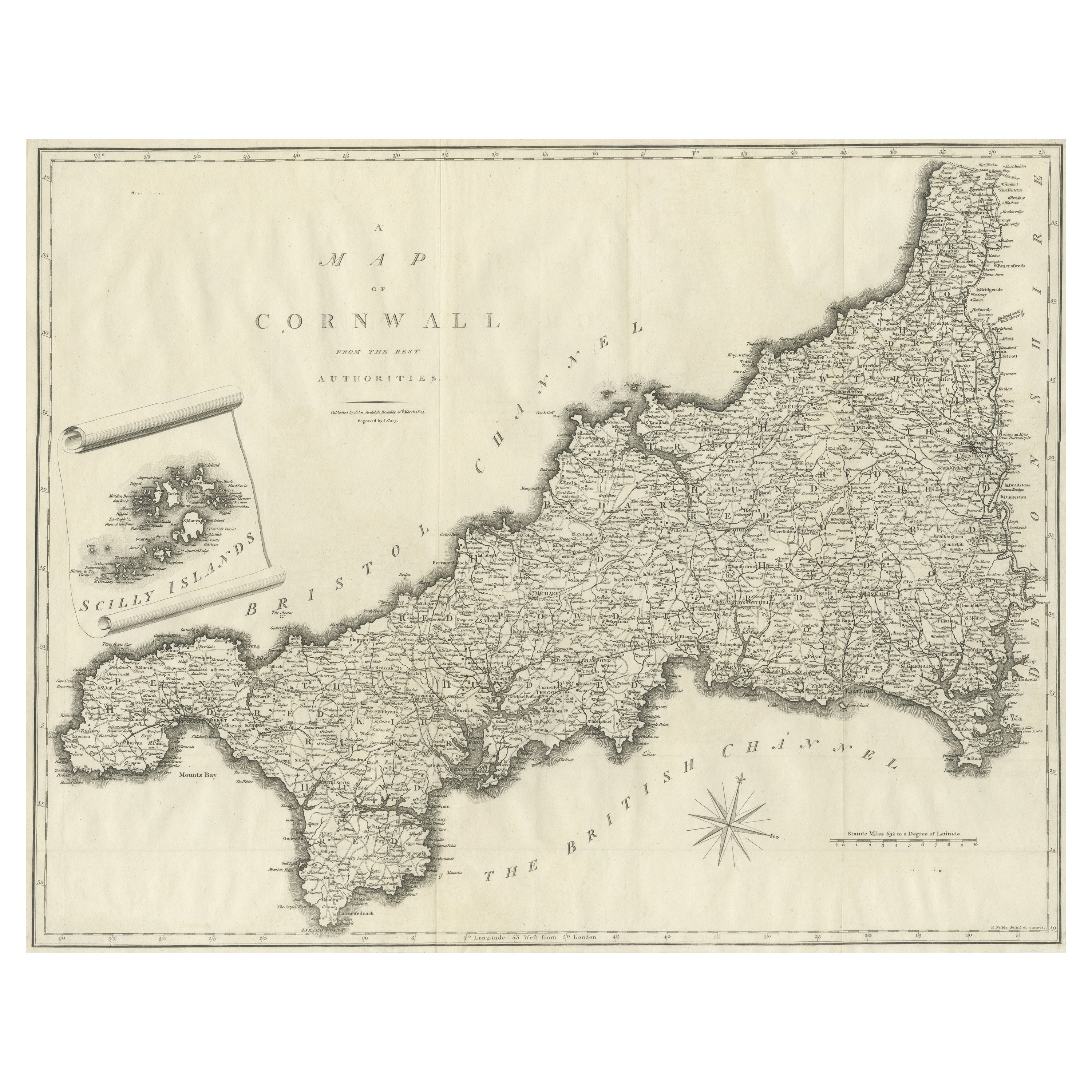
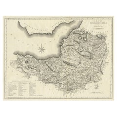
Large Antique County Map of Cornwall and the Isles of Scilly, England
Located in Langweer, NL
Antique map titled 'A Map of Cornwall from the best Authorities'. Original old county map of Cornwall, England. With inset map of the Scilly Islands. Engraved by John Cary. Originate...
Category
Antique Early 19th Century Maps
Materials
Paper
$307 Sale Price
20% Off
Map North Wales Robert Marsden Anglesey
Located in BUNGAY, SUFFOLK
Map of North Wales by Robert Marsden
Including Anglesey
Charming topography and detail and colouring
just purchased more information to follow.
Category
Antique 18th Century English Georgian Maps
Materials
Paper

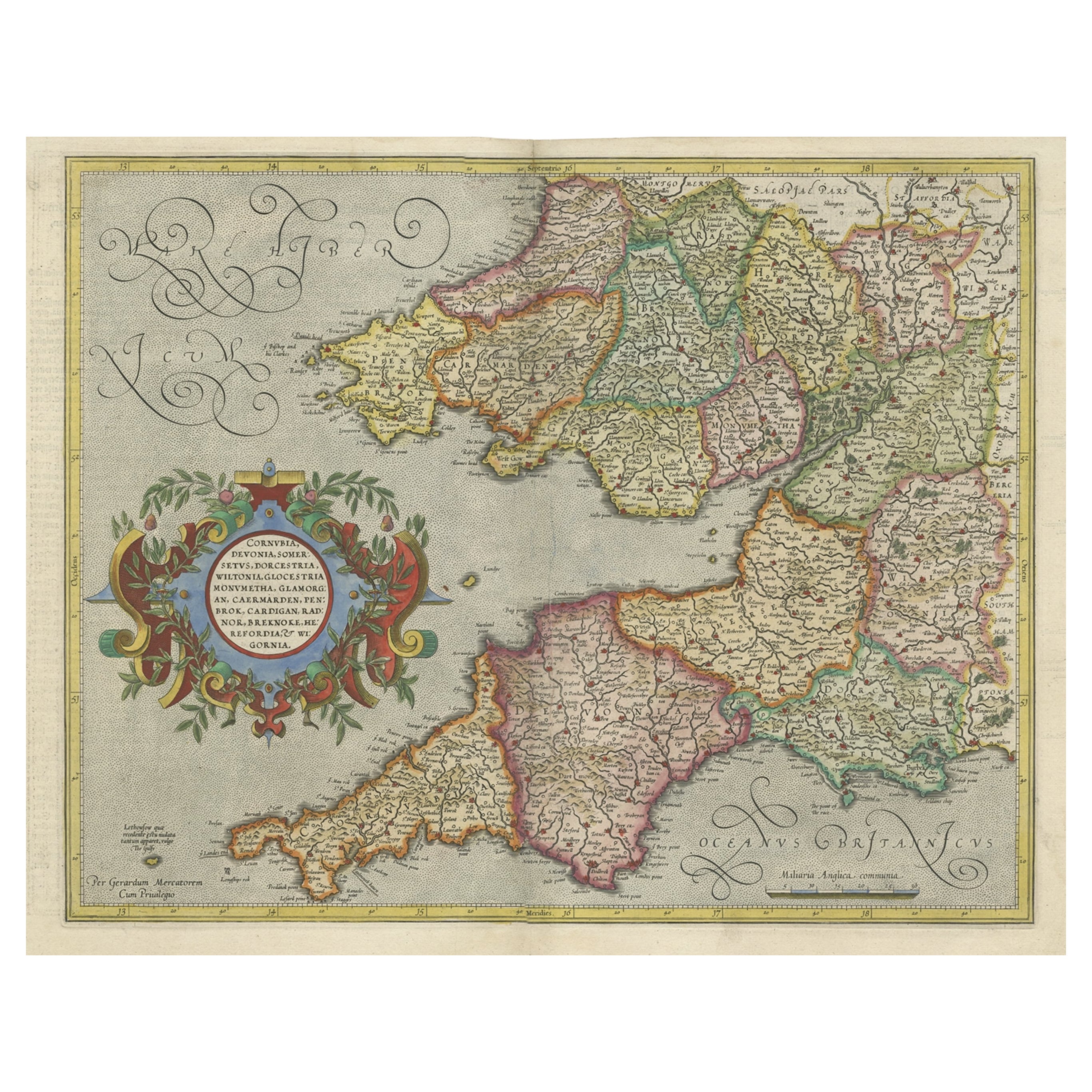
Original Antique Map of the English counties Cornwall, Devon, Dorset, etc, 1633
Located in Langweer, NL
Antique map titled 'Cornubia, Devonia, Somersetus, Dorcestria, Wiltonia, Glocestria, Monumetha, Glamorgan, Caermarden, Penbrok, Cardigan, Radnor, Breknoke et Herfordia'.
Old map of the English counties of Cornwall, Devon, Somerset, Dorset, Wiltshire, Gloucestershire, Herefordshire, Worcestershire etc. Originates from the 1633 German edition of the Mercator-Hondius Atlas Major, published by Henricus Hondius and Jan Jansson under the title: 'Atlas: das ist Abbildung der gantzen Welt, mit allen darin begriffenen Laendern und Provintzen: sonderlich von Teutschland, Franckreich, Niderland, Ost und West Indien: mit Beschreibung der selben.'
Artists and Engravers: Gerard Mercator (1512 - 1594) originally a student of philosophy was one of the most renowned cosmographers and geographers of the 16th century, as well as an accomplished scientific instrument maker. He is most famous for introducing Mercators Projection, a system which allowed navigators to plot the same constant compass bearing on a flat...
Category
Antique 1630s Maps
Materials
Paper
$1,104 Sale Price
20% Off
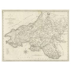
Large Antique County Map of South Wales, England
Located in Langweer, NL
Antique map titled 'A Map of South Wales from the best Authorities'. Original old county map of South Wales, England. Engraved by John Cary. Originates from 'New British Atlas' by Jo...
Category
Antique Early 19th Century Maps
Materials
Paper
$172 Sale Price
20% Off
Map Suffolk Southwold Aldeburgh Dunwich Bawdsey Harwich Ipswich
Located in BUNGAY, SUFFOLK
Map Suffolk including many popular destinations on the coast Southwold, Dunwich, Aldeburgh bawdsey felixstowe harwich ipswich.
Charming topography and colouring.
In the original fr...
Category
Antique 19th Century European Georgian Maps
Materials
Paper
Large Antique County Map of Somersetshire, England
Located in Langweer, NL
Antique map titled 'A Map of Somersetshire from the best Authorities'. Original old county map of Somersetshire, England. Engraved by John Cary. Originates from 'New British Atlas' b...
Category
Antique Early 19th Century Maps
Materials
Paper
$307 Sale Price
20% Off