Items Similar to Antique Dutch Map of Gelderland – Sleeswijk Provincial Atlas, 1914

Want more images or videos?
Request additional images or videos from the seller
1 of 10
Antique Dutch Map of Gelderland – Sleeswijk Provincial Atlas, 1914
$251.41
£188.01
€210
CA$346.43
A$377.94
CHF 200.12
MX$4,528.81
NOK 2,548.61
SEK 2,330.51
DKK 1,599.40
About the Item
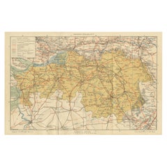
Antique Map of Gelderland – Sleeswijk Atlas, 1914
Description:
This antique map of Gelderland was published in 1914 in the Sleeswijk Atlas, one of the most widely used Dutch school atlases of the early 20th century. It depicts the largest province of the Netherlands, known for its varied landscapes ranging from river valleys to forests and heathlands.
The map extends from Utrecht and the Randstad in the west across the Veluwe to the eastern borders with Germany, and from Harderwijk on the Zuiderzee down to Nijmegen and the Rhine valley in the south. Major cities such as Arnhem, Nijmegen, Zutphen, Apeldoorn, and Wageningen are prominently marked, alongside smaller towns and villages. The Veluwe region appears as an expansive sandy and wooded area in the center, contrasting with the fertile river lands of the Betuwe and the Liemers.
The extensive river system is carefully drawn, showing the courses of the Rhine, Waal, IJssel, and Maas as they cross the province. Red lines highlight the growing railway network that connected Gelderland to the rest of the Netherlands and Germany. The legend (“Verklaring”) provides symbols for tramways, roads, waterways, boundaries, and dikes. With its scale of 1:400,000, the map is both precise and legible, designed for classroom use but today valued for its historic and decorative qualities.
Published by A. Sleeswijk in Bussum and lithographed by J. Smulders
Co. in The Hague, the map exemplifies early 20th-century Dutch educational cartography. Its balanced color scheme and clear typography make it both a practical learning tool and an attractive historical artifact.
Condition report: Good condition with original centerfold as issued. Some light toning along the fold and lower margins, with minor handling signs. Plate mark visible. Colors remain fresh and well preserved.
Framing tips: A light ivory or cream mat will complement the warm tones of the map, while a dark wood or slim black frame provides strong contrast for a timeless look. For a more classical presentation, a gilt frame enhances the historical appeal.
Technique: Lithograph with original color
Maker: A. Sleeswijk, Bussum / J. Smulders
Co., The Hague, 1914
- Dimensions:Height: 9.38 in (23.8 cm)Width: 14.3 in (36.3 cm)Depth: 0.01 in (0.2 mm)
- Materials and Techniques:
- Place of Origin:
- Period:
- Date of Manufacture:circa 1914
- Condition:Condition report: Good condition with original centerfold as issued. Some light toning along the fold and lower margins, with minor handling signs. Plate mark visible. Colors remain fresh and well preserved.
- Seller Location:Langweer, NL
- Reference Number:Seller: BG-07094-61stDibs: LU3054346556622
About the Seller
5.0
Recognized Seller
These prestigious sellers are industry leaders and represent the highest echelon for item quality and design.
Platinum Seller
Premium sellers with a 4.7+ rating and 24-hour response times
Established in 2009
1stDibs seller since 2017
2,791 sales on 1stDibs
Typical response time: <1 hour
- ShippingRetrieving quote...Shipping from: Langweer, Netherlands
- Return Policy
More From This Seller
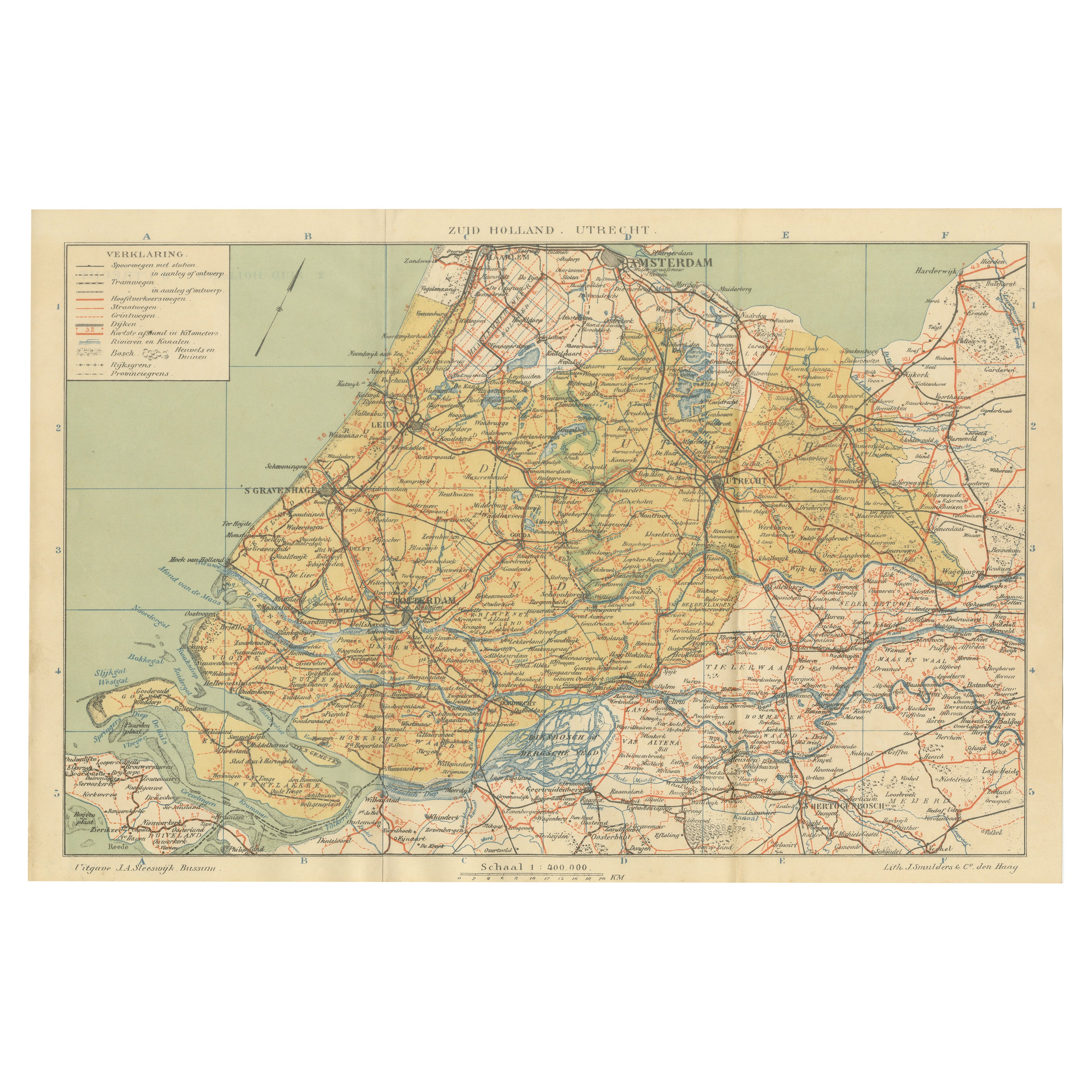
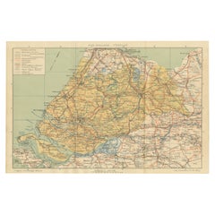
View AllAntique Dutch Map of Zuid-Holland
Utrecht – Sleeswijk Provincial Atlas, 1914
Located in Langweer, NL
Antique Map of Zuid-Holland & Utrecht – Sleeswijk Atlas, 1914
This antique map of Zuid-Holland and Utrecht was published in 1914 in the well-known Sleeswijk Atlas, a Dutch school at...
Category
Early 20th Century Dutch Maps
Materials
Paper
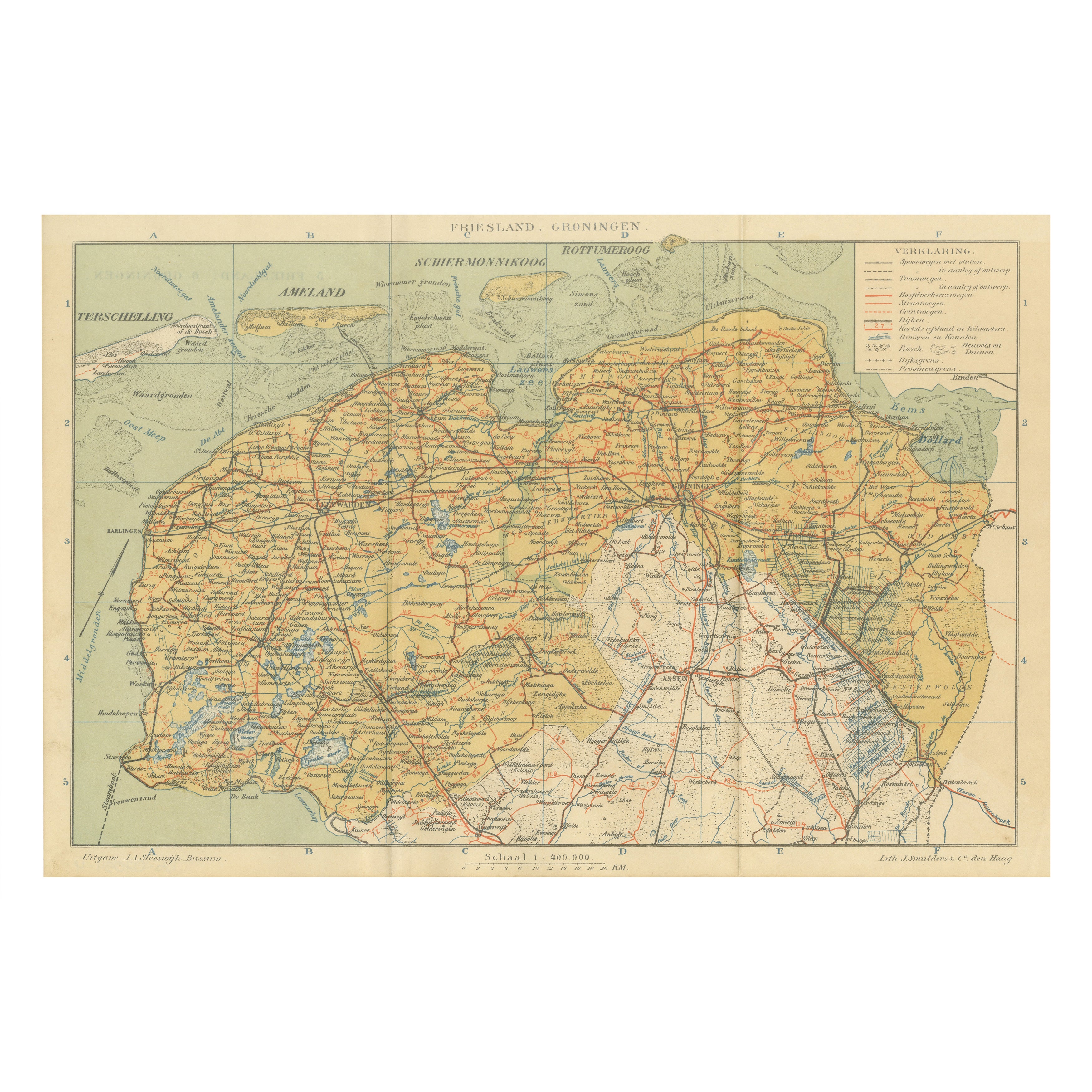
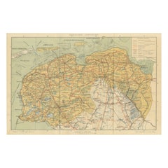
Antique Map of Friesland
Groningen – Sleeswijk Atlas Dutch Provinces, 1914
Located in Langweer, NL
Antique Map of Friesland & Groningen – Sleeswijk Atlas, 1914
Description:
This antique map of Friesland and Groningen was published in 1914 in the Sleeswijk Atlas, a Dutch school at...
Category
Early 20th Century Dutch Maps
Materials
Paper
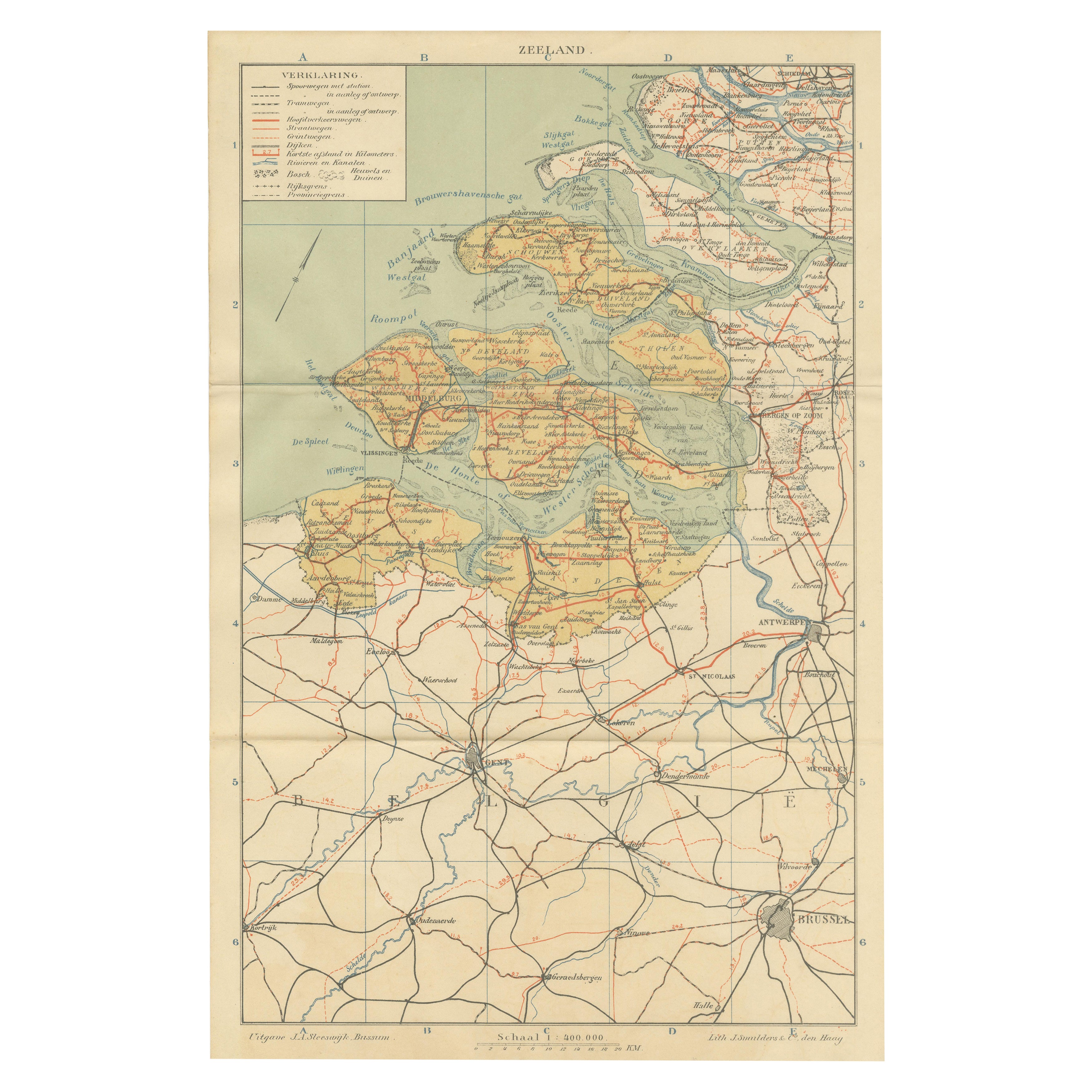
Rare Antique Map of Zeeland – Sleeswijk Atlas of the Netherlands, 1914
Located in Langweer, NL
Antique Map of Zeeland – Sleeswijk Atlas, 1914
This antique map of Zeeland was published in 1914 in the Sleeswijk Atlas, one of the most widely used Dutch school atlases of the earl...
Category
Early 20th Century Dutch Maps
Materials
Paper

Rare Antique Map of Noord-Brabant – Sleeswijk Atlas of the Netherlands, 1914
Located in Langweer, NL
Antique Map of Noord-Brabant – Sleeswijk Atlas, 1914
Description:
This antique map of Noord-Brabant was published in 1914 in the Sleeswijk Atlas, a prominent Dutch school atlas that...
Category
Early 20th Century Dutch Maps
Materials
Paper
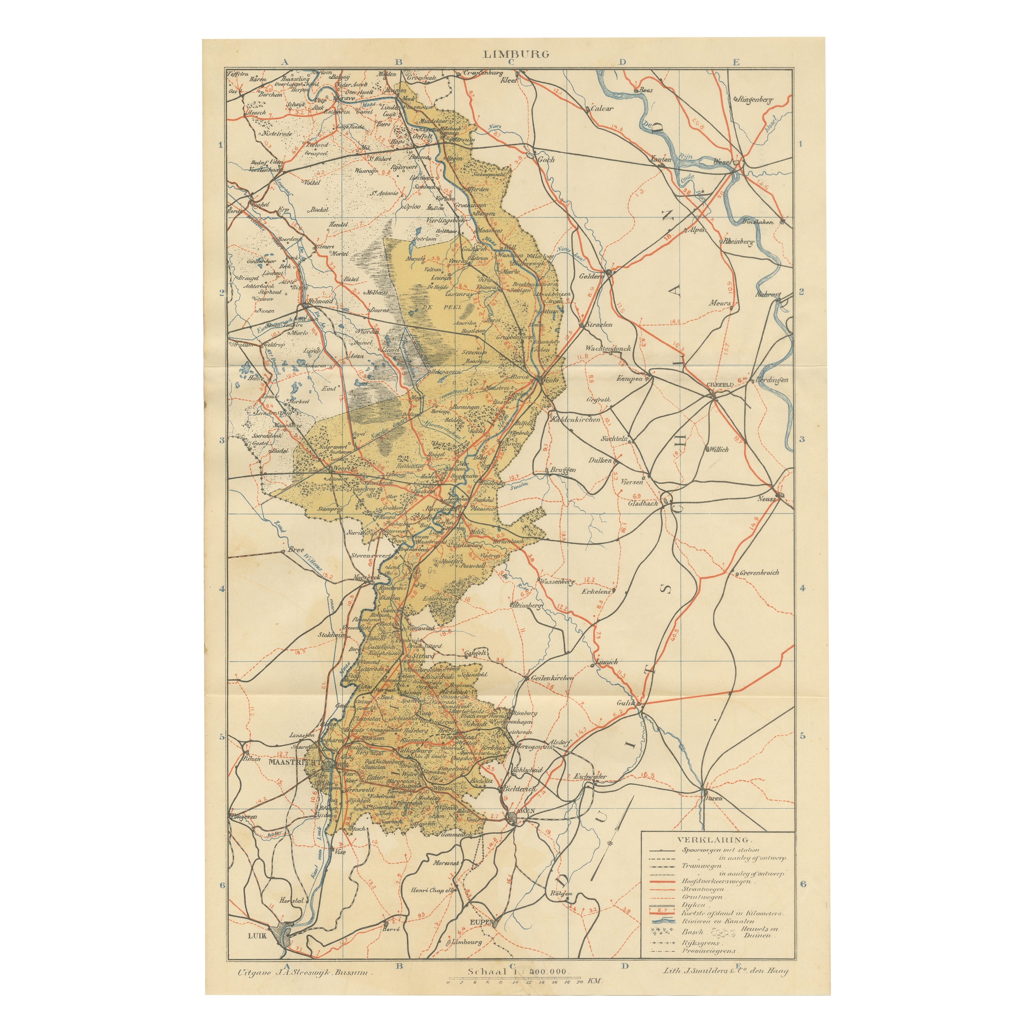
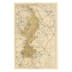
Rare Antique Map of Limburg – Sleeswijk Atlas of the Netherlands, 1914
Located in Langweer, NL
Antique Map of Limburg – Sleeswijk Atlas, 1914
Description:
This antique map of Limburg was published in 1914 in the Sleeswijk Atlas, a widely used Dutch school atlas of the early 2...
Category
Early 20th Century Dutch Maps
Materials
Paper
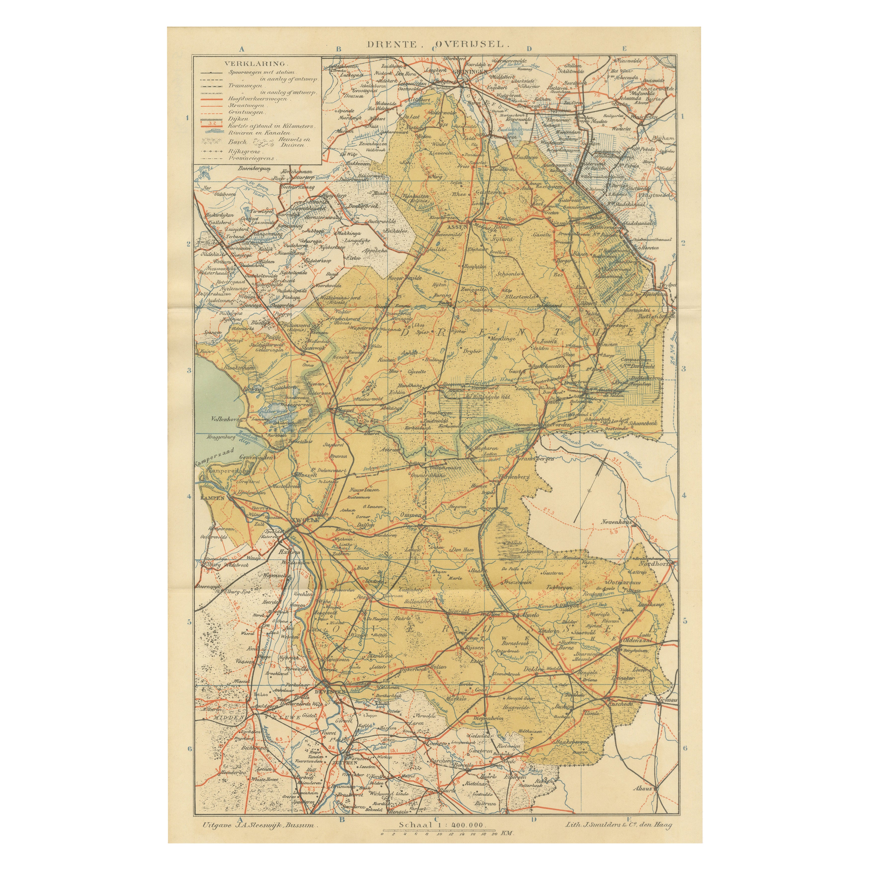
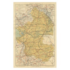
Rare Antique Map of Drenthe
Overijssel – Sleeswijk Atlas of Provinces, 1914
Located in Langweer, NL
Antique Map of Drenthe & Overijssel – Sleeswijk Atlas, 1914
Description:
This antique map of Drenthe and Overijssel was published in 1914 in the Sleeswijk Atlas, a key Dutch school ...
Category
Early 20th Century Dutch Maps
Materials
Paper
You May Also Like
The Netherlands (Holland), Belgium and Luxemburg. Century Atlas antique map
Located in Melbourne, Victoria
'The Century Atlas. The Netherlands (Holland), Belgium and Luxemburg.'
Original antique map, 1903.
Inset maps of 'Amsterdam' and 'Brussels'.
Central fold as issued. Map name and num...
Category
Early 20th Century Victorian More Prints
Materials
Lithograph

England and Wales, Northern Part. Century Atlas antique vintage map
Located in Melbourne, Victoria
'The Century Atlas. England and Wales, Northern Part'
Original antique map, 1903.
Central fold as issued. Map name and number printed on the reverse corners.
Sheet 29.5cm by 40cm.
Category
Early 20th Century Victorian More Prints
Materials
Lithograph

1752 Vaugoundy Map of Flanders : Belgium, France, and the Netherlands, Ric.a002
Located in Norton, MA
Large Vaugoundy Map of Flanders:
Belgium, France, and the Netherlands
Colored -1752
Ric.a002
Description: This is a 1752 Didier Robert de Vaugondy map of Flanders. The map de...
Category
Antique 17th Century Unknown Maps
Materials
Paper

Original Antique English County Map, Nottinghamshire, J
C Walker, 1851
Located in St Annes, Lancashire
Great map of Nottinghamshire
Original colour
By J & C Walker
Published by Longman, Rees, Orme, Brown & Co. 1851
Unframed.
Category
Antique 1850s English Other Maps
Materials
Paper

France, Northern Part. Century Atlas antique map
Located in Melbourne, Victoria
'The Century Atlas. France, Northern Part.'
Original antique map, 1903.
Inset maps of 'France in Provinces' and 'Paris and Vicinity'.
Central fold as issued. Map name and number pr...
Category
Early 20th Century Victorian More Prints
Materials
Lithograph

German Empire, Northern Part. Century Atlas antique vintage map
Located in Melbourne, Victoria
'The Century Atlas. German Empire, Northern Part.'
Original antique map, 1903.
Central fold as issued. Map name and number printed on the reverse corne...
Category
Early 20th Century Victorian More Prints
Materials
Lithograph
