Items Similar to Antique Dutch Map – Westergo Region in Friesland by von Reilly, 1791


Want more images or videos?
Request additional images or videos from the seller
1 of 10
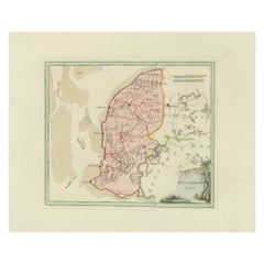
Antique Dutch Map – Westergo Region in Friesland by von Reilly, 1791
$456.72
£338.31
€380
CA$624.78
A$680.98
CHF 360.03
MX$8,197.69
NOK 4,569.64
SEK 4,189.43
DKK 2,895.39
About the Item
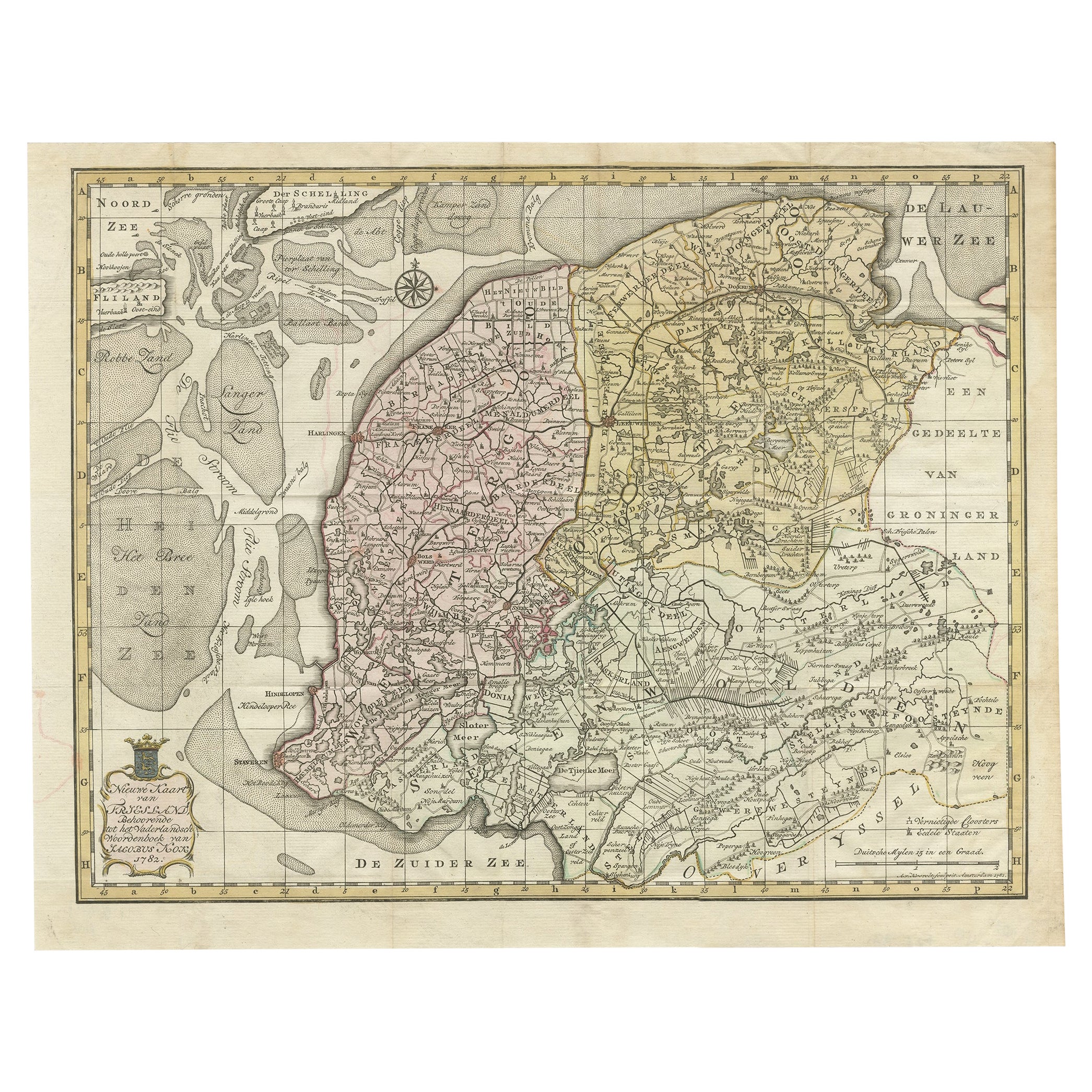
Antique Map of Westergo, Friesland by von Reilly, 1791
Original engraved map titled Westergoo No. 640, published in Vienna in 1791. This sheet presents the region of Westergo, the historic heart of Friesland, bordered by the Zuiderzee (now IJsselmeer) and the Wadden Sea to the west and north. The engraving was issued in Franz Joseph Johann von Reilly’s Schauplatz der fünf Theile der Welt, engraved by Ignaz Alberti in Vienna.
The map is densely filled with Frisian towns, villages, and waterways, reflecting the importance of this area in the province’s history. Prominent places include Bolsward, Sneek (Snits), Workum, Hindeloopen, Harlingen, Franeker, and IJlst, all among Friesland’s medieval cities. Numerous smaller settlements are also marked: Makkum, Witmarsum, Schraard, Parrega, Exmorra, Ferwoude, Allingawier, Molkwerum, Koudum, Arum, Achlum, Pingjum, Kimswerd, Wijnaldum, Sexbierum, Minnertsga, Berlikum (Berltsum), Zweins, Dronrijp, Wommels, Easterein, Winsum, and many others. The coastline features tidal flats and inlets of the Waddenzee, while inland lakes and waterways connect the towns, underscoring the maritime and agricultural character of the region.
The title cartouche at lower right, framed with rustic motifs, adds a decorative touch typical of von Reilly’s atlas. Districts are outlined in red hand coloring, emphasizing administrative boundaries.
This sheet is significant as it depicts the cultural and economic heartland of Friesland in the late 18th century. Westergo was historically the center of Frisian trade, law, and scholarship, with cities like Franeker (site of the Frisian University until 1811) and Harlingen as a major seaport. The density of place names makes this map especially valuable to collectors, genealogists, and those with regional roots.
Condition report: Very good condition with light toning. Marginal age marks visible but outside the image area. Original red hand coloring of boundaries intact. Blank verso.
Framing tips: A dark wood or gilt frame with a cream mat will complement the engraved detail. A double mat with a thin red inner line can echo the boundary coloring, giving a refined visual effect.
Technique: Engraving with original hand color
Maker: Franz Joseph Johann von Reilly, engraved by Ignaz Alberti, Vienna, 1791
- Dimensions:Height: 11.62 in (29.5 cm)Width: 17.52 in (44.5 cm)Depth: 0.01 in (0.2 mm)
- Materials and Techniques:Paper,Engraved
- Place of Origin:
- Period:
- Date of Manufacture:1791
- Condition:Condition report: Very good condition with light toning. Marginal age marks visible but outside the image area. Original red hand coloring of boundaries intact. Blank verso.
- Seller Location:Langweer, NL
- Reference Number:Seller: BG-13229-21stDibs: LU3054346690602
About the Seller
5.0
Recognized Seller
These prestigious sellers are industry leaders and represent the highest echelon for item quality and design.
Platinum Seller
Premium sellers with a 4.7+ rating and 24-hour response times
Established in 2009
1stDibs seller since 2017
2,813 sales on 1stDibs
Typical response time: 1 hour
- ShippingRetrieving quote...Shipping from: Langweer, Netherlands
- Return Policy
More From This Seller
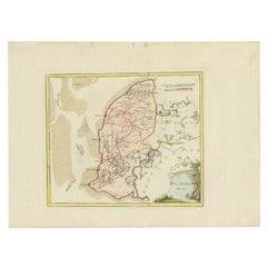
View AllAntique Map of Southern Westergo, Friesland by von Reilly, 1791
Located in Langweer, NL
Antique Map of Southern Westergo, Friesland by von Reilly, 1791
Original engraved map titled Westergoo Norde, published in Vienna in 1791. This sheet depicts the southern and coasta...
Category
Antique 18th Century Austrian Maps
Materials
Paper
Antique Map of Friesland by Von Reilly, 1791
Located in Langweer, NL
Antique map titled 'Friesland'. Map of the province of Friesland, the Netherlands. This map orginates from 'Schauplatz der fünf Theile der Welt'. Artists and Engravers: Franz Joseph ...
Category
Antique 18th Century Austrian Maps
Materials
Paper

Antique Map of Westergo in Friesland, 1791
Located in Langweer, NL
Antique map titled 'Westergo'. Map of the Westergo region, Friesland, the Netherlands. This map orginates from 'Schauplatz der fünf Theile der Welt'.
Artists and Engravers: Franz...
Category
Antique 18th Century Maps
Materials
Paper
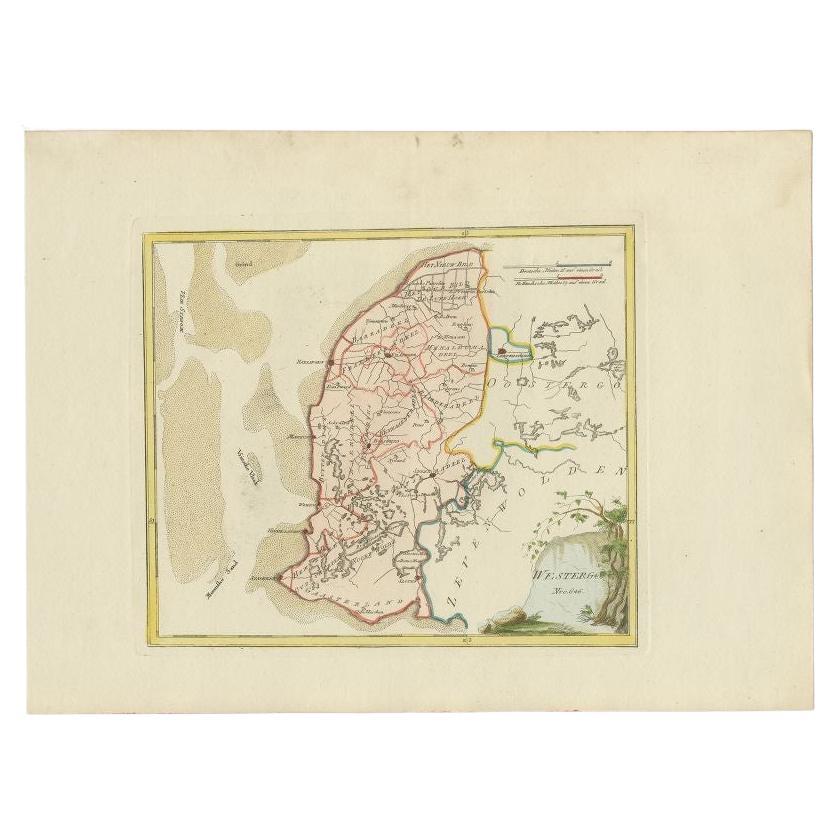
Antique Map of Province Friesland, The Netherlands, 1787
Located in Langweer, NL
Antique map titled 'Nieuwe Kaart van Friesland behoorende tot het Vaderlandsch Woordenboek van Jacobus Kok'. Original antique map of the province of Friesland, the Netherlands. This ...
Category
Antique 18th Century Dutch Maps
Materials
Paper
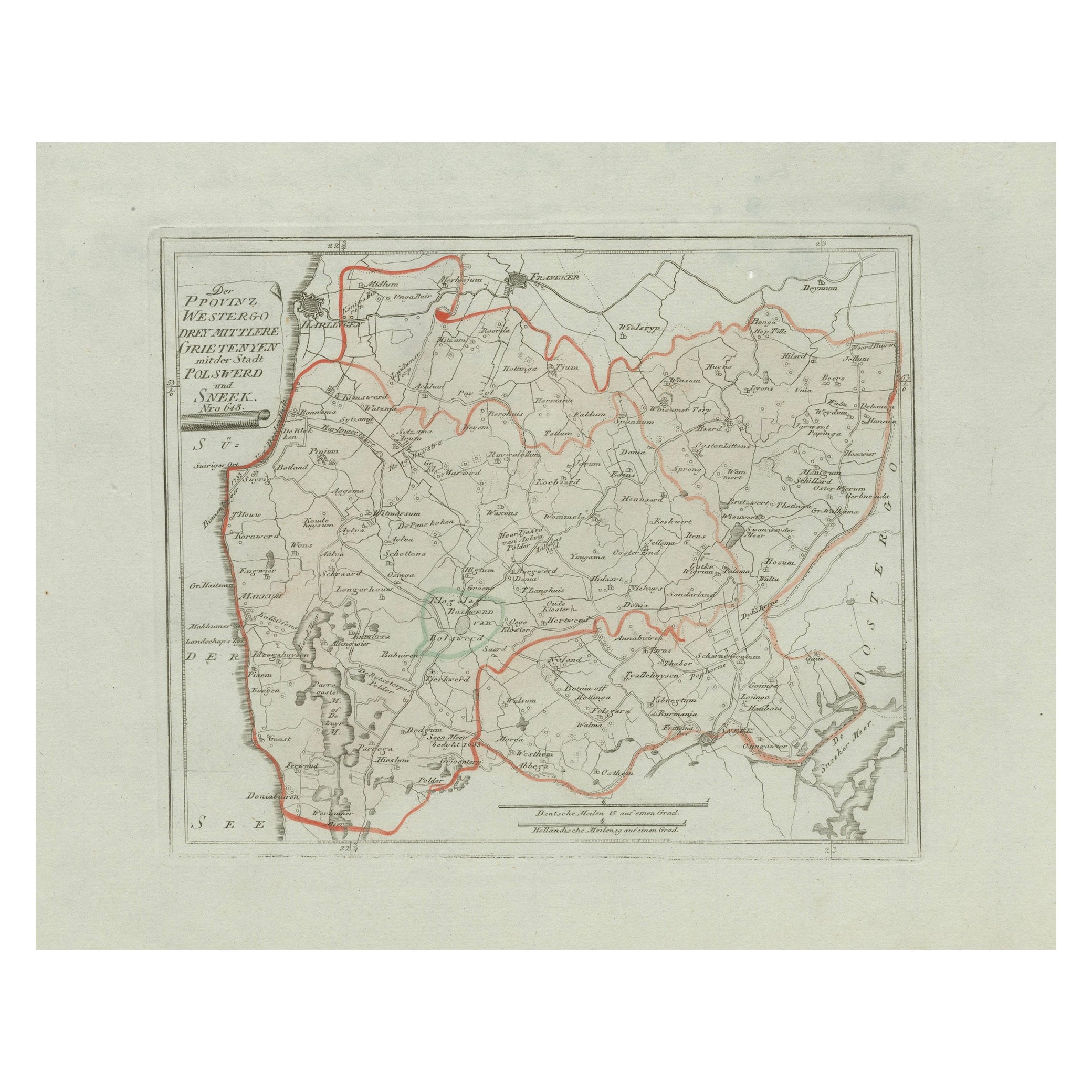
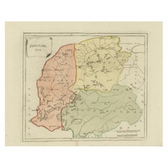
Antique Map of Sneek and Bolsward, Friesland – Dutch Provincial Map, 1791
Located in Langweer, NL
Antique Map of Sneek and Bolsward, Friesland by von Reilly, 1791
Original engraved map titled Der Provinz Westergo drey mittlere Grietenyen, mit der Stadt Bolsward und Sneek No. 641...
Category
Antique 18th Century Austrian Maps
Materials
Paper

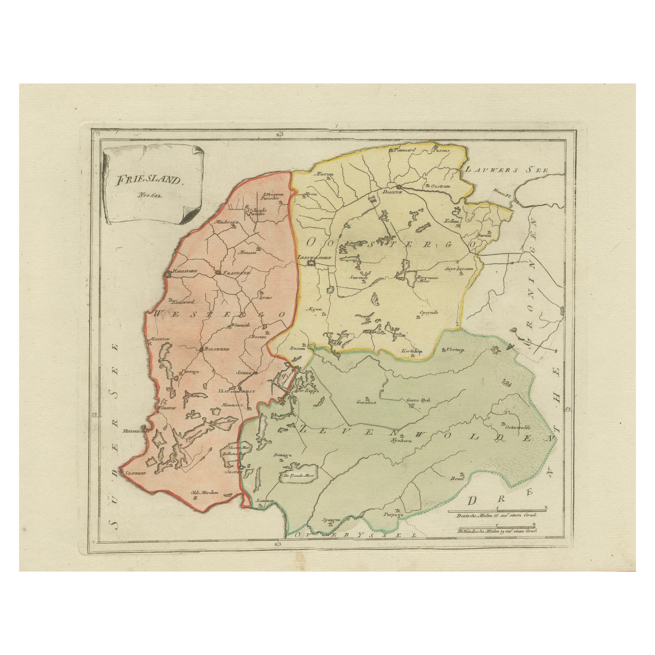
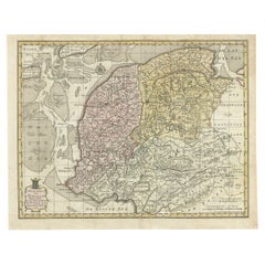
Antique General Map of Friesland – Dutch Provincial Map by von Reilly, 1791
Located in Langweer, NL
Antique General Map of Friesland by von Reilly, 1791
Original engraved map titled Friesland No. 640, published in Vienna in 1791. This sheet is the general overview of the province ...
Category
Antique 18th Century Austrian Maps
Materials
Paper
You May Also Like
1752 Vaugoundy Map of Flanders : Belgium, France, and the Netherlands, Ric.a002
Located in Norton, MA
Large Vaugoundy Map of Flanders:
Belgium, France, and the Netherlands
Colored -1752
Ric.a002
Description: This is a 1752 Didier Robert de Vaugondy map of Flanders. The map de...
Category
Antique 17th Century Unknown Maps
Materials
Paper

1790 Thomas Stackhouse Map, Entitled "Russia in Europe, " , Ric.a004
Located in Norton, MA
1790 Thomas Stackhouse map, entitled
"Russia in Europe"
Ric.a004
Stackhouse, Thomas
Russia in Europe [map]
London: T. Stackhouse, 1783. Map. Matted hand-colored copper engraving. Image size: 14.5 x 15.25 inches. Mat size: 22.75 x 23.75 inches. A beautiful example of this map of Eastern Europe...
Category
Antique 17th Century Unknown Maps
Materials
Paper

1839 Map of Karte Des "Russischen Reiches in Europa Und Asien" Ric.R0013
Located in Norton, MA
1839 map of Karte Des
"Russischen Reiches in Europa and Asien"
Ric.r013
Map of the European and Asian parts of Russian Empire. Karte der Russischen Reiches in Europa und Asien...
Category
Antique 19th Century Unknown Maps
Materials
Paper

1643 Willem&Joan Blaeu Map NW Flanders "Flandriae Teutonicae Pars Prientalior
Located in Norton, MA
1643 Willem and Joan Blaeu map of northwest Flanders, entitled
"Flandriae Teutonicae Pars Prientalior,"
Ric0012
" Authentic" - Map of the northwest Fl...
Category
Antique 17th Century Dutch Maps
Materials
Paper

Von Reilly Map of the Russian Empire, 1796
Located in Savannah, GA
A map of the Russian Empire in Europe by Von Reilly. Published in Vienna, 1796.
32 inches wide by 24 ½ inches tall
Category
Antique 1790s Austrian Prints
Materials
Glass, Wood, Paper

Original Antique Map of Europe, Arrowsmith, 1820
Located in St Annes, Lancashire
Great map of Europe
Drawn under the direction of Arrowsmith.
Copper-plate engraving.
Published by Longman, Hurst, Rees, Orme and Brown, 1820
...
Category
Antique 1820s English Maps
Materials
Paper
