Items Similar to Antique Engraving of Blaeu
s first Map of Brazil, Circa 1640


Want more images or videos?
Request additional images or videos from the seller
1 of 10
Antique Engraving of Blaeu
s first Map of Brazil, Circa 1640
$1,674.48
£1,243.40
€1,400
CA$2,300.49
A$2,501.10
CHF 1,326.08
MX$29,981.80
NOK 16,853.85
SEK 15,440.42
DKK 10,672.49
About the Item
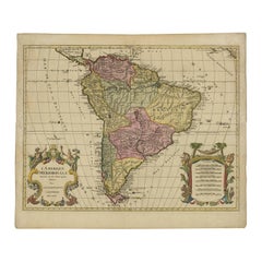
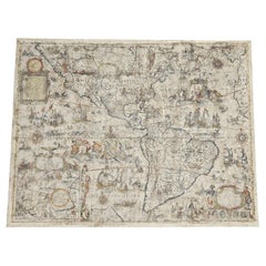
Antique map titled 'Novus Brasiliae Typus'. Fine old color example of Blaeu's first map of Brazil, with north oriented to the right. Includes inset map of Baya de todos Santos, elaborate cartouche, 2 compass roses and richly embellished vignettes of native Brazilian life and animals.
The interior of the map includes vignettes of indigenous animals and native scenes, including cannibalism. Inset within a decorative border is a small map of "Baya de todos Sanctos". In the sea are monsters, a galleon and two compass roses. The large title cartouche features a male and female Brazilian, both of whom are shown naked.
Willem Janszoon Blaeu (1571-1638) was a prominent Dutch geographer and publisher. Born the son of a herring merchant, Blaeu chose not fish but mathematics and astronomy for his focus. He studied with the famous Danish astronomer Tycho Brahe, with whom he honed his instrument and globe making skills. Blaeu set up shop in Amsterdam, where he sold instruments and globes, published maps, and edited the works of intellectuals like Descartes and Hugo Grotius. In 1635, he released his atlas, Theatrum Orbis Terrarum, sive, Atlas novus.
- Creator:Willem Blaeu (Artist)
- Dimensions:Height: 19.3 in (49 cm)Width: 22.84 in (58 cm)Depth: 0.02 in (0.5 mm)
- Materials and Techniques:Paper,Engraved
- Place of Origin:
- Period:Mid-17th Century
- Date of Manufacture:circa 1640
- Condition:Wear consistent with age and use. Original/contemporary hand coloring. Shows wear and soiling. Original folding line, Latin text on verso. Please study image carefully.
- Seller Location:Langweer, NL
- Reference Number:Seller: BGPB-0031stDibs: LU3054331176732
About the Seller
5.0
Recognized Seller
These prestigious sellers are industry leaders and represent the highest echelon for item quality and design.
Platinum Seller
Premium sellers with a 4.7+ rating and 24-hour response times
Established in 2009
1stDibs seller since 2017
2,823 sales on 1stDibs
Typical response time: 1 hour
- ShippingRetrieving quote...Shipping from: Langweer, Netherlands
- Return Policy
More From This Seller
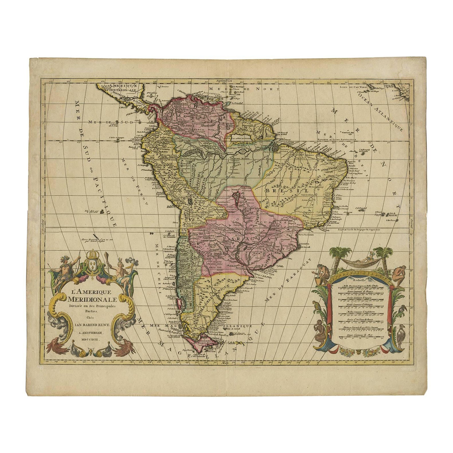
View AllMap of South America 1792 by Elwe – Hand-Colored Antique Dutch Engraving
By J.B. Elwe
Located in Langweer, NL
Map of South America 1792 by Elwe – Hand-Colored Antique Dutch Engraving
This striking antique map of South America, titled "L'Amerique Meridionale," was published in 1792 by the Du...
Category
Antique Late 18th Century European Maps
Materials
Paper
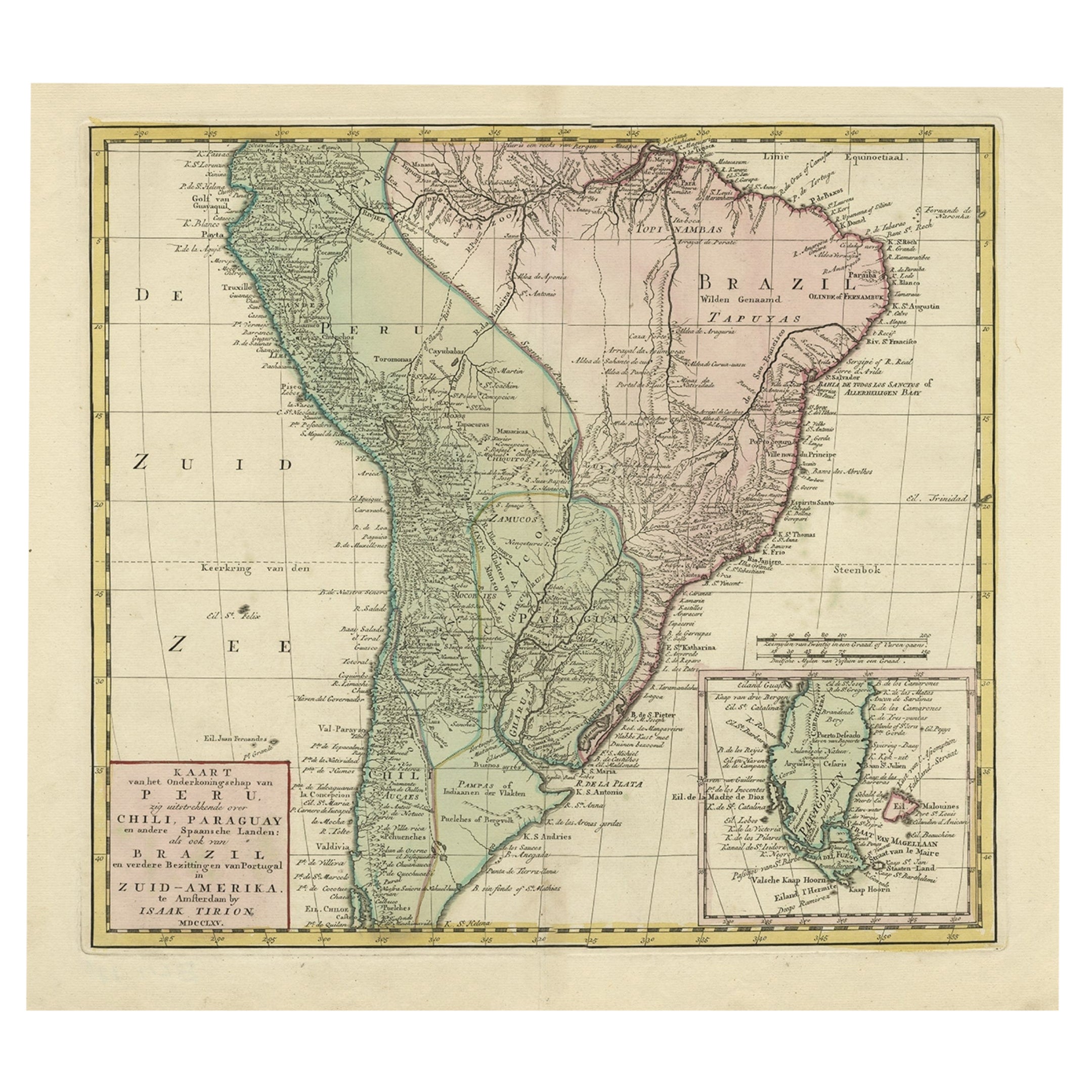
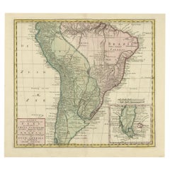
Attractive Antique Hand-Coloured Map of South America, ca.1765
Located in Langweer, NL
Antique map titled 'Kaart van het Onderkoningschap van Peru zig uitstrekkende: over Chile, Paraguay en andere Spaansche Landen als ook van Brazil en verdere Bezittingen van Portugal ...
Category
Antique 1760s Maps
Materials
Paper
Antique Map of South America by Tirion
circa 1765
Located in Langweer, NL
Antique map titled 'Kaart van het Onderkoningschap van Peru, zig uitstrekkende over Chili, Paraguay en andere Spaansche Landen: als ook van Brazil en verdere Bezittingen van Portugal...
Category
Antique Mid-18th Century Maps
Materials
Paper

$478 Sale Price
20% Off
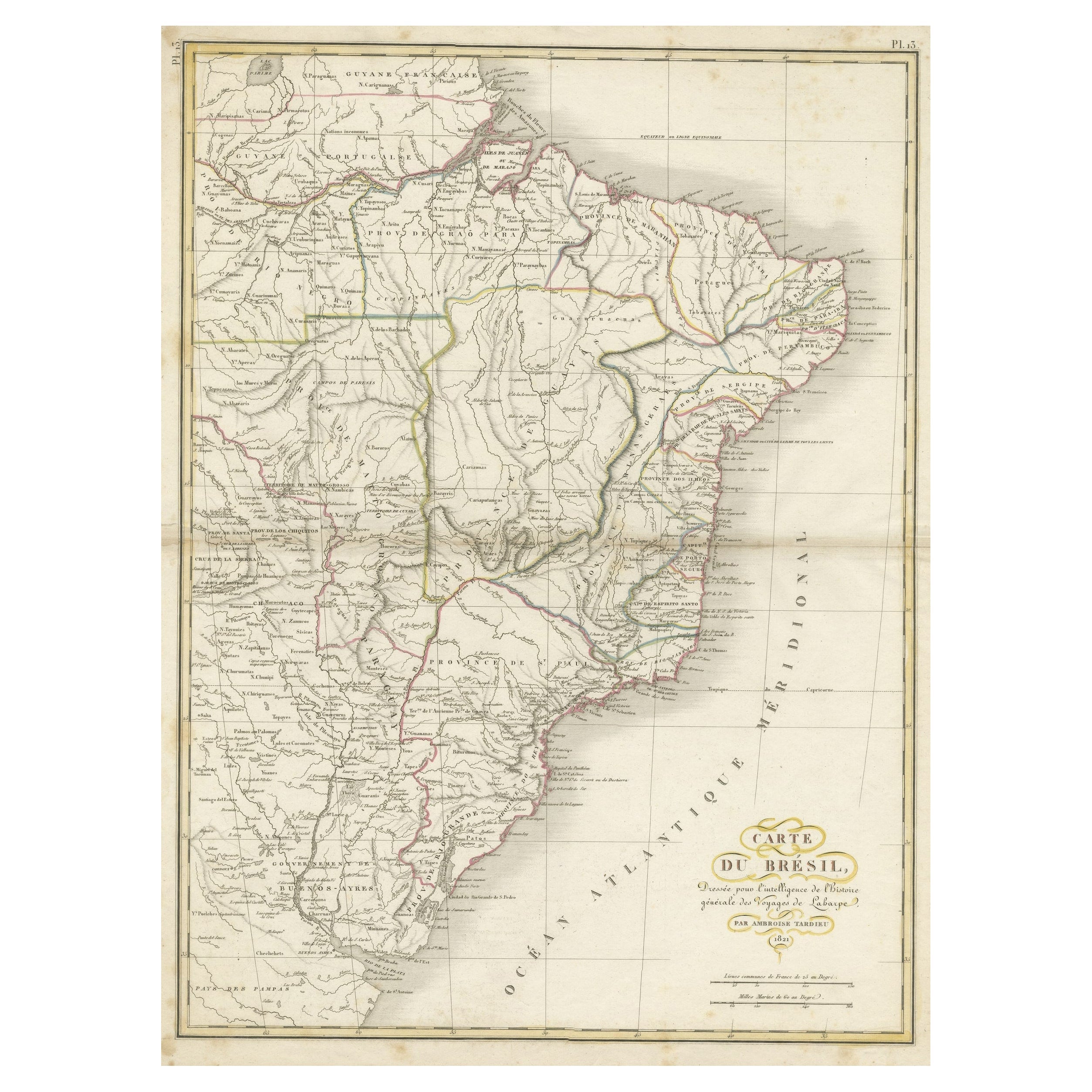
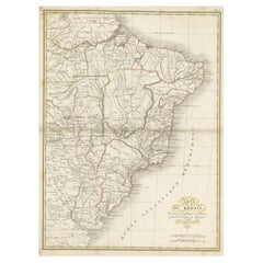
Antique Map of Brazil Extending South to the Mouth of the Rio de la Plata
Located in Langweer, NL
Antique map titled 'Carte du Brésil'. ?Beautiful map of Brazil extending south to the mouth of the Rio de la Plata and Buenos-Aires in Argentina. Published by Tardieu, 1821.
Pier...
Category
Antique Early 19th Century Maps
Materials
Paper
$229 Sale Price
20% Off
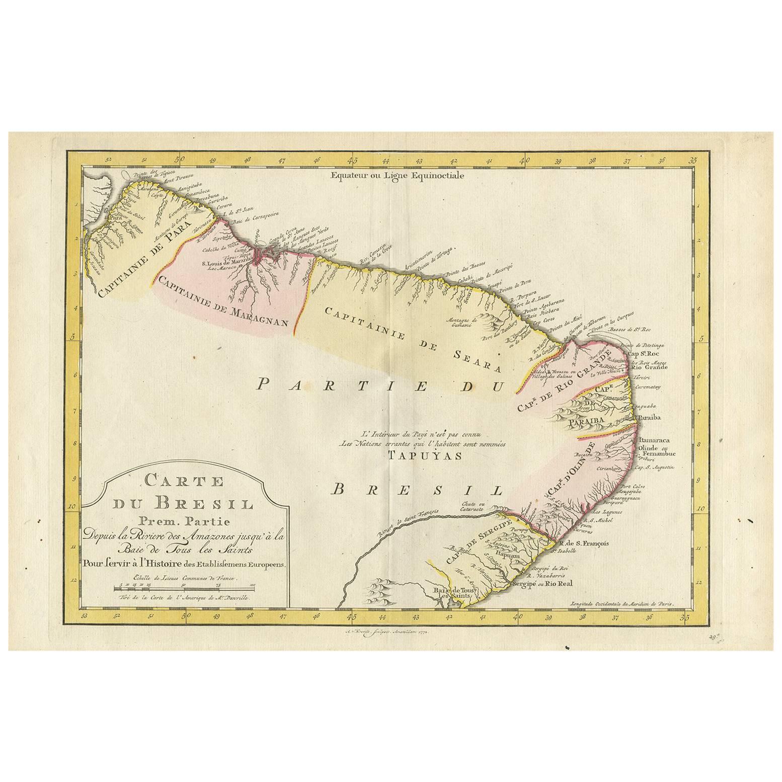
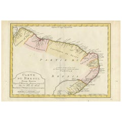
Antique Map of the Eastern Part of Brazil by A. Van Krevelt, 1772
Located in Langweer, NL
Rare edition of this accurate map of eastern part of Brazil. This map originates from 'Atlas Portatif pour servir a l'intelligence de l'Histoire Philosophique et Politique des etabli...
Category
Antique Late 18th Century Maps
Materials
Paper
Antique Map of South American, The West Indies
Most of Africa, Ca.1775
Located in Langweer, NL
Antique map titled 'Carte pour Servir a l' Histoire Philosophique et Politique des Etablissemens et du Commerce des Europeens dans les deux Indes'.
This map is roughly centered o...
Category
Antique 1770s Maps
Materials
Paper

$727 Sale Price
20% Off
You May Also Like
North
South America: A 17th Century Hand-colored Map by Jansson
Goos
By Johannes Janssonius
Located in Alamo, CA
A 17th century hand-colored map of North & South America entitled "Americae Descriptio" by the cartographer Johannes Jansson, published in Jansson's Atlas Minor in Amsterdam in 1628....
Category
Antique 1620s Dutch Maps
Materials
Paper

$1,020 Sale Price
20% Off
1640 Willem Blaeu Map Entitled "Contado di molise et principato vltra, " Ric.a003
By Willem Blaeu
Located in Norton, MA
1640 Willem Blaeu map entitled
"Contado di molise et principato vltra,"
Colored
Ric. a003
Measures: 38 x 49.6 cm and wide margins
DBLAEU.
Cou...
Category
Antique 17th Century Dutch Maps
Materials
Paper

South America: Hand-colored 18th Century Framed Map by Thomas Jefferys
By Thomas Jefferys
Located in Alamo, CA
This detailed hand-colored map of South America by Thomas Jefferys was published in London in 1750. The map shows countries, early colonial possessions, towns, rivers, mountains, and...
Category
Antique Mid-18th Century English Maps
Materials
Paper

$460 Sale Price
20% Off
Original Antique Map of South America. C.1780
Located in St Annes, Lancashire
Great map of South America
Copper-plate engraving
Published C.1780
Two small worm holes to left side of map
Unframed.
Category
Antique Early 1800s English Georgian Maps
Materials
Paper

One of the most influential maps of America ever made, 17th Century Willem Blaeu
By Willem Blaeu
Located in ZWIJNDRECHT, NL
A rare and important 17th Century Italian Engraving of Willem Blaeu's Great Wall Map of America, "America quarta pars orbis quam plerunq, nuvum orbem apellitant primo detecta est ann...
Category
Antique 17th Century Dutch Dutch Colonial Maps
Materials
Paper, Linen
$89,704
Free Shipping
Antique Map - Mare Pacificum - Etching by Johannes Janssonius - 1650s
By Johannes Janssonius
Located in Roma, IT
Mare Pacificum is an antique map realized in 1650 by Johannes Janssonius (1588-1664).
The Map is Hand-colored etching, with coeval watercolorang.
Good conditions with slight foxing...
Category
1650s Modern Figurative Prints
Materials
Etching
