Items Similar to Antique Europe Map with Political Boundaries – Collectible Wall Art, 1884


Video Loading
Want more images or videos?
Request additional images or videos from the seller
1 of 11
Antique Europe Map with Political Boundaries – Collectible Wall Art, 1884
$432.36
£320.27
€360
CA$591.58
A$643.68
CHF 340.82
MX$7,743.91
NOK 4,327.66
SEK 3,959.51
DKK 2,743.49
About the Item
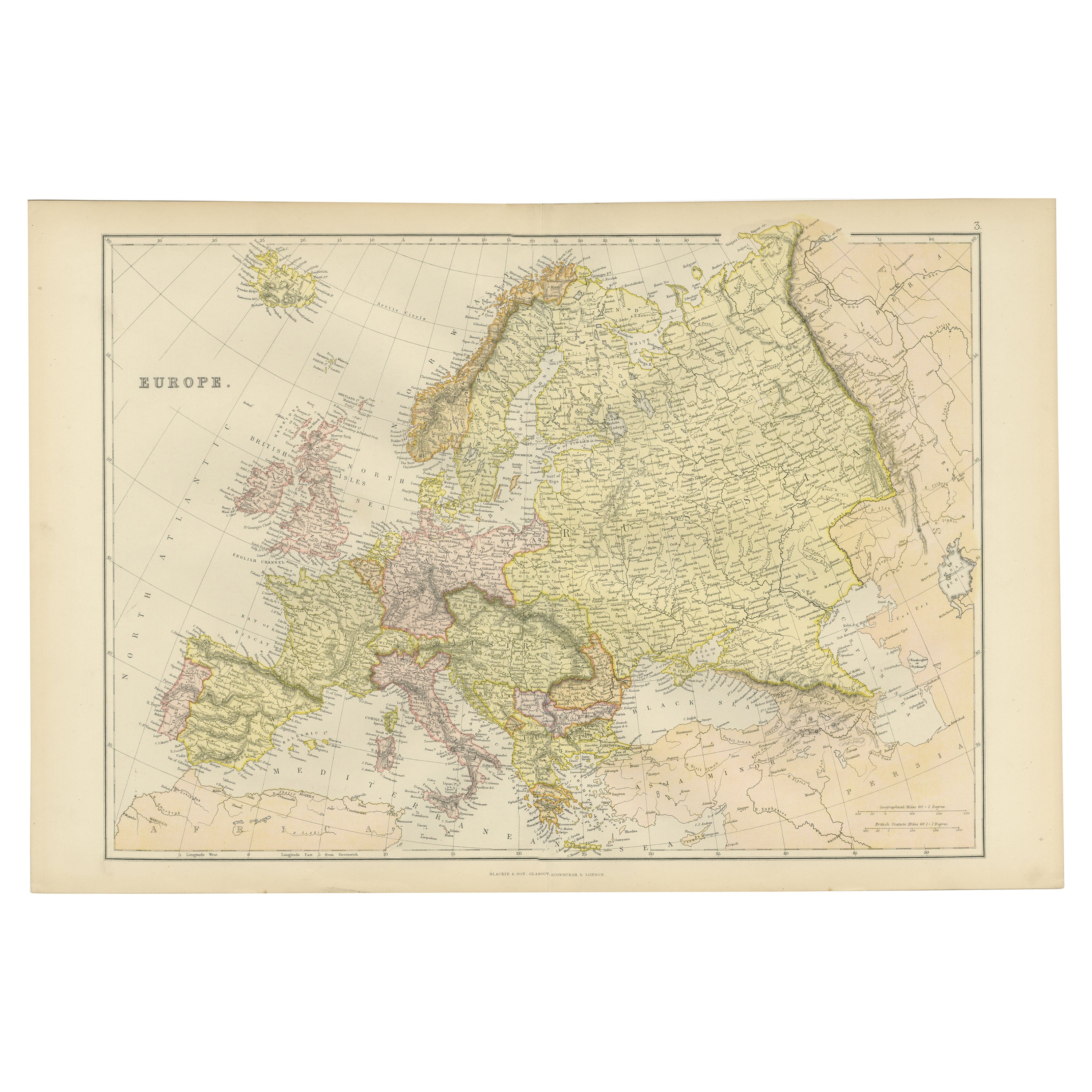
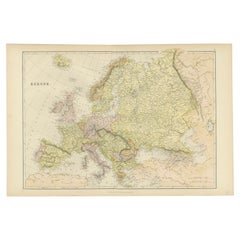
Antique Map of Europe with Political Divisions – Black’s Atlas, 1884
This detailed engraved map of Europe was published in the New and Revised Edition of Black’s General Atlas of the World in Edinburgh, 1884. It offers a clear political overview of the continent in the late 19th century, just before the dramatic upheavals of the First World War.
The map is color-coded by country, each region distinguished by delicate hand-applied tints. It covers the entire European continent, from Iceland in the northwest to the Caucasus and Asia Minor in the southeast. Major empires of the era dominate the political landscape, including the vast Russian Empire stretching into Asia, the Austro-Hungarian Empire in Central Europe, and the Ottoman Empire controlling much of the Balkans. Western Europe shows the established nations of France, Spain, Portugal, Italy, and Germany (recently unified under the German Empire in 1871). The British Isles are prominently placed, with Ireland still under British rule.
Mountain ranges, rivers, and major cities are finely engraved, while coastlines and seas are clearly delineated, including the North Sea, Mediterranean, Black Sea, and the Baltic. The map provides an excellent historical reference for Europe at a time of great industrial and imperial expansion, offering valuable insight into the political and territorial alignments of the period.
This piece represents not only a geographic document but also a snapshot of European history during a period of relative stability, before the redrawing of borders in the 20th century. Its combination of clarity, detail, and subtle coloring makes it highly attractive both as a collector’s item and as a decorative work.
Condition report:
Very good condition. Original hand coloring remains bright and even. Center fold as issued. Minor toning and faint age spotting in margins, not affecting the printed area. Plate mark visible.
Framing tips:
This map displays beautifully with a wide archival mat in cream or ivory to enhance the soft pastel coloring. A walnut or dark oak frame provides warmth and contrast, while a gilt frame emphasizes its Victorian heritage. UV-protective glass is recommended to preserve the original color.
Technique: Engraving with original hand coloring
Maker: Black’s General Atlas, Edinburgh, 1884
- Dimensions:Height: 17.84 in (45.3 cm)Width: 24.1 in (61.2 cm)Depth: 0.01 in (0.2 mm)
- Materials and Techniques:
- Place of Origin:
- Period:
- Date of Manufacture:1884
- Condition:Very good condition. Original hand coloring remains bright and even. Center fold as issued. Minor toning and faint age spotting in margins, not affecting the printed area. Plate mark visible.
- Seller Location:Langweer, NL
- Reference Number:Seller: BG-13601-3-61stDibs: LU3054346514562
About the Seller
5.0
Recognized Seller
These prestigious sellers are industry leaders and represent the highest echelon for item quality and design.
Platinum Seller
Premium sellers with a 4.7+ rating and 24-hour response times
Established in 2009
1stDibs seller since 2017
2,816 sales on 1stDibs
Typical response time: 1 hour
- ShippingRetrieving quote...Shipping from: Langweer, Netherlands
- Return Policy
More From This Seller
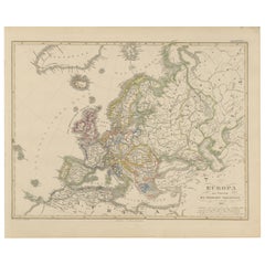
View AllAntique Map of Europe, 1903, with Intricate Political Boundaries and Rich Detail
Located in Langweer, NL
Title: Antique Map of Europe, 1903, with Intricate Political Boundaries and Rich Detail
Description:
This antique map, titled "Europe," is a finely engraved and beautifully colored ...
Category
Early 20th Century Maps
Materials
Paper

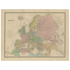
Antique Map of Europe – Political Divisions by Andriveau-Goujon, Paris 1861
Located in Langweer, NL
Antique Map of Europe – Political Divisions by Andriveau-Goujon, Paris 1861
This beautifully engraved and hand-colored antique map of Europe was published in 1861 by the Parisian ca...
Category
Antique Mid-19th Century French Maps
Materials
Paper
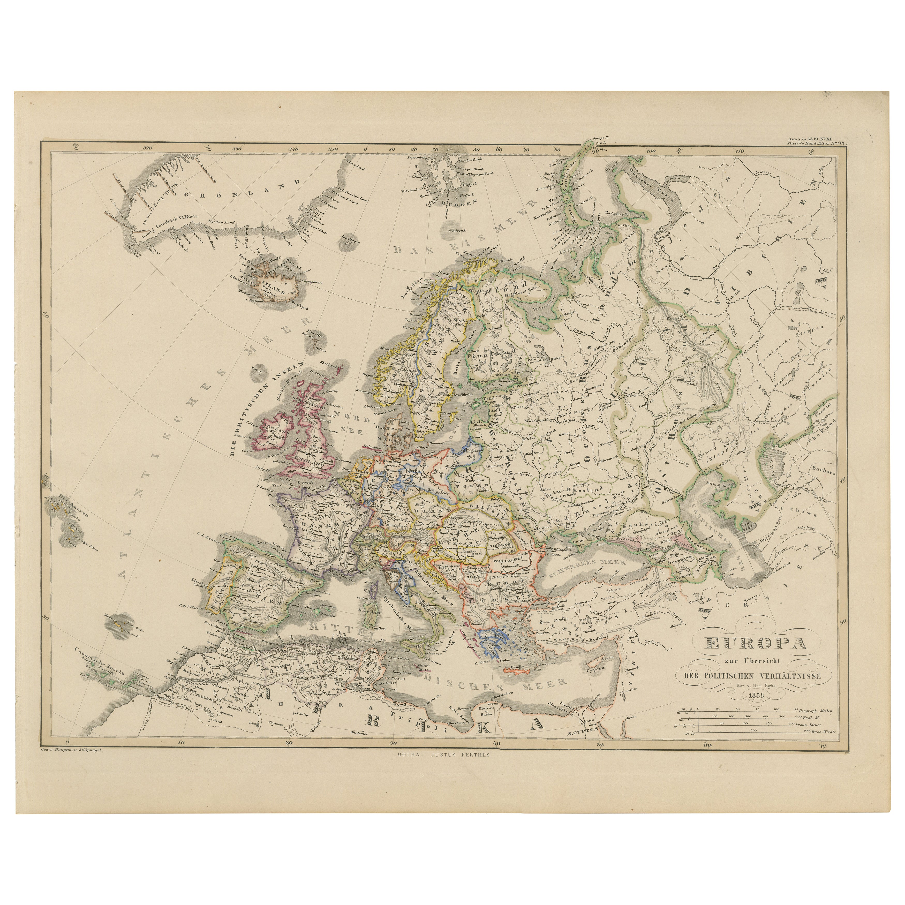
Europe Map – Political Divisions and Borders, Published in 1858
Located in Langweer, NL
Europe Map – Political Divisions and Borders 1858
This fine antique print shows Europe with its political divisions titled “Europa zur Übersicht der politischen Verhältnisse” meanin...
Category
Antique Mid-19th Century German Maps
Materials
Paper
Antique Map of the European Continent, 1882
Located in Langweer, NL
Antique map titled 'Europe'. Old map of the European continent. This map originates from 'The Royal Atlas of Modern Geography, Exhibiting, in a Series of ...
Category
Antique 19th Century Maps
Materials
Paper

Antique Map of Europe from an Old Dutch School-Atlas, 1852
Located in Langweer, NL
Antique map titled 'Europa'. Map of Europe. This map originates from 'School-Atlas van alle deelen der Aarde' by Otto Petri.
Artists and Engravers: Published by A. Baedeker (Otto...
Category
Antique 19th Century Maps
Materials
Paper

Colorful Detailed Antique Map of Europe, Published in 1882
Located in Langweer, NL
"The Antique Map of Europe from 'The Comprehensive Atlas and Geography of the World,' published in 1882 by Blackie & Son, is a testament to meticulous cartography and scholarly preci...
Category
Antique 1880s Maps
Materials
Paper
$182 Sale Price
20% Off
You May Also Like
Large Original Antique Map of Europe by Sidney Hall, 1847
Located in St Annes, Lancashire
Great map of Europe
Drawn and engraved by Sidney Hall
Steel engraving
Original colour outline
Published by A & C Black. 1847
Unframed
Free shipping.
Category
Antique 1840s Scottish Maps
Materials
Paper

Russia in Europe with Poland and Finland. Century Atlas antique vintage map
Located in Melbourne, Victoria
'The Century Atlas. Russia in Europe with Poland and Finland'
Original antique map, 1903.
Central fold as issued. Map name and number printed on the reverse corners.
Sheet 40cm by ...
Category
Early 20th Century Victorian More Prints
Materials
Lithograph

Original Antique Map of Europe, Arrowsmith, 1820
Located in St Annes, Lancashire
Great map of Europe
Drawn under the direction of Arrowsmith.
Copper-plate engraving.
Published by Longman, Hurst, Rees, Orme and Brown, 1820
...
Category
Antique 1820s English Maps
Materials
Paper

1870 "Johnson
s Europe" Map Published by A. J. Johnson
Located in Colorado Springs, CO
Presented is an original 1870 "Johnson’s Europe" map. First published in 1864, this map was issued as pages 87 and 88 in the 1870 edition of “Johnson's New Illustrated (Steel Plate) ...
Category
Antique 1870s American Victorian Maps
Materials
Paper

Large Original Antique Map of Italy. John Dower, 1861
Located in St Annes, Lancashire
Great map of Italy
Lithograph engraving by John Dower
Original colour
Published, 1861
Unframed
Good condition / repair to top right corner seen in last image
Category
Antique 1860s English Victorian Maps
Materials
Paper

Italy, Central and Southern Part. Century Atlas antique map
Located in Melbourne, Victoria
'The Century Atlas. Italy, Central and Southern Part.'
Original antique map, 1903.
Inset maps of Sicily and Naples.
Central fold as issued. Map name an...
Category
Early 20th Century Victorian More Prints
Materials
Lithograph
