Items Similar to Antique French Map of Ille-et-Vilaine Region with Rennes, Saint-Malo, 1800s


Want more images or videos?
Request additional images or videos from the seller
1 of 9
Antique French Map of Ille-et-Vilaine Region with Rennes, Saint-Malo, 1800s
$167.57
£124.51
€140
CA$229.54
A$250.41
CHF 132.81
MX$3,016.88
NOK 1,685.65
SEK 1,543.26
DKK 1,066.50
About the Item
Antique Map of Ille-et-Vilaine, France by Vuillemin, 19th Century
This decorative antique map presents the French département of Ille-et-Vilaine, situated in the Brittany region of northwestern France. Engraved by Alexandre Vuillemin in the mid-19th century, it originates from his renowned atlas of the departments of France, admired for its blend of cartographic accuracy and artistic embellishment.
The map details towns, villages, rivers, and road networks, with boundaries highlighted in original outline hand-coloring. Surrounding vignettes enrich the composition: a portrait of the celebrated French writer and statesman François-René de Chateaubriand, born in Saint-Malo, anchors the left margin, while a view of Rennes, the département’s capital, graces the top right. Additional embellishments include a horse vignette symbolizing regional agriculture and the departmental coat of arms at lower right.
Ille-et-Vilaine is a département rich in history, marked by its medieval towns, fortified castles, and coastal ports. Rennes, a center of learning and culture, is prominently noted, alongside Saint-Malo, a historic walled port city once famed for privateers and seafaring trade.
Alexandre Vuillemin (1812–1880) was a distinguished French cartographer and publisher, recognized for his clear geographical renderings enlivened with fine engravings. His atlas of France’s departments provided not only practical information but also a richly illustrated overview of regional identity during the 19th century.
Condition report: Very good condition with strong hand-coloring of borders. Some light scattered foxing and faint toning in the margins, consistent with age. Clean impression with well-preserved decorative vignettes.
Framing tips: An ebonized or gilt frame with a wide ivory mat will highlight the engraved details and decorative vignettes. A narrow Breton blue inner liner could be added to echo the coastal identity of the region.
Technique: Engraving with original hand color
Maker: Alexandre Vuillemin, France, mid-19th century
- Dimensions:Height: 12.8 in (32.5 cm)Width: 10.28 in (26.1 cm)Depth: 0.01 in (0.2 mm)
- Materials and Techniques:Paper,Engraved
- Place of Origin:
- Period:
- Date of Manufacture:circa 1850
- Condition:Condition report: Very good condition with strong hand-coloring of borders. Some light scattered foxing and faint toning in the margins, consistent with age. Clean impression with well-preserved decorative vignettes.
- Seller Location:Langweer, NL
- Reference Number:Seller: BG-13331-341stDibs: LU3054346796672
About the Seller
5.0
Recognized Seller
These prestigious sellers are industry leaders and represent the highest echelon for item quality and design.
Platinum Seller
Premium sellers with a 4.7+ rating and 24-hour response times
Established in 2009
1stDibs seller since 2017
2,820 sales on 1stDibs
Typical response time: 1 hour
- ShippingRetrieving quote...Shipping from: Langweer, Netherlands
- Return Policy
More From This Seller
View AllMap of Loire France with Saint-Étienne and Montbrison by Vuillemin, 19th c
Located in Langweer, NL
Map of Loire France with Saint-Étienne and Montbrison by Vuillemin, 19th c
This beautifully engraved and hand-colored map of the department of Loire in east-central France is from t...
Category
Antique Mid-19th Century French Maps
Materials
Paper

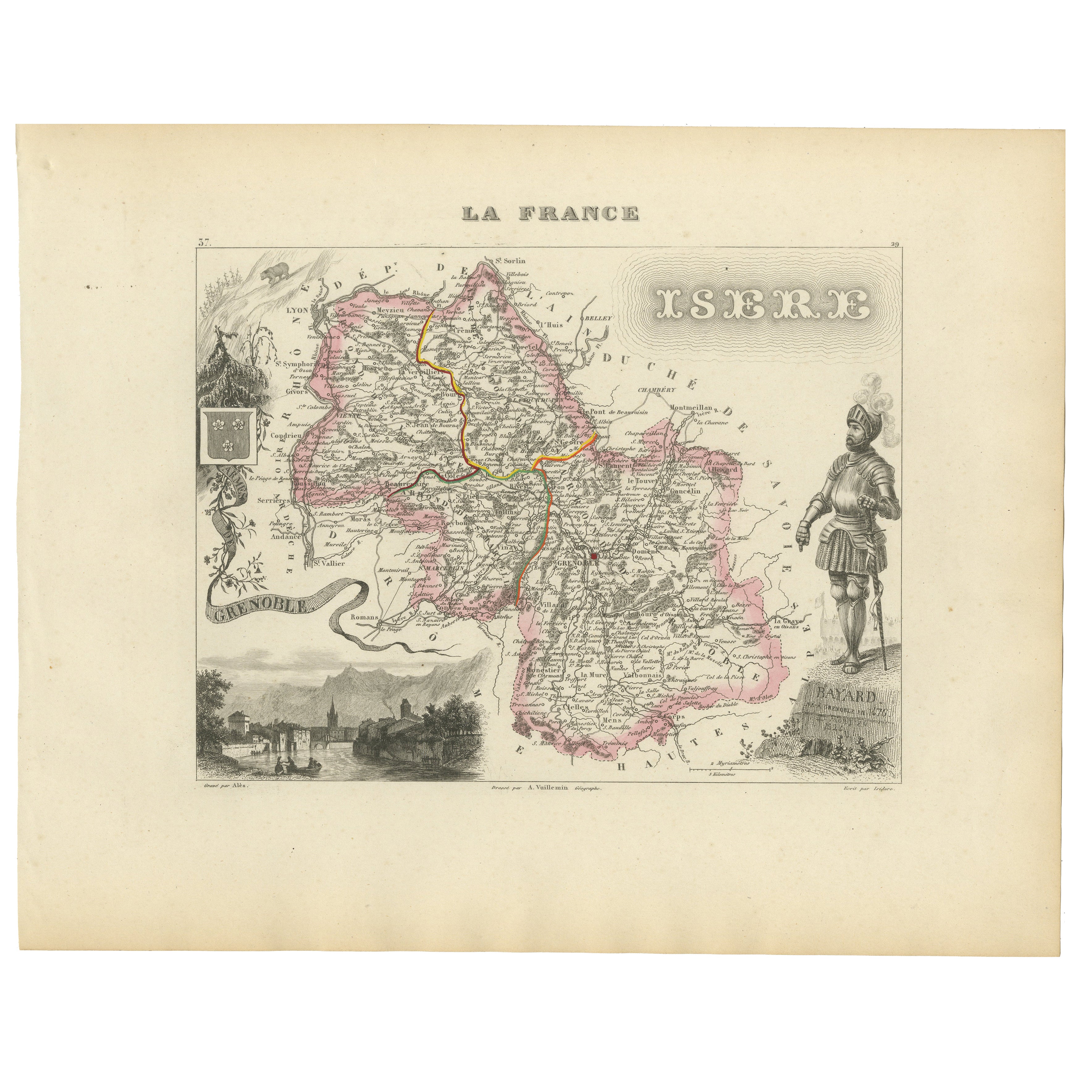
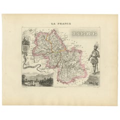
Antique French Map of Isère Region with Grenoble, Vienne, Dauphiné, 1800s
Located in Langweer, NL
Antique Map of Isère, France by Vuillemin, 19th Century
This decorative 19th-century map presents the département of Isère in southeastern France, engraved by Alexandre Vuillemin. C...
Category
Antique Mid-19th Century French Maps
Materials
Paper
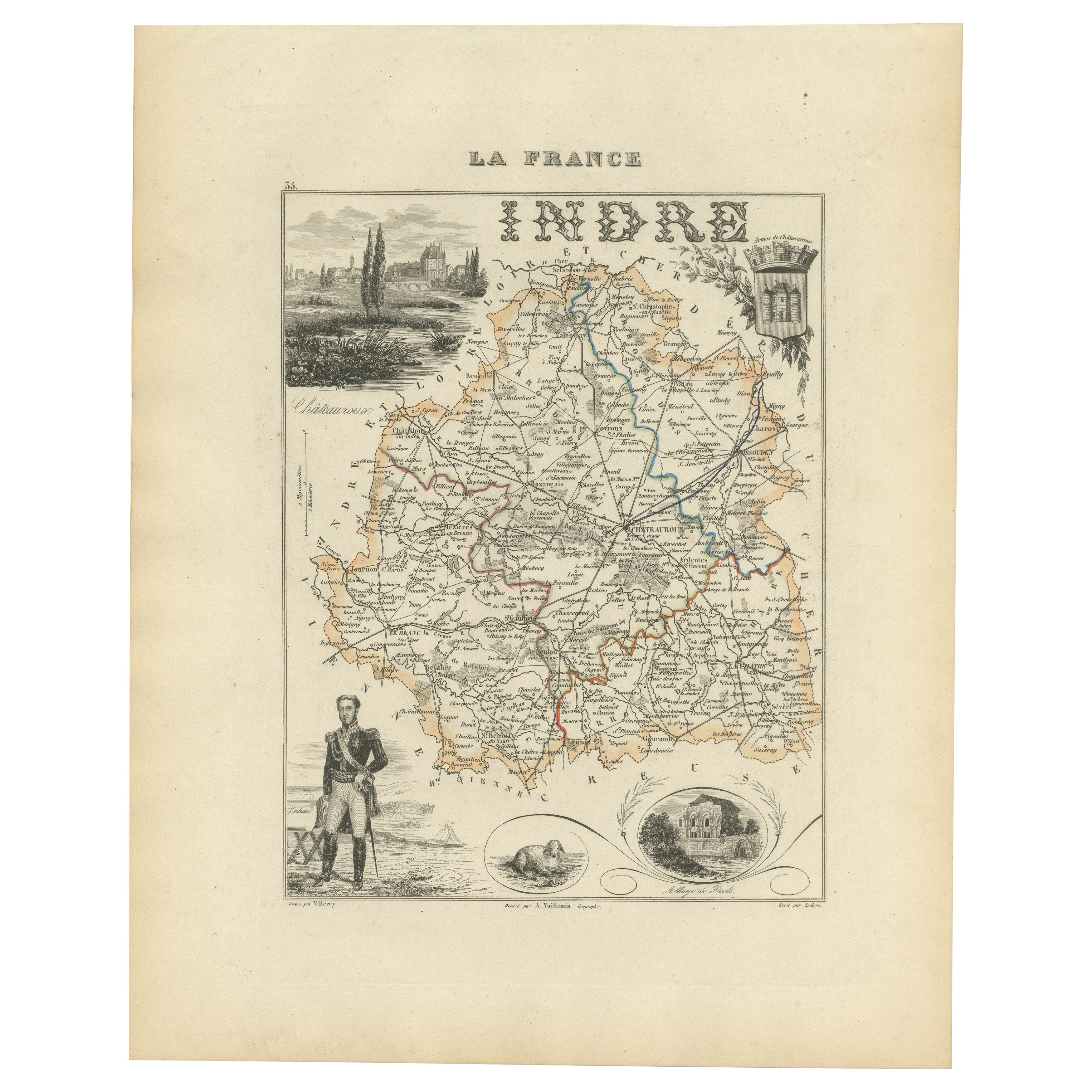
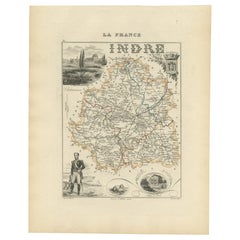
Antique French Map of Indre Region with Châteauroux and Issoudun, 1800s
Located in Langweer, NL
Antique Map of Indre, France by Vuillemin, 19th Century
This fine decorative map presents the département of Indre, situated in the Centre-Val de Loire region of central France. Eng...
Category
Antique Mid-19th Century French Maps
Materials
Paper
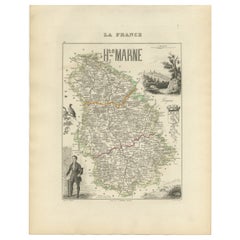
Antique Map of Haute-Marne France by Vuillemin with Decorative Insets, 1850s
Located in Langweer, NL
Antique Map of Haute-Marne France by Vuillemin with Decorative Insets, 1840s
This finely engraved and hand-colored map of Haute-Marne, a historical department in northeastern France...
Category
Antique Mid-19th Century French Maps
Materials
Paper
Antique Map of Marne, France – Engraved by Levasseur, 1850s
Located in Langweer, NL
Antique Map of Marne, France – Engraved by Levasseur, 1850s
This beautifully detailed 19th-century engraved map of the Marne department in northeastern France was created by the ren...
Category
Antique Mid-19th Century French Maps
Materials
Paper

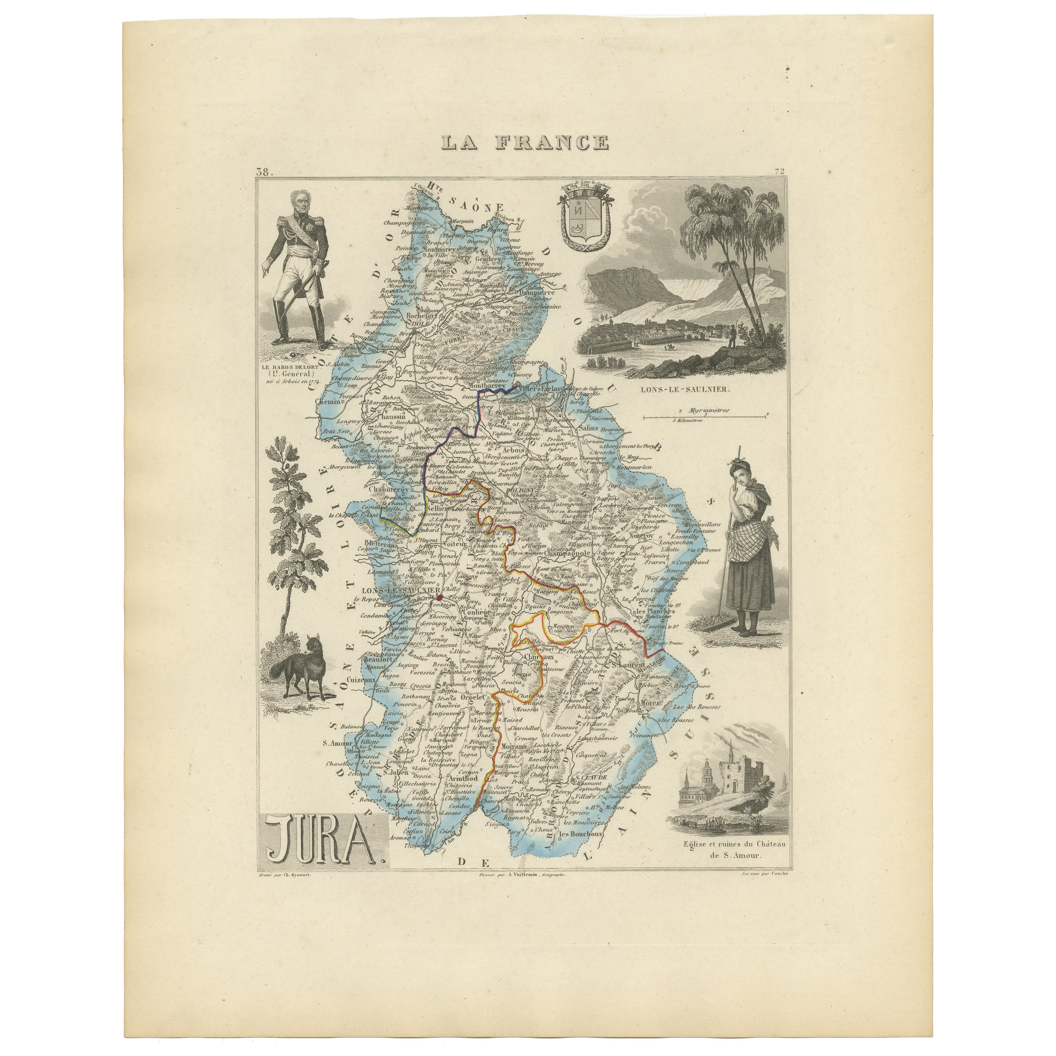
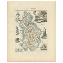
Antique French Map of Jura Region with Lons-le-Saunier, Dole, 1800s
Located in Langweer, NL
Antique Map of Jura, France by Vuillemin, 19th Century
This decorative 19th-century engraved map shows the département of Jura in eastern France, produced by Alexandre Vuillemin. Th...
Category
Antique Mid-19th Century French Maps
Materials
Paper
You May Also Like
Saone and Loire, France. Antique map of a French department, 1856
By Victor Levasseur
Located in Melbourne, Victoria
'Dept. de Saone et Loire', steel engraving with original outline hand-colouring., 1856, from Levasseur's Atlas National Illustre.
The French department of Saone et Loire is at the ...
Category
19th Century Naturalistic Landscape Prints
Materials
Engraving

L
Isere, France. Antique map of French department, 1856
By Victor Levasseur
Located in Melbourne, Victoria
'Dept. de L'Isere', Steel engraving with original outline hand-colouring., 1856, from Levasseur's 'Atlas National Illustre'.
This area is known for its production of Bleu du Vercor...
Category
19th Century Naturalistic Landscape Prints
Materials
Engraving

Var, France. Antique map of a French department, 1856
By Victor Levasseur
Located in Melbourne, Victoria
'Dept. du Var', steel engraving with original outline hand-colouring., 1856, from Levasseur's Atlas National Illustre.
Var covers the heart of the French Riviera or Cote d'Azur., and includes the resort cities of Cannes, Nice and San Tropez...
Category
19th Century Naturalistic Landscape Prints
Materials
Engraving

Large 19th Century Map of France
Located in Pease pottage, West Sussex
Large 19th Century Map of France.
Remarkable condition, with a pleasing age worn patina.
Recently framed.
France Circa 1874.
Category
Antique Late 19th Century French Maps
Materials
Linen, Paper

1771 Bonne Map of Poitou, Touraine and Anjou, France, Ric.a015
Located in Norton, MA
1771 Bonne Map of Poitou,
Touraine and Anjou, France
Ric.a015
1771 Bonne map of Potiou, Touraine and Anjou entitled "Carte des Gouvernements D'Anjou et du Saumurois, de la Touraine, du Poitou,du Pays d'aunis, Saintonge?Angoumois,"
Carte des gouvernements d'Anjou et du Saumurois, de la Touraine, du Poitou, du Pays d'Aunis, Saintonge-Angoumois. Projettee et assujettie au ciel par M. Bonne, Hyd. du Roi. A Paris, Chez Lattre, rue St. Jacques a la Ville de Bord(ea)ux. Avec priv. du Roi. 1771. Arrivet inv. & sculp., Atlas moderne ou collection de cartes sur toutes...
Category
Antique 17th Century Unknown Maps
Materials
Paper

Lozere, France. Antique map of a French department, 1856
By Victor Levasseur
Located in Melbourne, Victoria
'Dept. de La Lozere', steel engraving with original outline hand-colouring., 1856, from Levasseur's 'Atlas National Illustre'.
This remote mountainous part of Languedoc is rural, s...
Category
19th Century Naturalistic Landscape Prints
Materials
Engraving
