Items Similar to Antique French Map of Isère Region with Grenoble, Vienne, Dauphiné, 1800s


Want more images or videos?
Request additional images or videos from the seller
1 of 9
Antique French Map of Isère Region with Grenoble, Vienne, Dauphiné, 1800s
$166.12
£124.02
€140
CA$230.79
A$248.25
CHF 132.67
MX$2,926.11
NOK 1,672.65
SEK 1,529.12
DKK 1,066.96
About the Item
Antique Map of Isère, France by Vuillemin, 19th Century
This decorative 19th-century map presents the département of Isère in southeastern France, engraved by Alexandre Vuillemin. Centered on Grenoble, the map outlines towns, rivers, and transport routes, with departmental boundaries highlighted in original hand color.
The map is enriched with finely engraved vignettes that reflect the region’s identity. At the lower left is a detailed view of Grenoble, framed by the surrounding Alpine landscape. To the right stands an engraved portrait of Pierre Terrail, seigneur de Bayard (1473–1524), known as the “Chevalier sans peur et sans reproche” (the knight without fear and beyond reproach), a legendary figure of French chivalry. At the upper left appears the coat of arms of Isère. Together, these elements capture both the cultural pride and historic importance of the region.
Isère, part of the historical Dauphiné province, is renowned for its Alpine scenery, medieval towns, and strategic role in French history. Vuillemin’s decorative approach celebrates both the geography and heritage of the département.
Alexandre Vuillemin (1812–1880) was one of France’s most accomplished 19th-century cartographers, known for his finely engraved maps and atlases. His *Atlas des départements de la France* is particularly prized for its fusion of geographic accuracy with artistic embellishment.
Condition report: Very good condition with crisp engraving and bright original hand coloring. Light marginal toning and minor foxing spots consistent with age, not affecting the printed area.
Framing tips: A dark green or walnut frame with ivory matting will harmonize beautifully with the Alpine vignette. A slim gilt fillet may also enhance the decorative engravings and coat of arms.
Technique: Engraving with original hand color
Maker: Alexandre Vuillemin, France, mid-19th century
- Dimensions:Height: 10.28 in (26.1 cm)Width: 12.8 in (32.5 cm)Depth: 0.01 in (0.2 mm)
- Materials and Techniques:Paper,Engraved
- Place of Origin:
- Period:
- Date of Manufacture:circa 1850
- Condition:Condition report: Very good condition with crisp engraving and bright original hand coloring. Light marginal toning and minor foxing spots consistent with age, not affecting the printed area.
- Seller Location:Langweer, NL
- Reference Number:Seller: BG-13331-371stDibs: LU3054346798142
About the Seller
5.0
Recognized Seller
These prestigious sellers are industry leaders and represent the highest echelon for item quality and design.
Platinum Seller
Premium sellers with a 4.7+ rating and 24-hour response times
Established in 2009
1stDibs seller since 2017
2,836 sales on 1stDibs
Typical response time: 1 hour
- ShippingRetrieving quote...Shipping from: Langweer, Netherlands
- Return Policy
More From This Seller
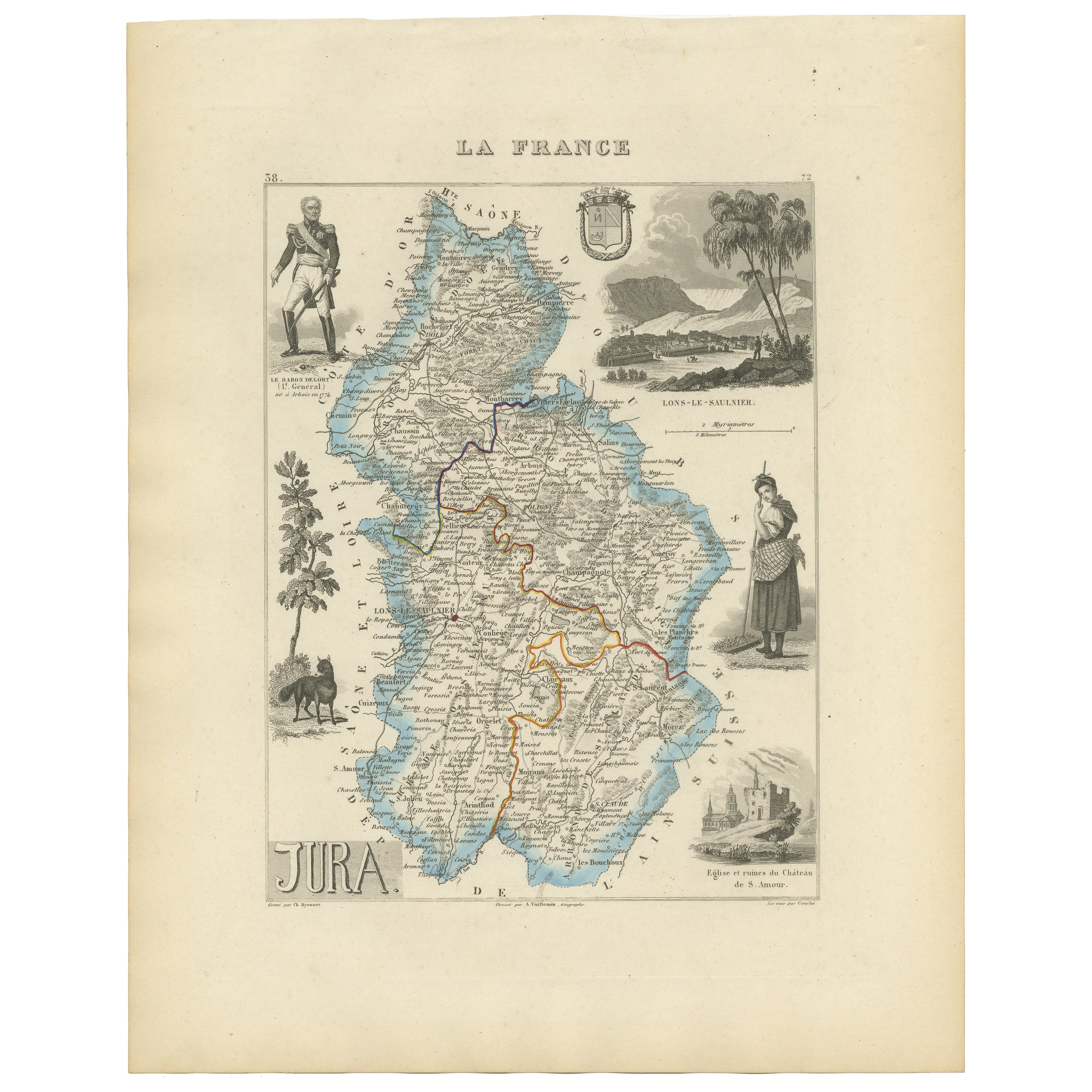
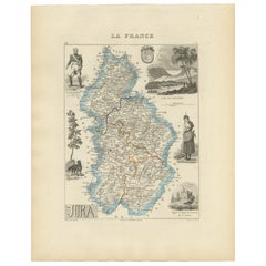
View AllAntique French Map of Jura Region with Lons-le-Saunier, Dole, 1800s
Located in Langweer, NL
Antique Map of Jura, France by Vuillemin, 19th Century
This decorative 19th-century engraved map shows the département of Jura in eastern France, produced by Alexandre Vuillemin. Th...
Category
Antique Mid-19th Century French Maps
Materials
Paper
Antique French Map of Ille-et-Vilaine Region with Rennes, Saint-Malo, 1800s
Located in Langweer, NL
Antique Map of Ille-et-Vilaine, France by Vuillemin, 19th Century
This decorative antique map presents the French département of Ille-et-Vilaine, situated in the Brittany region of ...
Category
Antique Mid-19th Century French Maps
Materials
Paper

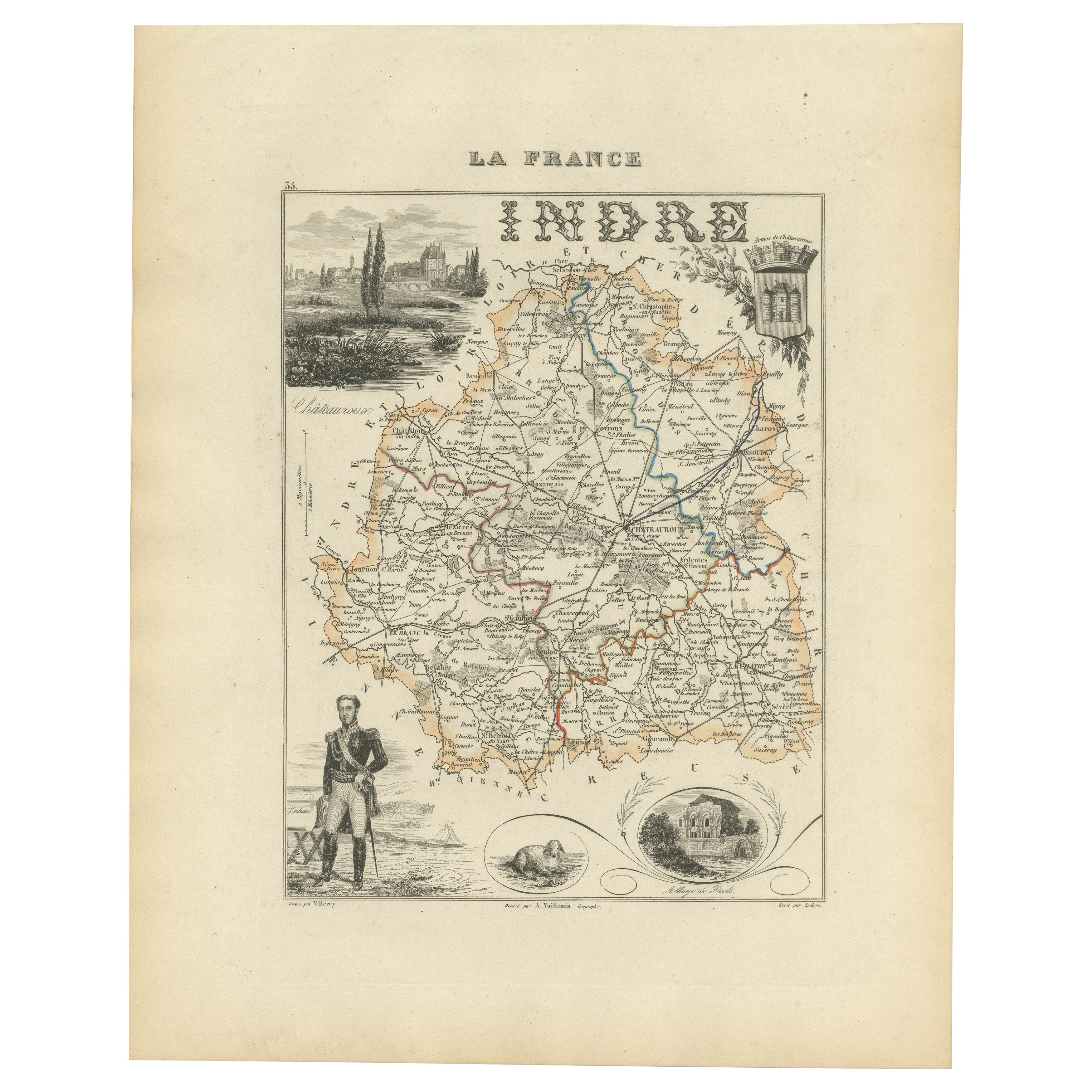
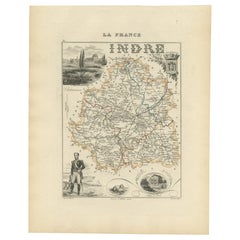
Antique French Map of Indre Region with Châteauroux and Issoudun, 1800s
Located in Langweer, NL
Antique Map of Indre, France by Vuillemin, 19th Century
This fine decorative map presents the département of Indre, situated in the Centre-Val de Loire region of central France. Eng...
Category
Antique Mid-19th Century French Maps
Materials
Paper
Antique Map of Marne, France – Engraved by Levasseur, 1850s
Located in Langweer, NL
Antique Map of Marne, France – Engraved by Levasseur, 1850s
This beautifully detailed 19th-century engraved map of the Marne department in northeastern France was created by the ren...
Category
Antique Mid-19th Century French Maps
Materials
Paper

Map of Gers France with Auch and Armagnac Wine Region by Vuillemin, 19th c
Located in Langweer, NL
Map of Gers France with Auch and Armagnac Wine Region by Vuillemin, 19th c
This 19th-century engraved and hand-colored map of the department of Gers in southwestern France was creat...
Category
Antique Mid-19th Century French Maps
Materials
Paper

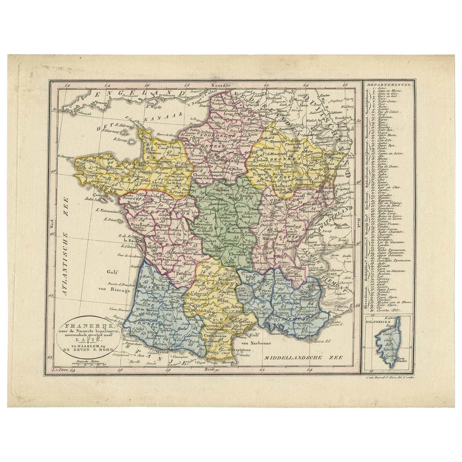
Antique Map of France by Van Baarsel (c.1820)
Located in Langweer, NL
'Frankrijk naar de nieuwste bepalingen meerendeels gevolgd naar Lapie'. Beautiful map of France with an inset map of the island of Corsica. Includes a table with reference to the dep...
Category
Antique Early 19th Century Dutch Maps
Materials
Paper

You May Also Like
Aube, France. Antique map of a French department, 1856
By Victor Levasseur
Located in Melbourne, Victoria
'Dept. de L'Aube', steel engraving with original outline hand-colouring., 1856, from Levasseur's 'Atlas National Illustre'.
This area of France is known for its production of Chaou...
Category
19th Century Naturalistic Landscape Prints
Materials
Engraving

L
Isere, France. Antique map of French department, 1856
By Victor Levasseur
Located in Melbourne, Victoria
'Dept. de L'Isere', Steel engraving with original outline hand-colouring., 1856, from Levasseur's 'Atlas National Illustre'.
This area is known for its production of Bleu du Vercor...
Category
19th Century Naturalistic Landscape Prints
Materials
Engraving

Large 19th Century Map of France
Located in Pease pottage, West Sussex
Large 19th Century Map of France.
Remarkable condition, with a pleasing age worn patina.
Recently framed.
France Circa 1874.
Category
Antique Late 19th Century French Maps
Materials
Linen, Paper

Map of France - Etching - 1820
Located in Roma, IT
Map of France is an Original Etching realized by an unknown artist of 19th century in 1820.
Very good condition on two sheets of white paper joined at t...
Category
1820s Modern Figurative Prints
Materials
Etching

Lozere, France. Antique map of a French department, 1856
By Victor Levasseur
Located in Melbourne, Victoria
'Dept. de La Lozere', steel engraving with original outline hand-colouring., 1856, from Levasseur's 'Atlas National Illustre'.
This remote mountainous part of Languedoc is rural, s...
Category
19th Century Naturalistic Landscape Prints
Materials
Engraving

Saone and Loire, France. Antique map of a French department, 1856
By Victor Levasseur
Located in Melbourne, Victoria
'Dept. de Saone et Loire', steel engraving with original outline hand-colouring., 1856, from Levasseur's Atlas National Illustre.
The French department of Saone et Loire is at the ...
Category
19th Century Naturalistic Landscape Prints
Materials
Engraving
