Items Similar to Antique French Map of Landes Region with Mont-de-Marsan, Dax, Bayonne, 1800s


Want more images or videos?
Request additional images or videos from the seller
1 of 9
Antique French Map of Landes Region with Mont-de-Marsan, Dax, Bayonne, 1800s
$167.25
£125
€140
CA$230.74
A$252.73
CHF 133.06
MX$3,016.22
NOK 1,695.74
SEK 1,550.16
DKK 1,067.10
About the Item
Antique Map of Landes, France by Vuillemin, 19th Century
This fine 19th-century engraved map depicts the département of Landes in southwestern France, engraved by Alexandre Vuillemin. The map shows towns, rivers, and main roads, with departmental boundaries highlighted in original hand color.
The decorative framework includes an oval portrait of Théophile de Bordeu (1722–1776), the physician and philosopher born in Mont-de-Marsan, a coat of arms, and a vignette view of Mont-de-Marsan, the departmental capital, complete with bridge and church. The embellishments reflect the region’s cultural and historical character.
The Landes, part of the Nouvelle-Aquitaine region, is renowned for its vast pine forests, sandy coastline along the Atlantic, and traditional culture, including gastronomy and folk festivals. The map captures both the geography and the spirit of the département in the Romantic cartographic style of the mid-19th century.
Alexandre Vuillemin (1812–1880) was a prolific French cartographer known for his atlas maps, where geography was paired with decorative artistry. His series of French départements remains highly collectible for its blend of accuracy and ornamentation.
Condition report: Very good condition with a strong, clean impression and bright hand-coloring. Minor marginal toning and light foxing at the sheet edges, not affecting the printed area.
Framing tips: This map would display beautifully in a dark walnut or black frame with ivory matting. Adding a gilt fillet would enhance the fine engraved vignette details and highlight the hand coloring.
Technique: Engraving with original hand color
Maker: Alexandre Vuillemin, France, mid-19th century
- Dimensions:Height: 10.28 in (26.1 cm)Width: 12.8 in (32.5 cm)Depth: 0.01 in (0.2 mm)
- Materials and Techniques:Paper,Engraved
- Place of Origin:
- Period:
- Date of Manufacture:circa 1850
- Condition:Condition report: Very good condition with a strong, clean impression and bright hand-coloring. Minor marginal toning and light foxing at the sheet edges, not affecting the printed area.
- Seller Location:Langweer, NL
- Reference Number:Seller: BG-13331-391stDibs: LU3054346798412
About the Seller
5.0
Recognized Seller
These prestigious sellers are industry leaders and represent the highest echelon for item quality and design.
Platinum Seller
Premium sellers with a 4.7+ rating and 24-hour response times
Established in 2009
1stDibs seller since 2017
2,806 sales on 1stDibs
Typical response time: 1 hour
- ShippingRetrieving quote...Shipping from: Langweer, Netherlands
- Return Policy
More From This Seller
View AllAntique French Map of Ille-et-Vilaine Region with Rennes, Saint-Malo, 1800s
Located in Langweer, NL
Antique Map of Ille-et-Vilaine, France by Vuillemin, 19th Century
This decorative antique map presents the French département of Ille-et-Vilaine, situated in the Brittany region of ...
Category
Antique Mid-19th Century French Maps
Materials
Paper

Map of Côtes-du-Nord France with Saint-Brieuc and Brittany Coastline, c.1850
Located in Langweer, NL
Map of Côtes-du-Nord France with Saint-Brieuc and Brittany Coastline, 19th c
Description:
This elegant 19th-century map of Côtes-du-Nord, the historic name for what is now known as ...
Category
Antique Mid-19th Century French Maps
Materials
Paper

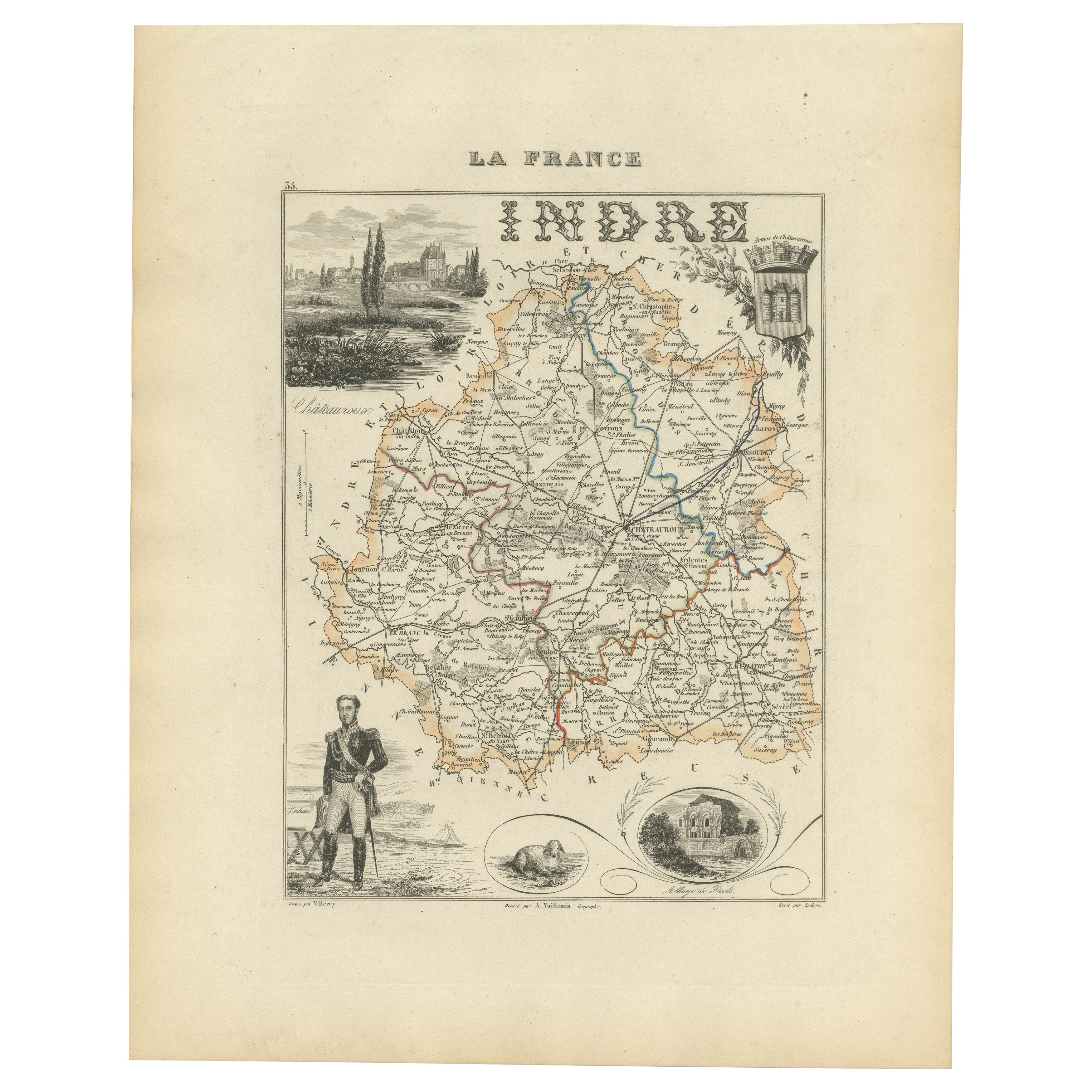
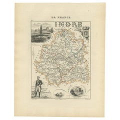
Antique French Map of Indre Region with Châteauroux and Issoudun, 1800s
Located in Langweer, NL
Antique Map of Indre, France by Vuillemin, 19th Century
This fine decorative map presents the département of Indre, situated in the Centre-Val de Loire region of central France. Eng...
Category
Antique Mid-19th Century French Maps
Materials
Paper
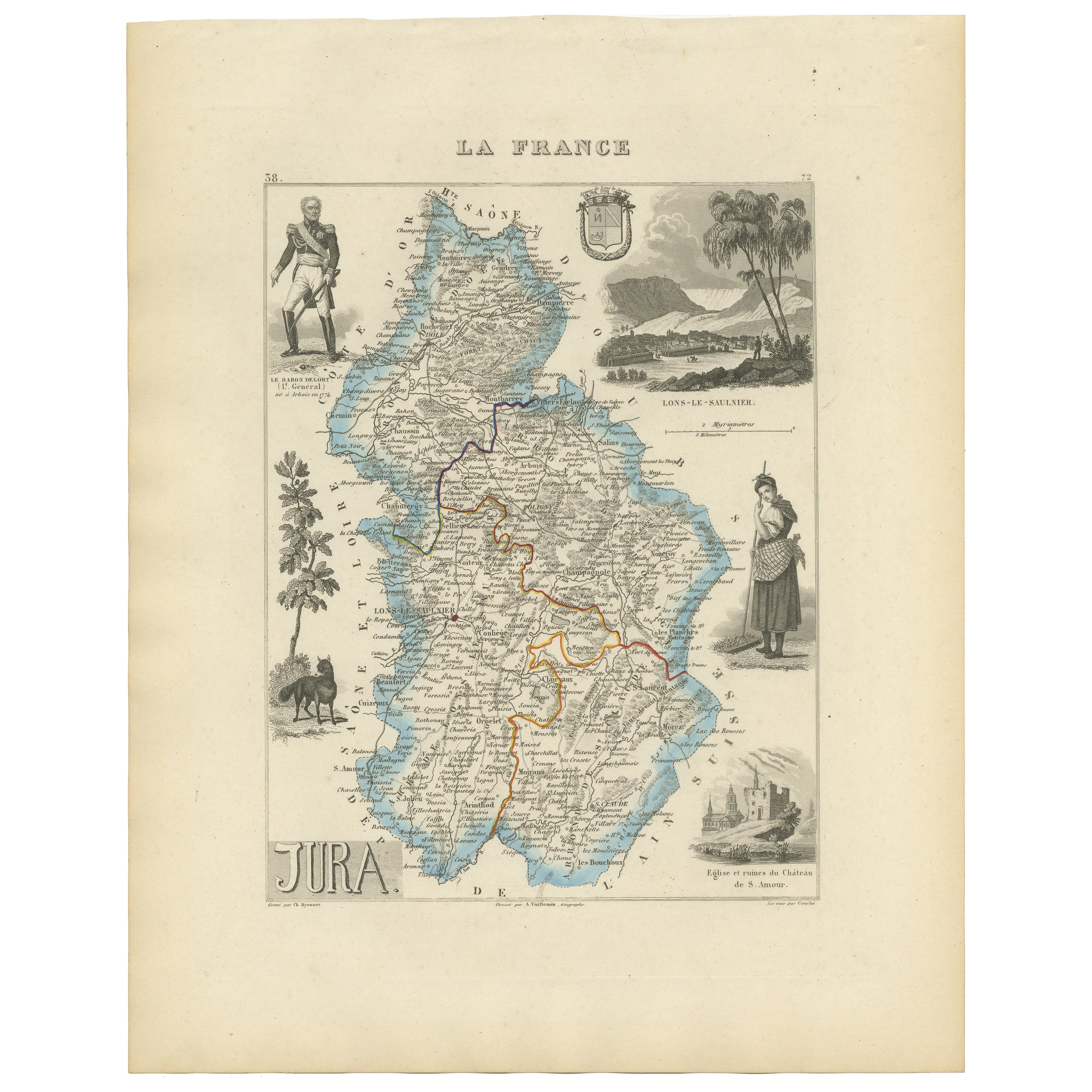
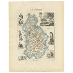
Antique French Map of Jura Region with Lons-le-Saunier, Dole, 1800s
Located in Langweer, NL
Antique Map of Jura, France by Vuillemin, 19th Century
This decorative 19th-century engraved map shows the département of Jura in eastern France, produced by Alexandre Vuillemin. Th...
Category
Antique Mid-19th Century French Maps
Materials
Paper
Map of Loire France with Saint-Étienne and Montbrison by Vuillemin, 19th c
Located in Langweer, NL
Map of Loire France with Saint-Étienne and Montbrison by Vuillemin, 19th c
This beautifully engraved and hand-colored map of the department of Loire in east-central France is from t...
Category
Antique Mid-19th Century French Maps
Materials
Paper

Antique Map of Marne, France – Engraved by Levasseur, 1850s
Located in Langweer, NL
Antique Map of Marne, France – Engraved by Levasseur, 1850s
This beautifully detailed 19th-century engraved map of the Marne department in northeastern France was created by the ren...
Category
Antique Mid-19th Century French Maps
Materials
Paper

You May Also Like
Var, France. Antique map of a French department, 1856
By Victor Levasseur
Located in Melbourne, Victoria
'Dept. du Var', steel engraving with original outline hand-colouring., 1856, from Levasseur's Atlas National Illustre.
Var covers the heart of the French Riviera or Cote d'Azur., and includes the resort cities of Cannes, Nice and San Tropez...
Category
19th Century Naturalistic Landscape Prints
Materials
Engraving

Aude, France. Antique map of a French department, 1856
By Victor Levasseur
Located in Melbourne, Victoria
'Dept. de L' Aude', steel engraving with original outline hand-colouring., 1856, from Levasseur's 'Atlas National Illustre'.
This area of France is famous for its wide variety of v...
Category
19th Century Naturalistic Landscape Prints
Materials
Engraving

L
Isere, France. Antique map of French department, 1856
By Victor Levasseur
Located in Melbourne, Victoria
'Dept. de L'Isere', Steel engraving with original outline hand-colouring., 1856, from Levasseur's 'Atlas National Illustre'.
This area is known for its production of Bleu du Vercor...
Category
19th Century Naturalistic Landscape Prints
Materials
Engraving

Aube, France. Antique map of a French department, 1856
By Victor Levasseur
Located in Melbourne, Victoria
'Dept. de L'Aube', steel engraving with original outline hand-colouring., 1856, from Levasseur's 'Atlas National Illustre'.
This area of France is known for its production of Chaou...
Category
19th Century Naturalistic Landscape Prints
Materials
Engraving

Saone and Loire, France. Antique map of a French department, 1856
By Victor Levasseur
Located in Melbourne, Victoria
'Dept. de Saone et Loire', steel engraving with original outline hand-colouring., 1856, from Levasseur's Atlas National Illustre.
The French department of Saone et Loire is at the ...
Category
19th Century Naturalistic Landscape Prints
Materials
Engraving

Bas Rhin, France. Antique map of a French department, 1856
By Victor Levasseur
Located in Melbourne, Victoria
'Dept. du Bas Rhin', steel engraving with original outline hand-colouring., 1856, from Levasseur's Atlas National Illustre.
Part of the Alsace wine region surrounding Strasbourg. T...
Category
19th Century Naturalistic Landscape Prints
Materials
Engraving
