Items Similar to Antique Habsburg Empire Map – Southeastern Germany to Venice, 1858
Video Loading
Want more images or videos?
Request additional images or videos from the seller
1 of 11
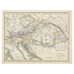
Antique Habsburg Empire Map – Southeastern Germany to Venice, 1858
$593.98
£440.18
€495
CA$811.80
A$883.71
CHF 469.07
MX$10,632.88
NOK 5,943.77
SEK 5,446.17
DKK 3,770.56
About the Item
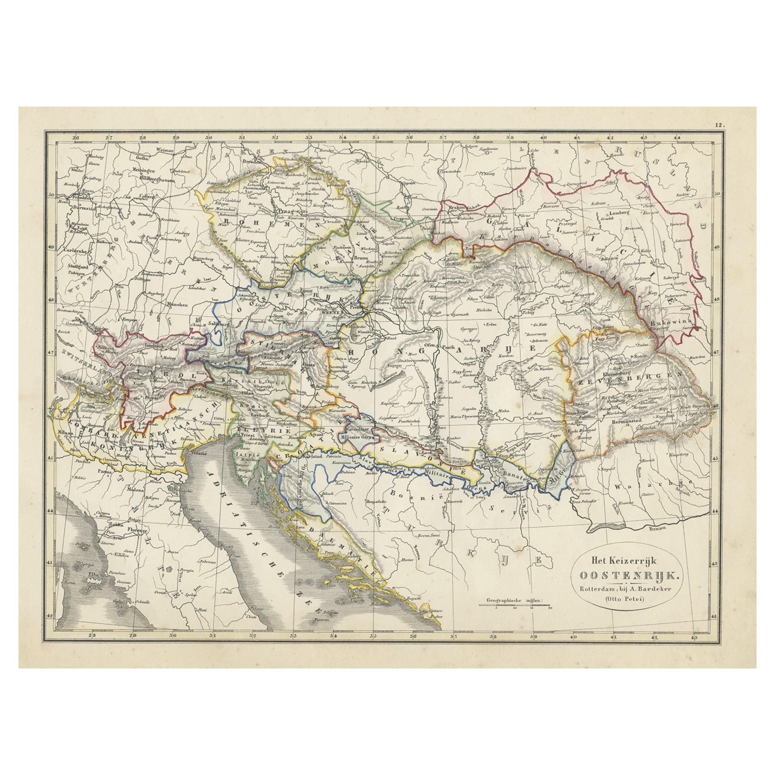
Map of Southeastern Germany
Northern Italy – Antique Engraving, 1858
Antique map titled "Süd-Östliches Deutschland nebst einem Theil des nördlichen Italien," published by Justus Perthes in Gotha in 1855. This finely engraved map offers a detailed view of Southeastern Germany, the Austrian Empire, and Northern Italy in the mid-19th century, just before the unification of Italy and the consolidation of German states.
The map covers southern Bavaria, Tyrol, Styria, Carinthia, Carniola, the Kingdom of Lombardy-Venetia, and regions extending into modern-day Slovenia, Croatia, and northeastern Italy. Cities such as Vienna, Salzburg, Venice, Trieste, Graz, and Milan are clearly marked, alongside a dense network of towns, rivers, roads, and railway lines.
Provincial borders are delicately hand-colored, and a legend at lower right classifies territories based on their political status within the Austrian monarchy. Elevation is indicated through fine hachuring, and both horizontal and vertical elevation profiles frame the map, offering insight into the mountainous Alpine and Dinaric terrain.
This map provides a valuable historical snapshot of Central Europe and the northern Adriatic region under Habsburg rule. It is particularly appealing for collectors interested in 19th-century European cartography, the Austro-Italian relationship, or antique maps of the Alps and Adriatic.
Condition report:
Very good condition. Minor toning to outer margins. Hand-coloring remains vivid. No tears, foxing, or repairs.
Framing suggestions:
Best displayed in a dark or natural wood frame with a soft ivory mat. A thin blue or red inner mat line may highlight the delicate border colors. Perfect for a study, library, or historic-themed interior.
Technique: Copperplate engraving with original hand-coloring
Maker: Justus Perthes, Gotha, 1858
- Dimensions:Height: 14.77 in (37.5 cm)Width: 17.88 in (45.4 cm)Depth: 0.01 in (0.2 mm)
- Materials and Techniques:Paper,Engraved
- Place of Origin:
- Period:
- Date of Manufacture:1858
- Condition:Very good condition. Minor toning to outer margins. Hand-coloring remains vivid. No tears, foxing, or repairs.
- Seller Location:Langweer, NL
- Reference Number:Seller: BG-05552-331stDibs: LU3054346118502
About the Seller
5.0
Recognized Seller
These prestigious sellers are industry leaders and represent the highest echelon for item quality and design.
Platinum Seller
Premium sellers with a 4.7+ rating and 24-hour response times
Established in 2009
1stDibs seller since 2017
2,816 sales on 1stDibs
Typical response time: 1 hour
- ShippingRetrieving quote...Shipping from: Langweer, Netherlands
- Return Policy
More From This Seller
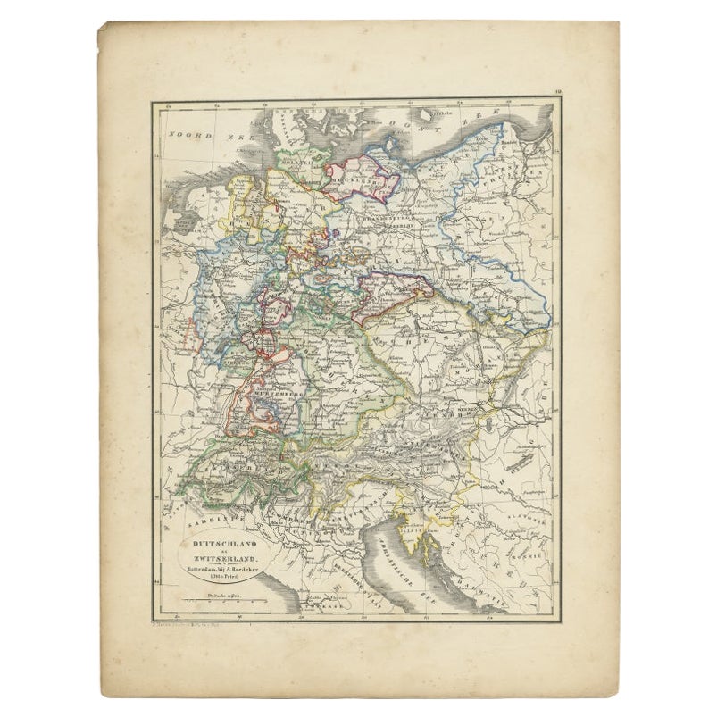
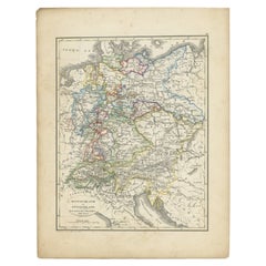
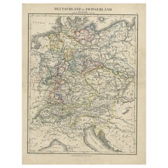
View AllAntique Map of Germany and Switzerland from an Old Dutch School Atlas, 1852
Located in Langweer, NL
Antique map titled 'Duitschland en Zwitersland'. Map of Germany and Switzerland. This map originates from 'School-Atlas van alle deelen der Aarde' by Otto Petri. Artists and Engraver...
Category
Antique 19th Century Maps
Materials
Paper
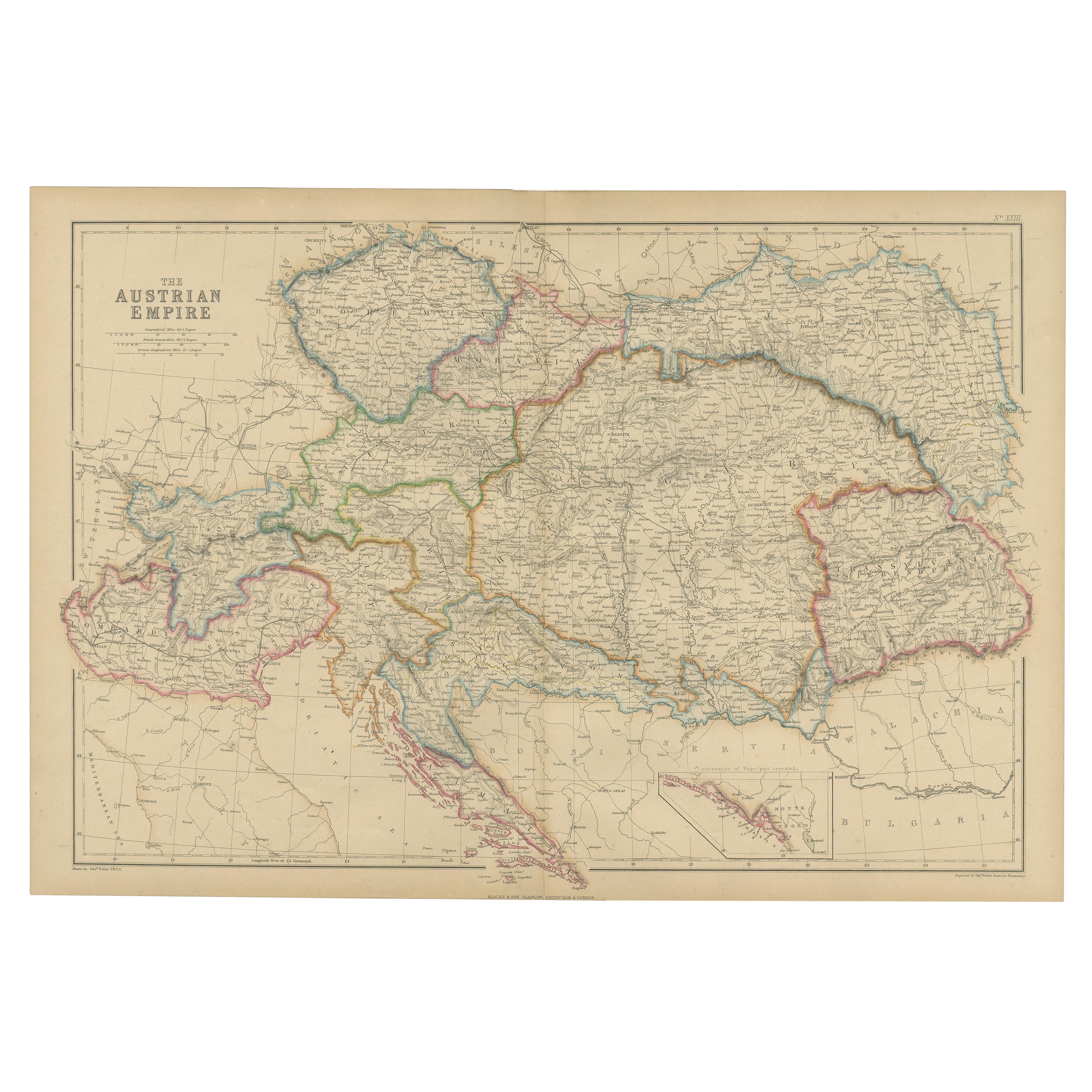
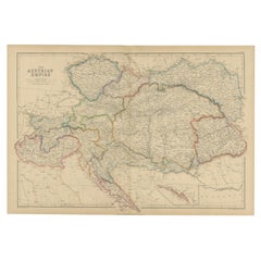
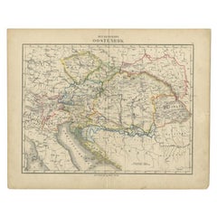
Antique Map of the Austrian Empire by W. G. Blackie, 1859
Located in Langweer, NL
Antique map titled 'The Austrian Empire'. Original antique map of the Austrian Empire with inset map of Montenegro. This map originates from ‘The Imperial Atlas of Modern Geography’....
Category
Antique Mid-19th Century Maps
Materials
Paper
$209 Sale Price
30% Off
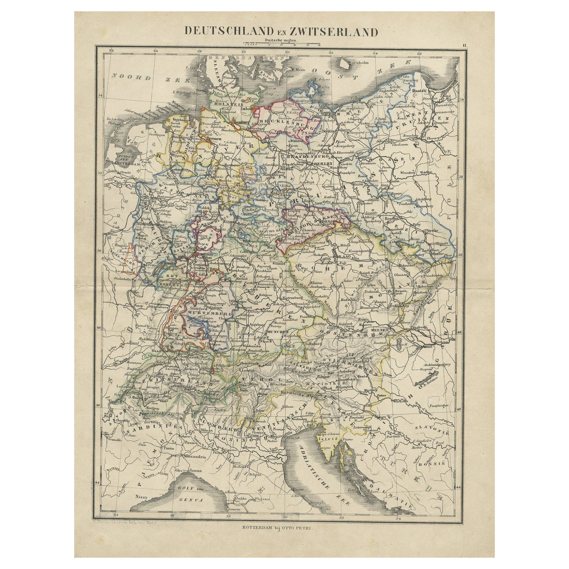
Antique Map of Germany and Switzerland from an Old Dutch School Atlas, c.1873
Located in Langweer, NL
Antique map titled 'Deutschland en Zwitserland'. Old map depicting Germany and Switzerland. This map originates from 'School-Atlas van alle Deelen der Aarde'. Artists and Engravers: ...
Category
Antique 19th Century Maps
Materials
Paper
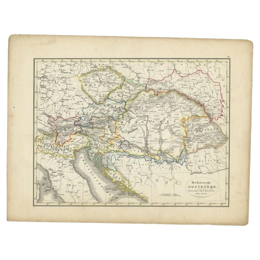
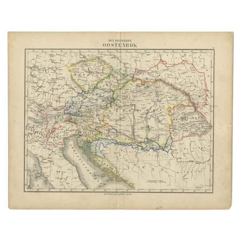
Antique Map of the Austrian Empire by Petri, 1852
Located in Langweer, NL
Antique map titled 'Het Keizerrijk Oostenrijk'. Map of the Austrian Empire. This map originates from 'School-Atlas van alle deelen der Aarde' by Otto Petri....
Category
Antique 19th Century Maps
Materials
Paper

$115 Sale Price
20% Off
Original Antique Map of Austria from an Old Dutch School Atlas, 1852
Located in Langweer, NL
Antique map titled 'Het Keizerrijk Oostenrijk'.
Map of the Austrian Empire. This map originates from 'School-Atlas van alle deelen der Aarde' by Otto Petri...
Category
Antique 1850s Maps
Materials
Paper
$182 Sale Price
20% Off
Antique Map of the Austrian Empire by Petri, c.1873
Located in Langweer, NL
Antique map titled 'Het Keizerrijk Oostenrijk'. Old map depicting the Austrian Empire. This map originates from 'School-Atlas van alle Deelen der Aarde'. Artists and Engravers: Publi...
Category
Antique 19th Century Maps
Materials
Paper
$89 Sale Price
20% Off
You May Also Like
1849 Map of "Europaische Russland",
Meyer Map of European Russia
, Ric. R017
Located in Norton, MA
1849 Map of
"Europaische Russland"
( Meyer Map of European Russia)
Ric.r017
A lovely map of European Russia dating to 1849 by Joseph Meyer. It covers the European portions of...
Category
Antique 19th Century Unknown Maps
Materials
Paper

1853 Map of "Russia in Europe Including Poland" Ric.r016
Located in Norton, MA
Description
Russia in Europe incl. Poland by J Wyld c.1853
Hand coloured steel engraving
Dimension: Paper: 25 cm W x 33 cm H ; Sight: 22 cm W x 28 cm H
Condition: Good ...
Category
Antique 19th Century Unknown Maps
Materials
Paper

1839 Map of Karte Des "Russischen Reiches in Europa Und Asien" Ric.R0013
Located in Norton, MA
1839 map of Karte Des
"Russischen Reiches in Europa and Asien"
Ric.r013
Map of the European and Asian parts of Russian Empire. Karte der Russischen Reiches in Europa und Asien...
Category
Antique 19th Century Unknown Maps
Materials
Paper

1870 "Johnson
s Europe" Map Published by A. J. Johnson
Located in Colorado Springs, CO
Presented is an original 1870 "Johnson’s Europe" map. First published in 1864, this map was issued as pages 87 and 88 in the 1870 edition of “Johnson's New Illustrated (Steel Plate) ...
Category
Antique 1870s American Victorian Maps
Materials
Paper

Austria-Hungary, Western Part. Century Atlas antique vintage map
Located in Melbourne, Victoria
'The Century Atlas. Austria-Hungary, Western Part'
Original antique map, 1903.
Central fold as issued. Map name and number printed on the reverse corners.
Sheet 40cm by 29.5cm.
Category
Early 20th Century Victorian More Prints
Materials
Lithograph

Large Original Antique Map of Poland by Sidney Hall, 1847
Located in St Annes, Lancashire
Great map of Poland
Drawn and engraved by Sidney Hall
Steel engraving
Original colour outline
Published by A & C Black. 1847
Unframed
...
Category
Antique 1840s Scottish Maps
Materials
Paper

More Ways To Browse
Bavaria Antique
German Empire
Austrian Empire
German Empire Furniture
City Antique Vienna
Beni Ourain Rugs
Glass Top Wood Base Coffee Tables
T Chair
Pair Of Danish Chairs
Veneer Dining Tables
1970 Italian Armchair
Furniture Uk
House Of Denmark Table And Chairs
Louis Marble Top Side Table
Antique Russian Rugs
Baker Furniture By
For Kids
Sterling Silver Flatware Set Service For 12