Items Similar to Antique Handcolored Map of the Dutch Province Groningen, Incl. Emden, Ca.1680


Want more images or videos?
Request additional images or videos from the seller
1 of 5
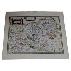
Antique Handcolored Map of the Dutch Province Groningen, Incl. Emden, Ca.1680
$1,136.81
£849.08
€950
CA$1,566.16
A$1,706.84
CHF 903.85
MX$20,500.99
NOK 11,442.90
SEK 10,520.63
DKK 7,237.36
About the Item
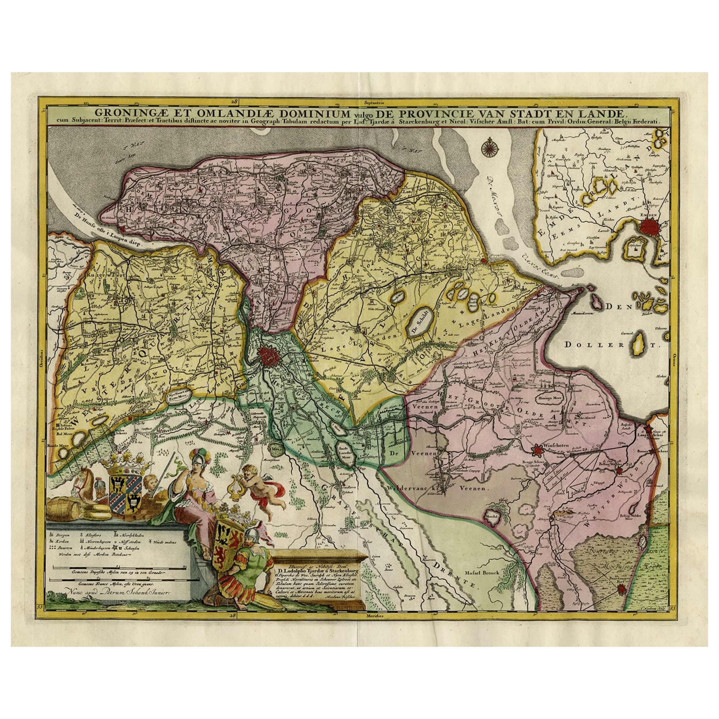
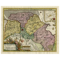
Antique print, titled: 'Groningae et Omlandiae Dominium vulgo de Pronvicie van Stadt en Lande …'
A map of the Dutch province Groningen. A small part of Germany is also shown (Emden). Published by Nicolaes Visscher II.
Artists and Engravers: Made by 'Andries Hogeboom' after Cartographers: Lu. Tjardae a Starckenburg
Nicolaes Visscher II. Andries Hogeboom Ludolph Tjarda van Starkenburg. Nicolaes Visscher II (1649-1702).
Condition: Good, given age. Original middle fold, as issued, flattened out. Right margin soiled and with small tears. Left margin cropped to the platemark. Top and bottom margins a little soiled. Two small tears in the lower margin, closed with acid-free archival tape. General age-related toning and/or occasional minor defects from handling. Please study scan carefully.
- Dimensions:Height: 20.75 in (52.7 cm)Width: 23.63 in (60 cm)Depth: 0 in (0.02 mm)
- Materials and Techniques:
- Period:1680-1689
- Date of Manufacture:circa 1680
- Condition:
- Seller Location:Langweer, NL
- Reference Number:Seller: PCT-566551stDibs: LU3054326763672
About the Seller
5.0
Recognized Seller
These prestigious sellers are industry leaders and represent the highest echelon for item quality and design.
Platinum Seller
Premium sellers with a 4.7+ rating and 24-hour response times
Established in 2009
1stDibs seller since 2017
2,786 sales on 1stDibs
Typical response time: <1 hour
- ShippingRetrieving quote...Shipping from: Langweer, Netherlands
- Return Policy
More From This Seller
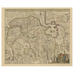
View AllDecorative Hand-Colored Antique Map of Groningen in the Netherlands, ca.1730
Located in Langweer, NL
Antique print, titled: 'Groningae et Omlandiae Dominium vulgo de Provincie van Stadt en Lande (…) ' - This map shows Groningen, the Netherlands. Lower left scale sticks in the decora...
Category
Antique 1730s Maps
Materials
Paper
$1,196 Sale Price
20% Off
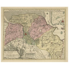
Antique Map of the Province Groningen in The Netherlands, c.1680
Located in Langweer, NL
Antique map titled 'Groningae et Omlandiae Dominium vulgo de Provincie van Stadt en Lande'.
Old map of the province of Groningen, the Netherlands. This map originates from 'Germani...
Category
Antique 17th Century Maps
Materials
Paper

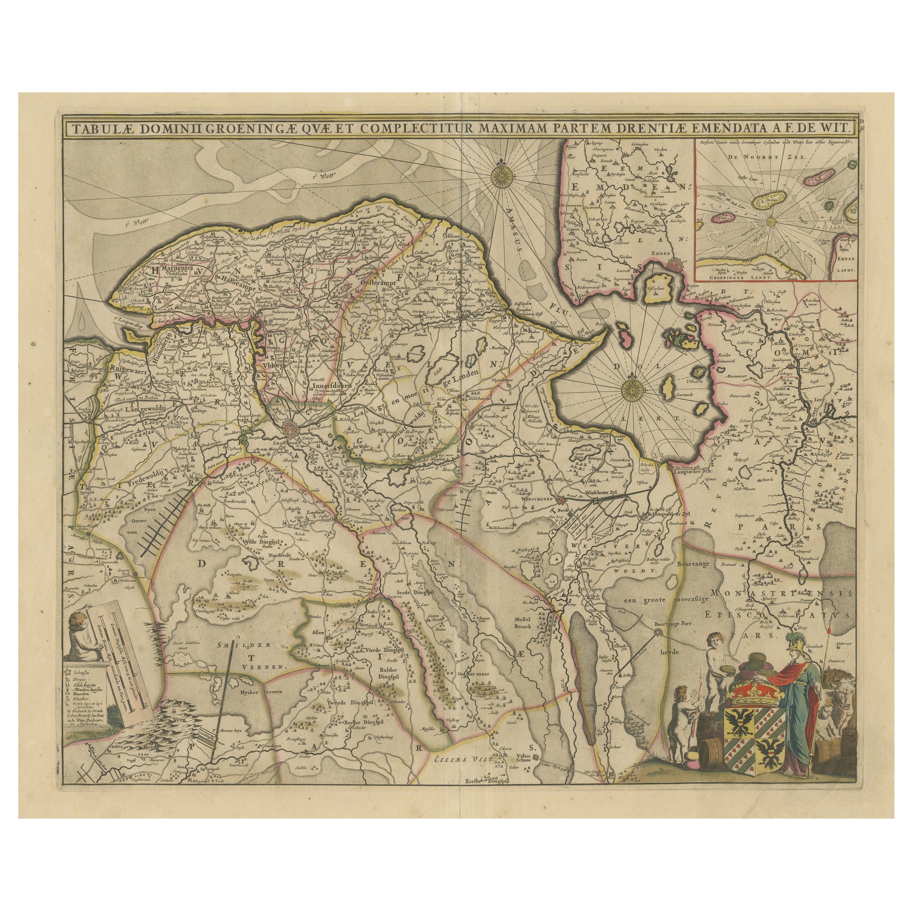
Antique Map of The Dutch Province of Groningen by De Wit, c.1680
Located in Langweer, NL
Antique map titled 'Tabulae dominii Groeningae quae et complecitur maximam partem Drentiae Emendata'.
Old map of the province of Groningen, the Netherlands. With an inset map of th...
Category
Antique 17th Century Maps
Materials
Paper

Antique Map of Groningen with Contemporary Hand Coloring
Located in Langweer, NL
Antique map titled 'Tabulae dominii Groeningae quae et complecititur maximam partem Dreniae Emendata a F. de Wit'. Original antique map of the province of Groningen, the Netherlands....
Category
Antique Late 17th Century Maps
Materials
Paper
$631 Sale Price
20% Off
Antique Map of the Province of Groningen in the Netherlands, c.1700
Located in Langweer, NL
Antique map titled 'Groningae et Omlandiae Dominium vulgo de Provincie van Stadt en Lande'.
Old map of the province of Groningen, the Netherlands. This map originates from 'Atlas C...
Category
Antique 18th Century Maps
Materials
Paper
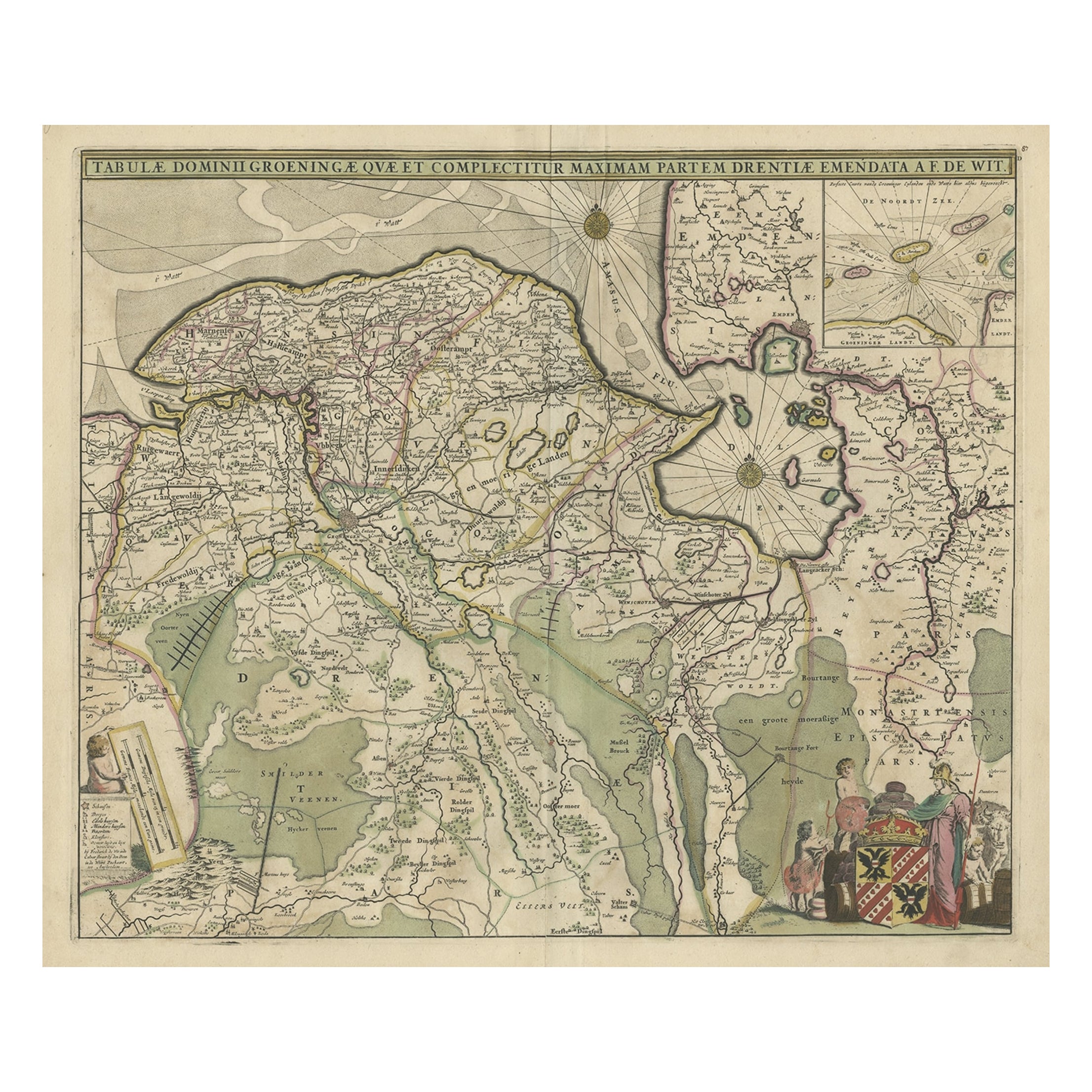
Old Map of the Province of Groningen, the Netherlands
inset of Islands, C.1680
Located in Langweer, NL
Antique map titled 'Tabulae dominii Groeningae quae et complecitur maximam partem Drentiae Emendata'.
Old map of the province of Groningen, the Netherlands. With an inset map of ...
Category
Antique 1680s Maps
Materials
Paper
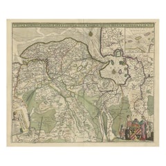
$1,196 Sale Price
20% Off
You May Also Like
1643 Willem&Joan Blaeu Map NW Flanders "Flandriae Teutonicae Pars Prientalior
Located in Norton, MA
1643 Willem and Joan Blaeu map of northwest Flanders, entitled
"Flandriae Teutonicae Pars Prientalior,"
Ric0012
" Authentic" - Map of the northwest Fl...
Category
Antique 17th Century Dutch Maps
Materials
Paper

1635 Willem Blaeu Map of Northern France"Comitatvs Bellovacvm" Ric.a08
Located in Norton, MA
1635 Willem Blaeu map of northern France, entitled.
"Comitatvs Bellovacvm Vernacule Beavvais,"
Colored
Ric.a008
“COMITATVS BELLOVACVM…” Amsterdam: W...
Category
Antique 17th Century Unknown Maps
Materials
Paper

1752 Vaugoundy Map of Flanders : Belgium, France, and the Netherlands, Ric.a002
Located in Norton, MA
Large Vaugoundy Map of Flanders:
Belgium, France, and the Netherlands
Colored -1752
Ric.a002
Description: This is a 1752 Didier Robert de Vaugondy map of Flanders. The map de...
Category
Antique 17th Century Unknown Maps
Materials
Paper

1633 map, entitled "La douche de Berry, " Original Hand Colored Ric.0005
Located in Norton, MA
1633 map, entitled
"La douche de Berry,"
Hand Colored
Ric.0005
Description:
1633 map, entitled "La douche de Berry,"
Dimension: Paper: 23.3" W x 20.3" H (59 cm W x 51.7 cm H) ; ...
Category
Antique 17th Century Dutch Maps
Materials
Paper
1571-1638 Willem Blaeu map entitled, "Ilcadorino, " Hand Colored Ric0009
Located in Norton, MA
Willem Blaeu map entitled,
"Ilcadorino,".
Hand colored.
Description: large, unusual, and nice antique copper engraved map of Ilcadorino, by Willem BL...
Category
Antique 16th Century Dutch Maps
Materials
Paper

Antique Colored Belgium Map Flandria Gallica Flanders Henricus Hondius
Located in Dayton, OH
Antique hand colored map of Flanders, Belgium, engraved by Henricus Hondius.
Sans frame - 21.25” x 18”.
Category
Antique 19th Century Renaissance Maps
Materials
Paper

$245 Sale Price
30% Off
More Ways To Browse
Antique Map By Coronelli
Cyprus Antique Maps
John Speed Maps
M Howard
Used Office Furniture Michigan
Antique Geological Maps
Antique Manitoba
Australian Colonial
Bengal Map
Stanford Furniture
Tennessee Antique Furniture
Used Furniture Alabama
Used Office Furniture Maine
Ancient World Map
Antique Florida Map
Antique Map Chile
Antique Map Of Georgia
Antique Mississippi Furniture