Items Similar to Antique Jamaica Map, English, Caribbean, Cartography, Thomas Jefferys, Georgian
Want more images or videos?
Request additional images or videos from the seller
1 of 13
Antique Jamaica Map, English, Caribbean, Cartography, Thomas Jefferys, Georgian
$1,642.26
£1,201
€1,411.47
CA$2,285.78
A$2,452.23
CHF 1,315.33
MX$29,524.57
NOK 16,581.25
SEK 15,119.80
DKK 10,545.58
About the Item
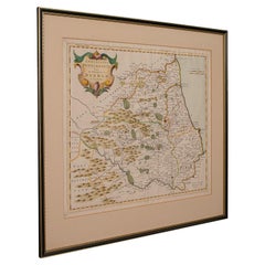
This is an antique Jamaica map. An English, framed Caribbean island engraving by Thomas Jefferys, dating to the 18th century and later, dated 1794.
Excellent Georgian period cartography of the famous island
Displaying a desirable aged patina and in good original order
Fascinating map, appealingly set within a later glazed frame
Improved and engraved by Jefferys, geographer to George III
Hand coloured palette accentuates the map with regional borders
Harbour maps of Bluefields, Kingston and Port Royal add further local interest
Distance scale is given in Statue Miles and Sea Leagues respectively
Dressed to the rear with hanging wire for ease of mounting
This is a quality antique Jamaica map, with fine cartographic interest and a quality engraving of Speed’s work. Delivered ready to display.
Dimensions:
Max Width: 55cm (21.75'')
Max Depth: 2cm (.75'')
Max Height: 45.5cm (18'')
Map Width: 43cm (17'')
Map Height: 32cm (12.5'')
- Dimensions:Height: 17.92 in (45.5 cm)Width: 21.66 in (55 cm)Depth: 0.79 in (2 cm)
- Style:Georgian (Of the Period)
- Materials and Techniques:
- Place of Origin:
- Period:1790-1799
- Date of Manufacture:Circa 1790
- Condition:Wear consistent with age and use. Presented in good, original antique condition.
- Seller Location:Hele, Devon, GB
- Reference Number:Seller: 258171stDibs: LU2645348250542
About the Seller
5.0
Platinum Seller
Premium sellers with a 4.7+ rating and 24-hour response times
Established in 2005
1stDibs seller since 2017
1,090 sales on 1stDibs
Typical response time: <1 hour
- ShippingRetrieving quote...Shipping from: Hele, Devon, United Kingdom
- Return Policy
More From This Seller
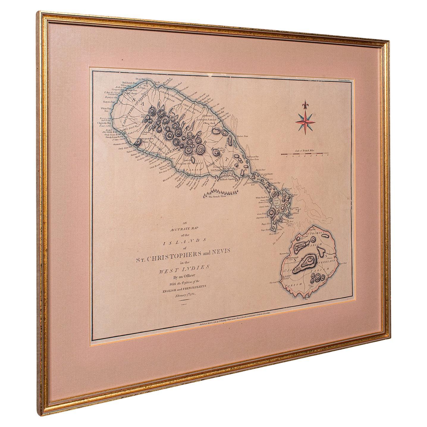
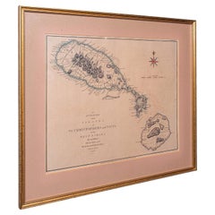
View AllAntique St Christopher
Nevis Map, English, Caribbean Cartography, Georgian
Located in Hele, Devon, GB
This is a superb antique map of St Christopher and Nevis. An English, framed Caribbean island cartography engraving, dating to the Georgian period and later, circa 1780. A fascinatin...
Category
Antique 1780s British Georgian Maps
Materials
Glass, Paper
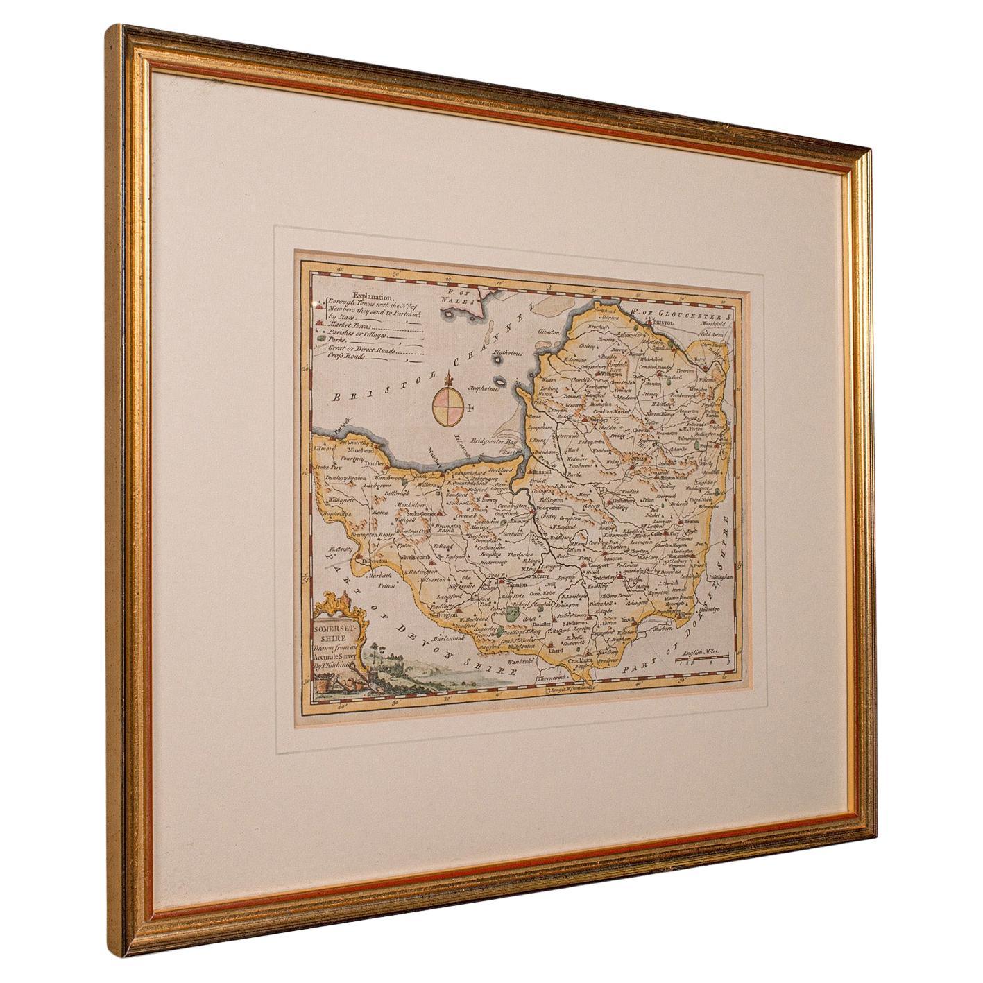
Antique Somerset Map, Thomas Kitchin, English, Cartographic Reference, Georgian
Located in Hele, Devon, GB
This is a fine antique Somerset map. An 18th century English cartographic county reference engraving by Thomas Kitchin (1718–1784), dating to the Georgian period, circa 1780. A beaut...
Category
Antique 1780s British Georgian Maps
Materials
Glass, Paper

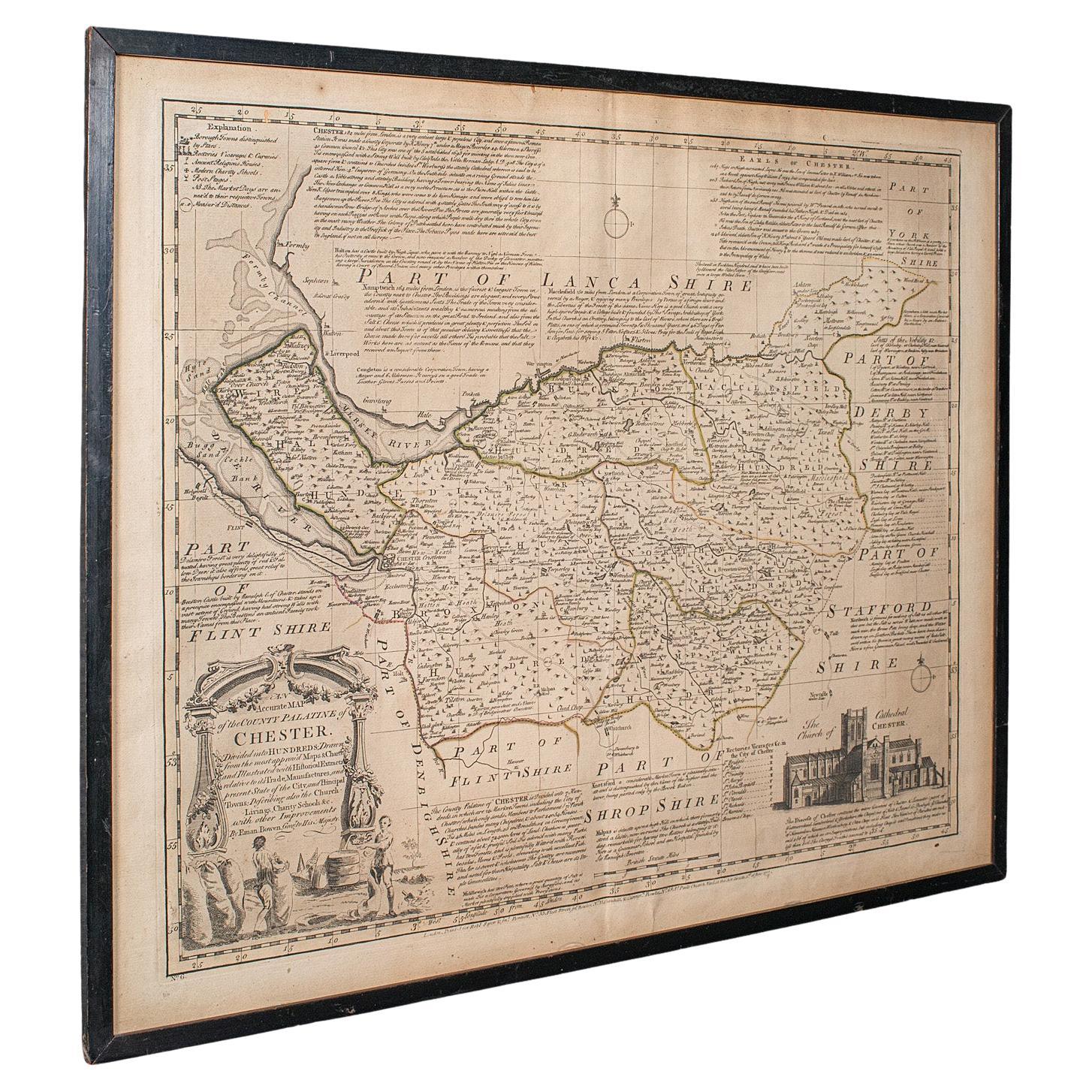
Antique Chester County Map, English, Cheshire, Framed Cartography, Georgian
Located in Hele, Devon, GB
This is an antique Palantine of Chester county map. An English, framed atlas engraving of Cheshire by Emanuel Bowen, dating to the 18th century and later, circa 1770.
Superb cartog...
Category
Antique 1770s British Georgian Maps
Materials
Glass, Paper
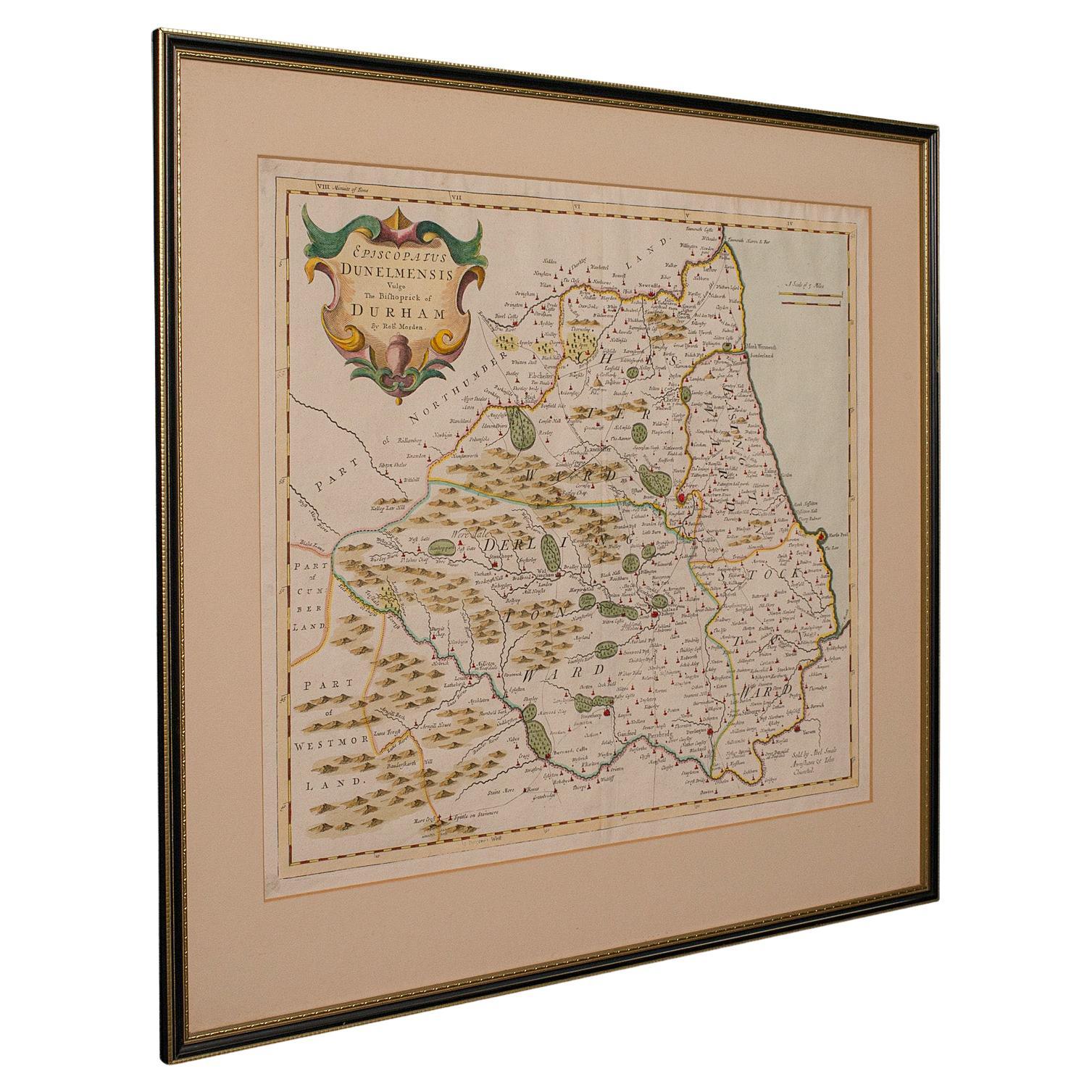
Antique Lithography Map, Durham, English, Framed, Cartography, Early Georgian
Located in Hele, Devon, GB
This is an antique lithography map of Durham. An English, framed engraving of cartographic interest, dating to the early 18th century and later, circa 1720.
Superb lithography of Du...
Category
Antique Early 18th Century British Georgian Maps
Materials
Wood
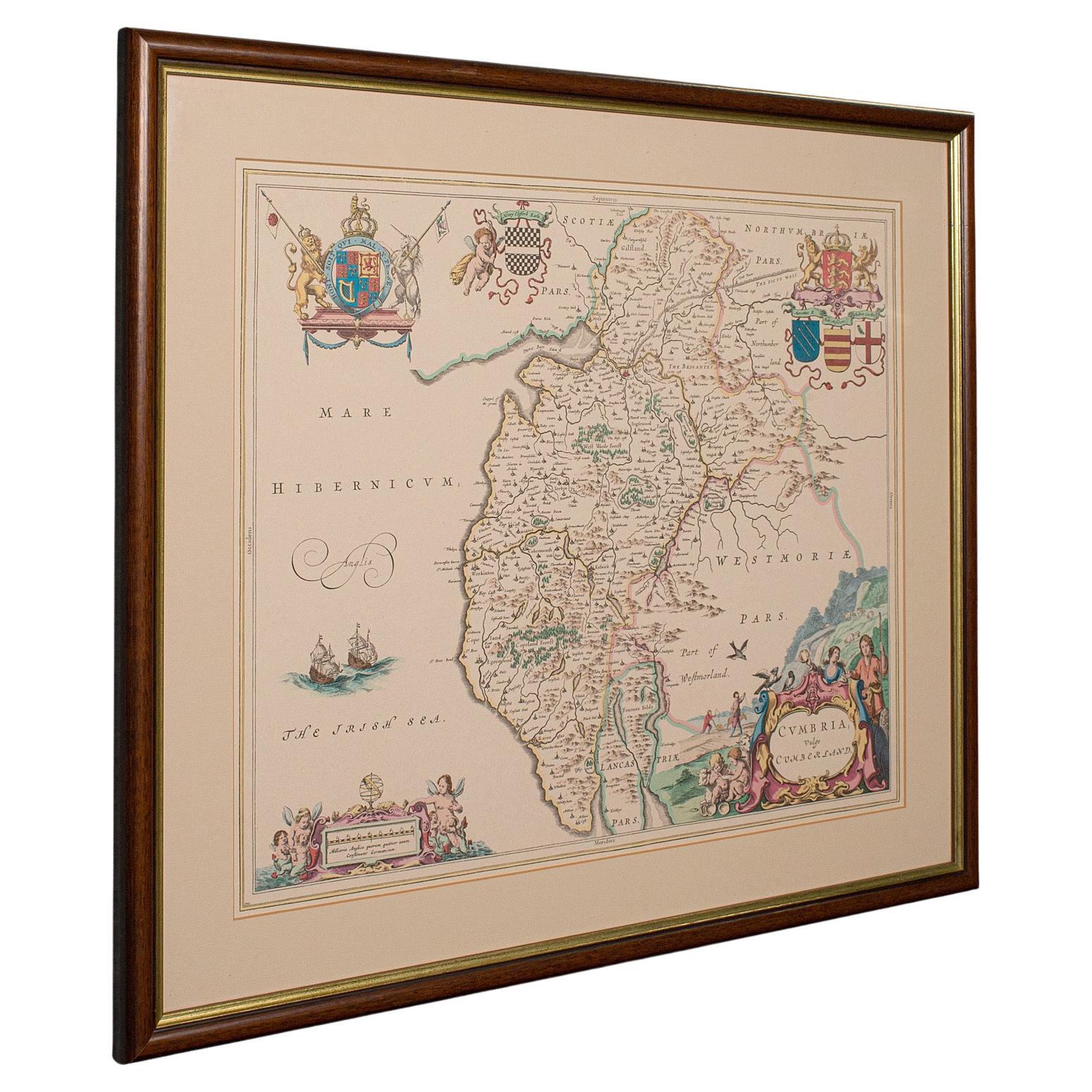
Antique Lithography Map, Cumbria, English, Framed Cartography Interest, Georgian
Located in Hele, Devon, GB
This is an antique lithography map of Cumbria. An English, framed engraving of cartographic interest, dating to the early 18th century and later.
...
Category
Antique Early 18th Century British Georgian Maps
Materials
Wood

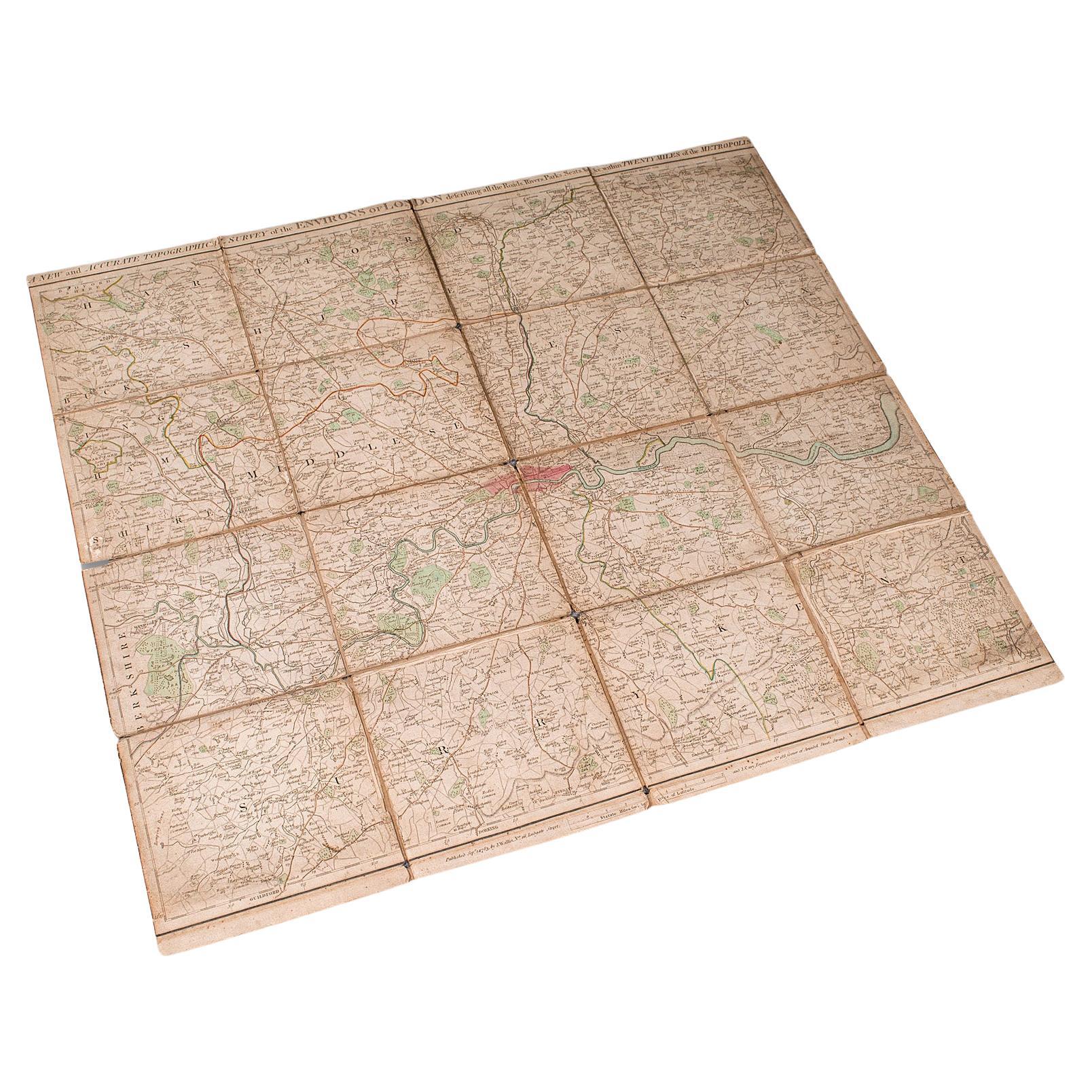
Antique Folding London Map, English, Cartography, Historic, Georgian, Dated 1783
Located in Hele, Devon, GB
This is an antique folding London map. An English, paper on linen cartographical study of the London metropolis and the surrounding area, published in the mid Georgian period, dated ...
Category
Antique Late 18th Century British Georgian Maps
Materials
Linen, Paper
You May Also Like
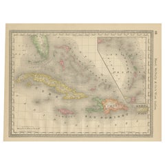
Antique Caribbean Map Wall Art – Cuba Jamaica Hispaniola, Rand McNally, ca.1888
Located in Langweer, NL
Title: Antique Caribbean Map Wall Art – Cuba Jamaica Hispaniola, Rand McNally
Description:
This finely colored antique atlas map depicts the Caribbean basin, centered on Cuba, Jamai...
Category
Antique Late 19th Century American Maps
Materials
Paper
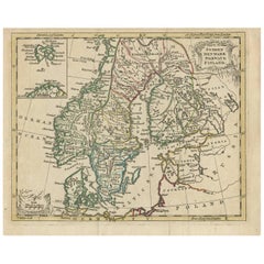
Antique Map of Scandinavia by T. Jefferys, circa 1750
Located in Langweer, NL
Antique map titled 'Sweden, Denmark, Norway & Finland'. An original mid-18th century copper engraved antique map of Scandinavia by Thomas Jefferys....
Category
Antique Mid-18th Century Maps
Materials
Paper
South America: Hand-colored 18th Century Framed Map by Thomas Jefferys
By Thomas Jefferys
Located in Alamo, CA
This detailed hand-colored map of South America by Thomas Jefferys was published in London in 1750. The map shows countries, early colonial possessions, towns, rivers, mountains, and...
Category
Antique Mid-18th Century English Maps
Materials
Paper

Antique Map of Guadelupe in the Caribbean, 1759
By Jacques-Nicolas Bellin
Located in Langweer, NL
Antique map titled 'Carte De L'Isle De La Guadeloupe'. Detailed map of Guadalupe, Mari-Galante and the Isles de Saintes. Produced by Nichlas Bellin for Prevost d'Exiles influential t...
Category
Antique Mid-18th Century French Maps
Materials
Paper

Antique Map of the Antilles in the Caribbean,
1875
Located in Langweer, NL
Antique map titled 'Carte des Iles Antilles'. Large map of the Antilles. This map originates from 'Atlas de Géographie Moderne Physique et Politique' by A. Levasseur. Published, 1875.
Category
Antique Late 19th Century French Maps
Materials
Paper

$326 Sale Price
44% Off
Antique Map of Guadeloupe, Island in the Caribbean, c.1757
Located in Langweer, NL
Antique map titled 'Carte de L'Isle de la Guadeloupe'.
A very decorative map of Guadeloupe in the Caribbean, adorned with rhumb lines, fleur-de-lys, and two decorative rococo-style...
Category
Antique 18th Century Maps
Materials
Paper
