Items Similar to Antique Map of Abyssinia, Sudan and the Red Sea, Arabia and Egypt South, 1749


Want more images or videos?
Request additional images or videos from the seller
1 of 6
Antique Map of Abyssinia, Sudan and the Red Sea, Arabia and Egypt South, 1749
$415.29
£310.04
€350
CA$576.97
A$620.61
CHF 331.67
MX$7,315.27
NOK 4,181.63
SEK 3,822.81
DKK 2,667.39
About the Item
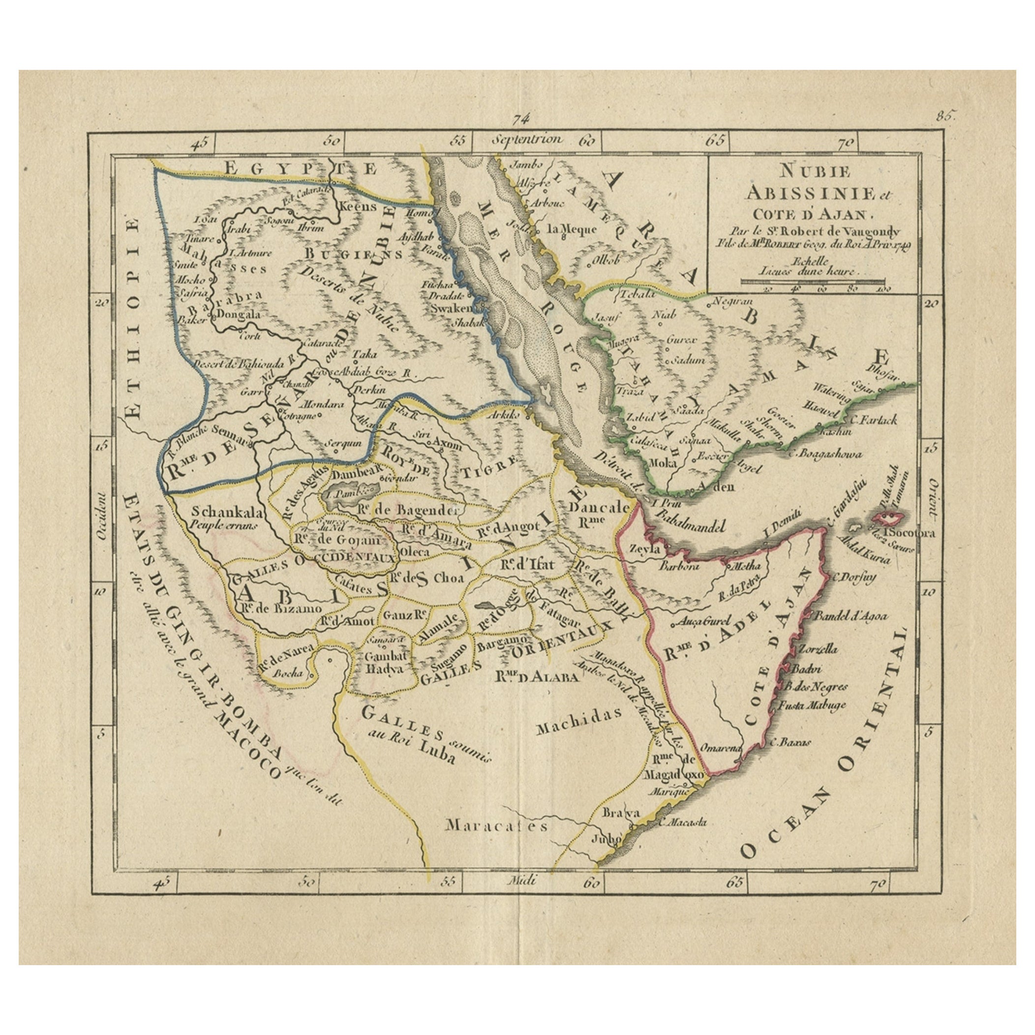
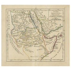
Antique map titled 'Nubie, Abissinie et Cote d'Ajan'. Map of Abyssinia, Sudan and the Red Sea by Robert Vaugondy. Covers from Arabia and Egypt south to Mogadishu and includes parts of modern day Sudan, Ethiopia, Somalia, Yemen, and Saudi Arabia. Originates from 'Atlas Portatif Universel et Militaire'.
Artists and Engravers: Gilles Robert de Vaugondy (1688-1766), also known as Le Sieur or Monsieur Robert, and his son, Didier Robert de Vaugondy (c.1723-1786), were leading cartographers in France during the 18th century.
Condition: Good, general age-related toning. Small defect (hole) in the middle of the image. Small split on folding line, please study image carefully.
Date: 1749
Overall size: 26 x 22 cm.
Image size: 18.5 x 16.5 cm.
We sell original antique maps to collectors, historians, educators and interior decorators all over the world. Our collection includes a wide range of authentic antique maps from the 16th to the 20th centuries. Buying and collecting antique maps is a tradition that goes back hundreds of years. Antique maps have proved a richly rewarding investment over the past decade, thanks to a growing appreciation of their unique historical appeal. Today the decorative qualities of antique maps are widely recognized by interior designers who appreciate their beauty and design flexibility. Depending on the individual map, presentation, and context, a rare or antique map can be modern, traditional, abstract, figurative, serious or whimsical. We offer a wide range of authentic antique maps for any budget.
- Dimensions:Height: 8.67 in (22 cm)Width: 10.24 in (26 cm)Depth: 0 in (0.01 mm)
- Materials and Techniques:
- Period:
- Date of Manufacture:1749
- Condition:
- Seller Location:Langweer, NL
- Reference Number:Seller: BG-12077-31stDibs: LU3054326271332
About the Seller
5.0
Recognized Seller
These prestigious sellers are industry leaders and represent the highest echelon for item quality and design.
Platinum Seller
Premium sellers with a 4.7+ rating and 24-hour response times
Established in 2009
1stDibs seller since 2017
2,836 sales on 1stDibs
Typical response time: 1 hour
- ShippingRetrieving quote...Shipping from: Langweer, Netherlands
- Return Policy
More From This Seller
View AllOriginal Antique Map of Abyssinia, Sudan and the Red Sea, 1749
Located in Langweer, NL
Antique map titled 'Nubie, Abissinie et Cote d'Ajan'.
Map of Abyssinia, Sudan and the Red Sea by Robert Vaugondy. Covers from Arabia and Egypt south to M...
Category
Antique 1740s Maps
Materials
Paper
$322 Sale Price
20% Off
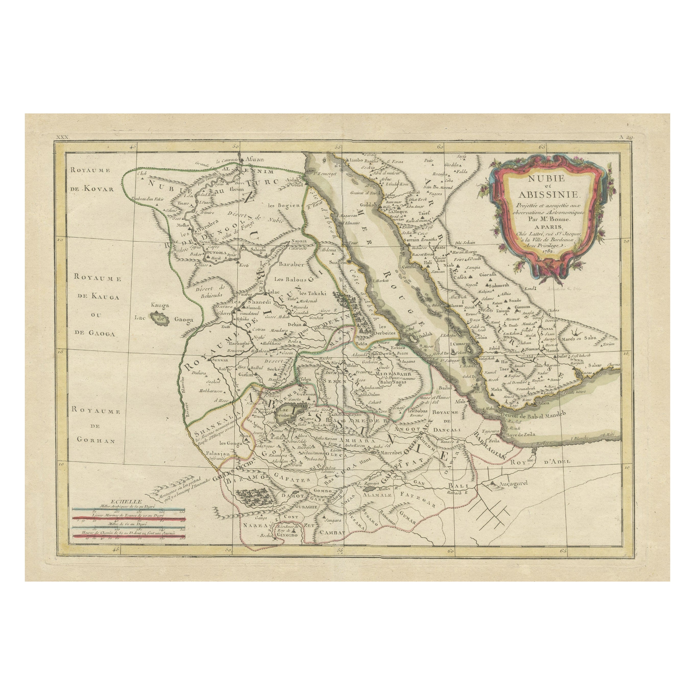
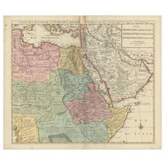
Antique Map of Arabia including Nubia and Abyssinia, also shows the Red Sea
Located in Langweer, NL
Antique map titled 'Nubie et Abissinie'. Original antique map of Nubia, a region along the Nile river, and Abyssinia or the Ethiopian Empire. This map o...
Category
Antique Late 18th Century Maps
Materials
Paper

$816 Sale Price
20% Off
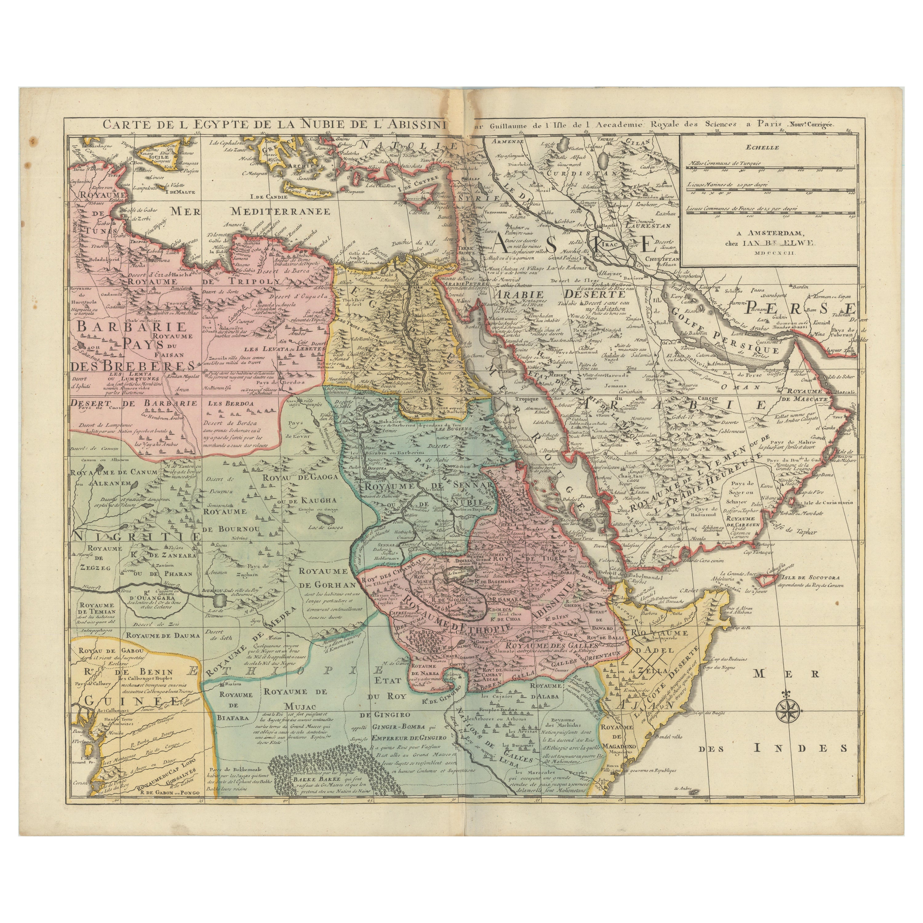
1792 Map of Eastern Africa and the Arabian Peninsula by Delisle/Elwe
Located in Langweer, NL
1792 Map of Eastern Africa and the Arabian Peninsula by Delisle/Elwe
This detailed 1792 map, created by Delisle and published by Elwe, depicts northeastern Africa, including Egypt, ...
Category
Antique 1790s Maps
Materials
Paper
$626 Sale Price
20% Off
Antique Map of the Arabian Peninsula by Franceschini,
1739
Located in Langweer, NL
Antique map titled 'Conventus et Residentiae'. Rare map of the Arabian Peninsula. This map originates from 'Provinciarum et Conventum Fratrum Discalc...
Category
Antique Mid-18th Century Maps
Materials
Paper

$533 Sale Price
40% Off
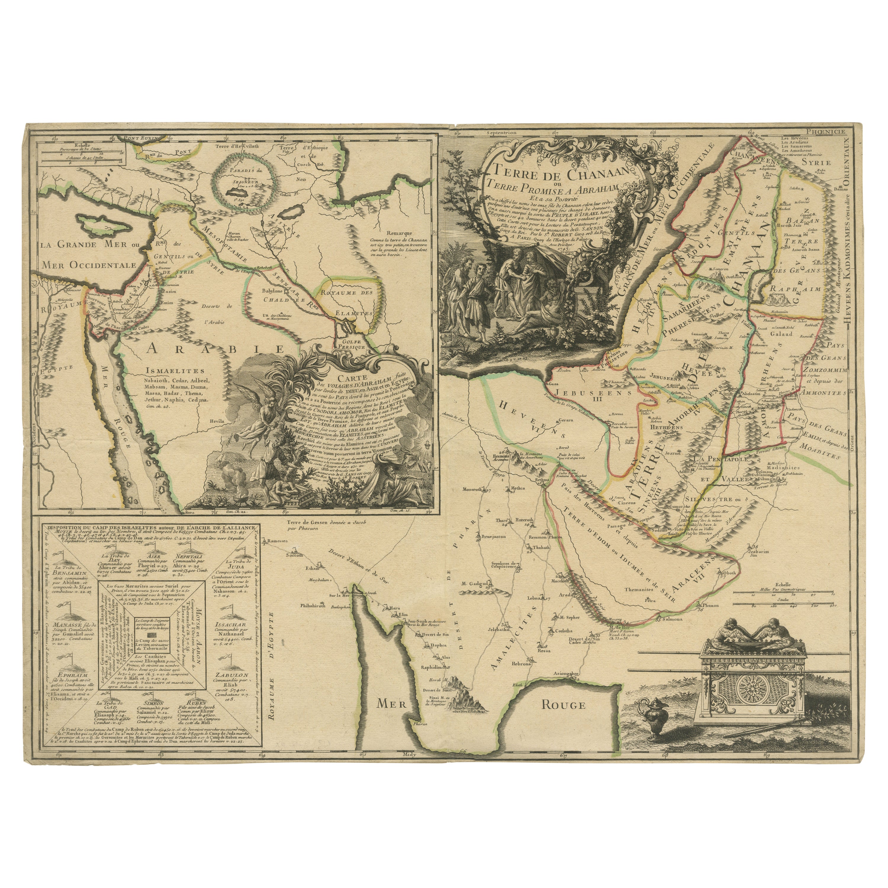
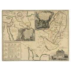
Old Map of Arabian Peninsula and Canaan, Highlighting Biblical Territories, 1750
Located in Langweer, NL
This antique map, titled "Terre de Chanaan ou Terre Promise a Abraham," is a finely detailed copper-engraved map created around 1750 by Delamarche in Paris, based on earlier works by...
Category
Antique 1750s French Maps
Materials
Paper
Nubia and Abyssinia – Venetian Map of Northeast Africa, Zatta, 1784
Located in Langweer, NL
Nubia and Abyssinia – Venetian Map of Northeast Africa, Zatta, 1784
This detailed late-18th-century map depicts Nubia and Abyssinia, covering large parts of present-day Sudan, Ethiopia, Eritrea, and the Horn of Africa. The map is titled “La Nubia ed Abissinia” and was published in Venice in 1784 by Antonio Zatta, one of the most important Italian map publishers of the period. It forms part of Zatta’s monumental Atlante Novissimo, produced with the privilege of the Venetian Senate.
The map presents the Nile basin in exceptional detail, tracing the river from its upper reaches through Nubia toward Egypt, while also mapping the Red Sea coast, inland mountain ranges, deserts, and regional kingdoms. Political and regional boundaries are outlined in contemporary hand color, distinguishing Nubia, Abyssinia, and neighboring territories. Numerous towns, tribal regions, rivers, and topographical features are carefully named, reflecting the synthesis of classical sources, Jesuit reports, and more recent travel accounts available to European geographers in the late Enlightenment period.
Zatta’s cartography represents the Italian continuation of the scientific mapping tradition pioneered by Delisle and d’Anville, emphasizing clarity, proportional accuracy, and critical compilation of sources. While interior Africa remained imperfectly known, this map shows a marked departure from earlier speculative geography, replacing legend with measured structure and comparative reasoning.
The decorative title cartouche, engraved in a restrained architectural style, anchors the upper right and reflects the sober elegance characteristic of Venetian Enlightenment cartography. Latitude and longitude lines, clean engraving, and balanced composition give the map strong visual presence without excess ornamentation.
This map is particularly appealing to collectors of African cartography, Nile exploration history, Ethiopian history, and Enlightenment-era geography. It also serves as an excellent intellectual counterpart to earlier French coastal and regional charts of Africa, illustrating the progression of European geographic knowledge during the 18th century.
Condition report
Good condition overall. Central vertical fold as issued. Light age toning and some mild discoloration, more noticeable along the fold. Minor scattered spots and faint handling marks. Original outline hand color. Plate mark visible. Margins intact.
Framing tips
A wide off-white or light sand-colored mat is recommended to balance the dense interior detail and preserve visual calm. A medium to dark wood frame enhances the engraved line work and complements the restrained hand coloring. Particularly effective as a scholarly centerpiece or paired with Indian Ocean or Nile-related maps.
Technique: Copper engraving with contemporary outline hand color
Maker: Antonio Zatta, Venice, 1784
Keywords: Nubia map, Abyssinia map, Ethiopia antique...
Category
Antique 1780s Italian Maps
Materials
Paper
You May Also Like
Persia, Armenia
Adjacent Regions: A 17th Century Hand-colored Map by De Wit
By Frederick de Wit
Located in Alamo, CA
A large 17th century hand colored copperplate engraved map entitled "Novissima nec non Perfectissima Scandinaviae Tabula comprehendens Regnorum Sueciae, Daniae et Norvegiae distincte...
Category
Antique Late 17th Century Dutch Maps
Materials
Paper

Map of Nubia and Abissinia - Original Etching by Antonio Zatta - 1784
Located in Roma, IT
This Map of Nubia and Abissinia is an etching realized by Antonio Zatta in Venice in 1784.
The state of preservation of the artwork is good expect for the worn paper with some littl...
Category
1770s Landscape Prints
Materials
Etching

Original Antique Map of Ancient Greece- Boeotia, Thebes, 1787
Located in St Annes, Lancashire
Great map of Ancient Greece. Showing the region of Boeotia, including Thebes
Drawn by J.D. Barbie Du Bocage
Copper plate engraving by P.F T...
Category
Antique 1780s French Other Maps
Materials
Paper

"Africa Vetus": a 17th Century Hand-Colored Map by Sanson
By Nicolas Sanson
Located in Alamo, CA
This original hand-colored copperplate engraved map of Africa entitled "Africa Vetus, Nicolai Sanson Christianiss Galliar Regis Geographi" was originally created by Nicholas Sanson d...
Category
Antique Late 17th Century French Maps
Materials
Paper

"Nova Barbariae Descriptio", a 17th Century Hand-Colored Map of North Africa
By Johannes Janssonius
Located in Alamo, CA
This original attractive 17th century hand-colored map of North Africa entitled "Nova Barbariae Descriptio" by Johannes Janssonius was published in Paris in 1635. It includes the Med...
Category
Antique Mid-17th Century Dutch Maps
Materials
Paper

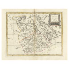
London 1744 Published Watercolour Antique Map of East Africa by Eman Bowen
Located in West Sussex, Pulborough
We are delighted to offer for sale this New and Accurate Map of Nubia & Abissinia, together with all the Kingdoms Tributary Thereto, and bordering upon them published in 1744 by Emanuel Bowen
This is a decorative antique engraved map of East Africa...
Category
Antique 1740s English George III Maps
Materials
Paper

More Ways To Browse
Ottoman Map
Roman Empire Map
Sebastian Munster
South African Antique
Antique Sri Lanka Map
Maps Balkans
Antique Map Of Jerusalem
Map Of Corsica
Solomons Temple
Antique Map Of Korea
Map Of Jerusalem
Prussia Map
Antique Maps Caribbean Islands
Antique Wine Maps
Used Furniture Wisconsin
Antique Furniture Michigan
Antique Maps Of Cape Of Good Hope
Antique Maps Of Texas