Items Similar to Antique Map of Aceh in Sumatra, Indonesia, 1900


Want more images or videos?
Request additional images or videos from the seller
1 of 7
Antique Map of Aceh in Sumatra, Indonesia, 1900
$347.05
£259.81
€290
CA$477.76
A$522.29
CHF 276.31
MX$6,250.02
NOK 3,515.70
SEK 3,218.27
DKK 2,209.44
About the Item
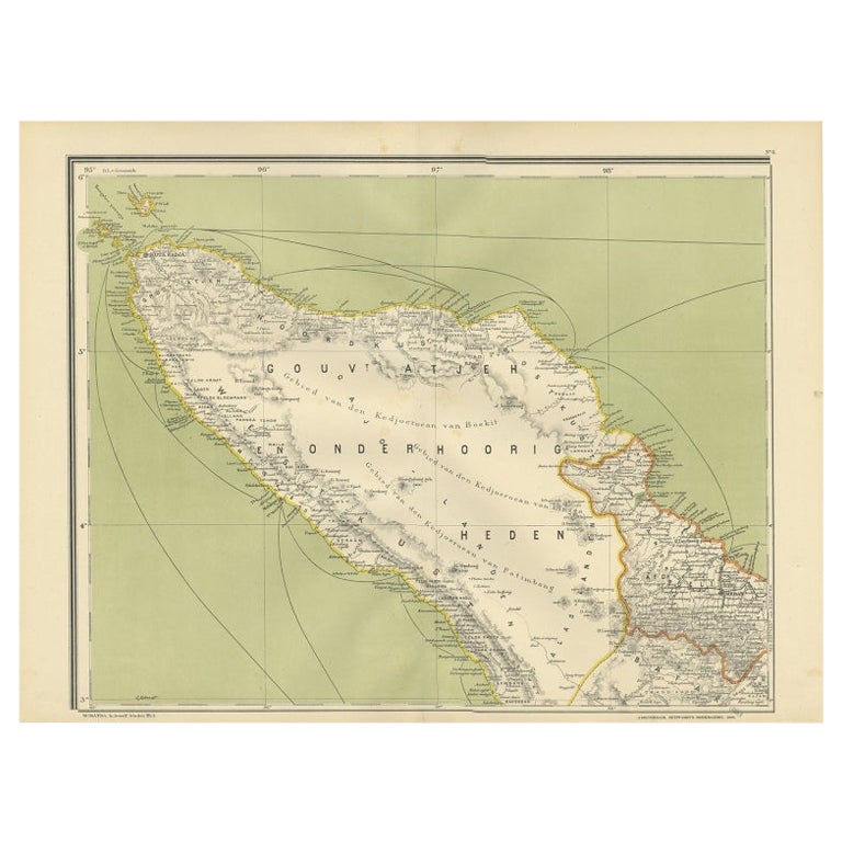
Antique map titled 'Groot-Atjeh en aangrenzende Kuststaten'. Old map of Aceh, with surrounding coastal regions. This map originates from 'Atlas van Nederlandsch Oost- en West-Indië' by I. Dornseiffen.
Artists and Engravers: Published by Seyffardt's Boekhandel, Amsterdam.
Condition: Very good, general age-related toning. Please study image carefully.
Date: 1900
Overall size: 52 x 38.9 cm.
Image size: 45.1 x 35.5 cm.
We sell original antique maps to collectors, historians, educators and interior decorators all over the world. Our collection includes a wide range of authentic antique maps from the 16th to the 20th centuries. Buying and collecting antique maps is a tradition that goes back hundreds of years. Antique maps have proved a richly rewarding investment over the past decade, thanks to a growing appreciation of their unique historical appeal. Today the decorative qualities of antique maps are widely recognized by interior designers who appreciate their beauty and design flexibility. Depending on the individual map, presentation, and context, a rare or antique map can be modern, traditional, abstract, figurative, serious or whimsical. We offer a wide range of authentic antique maps for any budget.
- Dimensions:Height: 15.32 in (38.9 cm)Width: 20.48 in (52 cm)Depth: 0 in (0.01 mm)
- Materials and Techniques:
- Period:
- Date of Manufacture:1900
- Condition:Condition: Very good, general age-related toning. Please study image carefully.
- Seller Location:Langweer, NL
- Reference Number:Seller: BG-06669-141stDibs: LU3054325991782
About the Seller
5.0
Recognized Seller
These prestigious sellers are industry leaders and represent the highest echelon for item quality and design.
Platinum Seller
Premium sellers with a 4.7+ rating and 24-hour response times
Established in 2009
1stDibs seller since 2017
2,792 sales on 1stDibs
Typical response time: <1 hour
- ShippingRetrieving quote...Shipping from: Langweer, Netherlands
- Return Policy
More From This Seller
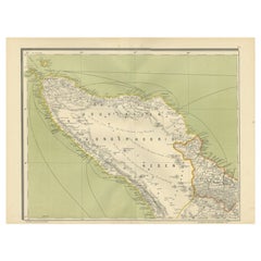
View AllAntique Map of Aceh or Adjeh in Northern Sumatra, Indonesia, 1900
Located in Langweer, NL
Antique map of Aceh, Sumatra. This map originates from 'Atlas van Nederlandsch Oost- en West-Indië' by I. Dornseiffen.
Artists and Engravers: Published by Seyffardt's Boekhandel, A...
Category
20th Century Maps
Materials
Paper
Antique Map of the East Coast of Sumatra , Indonesia, 1900
Located in Langweer, NL
Antique map of the East Coast of Sumatra. Also depicting the Strait of Malacca. This map originates from 'Atlas van Nederlandsch Oost- en West-Indië' by I. Dornseiffen.
Artists and...
Category
20th Century Maps
Materials
Paper

Antique Map of the Region of Lampung, Sumatra, Indonesia, 1900
Located in Langweer, NL
Antique map of the region of Lampung, Sumatra. Also depicting part of Palembang and Java. This map originates from 'Atlas van Nederlandsch Oost- en West-Indië' by I. Dornseiffen.
A...
Category
20th Century Maps
Materials
Paper

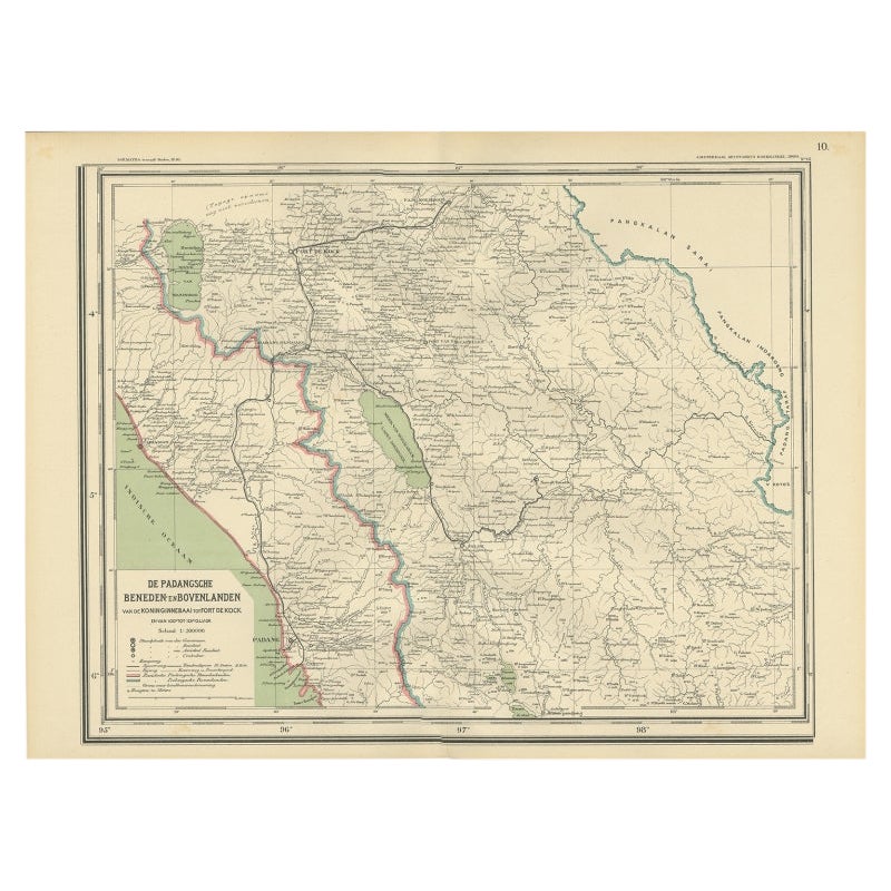
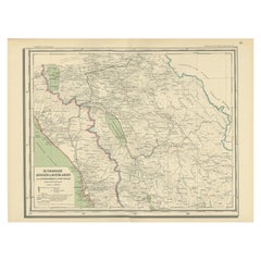
Antique Map of Padang, Sumatra, Indonesia, 1900
Located in Langweer, NL
Antique map titled 'De Padangsche Beneden-en Bovenlanden van de Koninginnedbaai tot Fort de Kock'. Old map of Padang, Sumatra. This map originates from 'Atlas van Nederlandsch Oost- ...
Category
20th Century Maps
Materials
Paper
Antique Map of West Sumatra, Indonesia, 1900
Located in Langweer, NL
Antique map titled 'Sumatra, Bangka, Blitoeng en de Riouw-Archipel'. Old map of West Sumatra depicting the various islands and the Strait of Malacca. This map originates from 'Atlas ...
Category
20th Century Maps
Materials
Paper

Antique Map of the Nias Archipelago, Sumatra, Indonsia, 1900
Located in Langweer, NL
Antique map of Nias Island and surrounding islands including the Banyak islands, Pini island and Simeulue Island. This map originates from 'Atlas van Nederlandsch Oost- en West-Indië...
Category
20th Century Maps
Materials
Paper

You May Also Like
Original Antique Map of the American State of Michigan ( Northern Part ), 1903
Located in St Annes, Lancashire
Antique map of Michigan ( Northern part )
Published By A & C Black. 1903
Original colour
Good condition
Unframed.
Free shipping
Category
Antique Early 1900s English Maps
Materials
Paper

Large Original Antique Map of Java and Borneo, Fullarton, C.1870
Located in St Annes, Lancashire
Great map of Java and Borneo
Wonderful figurative borders
From the celebrated Royal Illustrated Atlas
Lithograph. Original color.
Published by Fullarton, Edinburgh. C.1870
Unfr...
Category
Antique 1870s Scottish Maps
Materials
Paper

Africa. North-West Part. Century Atlas antique vintage map
Located in Melbourne, Victoria
'The Century Atlas. Africa. Southern Part'
Original antique map, 1903.
Central fold as issued. Map name and number printed on the reverse corners.
Sheet 40cm by 29.5cm.
Category
Early 20th Century Victorian More Prints
Materials
Lithograph

Central America. Century Atlas antique vintage map
Located in Melbourne, Victoria
'The Century Atlas. Central America.'
Original antique map, 1903.
Inset maps of 'The Country around Lake Nicaragua'.
Central fold as issued. Map name and number printed on the reve...
Category
Early 20th Century Victorian More Prints
Materials
Lithograph

Large Original Antique Map of The Canary Islands. 1894
Located in St Annes, Lancashire
Superb Antique map of The Canary Islands
Published Edward Stanford, Charing Cross, London 1894
Original colour
Good condition
Unframed.
Free shipping
Category
Antique 1890s English Maps
Materials
Paper

Africa. North-East Part. Century Atlas antique vintage map
Located in Melbourne, Victoria
'The Century Atlas. Africa. North-East Part'
Original antique map, 1903.
Inset map of 'Nile Delta and Suez Canal'.
Central fold as issued. Map name and nu...
Category
Early 20th Century Victorian More Prints
Materials
Lithograph

More Ways To Browse
The Vintage Map
Indonesian Antiques
Antique Texas Furniture
Military Map
Antique Maps New Zealand
Birds Eye View Map
North Africa Map
West Africa Map
Antique Compass Map
Antique Maps California
Biblical Maps
Hungary Map
Maps Of Mediterranean
Treasure Map
Antique Navigational Tools
Mississippi Furniture
Caribbean Antiques
Antique Maps West Indies