Items Similar to Antique Map of Africa by A
C, Black, 1870


Want more images or videos?
Request additional images or videos from the seller
1 of 6
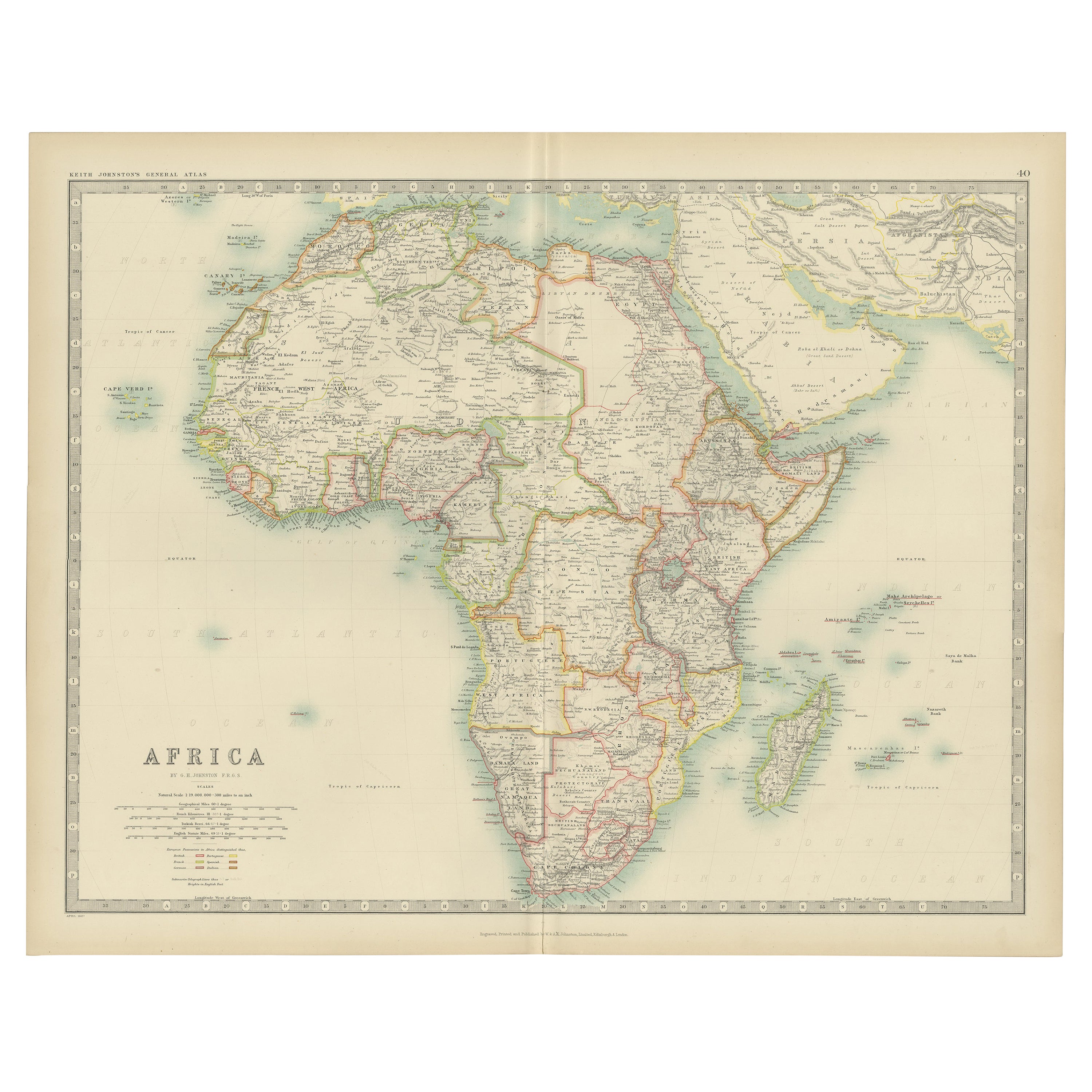
Antique Map of Africa by A
C, Black, 1870
$262.15
$327.6920% Off
£195.26
£244.0820% Off
€220
€27520% Off
CA$361
CA$451.2520% Off
A$392.94
A$491.1820% Off
CHF 208.21
CHF 260.2620% Off
MX$4,725.73
MX$5,907.1620% Off
NOK 2,647.29
NOK 3,309.1120% Off
SEK 2,425.95
SEK 3,032.4320% Off
DKK 1,676.25
DKK 2,095.3220% Off
About the Item
Antique map titled 'Africa'. Original antique map of Africa. This map originates from ‘Black's General Atlas of The World’. Published by A
C. Black, 1870.
- Dimensions:Height: 23.63 in (60 cm)Width: 17.52 in (44.5 cm)Depth: 0.02 in (0.5 mm)
- Materials and Techniques:
- Period:
- Date of Manufacture:1870
- Condition:Wear consistent with age and use. General age-related toning. some foxing, tears along the folding line, Please study image carefully.
- Seller Location:Langweer, NL
- Reference Number:Seller: BG-12784-361stDibs: LU3054325447102
About the Seller
5.0
Recognized Seller
These prestigious sellers are industry leaders and represent the highest echelon for item quality and design.
Platinum Seller
Premium sellers with a 4.7+ rating and 24-hour response times
Established in 2009
1stDibs seller since 2017
2,824 sales on 1stDibs
Typical response time: 1 hour
- ShippingRetrieving quote...Shipping from: Langweer, Netherlands
- Return Policy
More From This Seller
View AllAntique Map of Africa with European Language Borders, 1852
Located in Langweer, NL
Antique map titled 'Afrika'. Map of Africa. This map originates from 'School-Atlas van alle deelen der Aarde' by Otto Petri.
Artists and Engravers: Published by A. Baedeker (Otto...
Category
Antique 19th Century Maps
Materials
Paper

Antique Map of Africa by Johnston (1909)
Located in Langweer, NL
Antique map titled 'Africa'. Original antique map of Africa. This map originates from the ‘Royal Atlas of Modern Geography’. Published by W. & A....
Category
Early 20th Century Maps
Materials
Paper

$238 Sale Price
20% Off
Antique Map of Africa by Pierre M. Lapie, Mid-19th Century Print
Located in Langweer, NL
Antique map titled 'Carte d'Afrique'. Map of Africa. This map originates from 'Atlas universel de géographie ancienne et moderne (..)' by Pierre M. Lapie...
Category
Antique Mid-19th Century French Maps
Materials
Paper

$500 Sale Price
30% Off
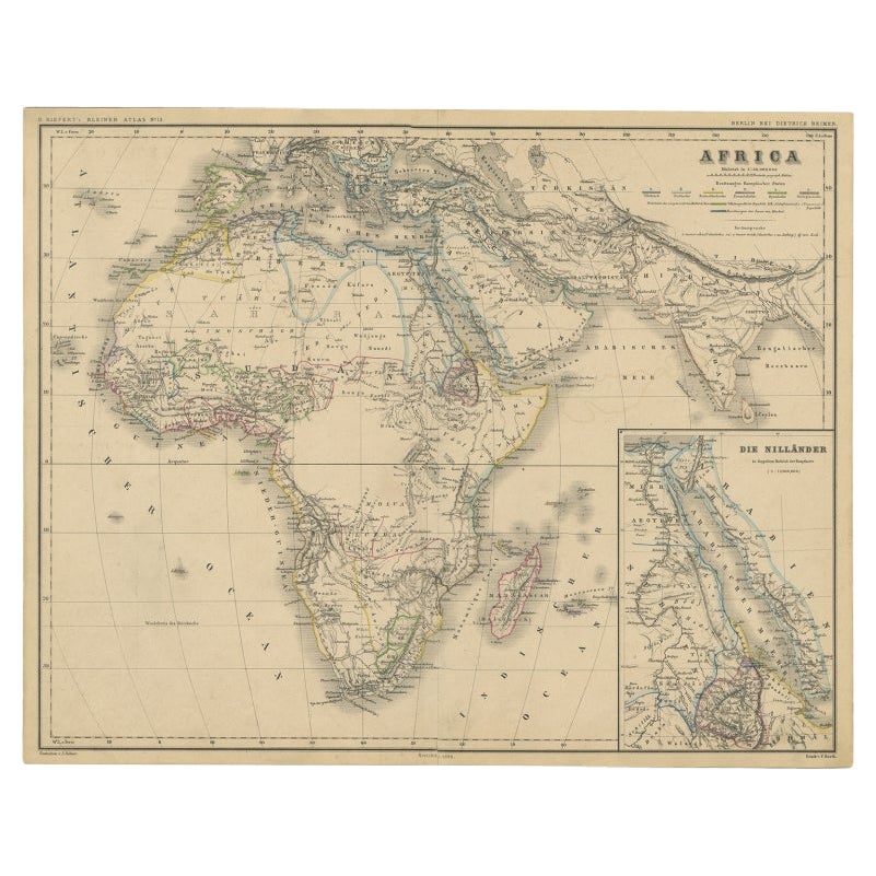
Antique Map of the African Continent with Inset of the Nile River Delta, c.1870
Located in Langweer, NL
Antique map titled 'Africa'. Old map of the African continent. This map originates from 'H. Kiepert's Kleiner Atlas der Neueren Geographie für Schule...
Category
Antique 19th Century Maps
Materials
Paper

$305 Sale Price
20% Off
Antique Map of Africa by Dufour, circa 1834
Located in Langweer, NL
Antique map titled 'Afrique'. Uncommon map of Africa. Published by or after A.H. Dufour, circa 1834. Source unknown, to be determined.
Category
Antique Mid-19th Century Maps
Materials
Paper

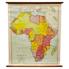
Antique Map of Africa, Highlighting Colonial Divisions, Geographic Features 1903
Located in Langweer, NL
Title: Antique Map of Africa, 1903, Highlighting Colonial Divisions and Geographic Features
Description: This antique map, titled "Africa," was engraved and published in 1903 by W. ...
Category
Early 20th Century Maps
Materials
Paper

You May Also Like
Original Antique Map of Africa by Dower, circa 1835
Located in St Annes, Lancashire
Nice map of Africa
Drawn and engraved by J.Dower
Published by Orr & Smith. C.1835
Unframed.
Free shipping
Category
Antique 1830s English Maps
Materials
Paper

Large Original Antique Map of Africa. C.1900
Located in St Annes, Lancashire
Fabulous map of Africa
Original color.
Engraved and printed by the George F. Cram Company, Indianapolis.
Published, C.1900.
Unframed.
Free shipping.
Category
Antique 1890s American Maps
Materials
Paper

"Africa Vetus": a 17th Century Hand-Colored Map by Sanson
By Nicolas Sanson
Located in Alamo, CA
This original hand-colored copperplate engraved map of Africa entitled "Africa Vetus, Nicolai Sanson Christianiss Galliar Regis Geographi" was originally created by Nicholas Sanson d...
Category
Antique Late 17th Century French Maps
Materials
Paper

Africa. Central. Century Atlas antique vintage map
Located in Melbourne, Victoria
'The Century Atlas. Africa. Central'
Inset map of 'Madagascar'.
Original antique map, 1903.
Central fold as issued. Map name and number printed on the reverse corners.
Sheet 29.5cm...
Category
Early 20th Century Victorian More Prints
Materials
Lithograph

Large University Chart “Africa Physical ” by Bacon
Located in Godshill, Isle of Wight
Large University chart “Africa Physical ” by Bacon
W&A K Johnston’s charts of physical maps by G W Bacon,
This is a Physical map of Africa, it is lithograph set on Linen mounte...
Category
Early 20th Century Beaux Arts Maps
Materials
Linen
Africa. Southern Part. Century Atlas antique vintage map
Located in Melbourne, Victoria
'The Century Atlas. Africa. Southern Part'
Original antique map, 1903.
Inset maps of 'Cape Town', 'Johannesburg' and 'Ladysmith'.
Central fold as issued. Map name and number printe...
Category
Early 20th Century Victorian More Prints
Materials
Lithograph

More Ways To Browse
Antique Map Of Egypt
Map Of Austria
New Zealand Map
Antique Linen Map
19th Century World Map
Antique Ohio Maps
Antique Texas Furniture
Military Map
Antique Maps New Zealand
Birds Eye View Map
North Africa Map
West Africa Map
Antique Compass Map
Antique Maps California
Biblical Maps
Hungary Map
Maps Of Mediterranean
Treasure Map