Items Similar to Antique Map of Africa with European Language Borders, 1852


Want more images or videos?
Request additional images or videos from the seller
1 of 6
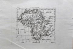
Antique Map of Africa with European Language Borders, 1852
$190.66
£142.01
€160
CA$262.55
A$285.78
CHF 151.42
MX$3,436.89
NOK 1,925.30
SEK 1,764.32
DKK 1,219.09
About the Item
Antique map titled 'Afrika'. Map of Africa. This map originates from 'School-Atlas van alle deelen der Aarde' by Otto Petri.
Artists and Engravers: Published by A. Baedeker (Otto Petri).
Condition: Good, general age-related toning. Minor wear, mainly in margins. Blank verso, please study image carefully.
Date: 1852
Overall size: 34.5 x 27 cm.
Image size: 26.5 x 21cm.
We sell original antique maps to collectors, historians, educators and interior decorators all over the world. Our collection includes a wide range of authentic antique maps from the 16th to the 20th centuries. Buying and collecting antique maps is a tradition that goes back hundreds of years. Antique maps have proved a richly rewarding investment over the past decade, thanks to a growing appreciation of their unique historical appeal. Today the decorative qualities of antique maps are widely recognized by interior designers who appreciate their beauty and design flexibility. Depending on the individual map, presentation, and context, a rare or antique map can be modern, traditional, abstract, figurative, serious or whimsical. We offer a wide range of authentic antique maps for any budget.
- Dimensions:Height: 10.63 in (27 cm)Width: 13.59 in (34.5 cm)Depth: 0 in (0.01 mm)
- Materials and Techniques:
- Period:
- Date of Manufacture:1852
- Condition:
- Seller Location:Langweer, NL
- Reference Number:Seller: BG-05294-171stDibs: LU3054326254542
About the Seller
5.0
Recognized Seller
These prestigious sellers are industry leaders and represent the highest echelon for item quality and design.
Platinum Seller
Premium sellers with a 4.7+ rating and 24-hour response times
Established in 2009
1stDibs seller since 2017
2,824 sales on 1stDibs
Typical response time: 1 hour
- ShippingRetrieving quote...Shipping from: Langweer, Netherlands
- Return Policy
More From This Seller
View AllAntique Map of Africa by Dufour, circa 1834
Located in Langweer, NL
Antique map titled 'Afrique'. Uncommon map of Africa. Published by or after A.H. Dufour, circa 1834. Source unknown, to be determined.
Category
Antique Mid-19th Century Maps
Materials
Paper

Antique Map of Africa by A
C, Black, 1870
Located in Langweer, NL
Antique map titled 'Africa'. Original antique map of Africa. This map originates from ‘Black's General Atlas of The World’. Published by A & C. Black, 1870.
Category
Antique Late 19th Century Maps
Materials
Paper

$262 Sale Price
20% Off
Antique Map of Africa by Pierre M. Lapie, Mid-19th Century Print
Located in Langweer, NL
Antique map titled 'Carte d'Afrique'. Map of Africa. This map originates from 'Atlas universel de géographie ancienne et moderne (..)' by Pierre M. Lapie...
Category
Antique Mid-19th Century French Maps
Materials
Paper

$500 Sale Price
30% Off
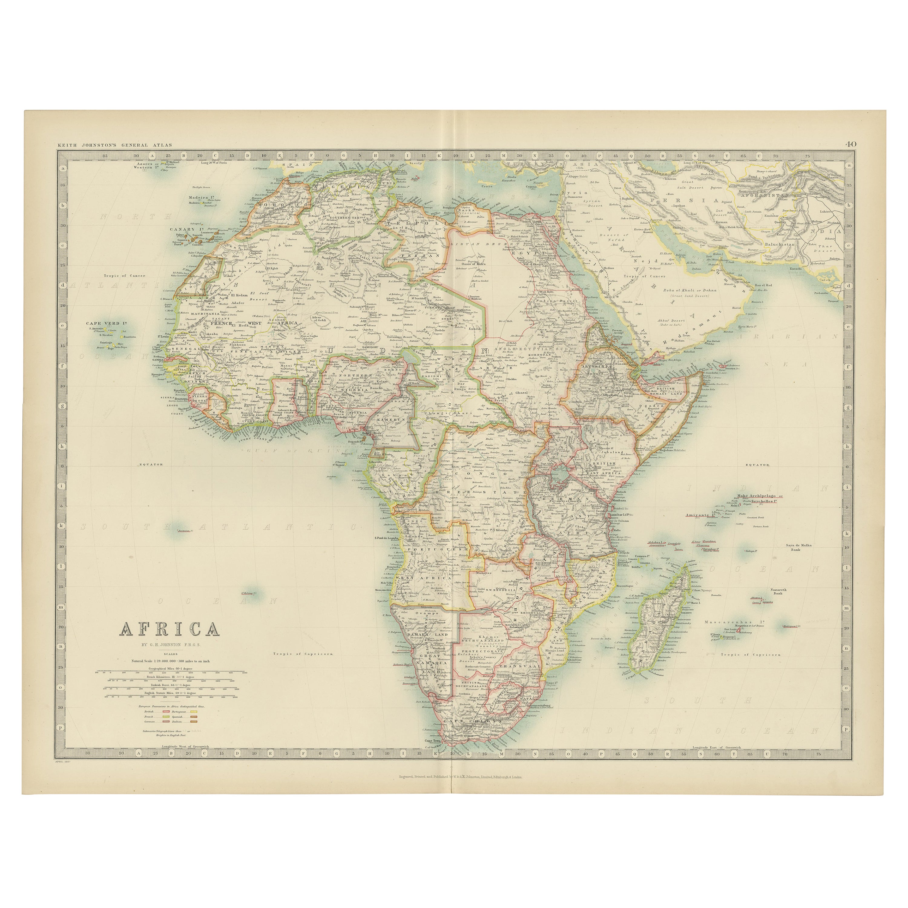
Antique Map of Africa by Johnston (1909)
Located in Langweer, NL
Antique map titled 'Africa'. Original antique map of Africa. This map originates from the ‘Royal Atlas of Modern Geography’. Published by W. & A....
Category
Early 20th Century Maps
Materials
Paper

$238 Sale Price
20% Off
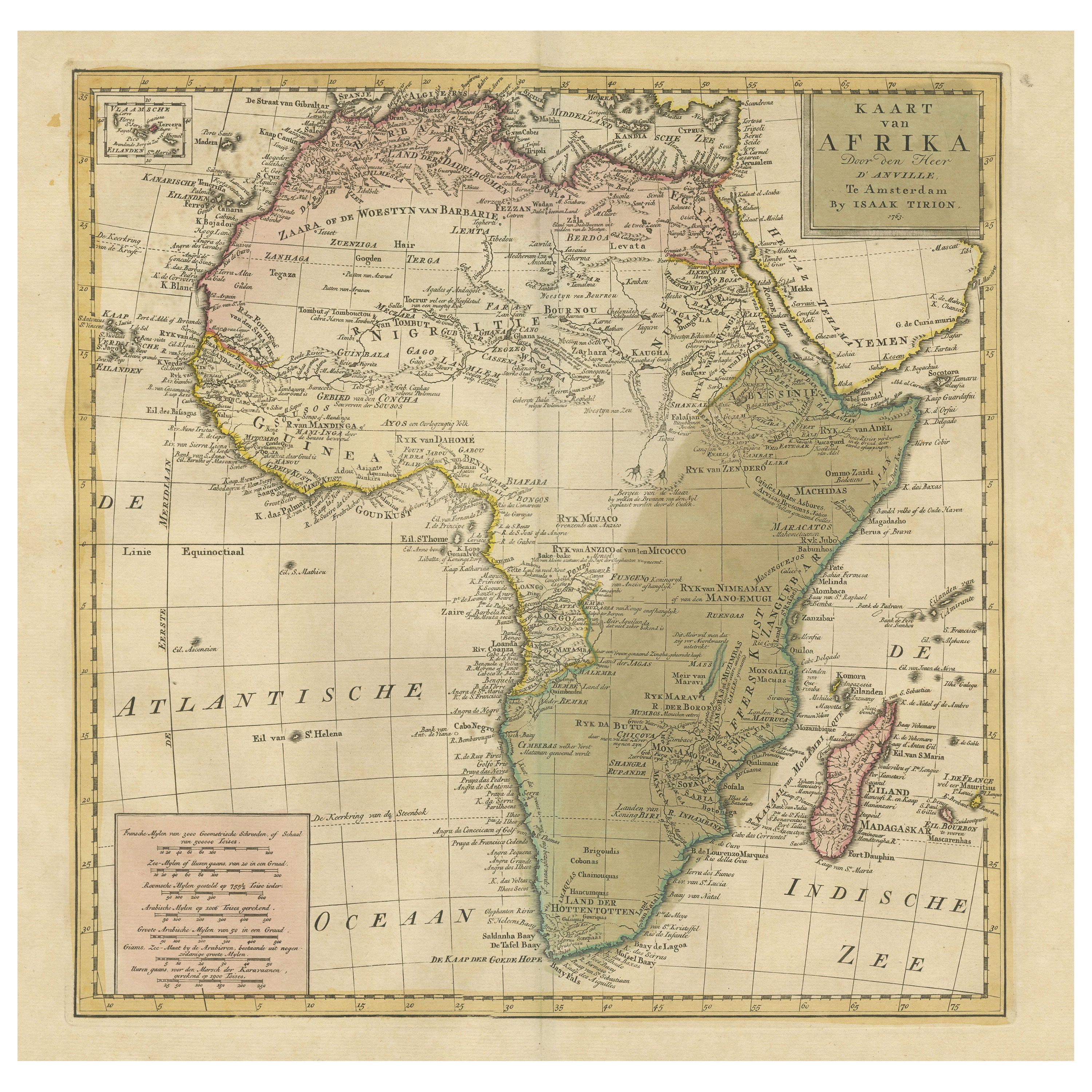
Antique Map of Africa with Original Hand Coloring
Located in Langweer, NL
Antique map titled 'Kaart van Afrika door den Heer d'Anville'. Detailed original old map of Africa, with very small inset map titled 'Vlaamsche Eilanden', which shows the Azores. Pub...
Category
Antique Mid-18th Century Maps
Materials
Paper
$743 Sale Price
20% Off
Antique Map of the African Continent with Inset of the Nile River Delta, c.1870
Located in Langweer, NL
Antique map titled 'Africa'. Old map of the African continent. This map originates from 'H. Kiepert's Kleiner Atlas der Neueren Geographie für Schule...
Category
Antique 19th Century Maps
Materials
Paper

$305 Sale Price
20% Off
You May Also Like
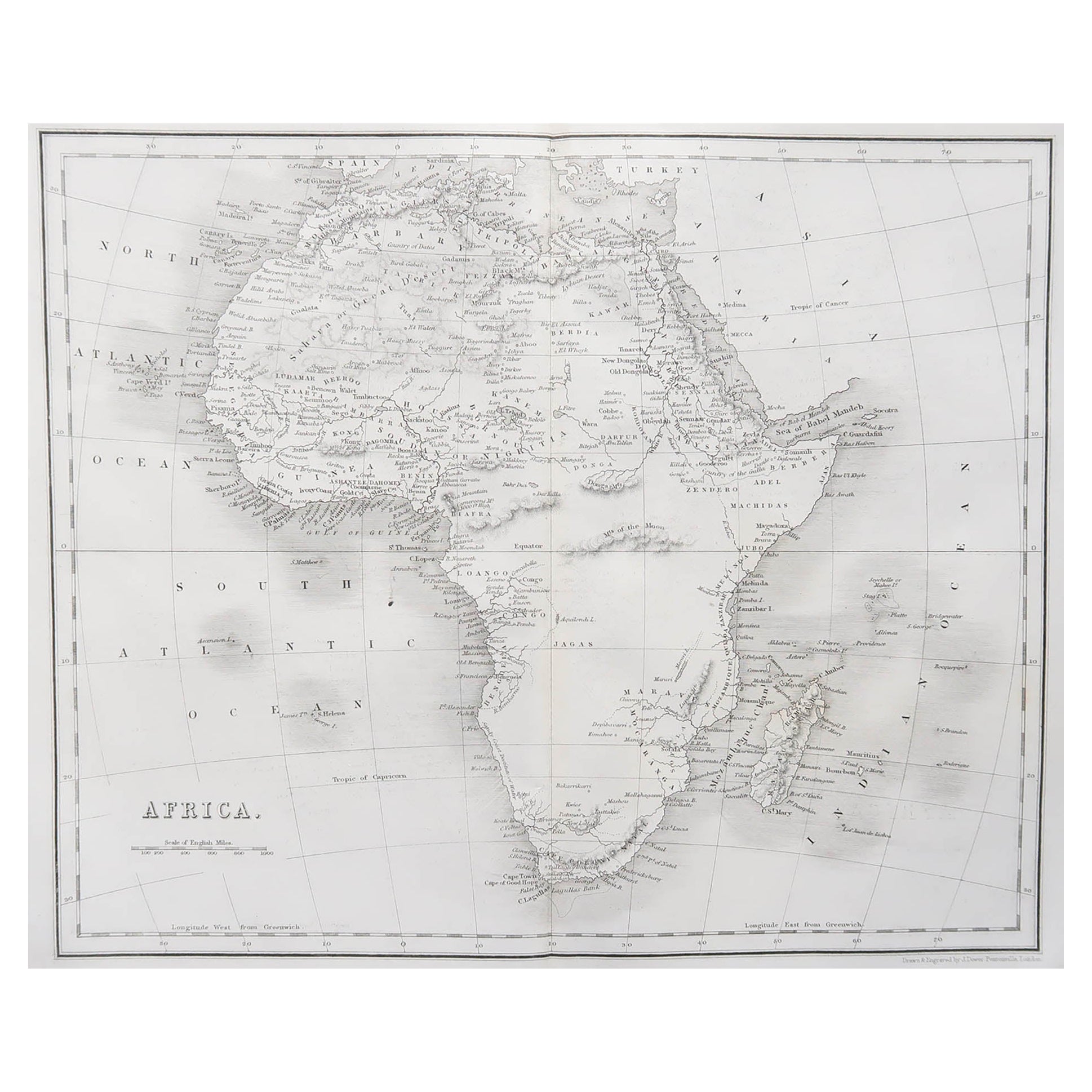
Original Antique Map of Africa by Dower, circa 1835
Located in St Annes, Lancashire
Nice map of Africa
Drawn and engraved by J.Dower
Published by Orr & Smith. C.1835
Unframed.
Free shipping
Category
Antique 1830s English Maps
Materials
Paper

Large Original Antique Map of Africa. C.1900
Located in St Annes, Lancashire
Fabulous map of Africa
Original color.
Engraved and printed by the George F. Cram Company, Indianapolis.
Published, C.1900.
Unframed.
Free shipping.
Category
Antique 1890s American Maps
Materials
Paper

"Africa Vetus": a 17th Century Hand-Colored Map by Sanson
By Nicolas Sanson
Located in Alamo, CA
This original hand-colored copperplate engraved map of Africa entitled "Africa Vetus, Nicolai Sanson Christianiss Galliar Regis Geographi" was originally created by Nicholas Sanson d...
Category
Antique Late 17th Century French Maps
Materials
Paper

Africa: A Large 17th Century Hand-Colored Map by Sanson and Jaillot
By Nicolas Sanson
Located in Alamo, CA
This large original hand-colored copperplate engraved map of Africa entitled "L'Afrique divisee suivant l'estendue de ses principales parties ou sont distingues les uns des autres, L...
Category
Antique 1690s French Maps
Materials
Paper

Ancient Map of Africa - Etching - 19th century
Located in Roma, IT
This Map of Africa is an etching realized in the 19th century.
The state of preservation of the artwork is good. At the top of the paper, the inscription “Longitudine del Meridiano ...
Category
19th Century More Prints
Materials
Etching
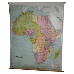
Map of Africa, archival. Printed in Edinburgh, Scotland, 1916. Free Delivery
Located in Madison, WI
Map of Africa from the geography classroom, 1916 edition. Printed in Edinburgh, Scotland. Mounted on pulldown wooden roller with wall mounting brackets....
Category
Early 20th Century Scottish Edwardian Maps
Materials
Wood, Paper
More Ways To Browse
Otto Petri
Antique Nautical Maps
Sri Lanka Map
Hand Painted Antique Map
Ottoman Map
Philippines Map
Roman Empire Map
Sebastian Munster
South African Antique
Antique Sri Lanka Map
Maps Balkans
Antique Map Of Jerusalem
Map Of Corsica
Solomons Temple
Antique Map Of Korea
Map Of Jerusalem
Prussia Map
Antique Maps Caribbean Islands