Items Similar to Antique Map of Africa with Ocean Currents and Other Details, C.1780


Video Loading
Want more images or videos?
Request additional images or videos from the seller
1 of 12
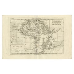
Antique Map of Africa with Ocean Currents and Other Details, C.1780
$284.77
£212.60
€240
CA$395.64
A$425.56
CHF 227.43
MX$5,016.18
NOK 2,867.41
SEK 2,621.35
DKK 1,829.07
About the Item
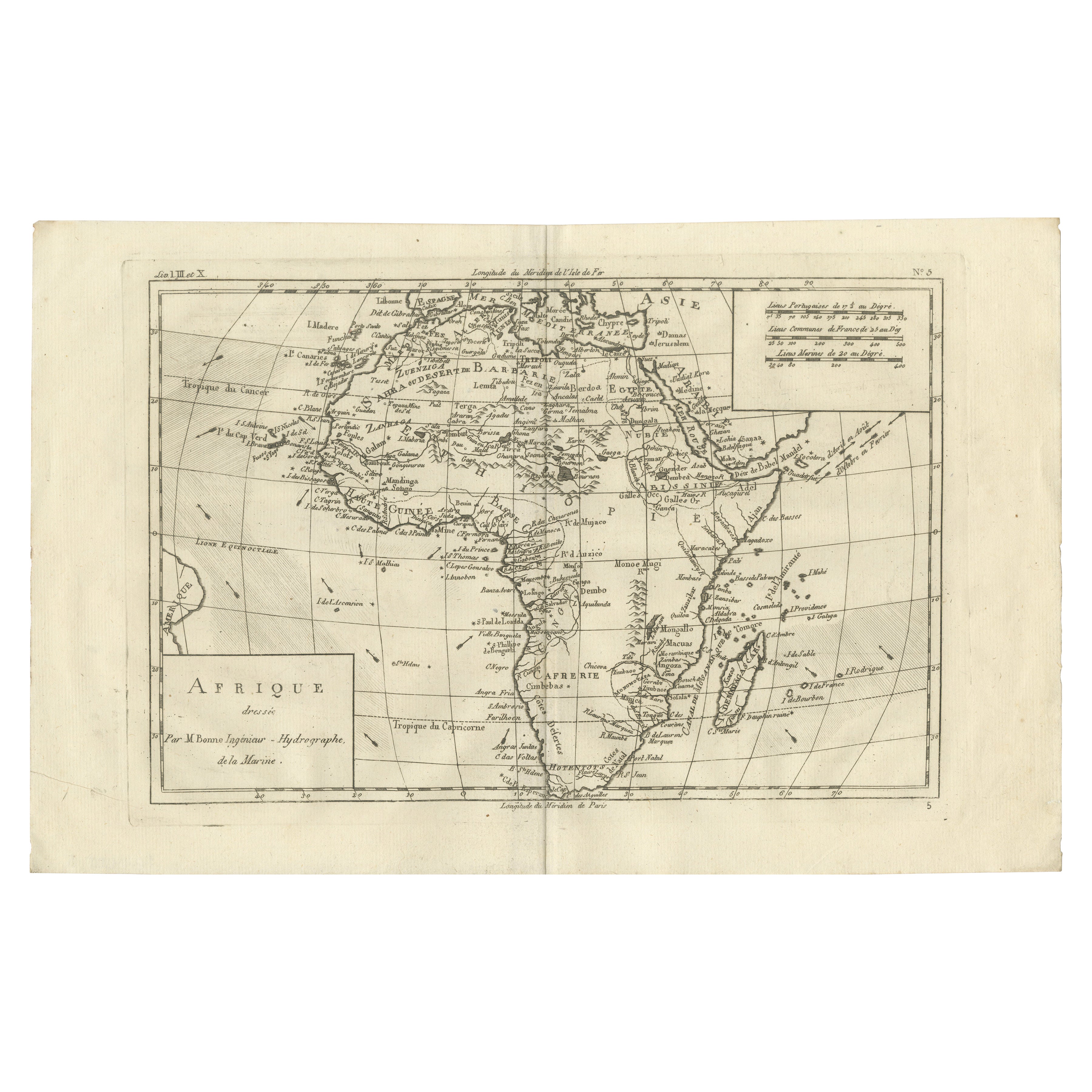
Antique map titled 'Afrique.' Detailed map of Africa, showing towns, rivers, some topographical features, ocean currents, ports and political boundaries. Source unknown, to be determined.
Artists and Engravers: Rigobert Bonne (1727-1795 ) was one of the most important cartographers of the late 18th century. In 1773 he succeeded Jacques Bellin as Royal Cartographer to France in the office of the Hydrographer at the Depôt de la Marine. Working in his official capacity Bonne compiled some of the most detailed and accurate maps of the period. Bonne's work represents an important step in the evolution of the cartographic ideology away from the decorative work of the 17th and early 18th century towards a more detail oriented and practical aesthetic. With regard to the rendering of terrain Bonne maps bear many stylistic similarities to those of his predecessor, Bellin. However, Bonne maps generally abandon such common 18th century decorative features such as hand coloring, elaborate decorative cartouches, and compass roses. While mostly focusing on coastal regions, the work of Bonne is highly regarded for its detail, historical importance, and overall aesthetic appeal.
Condition: Good, given age. Slight discolouriation near middle fold. Arabia with outline hand colouring. Right edge with tiny tear. Original middle fold as issued. General age-related toning and/or occasional minor defects from handling. Please study image carefully.
Date: c.1780
Overall size: 38.5 x 26 cm.
Image size: 31.8 x 22 cm.
We sell original antique maps to collectors, historians, educators and interior decorators all over the world. Our collection includes a wide range of authentic antique maps from the 16th to the 20th centuries. Buying and collecting antique maps is a tradition that goes back hundreds of years. Antique maps have proved a richly rewarding investment over the past decade, thanks to a growing appreciation of their unique historical appeal. Today the decorative qualities of antique maps are widely recognized by interior designers who appreciate their beauty and design flexibility. Depending on the individual map, presentation, and context, a rare or antique map can be modern, traditional, abstract, figurative, serious or whimsical. We offer a wide range of authentic antique maps for any budget.
- Dimensions:Height: 10.24 in (26 cm)Width: 15.16 in (38.5 cm)Depth: 0 in (0.01 mm)
- Materials and Techniques:Paper,Engraved
- Place of Origin:
- Period:
- Date of Manufacture:circa 1780
- Condition:Condition: Good, given age. Slight discolouriation near middle fold. Arabia with outline hand colouring. Right edge with tiny tear. Original middle fold as issued. General age-related toning and/or occasional minor defects from handling.
- Seller Location:Langweer, NL
- Reference Number:Seller: PCT-620331stDibs: LU3054326254532
About the Seller
5.0
Recognized Seller
These prestigious sellers are industry leaders and represent the highest echelon for item quality and design.
Platinum Seller
Premium sellers with a 4.7+ rating and 24-hour response times
Established in 2009
1stDibs seller since 2017
2,836 sales on 1stDibs
Typical response time: 1 hour
- ShippingRetrieving quote...Shipping from: Langweer, Netherlands
- Return Policy
More From This Seller
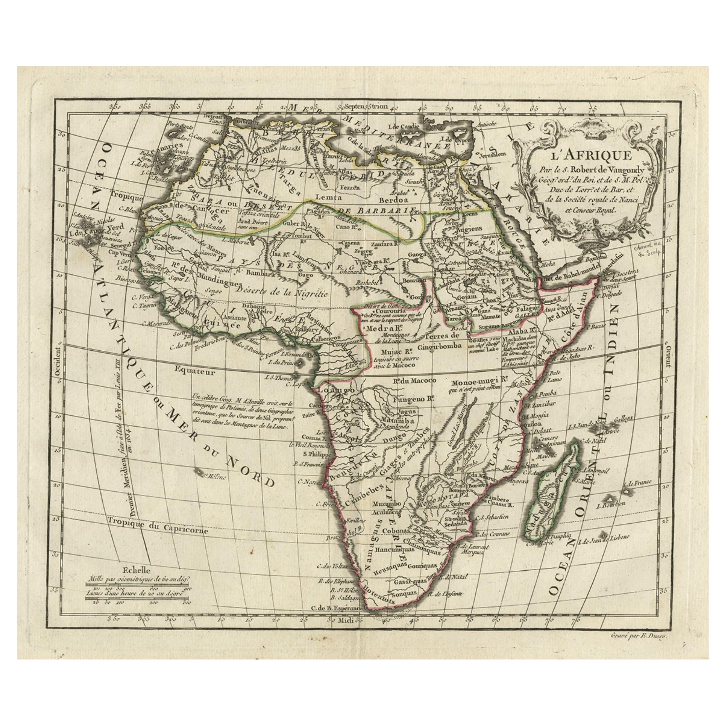
View AllAntique Map of Africa with French Cartouche and Scale, c.1780
Located in Langweer, NL
Antique map titled 'L'Afrique'. Original antique map of Africa. With beautiful title cartouche and scale. Source unknown, to be determined.
Artists and Engravers: Gilles Robert de...
Category
Antique 18th Century Maps
Materials
Paper
$332 Sale Price
20% Off
Antique Map of Africa by Keizer
de Lat, 1788
Located in Langweer, NL
Antique map titled 'Kaartje van Africa (..)'. Uncommon original antique map of Africa. This map originates from 'Nieuwe Natuur- Geschied- en Handelkundige Zak- en Reisatlas' by Gerri...
Category
Antique Late 18th Century Maps
Materials
Paper

$379 Sale Price
20% Off
Antique Map of Africa by Homann Heirs,
1804
Located in Langweer, NL
Antique map titled 'Charte von Africa'. Large, original antique map of Africa by Franz Ludwig Güssefeld. Published by Homann Heirs, 1804.
Category
Antique Early 19th Century Maps
Materials
Paper

$1,423 Sale Price
20% Off
Antique Map of Africa by Bordiga Fratelli
circa 1818
Located in Langweer, NL
Antique map titled 'Carta dell Africa'. Large and quite scarce Italian map of Africa, reflecting the then-current knowledge of the continent's geography, with large areas left comple...
Category
Antique Early 19th Century Maps
Materials
Paper

$1,708 Sale Price
20% Off
Africa Map by Rigobert Bonne – Pre-Colonial Geography c.1780
Located in Langweer, NL
Africa Map by Rigobert Bonne – Pre-Colonial Geography c.1780
DESCRIPTION
This map of Africa captures European geographic knowledge prior to large-scale colonial penetration. Engrave...
Category
Antique Late 18th Century French Maps
Materials
Paper
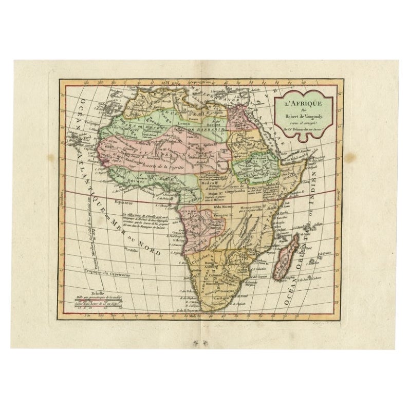
Antique Map of Africa by Delamarche, 1806
Located in Langweer, NL
Antique map titled 'L'Afrique'.
Decorative map of Africa by Robert de Vaugondy, revised and published by Delamarche. Source unknown, to be determined.
Artists and Engravers: Charl...
Category
Antique 19th Century Maps
Materials
Paper

$256 Sale Price
20% Off
You May Also Like
Original Antique Map of Africa by Dower, circa 1835
Located in St Annes, Lancashire
Nice map of Africa
Drawn and engraved by J.Dower
Published by Orr & Smith. C.1835
Unframed.
Free shipping
Category
Antique 1830s English Maps
Materials
Paper

"Africa Vetus": a 17th Century Hand-Colored Map by Sanson
By Nicolas Sanson
Located in Alamo, CA
This original hand-colored copperplate engraved map of Africa entitled "Africa Vetus, Nicolai Sanson Christianiss Galliar Regis Geographi" was originally created by Nicholas Sanson d...
Category
Antique Late 17th Century French Maps
Materials
Paper

Africa: A Large 17th Century Hand-Colored Map by Sanson and Jaillot
By Nicolas Sanson
Located in Alamo, CA
This large original hand-colored copperplate engraved map of Africa entitled "L'Afrique divisee suivant l'estendue de ses principales parties ou sont distingues les uns des autres, L...
Category
Antique 1690s French Maps
Materials
Paper

Map of Africa - Original Etching by C. Brue - 1820
Located in Roma, IT
Map of Africa is an original etching realized by C.Brue in 1820.
The print comes from the Series "Atlas Universal" PL. 31.
The state of preservation of the artwork is good except f...
Category
1820s Modern Figurative Prints
Materials
Etching

Africa: A Large 17th Century Hand-colored Map By Sanson and Jaillot
By Nicholas Sanson d
Abbeville
Located in Alamo, CA
This large original hand-colored copperplate engraved map of Africa entitled "L'Afrique divisee suivant l'estendue de ses principales parties ou sont distingues les uns des autres, L...
Category
1690s Landscape Prints
Materials
Engraving

"Africa Vetus": A 17th Century Hand-colored Map By Sanson
By Nicholas Sanson d
Abbeville
Located in Alamo, CA
This original hand-colored copperplate engraved map of Africa entitled "Africa Vetus, Nicolai Sanson Christianiss Galliar Regis Geographi" was originally created by Nicholas Sanson d...
Category
1690s Landscape Prints
Materials
Engraving

More Ways To Browse
Antique Nautical Maps
Sri Lanka Map
Hand Painted Antique Map
Ottoman Map
Philippines Map
Roman Empire Map
Sebastian Munster
South African Antique
Antique Sri Lanka Map
Maps Balkans
Antique Map Of Jerusalem
Map Of Corsica
Solomons Temple
Antique Map Of Korea
Map Of Jerusalem
Prussia Map
Antique Maps Caribbean Islands
Antique Wine Maps