Items Similar to Antique Map of Asia by Alexandre Blondeau, Paper Print, Circa 1800

Want more images or videos?
Request additional images or videos from the seller
1 of 9
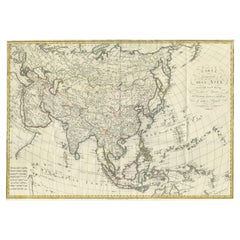
Antique Map of Asia by Alexandre Blondeau, Paper Print, Circa 1800
$308.50
£230.31
€260
CA$428.61
A$461.03
CHF 246.39
MX$5,434.20
NOK 3,106.36
SEK 2,839.80
DKK 1,981.49
About the Item
Asia Map, from Mediterranean to Japan – Antique Map by Alexandre Blondeau, c. 1800
This fine circa 1800 map of Asia presents the entire continent in a single, coherent composition, extending from the eastern Mediterranean and parts of northeastern Africa across the Middle East, India, China, and Southeast Asia to the Pacific, reaching as far north as the Bering Sea and south to Java and New Guinea. The map offers a compelling snapshot of European geographical knowledge at the turn of the 19th century, combining relatively well-established regions with areas that remained speculative and imperfectly understood.
The map was produced by Alexandre Blondeau, a French cartographer active around the late 18th and early 19th centuries. Blondeau’s work reflects the transitional phase of cartography during this period, when scientific measurement and exploration were steadily improving accuracy, yet vast regions—particularly in northern and eastern Asia—were still mapped using incomplete reports, travelers’ accounts, and earlier sources.
One of the most interesting features of this map is its depiction of the extreme northeast of Asia. Japan, Hokkaido, Sakhalin Island, Kamchatka, and Korea appear in noticeably distorted and misshapen forms, revealing the limited and often conflicting information available to European mapmakers at the time. Sakhalin, in particular, is ambiguously rendered, reflecting uncertainty over whether it was an island or connected to the mainland. These elements make the map especially appealing to collectors interested in the evolution of geographic knowledge and the history of exploration.
The map is finely engraved with clear political and regional boundaries, enhanced by original outline hand coloring. Major seas, rivers, and mountain ranges are carefully delineated, while the use of a graticule underscores the scientific ambitions of the period. The overall aesthetic is balanced and elegant, with generous margins that frame the image and make it well suited for both scholarly appreciation and decorative display.
Condition:
Good condition. Light, even age-related toning to the paper. Minor scattered spotting and light handling marks, mostly confined to the margins. The engraved image remains clear and well-defined, with visible plate marks.
Framing tips:
This map works beautifully in a classic dark walnut or ebonized frame with a soft ivory or light beige mat to emphasize its historical character. For a more contemporary interior, a simple black frame with a wide neutral mat will give the map a clean, gallery-style presentation while allowing the detail and coloring to stand out.
Technique: Engraving with original outline hand color
Maker: Alexandre Blondeau, France, circa 1800
- Dimensions:Height: 9.45 in (24 cm)Width: 14.18 in (36 cm)Depth: 0.02 in (0.5 mm)
- Materials and Techniques:Paper,Engraved
- Period:
- Date of Manufacture:circa 1800
- Condition:Good condition. Light, even age-related toning to the paper. Minor scattered spotting and light handling marks, mostly confined to the margins. The engraved image remains clear and well-defined, with visible plate marks.
- Seller Location:Langweer, NL
- Reference Number:Seller: BG-094611stDibs: LU3054310028551
About the Seller
5.0
Recognized Seller
These prestigious sellers are industry leaders and represent the highest echelon for item quality and design.
Platinum Seller
Premium sellers with a 4.7+ rating and 24-hour response times
Established in 2009
1stDibs seller since 2017
2,838 sales on 1stDibs
Typical response time: 1 hour
- ShippingRetrieving quote...Shipping from: Langweer, Netherlands
- Return Policy
More From This Seller
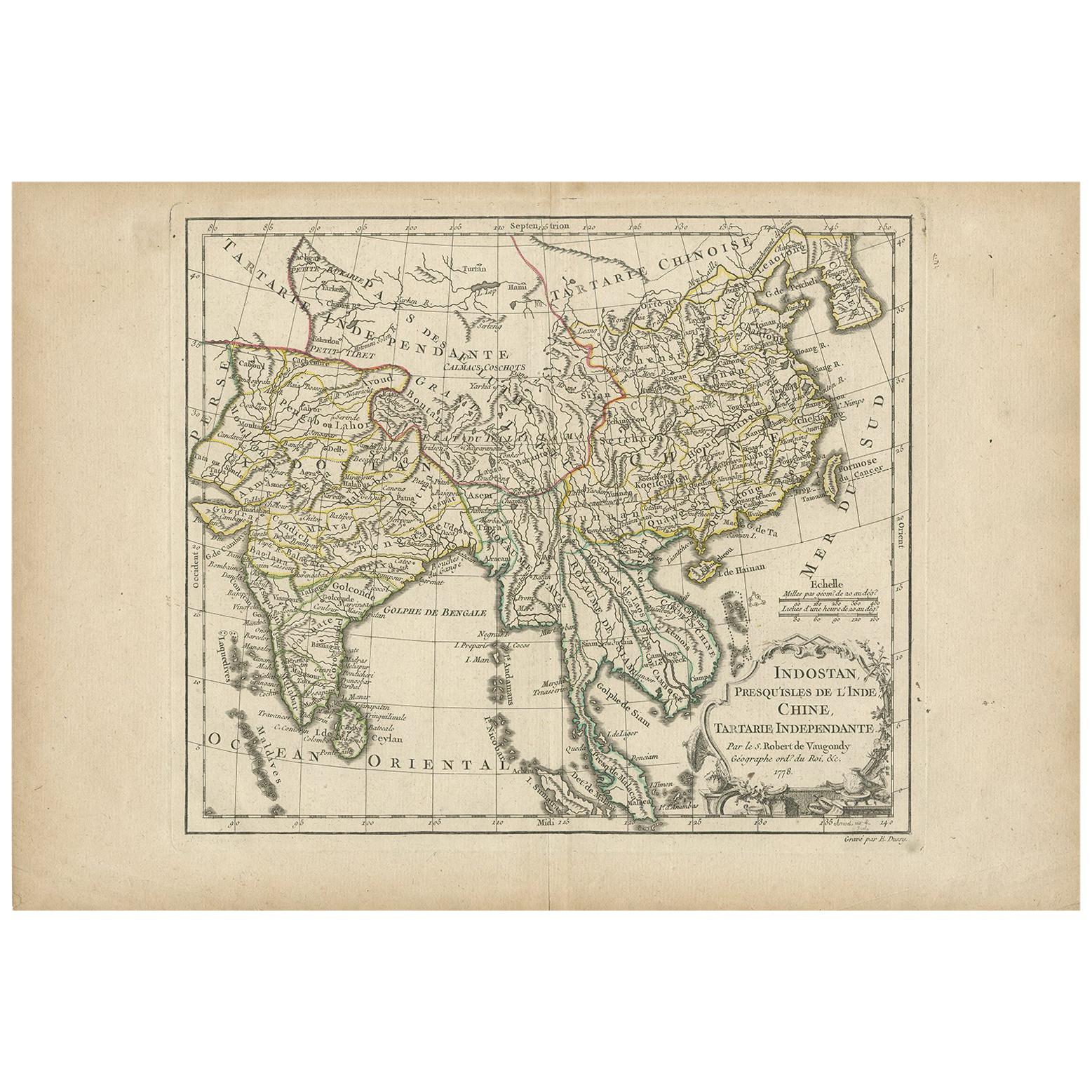
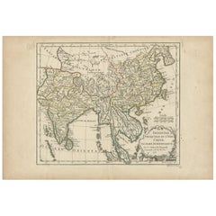
View AllAntique Map of Asia by Dussy, 1778
Located in Langweer, NL
Antique map of Asia titled 'Indostan presqu'isles de l'Inde, Chine, Tartarie Independante'. Depicting South-East Asia including Hindustan, India an...
Category
Antique Late 18th Century French Maps
Materials
Paper
Antique Map of Asia by Guthrie, 1787
Located in Langweer, NL
Antique map titled 'Asia from the best Authorities'. Old map of the Asian continent. This map originates from 'A New Geographical, Historical and Commercial Grammar; and Present State of the several Kingdoms of the World' 10th ed. by W. Guthrie.
Artists and Engravers: Published by Ch.Dilly; GGJ...
Category
Antique 18th Century Maps
Materials
Paper

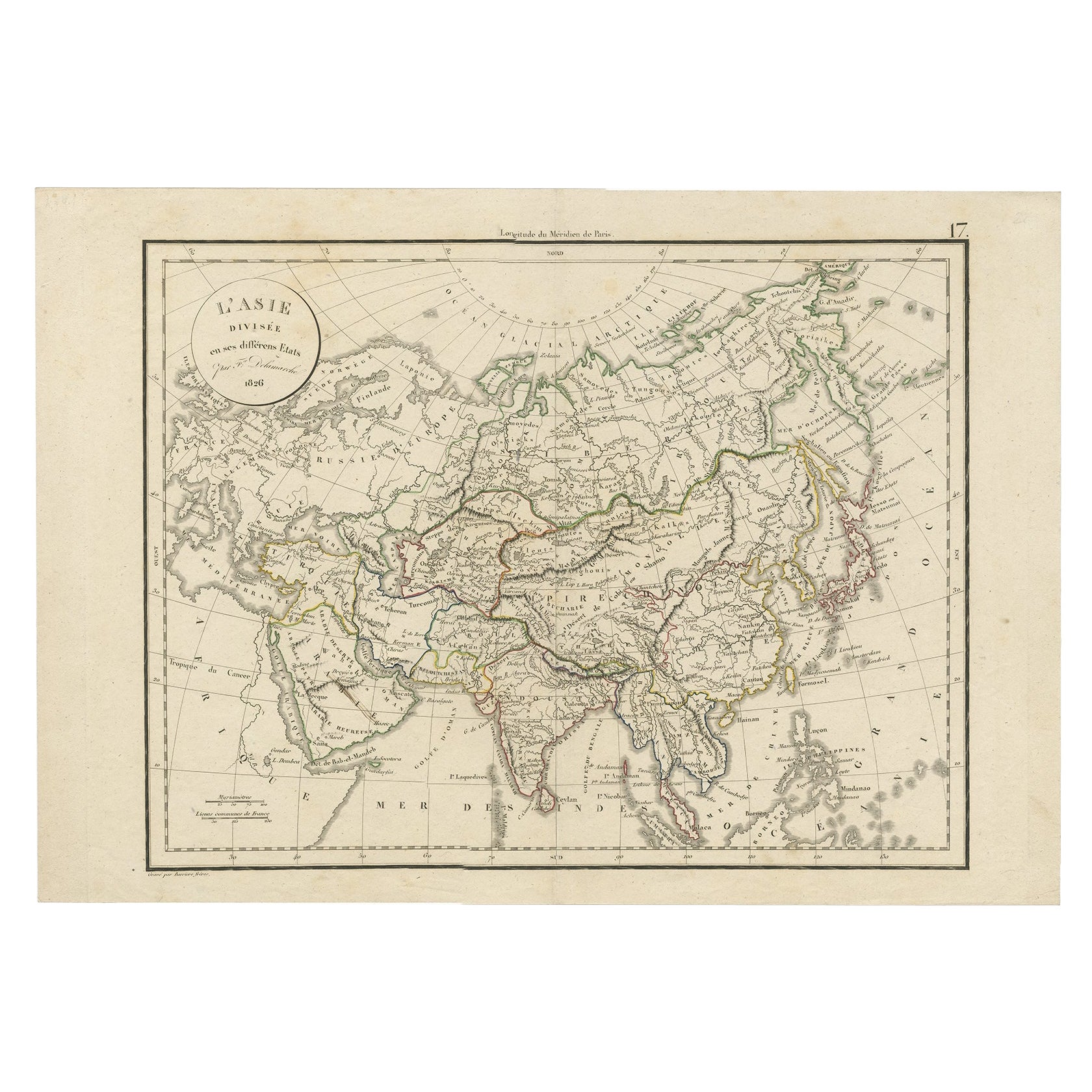
Antique Map of Asia by Delamarche, 1826
Located in Langweer, NL
Vaugondy's map plates and copyrights and later addes many plates from other sources as well. Charles Delamarche eventually passed control of the firm to his son Felix Delamarche (18t...
Category
Antique 19th Century Maps
Materials
Paper
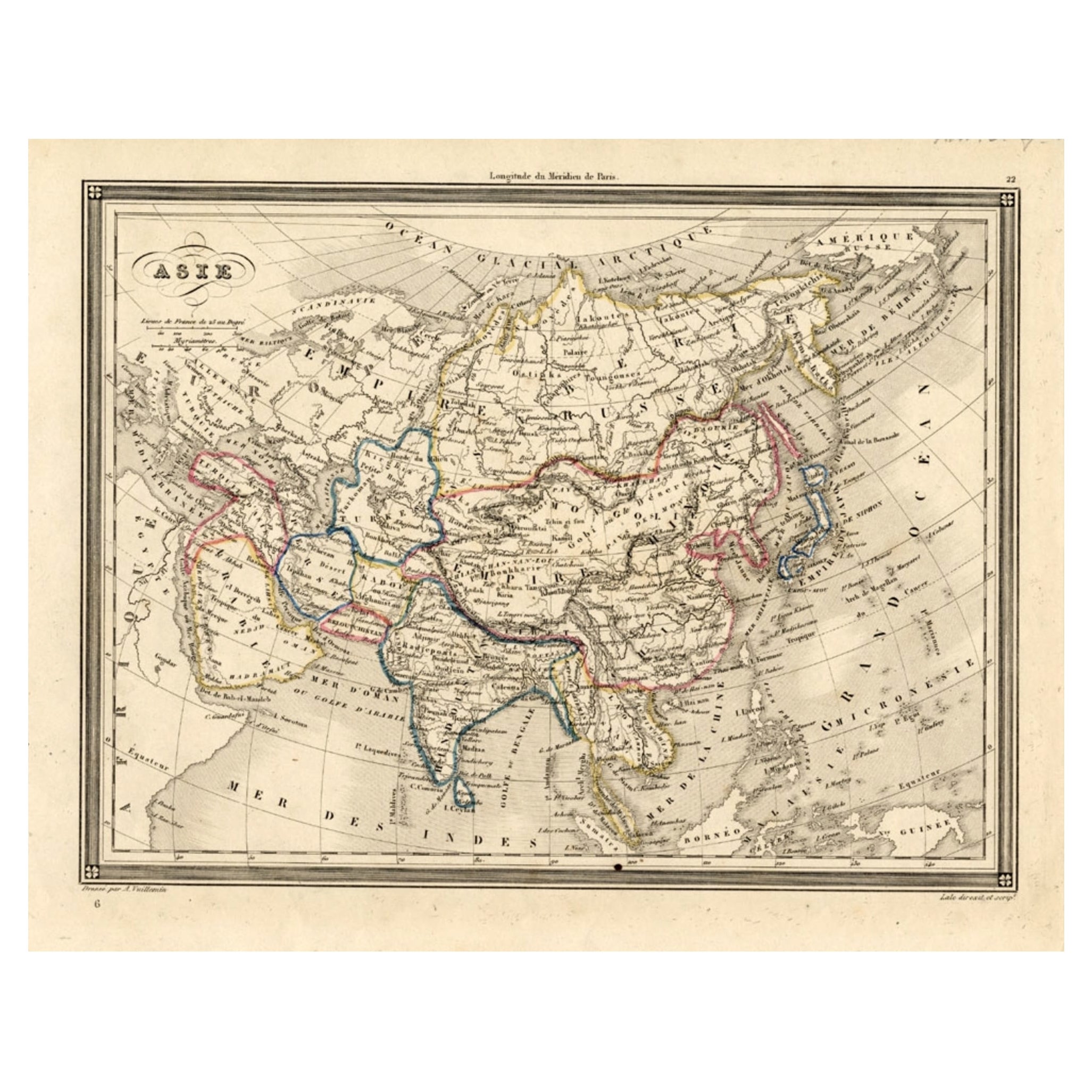
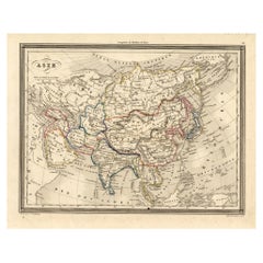
Antique Map of Asia, 1846
Located in Langweer, NL
Antique map titled 'Asie'. Original antique map of Asia. Source unknown, to be determined.
Artists and Engravers: Alexandre Vuillemin (1812-188...
Category
Antique 19th Century Maps
Materials
Paper
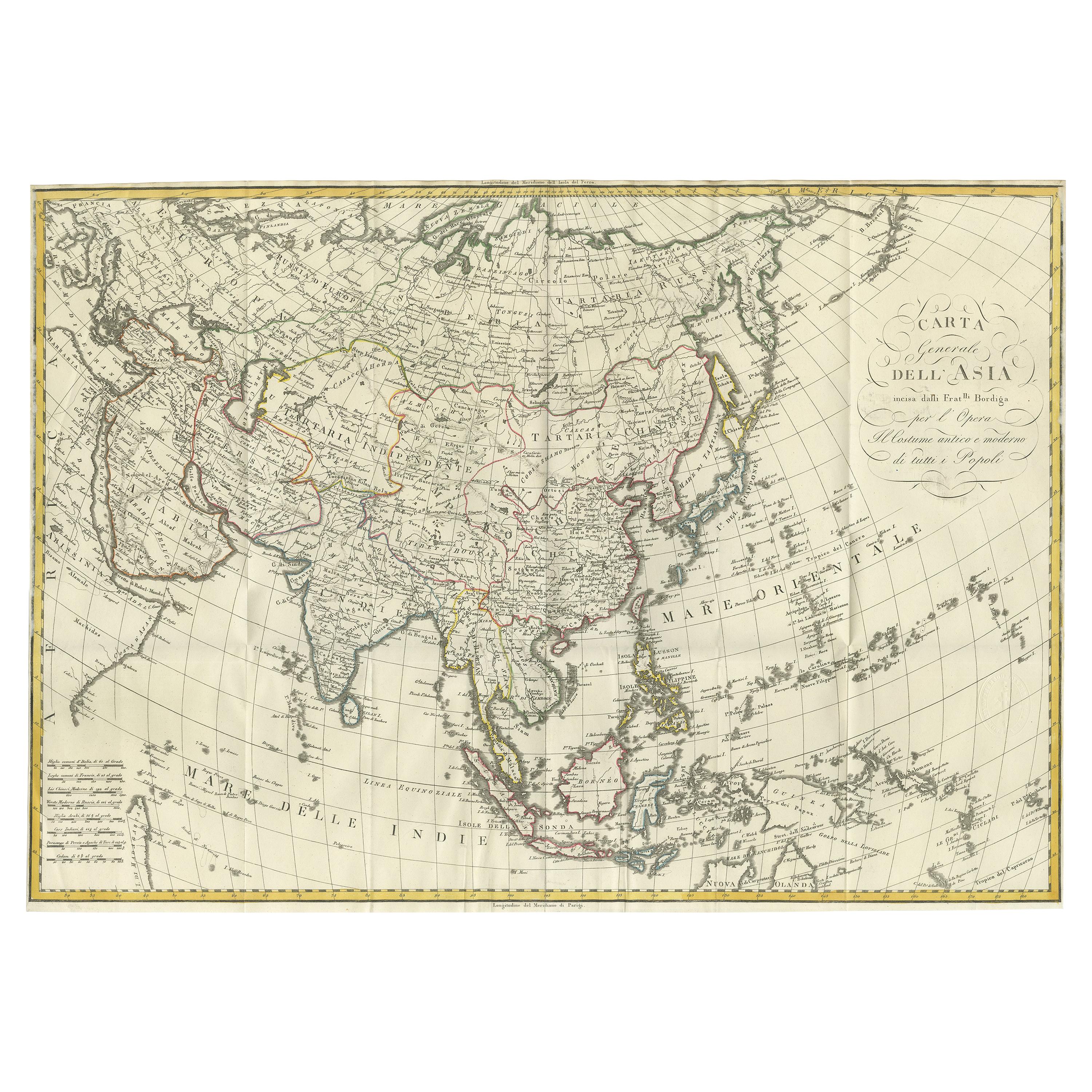
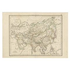
Antique Map of Asia by Ferrario
1815
Located in Langweer, NL
Antique map titled 'Carta generale dell' Asia (..)'. Original antique map of Asia. This map originates from ' Le Costume Ancien et Moderne' by Jule...
Category
Antique Early 19th Century Maps
Materials
Paper
$901 Sale Price
20% Off
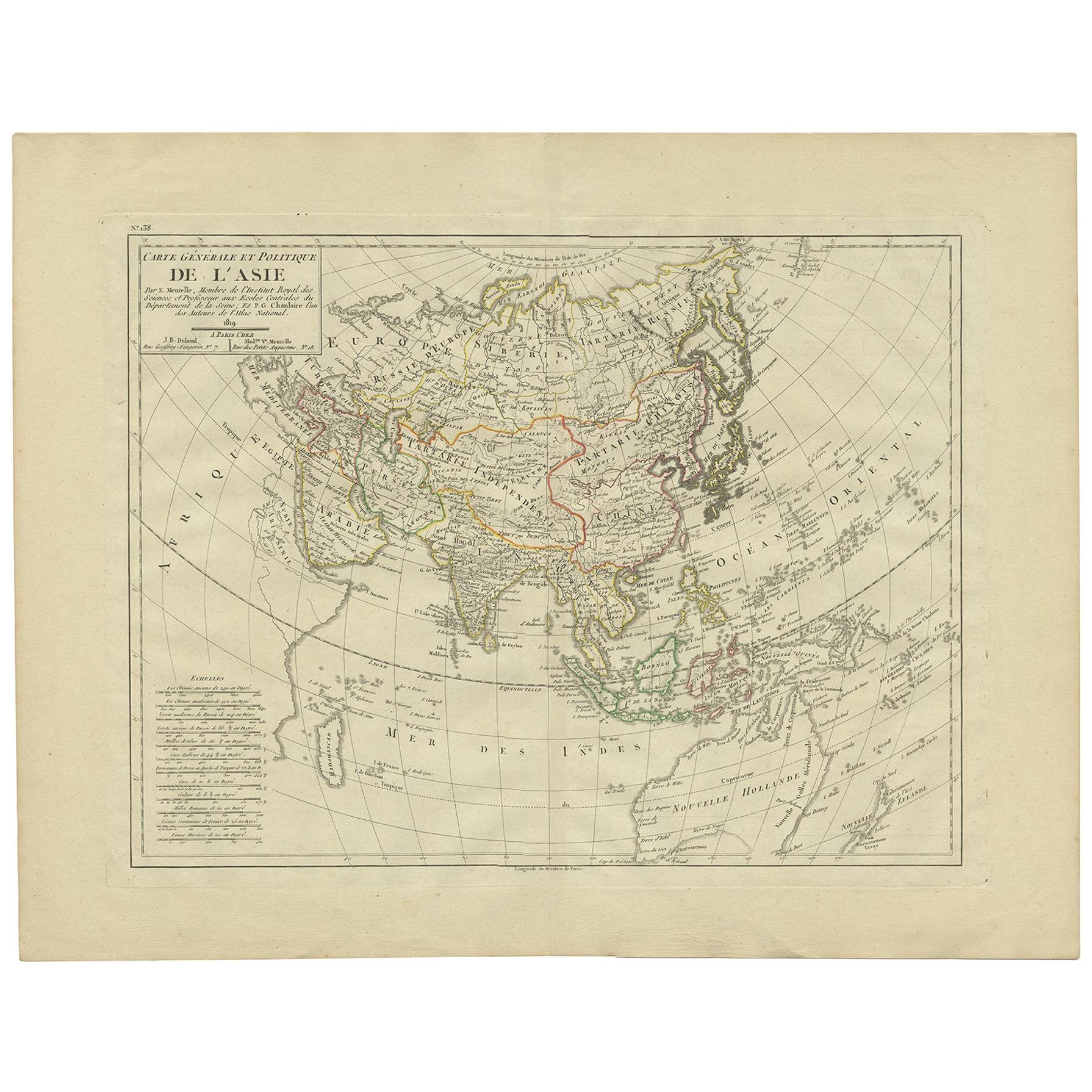
Antique Map of Asia by Mentelle, 1819
Located in Langweer, NL
Antique map titled 'Carte générale et Politique de l'Asie'. Detailed map of Asia. Includes a nice early depiction of Australia (Nouvelle Hollande), including its unknown and conjectu...
Category
Antique Early 19th Century French Maps
Materials
Paper
You May Also Like
Antique 1803 Italian Map of Asia Including China Indoneseia India
Located in Amsterdam, Noord Holland
Antique 1803 Italian Map of Asia Including China Indoneseia India
Very nice map of Asia. 1803.
Additional information:
Type: Map
Country of Manufacturing: Europe
Period: 19th centu...
Category
Antique 19th Century European Maps
Materials
Paper

$438 Sale Price
39% Off
Antique French Map of Asia Including China Indoneseia India, 1783
Located in Amsterdam, Noord Holland
Very nice map of Asia. 1783 Dedie au Roy.
Additional information:
Country of Manufacturing: Europe
Period: 18th century Qing (1661 - 1912)
Condition: Overall Condition B (Good Used)...
Category
Antique 18th Century European Maps
Materials
Paper

$486 Sale Price
40% Off
Super Rare Antique French Map of Chine and the Chinese Empire, 1780
Located in Amsterdam, Noord Holland
Super Rare Antique French Map of Chine and the Chinese Empire, 1780
Very nice map of Asia. 1780 Made by Bonne.
Additional information:
Type: Map
...
Category
Antique 18th Century European Maps
Materials
Paper

$438 Sale Price
49% Off
Large Original Antique Map of Asia by Sidney Hall, 1847
Located in St Annes, Lancashire
Great map of Asia
Drawn and engraved by Sidney Hall
Steel engraving
Original colour outline
Published by A & C Black. 1847
Unframed
Free shipping
Category
Antique 1840s Scottish Maps
Materials
Paper

Original Antique Map of China, Arrowsmith, 1820
Located in St Annes, Lancashire
Great map of China
Drawn under the direction of Arrowsmith
Copper-plate engraving
Published by Longman, Hurst, Rees, Orme and Brown, 1820
Unfr...
Category
Antique 1820s English Maps
Materials
Paper

Original Antique Map of The Eastern Hemisphere by Dower, circa 1835
Located in St Annes, Lancashire
Nice map of the Eastern Hemisphere
Drawn and engraved by J.Dower
Published by Orr & Smith. C.1835
Unframed.
Free shipping
Category
Antique 1830s English Maps
Materials
Paper

More Ways To Browse
19th Century Map Of Africa
Java Map
Illustrated Map
Antique World Maps
Antique Southern Furniture
Map Of Europe
Antique Maps Of Holland
Compass Rose Antique
Antique Furniture Portugal
Antique Maps Of Europe
Mexican Antiques
Map Of Africa
Mississippi Antique
Antique Furniture Plans
Ancient Collectibles
Antique Wood Coat Of Arms
Antique Quadrant
Antique Maps Of Africa