Items Similar to Antique Map of Australia, 1903, with Colonial Divisions and Detailed Topography

Want more images or videos?
Request additional images or videos from the seller
1 of 10
Antique Map of Australia, 1903, with Colonial Divisions and Detailed Topography
$320.96
£238.89
€270
CA$445.14
A$479.23
CHF 256.64
MX$5,774.59
NOK 3,238.07
SEK 2,963.36
DKK 2,057.90
About the Item
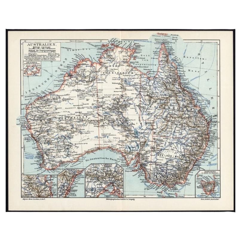
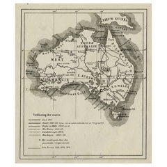
Title: Antique Map of Australia, 1903, with Colonial Divisions and Detailed Topography
Description: This antique map, titled "Australia," was engraved and published in 1903 by W.
A.K. Johnston in Edinburgh and London. It beautifully captures the vast expanse of the Australian continent at the dawn of the 20th century, highlighting the colonial divisions that would soon evolve into the modern states of Australia.
The map is delicately colored in soft pastel shades to mark these colonial boundaries, including Western Australia, South Australia, Queensland, New South Wales, and Victoria. The inset map of Tasmania provides additional detail on this island state, showcasing its important maritime connections and its role within the broader context of Australia.
Major cities, towns, rivers, and mountain ranges are all marked with precision, reflecting the incredible detail and clarity of Johnston’s engraving. From the coastal hubs of Sydney and Melbourne to the remote expanses of the interior, this map offers a fascinating look at a continent on the cusp of transformation, just two years after the federation of the Australian colonies into the Commonwealth of Australia.
For collectors, historians, and those with a passion for Australian history, this map is more than just a decorative piece—it is a portal to a formative period in the continent’s history, capturing both its rugged natural beauty and its political aspirations.
Condition report:
This map is in very good antique condition, with minor age-related foxing and gentle toning at the edges. The colors remain vibrant and the paper is well-preserved and stable.
Framing tips:
A classic wooden frame in walnut or cherry will enhance the soft pastel colors and historical detail of this map. Use a cream or off-white matting to highlight the fine linework and create a refined, timeless focal point for any home, library, or office.
- Dimensions:Height: 14.49 in (36.8 cm)Width: 18.51 in (47 cm)Depth: 0.01 in (0.2 mm)
- Materials and Techniques:
- Period:
- Date of Manufacture:1903
- Condition:This map is in very good antique condition, with minor foxing and gentle edge toning typical for its age. The colors remain vibrant and the paper is stable and well-preserved. Folding line as issued.
- Seller Location:Langweer, NL
- Reference Number:Seller: BG-13577-321stDibs: LU3054345263282
About the Seller
5.0
Recognized Seller
These prestigious sellers are industry leaders and represent the highest echelon for item quality and design.
Platinum Seller
Premium sellers with a 4.7+ rating and 24-hour response times
Established in 2009
1stDibs seller since 2017
2,828 sales on 1stDibs
Typical response time: 1 hour
- ShippingRetrieving quote...Shipping from: Langweer, Netherlands
- Return Policy
More From This Seller
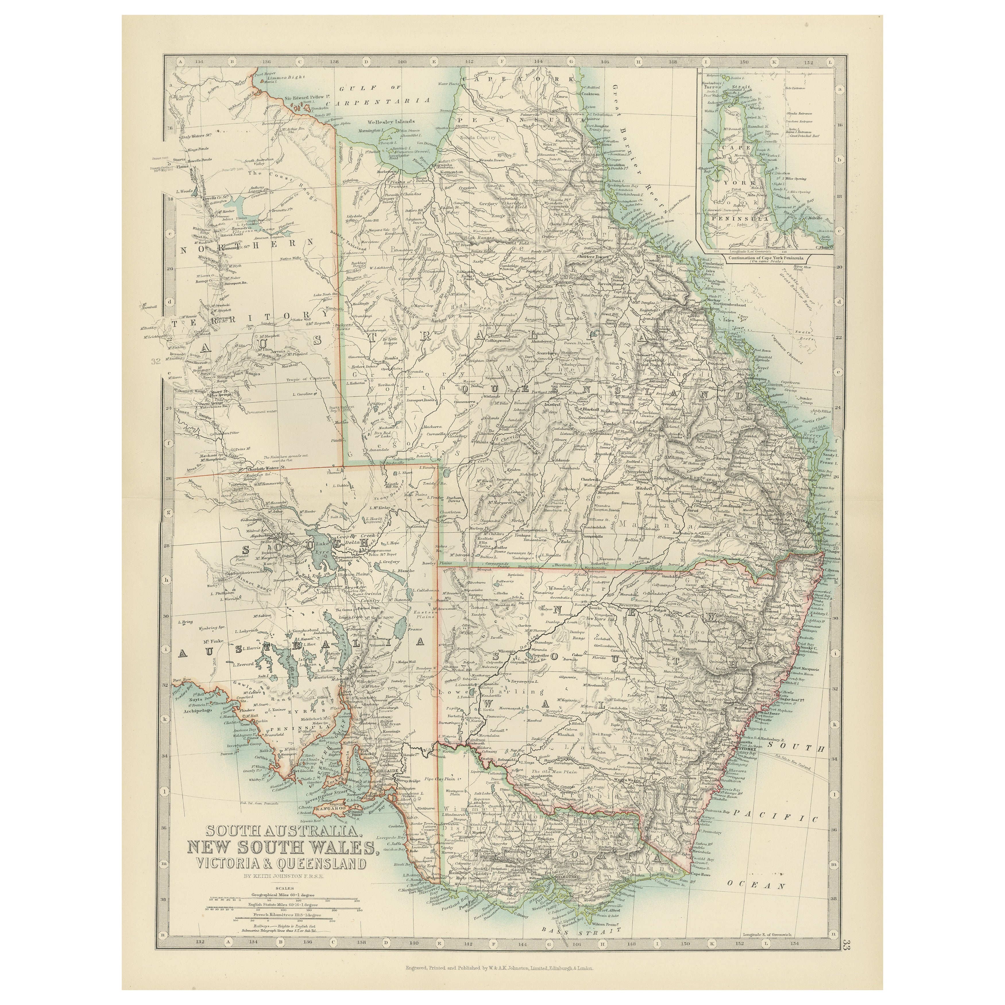
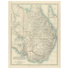
View AllAntique Map of South Australia, New South Wales, Victoria and Queensland, 1903
Located in Langweer, NL
Title: Antique Map of South Australia, New South Wales, Victoria, and Queensland, 1903
Description:
This antique map, titled "South Australia, New South Wales, Victoria, and Queensl...
Category
Early 20th Century Maps
Materials
Paper
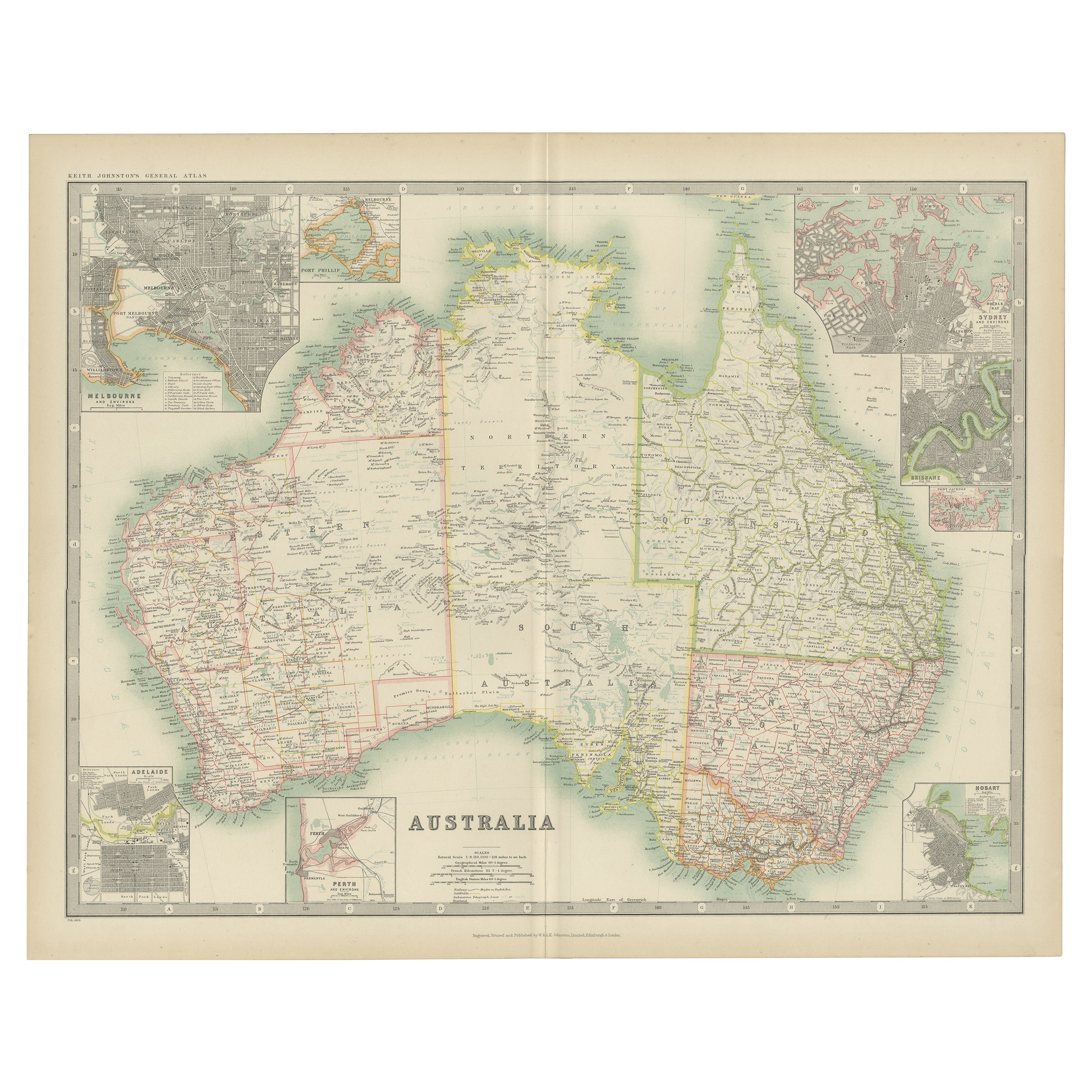
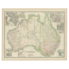
Antique Map of Australia by Johnston
1909
Located in Langweer, NL
Antique map titled 'Australia'. Original antique map of Australia. With inset maps of Melbourne, Port Phillip, Adelaide, Perth, Sydney, Brisba...
Category
Early 20th Century Maps
Materials
Paper
$332 Sale Price
20% Off
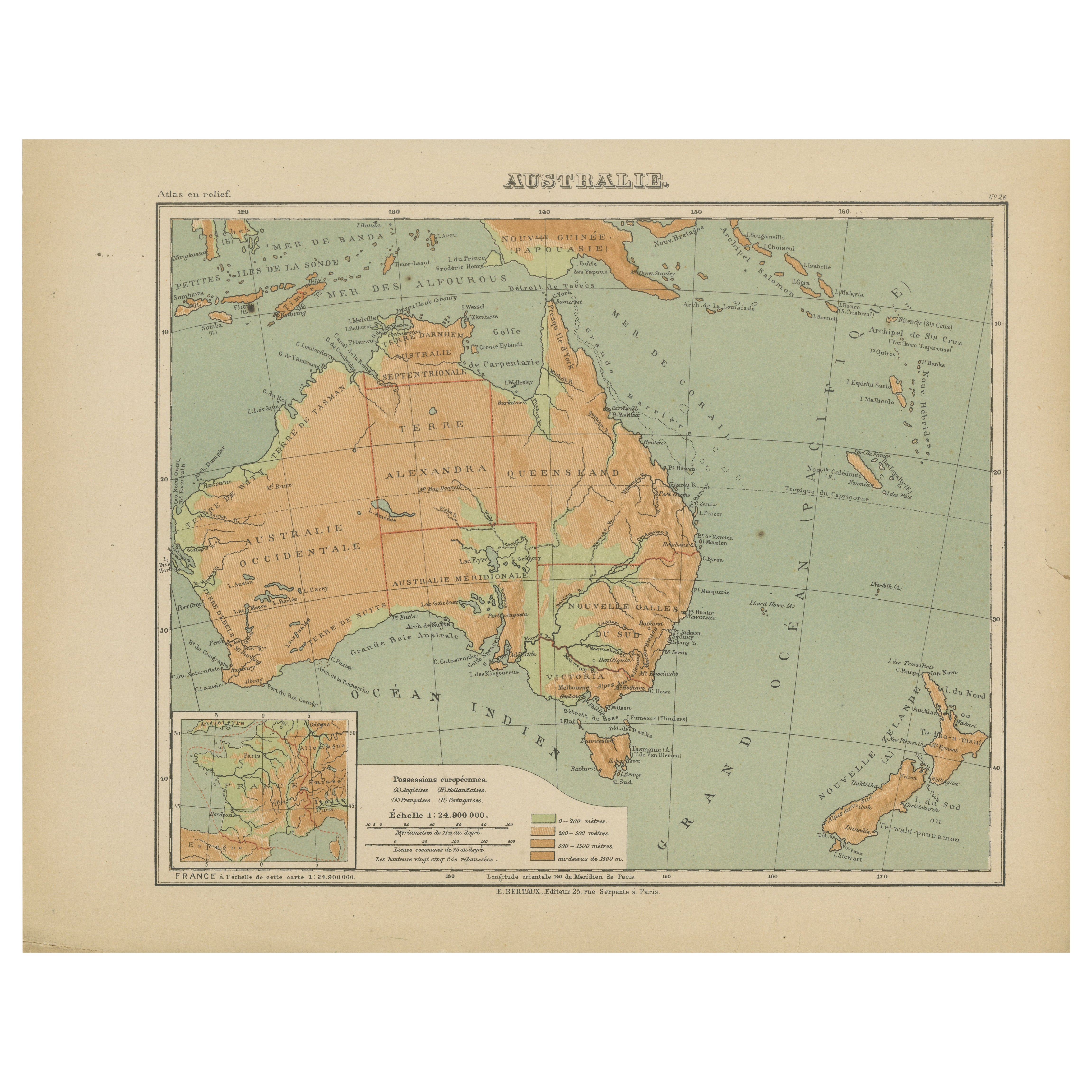
Antique Map of Australia and Oceania – Physical Relief Map by Hachette, c.1883
Located in Langweer, NL
Antique Map of Australia and Oceania – Physical Relief Map by Hachette, c.1883
Description:
This antique map titled “Australie” was published circa 1883 by Hachette in Paris as part...
Category
Antique Late 19th Century French Maps
Materials
Paper
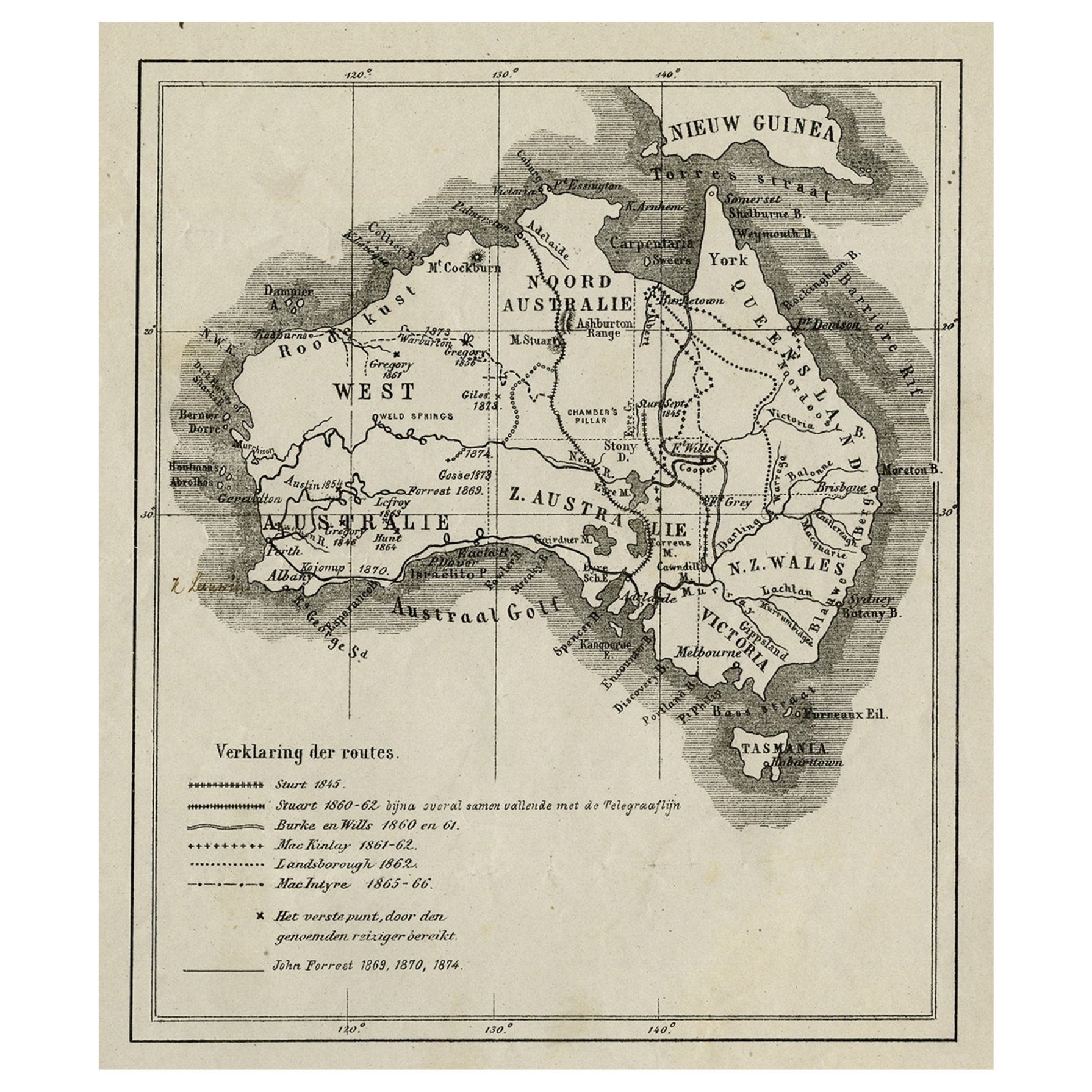
Old Map of Australia Showing The Routes of the Main Explorers, ca.1900
Located in Langweer, NL
Antique print, untitled. This map shows Australia with the routes of explorers in the continent and marking the furthest point reached.. Source unknown, to be determined.
Artists ...
Category
Antique Early 1900s Maps
Materials
Paper
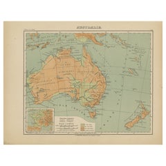
German Antique Map of Australia, Meyers, 1885
Located in Langweer, NL
Australien.' (Map of Australia. With inset maps of the large cities and Tasmania.) This attractive original old antique print / plate / map originate...
Category
Antique 19th Century Maps
Materials
Paper

$76 Sale Price
20% Off
Antique Detailed Map of New South Wales, Queensland
Victoria, Australia, 1865
Located in Langweer, NL
Antique map Australia titled 'South Australia, New South Wales, Victoria & Queensland'. Old map depicting South Australia including New South Wal...
Category
Antique 19th Century Maps
Materials
Paper

$332 Sale Price
20% Off
You May Also Like
Original Antique Map of Australia by Dower, circa 1835
Located in St Annes, Lancashire
Nice map of Australia
Drawn and engraved by J.Dower
Published by Orr & Smith. C.1835
Unframed.
Free shipping
Category
Antique 1830s English Maps
Materials
Paper

Large Original Antique Map of Australia by Sidney Hall, 1847
Located in St Annes, Lancashire
Great map of Australia
Drawn and engraved by Sidney Hall
Steel engraving
Original colour outline
Published by A & C Black. 1847
Unframed
Free shipping.
Category
Antique 1840s Scottish Maps
Materials
Paper

Australia, Tallis antique map, 1851
Located in Melbourne, Victoria
'Australia'
With decorative border surrounds and vignettes including a view of Sydney, Kangaroos, Natives of Australia Felix, Australian Parrots and Cockatoos and Natives of the Tri...
Category
19th Century Naturalistic Landscape Prints
Materials
Engraving

Vintage Australia Map, Framed, Historic 19th Century Cartography Interest, 1988
Located in Hele, Devon, GB
This is a vintage Australia map. A late 20th century reproduction of John Tallis’ original 1850 steel engraving, produced to mark the 1988 Australian Bicentennial.
Fascinating repro...
Category
1990s Australian Victorian Maps
Materials
Glass, Paper

Antique Vintage Australia Wall Map By W
A K Johnston
By W.
A.K. Johnston
Located in Stockbridge, GB
Vintage Australia Wall Map By W & A K Johnston
A vintage school pull down wall map of Australia. The map has a wooden hanging pole at the top...
Category
Mid-20th Century British Schoolhouse Posters
Materials
Canvas, Wood
Africa. Southern Part. Century Atlas antique vintage map
Located in Melbourne, Victoria
'The Century Atlas. Africa. Southern Part'
Original antique map, 1903.
Inset maps of 'Cape Town', 'Johannesburg' and 'Ladysmith'.
Central fold as issued. Map name and number printe...
Category
Early 20th Century Victorian More Prints
Materials
Lithograph

More Ways To Browse
Australian Antique Furniture
Cream Soup
Early English Silver
Paisley Rugs and Carpets
Black And Chrome Lounge Chair
Vintage 1930 Dining Room Set
Antique Brass And Copper
Antique Cow
Antique Harvest
Antique Victorian Dining Tables
Environment Furniture
Italian Plastic Chairs
Made In Belgium
Black Crystal Glasses
French Mid Century Modern Rug
China Silk Rug
Chrome Glass Coffee Tables
Antique Italian Chairs