Items Similar to Antique Map of Australia, New Zealand and Oceania by F. von Stülpnagel, 1850


Want more images or videos?
Request additional images or videos from the seller
1 of 5
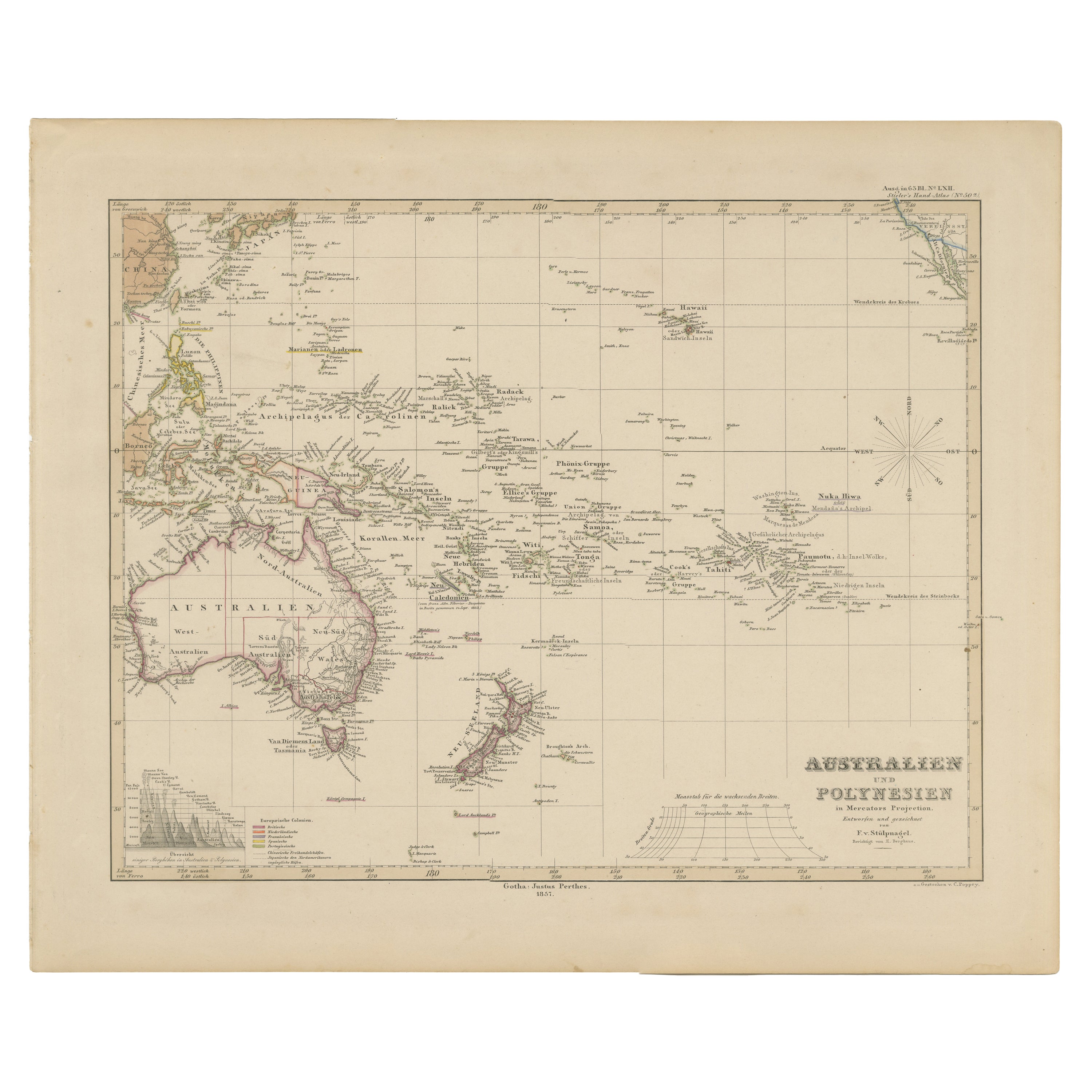
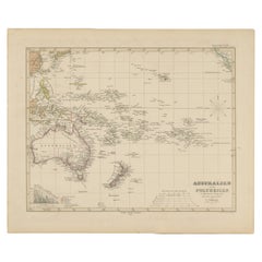
Antique Map of Australia, New Zealand and Oceania by F. von Stülpnagel, 1850
$184.33
$263.3230% Off
£136.96
£195.6630% Off
€154
€22030% Off
CA$252.49
CA$360.7030% Off
A$275.45
A$393.5030% Off
CHF 146.09
CHF 208.7130% Off
MX$3,318.57
MX$4,740.8130% Off
NOK 1,854.21
NOK 2,648.8830% Off
SEK 1,697.58
SEK 2,425.1230% Off
DKK 1,173.15
DKK 1,675.9330% Off
About the Item
Antique map titled 'Australien und Polynesien in Mercators Projection'. A map of Australia, New Zealand and Oceania. This includes Fiji, Tahiti and several other island groups in the Pacific. On the right edge California is (just) visible. Sheet 50a from 'Stieler's Hand-Atlas' published in Gotha: Justus Perthes, 1850.
- Dimensions:Height: 15.16 in (38.5 cm)Width: 18.31 in (46.5 cm)Depth: 0.02 in (0.5 mm)
- Materials and Techniques:
- Period:
- Date of Manufacture:1850
- Condition:Please study image carefully.
- Seller Location:Langweer, NL
- Reference Number:Seller: BG-100261stDibs: LU3054310809823
About the Seller
5.0
Recognized Seller
These prestigious sellers are industry leaders and represent the highest echelon for item quality and design.
Platinum Seller
Premium sellers with a 4.7+ rating and 24-hour response times
Established in 2009
1stDibs seller since 2017
2,820 sales on 1stDibs
Typical response time: 1 hour
- ShippingRetrieving quote...Shipping from: Langweer, Netherlands
- Return Policy
More From This Seller
View AllMid-19th Century Map of Australasia by Carl Flemming - 1855
Located in Langweer, NL
Title: "Mid-19th Century Map of Australasia by Carl Flemming - 1855"
Description: This original 1855 antique map from the Sohr-Berghaus Atlas, created by Carl Flemming, is a detaile...
Category
Antique 1850s Maps
Materials
Paper

Antique Map of Australia and surrounding Islands by F. von Stülpnagel, 1850
Located in Langweer, NL
Antique map titled 'Festland von Asutralien und benachbarte Inseln'. Map showing Australia, New Zealand, Southern New-Guinea and surrounding islands. This map originates from Stieler...
Category
Antique Mid-19th Century Maps
Materials
Paper

$184 Sale Price
30% Off
Antique Map of Australia and Polynesia, inset of Tasmania c.1860
Located in Langweer, NL
German antique map titled 'Australien und Polynesien'. Old map of Australia (New Holland) and Polynesia. With an inset map of Southern Australia including Tasmania (Van Diemen's Land...
Category
Antique 19th Century Maps
Materials
Paper

Antique Map of Australasia, New Zealand, Polynesia
the Pacific Ocean, 1840
Located in Langweer, NL
Antique map titled 'The Pacific Ocean'.
This map depicts Australasia, New Zealand, Polynesia and islands in the Pacific Ocean including the Sandwich Islands.
Artists and Engravers: Published by the Society for the Diffusion of Useful Knowledge, 1840. Engraved by J. & C. Walker.
Condition:
Good, general age-related toning. Few tiny tears...
Category
Antique 1840s Maps
Materials
Abalone, Paper

Antique Map of Australia, New Zealand
Polynesia – Stülpnagel, 1857
Located in Langweer, NL
Antique Map of Australia, New Zealand & Polynesia – Stülpnagel, 1857
Description:
This finely engraved and delicately hand-colored map titled "Australien und Polynesien in Mercator'...
Category
Antique Mid-19th Century German Maps
Materials
Paper
Antique Map of Australia by H. Kiepert, 1875
Located in Langweer, NL
Antique map titled 'Australien'. Large and detailed map of Australia and New Zealand. With color key in lower left. The map is prepared by H. Kiepert...
Category
Antique Late 19th Century Maps
Materials
Paper

$197 Sale Price
40% Off
You May Also Like
Large Original Antique Map of Australia by Sidney Hall, 1847
Located in St Annes, Lancashire
Great map of Australia
Drawn and engraved by Sidney Hall
Steel engraving
Original colour outline
Published by A & C Black. 1847
Unframed
Free shipping.
Category
Antique 1840s Scottish Maps
Materials
Paper

Original Antique Map of Australia by Dower, circa 1835
Located in St Annes, Lancashire
Nice map of Australia
Drawn and engraved by J.Dower
Published by Orr & Smith. C.1835
Unframed.
Free shipping
Category
Antique 1830s English Maps
Materials
Paper

Ancient Map of Oceania - Original Etching - 19th century
Located in Roma, IT
This Map of Oceania is an etching realized in the 19th century.
The state of preservation of the artwork is good. At the top of the paper, the inscription “Longitudine del Meridiano...
Category
19th Century More Prints
Materials
Etching

Large Original Antique Map of The Pacific Ocean, Fullarton, C.1870
Located in St Annes, Lancashire
Great map of The Pacific Ocean
From the celebrated Royal Illustrated Atlas
Lithograph by Swanston. Original color.
Published by Fullarton,...
Category
Antique 1870s Scottish Maps
Materials
Paper

Original Antique Map of The World by Dower, circa 1835
Located in St Annes, Lancashire
Nice map of the World
Drawn and engraved by J.Dower
Published by Orr & Smith. C.1835
Unframed.
Free shipping
Category
Antique 1830s English Maps
Materials
Paper

Australia, Tallis antique map, 1851
Located in Melbourne, Victoria
'Australia'
With decorative border surrounds and vignettes including a view of Sydney, Kangaroos, Natives of Australia Felix, Australian Parrots and Cockatoos and Natives of the Tri...
Category
19th Century Naturalistic Landscape Prints
Materials
Engraving

More Ways To Browse
Maps Of Australia
Antique Maps Australia
Antique Collectables Australia
19th Century Australian Furniture
Mercator Map
New Zealand Map
Antique Maps New Zealand
Antique Maps Of Holland
Compass Rose Antique
Antique Furniture Portugal
Antique Maps Of Europe
Mexican Antiques
Map Of Africa
Mississippi Antique
Antique Furniture Plans
Ancient Collectibles
Antique Wood Coat Of Arms
Antique Quadrant