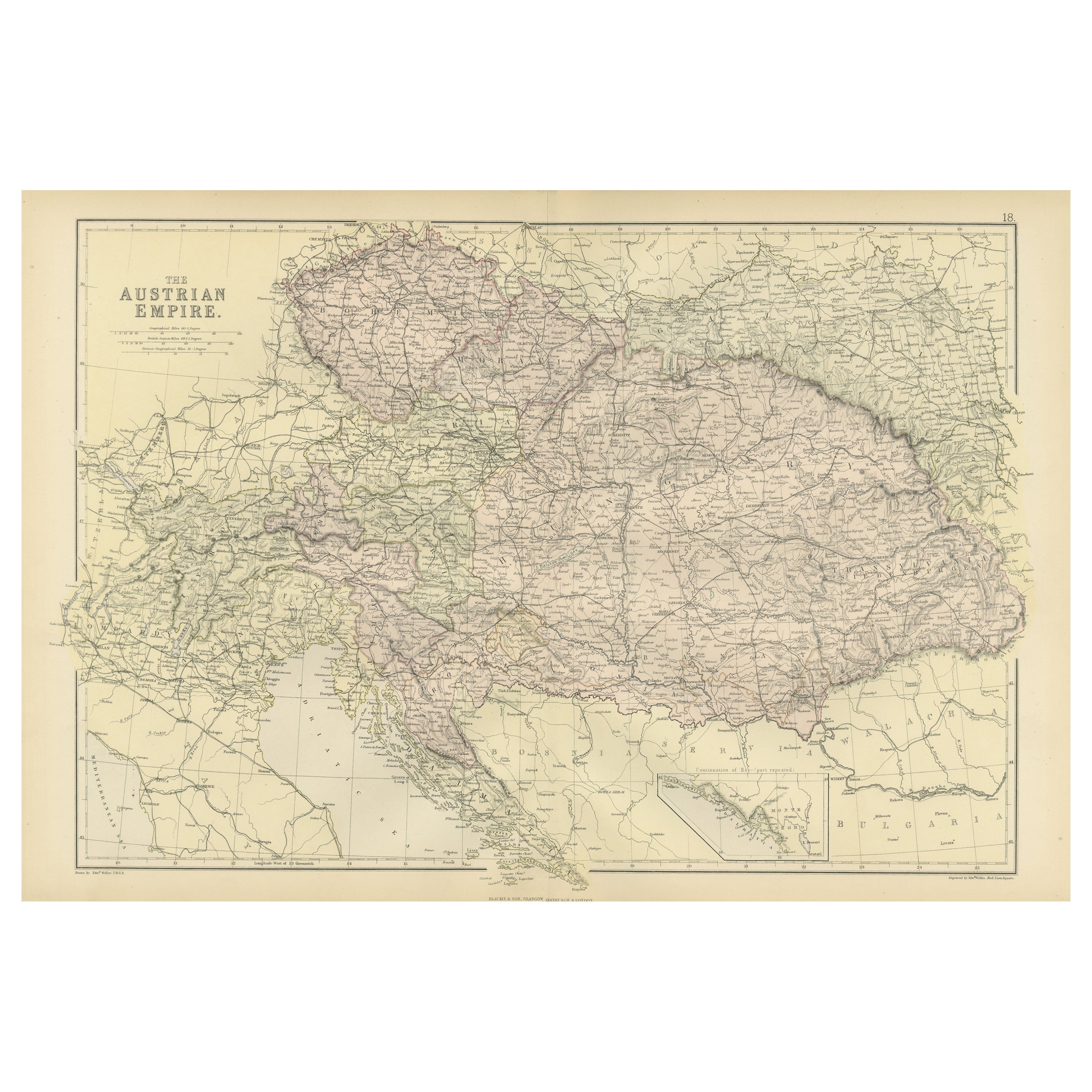
Items Similar to Antique Map of Austrian Dominions by A
C. Black, 1870

Want more images or videos?
Request additional images or videos from the seller
1 of 7
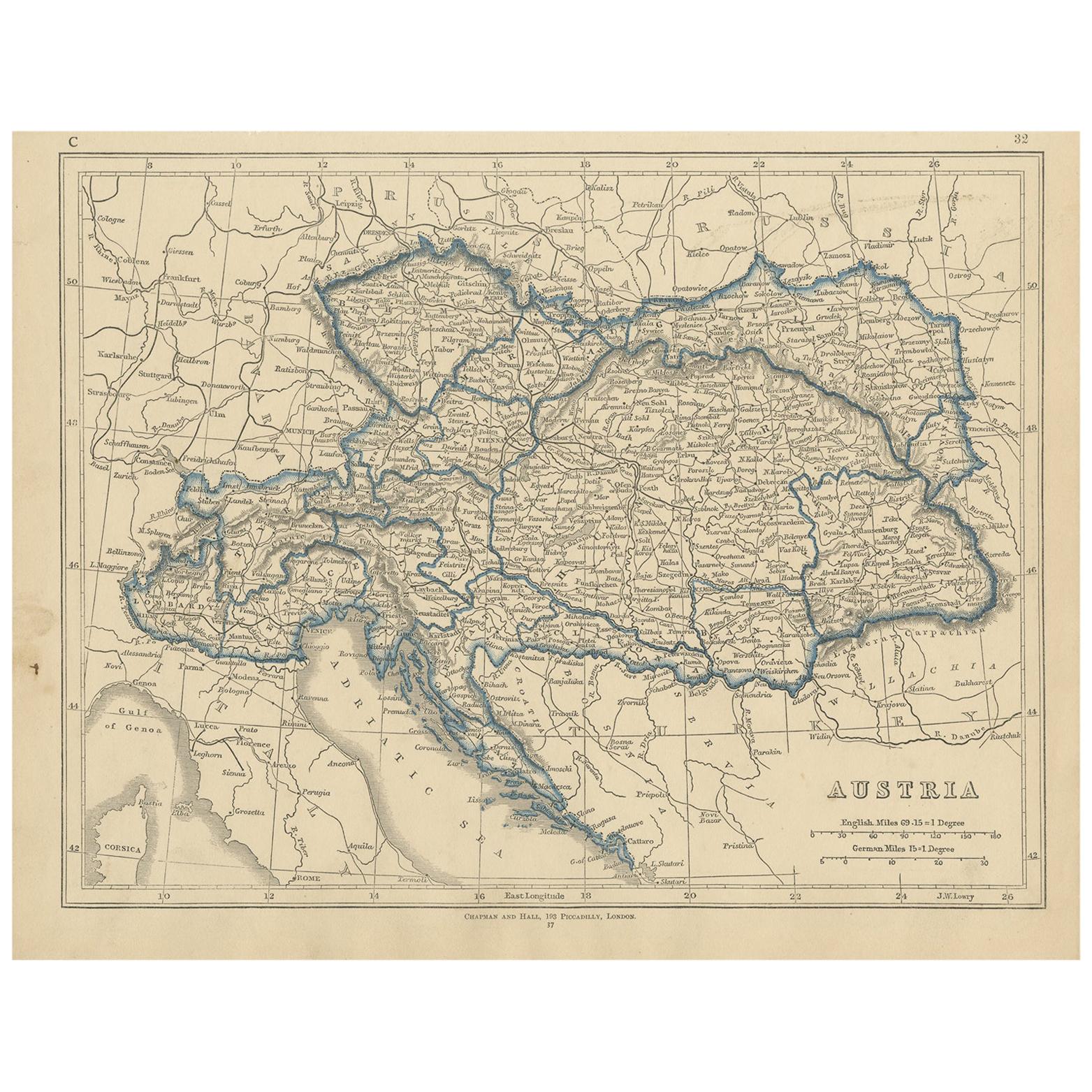
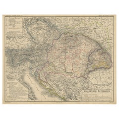
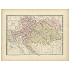
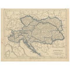
Antique Map of Austrian Dominions by A
C. Black, 1870
$167.57
$209.4620% Off
£124.51
£155.6320% Off
€140
€17520% Off
CA$229.54
CA$286.9220% Off
A$250.41
A$313.0120% Off
CHF 132.81
CHF 166.0220% Off
MX$3,016.88
MX$3,771.1020% Off
NOK 1,685.65
NOK 2,107.0620% Off
SEK 1,543.26
SEK 1,929.0720% Off
DKK 1,066.50
DKK 1,333.1320% Off
About the Item
Antique map titled 'Austrian Dominions'. Original antique map of Austrian Dominions. This map originates from ‘Black's General Atlas of The World’. Published by A
C. Black, 1870.
- Dimensions:Height: 13 in (33 cm)Width: 17.52 in (44.5 cm)Depth: 0.02 in (0.5 mm)
- Materials and Techniques:
- Period:
- Date of Manufacture:1870
- Condition:Wear consistent with age and use. General age-related toning. some foxing, Please study image carefully.
- Seller Location:Langweer, NL
- Reference Number:Seller: BG-12784-191stDibs: LU3054325441042
About the Seller
5.0
Recognized Seller
These prestigious sellers are industry leaders and represent the highest echelon for item quality and design.
Platinum Seller
Premium sellers with a 4.7+ rating and 24-hour response times
Established in 2009
1stDibs seller since 2017
2,819 sales on 1stDibs
Typical response time: 1 hour
- ShippingRetrieving quote...Shipping from: Langweer, Netherlands
- Return Policy
More From This Seller
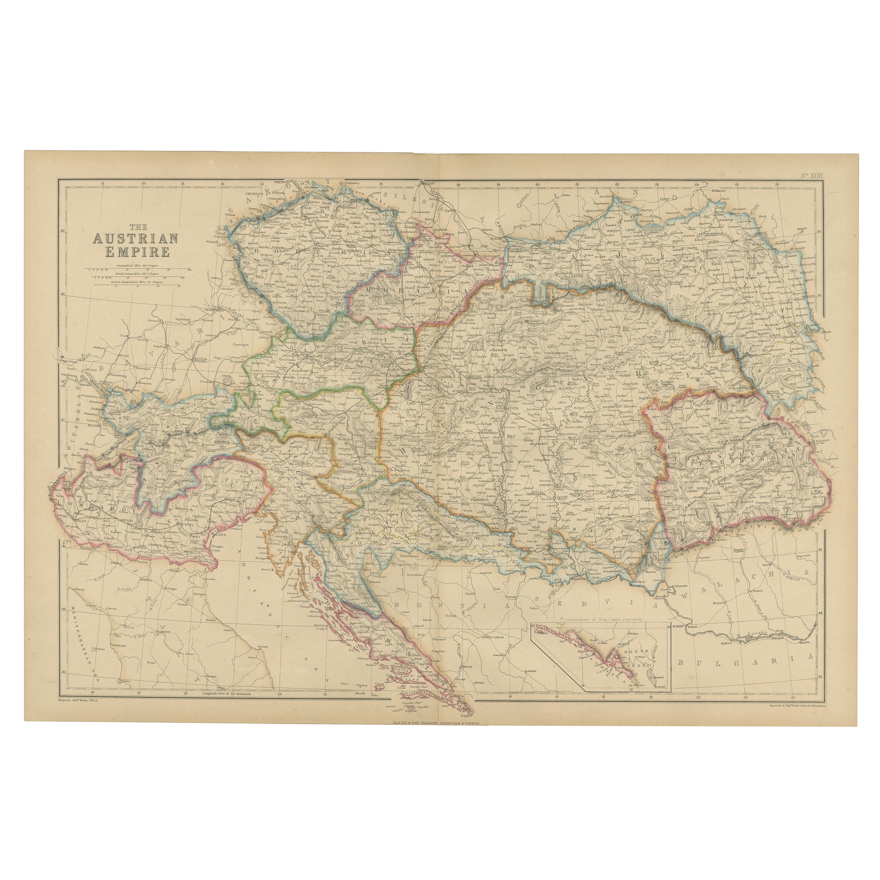
View AllAntique Map of the Austrian Empire by W. G. Blackie, 1859
Located in Langweer, NL
Antique map titled 'The Austrian Empire'. Original antique map of the Austrian Empire with inset map of Montenegro. This map originates from ‘The Imperial Atlas of Modern Geography’....
Category
Antique Mid-19th Century Maps
Materials
Paper
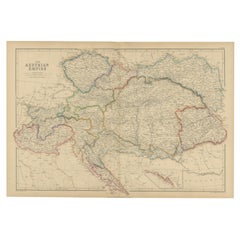
$209 Sale Price
30% Off
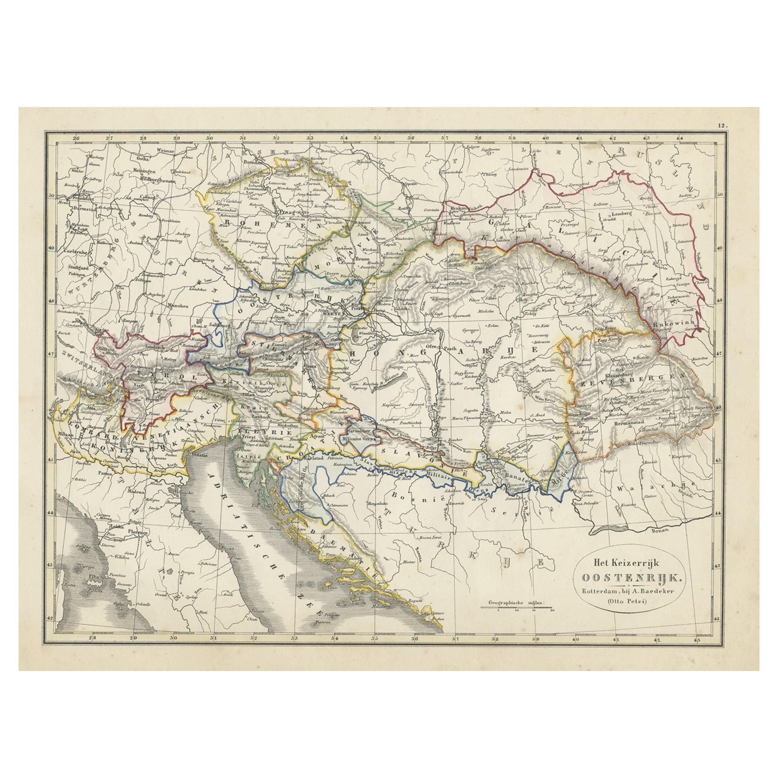
Original Antique Map of Austria from an Old Dutch School Atlas, 1852
Located in Langweer, NL
Antique map titled 'Het Keizerrijk Oostenrijk'.
Map of the Austrian Empire. This map originates from 'School-Atlas van alle deelen der Aarde' by Otto Petri...
Category
Antique 1850s Maps
Materials
Paper
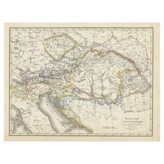
$181 Sale Price
20% Off
Original Antique Map of The Austrian Empire, 1882
Located in Langweer, NL
Step into the past with an original Antique Map of The Austrian Empire from the esteemed 'Comprehensive Atlas and Geography of the World,' meticulously crafted in 1882. This intricat...
Category
Antique 1880s Maps
Materials
Paper
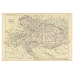
$201 Sale Price
20% Off
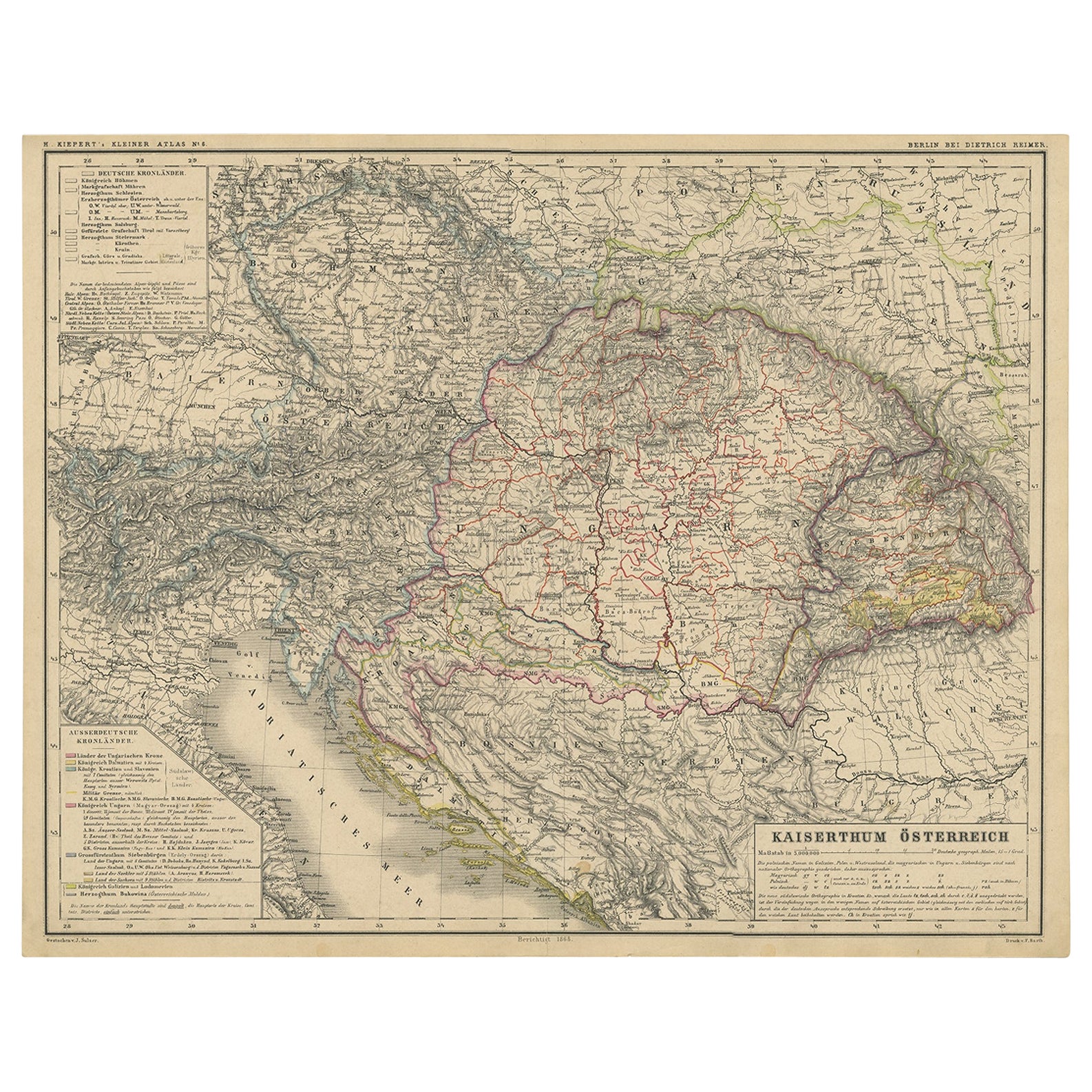
Old German Map of the Austrian Empire, ca.1870
Located in Langweer, NL
Antique map titled 'Kaiserthum Österreich'.
Old map of the Austrian Empire. This map originates from 'H. Kiepert's Kleiner Atlas der Neueren Geographie für Schule und Haus'.
Arti...
Category
Antique 1870s German Maps
Materials
Paper
$277 Sale Price
20% Off
Antique Map of Austria-Hungary by Levasseur,
1875
Located in Langweer, NL
Antique map titled 'Carte générale de la Monarchie Austro-Hongroise (..)'. Large map of Austria-Hungary. This map originates from 'Atlas de Géographie M...
Category
Antique Late 19th Century Maps
Materials
Paper
$311 Sale Price
35% Off
Antique Map of Austria by Lowry, 1852
Located in Langweer, NL
Antique map titled 'Austria'. Original map of Austria. This map originates from 'Lowry's Table Atlas constructed and engraved from the most recent Autho...
Category
Antique Mid-19th Century Maps
Materials
Paper
$95 Sale Price
20% Off
You May Also Like
Austria-Hungary, Western Part. Century Atlas antique vintage map
Located in Melbourne, Victoria
'The Century Atlas. Austria-Hungary, Western Part'
Original antique map, 1903.
Central fold as issued. Map name and number printed on the reverse corners.
Sheet 40cm by 29.5cm.
Category
Early 20th Century Victorian More Prints
Materials
Lithograph

Large Original Antique Map of Poland by Sidney Hall, 1847
Located in St Annes, Lancashire
Great map of Poland
Drawn and engraved by Sidney Hall
Steel engraving
Original colour outline
Published by A & C Black. 1847
Unframed
...
Category
Antique 1840s Scottish Maps
Materials
Paper

Large Original Antique Map of Italy. John Dower, 1861
Located in St Annes, Lancashire
Great map of Italy
Lithograph engraving by John Dower
Original colour
Published, 1861
Unframed
Good condition / repair to top right corner seen in last image
Category
Antique 1860s English Victorian Maps
Materials
Paper

1853 Map of "Russia in Europe Including Poland" Ric.r016
Located in Norton, MA
Description
Russia in Europe incl. Poland by J Wyld c.1853
Hand coloured steel engraving
Dimension: Paper: 25 cm W x 33 cm H ; Sight: 22 cm W x 28 cm H
Condition: Good ...
Category
Antique 19th Century Unknown Maps
Materials
Paper

Hand-Colored 18th Century Homann Map of the Danube, Italy, Greece, Croatia
By Johann Baptist Homann
Located in Alamo, CA
"Fluviorum in Europa principis Danubii" is a hand colored map of the region about the Danube river created by Johann Baptist Homann (1663-1724) in his 'Atlas Novus Terrarum', publish...
Category
Antique Early 18th Century German Maps
Materials
Paper

Large Original Antique Map of Europe by Sidney Hall, 1847
Located in St Annes, Lancashire
Great map of Europe
Drawn and engraved by Sidney Hall
Steel engraving
Original colour outline
Published by A & C Black. 1847
Unframed
Free shipping.
Category
Antique 1840s Scottish Maps
Materials
Paper

More Ways To Browse
Map Of Austria
Map Of Egypt
Antique Ecuador
Antique Map New York
Nautical Maps
18th Century Maps America
Antique Map Of Egypt
Map Of Austria
New Zealand Map
Antique Linen Map
19th Century World Map
Antique Ohio Maps
Antique Texas Furniture
Military Map
Antique Maps New Zealand
Birds Eye View Map
North Africa Map
West Africa Map