Items Similar to Antique Map of the Batu Islands by Dornseiffen, 1900


Want more images or videos?
Request additional images or videos from the seller
1 of 5
Antique Map of the Batu Islands by Dornseiffen, 1900
$81.67
$102.0820% Off
£60.49
£75.6220% Off
€68
€8520% Off
CA$111.74
CA$139.6820% Off
A$121.58
A$151.9820% Off
CHF 64.38
CHF 80.4720% Off
MX$1,462.74
MX$1,828.4220% Off
NOK 817.45
NOK 1,021.8120% Off
SEK 747.91
SEK 934.8820% Off
DKK 518.22
DKK 647.7720% Off
About the Item
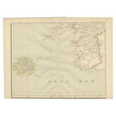
Antique map of the Batu Islands with the large title 'Soematra, Bangka en de Riouw-Lingga Archipel'. This map originates from 'Atlas van Nederlandsch Oost- en West-Indië' by I. Dornseiffen. Artists and Engravers: Published by Seyffardt's Boekhandel, Amsterdam.
Artist: Published by Seyffardt's Boekhandel, Amsterdam.
Condition: Very good, general age-related toning. Please study image carefully.
Date: 1900
Overall size: 52 x 38.9 cm.
Image size: 0.001 x 45.9 x 35.5 cm.
Antique prints have long been appreciated for both their aesthetic and investment value. They were the product of engraved, etched or lithographed plates. These plates were handmade out of wood or metal, which required an incredible level of skill, patience and craftsmanship. Whether you have a house with Victorian furniture or more contemporary decor an old engraving can enhance your living space. We offer a wide range of authentic antique prints for any budget.
- Dimensions:Height: 15.32 in (38.9 cm)Width: 20.48 in (52 cm)Depth: 0 in (0.01 mm)
- Materials and Techniques:
- Period:
- Date of Manufacture:1900
- Condition:
- Seller Location:Langweer, NL
- Reference Number:Seller: BG-06669-91stDibs: LU3054327774492
About the Seller
5.0
Recognized Seller
These prestigious sellers are industry leaders and represent the highest echelon for item quality and design.
Platinum Seller
Premium sellers with a 4.7+ rating and 24-hour response times
Established in 2009
1stDibs seller since 2017
2,816 sales on 1stDibs
Typical response time: 1 hour
- ShippingRetrieving quote...Shipping from: Langweer, Netherlands
- Return Policy
More From This Seller
View AllAntique Map of West Sumatra, Indonesia, 1900
Located in Langweer, NL
Antique map titled 'Sumatra, Bangka, Blitoeng en de Riouw-Archipel'. Old map of West Sumatra depicting the various islands and the Strait of Malacca. This map originates from 'Atlas ...
Category
20th Century Maps
Materials
Paper

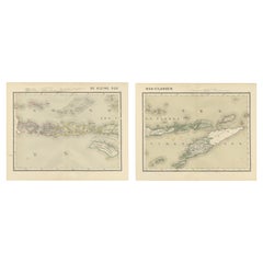
Antique Map of the Java Sea by Dornseiffen, 1900
Located in Langweer, NL
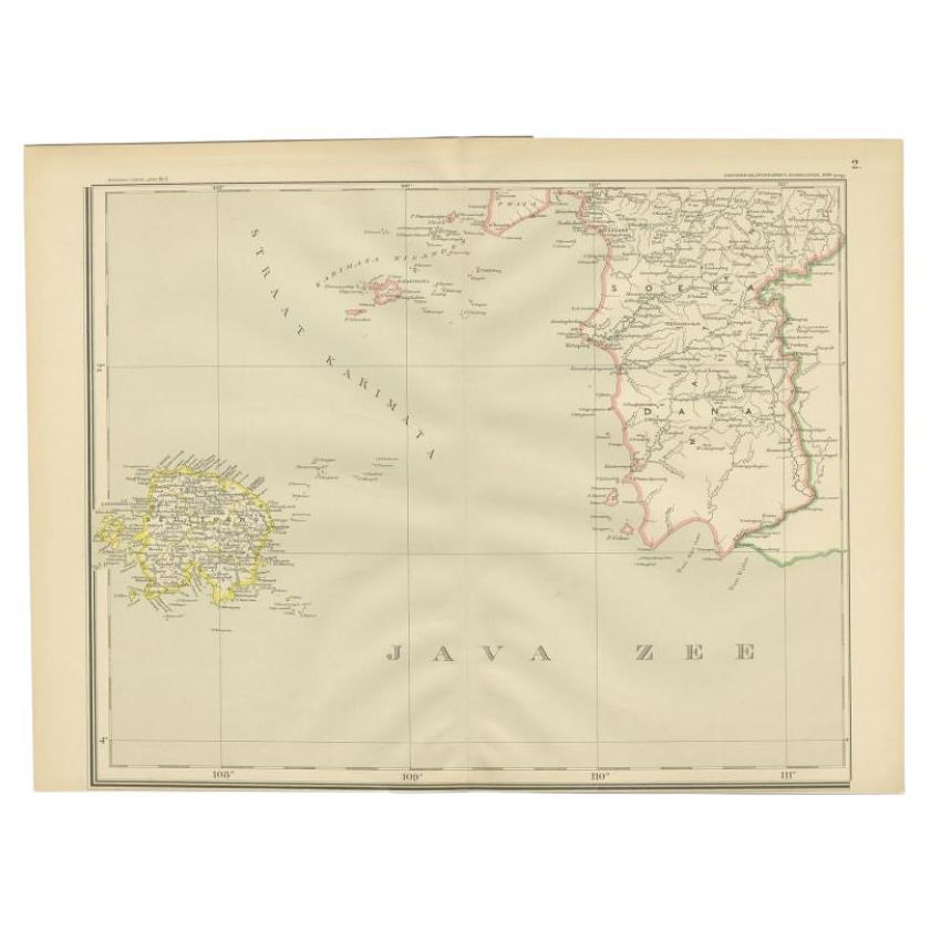
Antique map of the Java Sea. Also depicts Bilitung, the Karimata Islands and Sukadana, Borneo. This map originates from 'Atlas van Nederlandsch Oost- en West-Indië' by I. Dornseiffen...
Category
20th Century Maps
Materials
Paper
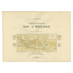
Antique Map of the East Indies by Dornseiffen, 1900
Located in Langweer, NL
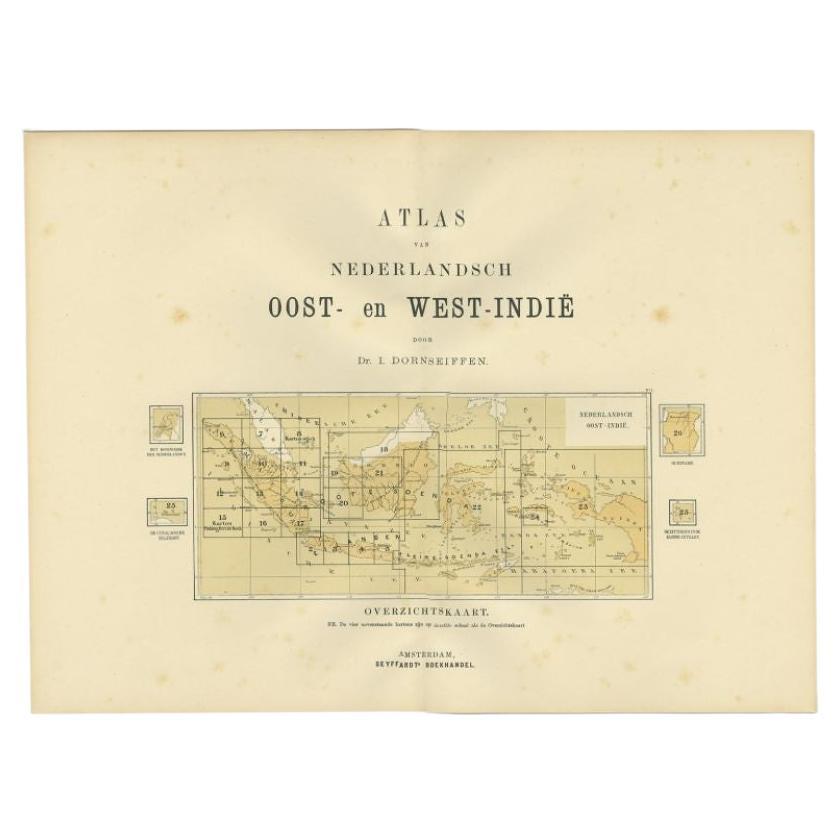
Title page of 'Atlas van Nederlandsch Oost- en West-Indië' by I. Dornseiffen. It shows the regions of the various maps included in this atlas. Included are the Dutch East Indies and ...
Category
20th Century Maps
Materials
Paper
Antique Two-Sheet Map of the Lesser Sunda Islands, Dutch East Indies - 1884
Located in Langweer, NL
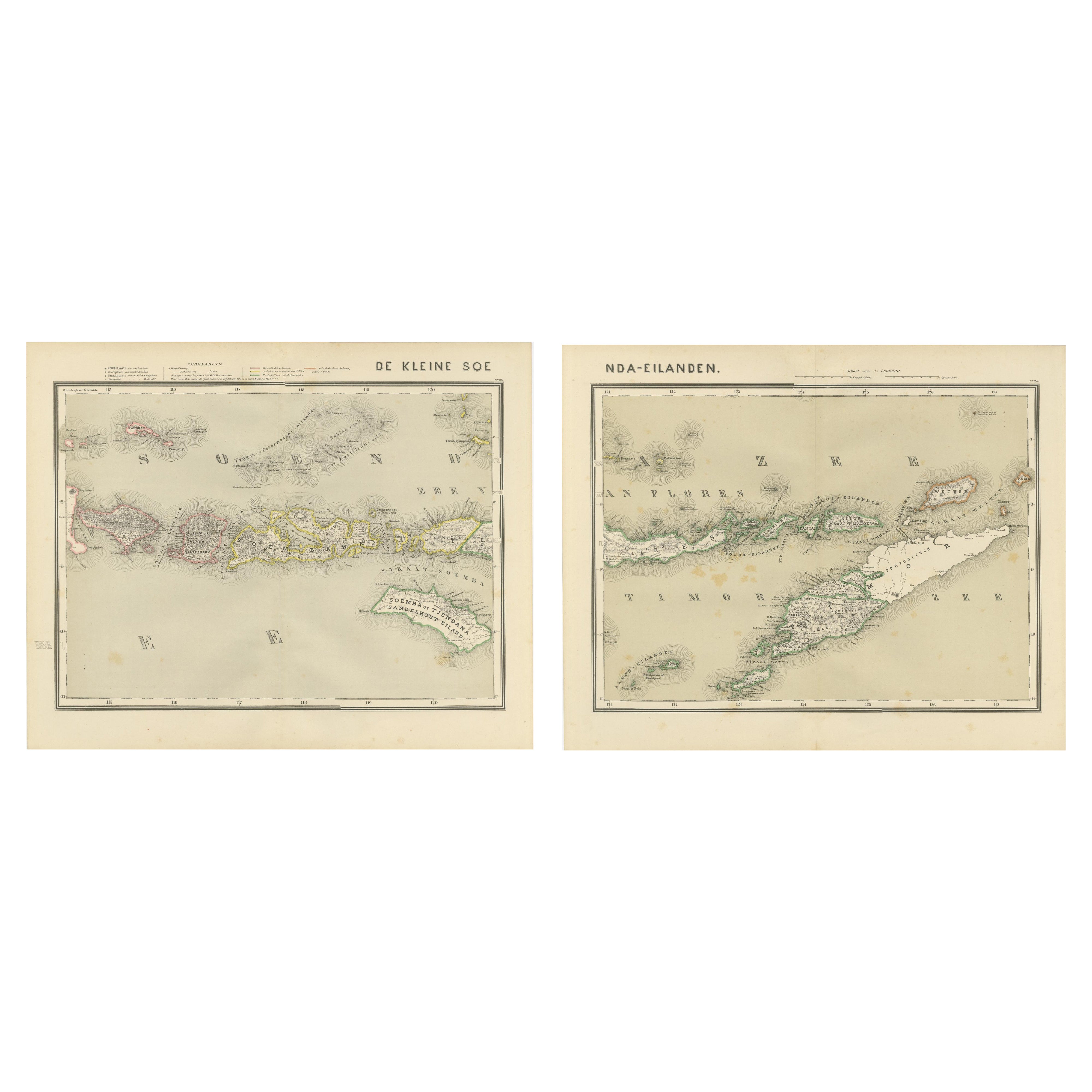
Antique Two-Sheet Map of the Lesser Sunda Islands by Dornseiffen, Dutch East Indies, 1884
This impressive two-sheet antique map set depicts the Lesser Sunda Islands (De Kleine Soen...
Category
Antique 1880s Dutch Maps
Materials
Paper
Antique Map of the Moluccas by Stemfoort, 1885
Located in Langweer, NL
Antique map titled 'Kaart der Molukken'. Old map of the southern tip of the Moluccas, or Maluku Islands. With an inset map of part of Ambon Island and an inset map of New Guinea. Thi...
Category
Antique 19th Century Dutch Maps
Materials
Paper

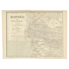
Antique Map of West Kalimantan, Borneo, Indonesia, 1900
Located in Langweer, NL
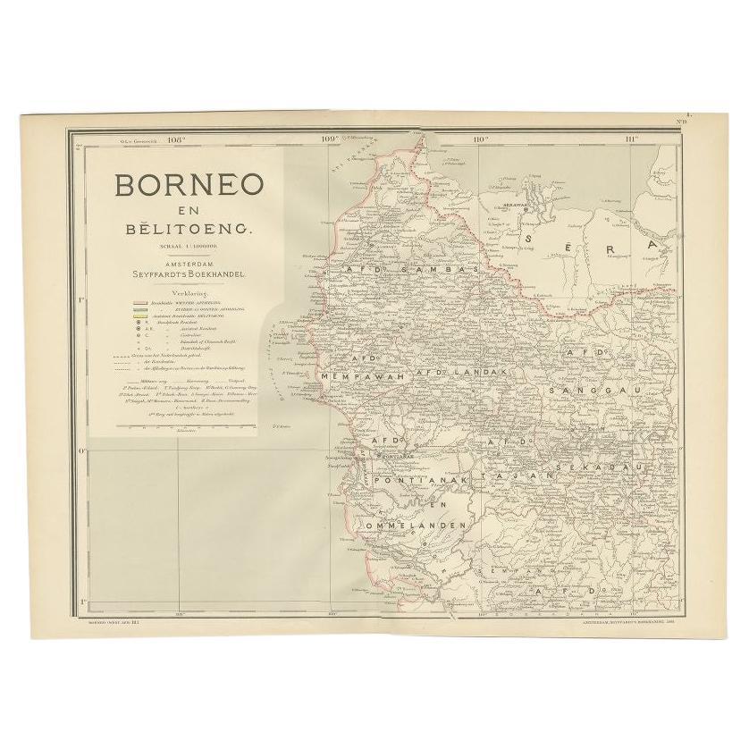
Antique map titled 'Borneo en Belitoeng'. Old map of West Kalimantan, Borneo. This map originates from 'Atlas van Nederlandsch Oost- en West-Indië' by I. Dornseiffen.
Artists and...
Category
20th Century Maps
Materials
Paper
You May Also Like
Large Original Antique Map of Java and Borneo, Fullarton, C.1870
Located in St Annes, Lancashire
Great map of Java and Borneo
Wonderful figurative borders
From the celebrated Royal Illustrated Atlas
Lithograph. Original color.
Published by Fullarton, Edinburgh. C.1870
Unfr...
Category
Antique 1870s Scottish Maps
Materials
Paper

Original Antique Map of South East Asia by Thomas Clerk, 1817
Located in St Annes, Lancashire
Great map of South East Asia
Copper-plate engraving
Drawn and engraved by Thomas Clerk, Edinburgh.
Published by Mackenzie And Dent, 1817
Unframed.
Category
Antique 1810s English Maps
Materials
Paper

Large Original Antique Map of The Canary Islands. 1894
Located in St Annes, Lancashire
Superb Antique map of The Canary Islands
Published Edward Stanford, Charing Cross, London 1894
Original colour
Good condition
Unframed.
Free shipping
Category
Antique 1890s English Maps
Materials
Paper

Large Original Antique Map of The Greek Islands. 1894
Located in St Annes, Lancashire
Superb Antique map of The Greek Islands
Published Edward Stanford, Charing Cross, London 1894
Original colour
Good condition
Unframed.
Free shipping
Category
Antique 1890s English Maps
Materials
Paper

Large Original Antique Map of The Leeward Islands. 1894
Located in St Annes, Lancashire
Superb Antique map of The Leeward Islands
Published Edward Stanford, Charing Cross, London 1894
Original colour
Good condition
Unframed.
Free shipping
Category
Antique 1890s English Maps
Materials
Paper

Large Original Antique Map of the The Windward Islands. 1894
Located in St Annes, Lancashire
Superb Antique map of The Windward Islands
Published Edward Stanford, Charing Cross, London 1894
Original colour
Good condition
Unframed.
Free shipping
Category
Antique 1890s English Maps
Materials
Paper

More Ways To Browse
The Vintage Map
Antique Map Of Yorkshire
British Empire Map
Caucasus Map
Framed London Map
J Warren
Large Framed Maps
Map Of Jamaica
Map Of Madagascar
Map Of Normandy
Map Of Singapore
Map Of Vienna
Missouri Map
Nantucket Map
Old School Maps
Santa Cruz Used Furniture
Ukraine Antique Map
Used Office Furniture Cincinnati