Items Similar to Antique Map of Berkshire, South East England
Want more images or videos?
Request additional images or videos from the seller
1 of 6
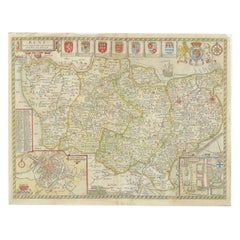
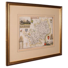
Antique Map of Berkshire, South East England
$1,141.19
$1,426.4920% Off
£849.38
£1,061.7320% Off
€960
€1,20020% Off
CA$1,582.72
CA$1,978.4020% Off
A$1,703.94
A$2,129.9220% Off
CHF 912.49
CHF 1,140.6220% Off
MX$20,531.87
MX$25,664.8320% Off
NOK 11,513.13
NOK 14,391.4120% Off
SEK 10,536.37
SEK 13,170.4720% Off
DKK 7,316.97
DKK 9,146.2220% Off
About the Item
Antique map titled 'Bercheria vernacule Barkshire'. Original old map of Berkshire, a historic county in South East England. Published circa 1665 by J. Blaeu. Willem Jansz. Blaeu and his son Joan Blaeu are the most widely known cartographic publishers of the seventeenth century.
- Creator:Joan (Johannes) Blaeu (Artist)
- Dimensions:Height: 21.97 in (55.8 cm)Width: 25.44 in (64.6 cm)Depth: 0.02 in (0.5 mm)
- Materials and Techniques:
- Period:
- Date of Manufacture:c.1665
- Condition:Wear consistent with age and use. General age-related toning. Original folding line. Minor wear and soiling. Latin text on verso. Please study image carefully.
- Seller Location:Langweer, NL
- Reference Number:Seller: BG-133741stDibs: LU3054332517272
About the Seller
5.0
Recognized Seller
These prestigious sellers are industry leaders and represent the highest echelon for item quality and design.
Platinum Seller
Premium sellers with a 4.7+ rating and 24-hour response times
Established in 2009
1stDibs seller since 2017
2,828 sales on 1stDibs
Typical response time: 1 hour
- ShippingRetrieving quote...Shipping from: Langweer, Netherlands
- Return Policy
More From This Seller
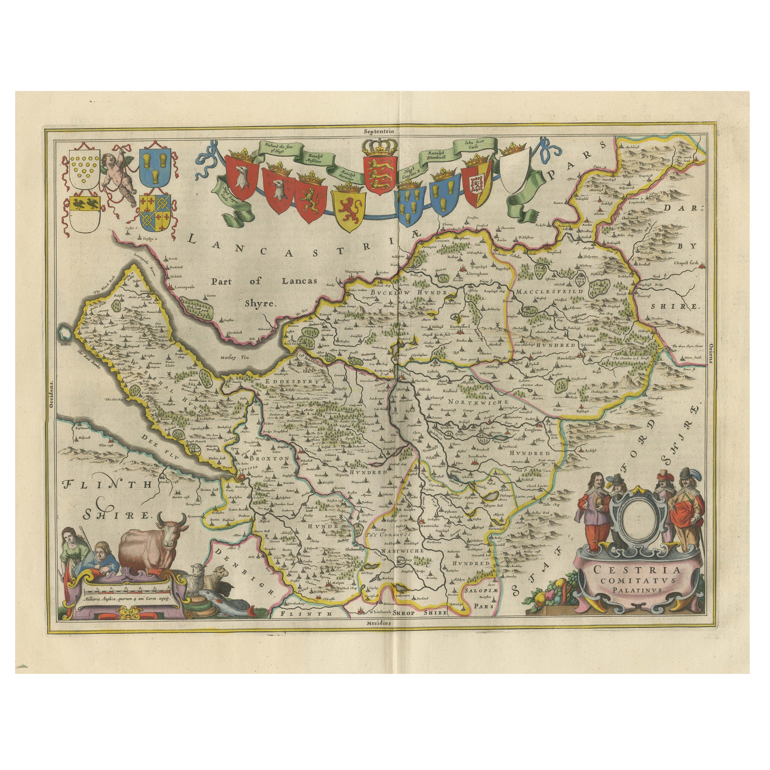
View AllAntique Map of Cheshire, North West England
By Joan (Johannes) Blaeu
Located in Langweer, NL
Antique map titled 'Cestria comitatus Palatinus'. Original old map of Cheshire, Northwest England. Published circa 1665 by J. Blaeu. Willem Jansz. Blaeu and his son Joan Blaeu are th...
Category
Antique Mid-17th Century Maps
Materials
Paper
$1,141 Sale Price
20% Off
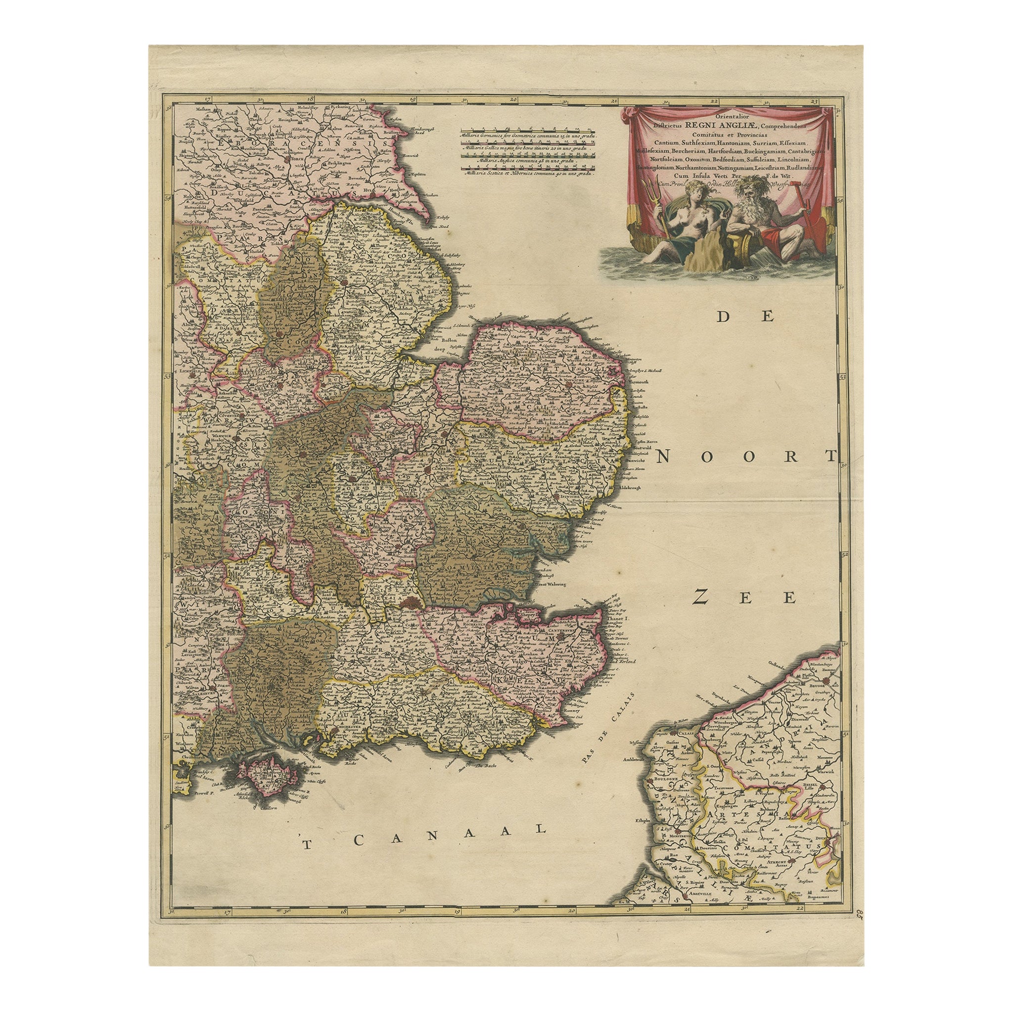
Detailed Antique Map of Southeast England, incl Warwickshire and Hampshire, 1690
Located in Langweer, NL
Antique map titled 'Orientalior districtus Regni Angliae (..)'.
Detailed map of southeast England encompassing the country from Lincolnshire and the Wash south and including Warw...
Category
Antique 1690s Maps
Materials
Paper
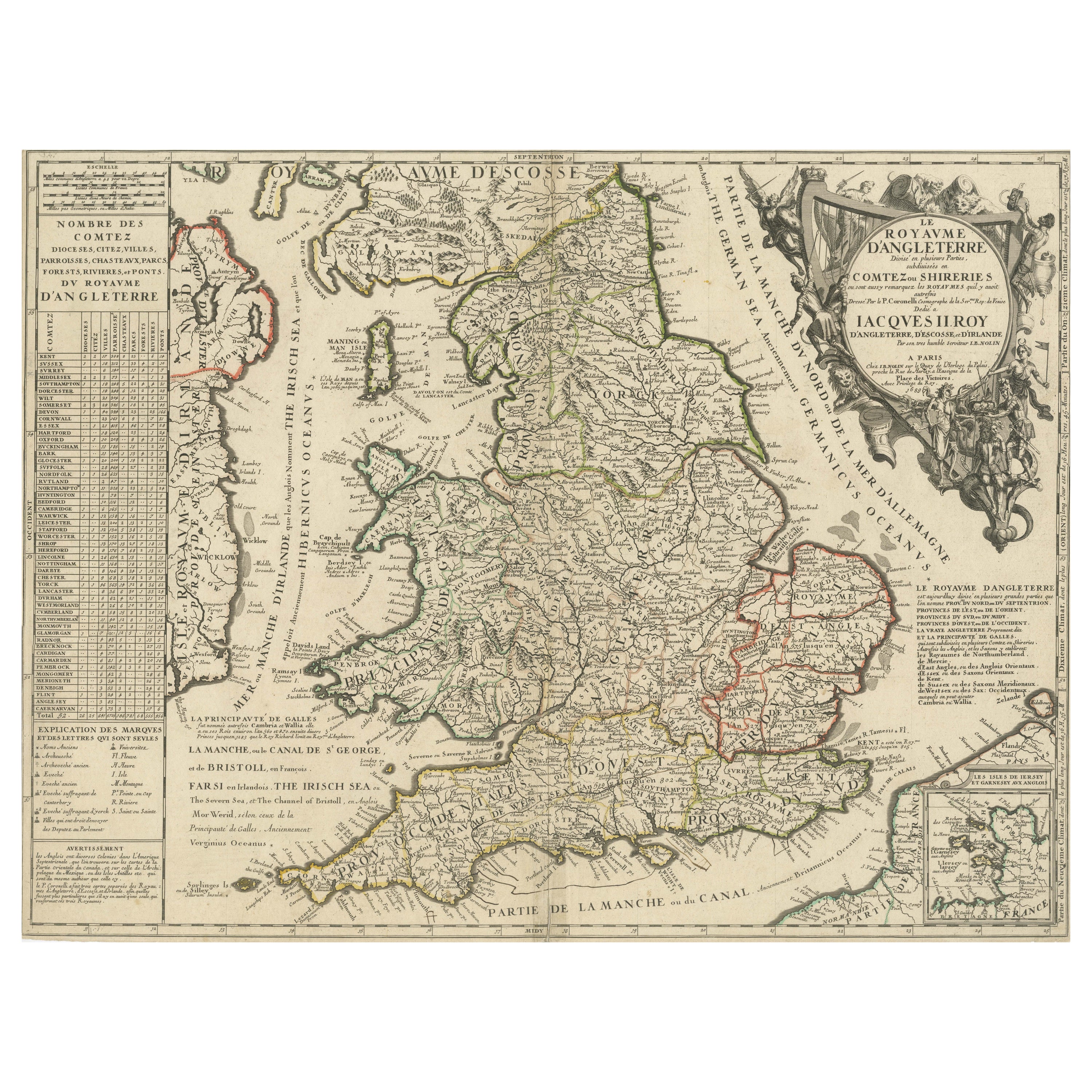
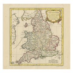
Original Antique Map of England and Wales with Large Cartouche
Located in Langweer, NL
Antique map titled 'Le Royaume d'Angleterre divisé en plusieurs Parties (..)'. Large and rare map of England and Wales by J.B. Nolin after Coronelli. With decorative cartouche, table...
Category
Antique Late 17th Century Maps
Materials
Paper

$418 Sale Price
20% Off
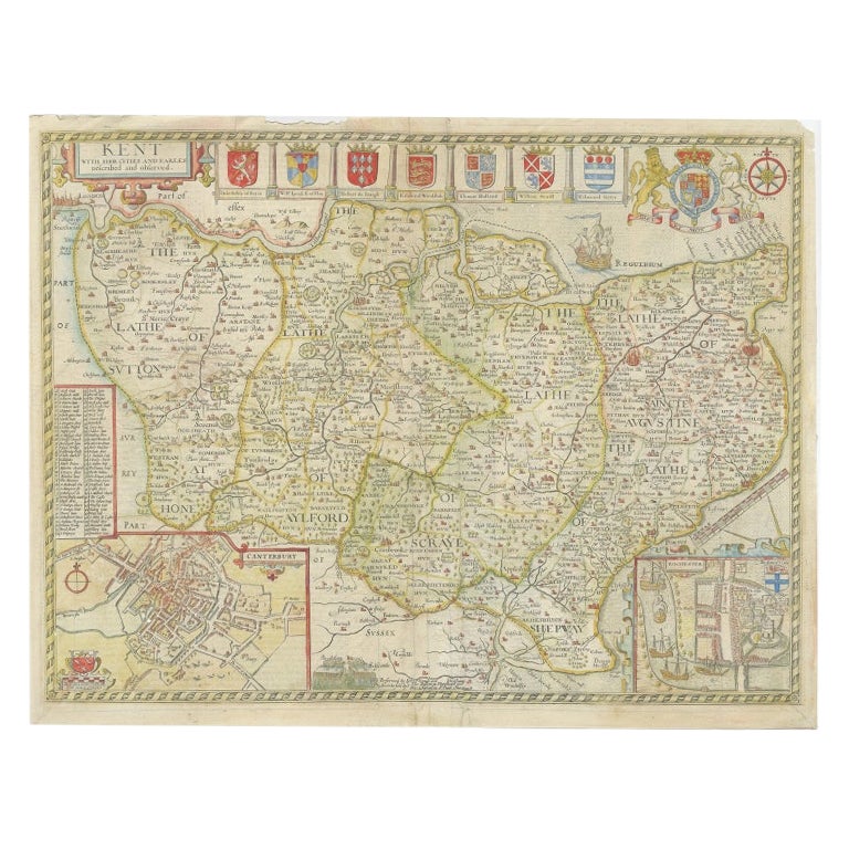
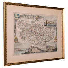
Antique Map of Kent with Inset Plans of Rochester
Canterbury, England, 1676
Located in Langweer, NL
Antique map titled 'Kent with her Cities and Earles described and observed'.
Map of Kent, England. Includes inset town plans of Rochester and Canterbury....
Category
Antique 17th Century Maps
Materials
Paper
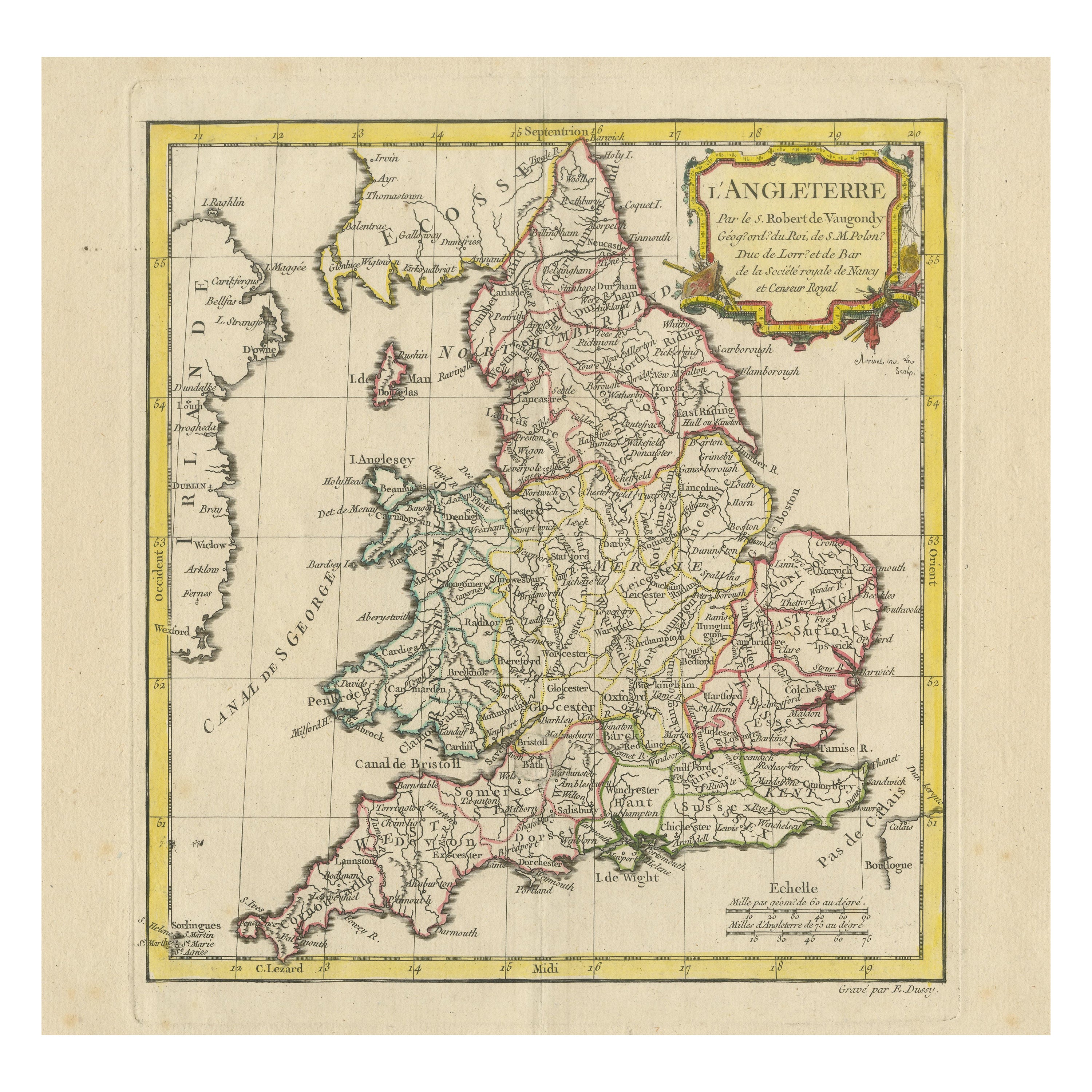
Original Antique Map of England with Decorative Cartouche
Located in Langweer, NL
Antique map titled 'l'Angleterre (..)'. Original antique map of England, with beautiful hand coloring and decorative cartouche. This map originates from 'Nouvel Atlas Portatif destin...
Category
Antique Late 18th Century Maps
Materials
Paper
$275 Sale Price
20% Off
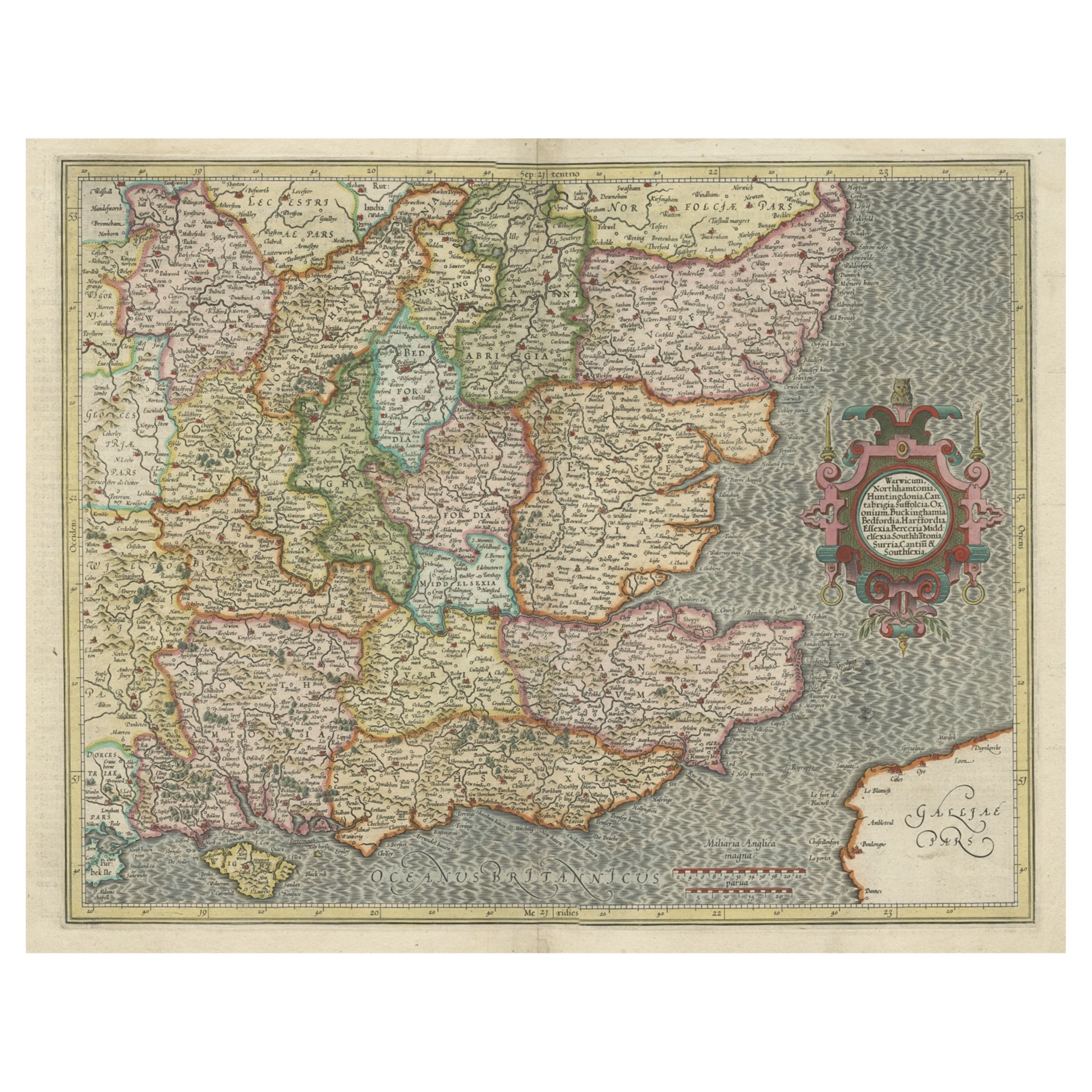
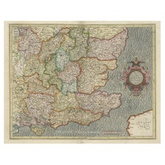
Original Old Map of South East England Incl London, Oxford, Cambridge, Etc, 1633
Located in Langweer, NL
Antique map titled 'Warwicum, Northhamtonia, Huntingdonia, Cantabrigia, Suffolcia, Oxonium, Buckinghamia, Befordia, Harfordia, Essexia, Berceria, Middlesexia, Southhatonia, Surria, Catiu & Southsexia'.
Old map of south east England. Includes London, Salisbury, Oxford, Cambridge, Leicester and Norwich and the Isle of Wight. Originates from the 1633 German edition of the Mercator-Hondius Atlas Major, published by Henricus Hondius and Jan Jansson under the title: 'Atlas: das ist Abbildung der gantzen Welt, mit allen darin begriffenen Laendern und Provintzen: sonderlich von Teutschland, Franckreich, Niderland, Ost und West Indien: mit Beschreibung der selben.'
Artists and engravers: Gerard Mercator (1512 - 1594) originally a student of philosophy was one of the most renowned cosmographers and geographers of the 16th century, as well as an accomplished scientific instrument maker. He is most famous for introducing Mercators Projection, a system which allowed navigators to plot the same constant compass bearing on a flat map.
Category
Antique 1630s Maps
Materials
Paper
$1,093 Sale Price / item
20% Off
You May Also Like
17th Century Hand-Colored Map of Southeastern England by Mercator and Hondius
By Gerard Mercator
Located in Alamo, CA
A 17th century copperplate hand-colored map entitled "The Sixt Table of England" by Gerard Mercator and Jodocus Hondius, published in Amsterdam in 1635 in 'Cosmographicall Descriptio...
Category
Antique Mid-17th Century Dutch Maps
Materials
Paper

Hampshire County, Britain/England: A Map from Camden
s" Britannia" in 1607
By John Norden
Located in Alamo, CA
An early hand-colored map of Britain's Hampshire county, published in the 1607 edition of William Camden's great historical description of the British Isles, "Britannia". This map was drawn by cartographer John Norden (c. 1547-1625) and engraved by William Hole (active 1607-1624) and William Kip...
Category
Antique Early 17th Century English Maps
Materials
Paper

Vintage County Map, Kent, History 19th Century Cartography, After Thomas Moule
Located in Hele, Devon, GB
This is an vintage lithography map of Kent. An English, framed atlas engraving of cartographic interest, with mapping dating to the early 19th century.
Superb reproduction lithograp...
Category
Vintage 1980s British Early Victorian Maps
Materials
Glass, Paper
Antique County Map, Shropshire, English, Atlas Engraving, Richard Blome, C.1673
Located in Hele, Devon, GB
This is an antique county map of Shropshire. An English, framed atlas engraving by Richard Blome, dating to the 17th century and later.
A treat for the collector or county native, ...
Category
Antique 17th Century British Restauration Maps
Materials
Glass, Wood, Paper

Antique County Map, Hertfordshire, English, Framed Engraving, Cartography, Litho
Located in Hele, Devon, GB
This is an antique county map of Hertfordshire. An English, framed atlas engraving of cartographic interest, dating to the mid 19th century and later.
Superb lithography of Hertfor...
Category
Antique Mid-19th Century British Victorian Maps
Materials
Glass, Wood, Paper
Map of Essex by Emanuel Bowen
Located in Cheshire, GB
Map of part of Essex and part of Kent, hand-coloured. Encased in an ebonized and gilded frame.
Dimensions
Height 25.5 Inches
Length 32.5 Inches
width 1 Inches.
Category
Antique Late 19th Century British Maps
Materials
Paper

$986 Sale Price
50% Off