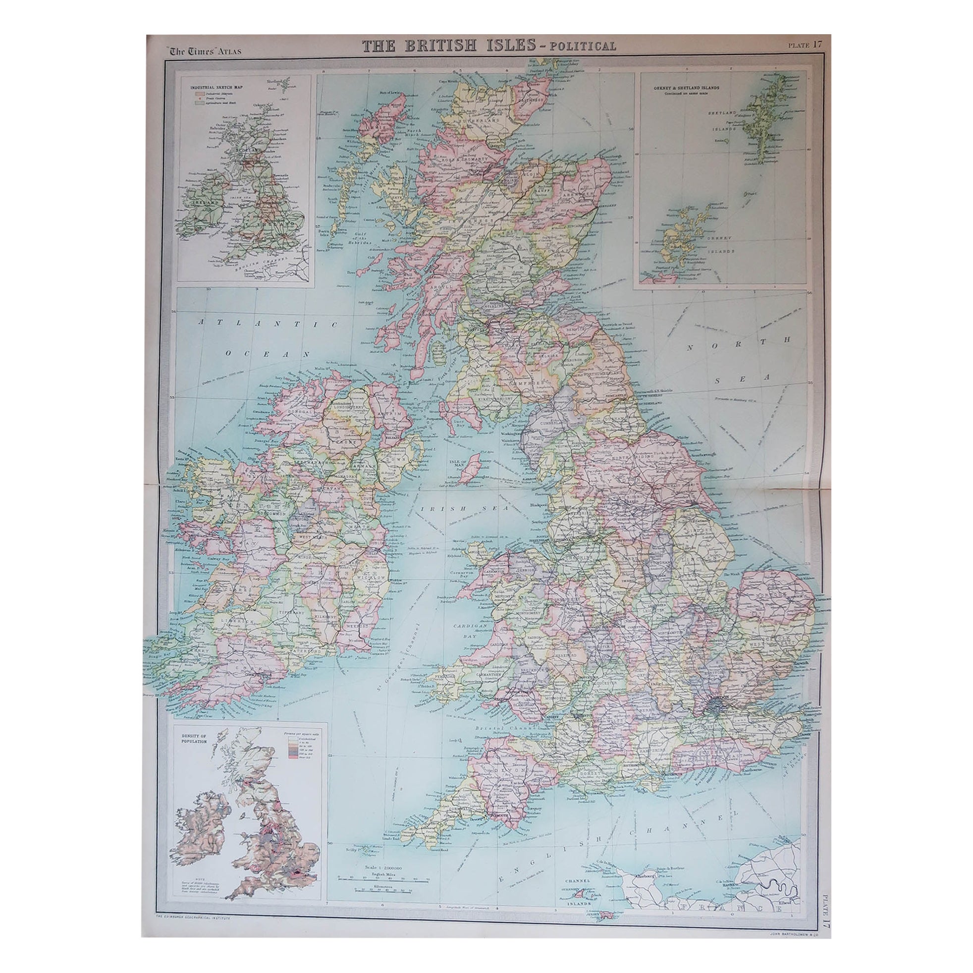
Items Similar to Antique Map of the British Isles by Johnston
1909


Want more images or videos?
Request additional images or videos from the seller
1 of 5
Antique Map of the British Isles by Johnston
1909
$240.18
$300.2220% Off
£177.89
£222.3620% Off
€200
€25020% Off
CA$328.55
CA$410.6920% Off
A$357.57
A$446.9620% Off
CHF 189.55
CHF 236.9320% Off
MX$4,301.81
MX$5,377.2620% Off
NOK 2,404.05
NOK 3,005.0620% Off
SEK 2,199.54
SEK 2,749.4220% Off
DKK 1,524.03
DKK 1,905.0420% Off
About the Item
Antique map titled 'The British Isles'. Original antique map of the British Isles. With inset maps of the Shetland Islands, Chanel Islands, and London. This map originates from the ‘Royal Atlas of Modern Geography’. Published by W.
A.K. Johnston, 1909.
- Dimensions:Height: 24.41 in (62 cm)Width: 19.49 in (49.5 cm)Depth: 0.02 in (0.5 mm)
- Materials and Techniques:
- Period:
- Date of Manufacture:1909
- Condition:Minor fading. General age-related toning, some foxing. Please study image carefully.
- Seller Location:Langweer, NL
- Reference Number:Seller: BG-12940-4A1stDibs: LU3054324702552
About the Seller
5.0
Recognized Seller
These prestigious sellers are industry leaders and represent the highest echelon for item quality and design.
Platinum Seller
Premium sellers with a 4.7+ rating and 24-hour response times
Established in 2009
1stDibs seller since 2017
2,813 sales on 1stDibs
Typical response time: 1 hour
- ShippingRetrieving quote...Shipping from: Langweer, Netherlands
- Return Policy
More From This Seller
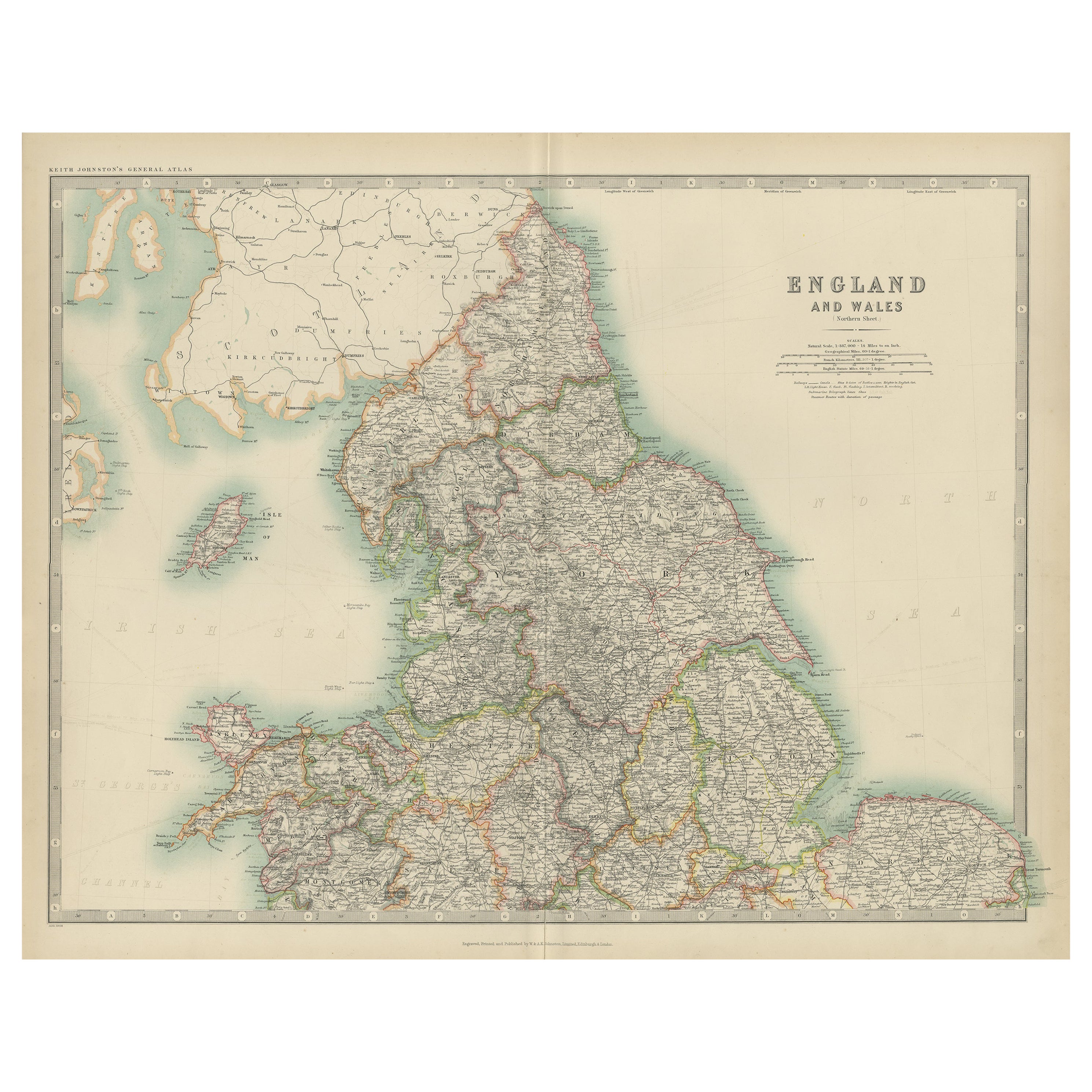
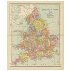
View AllOriginal Antique Map of England and Wales from the 1909 Royal Atlas
Located in Langweer, NL
The antique map titled 'England and Wales' is a historical cartographic representation of these two nations. This original antique map of England...
Category
Early 20th Century Maps
Materials
Paper

$240 Sale Price
20% Off
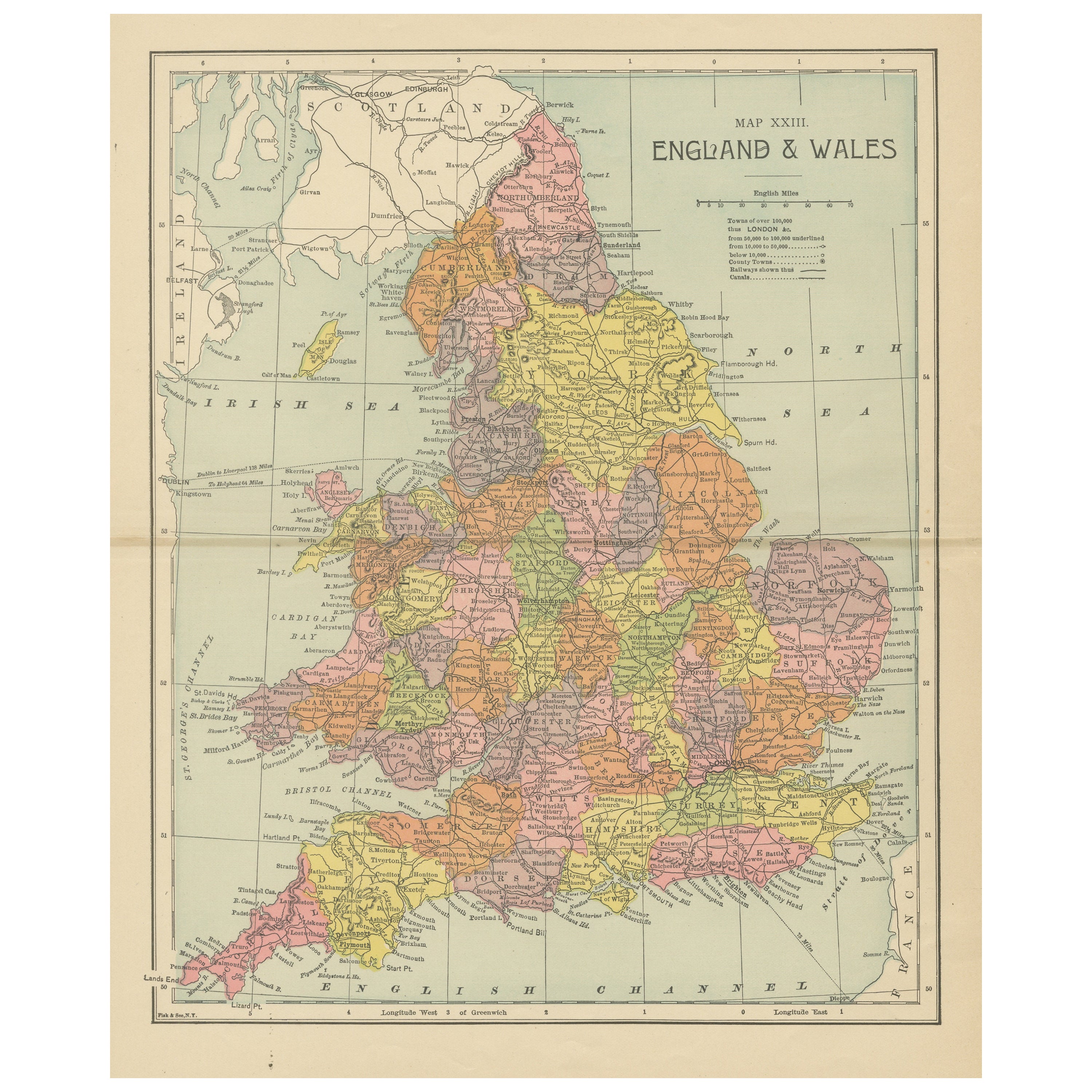
Lithographed Antique Map of England and Wales
Located in Langweer, NL
Original antique map titled 'Map XXIII England & Wales'. Lithographed map of England and Wales. Published by Fisk & See, circa 1890.
Category
Antique Late 19th Century Maps
Materials
Paper
$182 Sale Price
20% Off
Antique Map of, Northern England and Wales by Johnston, 1882
Located in Langweer, NL
Antique map titled 'England and Wales'.
Old map of England and Wales. This map originates from 'The Royal Atlas of Modern Geography, Exhibiting, in a Series of Entirely Original an...
Category
Antique 19th Century Maps
Materials
Paper

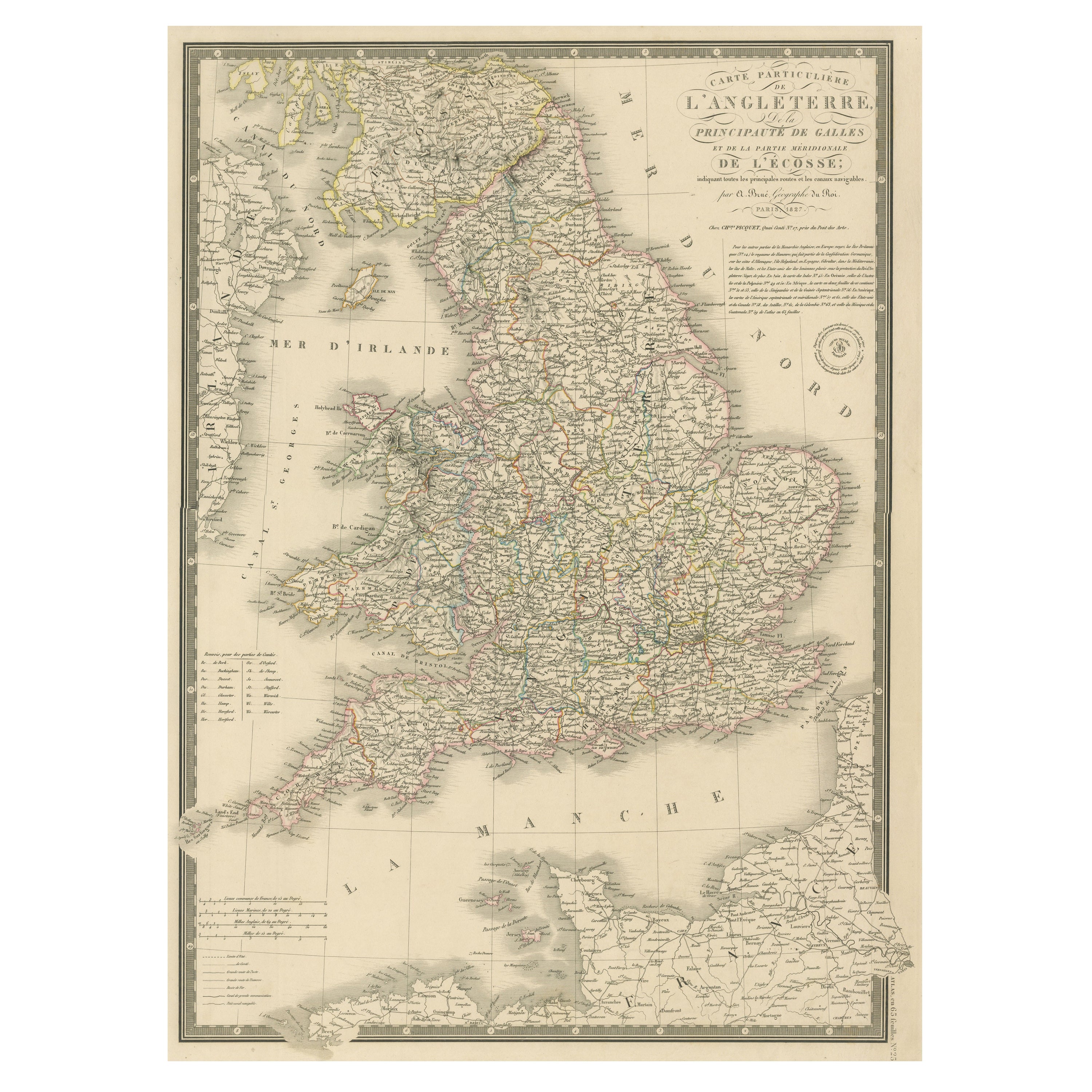
Antique Map of the British Isles and Part of the Coast of France
Located in Langweer, NL
Antique map titled 'Carte Particuliere l'Angleterre (..)'. Original antique map of the British Isles and part of the coast of France. It shows England and part of Wales. Published by...
Category
Antique Mid-19th Century Maps
Materials
Paper
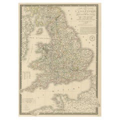
$220 Sale Price
20% Off
Antique Map of England and Wales by Johnson
1872
Located in Langweer, NL
Antique map titled 'Johnson's England and Wales'. Original map of England and Wales. This map originates from 'Johnson's New Illustrated Family Atlas of the World' by A.J. Johnson. P...
Category
Antique Late 19th Century American Maps
Materials
Paper

$225 Sale Price
25% Off
Original Antique Map of the British Isles Surrounded by Text
Located in Langweer, NL
Antique map titled 'Des Isles Britanniques'. Original antique map of the British isles. This map is divided in to three major regions of the 18th century United Kingdom: England, Ire...
Category
Antique Late 18th Century Maps
Materials
Paper

$355 Sale Price
20% Off
You May Also Like
Large Original Vintage Map of the United Kingdom, circa 1920
Located in St Annes, Lancashire
Great map of The United Kingdom
Unframed
Original color
By John Bartholomew and Co. Edinburgh Geographical Institute
Published, circa 1920
Free shipping.
Category
Vintage 1920s British Maps
Materials
Paper

England and Wales, Northern Part. Century Atlas antique vintage map
Located in Melbourne, Victoria
'The Century Atlas. England and Wales, Northern Part'
Original antique map, 1903.
Central fold as issued. Map name and number printed on the reverse corners.
Sheet 29.5cm by 40cm.
Category
Early 20th Century Victorian More Prints
Materials
Lithograph

England, Scotland
Ireland: A Hand Colored Map of Great Britain by Tirion
By Isaak Tirion
Located in Alamo, CA
This is a hand-colored double page copperplate map of Great Britain entitled "Nieuwe Kaart van de Eilanden van Groot Brittannien Behelzende de Kon...
Category
Antique Mid-18th Century Dutch Maps
Materials
Paper

$700 Sale Price
20% Off
Large Original Vintage Map of British Island Possessions, circa 1920
Located in St Annes, Lancashire
Great map of British Island Possessions
Original color. Good condition
Published by Alexander Gross
Unframed.
Category
Vintage 1920s English Maps
Materials
Paper

Large Original Antique Map of Ireland. C.1900
Located in St Annes, Lancashire
Fabulous map of Ireland
Original color.
Engraved and printed by the George F. Cram Company, Indianapolis.
Published, C.1900.
Unframed.
Free shipping.
Category
Antique 1890s American Maps
Materials
Paper

Large 17th Century Hand Colored Map of England and the British Isles by de Wit
By Frederick de Wit
Located in Alamo, CA
A large hand colored 17th century map of England and the British Isles by Frederick de Wit entitled "Accuratissima Angliæ Regni et Walliæ Principatus", published in Amsterdam in 1680. It is a highly detailed map of England, Scotland, the Scottish Isles...
Category
Antique Late 17th Century Dutch Maps
Materials
Paper

$940 Sale Price
20% Off