Items Similar to Antique Map of Cairo and Surroundings by Balbi
1847


Want more images or videos?
Request additional images or videos from the seller
1 of 5
Antique Map of Cairo and Surroundings by Balbi
1847
$142.39
$177.9820% Off
£106.30
£132.8720% Off
€120
€15020% Off
CA$197.82
CA$247.2720% Off
A$212.78
A$265.9820% Off
CHF 113.72
CHF 142.1520% Off
MX$2,508.09
MX$3,135.1220% Off
NOK 1,433.70
NOK 1,792.1320% Off
SEK 1,310.68
SEK 1,638.3520% Off
DKK 914.53
DKK 1,143.1720% Off
About the Item
Antique map titled 'Le Kaire'. Original antique map of Cairo and surroundings, Egypt. This map originates from 'Abrégé de Géographie (..)' by Adrien Balbi. Published 1847.
- Dimensions:Height: 9.06 in (23 cm)Width: 11.23 in (28.5 cm)Depth: 0.02 in (0.5 mm)
- Materials and Techniques:
- Period:
- Date of Manufacture:1847
- Condition:General age-related toning, original folding line. Minor wear, blank verso. Please study image carefully.
- Seller Location:Langweer, NL
- Reference Number:Seller: BG-12783-141stDibs: LU3054324648732
About the Seller
5.0
Recognized Seller
These prestigious sellers are industry leaders and represent the highest echelon for item quality and design.
Platinum Seller
Premium sellers with a 4.7+ rating and 24-hour response times
Established in 2009
1stDibs seller since 2017
2,836 sales on 1stDibs
Typical response time: 1 hour
- ShippingRetrieving quote...Shipping from: Langweer, Netherlands
- Return Policy
More From This Seller
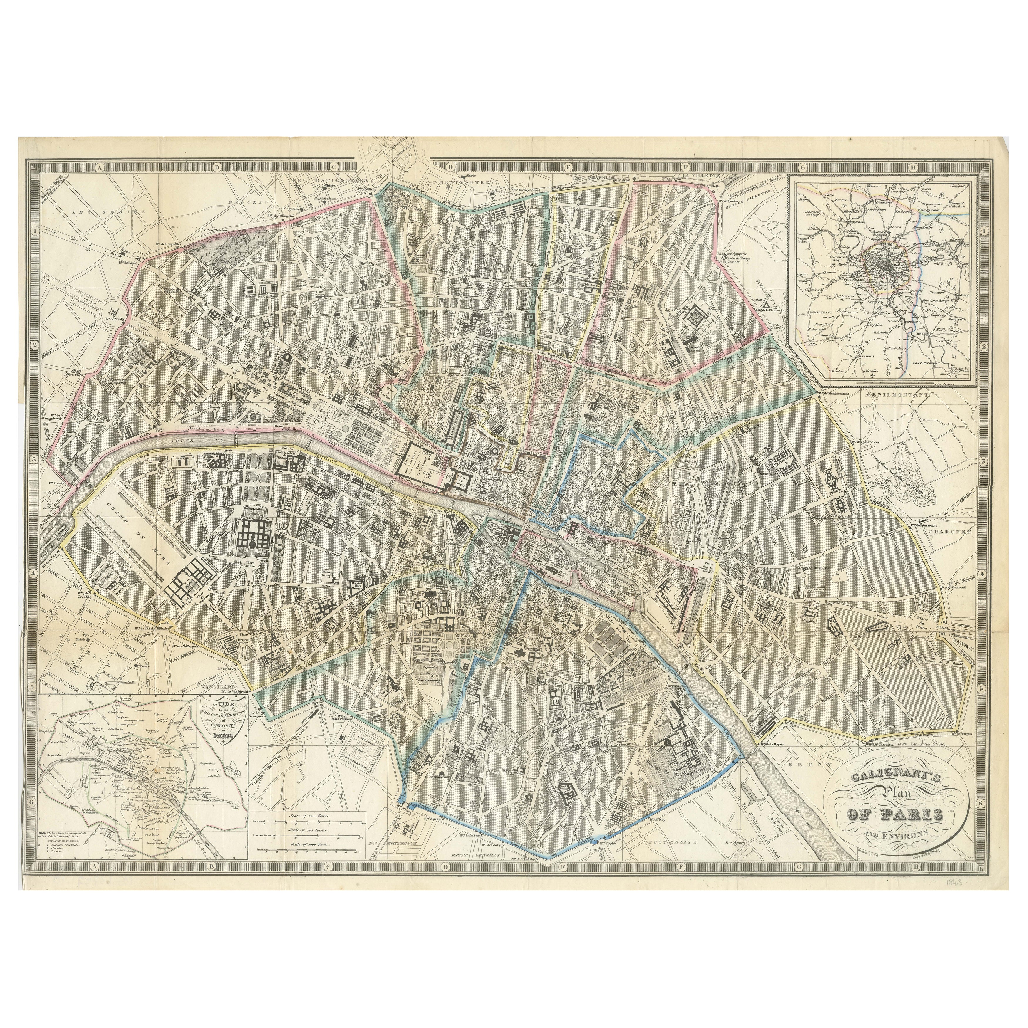
View AllParis and Surroundings – Antique Map by Gall and Inglis, Published 1843
Located in Langweer, NL
Antique Map of Paris and Environs by Gall and Inglis, 1843
This finely detailed map titled "Gall & Inglis’ Plan of Paris and Environs" was published in 1843 and provides a fascinati...
Category
Antique Mid-19th Century English Maps
Materials
Paper

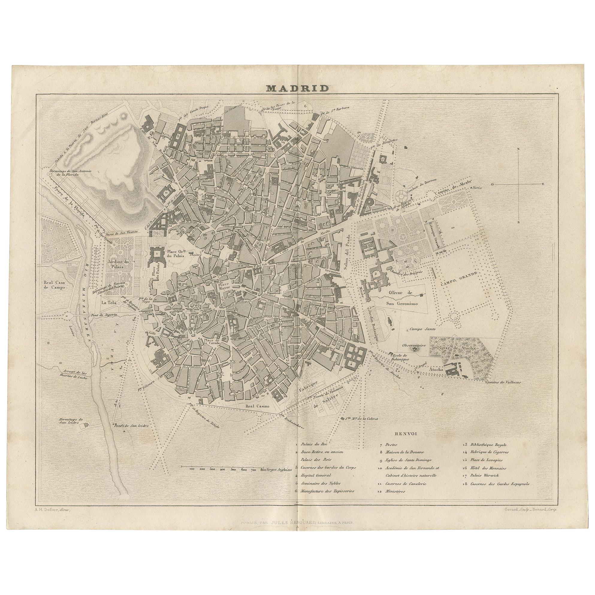
Antique Map of the City of Madrid by Balbi
1847
Located in Langweer, NL
Antique map titled 'Madrid'. Original antique map of the city of Madrid, Spain. This map originates from 'Abrégé de Géographie (..)' by Adrien Balbi. Published 1847.
Category
Antique Mid-19th Century Maps
Materials
Paper
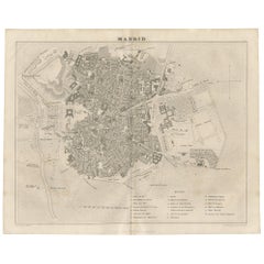
$142 Sale Price
20% Off
Antique Map of France by Balbi
1847
Located in Langweer, NL
Antique map titled 'France'. Original antique map of France. This map originates from 'Abrégé de Géographie (..)' by Adrien Balbi. Published 1847.
Category
Antique Mid-19th Century Maps
Materials
Paper

$118 Sale Price
20% Off
Antique Map of the City of London by Balbi
1847
Located in Langweer, NL
Antique map titled 'London'. Original antique map of the city of London. This map originates from 'Abrégé de Géographie (..)' by Adrien Balbi. Published 1847.
Category
Antique Mid-19th Century Maps
Materials
Paper

$189 Sale Price
20% Off
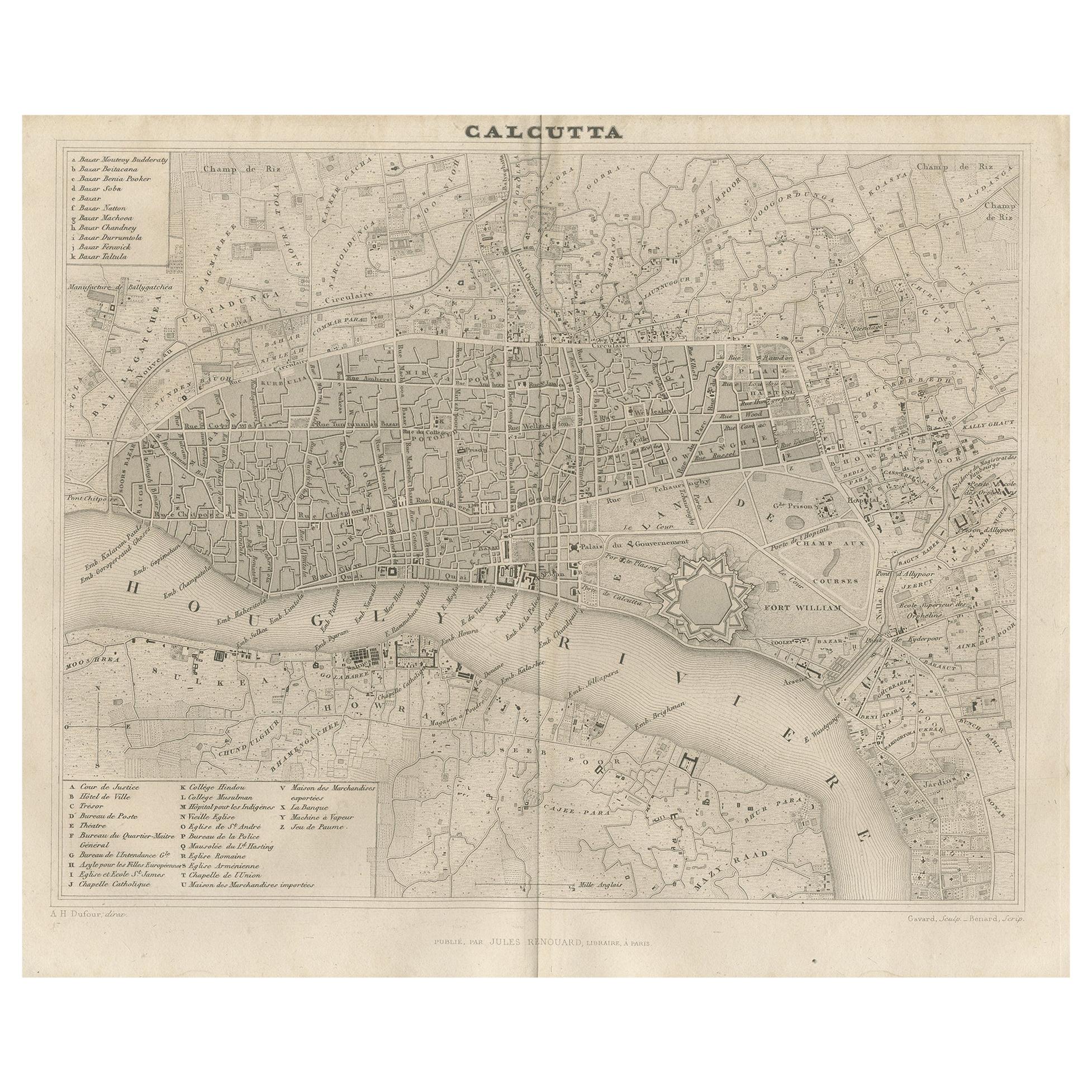
Antique Map of the City of Kolkata by Balbi
1847
Located in Langweer, NL
Antique map titled 'Calcutta'. Original antique map of the city of Kolkata, India. This map originates from 'Abrégé de Géographie (..)' by Adrien Balbi. Published 1847.
Category
Antique Mid-19th Century Maps
Materials
Paper
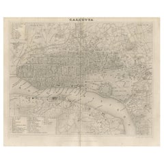
$142 Sale Price
20% Off
Antique Map of the City of Berlin in Germany,
1847
Located in Langweer, NL
Antique map titled 'Berlin'. Original antique map of the city of Berlin, Germany. This map originates from 'Abrégé de Géographie (..)' by Adrien Balbi. Published 1847.
Category
Antique Mid-19th Century Maps
Materials
Paper

$142 Sale Price
20% Off
You May Also Like
Original Large Antique Map of Paris, France by John Dower, 1861
Located in St Annes, Lancashire
Fabulous monochrome map of Paris.
Vignettes of St Germain En Laye, Saint Cloud, Versailles and Fontainbleau.
Unframed.
Drawn by J.Dower.
Lithography by Weller. 4 sheets joined to...
Category
Antique 1860s English Victorian Maps
Materials
Paper

1851 Original map by Maillard - Plan de Paris et ses Fortifications
Located in PARIS, FR
In the world of cartography, maps transcend mere geography; they are historical records and works of art, encapsulating the essence of a place at a specific moment in time. The 1851 ...
Category
1850s Prints and Multiples
Materials
Linen, Paper, Lithograph

Original Antique Map or City Plan of Madrid, Spain. Circa 1835
Located in St Annes, Lancashire
Nice map of Madrid
Drawn and engraved by J.Dower
Published by Orr & Smith. C.1835
Unframed.
Free shipping
Category
Antique 1830s English Maps
Materials
Paper

Original Antique Map or City Plan of Rome, Italy. Circa 1835
Located in St Annes, Lancashire
Nice map of Rome
Drawn and engraved by J.Dower
Published by Orr & Smith. C.1835
Unframed.
Free shipping
Category
Antique 1830s English Maps
Materials
Paper

"Plan de Paris" - Antique Recreation of a Map of Paris
Located in New York, NY
Printed in the Early 20th Century, this antique "Plan de Paris" is a recreation of an earlier map from 1710, originally commissioned by Louis XIV. It was an intricately rendered view...
Category
Early 20th Century French Louis XIV Maps
Materials
Linen, Wood, Paper
Original Antique Map or City Plan of Venice, Italy. Circa 1835
Located in St Annes, Lancashire
Nice map of Venice
Drawn and engraved by J.Dower
Published by Orr & Smith. C.1835
Unframed.
Free shipping
Category
Antique 1830s English Maps
Materials
Paper
