Items Similar to Antique Map of China and Japan by Meyer, 1895


Want more images or videos?
Request additional images or videos from the seller
1 of 5
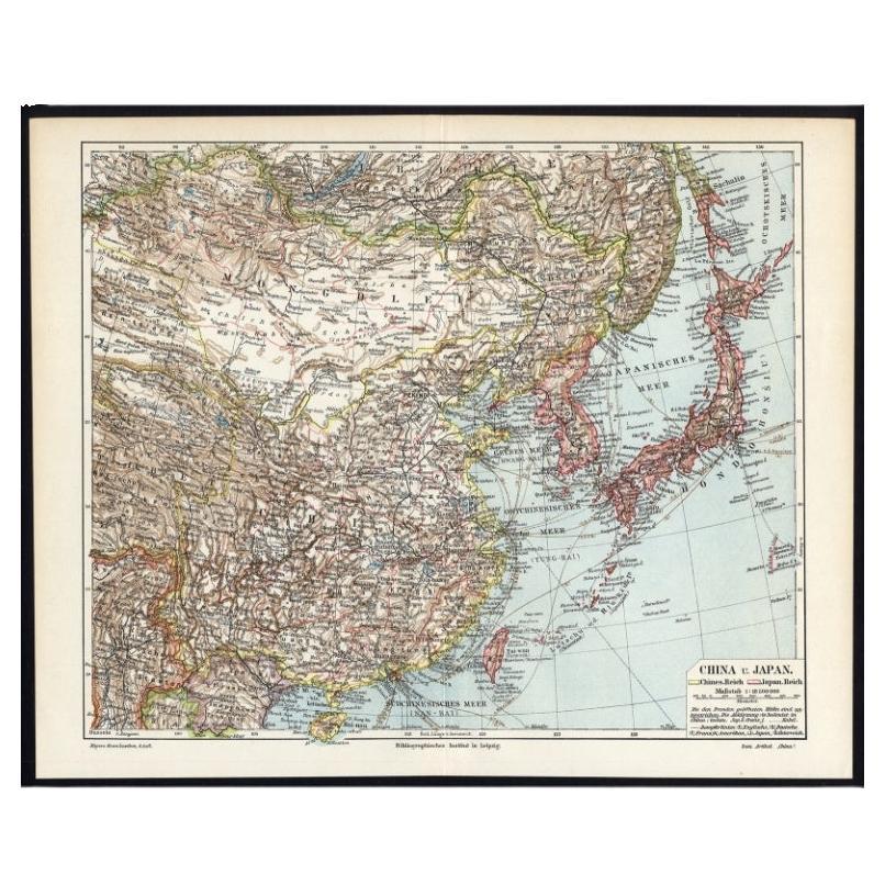
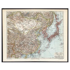
Antique Map of China and Japan by Meyer, 1895
$80.70
$100.8820% Off
£60.20
£75.2520% Off
€68
€8520% Off
CA$112.32
CA$140.4020% Off
A$120.50
A$150.6320% Off
CHF 64.64
CHF 80.7920% Off
MX$1,450.84
MX$1,813.5520% Off
NOK 814.81
NOK 1,018.5120% Off
SEK 742.99
SEK 928.7420% Off
DKK 518.21
DKK 647.7620% Off
About the Item
Antique map titled 'China und Japan'. Map of China, Mongolia, Taiwan and Japan. With an inset map of Jiaozhou Wan near Qingdao, and another of the region around Hongkong, including Kanton and Macau, with small plans of Hong Kong and Kanton. This map originates from a 1885-1907 edition of a famous German encyclopedia titled 'Meyers grosses Konversations-Lexikon', published in Leipzig and Vienna. Meyers Konversations-Lexikon was a major German encyclopedia that existed in various editions from 1839 until 1984, when it merged with the Brockhaus encyclopedia. Several of the plates were also used in Dutch Encyclopedia's like Winkler Prins.
Artists and Engravers: Meyers Konversations-Lexikon was a major German encyclopedia that existed in various editions from 1839 until 1984, when it merged with the Brockhaus encyclopedia. Several of the plates were also used in Dutch Encyclopedia's like Winkler Prins.
Condition: Very good, given age. Original fold, as issued. General age-related toning and/or occasional minor defects from handling. Please study image carefully.
Date: c.1895
Overall size: 40 x 24.4 cm.
Image size: 0.001 x 36 x 22 cm.
We sell original antique maps to collectors, historians, educators and interior decorators all over the world. Our collection includes a wide range of authentic antique maps from the 16th to the 20th centuries. Buying and collecting antique maps is a tradition that goes back hundreds of years. Antique maps have proved a richly rewarding investment over the past decade, thanks to a growing appreciation of their unique historical appeal. Today the decorative qualities of antique maps are widely recognized by interior designers who appreciate their beauty and design flexibility. Depending on the individual map, presentation, and context, a rare or antique map can be modern, traditional, abstract, figurative, serious or whimsical. We offer a wide range of authentic antique maps for any budget.
- Dimensions:Height: 9.61 in (24.4 cm)Width: 15.75 in (40 cm)Depth: 0 in (0.01 mm)
- Materials and Techniques:
- Period:
- Date of Manufacture:circa 1895
- Condition:
- Seller Location:Langweer, NL
- Reference Number:Seller: PC-644291stDibs: LU3054325638942
About the Seller
5.0
Recognized Seller
These prestigious sellers are industry leaders and represent the highest echelon for item quality and design.
Platinum Seller
Premium sellers with a 4.7+ rating and 24-hour response times
Established in 2009
1stDibs seller since 2017
2,830 sales on 1stDibs
Typical response time: 1 hour
- ShippingRetrieving quote...Shipping from: Langweer, Netherlands
- Return Policy
More From This Seller
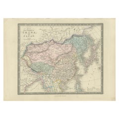
View AllGerman Antique Map of China And Japan by Meyer, 1902
Located in Langweer, NL
Antique map titled 'China und Japan.' (Map of China and Japan). This attractive original old antique print / plate / map originates from the 6th edition of a famous German encycloped...
Category
20th Century Maps
Materials
Paper
$75 Sale Price
20% Off
Antique Map of China and Japan by Johnson, 1872
Located in Langweer, NL
Antique map titled 'Johnson's China and Japan'. Map of China and Japan, with an inset map of the vicinity of Canton and Hong Kong. This map originates from 'Johnson's New Illustrated...
Category
Antique Late 19th Century Maps
Materials
Paper

$284 Sale Price
20% Off
Antique Map of China and Japan by A.K. Johnston, 1865
Located in Langweer, NL
Antique map titled 'China and Japan'. Depicting Eastern China, the Islands of Japan and more. This map originates from the ‘Royal Atlas of Modern Geography’ by Alexander Keith Johnst...
Category
Antique Mid-19th Century Maps
Materials
Paper

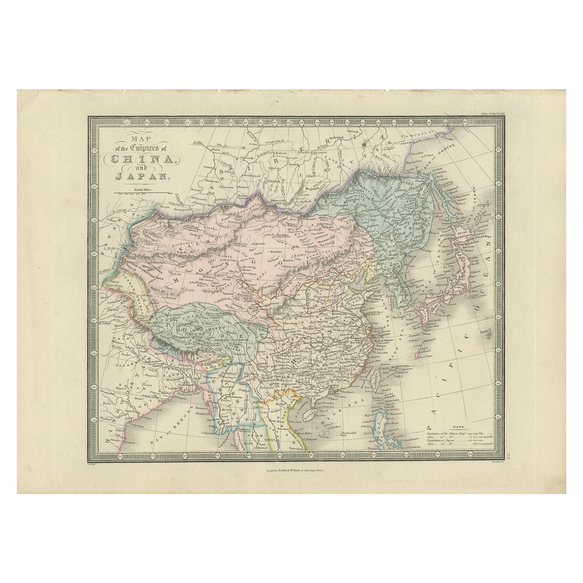
Antique Map of China and Japan by Wyld
1845
Located in Langweer, NL
Antique map titled 'Map of the Empires of China and Japan'. Original antique map of China and Japan. This map originates from 'An Atlas of the World, Comprehending Separate Maps of i...
Category
Antique Mid-19th Century Maps
Materials
Paper
$213 Sale Price
40% Off
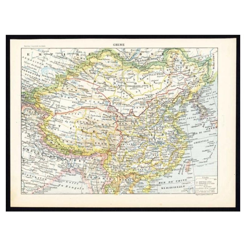
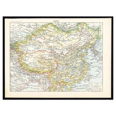
Antique Map of China by Larousse, 1897
By Pierre Larousse
Located in Langweer, NL
Sheet: Front: 'Chine.' (China map). Verso: 'China.' (China views, nature, animals, costume). This rare early lithographic print originates from: 'Nouveau Lar...
Category
Antique 19th Century Maps
Materials
Paper
$50 Sale Price
50% Off
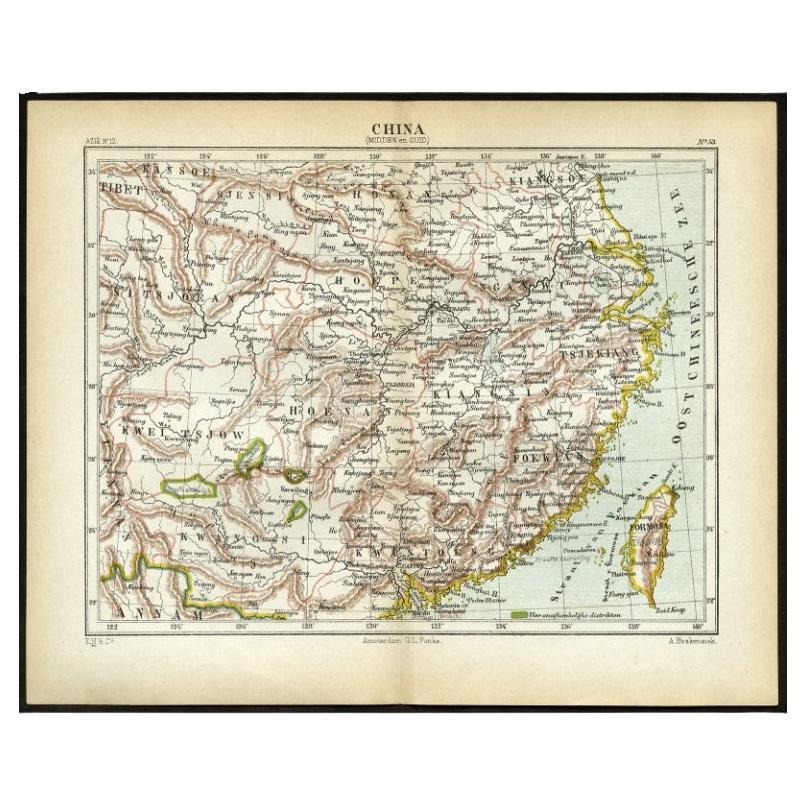
Antique Map of Central and Southern China by Kuyper, 1880
Located in Langweer, NL
Plate 53 : 'China, Midden en Zuid.' (China, Central and South). This lithographed map originates from: 'Wereld-atlas voor Kantoor en Huiskamer' (transl: World Atlas for the office an...
Category
Antique 19th Century Maps
Materials
Paper
$61 Sale Price
20% Off
You May Also Like
Large Original Vintage Map of China, circa 1920
Located in St Annes, Lancashire
Great map of China.
Original color. Good condition.
Published by Alexander Gross
Unframed.
Category
Vintage 1920s English Edwardian Maps
Materials
Paper

China and Japan, English antique map by Alexander Keith Johnston, 1901
Located in Melbourne, Victoria
'China and Japan', antique lithographic map by Keith Johnston.
Central vertical fold as issued.
495mm by 625mm (sheet)
Alexander Keith Johnston FRS...
Category
Early 20th Century Victorian More Prints
Materials
Lithograph

Large Original Vintage Map of Japan, circa 1920
Located in St Annes, Lancashire
Great map of Japan
Unframed
Original color
By John Bartholomew and Co. Edinburgh Geographical Institute
Published, circa 1920
Free shipping.
Category
Vintage 1920s British Maps
Materials
Paper

Large Original Antique Map of Asia by Sidney Hall, 1847
Located in St Annes, Lancashire
Great map of Asia
Drawn and engraved by Sidney Hall
Steel engraving
Original colour outline
Published by A & C Black. 1847
Unframed
Free shipping
Category
Antique 1840s Scottish Maps
Materials
Paper

Super Rare Antique French Map of Chine and the Chinese Empire, 1780
Located in Amsterdam, Noord Holland
Super Rare Antique French Map of Chine and the Chinese Empire, 1780
Very nice map of Asia. 1780 Made by Bonne.
Additional information:
Type: Map
...
Category
Antique 18th Century European Maps
Materials
Paper

$438 Sale Price
49% Off
Large Original Vintage Map of Japan, circa 1920
Located in St Annes, Lancashire
Great map of Japan
Original color. Good condition
Published by Alexander Gross
Unframed.
Category
Vintage 1920s English Maps
Materials
Paper

More Ways To Browse
Chinese And Japanese Antique Furniture
Japan Antiques Collectables
Antique Map Of Egypt
Map Of Austria
New Zealand Map
Antique Linen Map
19th Century World Map
Antique Ohio Maps
Antique Texas Furniture
Military Map
Antique Maps New Zealand
Birds Eye View Map
North Africa Map
West Africa Map
Antique Compass Map
Antique Maps California
Biblical Maps
Hungary Map