Items Similar to Antique Map of China by W. G. Blackie, 1859

Want more images or videos?
Request additional images or videos from the seller
1 of 6
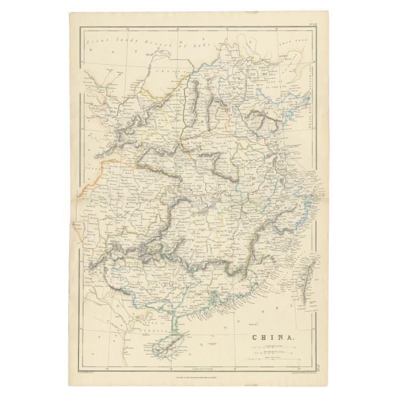
Antique Map of China by W. G. Blackie, 1859
$240.20
$300.2520% Off
£177.93
£222.4120% Off
€200
€25020% Off
CA$328.65
CA$410.8220% Off
A$357.60
A$44720% Off
CHF 189.34
CHF 236.6820% Off
MX$4,302.17
MX$5,377.7120% Off
NOK 2,404.26
NOK 3,005.3220% Off
SEK 2,199.73
SEK 2,749.6620% Off
DKK 1,524.16
DKK 1,905.2020% Off
About the Item
Antique map titled 'China'. Original antique map of China. This map originates from ‘The Imperial Atlas of Modern Geography’. Published by W. G. Blackie, 1859.
- Dimensions:Height: 21.26 in (54 cm)Width: 14.57 in (37 cm)Depth: 0.02 in (0.5 mm)
- Materials and Techniques:
- Period:
- Date of Manufacture:1859
- Condition:Wear consistent with age and use. General age-related toning. some foxing, Please study image carefully.
- Seller Location:Langweer, NL
- Reference Number:Seller: BG-12685-1-521stDibs: LU3054325241382
About the Seller
5.0
Recognized Seller
These prestigious sellers are industry leaders and represent the highest echelon for item quality and design.
Platinum Seller
Premium sellers with a 4.7+ rating and 24-hour response times
Established in 2009
1stDibs seller since 2017
2,816 sales on 1stDibs
Typical response time: 1 hour
- ShippingRetrieving quote...Shipping from: Langweer, Netherlands
- Return Policy
More From This Seller
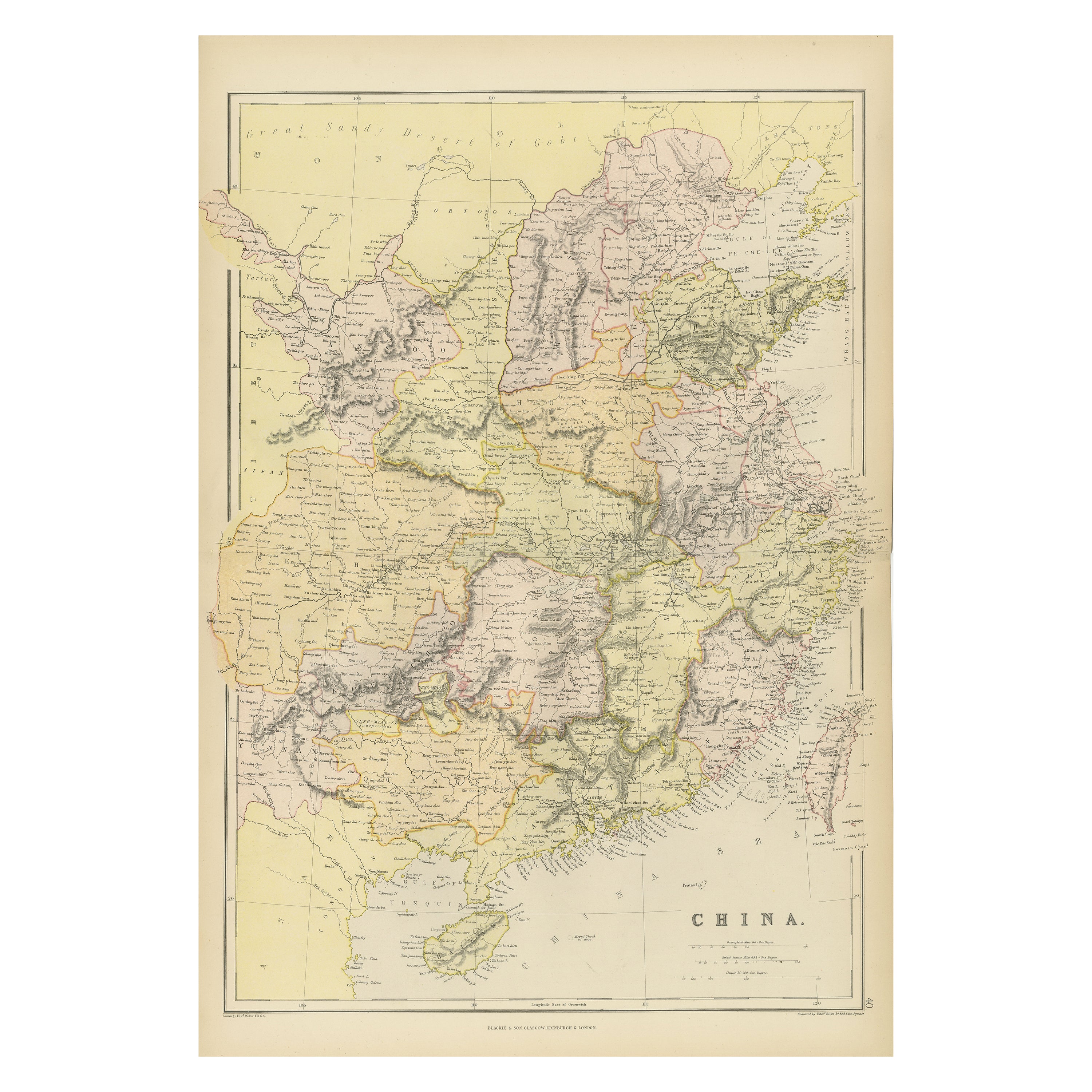
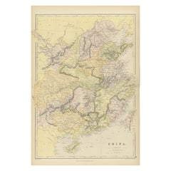
View AllAntique Map of China, 1874
Located in Langweer, NL
Antique map titled 'China'. Detailed map of China originates from Blackie's 'The Comprehensive Atlas & Geography of the World'.
Artists and Engravers: ...
Category
Antique 19th Century Maps
Materials
Paper

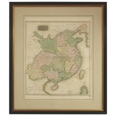
Antique 19th Century Map of China by Blackie
Son, 1882
Located in Langweer, NL
This map is an 1882 Blackie & Son map of China. The title "CHINA." is prominently displayed at the bottom. The map is colored to differentiate various regions, possibly indicating di...
Category
Antique 1880s Maps
Materials
Paper
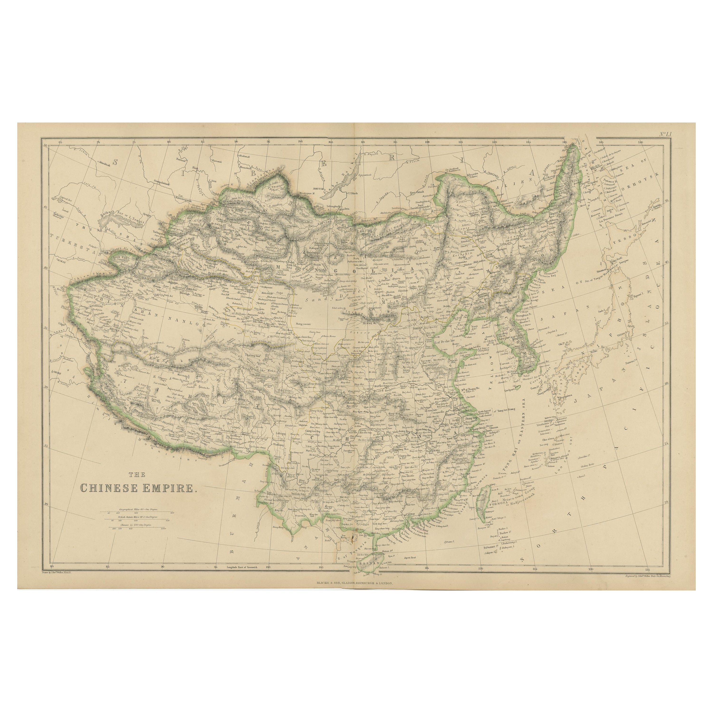
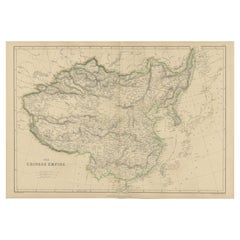
Antique Map of the Chinese Empire by W. G. Blackie, 1859
Located in Langweer, NL
Antique map titled 'The Chinese Empire'. Original antique map of the Chinese Empire. This map originates from ‘The Imperial Atlas of Modern Geography’. Published by W. G. Blackie, 1859.
Category
Antique Mid-19th Century Maps
Materials
Paper
$240 Sale Price
20% Off
Antique Map of China by A
C, Black, 1870
Located in Langweer, NL
Antique map titled 'China'. Original antique map of China. This map originates from ‘Black's General Atlas of The World’. Published by A & C. Black, 1870.
Category
Antique Late 19th Century Maps
Materials
Paper

$264 Sale Price
20% Off
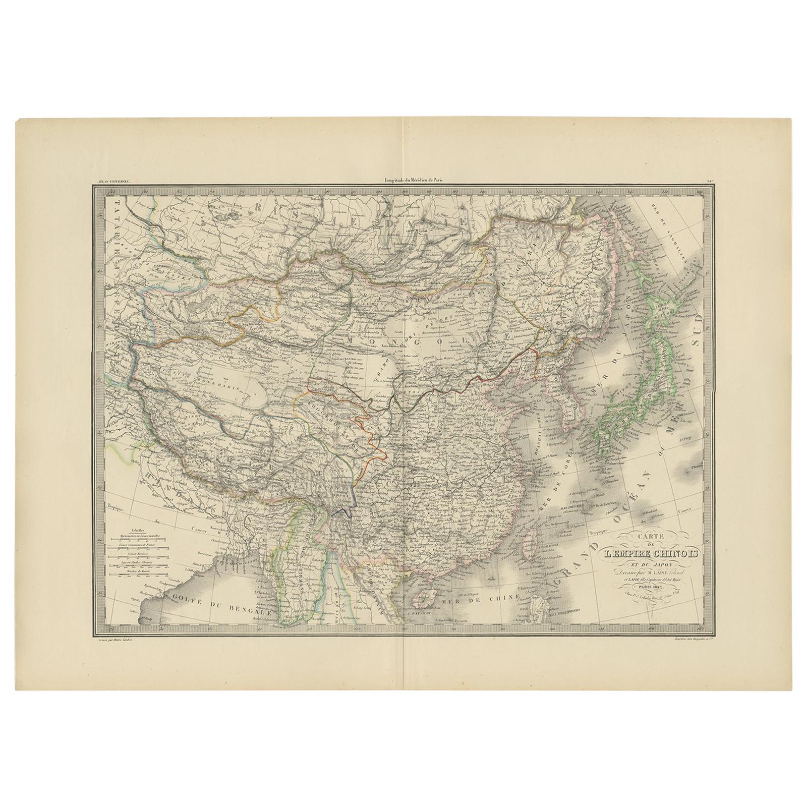
Antique Map of the Chinese Empire and Japan by Lapie, 1842
Located in Langweer, NL
Antique map titled 'Carte de L'Empire Chinois et du Japon'. Map of the Chinese Empire (China) and Japan. This map originates from 'Atlas universel de géographie ancienne et moderne (...
Category
Antique Mid-19th Century Maps
Materials
Paper

Antique Map of China by Wilkinson
1803
Located in Langweer, NL
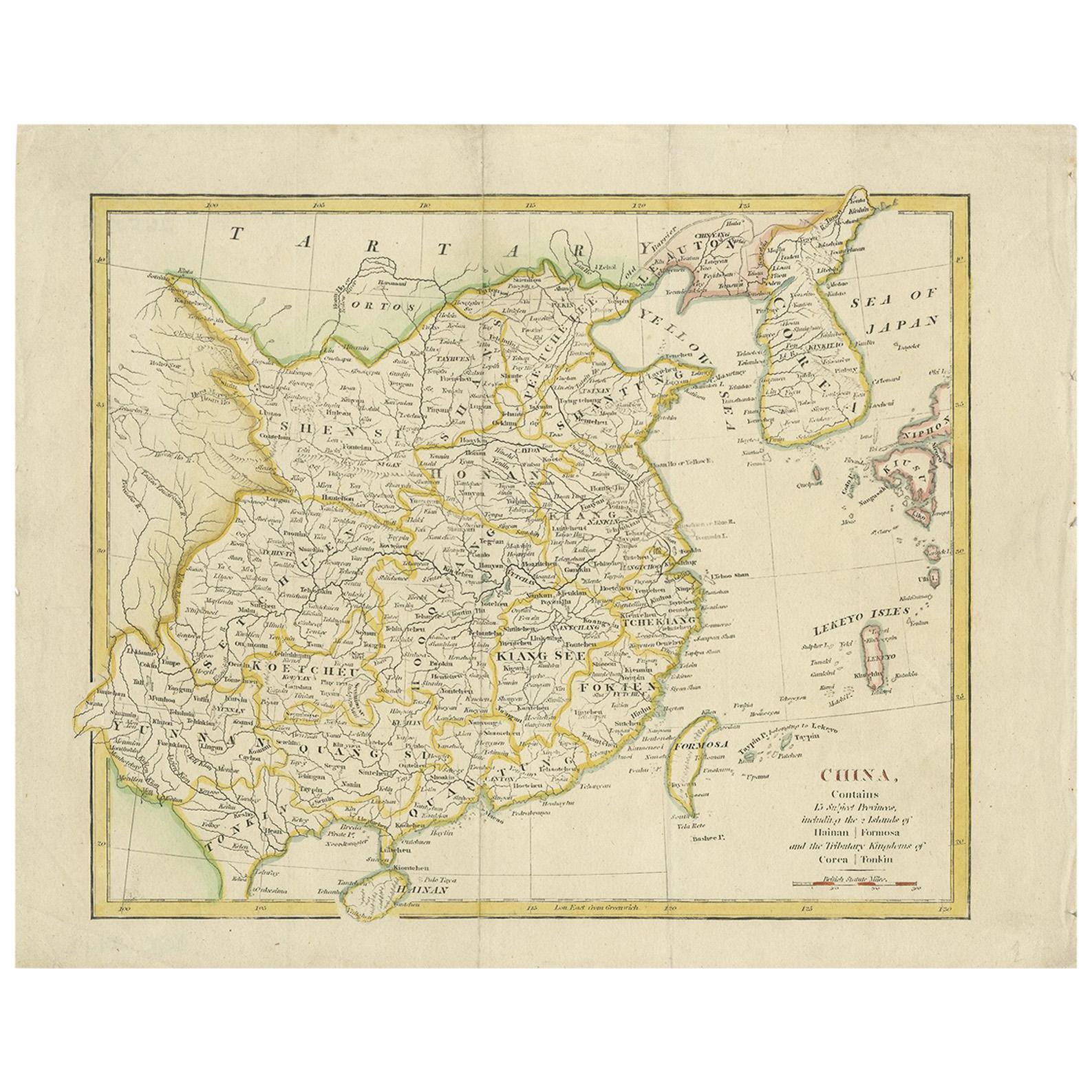
Antique map titled 'China, Contains 15 Subject Provinces Including the 2 Islands of Hainan, Formosa and the Tributary Kingdoms of Korea, Tonkin'. Old map depicting China, extending f...
Category
Antique Early 19th Century Maps
Materials
Paper

You May Also Like
Original Antique Map of China, Arrowsmith, 1820
Located in St Annes, Lancashire
Great map of China
Drawn under the direction of Arrowsmith
Copper-plate engraving
Published by Longman, Hurst, Rees, Orme and Brown, 1820
Unfr...
Category
Antique 1820s English Maps
Materials
Paper

Large Original Vintage Map of China, circa 1920
Located in St Annes, Lancashire
Great map of China.
Original color. Good condition.
Published by Alexander Gross
Unframed.
Category
Vintage 1920s English Edwardian Maps
Materials
Paper

Super Rare Antique French Map of Chine and the Chinese Empire, 1780
Located in Amsterdam, Noord Holland
Super Rare Antique French Map of Chine and the Chinese Empire, 1780
Very nice map of Asia. 1780 Made by Bonne.
Additional information:
Type: Map
...
Category
Antique 18th Century European Maps
Materials
Paper

$438 Sale Price
49% Off
Framed Early 19th Century Drawn and Engraved Map of China
By John Knighton Thomson
Located in San Francisco, CA
Hand drawn and tinted engraved map of China dated 1815
Created for Thomson's New General Atlas
Edinburgh
Beautifully framed with a linen covered mat.
Category
Antique Early 19th Century European Prints
Materials
Paper
China and Japan, English antique map by Alexander Keith Johnston, 1901
Located in Melbourne, Victoria
'China and Japan', antique lithographic map by Keith Johnston.
Central vertical fold as issued.
495mm by 625mm (sheet)
Alexander Keith Johnston FRS...
Category
Early 20th Century Victorian More Prints
Materials
Lithograph

Antique 1803 Italian Map of Asia Including China Indoneseia India
Located in Amsterdam, Noord Holland
Antique 1803 Italian Map of Asia Including China Indoneseia India
Very nice map of Asia. 1803.
Additional information:
Type: Map
Country of Manufacturing: Europe
Period: 19th centu...
Category
Antique 19th Century European Maps
Materials
Paper

$438 Sale Price
39% Off
More Ways To Browse
Map Of Egypt
Antique Ecuador
Antique Map New York
Nautical Maps
18th Century Maps America
Antique Map Of Egypt
Map Of Austria
New Zealand Map
Antique Linen Map
19th Century World Map
Antique Ohio Maps
Antique Texas Furniture
Military Map
Antique Maps New Zealand
Birds Eye View Map
North Africa Map
West Africa Map
Antique Compass Map