Items Similar to Antique Map of the Circle of Franconia, 1757


Want more images or videos?
Request additional images or videos from the seller
1 of 6
Antique Map of the Circle of Franconia, 1757
$653.29
$816.6120% Off
£483.86
£604.8220% Off
€544
€68020% Off
CA$893.67
CA$1,117.0820% Off
A$972.58
A$1,215.7320% Off
CHF 515.57
CHF 644.4620% Off
MX$11,700.91
MX$14,626.1420% Off
NOK 6,539.02
NOK 8,173.7820% Off
SEK 5,982.75
SEK 7,478.4320% Off
DKK 4,145.37
DKK 5,181.7220% Off
About the Item
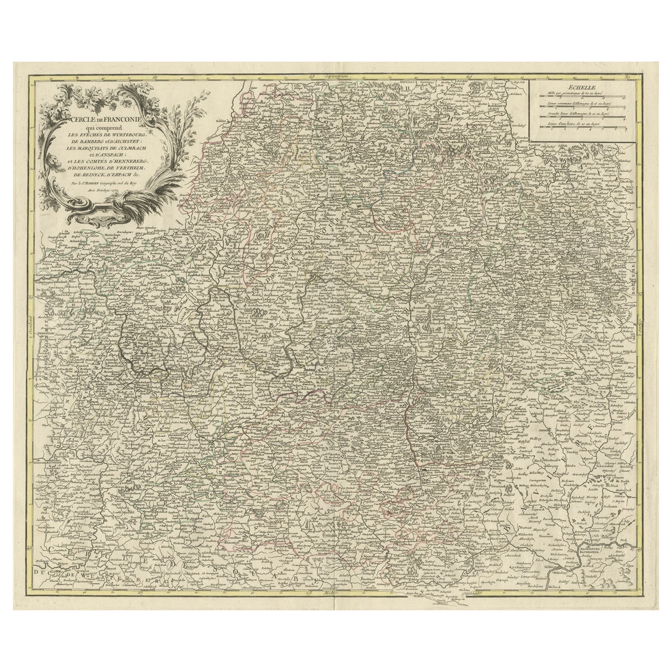
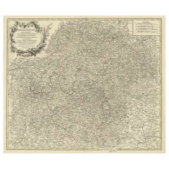
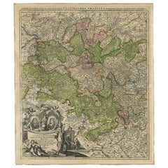
Antique map titled 'Cercle de Franconie (..)'. Map of the Circle of Franconia, Germany. Centered on Bamberg, Wurtzburg and Nuremberg. This map originates from 'Atlas Universel (..)'.
Artists and Engravers: Gilles Robert de Vaugondy (1688 - 1766), also known as Le Sieur or Monsieur Robert, and his son, Didier Robert de Vaugondy (c.1723 - 1786), were leading mapmakers in France during the 18th century. In 1757, they published The Atlas Universel, one of the most important atlases of the 18th century. To produce the atlas, the Vaugondys integrated older sources with more modern surveyed maps. They verified and corrected the latitude and longitude of many regional maps in the atlas with astronomical observations. The older material was revised with the addition of many new place names. In 1760, Didier Robert de Vaugondy was appointed geographer to Louis XV.
Condition: Fair/good, general age-related tonign. Original folding line, with repair. Minor wear and small defects, blank verso. Please study image carefully.
Date: 1757
Overall size: 69 x 56 cm.
Image size: 56 x 48 cm.
We sell original antique maps to collectors, historians, educators and interior decorators all over the world. Our collection includes a wide range of authentic antique maps from the 16th to the 20th centuries. Buying and collecting antique maps is a tradition that goes back hundreds of years. Antique maps have proved a richly rewarding investment over the past decade, thanks to a growing appreciation of their unique historical appeal. Today the decorative qualities of antique maps are widely recognized by interior designers who appreciate their beauty and design flexibility. Depending on the individual map, presentation, and context, a rare or antique map can be modern, traditional, abstract, figurative, serious or whimsical. We offer a wide range of authentic antique maps for any budget.
- Dimensions:Height: 22.05 in (56 cm)Width: 27.17 in (69 cm)Depth: 0 in (0.01 mm)
- Materials and Techniques:
- Period:
- Date of Manufacture:1757
- Condition:Repaired: Original folding line, with repair. Condition: Fair/good, general age-related tonign. Original folding line, with repair. Minor wear and small defects, blank verso. Please study image carefully.
- Seller Location:Langweer, NL
- Reference Number:Seller: BG-12674-31stDibs: LU3054329621412
About the Seller
5.0
Recognized Seller
These prestigious sellers are industry leaders and represent the highest echelon for item quality and design.
Platinum Seller
Premium sellers with a 4.7+ rating and 24-hour response times
Established in 2009
1stDibs seller since 2017
2,816 sales on 1stDibs
Typical response time: 1 hour
- ShippingRetrieving quote...Shipping from: Langweer, Netherlands
- Return Policy
More From This Seller
View AllMap of the Circle of Franconia, Germany Bamberg, Wurtzburg and Nuremberg, 1757
Located in Langweer, NL
Antique map titled 'Cercle de Franconie (..)'.
Map of the Circle of Franconia, Germany. Centered on Bamberg, Wurtzburg and Nuremberg. This map originates from 'Atlas Universel (..)'.
Artists and Engravers: Gilles Robert de Vaugondy (1688 - 1766), also known as Le Sieur or Monsieur Robert, and his son, Didier Robert de Vaugondy (c.1723 - 1786), were leading mapmakers in France during the 18th century. In 1757, they published The Atlas Universel, one of the most important atlases of the 18th century. To produce the atlas, the Vaugondys integrated older sources with more modern surveyed maps...
Category
Antique 1750s Maps
Materials
Paper
Antique Map of the Circle of Franconia by Homann, c.1703
Located in Langweer, NL
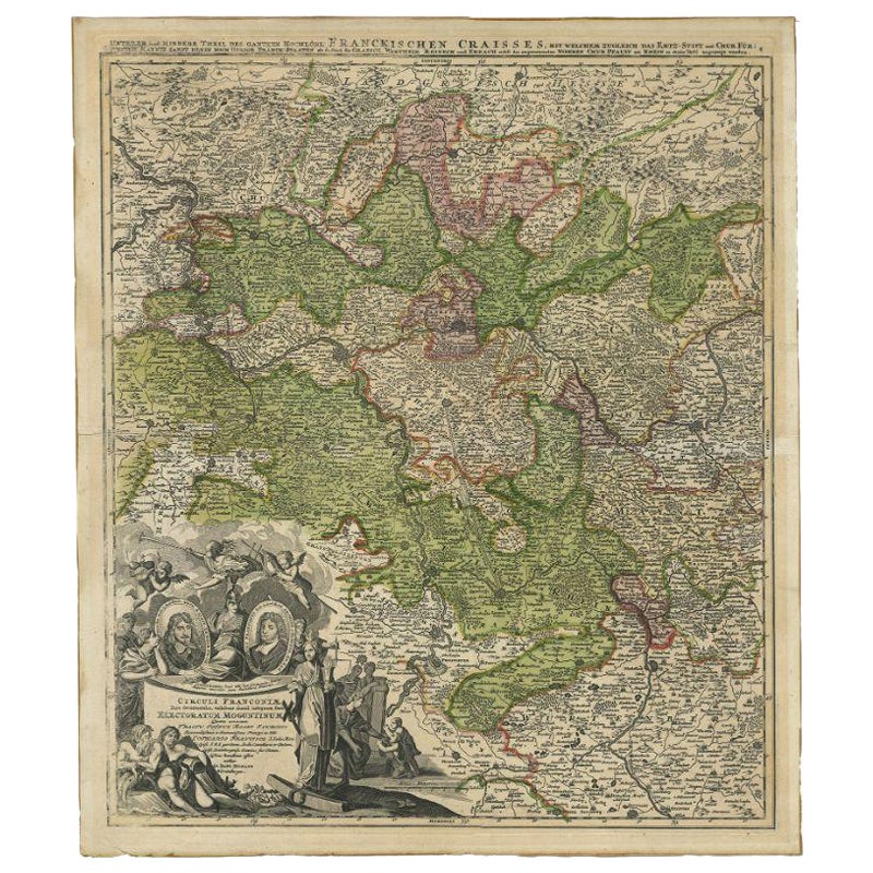
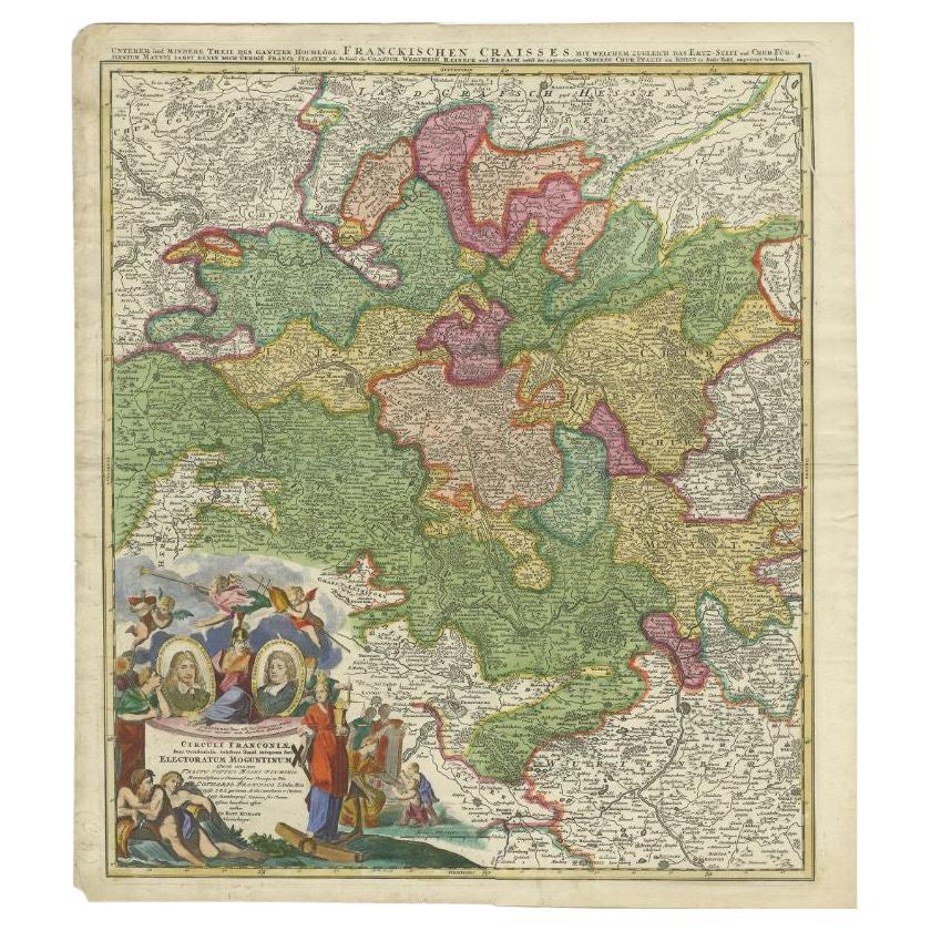
Antique map titled 'Circuli Franconiae pars Occidentalis, exhibes simul integrum fere Electoratum Moguntinum (..)'. Antique map centered on Nuremberg and Bamberg. Extends from the Do...
Category
Antique 18th Century Maps
Materials
Paper
$422 Sale Price
20% Off
Antique Map of the Circle of Franconia by Homann, c.1703
Located in Langweer, NL
Antique map titled 'Circuli Franconiae pars Occidentalis, exhibes simul integrum fere Electoratum Moguntinum (..)'. Antique map centered on Nuremberg and Bamberg. Extends from the Do...
Category
Antique 18th Century Maps
Materials
Paper

$342 Sale Price
20% Off
Antique Map of the Saxony Region
Germany
by F. de Wit, circa 1680
Located in Langweer, NL
A detailed map of a region in eastern Germany. Cartouches depict coat of arms surrounded by cherubs. The map is fully engraved with towns, political boundaries, rivers and forests. P...
Category
Antique Late 17th Century Dutch Maps
Materials
Paper

Antique Map of Part of Germany by Moll, c.1740
Located in Langweer, NL
Antique map Germany titled 'The North West Part of Germany; Containing ye Dominions of ye Arch: and El: of Cologne, Westphalia, / Juliers, Cleeves,...
Category
Antique 18th Century Maps
Materials
Paper

$110 Sale Price
20% Off
Antique Map of Southern Germany by F. de Wit, circa 1680
Located in Langweer, NL
This antique map depicts a portion of southern Germany that included the historic regions of Bavaria, the Palatinate, Prussia-Brandenburg, the Rhineland and Saxony. Regensberg, Freis...
Category
Antique Late 17th Century Maps
Materials
Paper

$667 Sale Price
20% Off
You May Also Like
17th Century Hand-Colored Map of a Region in West Germany by Janssonius
By Johannes Janssonius
Located in Alamo, CA
This attractive highly detailed 17th century original hand-colored map is entitled "Archiepiscopatus Maghdeburgensis et Anhaltinus Ducatus cum terris adjacentibus". It was published ...
Category
Antique Mid-17th Century Dutch Maps
Materials
Paper

$1,020 Sale Price
20% Off
1752 Vaugoundy Map of Flanders : Belgium, France, and the Netherlands, Ric.a002
Located in Norton, MA
Large Vaugoundy Map of Flanders:
Belgium, France, and the Netherlands
Colored -1752
Ric.a002
Description: This is a 1752 Didier Robert de Vaugondy map of Flanders. The map de...
Category
Antique 17th Century Unknown Maps
Materials
Paper

18th Century Hand-Colored Homann Map of Germany, Including Frankfurt and Berlin
By Johann Baptist Homann
Located in Alamo, CA
An 18th century hand-colored map entitled "Tabula Marchionatus Brandenburgici et Ducatus Pomeraniae quae sunt Pars Septentrionalis Circuli Saxoniae Superioris" by Johann Baptist Homa...
Category
Antique Early 18th Century German Maps
Materials
Paper

$620 Sale Price
20% Off
1771 Bonne Map of Poitou, Touraine and Anjou, France, Ric.a015
Located in Norton, MA
1771 Bonne Map of Poitou,
Touraine and Anjou, France
Ric.a015
1771 Bonne map of Potiou, Touraine and Anjou entitled "Carte des Gouvernements D'Anjou et du Saumurois, de la Touraine, du Poitou,du Pays d'aunis, Saintonge?Angoumois,"
Carte des gouvernements d'Anjou et du Saumurois, de la Touraine, du Poitou, du Pays d'Aunis, Saintonge-Angoumois. Projettee et assujettie au ciel par M. Bonne, Hyd. du Roi. A Paris, Chez Lattre, rue St. Jacques a la Ville de Bord(ea)ux. Avec priv. du Roi. 1771. Arrivet inv. & sculp., Atlas moderne ou collection de cartes sur toutes...
Category
Antique 17th Century Unknown Maps
Materials
Paper

18th Century Emanuel Bowen Map of County of York, c.1740
By Emanuel Bowen
Located in Royal Tunbridge Wells, Kent
Antique 18th century British rare and original Emanuel Bowen (1694-1767) map of the County of York divided into its Ridings and subdivided into wapontakes, mounted in solid wood fram...
Category
Antique Early 18th Century British Maps
Materials
Paper

Prussia, Poland, N. Germany, Etc: A Hand-colored 17th Century Map by Janssonius
By Johannes Janssonius
Located in Alamo, CA
This is an attractive hand-colored copperplate engraved 17th century map of Prussia entitled "Prussia Accurate Descripta a Gasparo Henneberg Erlichensi", published in Amsterdam by Joannes Janssonius in 1664. This very detailed map from the golden age of Dutch cartography includes present-day Poland, Latvia, Lithuania, Estonia and portions of Germany. This highly detailed map is embellished by three ornate pink, red, mint green and gold...
Category
Antique Mid-17th Century Dutch Maps
Materials
Paper

$1,020 Sale Price
20% Off
More Ways To Browse
Maps Of New Mexico
Antique Map Of Argentina
Antique Map Of Colombia
Cornwall Map
Early Texas Furniture
Iraq Map
James Cook Map
Kentucky Antiques
Map Of Mexican California
Montreal Map
Mughal Map
Napoleon Map
Rand Mcnally Vintage Maps
Tunisia Antique Map
Used Office Furniture Rhode Island
Antique Chesapeake Bay Map
Antique Copper Australia
Antique Furniture Pondicherry