Items Similar to Antique Map of the City of Kampen by Guicciardini, 1613

Want more images or videos?
Request additional images or videos from the seller
1 of 5
Antique Map of the City of Kampen by Guicciardini, 1613
$581.41
£434.05
€490
CA$807.76
A$868.86
CHF 464.34
MX$10,241.38
NOK 5,854.29
SEK 5,351.93
DKK 3,734.35
About the Item
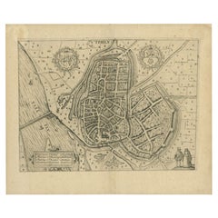
Antique map titled 'Urbis Campensis (..)'. Plan of the city of Kampen, the Netherlands. This map originates from the 1613 edition of 'Discrittione di tutti i Paesi Bassi', by L. Guicciardini, published by J. Janssonius.
Artists and Engravers: Lodovico Guicciardini (1521-1589): an Italian merchant from aristocratic descent.
Condition: Good, general age-related toning. Original folding line. Minor wear and soiling. Blank verso. Please study image carefully.
We sell original antique maps to collectors, historians, educators and interior decorators all over the world. Our collection includes a wide range of authentic antique maps from the 16th to the 20th centuries. Buying and collecting antique maps is a tradition that goes back hundreds of years. Antique maps have proved a richly rewarding investment over the past decade, thanks to a growing appreciation of their unique historical appeal. Today the decorative qualities of antique maps are widely recognized by interior designers who appreciate their beauty and design flexibility. Depending on the individual map, presentation, and context, a rare or antique map can be modern, traditional, abstract, figurative, serious or whimsical. We offer a wide range of authentic antique maps for any budget
- Dimensions:Height: 11.3 in (28.7 cm)Width: 14.1 in (35.8 cm)Depth: 0 in (0.01 mm)
- Materials and Techniques:Paper,Engraved
- Period:
- Date of Manufacture:1613
- Condition:Condition: Excellent.. Original folding line. Minor wear and soiling due to age. Blank verso. Please study image carefully.
- Seller Location:Langweer, NL
- Reference Number:Seller: PCT-85001stDibs: LU3054327792582
About the Seller
5.0
Recognized Seller
These prestigious sellers are industry leaders and represent the highest echelon for item quality and design.
Platinum Seller
Premium sellers with a 4.7+ rating and 24-hour response times
Established in 2009
1stDibs seller since 2017
2,836 sales on 1stDibs
Typical response time: 1 hour
- ShippingRetrieving quote...Shipping from: Langweer, Netherlands
- Return Policy
More From This Seller
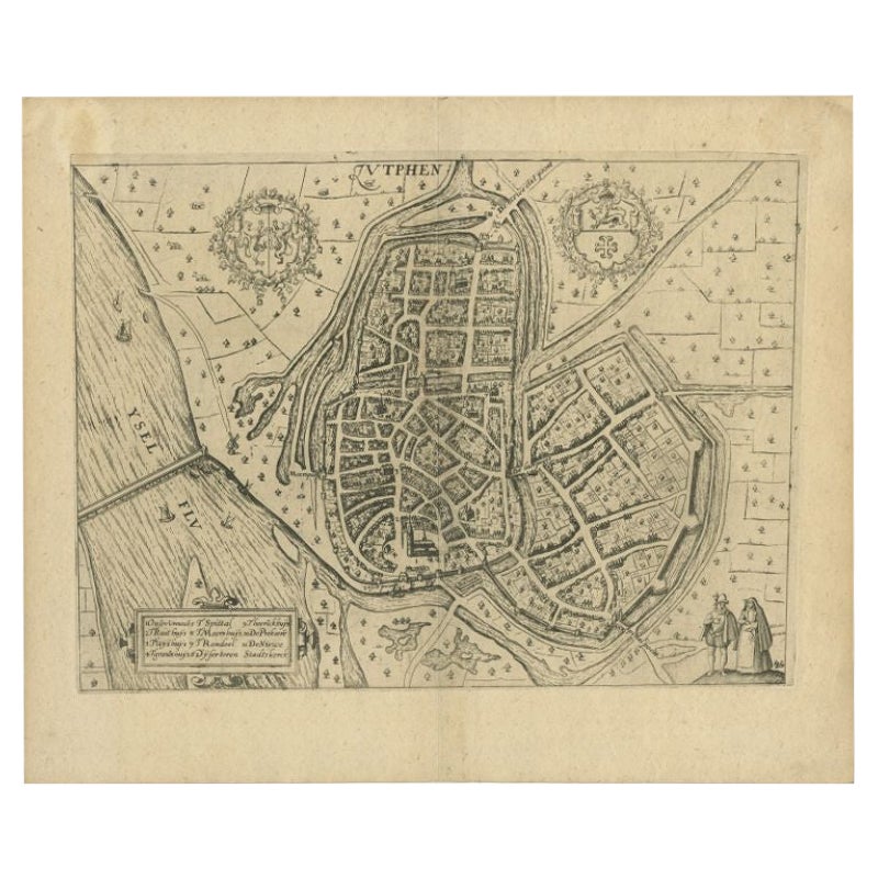
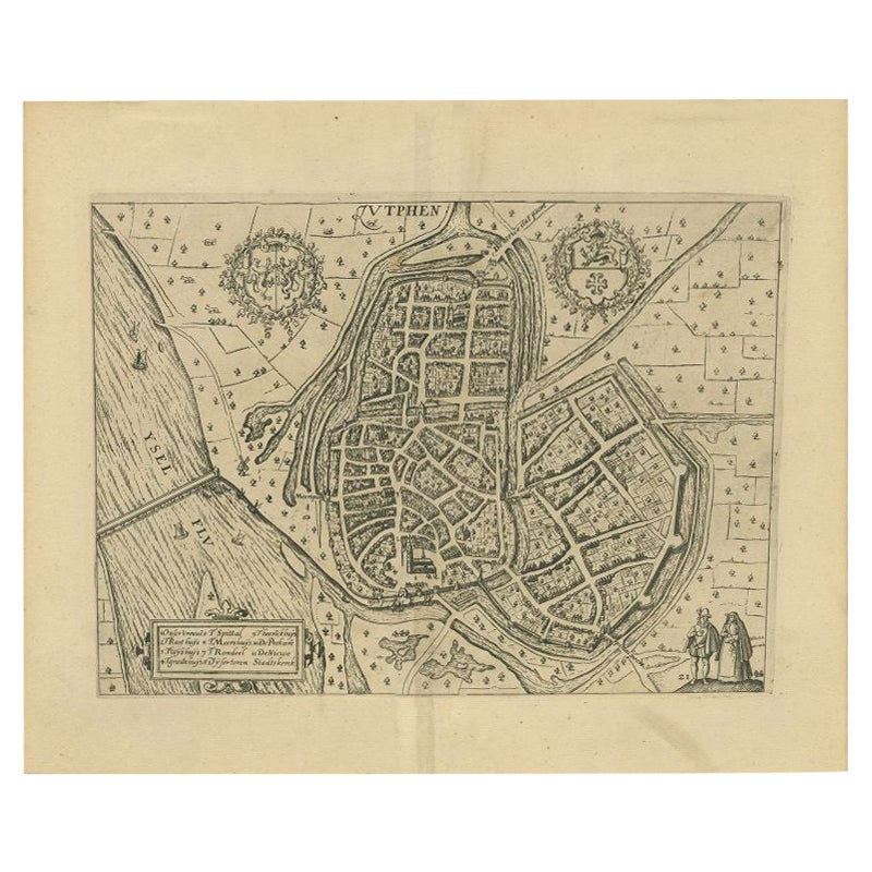
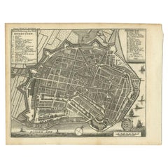
View AllAntique Map of the City of Zutphen by Guicciardini, 1613
Located in Langweer, NL
Antique map Zutphen titled 'Zutphen'. This map depicts the city of Zutphen, Gelderland, The Netherlands. Originates from 'Discrittione di tutti i Paesi Bassi'.
Artists and Engrav...
Category
Antique 17th Century Maps
Materials
Paper
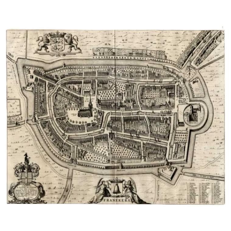
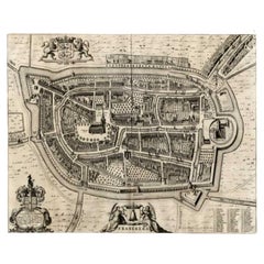
Antique Map of the City of Franeker by Blaeu, 1649
Located in Langweer, NL
Antique map titled 'Franekera'. Old map of the city of Franeker, Friesland. Also shows two cartouches, coats of arms and legend. This plan originates from the famous city Atlas: 'Ton...
Category
Antique 17th Century Maps
Materials
Paper
$358 Sale Price
20% Off
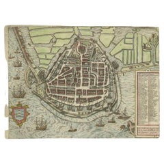
Antique Map of the City of Enkhuizen by Guicciardini, 1625
Located in Langweer, NL
Antique map titled 'Die Stadt Enchuijsen, La ville denchuijsen'. Map of Enkhuizen, Noord-Holland, The Netherlands. Oiginates from the 1625 edition of 'Discrittione di tutti i Paesi B...
Category
Antique 17th Century Maps
Materials
Paper
$289 Sale Price
20% Off
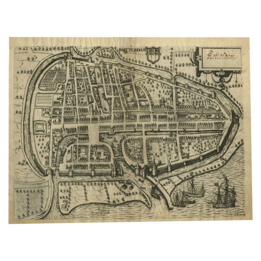
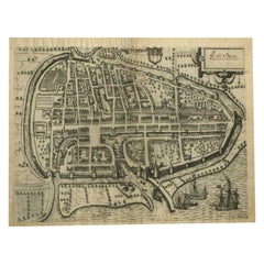
Antique Map of the City of Rotterdam by Guicciardini, C.1600
Located in Langweer, NL
Antique map titled 'Rotterdam'. Bird's eye view plan of Rotterdam in the province of Zuid-Holland, The Netherlands, Holland. This map originates from one of the editions of 'Discritt...
Category
Antique 17th Century Maps
Materials
Paper
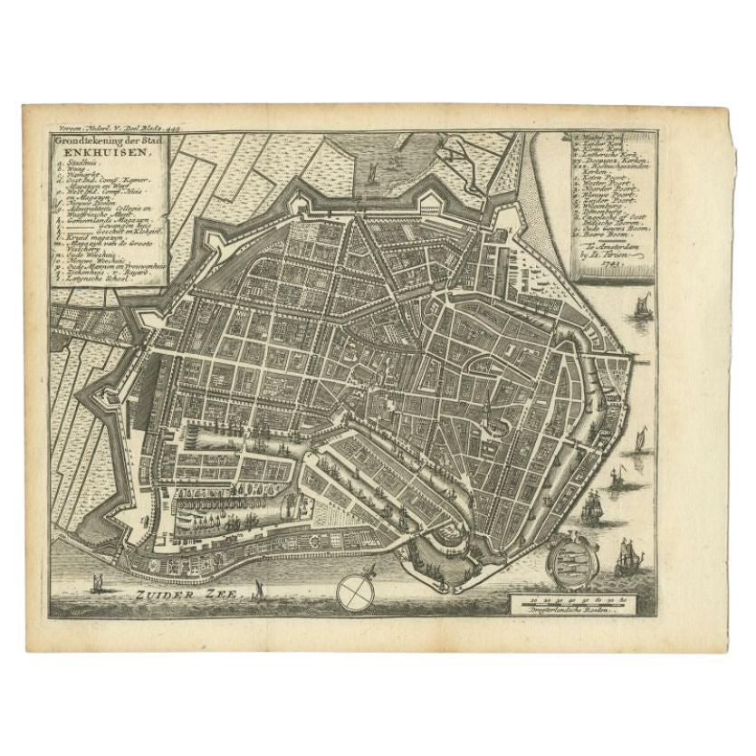
Antique Map of the City of Enkhuizen by Tirion, 1743
Located in Langweer, NL
Antique map titled ?Grondtekening der Stad Enkhuisen?. Beautiful map of the City of Enkhuizen. With Dutch legend. Decorated with compass rose, several ships and the city-arms. Artist...
Category
Antique 18th Century Maps
Materials
Paper
$142 Sale Price
20% Off
Antique Map of the City of Zutphen by Guicciardini, 1612
Located in Langweer, NL
Antique map Zutphen titled 'Zutphen'. This map depicts the city of Zutphen, Gelderland, The Netherlands. Originates from 'Beschryvinghe van alle de Neder-landen anderssins ghenoemt N...
Category
Antique 17th Century Maps
Materials
Paper

You May Also Like
Map of Antwerp - Etching by G.Braun and F. Hogenberg -Late 16th century
By Franz Hogenberg
Located in Roma, IT
This Map of Anverpia is an original etching hand colored realized by George Braun and Franz Hogenberg as part of the famous Atlas "Civitates Orbis Ter...
Category
16th Century Old Masters Figurative Prints
Materials
Etching

Utrecht, Antique Map from "Civitates Orbis Terrarum"
By Franz Hogenberg
Located in Roma, IT
Braun G., Hogenberg F., Traiectum or Utrecht, from the collection Civitates Orbis Terrarum, Cologne, T. Graminaeus, 1572-1617.
Very fine B/W aquatint showing a view of Utrecht, with...
Category
16th Century Landscape Prints
Materials
Etching

Map of Kampen, Netherlands - by G. Braun and F. Hogenberg - Late 16th Century
By Franz Hogenberg
Located in Roma, IT
This map of Kampen (the ancient Campensis) is an original etching realized by George Braun and Franz Hogenberg as part of the famous Series "Civitates Orbis Terrarum".
The “Civita...
Category
16th Century Figurative Prints
Materials
Etching

Map of Nijmegen - Etching by G. Braun and F. Hogenberg - Late 16th Century
By Franz Hogenberg
Located in Roma, IT
This map of Noviomagvs is an original etching realized by Georg Braun and Franz Hogenberg as part of the famous series "Civitates Orbis Terrarum".
The state of preservation of the ...
Category
16th Century Figurative Prints
Materials
Etching

Original Antique Map or City Plan of Amsterdam, Netherlands. Circa 1835
Located in St Annes, Lancashire
Nice map of Amsterdam
Drawn and engraved by J.Dower
Published by Orr & Smith. C.1835
Unframed.
Free shipping
Category
Antique 1830s English Maps
Materials
Paper

Map of Dordrecht - Etching by G. Braun/F. Hogenberg - Late 16th Century
Located in Roma, IT
Map od Dordrecht is an artwork realized by Braun and Hogemberg in the late 16th century.
Hand watercolored etching.
40x54 cm.
Good conditions.
Braun Hoghemberg (1541-1622) was a ...
Category
16th Century Old Masters Figurative Prints
Materials
Etching

More Ways To Browse
Caucasus Map
Framed London Map
J Warren
Large Framed Maps
Map Of Jamaica
Map Of Madagascar
Map Of Normandy
Map Of Singapore
Map Of Vienna
Missouri Map
Nantucket Map
Old School Maps
Santa Cruz Used Furniture
Ukraine Antique Map
Used Office Furniture Cincinnati
Antique Map Of Cuba
Antique Map Vietnam
Antique Maps Colorado