Items Similar to Antique Map of the City of Leeuwarden by Bast, 1603


Want more images or videos?
Request additional images or videos from the seller
1 of 5
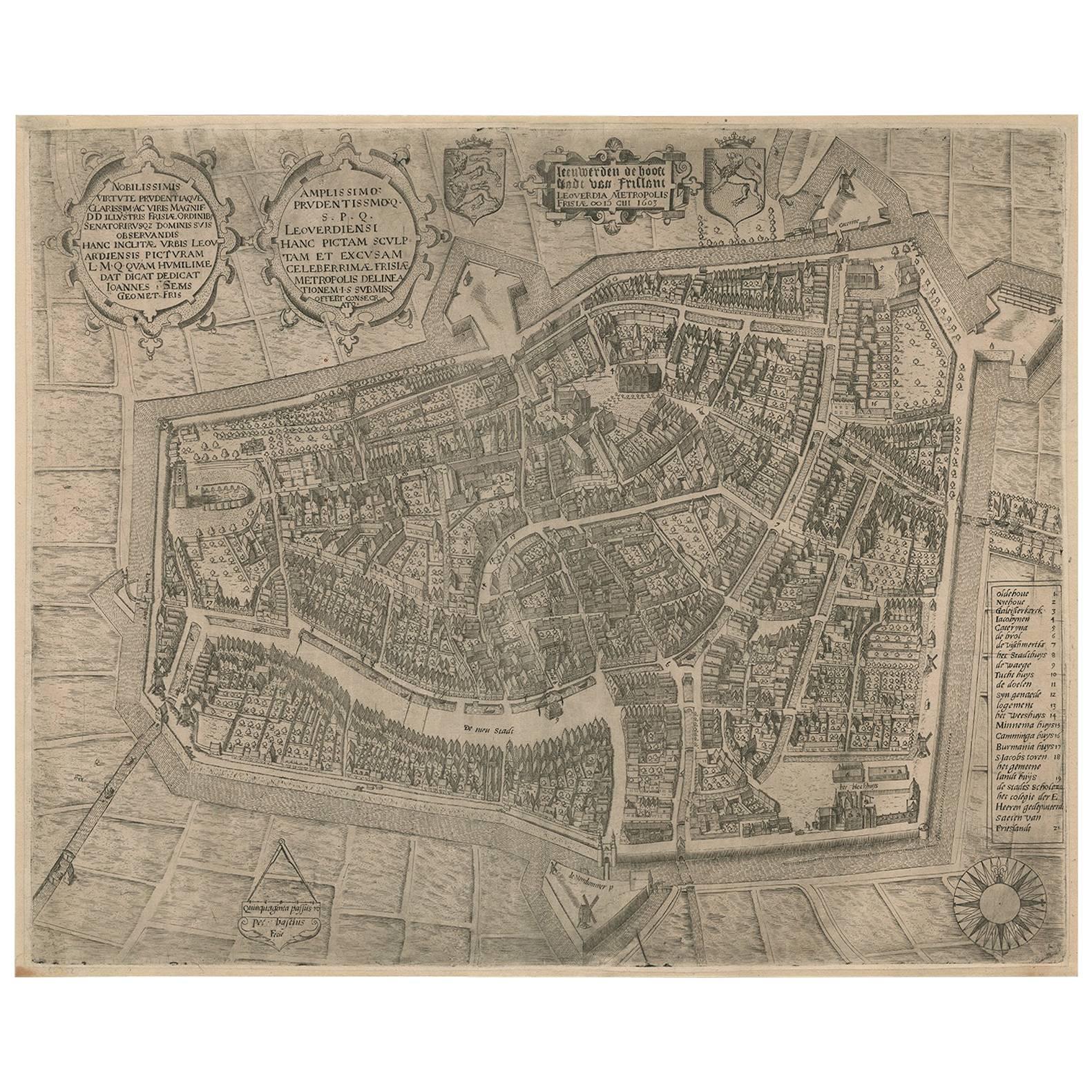
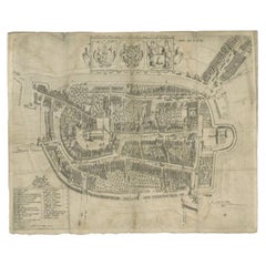
Antique Map of the City of Leeuwarden by Bast, 1603
$2,586.69
$3,233.3720% Off
£1,931.09
£2,413.8620% Off
€2,180
€2,72520% Off
CA$3,593.70
CA$4,492.1220% Off
A$3,865.54
A$4,831.9220% Off
CHF 2,065.86
CHF 2,582.3220% Off
MX$45,563.68
MX$56,954.6020% Off
NOK 26,045.60
NOK 32,55720% Off
SEK 23,810.62
SEK 29,763.2820% Off
DKK 16,614.05
DKK 20,767.5620% Off
About the Item
Antique map titled 'Leeuwerden de hooft stadt van Frislant. Leoverdia Metropolis Frisiae (…) 1603.' Very rare plan of Leeuwarden, Friesland, The Netherlands. With several carouches and coat of arms. With a legend and compass rose at bottom right.
Published by Ioannem / Jan Lamrinck in 1603. State: 3rd state (III). Ref: Hollstein Dutch 15-2(2).
Artists and Engravers: Made by 'Pieter Bast' after the surveyor Johan Sems. Pieter Bast (died 1605) was a Flemmish topographical engraver from Antwerp.
Condition: Good, given age. Original fold lines as issued. Printed from 2 plates, attached. Left bottom margin short from binding, as issued. General age-related toning and/or occasional minor defects from handling. Blank verso. Please study image carefully.
Date: 1603
Overall size: 51 x 41.4 cm.
Image size: 49.6 x 39.8 cm.
We sell original antique maps to collectors, historians, educators and interior decorators all over the world. Our collection includes a wide range of authentic antique maps from the 16th to the 20th centuries. Buying and collecting antique maps is a tradition that goes back hundreds of years. Antique maps have proved a richly rewarding investment over the past decade, thanks to a growing appreciation of their unique historical appeal. Today the decorative qualities of antique maps are widely recognized by interior designers who appreciate their beauty and design flexibility. Depending on the individual map, presentation, and context, a rare or antique map can be modern, traditional, abstract, figurative, serious or whimsical. We offer a wide range of authentic antique maps for any budget.
- Dimensions:Height: 16.3 in (41.4 cm)Width: 20.08 in (51 cm)Depth: 0 in (0.01 mm)
- Materials and Techniques:
- Period:
- Date of Manufacture:1603
- Condition:Condition: Good, given age. Original fold lines as issued. Printed from 2 plates, attached. Left bottom margin short from binding, as issued. General age-related toning and/or occasional minor defects from handling. Blank verso.
- Seller Location:Langweer, NL
- Reference Number:Seller: PCT-569021stDibs: LU3054327792692
About the Seller
5.0
Recognized Seller
These prestigious sellers are industry leaders and represent the highest echelon for item quality and design.
Platinum Seller
Premium sellers with a 4.7+ rating and 24-hour response times
Established in 2009
1stDibs seller since 2017
2,836 sales on 1stDibs
Typical response time: 1 hour
- ShippingRetrieving quote...Shipping from: Langweer, Netherlands
- Return Policy
More From This Seller
View AllRare Antique Map of Leeuwarden by P. Bast, 1603, Wall Art, Netherlands
By P. Bast
Located in Langweer, NL
Rare Antique Map of Leeuwarden, Friesland, The Netherlands, by P. Bast, 1603
This exceptionally rare city plan depicts Leeuwarden, the capital of Friesland in the northern Netherlan...
Category
Antique Early 17th Century Maps
Materials
Paper

$4,004 Sale Price
25% Off
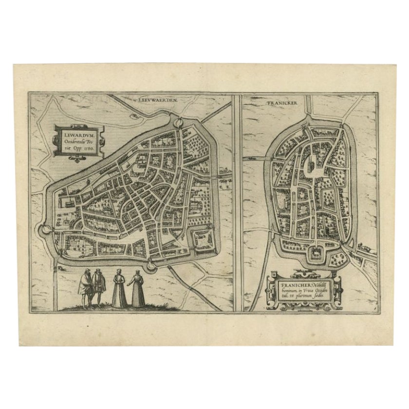
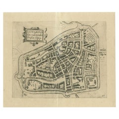
Antique Map of the City of Leeuwarden and Franeker by Braun
Hogenberg, 1580
Located in Langweer, NL
Antique map titled 'Lewardum Occidentlis Frisiae Opp: 1580, Franicher Nobiliu hominum, in Frisia Occidentali, ut plurimum saedes'. This sheet contains two very detailed bird’s-eye pl...
Category
Antique 16th Century Maps
Materials
Paper
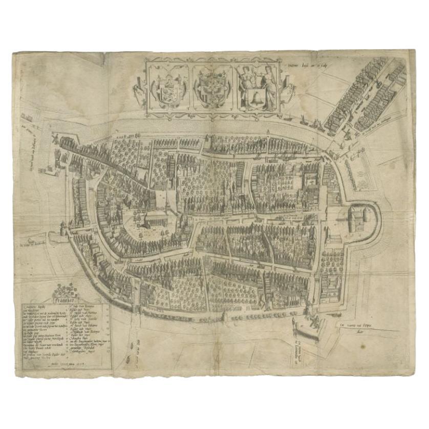
Antique Map of the City of Franeker by Bast, 1598
Located in Langweer, NL
Antique map titled 'Franeker'. Very rare and early map of the city of Franeker, Friesland. With decorative cartouche and Dutch legend. Artists and Engravers: Pieter Bast (1550-1605) ...
Category
Antique 16th Century Maps
Materials
Paper
$1,063 Sale Price
20% Off
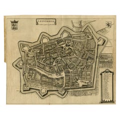
Antique Map of Leeuwarden, Capital of Friesland, the Netherlands, by Blaeu, 1649
Located in Langweer, NL
Antique map titled 'Leoverdia.'
Bird's-eye view plan of Leeuwarden, Friesland, the Netherlands. With key to locations and coats of arms. Text in Dutch on verso.
This plan origina...
Category
Antique 17th Century Maps
Materials
Paper

Antique Map of the City of Leeuwarden by Guicciardini, 1613
Located in Langweer, NL
Antique map tited 'Lewardum'. Plan of the city of Leeuwarden, Friesland, the Netherlands. This map originates from the 1613 edition of 'Discrittione di tutti i Paesi Bassi', by L. Gu...
Category
Antique 17th Century Maps
Materials
Paper
Antique Map of the City of Leeuwarden by Leti, 1690
Located in Langweer, NL
Antique map titled 'Leovardia.' A plan of Leeuwarden in Friesland, the Netherlands. With two coats of arms, the title in a scroll and an index of 30 buildings in the lower right. Fro...
Category
Antique 17th Century Maps
Materials
Paper
You May Also Like
Utrecht, Antique Map from "Civitates Orbis Terrarum"
By Franz Hogenberg
Located in Roma, IT
Braun G., Hogenberg F., Traiectum or Utrecht, from the collection Civitates Orbis Terrarum, Cologne, T. Graminaeus, 1572-1617.
Very fine B/W aquatint showing a view of Utrecht, with...
Category
16th Century Landscape Prints
Materials
Etching

Map of Groningen - Etching by George Braun - Late 16th Century
Located in Roma, IT
This map of Groninga is an original etching realized by George Braun and Franz Hogenberg, and part of the series "Civitates Orbis Terrarum".
The state of preservation of the artwork...
Category
16th Century Figurative Prints
Materials
Etching

Map of Antwerp - Etching by G.Braun and F. Hogenberg -Late 16th century
By Franz Hogenberg
Located in Roma, IT
This Map of Anverpia is an original etching hand colored realized by George Braun and Franz Hogenberg as part of the famous Atlas "Civitates Orbis Ter...
Category
16th Century Old Masters Figurative Prints
Materials
Etching

Map of Kampen, Netherlands - by G. Braun and F. Hogenberg - Late 16th Century
By Franz Hogenberg
Located in Roma, IT
This map of Kampen (the ancient Campensis) is an original etching realized by George Braun and Franz Hogenberg as part of the famous Series "Civitates Orbis Terrarum".
The “Civita...
Category
16th Century Figurative Prints
Materials
Etching

Map of the Netherlands - Etching by G. Braun and F. Hogenberg -Late 16th Century
By Franz Hogenberg
Located in Roma, IT
Map of the Netherlands is an original etching realized by George Braun and Franz Hogenberg, as part of the "Civitates Orbis Terrarum".
The “Civitates Orbis Terrarum” (Atlas of Citi...
Category
16th Century Figurative Prints
Materials
Etching

Map of Cambridge, engraving Pieter van der Aa after David Loggan
By Pieter Van Der Aa
Located in London, GB
Pieter van der Aa (1659 - 1733), after David Loggan (1634 - 1692)
Map of Cambridge
Engraving
12 x 16 cm
An eighteenth-century view of Cambridge, engraved by Pieter van der Aa after ...
Category
Early 18th Century Realist Prints and Multiples
Materials
Engraving
