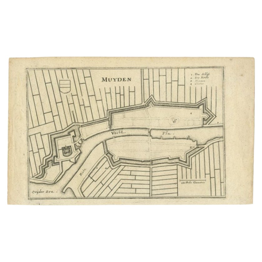
Items Similar to Antique Map of the City of Muiden by Merian, 1659
Want more images or videos?
Request additional images or videos from the seller
1 of 5
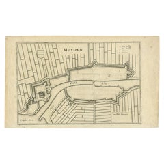
Antique Map of the City of Muiden by Merian, 1659
$185.99
£137.83
€155
CA$254.20
A$276.72
CHF 146.88
MX$3,329.49
NOK 1,861.18
SEK 1,705.37
DKK 1,180.68
About the Item
Antique map titled 'Muyden'. Original antique map of the city of Muiden, the Netherlands. This map originates from 'Topographia Germania Inferioris' by C. Merian. Published 1659.
Artists and Engravers: Caspar Merian (1627-1686) was one of the most important German topographical engravers and publishers in the Baroque period. He was the son and pupil of his father Matthaeus Merian the elder (1593-1650) and his first wife Maria Magdalena - de Bry. His brother was Matthaeus the younger. The artist Maria Sibylla Merian (1647-1717) was his half sister from his fathers second wife Johanna Sibylla Catharina.
Condition: Good, general age-related toning. Original folding line, minor wear and light creasing. Frame included, with a few small defects. Please study images carefully.
Date: 1659
Overall size: 44 x 36 cm.
Image size: 27 x 19 cm.
We sell original antique maps to collectors, historians, educators and interior decorators all over the world. Our collection includes a wide range of authentic antique maps from the 16th to the 20th centuries. Buying and collecting antique maps is a tradition that goes back hundreds of years. Antique maps have proved a richly rewarding investment over the past decade, thanks to a growing appreciation of their unique historical appeal. Today the decorative qualities of antique maps are widely recognized by interior designers who appreciate their beauty and design flexibility. Depending on the individual map, presentation, and context, a rare or antique map can be modern, traditional, abstract, figurative, serious or whimsical. We offer a wide range of authentic antique maps for any budget.
- Dimensions:Height: 14.18 in (36 cm)Width: 17.33 in (44 cm)Depth: 0 in (0.01 mm)
- Materials and Techniques:
- Period:
- Date of Manufacture:1659
- Condition:
- Seller Location:Langweer, NL
- Reference Number:Seller: BG-000751stDibs: LU3054327793262
About the Seller
5.0
Recognized Seller
These prestigious sellers are industry leaders and represent the highest echelon for item quality and design.
Platinum Seller
Premium sellers with a 4.7+ rating and 24-hour response times
Established in 2009
1stDibs seller since 2017
2,816 sales on 1stDibs
Typical response time: 1 hour
- ShippingRetrieving quote...Shipping from: Langweer, Netherlands
- Return Policy
More From This Seller
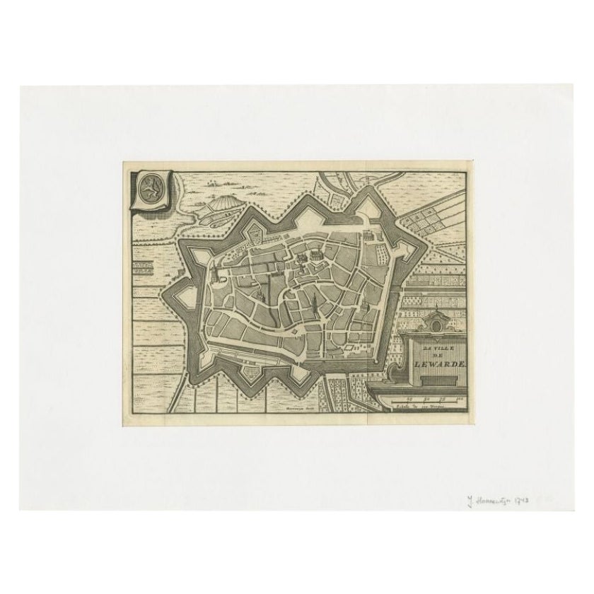
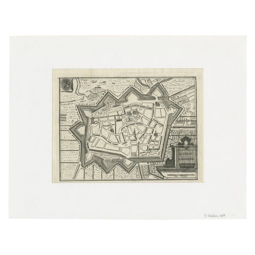
View AllAntique Map of the City of Leeuwarden by Harrewijn, 1743
Located in Langweer, NL
Antique map titled 'La Ville de Lewarde'. Old map of the city of Leeuwarden, Friesland. Originates from 'Les Délices des Pays-Bas' by Widow Foppens.
Artists and Engravers: Engrav...
Category
Antique 18th Century Maps
Materials
Paper
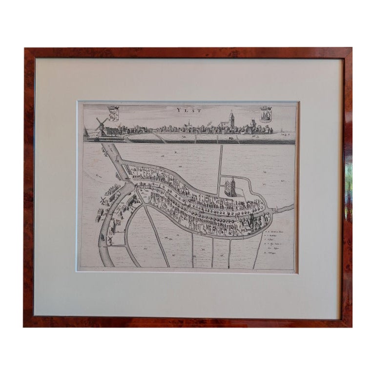
Antique City View and Map of IJlst, City in Friesland, Holland, Framed, 1664
Located in Langweer, NL
Antique map titled 'Ylst'. Old map and city view of the city of IJlst, Friesland. This map originates from 'Beschrijvinge van de Heerlyckheydt van Frieslandt' by B. Schotanus à Sterr...
Category
Antique 17th Century Maps
Materials
Paper

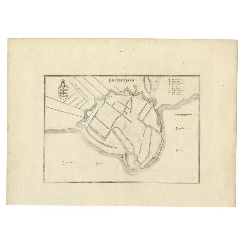
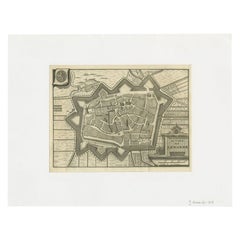
Antique Map of the City of Enkhuizen by Merian, 1659
Located in Langweer, NL
Antique map titled 'Enckhuysen'. This print depicts the city of Enkhuizen, the Netherlands. This print originates from 'Topographia Germaniae Inferioris (..)' by C. Merian. Artists a...
Category
Antique 17th Century Maps
Materials
Paper
$118 Sale Price
20% Off
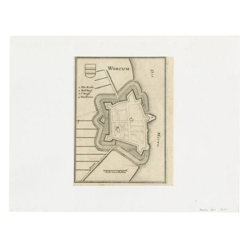
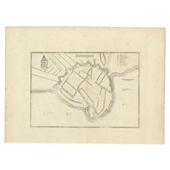
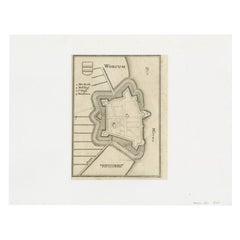
Antique Map of the City of Workum by Merian, 1654
Located in Langweer, NL
Antique map titled 'Worcum'. Old map of the city of Workum, Friesland. Originates from 'Topographia Germaniæ Inferioris' by C. Merian.
Artists and Engravers: Caspar Merian (1627-1...
Category
Antique 17th Century Maps
Materials
Paper
Antique Map of the City of Leeuwarden by Christyn, 1785
Located in Langweer, NL
Antique map titled 'La Ville de Lewarde'. Old map of the city of Leeuwarden, Friesland. Originates from 'Les Délices des Pays-Bas' by J.B. Christyn.
Artists and Engravers: Author:...
Category
Antique 18th Century Maps
Materials
Paper

Antique Map of the City of Muiden by Merian, 1659
Located in Langweer, NL
Antique map titled 'Muyden'. Original antique map of the city of Muiden, the Netherlands. This map originates from 'Topographia Germania Inferioris' by C. Merian. Published 1659.
...
Category
Antique 17th Century Maps
Materials
Paper
You May Also Like
Framed 1731 Color Engraving, Map of Rotterdam by Matthaus Seutter, "Roterodami"
Located in Bridgeport, CT
"Roterodami". Seutter (1678-1757) was an important German 18th century map maker. Bird's eye view of the city above with full details, neoclassi...
Category
Antique 18th Century European Renaissance Maps
Materials
Glass, Wood, Paper

1748 Map of Richmond Upon Thames by John Roque
Located in Gloucestershire, GB
A 1748 map of Richmond-Upon-Thames by famed surveyor and cartographer, John Roque. Placed in a simple black and gilt frame. The map is in fair condition but there are small sections ...
Category
Antique Mid-18th Century English Maps
Materials
Wood, Paper

19th Century Reprint of 16th Century Harbor Map of Copenhagen
Located in Haddonfield, NJ
This reprint of 1587 antique map of Copenhagen, Denmark retains its original mid-century mat and has been recently reframed in classic wood frame. The muted sepia colored map is a wo...
Category
Antique 1880s Danish Baroque Maps
Materials
Wood, Paper

Map Of The City Of Geneva, Framed Engraving, Late 18th Century
Located in MARSEILLE, FR
Beautiful engraving representing the city of Geneva corrected in 1775 and 1793
The engraving also presents inserts with the evolution of the city, the plan of ancient Geneva and ...
Category
Antique Late 18th Century Swiss Louis XV Prints
Materials
Paper

Antique Town Plan Map, Poole, English, Framed Cartography, Georgian, Circa 1780
Located in Hele, Devon, GB
This is an antique town plan map of Poole in Dorset. An English, framed atlas engraving, dating to the 18th century and later.
Fascinating cartography with annotated streets and pl...
Category
Antique Late 18th Century British George III Maps
Materials
Glass, Wood, Paper

Hand Colored 17th Century Visscher Map "Hollandiae" Southern Holland
By Nicolaes Visscher II
Located in Alamo, CA
A hand colored 17th century map of the southern portions of Holland by Nicolaus (Nicolas) Visscher II entitled "Hollandiae pars Meridionalis, vulgo Zuyd-Holland", published in Amsterdam in 1678. The map shows the region between Breda, Heusden, Gornichem, Gouda, Dordrecht, and Willemstad. It includes a decorative cartouche in the lower left corner.
The map is presented in an attractive maple colored wood frame with gold trim and a fabric mat.
The Visscher family were one of the great cartographic families of the 17th century. Begun by Claes Jansz Visscher...
Category
Antique Early 18th Century Dutch Maps
Materials
Paper

$1,020 Sale Price
20% Off
More Ways To Browse
Caucasus Map
Framed London Map
J Warren
Large Framed Maps
Map Of Jamaica
Map Of Madagascar
Map Of Normandy
Map Of Singapore
Map Of Vienna
Missouri Map
Nantucket Map
Old School Maps
Santa Cruz Used Furniture
Ukraine Antique Map
Used Office Furniture Cincinnati
Antique Map Of Cuba
Antique Map Vietnam
Antique Maps Colorado