Items Similar to Antique Map of the Coast of Juan Fernandez by Van Schley, 1757


Want more images or videos?
Request additional images or videos from the seller
1 of 5
Antique Map of the Coast of Juan Fernandez by Van Schley, 1757
$171.16
£127.18
€143
CA$234.45
A$255.78
CHF 135.66
MX$3,081.53
NOK 1,721.77
SEK 1,576.33
DKK 1,089.36
About the Item
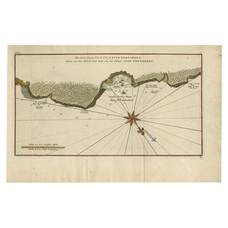
Antique map titled 'Cote du Nord Est de l'Isle de Juan Fernandez (..).' Map of the Chilean South Pacific archipelago of the Juan Fernandez Islands. This island was made famous by Daniel Defoe's novel Robinson Crusoe as the island on which he was marooned. This map refers to Admiral George Anson's voyage there in 1740-44 when the island provided sustenance for his men after their arduous journey around the tip of South America. This map is topped by a view of the Cumberland Bay with its own compass rose. Decorative cartouche and compass rose. This map originates from 'Histoire générale des voyages' by Antoine-François Prévost.
Artists and Engravers: Engraved by J. van Schley. Jakob van der Schley (Amsterdam, 1715-1779) was a Dutch draughtsman and engraver, who studied under Bernard Picart, and whose style he subsequently copied.
Condition: Good, given age. Some creasing in the bottom margin. Original folds as issued. General age-related toning and/or occasional minor defects from handling. Please study image carefully.
Date: 1757
Overall size: 36.4 x 25 cm.
Image size: 28 x 20.5 cm.
We sell original antique maps to collectors, historians, educators and interior decorators all over the world. Our collection includes a wide range of authentic antique maps from the 16th to the 20th centuries. Buying and collecting antique maps is a tradition that goes back hundreds of years. Antique maps have proved a richly rewarding investment over the past decade, thanks to a growing appreciation of their unique historical appeal. Today the decorative qualities of antique maps are widely recognized by interior designers who appreciate their beauty and design flexibility. Depending on the individual map, presentation, and context, a rare or antique map can be modern, traditional, abstract, figurative, serious or whimsical. We offer a wide range of authentic antique maps for any budget
- Dimensions:Height: 9.85 in (25 cm)Width: 14.34 in (36.4 cm)Depth: 0 in (0.01 mm)
- Materials and Techniques:
- Period:
- Date of Manufacture:1757
- Condition:
- Seller Location:Langweer, NL
- Reference Number:Seller: PCT-579091stDibs: LU3054327794962
About the Seller
5.0
Recognized Seller
These prestigious sellers are industry leaders and represent the highest echelon for item quality and design.
Platinum Seller
Premium sellers with a 4.7+ rating and 24-hour response times
Established in 2009
1stDibs seller since 2017
2,820 sales on 1stDibs
Typical response time: 1 hour
- ShippingRetrieving quote...Shipping from: Langweer, Netherlands
- Return Policy
More From This Seller
View AllAntique Map of Juan Fernandez Island by Anson, c.1740
Located in Langweer, NL
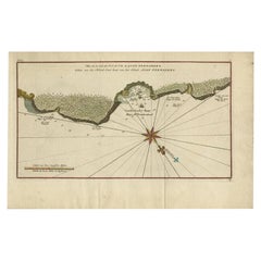
Antique map titled 'Plan de la Côte du N.E. de l 'Ile de Juan Fernandes'.
Map of the northeast coast of the island of Juan Fernandez with Cumberland Bay, South America. In 1740 Ans...
Category
Antique 18th Century English Maps
Materials
Paper

Antique Map of Juan Fernandez Island by Anson
1749
Located in Langweer, NL
Antique map titled 'l'Ile de Juan Fernandes dans la Mer du Sud (..) - Het Eiland Juan Fernandes in de Zuid Zee (..)'. This map depicts Juan Fernandez Island in the Southern Sea. This...
Category
Antique Mid-18th Century Maps
Materials
Paper

$191 Sale Price
20% Off
Original Antique Map of Juan Fernandez by Van Schley, 1757
Located in Langweer, NL
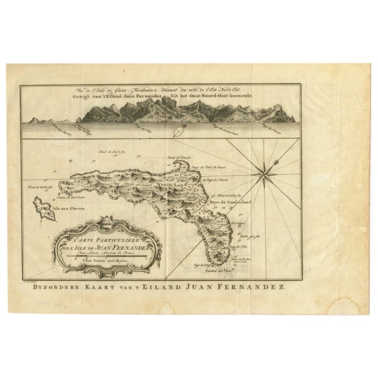
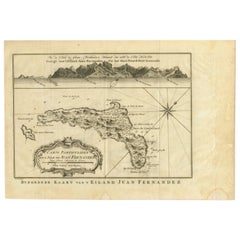
Antique map titled 'Carte Particuliere de l'Isle de Juan Fernandez - Byzondere Kaart van 't Eiland Juan Fernandez'.
Map of the Chilean Juan Fernandez Island, topped by a view of it...
Category
Antique 18th Century French Maps
Materials
Paper
Juan Fernandez Island Map – Antique Chilean Chart circa 1750
Located in Langweer, NL
Antique map titled 'Plan de la Côte du N.E. de l 'Ile de Juan Fernandes'.
Map of the northeast coast of the island of Juan Fernandez with Cumberland Bay, South America. In 1740 Ans...
Category
Antique 18th Century French Maps
Materials
Paper
Antique Map of Juan Fernandez Island and Cumberland Bay, Chile - ca.1749
Located in Langweer, NL
Antique map titled 'Plan de la Côte du N.E. de l 'Ile de Juan Fernandes - Schets van den Noord-Oost kant van het eiland Juan Fernandes '. This map depicts the northeast coast of the ...
Category
Antique Mid-18th Century French Maps
Materials
Paper

$191 Sale Price
20% Off
Antique Map of a Bay on the Coast of Chile, South America, c.1749
Located in Langweer, NL
Antique map titled 'Plan van een Baai en Haven aan de Kust van Chili (..) - Plan d'une Baye de la Côte du Chili (..)'. Original antique map of a bay on the coast of Chile discovered ...
Category
Antique 18th Century Maps
Materials
Paper

You May Also Like
West Coast of Africa, Guinea
Sierra Leone: An 18th Century Map by Bellin
By Jacques-Nicolas Bellin
Located in Alamo, CA
Jacques Bellin's copper-plate map entitled "Partie de la Coste de Guinee Dupuis la Riviere de Sierra Leona Jusquau Cap das Palmas", depicting the coast of Guinea and Sierra Leone in ...
Category
Antique Mid-18th Century French Maps
Materials
Paper

$460 Sale Price
20% Off
California, Alaska and Mexico: 18th Century Hand-Colored Map by de Vaugondy
By Didier Robert de Vaugondy
Located in Alamo, CA
This is an 18th century hand-colored map of the western portions of North America entitled "Carte de la Californie et des Pays Nord-Ouest separés de l'Asie par le détroit d'Anian, ex...
Category
Antique 1770s French Maps
Materials
Paper

Map Of The Island Of Cuba - Guillaume Thomas Raynal (1711-1796)
Located in Porto, PT
This historical map of the Island of Cuba was produced in the late 18th century and is taken from an edition of “Atlas de toutes les parties connues du globe terrestre” by the French...
Category
Antique 18th Century Prints
Materials
Glass, Paper

Original Antique Map of South America. C.1780
Located in St Annes, Lancashire
Great map of South America
Copper-plate engraving
Published C.1780
Two small worm holes to left side of map
Unframed.
Category
Antique Early 1800s English Georgian Maps
Materials
Paper

St. Christophe
St. Kitts
Island: An 18th Century Hand-colored Map by Bellin
By Jacques-Nicolas Bellin
Located in Alamo, CA
Jacques Bellin's copper-plate map of the Caribbean island of Saint Kitts entitled "Carte De De l'Isle St. Christophe Pour servir á l'Histoire Genle. des V...
Category
Antique Mid-18th Century French Maps
Materials
Paper

$460 Sale Price
20% Off
Antique Map - Mare Pacificum - Etching by Johannes Janssonius - 1650s
By Johannes Janssonius
Located in Roma, IT
Mare Pacificum is an antique map realized in 1650 by Johannes Janssonius (1588-1664).
The Map is Hand-colored etching, with coeval watercolorang.
Good conditions with slight foxing...
Category
1650s Modern Figurative Prints
Materials
Etching

More Ways To Browse
Large Framed Maps
Map Of Normandy
Map Of Singapore
Map Of Vienna
Missouri Map
Nantucket Map
Old School Maps
Santa Cruz Used Furniture
Ukraine Antique Map
Used Office Furniture Cincinnati
Antique Map Of Cuba
Antique Map Vietnam
Antique Maps Colorado
Antique Maps Of Kansas
Antique Marine Maps
Antique World Globe Map
Garde Corps
Marie Galante