Items Similar to Antique Map of Denmark by Hall, circa 1820


Want more images or videos?
Request additional images or videos from the seller
1 of 7
Antique Map of Denmark by Hall, circa 1820
$144.11
£106.73
€120
CA$197.13
A$214.54
CHF 113.73
MX$2,581.08
NOK 1,442.43
SEK 1,319.72
DKK 914.42
About the Item
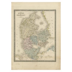
Antique map titled 'Denmark'. A map of Denmark and the direct surroundings (northern Germany, Baltic Sea, Kattegatt and North Sea, south east Sweden). Sheet XXV from an unidentified English atlas, published in London, circa 1820.
Artists and Engravers: Made by 'Sidney Hall' after an anonymous artist. Sidney Hall (1788–1831) was a British engraver and cartographer, popular for his early nineteenth century atlases containing maps of the United Kingdom and of the ancient world.
Condition: Very good, given age. Margin edges faintly browned with age. A small crease in the right margin (not affecting image). General age-related toning and/or occasional minor defects from handling. Please study image carefully.
Date: circa 1820
Overall size: 30.8 x 44 cm.
Image size: 0.001 x 25.5 x 38.5 cm.
We sell original antique maps to collectors, historians, educators and interior decorators all over the world. Our collection includes a wide range of authentic antique maps from the 16th to the 20th centuries. Buying and collecting antique maps is a tradition that goes back hundreds of years. Antique maps have proved a richly rewarding investment over the past decade, thanks to a growing appreciation of their unique historical appeal. Today the decorative qualities of antique maps are widely recognized by interior designers who appreciate their beauty and design flexibility. Depending on the individual map, presentation, and context, a rare or antique map can be modern, traditional, abstract, figurative, serious or whimsical. We offer a wide range of authentic antique maps for any budget.
- Dimensions:Height: 17.33 in (44 cm)Width: 12.13 in (30.8 cm)Depth: 0 in (0.01 mm)
- Materials and Techniques:
- Period:
- Date of Manufacture:circa 1820
- Condition:
- Seller Location:Langweer, NL
- Reference Number:Seller: PCT-565391stDibs: LU3054326159742
About the Seller
5.0
Recognized Seller
These prestigious sellers are industry leaders and represent the highest echelon for item quality and design.
Platinum Seller
Premium sellers with a 4.7+ rating and 24-hour response times
Established in 2009
1stDibs seller since 2017
2,813 sales on 1stDibs
Typical response time: 1 hour
- ShippingRetrieving quote...Shipping from: Langweer, Netherlands
- Return Policy
More From This Seller
View AllAntique Map of the Kingdom of Denmark by Wyld
1845
Located in Langweer, NL
Antique map titled 'Kingdom of Denmark'. Original antique map of the Kingdom of Denmark. This map originates from 'An Atlas of the World, Comprehending Separate Maps of its Various C...
Category
Antique Mid-19th Century Maps
Materials
Paper
$156 Sale Price
35% Off
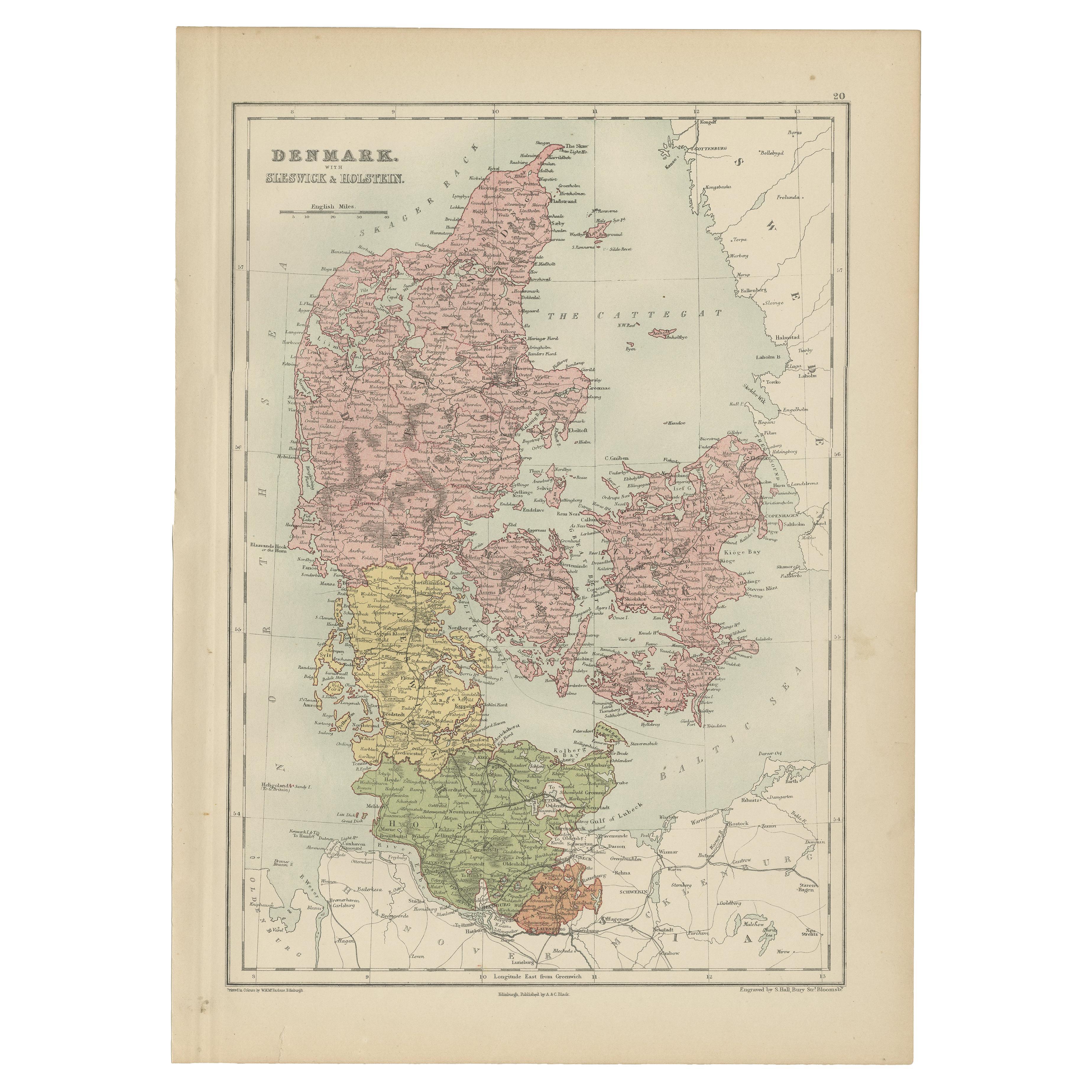
Antique Map of Denmark with Schleswig
Holstein by A
C. Black, 1870
Located in Langweer, NL
Antique map titled 'Denmark with Schleswig & Holstein'. Original antique map of Denmark with Schleswig & Holstein. This map originates from ‘Black's General Atlas of The World’. Publ...
Category
Antique Late 19th Century Maps
Materials
Paper

$126 Sale Price
40% Off
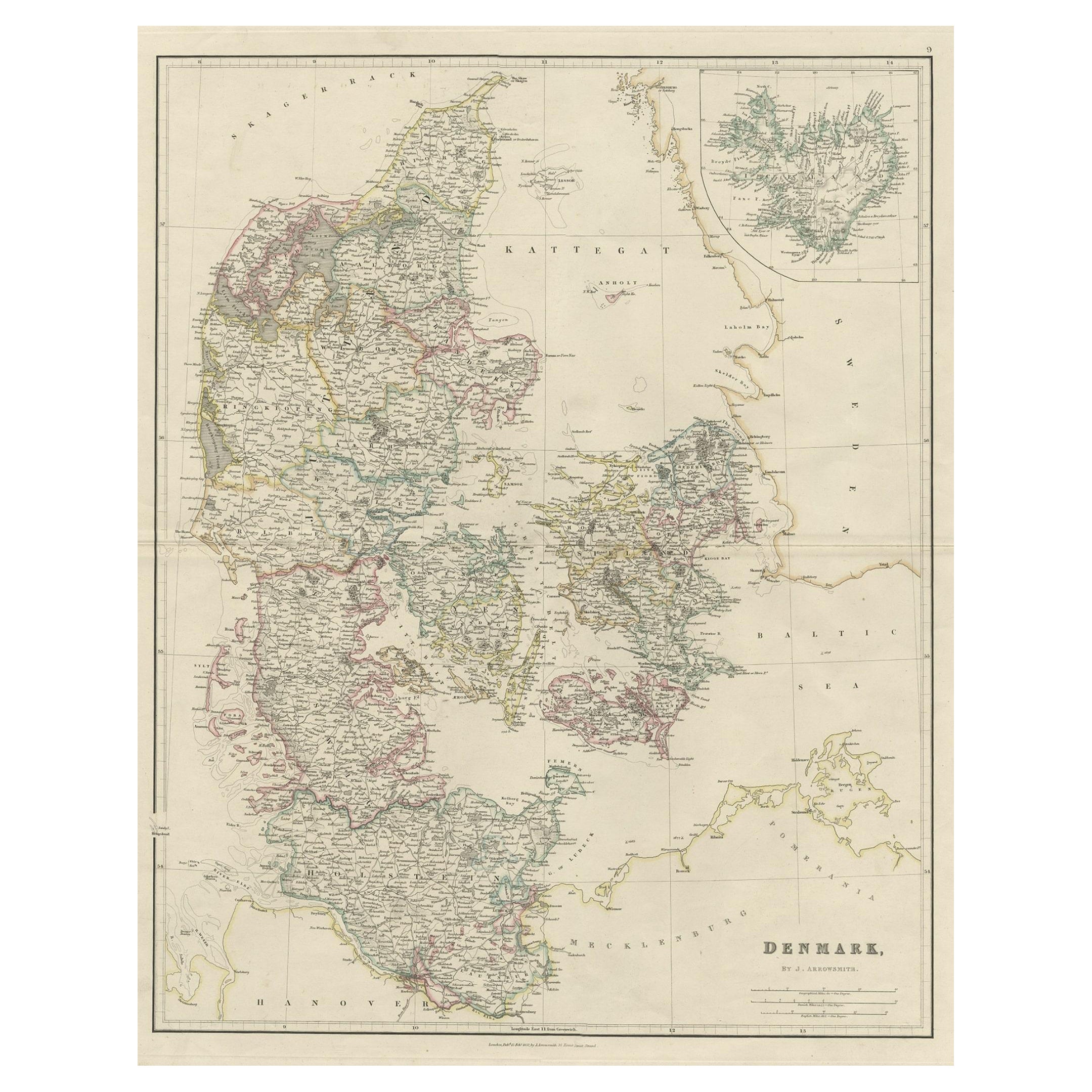
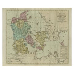
Antique Map of Denmark with an Inset Map of Iceland, 1832
Located in Langweer, NL
Antique map titled 'Denmark'. Large map of Denmark with an inset map of Iceland.
Artists and Engravers: Published by J. Arrowsmith in London, 1832.
Condition: Good, general age...
Category
Antique 19th Century Maps
Materials
Paper

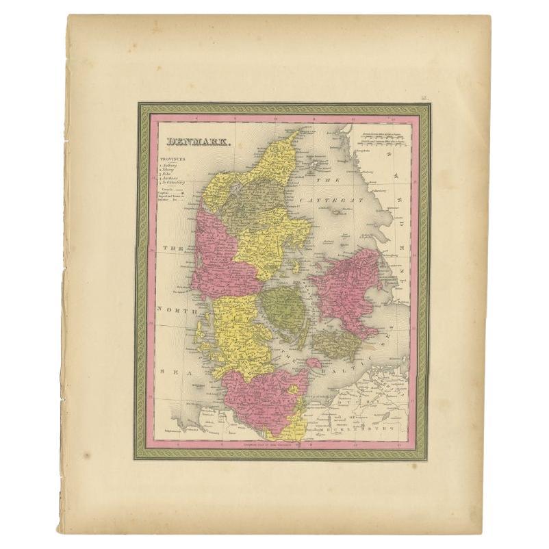
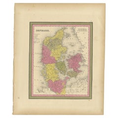
Antique Map of Denmark, Original and Decorative, c.1846
Located in Langweer, NL
Antique map titled 'Denmark'. Old map of Denmark. This map originates from 'A New Universal Atlas Containing Maps of the various Empires, Kingdoms, States and Republics Of The World ...
Category
Antique 19th Century Maps
Materials
Paper
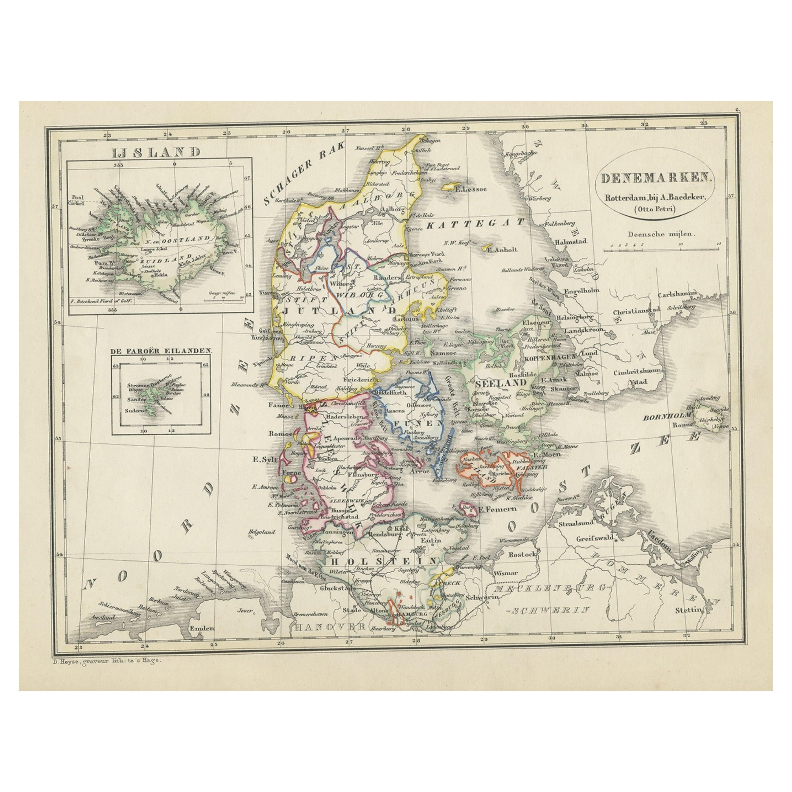
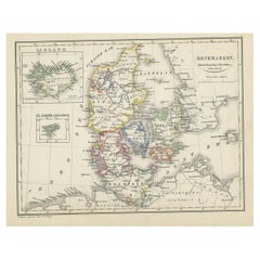
Antique Map of Denmark with An Inset of Iceland, 1852
Located in Langweer, NL
Antique map titled 'Denemarken'. Map of Denmark, with a small inset map of Iceland. This map originates from 'School-Atlas van alle deelen der Aarde' by Otto Petri...
Category
Antique 19th Century Maps
Materials
Paper
Large Antique Map of Denmark by Bowles, c.1780
By Thomas
Located in Langweer, NL
Antique map titled 'Bowles's new pocket map of the Kingdom of Denmark (..)' Large map of Denmark. Source unknown, to be determined.
Artists and Engravers: Made by 'Thomas & Carington Bowles' after 'J. Palairet'. Thomas Bowles, born around 1712, was map publisher and seller in London...
Category
Antique 18th Century Maps
Materials
Paper
You May Also Like
Original Antique Map of Sweden, Engraved by Barlow, 1806
Located in St Annes, Lancashire
Great map of Sweden
Copper-plate engraving by Barlow
Published by Brightly & Kinnersly, Bungay, Suffolk. 1806
Unframed.
Category
Antique Early 1800s English Maps
Materials
Paper

Denmark. Century Atlas antique vintage map
Located in Melbourne, Victoria
'The Century Atlas. Denmark'
Original antique map, 1903.
Inset maps of 'Faroe Islands', 'Iceland' and 'Copenhagen'.
Central fold as issued. Map name and number printed on the reve...
Category
Early 20th Century Victorian More Prints
Materials
Lithograph

Sweden
Adjacent Portions of Scandinavia: A Hand-Colored 18th C. Map by Homann
By Johann Baptist Homann
Located in Alamo, CA
This hand-colored map of Sweden and adjacent portions of Scandinavia entitled "Regni Sueciae in Omnes suas Subjacentes Provincias accurate divisi Tabula Generalis" was created by Joh...
Category
Antique 1720s German Maps
Materials
Paper

$780 Sale Price
20% Off
Original Antique Map of Europe, Arrowsmith, 1820
Located in St Annes, Lancashire
Great map of Europe
Drawn under the direction of Arrowsmith.
Copper-plate engraving.
Published by Longman, Hurst, Rees, Orme and Brown, 1820
...
Category
Antique 1820s English Maps
Materials
Paper

Scandinavia
Portions of Eastern Europe: 18th Century Hand-Colored Homann Map
By Johann Baptist Homann
Located in Alamo, CA
An early 18th century hand-colored copper-plate map entitled "Regni Sueciae in omnes suas Subjacentes Provincias accurate divisi Tabula Generalis" by Johann Baptist Homann (1663-1724...
Category
Antique Early 18th Century German Maps
Materials
Paper

$780 Sale Price
20% Off
Large Original Vintage Map of Sweden and Norway circa 1920
Located in St Annes, Lancashire
Great map of Sweden and Norway
Original color. Good condition
Published by Alexander Gross
Unframed.
Category
Vintage 1920s English Victorian Maps
Materials
Paper

More Ways To Browse
Antique Navigational Tools
Antique Mozambique
Malaysian Antique Furniture
Relief Map
Sur Tout
Antique Civil War Maps
Antique Nautical Maps
Civil War Map
Royal Stuart
Sri Lanka Map
Braun Artist
Hand Painted Antique Map
Ottoman Map
Philippines Map
Roman Empire Map
Sebastian Munster
South African Antique
Antique Sri Lanka Map