Items Similar to Antique Map of Drenthe, Province in the Netherlands, 1883

Want more images or videos?
Request additional images or videos from the seller
1 of 5
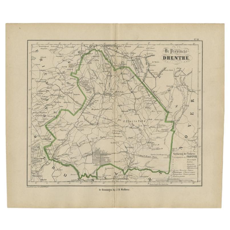
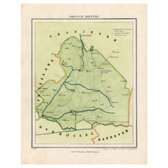
Antique Map of Drenthe, Province in the Netherlands, 1883
$147.20
£110.19
€123
CA$202.64
A$221.52
CHF 117.20
MX$2,650.87
NOK 1,491.14
SEK 1,364.99
DKK 937.11
About the Item
Antique map titled 'Drenthe'. Map of Drenthe, a province of the Netherlands. This map originates from 'Atlas van Nederland volgens de nieuwe spelregels' by J. Kuyper.
Artists and Engravers: Published by H.D. Tjeenk Willink.
Condition: Good, general age-related toning. Minor wear. Blank verso, please study image carefully.
Date: 1883
Overall size: 28.5 x 19 cm.
Image size: 22 x 16.5 cm.
- Dimensions:Height: 7.49 in (19 cm)Width: 11.23 in (28.5 cm)Depth: 0 in (0.01 mm)
- Materials and Techniques:
- Period:
- Date of Manufacture:1883
- Condition:
- Seller Location:Langweer, NL
- Reference Number:Seller: BG-07603-41stDibs: LU3054326172042
About the Seller
5.0
Recognized Seller
These prestigious sellers are industry leaders and represent the highest echelon for item quality and design.
Platinum Seller
Premium sellers with a 4.7+ rating and 24-hour response times
Established in 2009
1stDibs seller since 2017
2,792 sales on 1stDibs
Typical response time: <1 hour
- ShippingRetrieving quote...Shipping from: Langweer, Netherlands
- Return Policy
More From This Seller
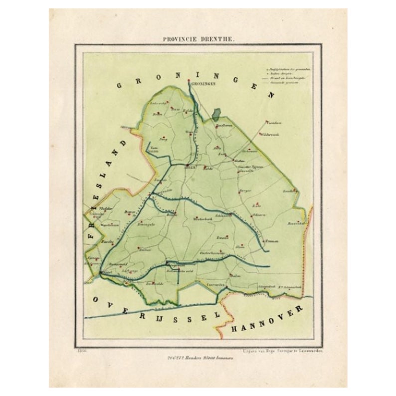
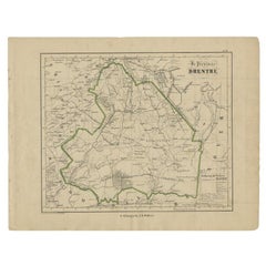
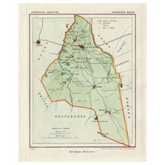
View AllAntique Map of Drenthe, Province of the Netherlands, C.1870
Located in Langweer, NL
Antique map titled 'De Provincie Drenthe'. Map of the province of Drenthe, the Netherlands. This map originates from 'F. C. Brugsma's Atlas van het Koninkrijk der Nederlanden (..)'. ...
Category
Antique 19th Century Maps
Materials
Paper
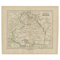
Antique Map of Drenthe, The Netherlands, 1864
Located in Langweer, NL
Antique map titled 'De Provincie Drenthe'. Map of the province of Drenthe, the Netherlands. This map originates from 'F. C. Brugsma's Atlas van het Koninkrijk der Nederlanden (..)'. ...
Category
Antique 19th Century Maps
Materials
Paper
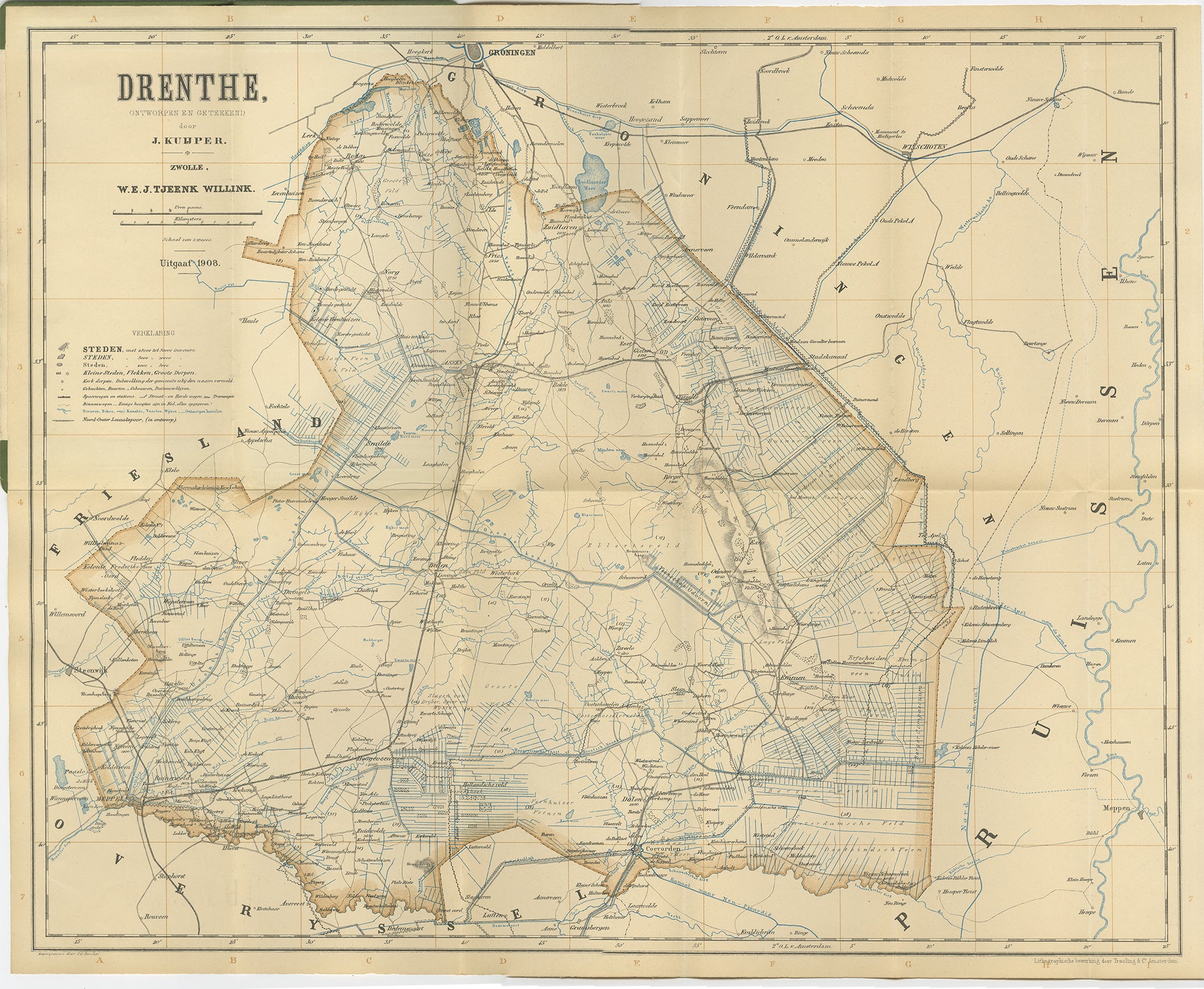
Drenthe Map 1908 – Antique Dutch Provincial Folding Map by J. Kuijper
Located in Langweer, NL
Antique Map of Drenthe – J. Kuijper Provincial Atlas, Zwolle 1908
This finely engraved antique map presents the Dutch province of Drenthe as drawn by J. Kuijper and published by W\....
Category
Early 20th Century Dutch Maps
Materials
Paper
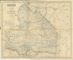
Antique Map of The Province of Drenthe in the Northern Netherlands, 1865
Located in Langweer, NL
Antique map titled 'Provincie Drenthe'. Original antique map of Drenthe, the Netherlands. These scarse detailed maps of Dutch Towns originate from the 'Gemeente-atlas' of Jacob Kuype...
Category
Antique 19th Century Maps
Materials
Paper
$210 Sale Price
20% Off
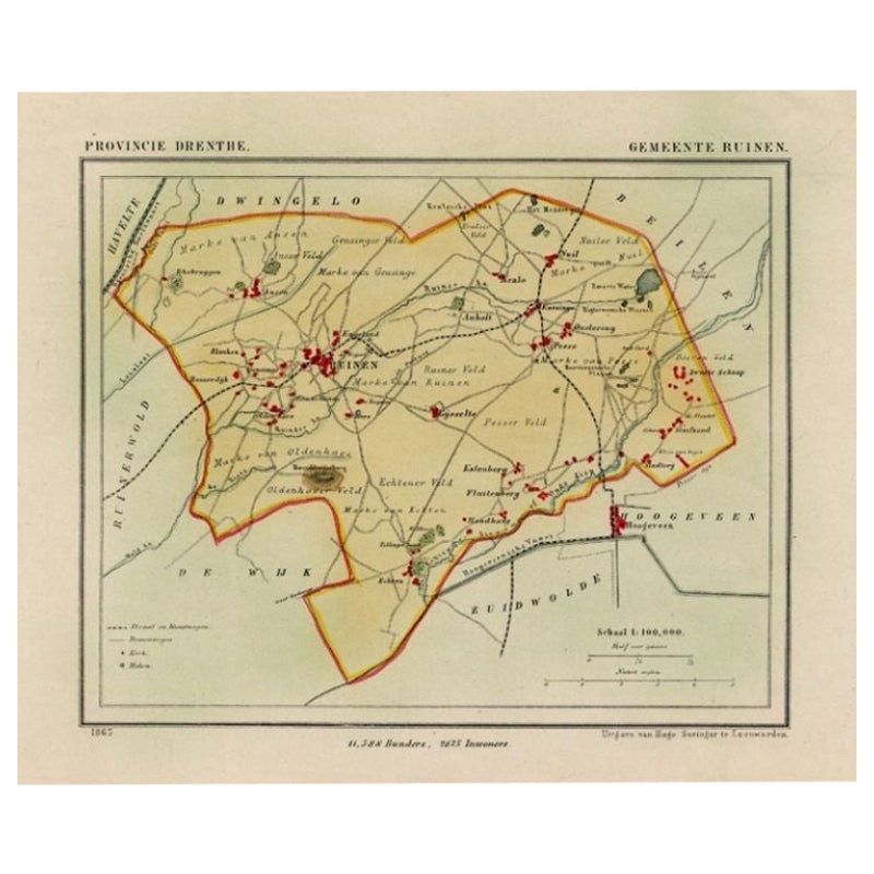
Antique Map of the Township of Ruinen, Drenthe in the Netherlands, circa 1865
Located in Langweer, NL
Drenthe: Gemeente Ruinen, Ansen, Bultinge, Oostering. These scarse detailed maps of Dutch Towns originate from the 'Gemeente-atlas' of Jacob Kuyper. This atlas of all towns in the Ne...
Category
Antique 19th Century Maps
Materials
Paper

$191 Sale Price
20% Off
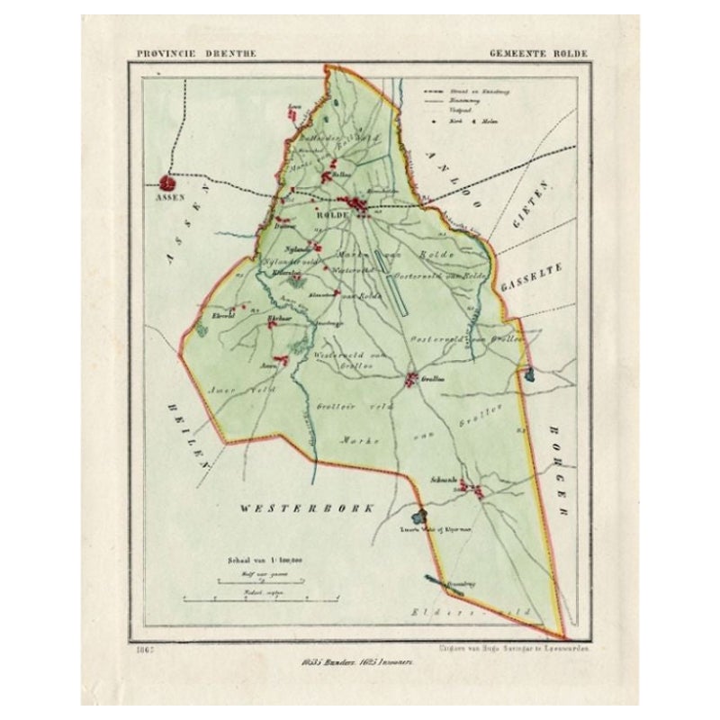
Antique Map of the Township of Rolde, Drenthe, the Netherlands, 1865
Located in Langweer, NL
Drenthe: Gemeente Rolde, Balloo, Grolloo, Schoonlo. These scarse detailed maps of Dutch Towns originate from the 'Gemeente-atlas' of Jacob Kuyper. This atlas of all towns in the Neth...
Category
Antique 19th Century Maps
Materials
Paper
$181 Sale Price
20% Off
You May Also Like
Denmark. Century Atlas antique vintage map
Located in Melbourne, Victoria
'The Century Atlas. Denmark'
Original antique map, 1903.
Inset maps of 'Faroe Islands', 'Iceland' and 'Copenhagen'.
Central fold as issued. Map name and number printed on the reve...
Category
Early 20th Century Victorian More Prints
Materials
Lithograph

Original Antique English County Map, Nottinghamshire, J
C Walker, 1851
Located in St Annes, Lancashire
Great map of Nottinghamshire
Original colour
By J & C Walker
Published by Longman, Rees, Orme, Brown & Co. 1851
Unframed.
Category
Antique 1850s English Other Maps
Materials
Paper

1752 Vaugoundy Map of Flanders : Belgium, France, and the Netherlands, Ric.a002
Located in Norton, MA
Large Vaugoundy Map of Flanders:
Belgium, France, and the Netherlands
Colored -1752
Ric.a002
Description: This is a 1752 Didier Robert de Vaugondy map of Flanders. The map de...
Category
Antique 17th Century Unknown Maps
Materials
Paper

Original Antique English County Map, Cambridgeshire, J
C Walker, 1851
Located in St Annes, Lancashire
Great map of Cambridgeshire
Original colour
By J & C Walker
Published by Longman, Rees, Orme, Brown & Co. 1851
Unframed.
Category
Antique 1850s English Other Maps
Materials
Paper

Original Antique English County Map, Huntingdonshire, J
C Walker, 1851
Located in St Annes, Lancashire
Great map of Huntingdonshire
Original colour
By J & C Walker
Published by Longman, Rees, Orme, Brown & Co. 1851
Unframed.
Category
Antique 1850s English Other Maps
Materials
Paper

Original Antique English County Map, Derbyshire, J
C Walker, 1851
Located in St Annes, Lancashire
Great map of Derbyshire
Original colour
By J & C Walker
Published by Longman, Rees, Orme, Brown & Co. 1851
Unframed.
Category
Antique 1850s English Other Maps
Materials
Paper
