Items Similar to Antique Map of The Dutch Province of Groningen by De Wit, c.1680


Want more images or videos?
Request additional images or videos from the seller
1 of 5
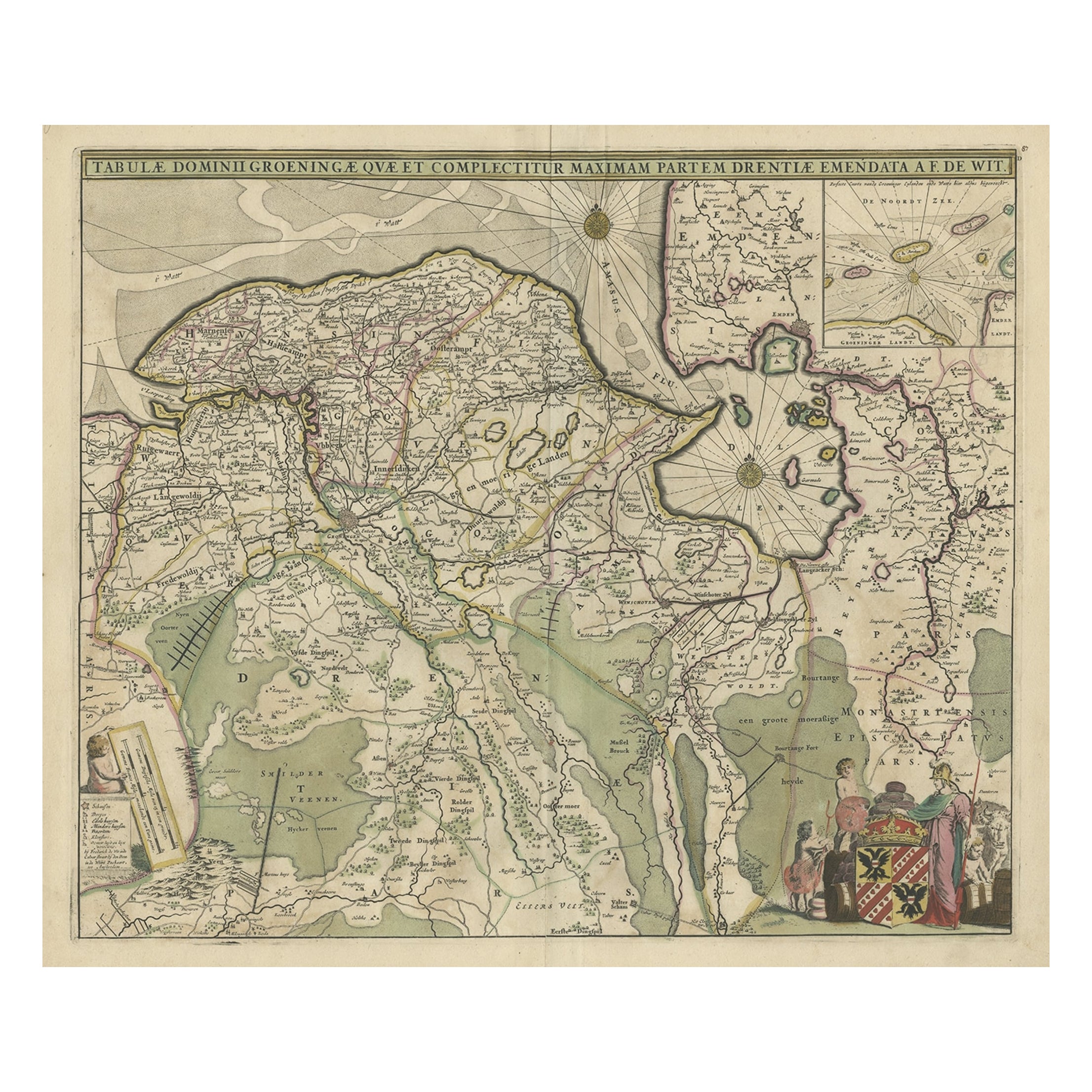
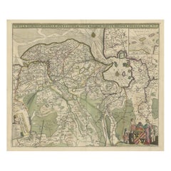
Antique Map of The Dutch Province of Groningen by De Wit, c.1680
$863.45
£639.51
€719
CA$1,181.15
A$1,285.45
CHF 681.42
MX$15,464.99
NOK 8,642.57
SEK 7,907.34
DKK 5,478.90
About the Item
Antique map titled 'Tabulae dominii Groeningae quae et complecitur maximam partem Drentiae Emendata'.
Old map of the province of Groningen, the Netherlands. With an inset map of the northern tip of Emden. Artists and Engravers: De Wit (1629 c.-1706) was a mapmaker and mapseller who was born in Gouda but who worked and died in Amsterdam. He moved to the city in 1648, where he opened a printing operation under the name of The Three Crabs; later, he changed the name of his shop to The White Chart. From the 1660s onward, he published atlases with a variety of maps; he is best known for these atlases and his Dutch town maps. After Frederik?s death in 1706, his wife Maria ran the shop for four years before selling it. Their son, Franciscus, was a stockfish merchant and had no interest in the map shop. At the auction to liquidate the de Wit stock, most of the plates went to Pieter Mortier, whose firm eventually became Covens
Mortier, one of the biggest cartography houses of the eighteenth century.
Artist: De Wit (1629 c.-1706) was a mapmaker and mapseller who was born in Gouda but who worked and died in Amsterdam. He moved to the city in 1648, where he opened a printing operation under the name of The Three Crabs; later, he changed the name of his shop to The White Chart. From the 1660s onward, he published atlases with a variety of maps; he is best known for these atlases and his Dutch town maps. After Frederik?s death in 1706, his wife Maria ran the shop for four years before selling it. Their son, Franciscus, was a stockfish merchant and had no interest in the map shop. At the auction to liquidate the de Wit stock, most of the plates went to Pieter Mortier, whose firm eventually became Covens
Mortier, one of the biggest cartography houses of the eighteenth century.
Condition: Very good, general age-related toning. Original/contemporary hand coloring. Please study image carefully.
Date: c.1680
Overall size: 0.001 x 62 x 52.5 cm.
Image size: 54.5 x 46 cm.
We sell original antique maps to collectors, historians, educators and interior decorators all over the world. Our collection includes a wide range of authentic antique maps from the 16th to the 20th centuries. Buying and collecting antique maps is a tradition that goes back hundreds of years. Antique maps have proved a richly rewarding investment over the past decade, thanks to a growing appreciation of their unique historical appeal. Today the decorative qualities of antique maps are widely recognized by interior designers who appreciate their beauty and design flexibility. Depending on the individual map, presentation, and context, a rare or antique map can be modern, traditional, abstract, figurative, serious or whimsical. We offer a wide range of authentic antique maps for any budget.
- Dimensions:Height: 20.67 in (52.5 cm)Width: 24.41 in (62 cm)Depth: 0 in (0.01 mm)
- Materials and Techniques:
- Period:
- Date of Manufacture:circa 1680
- Condition:
- Seller Location:Langweer, NL
- Reference Number:Seller: BG-11878-11stDibs: LU3054326284042
About the Seller
5.0
Recognized Seller
These prestigious sellers are industry leaders and represent the highest echelon for item quality and design.
Platinum Seller
Premium sellers with a 4.7+ rating and 24-hour response times
Established in 2009
1stDibs seller since 2017
2,816 sales on 1stDibs
Typical response time: 1 hour
- ShippingRetrieving quote...Shipping from: Langweer, Netherlands
- Return Policy
More From This Seller
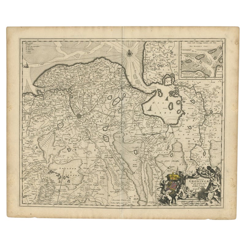
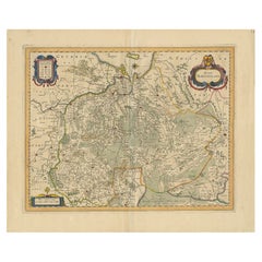
View AllOld Map of the Province of Groningen, the Netherlands
inset of Islands, C.1680
Located in Langweer, NL
Antique map titled 'Tabulae dominii Groeningae quae et complecitur maximam partem Drentiae Emendata'.
Old map of the province of Groningen, the Netherlands. With an inset map of ...
Category
Antique 1680s Maps
Materials
Paper
$1,200 Sale Price
20% Off
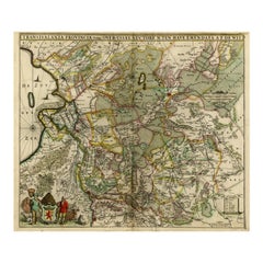
Antique Map of the Dutch Provinces Groningen and Drenthe, C.1660
Located in Langweer, NL
Antique map titled 'Dominii Groningae nec non maximae partis Drentiae (..)'. Map of Groningen and Drenthe in the north-east part of the Netherlands. Inset upper right corner of the "...
Category
Antique 17th Century Maps
Materials
Paper

Antique Map of the Province Groningen in The Netherlands, c.1680
Located in Langweer, NL
Antique map titled 'Groningae et Omlandiae Dominium vulgo de Provincie van Stadt en Lande'.
Old map of the province of Groningen, the Netherlands. This map originates from 'Germani...
Category
Antique 17th Century Maps
Materials
Paper

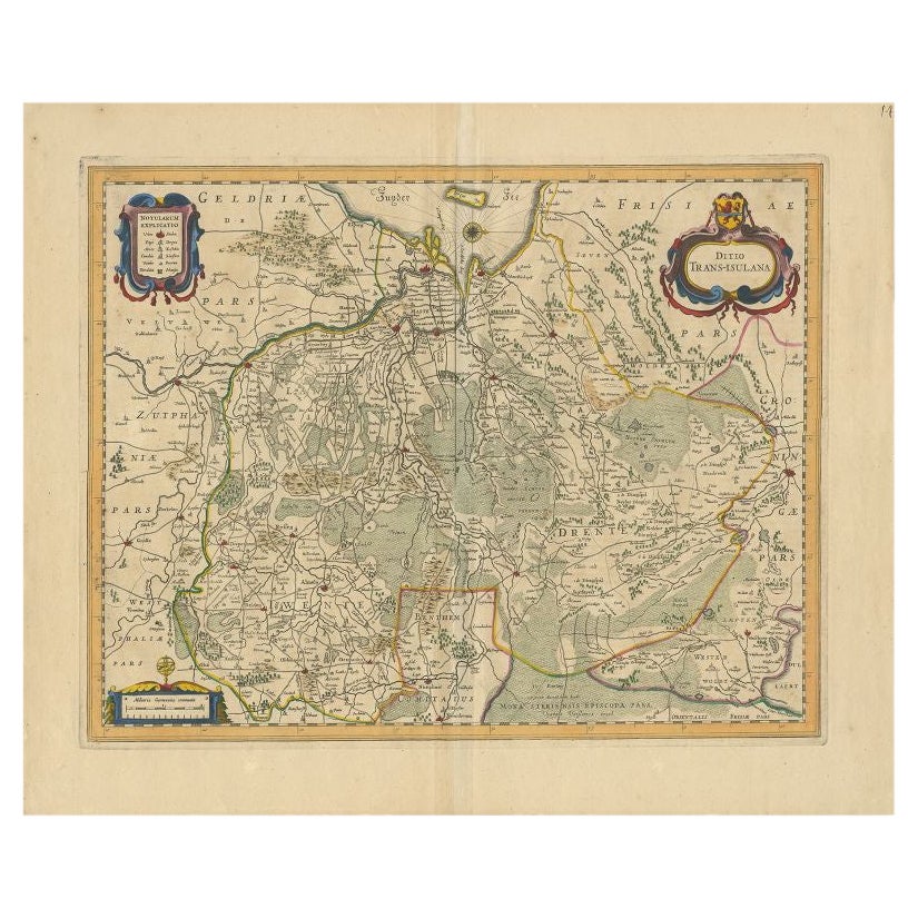
Antique Map of the Province of Overijssel by Janssonius, c.1650
Located in Langweer, NL
Antique map titled 'Ditio Trans-isulana'. Original antique map of the province of Overijssel, the Netherlands. With coat of arms and two decorative cartouches. Published by J. Jansso...
Category
Antique 17th Century Maps
Materials
Paper
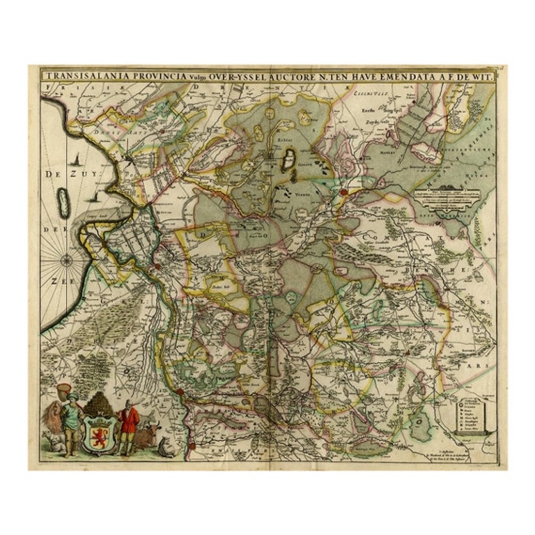
Antique Map of Overijssel by De Wit, c.1680
Located in Langweer, NL
Antique map titled 'Transisalania Provincia Vulgo Over-Yssel'. Original antique map of Overijssel, the Netherlands, showing the regio between Zutphen, Zwolle, Blokzijl, Coevorden, Ol...
Category
Antique 17th Century Maps
Materials
Paper
$427 Sale Price
20% Off
Antique Map of the Province of Gelderland, the Netherlands, c.1690
Located in Langweer, NL
Antique map titled 'Ducatus Geldriae novissima descriptio'. Map of Gelderland, The Netherlands. Shows many cities (like Arnhem, Nijmegen, Eindhoven, Zutphen, Zwolle, etc), roads, riv...
Category
Antique 17th Century Maps
Materials
Paper

You May Also Like
17th Century Hand Colored Map of the Liege Region in Belgium by Visscher
By Nicolaes Visscher II
Located in Alamo, CA
An original 17th century map entitled "Leodiensis Episcopatus in omnes Subjacentes Provincias distincté divisusVisscher, Leodiensis Episcopatus" by Nicolaes Visscher II, published in Amsterdam in 1688. The map is centered on Liege, Belgium, includes the area between Antwerp, Turnhout, Roermond, Cologne, Trier and Dinant.
This attractive map is presented in a cream-colored mat measuring 30" wide x 27.5" high. There is a central fold, as issued. There is minimal spotting in the upper margin and a tiny spot in the right lower margin, which are under the mat. The map is otherwise in excellent condition.
The Visscher family were one of the great cartographic families of the 17th century. Begun by Claes Jansz Visscher...
Category
Antique Late 17th Century Dutch Maps
Materials
Paper

$940 Sale Price
20% Off
1635 Willem Blaeu Map of Northern France"Comitatvs Bellovacvm" Ric.a08
Located in Norton, MA
1635 Willem Blaeu map of northern France, entitled.
"Comitatvs Bellovacvm Vernacule Beavvais,"
Colored
Ric.a008
“COMITATVS BELLOVACVM…” Amsterdam: W...
Category
Antique 17th Century Unknown Maps
Materials
Paper

1643 Willem&Joan Blaeu Map NW Flanders "Flandriae Teutonicae Pars Prientalior
Located in Norton, MA
1643 Willem and Joan Blaeu map of northwest Flanders, entitled
"Flandriae Teutonicae Pars Prientalior,"
Ric0012
" Authentic" - Map of the northwest Fl...
Category
Antique 17th Century Dutch Maps
Materials
Paper

1752 Vaugoundy Map of Flanders : Belgium, France, and the Netherlands, Ric.a002
Located in Norton, MA
Large Vaugoundy Map of Flanders:
Belgium, France, and the Netherlands
Colored -1752
Ric.a002
Description: This is a 1752 Didier Robert de Vaugondy map of Flanders. The map de...
Category
Antique 17th Century Unknown Maps
Materials
Paper

1640 Willem Blaeu Map Entitled "Contado di molise et principato vltra, " Ric.a003
By Willem Blaeu
Located in Norton, MA
1640 Willem Blaeu map entitled
"Contado di molise et principato vltra,"
Colored
Ric. a003
Measures: 38 x 49.6 cm and wide margins
DBLAEU.
Cou...
Category
Antique 17th Century Dutch Maps
Materials
Paper

1640 Joan Bleau Map Entitled"Diocecese de rheims et le pais de rethel, " Eic.a011
Located in Norton, MA
1640 Joan Bleau map entitled
"Diocecese de rheims et le pais de rethel,"
Ric.a011
OAN BLAEU
Diocecese de Rheims, et le pais de Rethel.
Handcolored engraving, c.1640.
...
Category
Antique 17th Century Dutch Maps
Materials
Paper

More Ways To Browse
Dutch Antiques
Map Of Jerusalem
Antique Maps Caribbean Islands
Antique Wine Maps
Used Furniture Wisconsin
Antique Furniture Michigan
Antique Maps Of Cape Of Good Hope
Antique Maps Of Texas
Antique Virginia Furniture
Otto Petri
American West Antiques
Antique Furniture Brunswick
Antique Map Ceylon
Antique Map Of The Philippines
Antique Mississippi Map
Celestial Map
Map Of Middle East
17th Century American Furniture