Items Similar to Antique Map of East Canada
Quebec and New Brunswick
by Tallis
c.1850


Want more images or videos?
Request additional images or videos from the seller
1 of 5
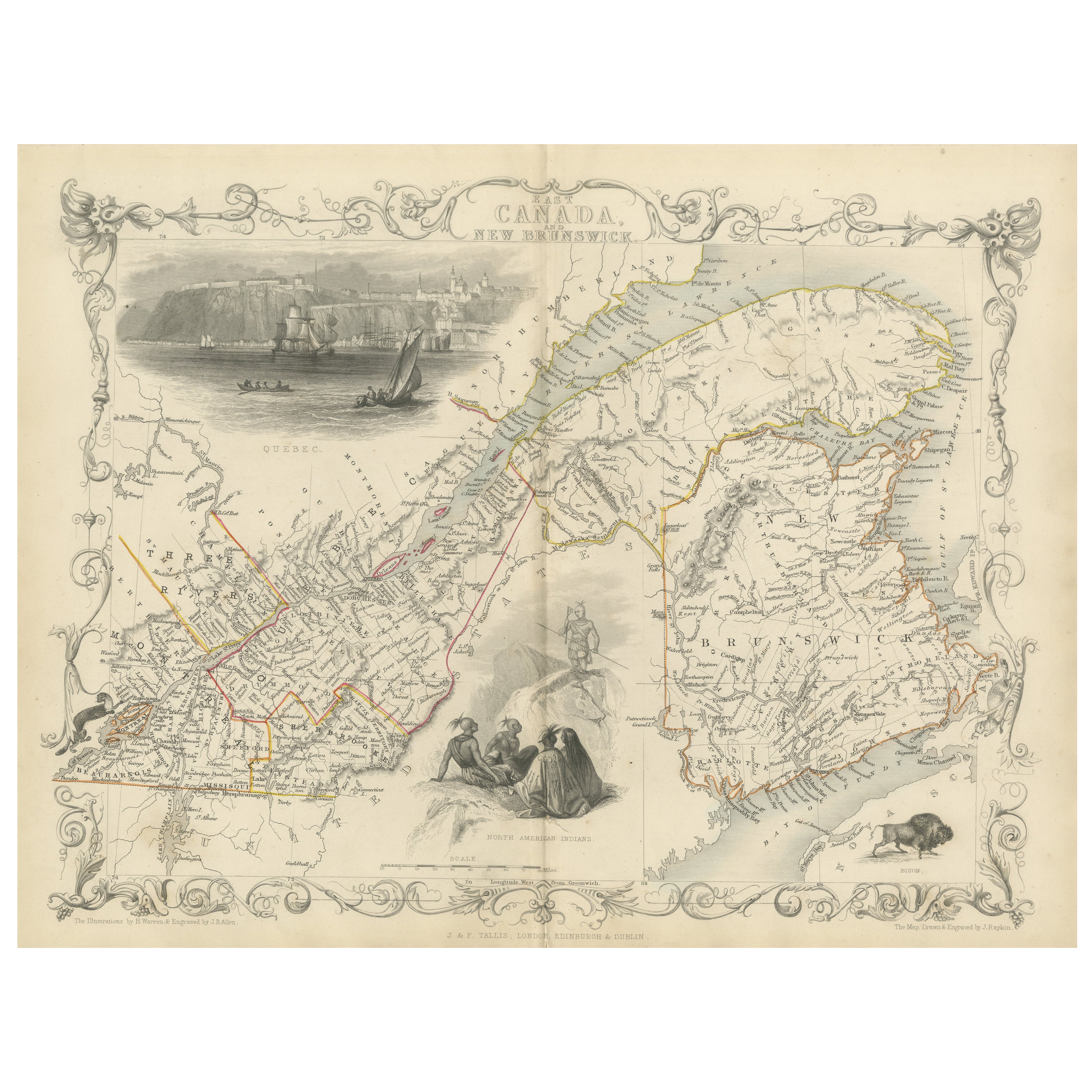
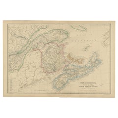
Antique Map of East Canada
Quebec and New Brunswick
by Tallis
c.1850
$593.28
£442.91
€500
CA$824.24
A$886.59
CHF 473.82
MX$10,450.38
NOK 5,973.76
SEK 5,461.15
DKK 3,810.56
About the Item
Antique map titled 'East Canada, and New Brunswick'. Decorative regional map of East Canada or what is now Quebec and New Brunswick. With decorative vignettes of Quebec, North American Indians and a bison. This map originates from 'The History and Topography of the United States of America: edited by John Howard Hinton, A.M'. Printed and published by John Tallis and Company, London and New York. Published circa 1850.
- Dimensions:Height: 10.44 in (26.5 cm)Width: 13.78 in (35 cm)Depth: 0.02 in (0.5 mm)
- Materials and Techniques:
- Period:
- Date of Manufacture:circa 1850
- Condition:General age-related toning, original folding line. Minor wear, blank verso. Please study image carefully.
- Seller Location:Langweer, NL
- Reference Number:Seller: BG-13016-2-71stDibs: LU3054324586402
About the Seller
5.0
Recognized Seller
These prestigious sellers are industry leaders and represent the highest echelon for item quality and design.
Platinum Seller
Premium sellers with a 4.7+ rating and 24-hour response times
Established in 2009
1stDibs seller since 2017
2,836 sales on 1stDibs
Typical response time: 1 hour
- ShippingRetrieving quote...Shipping from: Langweer, Netherlands
- Return Policy
More From This Seller
View AllDecorative 1850s Map of Eastern Canada and New Brunswick with Historic Vignettes
Located in Langweer, NL
Decorative 1850s Map of Eastern Canada and New Brunswick with Historic Vignettes
This beautifully crafted 19th-century map of Eastern Canada and New Brunswick, drawn and engrave...
Category
Antique 1850s Maps
Materials
Paper

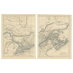
Antique Map of West Canada by Tallis
c.1850
Located in Langweer, NL
Antique map titled 'West Canada'. Original antique map of West Canada, with decorative vignettes titled Kingston and Falls of Niagara. This map originates from 'The History and Topog...
Category
Antique Mid-19th Century Maps
Materials
Paper

$284 Sale Price
20% Off
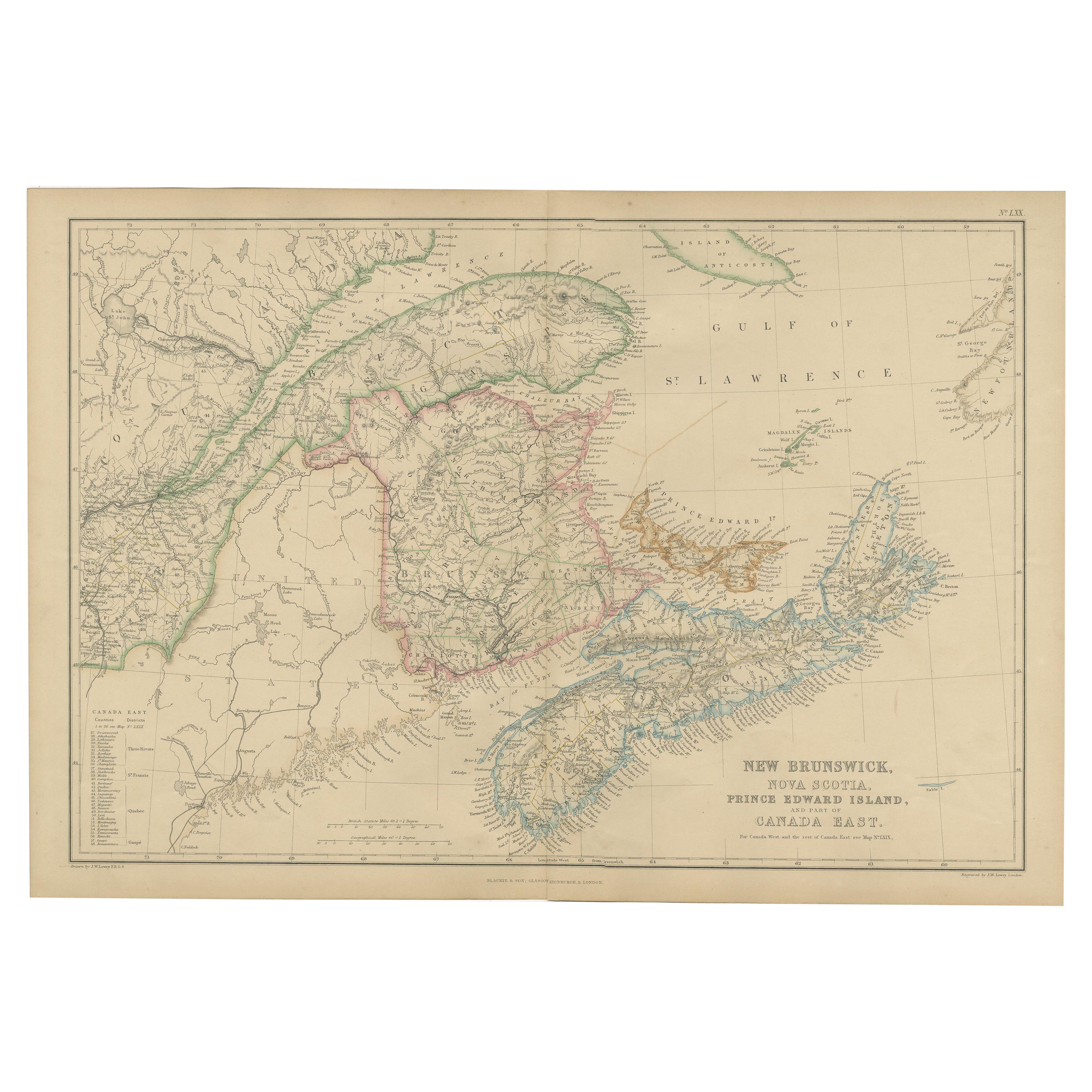
Antique Map of New Brunswick by W. G. Blackie, 1859
Located in Langweer, NL
Antique map titled 'New Brunswick, Nova Scotia, Prince Edward Island and Part of Canada east'. Original antique map of New Brunswick, Nova Scotia,...
Category
Antique Mid-19th Century Maps
Materials
Paper
$237 Sale Price
20% Off
Antique Map of New Brunswick, Nova Scotia and Surroundings by Johnson, 1872
Located in Langweer, NL
Antique map titled 'Johnson's Quebec, of the dominion of Canada (..)'. Original map of New Brunswick, Nova Scotia, Newfoundland and Prince Edward Island....
Category
Antique Late 19th Century Maps
Materials
Paper

$332 Sale Price
20% Off
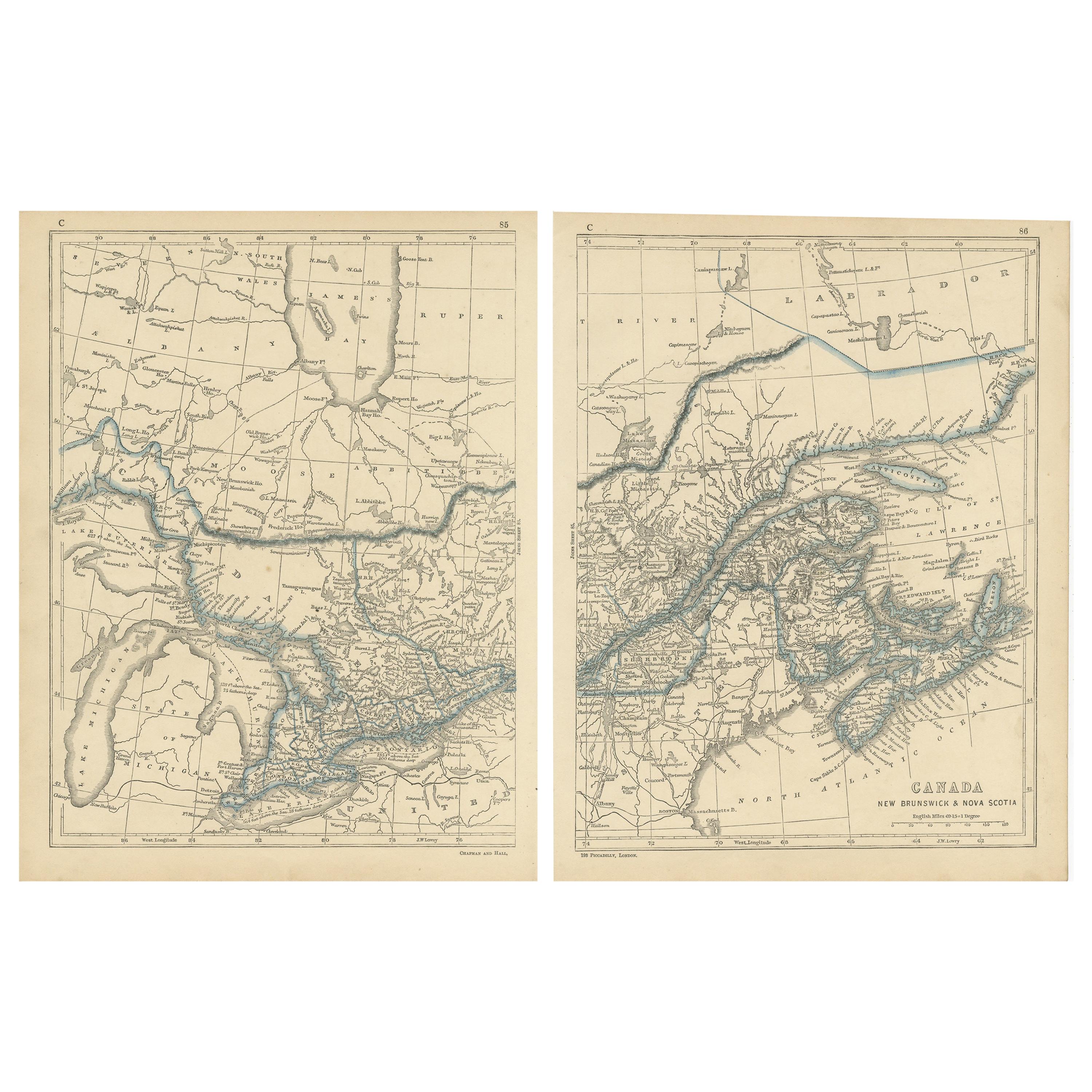
Antique Map of Canada, New Brunswick and Nova Scotia by Lowry, 1852
Located in Langweer, NL
Antique map titled 'Canada, New Brunswick & Nova Scotia'. Two individual sheets of Canada, New Brunswick and Nova Scotia. This map originates from 'Lowry...
Category
Antique Mid-19th Century Maps
Materials
Paper
$189 Sale Price / set
20% Off
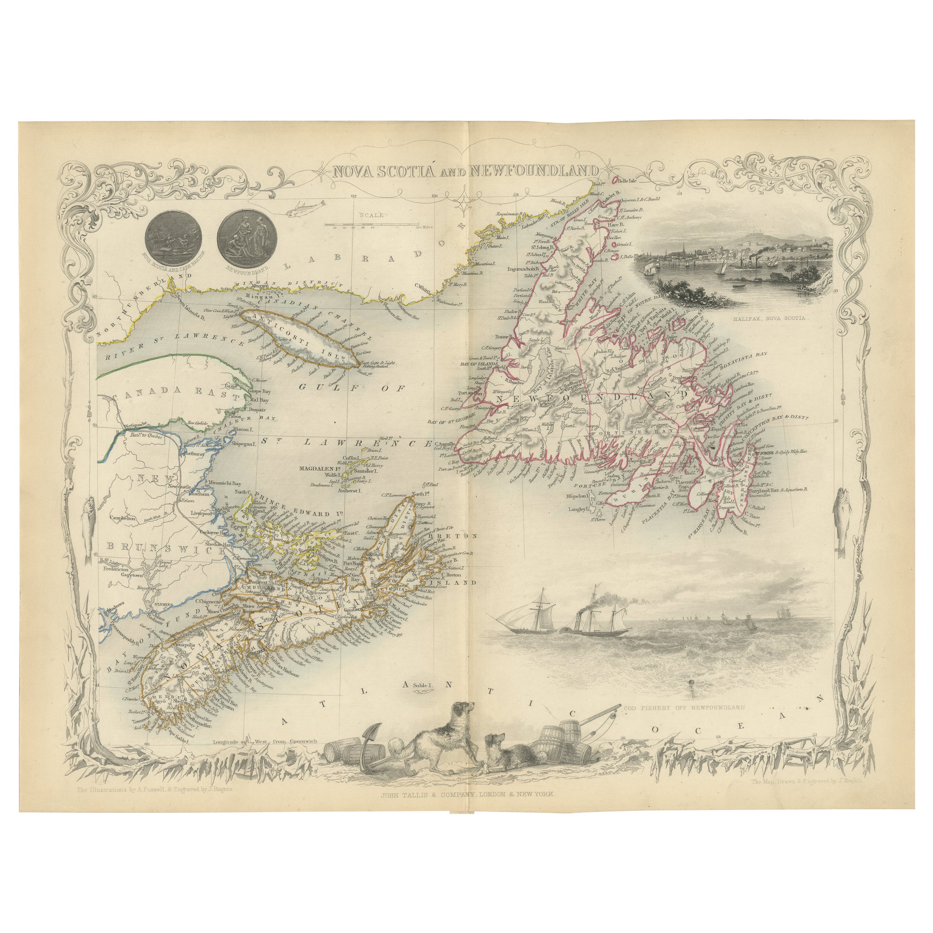
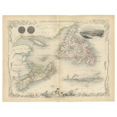
A Decorative Map of Nova Scotia and Newfoundland by John Tallis, 1851
Located in Langweer, NL
The map is part of the series created by John Tallis & Company, known for their mid-19th-century maps. This particular map illustrates the regions of Nova Scotia and Newfoundland and...
Category
Antique 1850s English Maps
Materials
Paper
You May Also Like
Original Antique Map of New Brunswick and Nova Scotia, 1889
Located in St Annes, Lancashire
Great map of New Brunswick and Nova Scotia
Drawn and Engraved by W. & A.K. Johnston
Published By A & C Black, Edinburgh.
Original colour
Unfr...
Category
Antique 1880s Scottish Victorian Maps
Materials
Paper

Quebec. Canada. Century Atlas antique vintage map
Located in Melbourne, Victoria
'The Century Atlas. Quebec'
Original antique map, 1903.
Inset maps 'Sketch Map of Quebec', Quebec and Vicinity; and 'Montreal and Vicinity'.
Central fo...
Category
Early 20th Century Victorian More Prints
Materials
Lithograph

1858 Colton
s Map of New York, Ric.B011
Located in Norton, MA
An 1858 Colton's map of New York
Ric.b011
Colton’s New York, 1858 - A large original color engraved and very detailed map of the state of New York,...
Category
Antique 19th Century Unknown Maps
Materials
Paper

English Engraved Hand Colored Map of the North Eastern United States, circa 1817
Located in Charleston, SC
English copper engraved hand colored map of the North Eastern United States matted under glass in a gilt frame, Early 19th Century. Drawn and Engraved for Thomson's New General Atlas...
Category
Antique 1810s English George III Maps
Materials
Glass, Giltwood, Paint, Paper

Original Antique Map of North America by Dower, circa 1835
Located in St Annes, Lancashire
Nice map of North America
Drawn and engraved by J.Dower
Published by Orr & Smith. C.1835
Unframed.
Free shipping
Category
Antique 1830s English Maps
Materials
Paper

Large Original Antique City Plan of Montreal, Canada, circa 1900
By Rand McNally
Co.
Located in St Annes, Lancashire
Fabulous colorful map of Montreal
Original color
By Rand, McNally & Co.
Published, circa 1900
Unframed
Minor edge tears
Free shipping.
Category
Antique Early 1900s American Maps
Materials
Paper
